Good ’nuff
Cool place.
Water Clarity – 8+ (Springs – 10)
Natural Quality – 9+
Perception – Weekday
Nearest town to starting point; High Springs, Fl.
Water reading at Hwy 441 was 32 feet
(White Springs/Suwannee reading 55′)
.
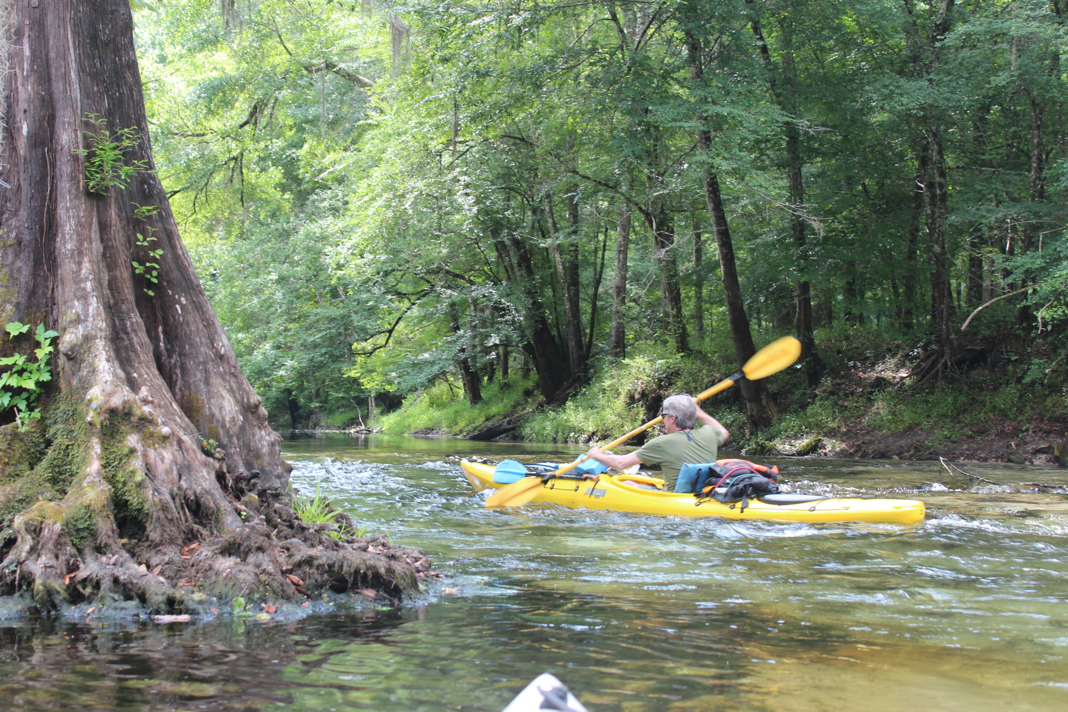
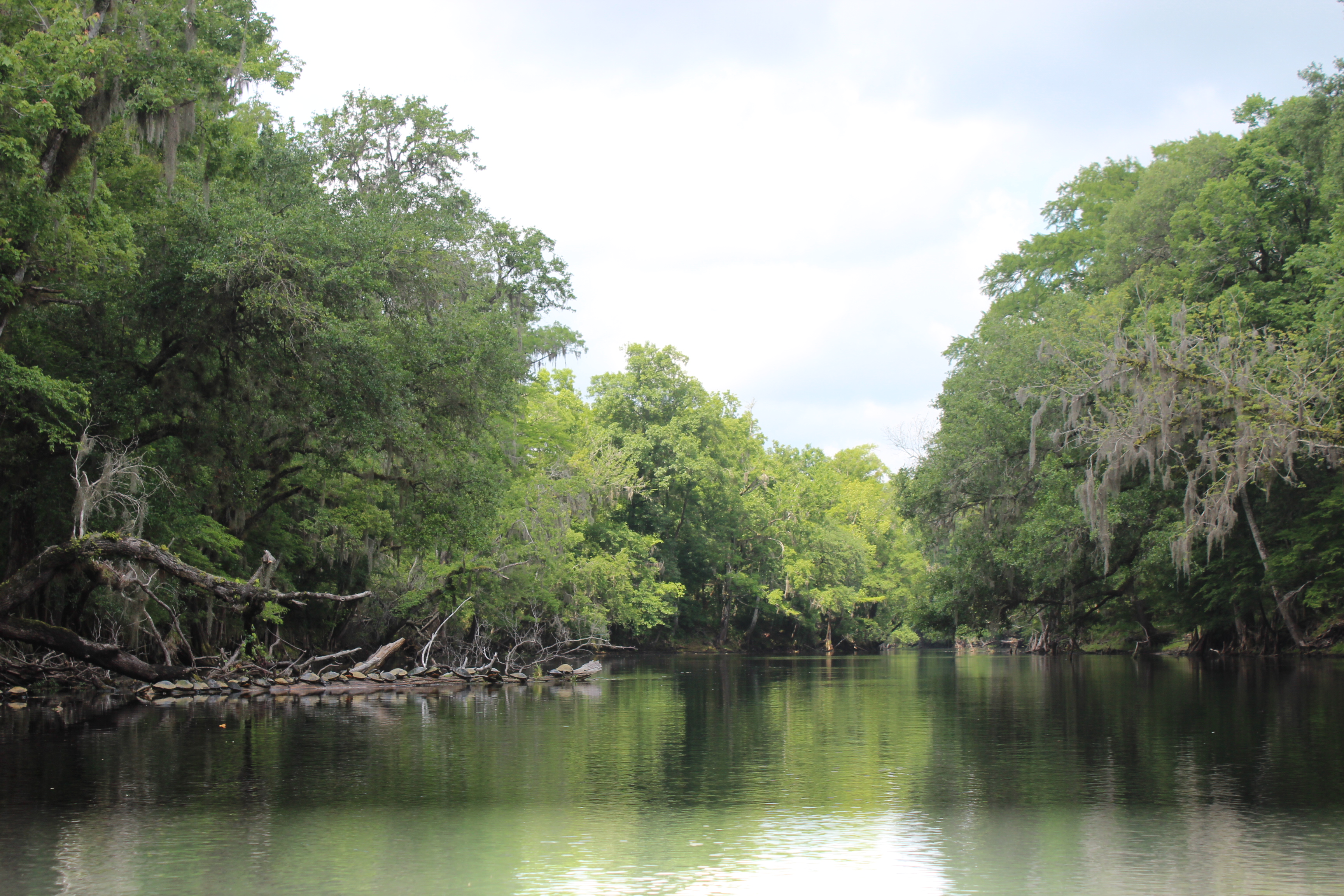
I’ve been interested with paddling the Sante Fe for several years now – by chance its just never proceed further than me stopping along it’s banks and staring blankly down into it’s slow moving tannic waters – always something else down the road.
Fall and spring paddles seem to convey the ‘riversphere’ that strikes me most; this spring I set my sights on several rivers in Florida; the Sante Fe was first. Gordy, a brother-in-law’s brother and paddlin friend dropped out of the Delaware deep freeze to figure-in; we met up at O’leno State Park and began our investigation of the Sante Fe’s ‘sphere.’
O’leno State Park is a pretty good place to start. The Park is interesting (and cheap), there are some historical exhibits at hand – plus a short trail-walk that takes you around the landscape where the Sante Fe river disappears into the earth. The river resurfaces 3 miles away at River Rise Preserve State Park.
Later on our paddle down the Sante Fe we noticed several occasions where smaller portions of the water would drop into the porous limestone – before bubbling up further downstream.

(VGPS – 21410 US-441, High Springs, FL)
Our objective was to paddle down-river from the Canoe Outpost at Hwy 41, maybe up the Ichetucknee, then to the confluence of the Suwannee river. Then ten more miles on the Suwannee (close a little-circle) to the hwy 340 bridge; two ez nights amidst the river’s orb.
.
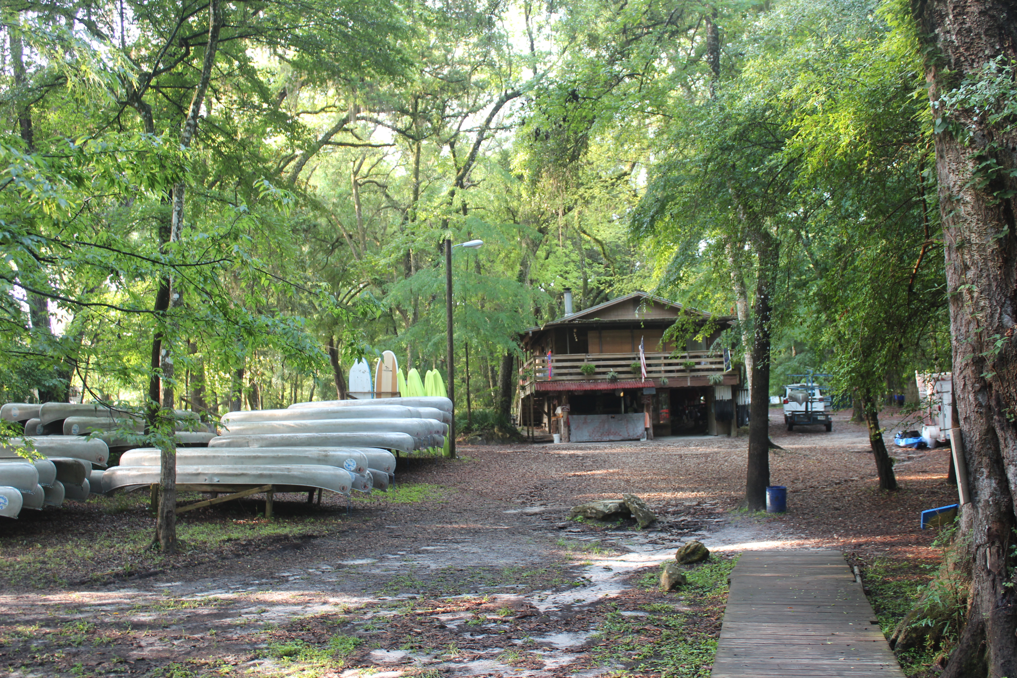
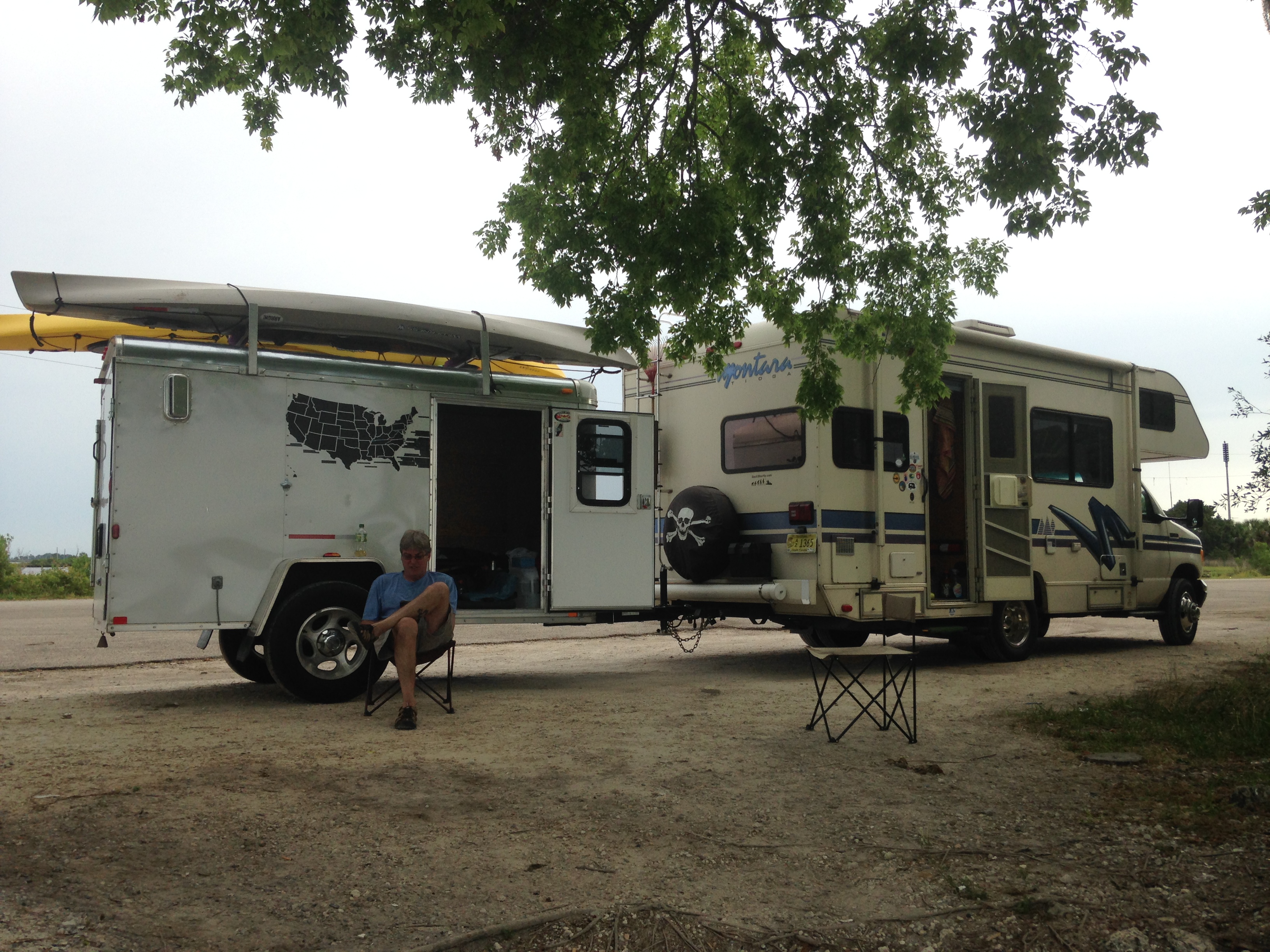
The folks at the Outpost are more than helpful, they of course will fill you in on any details, rent you a canoe – and/or go pick you up at one of the bridges downriver if you like. ‘Johnny’ agreed to deliver my vehicle to our ‘takeout point,’ cool.
I haven’t been on the water (other than our lake) over the past winter; different than years past. My circumstances has been with ‘interest,’ I find interested in a project and commit to it. This winter I found interest in Barn art, stuff I couldn’t do when I was younger because I couldn’t sit still long enough. Barn art worked well with my ‘thinkin-cap’ on and before I knew it – another season had passed.

Long story short; it felt doggone good to finally be sitting atop the soft current of the Sante Fe, ‘thinkin-cap’ fits there too.

.
The turtles of the Sante Fe must have been fairly use to folks, as they remained in place as we eased by; normally turtles slip into the water at first sight of a moving paddle. We joked that just maybe they know when the gators are hungry.

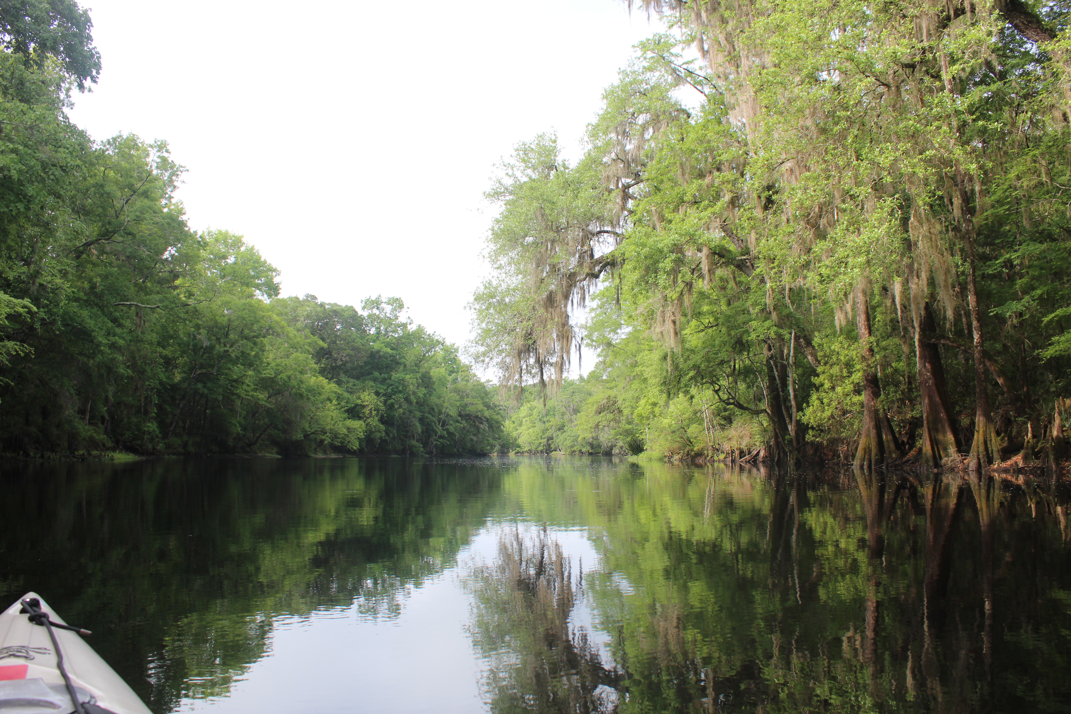
That soft current is much like the Suwanee‘s, slow and steady – with about the same 2.5 to 3 mph movement. It’s a ‘second-nature’ stroke and an easy seat to be in. Fishin must be good too, along with the fishin-boats further downriver; there was also some ‘cane-pole’ fishin goin on at contemplation point. Peace, and the simplest of times.

Just past the Hwy 27 bridge stood the old highway or railroad pilings. As a native of this state, I know that the highway was one of the original thorough fares of Florida, along with 41, 301, and several others. I eased by absorbing the setting much as one would respect the headstone in a cemetery. Identifying natural or past ‘crossings’ along a river is the recognizing their story – stoic testimonies.
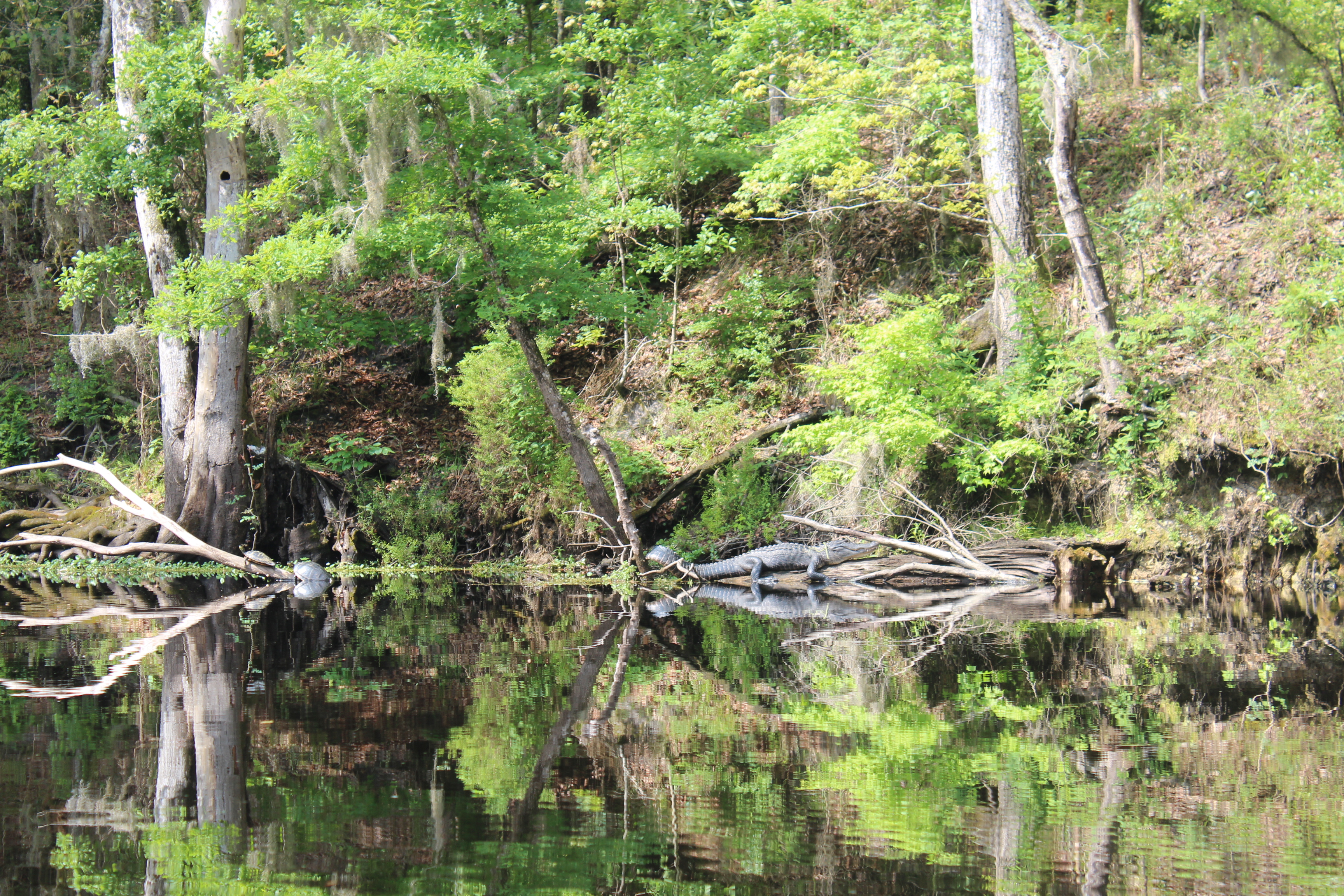
Living testimonies (gators) to a further past were basking in the early sun (big lizards).

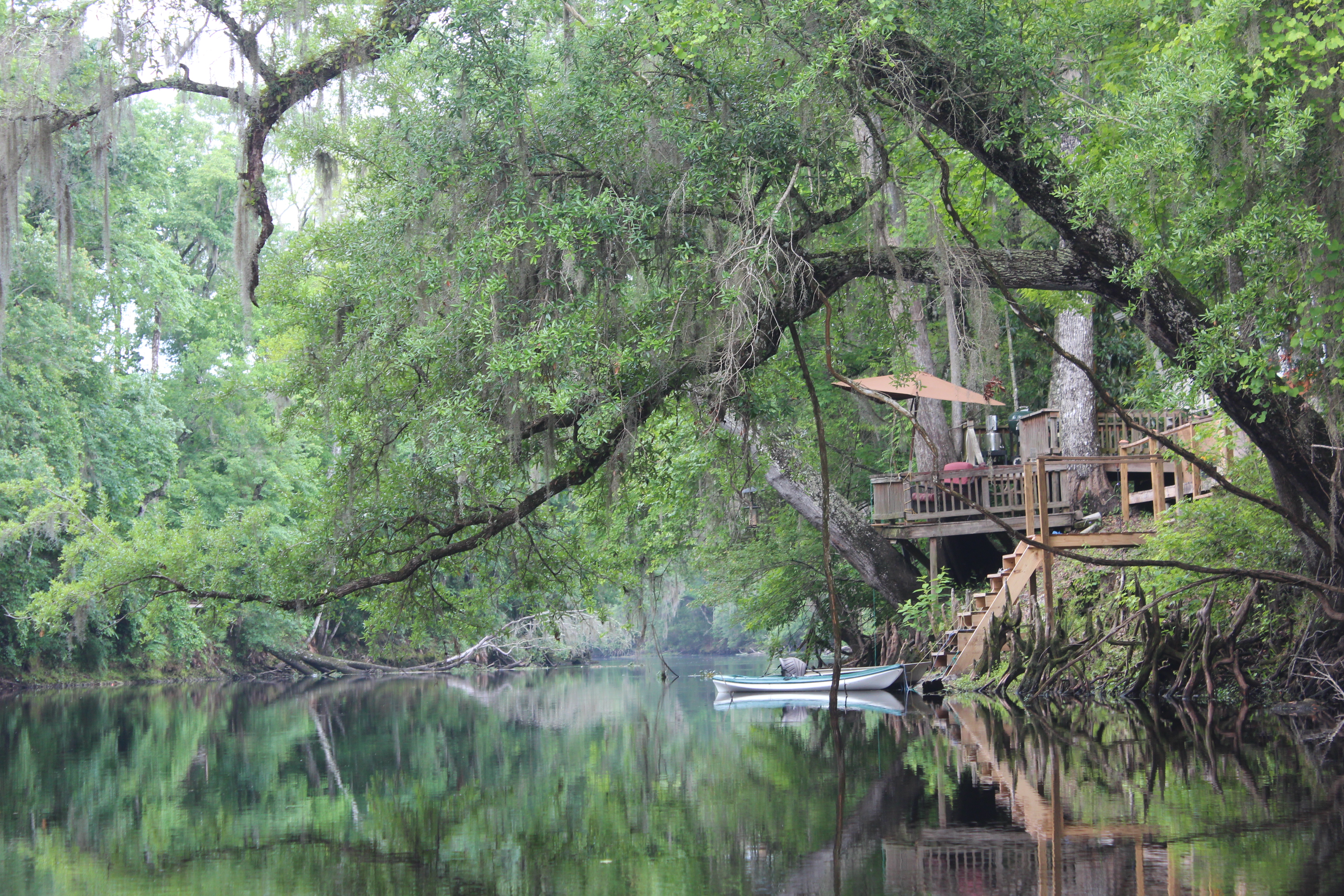
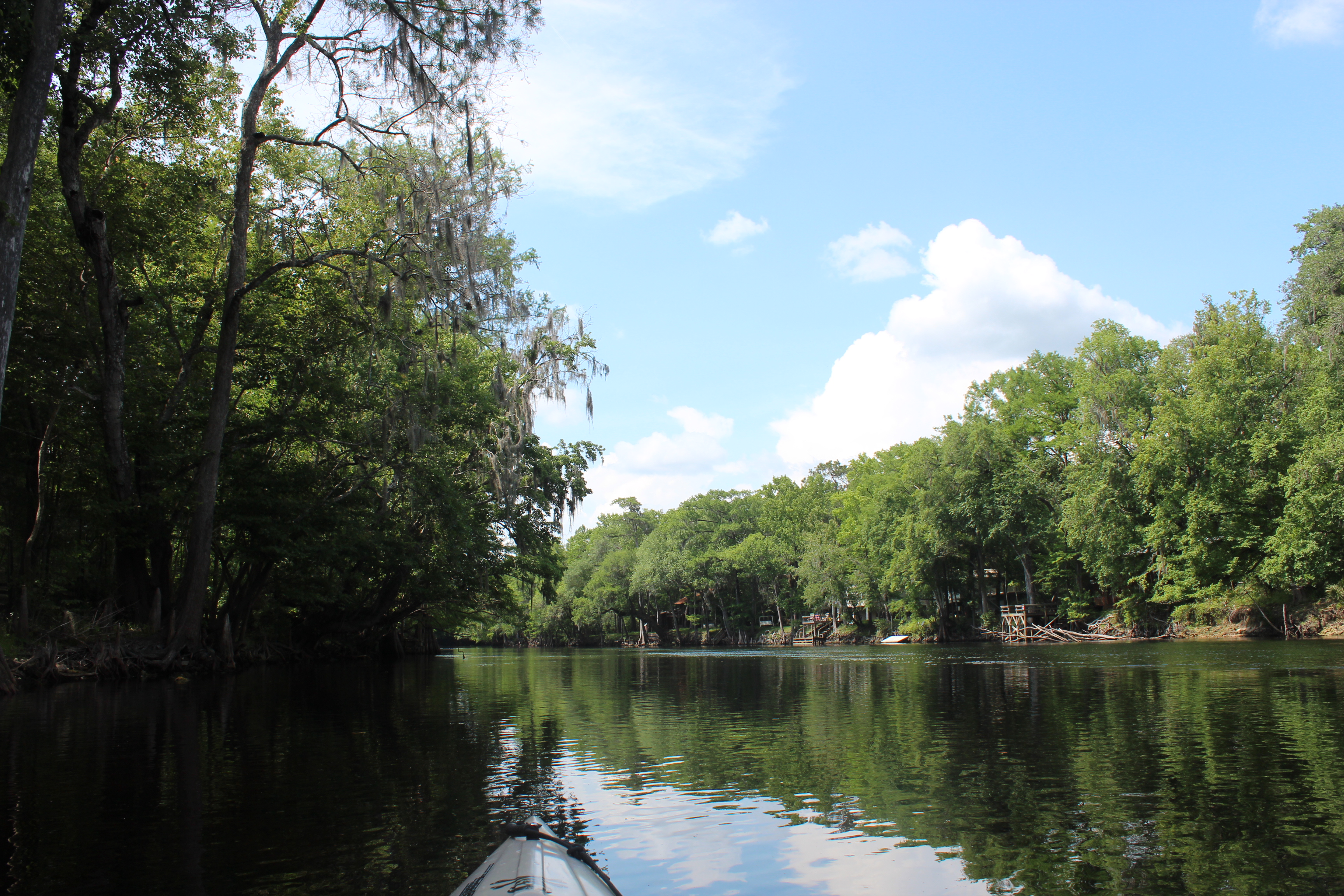
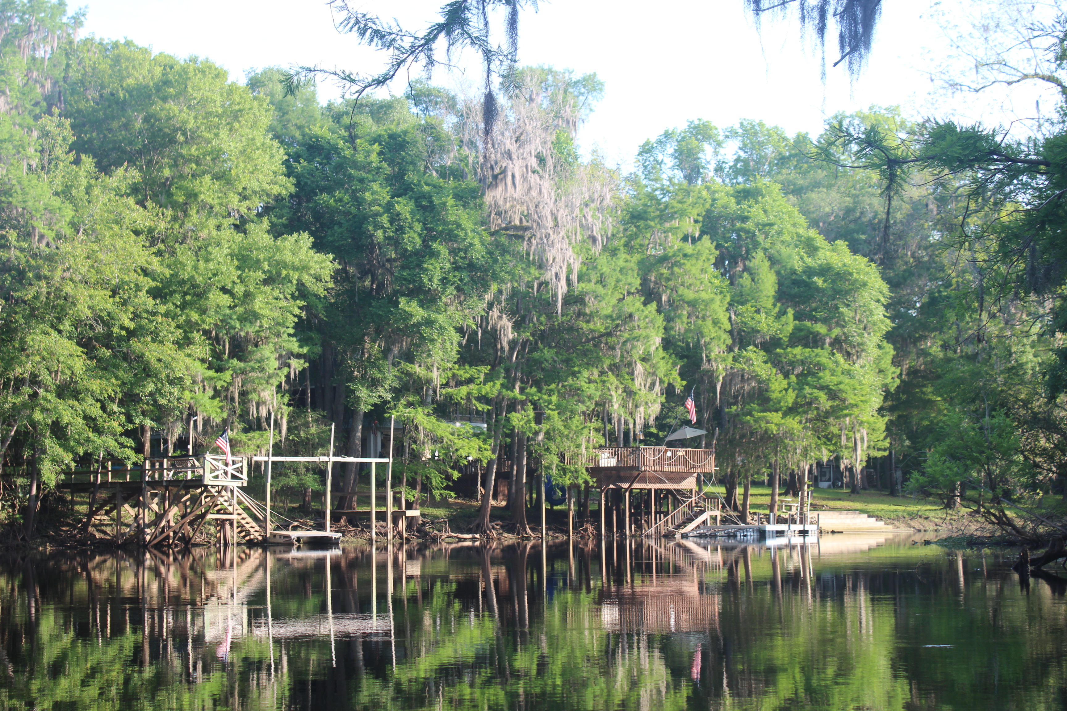
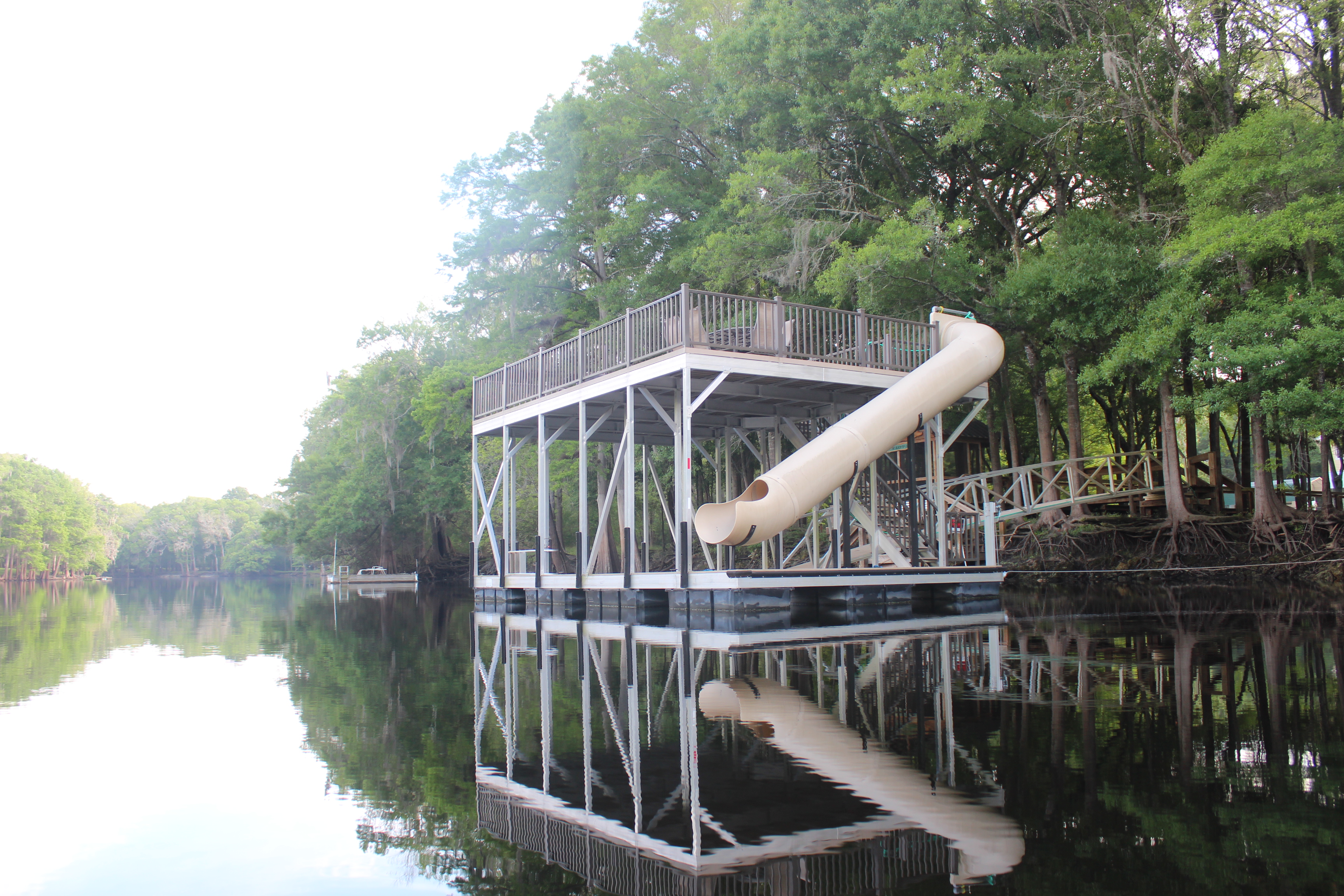
Homes were infrequent day one, but several leaned against the river’s bank; each interesting with its own caricature – allowing more contemplation’s while paddling by

like – What is your reason for paddling?

While easing further along, the river-word I felt was “sanitary,’ even with the darker tannic waters of the main channel, there was something about the Sante Fe just provided that feeling. When paddling different settings, it’s even possible to feel the difference in the water too (i.e.thinner/thicker) – anyway, the Sante Fe’s ‘sphere’ had a certain “sanitary” feel to it – something like the Current river in the Ozarks – a positive for sure.
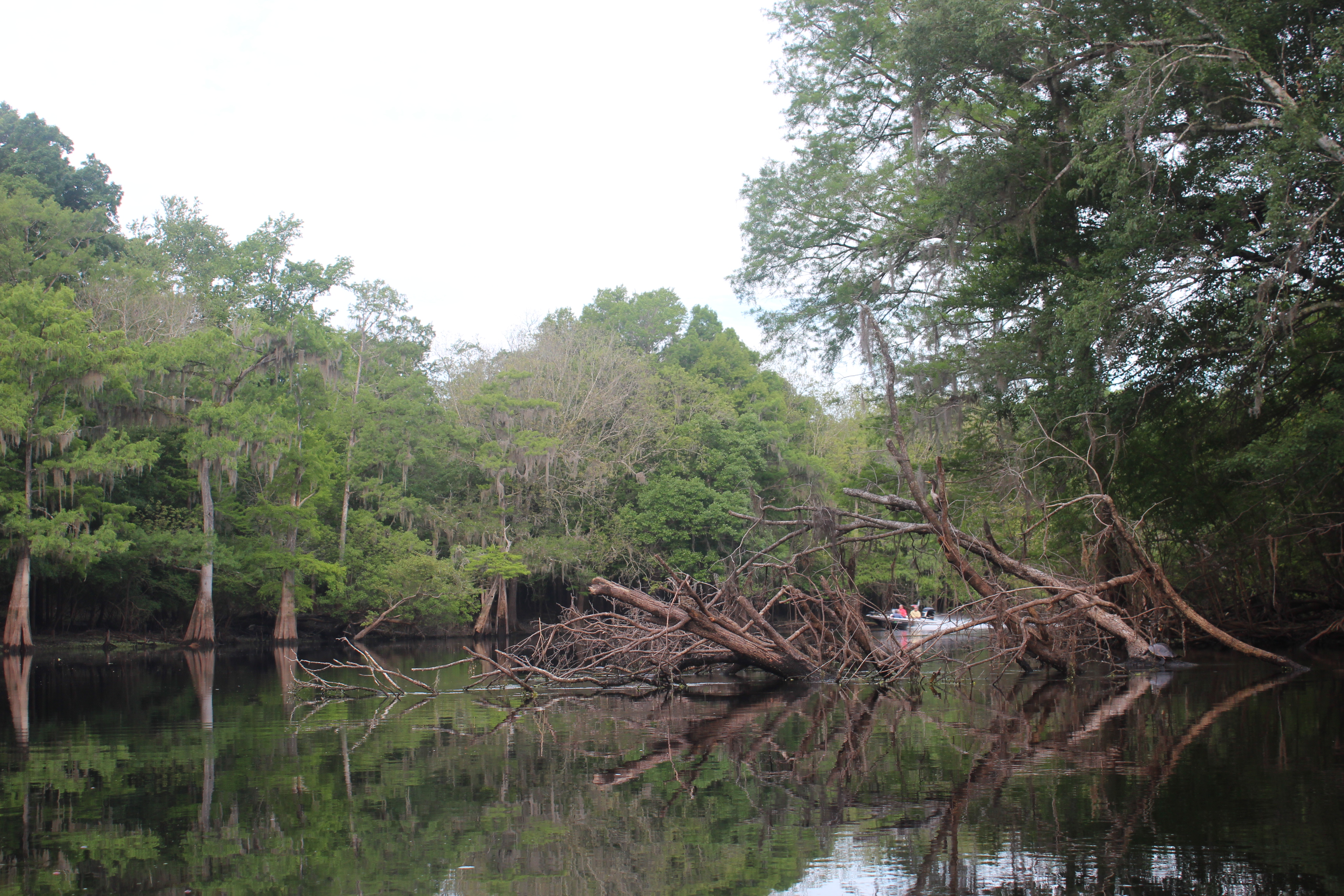
The one or two areas of shoals encountered were an easy pass – the bottom was more of soft rivergrass with an occasional smoothed limestone bolder. I could understand why so many folks could enjoy this river, along the way I only noticed only one area where unnatural debris was obvious.
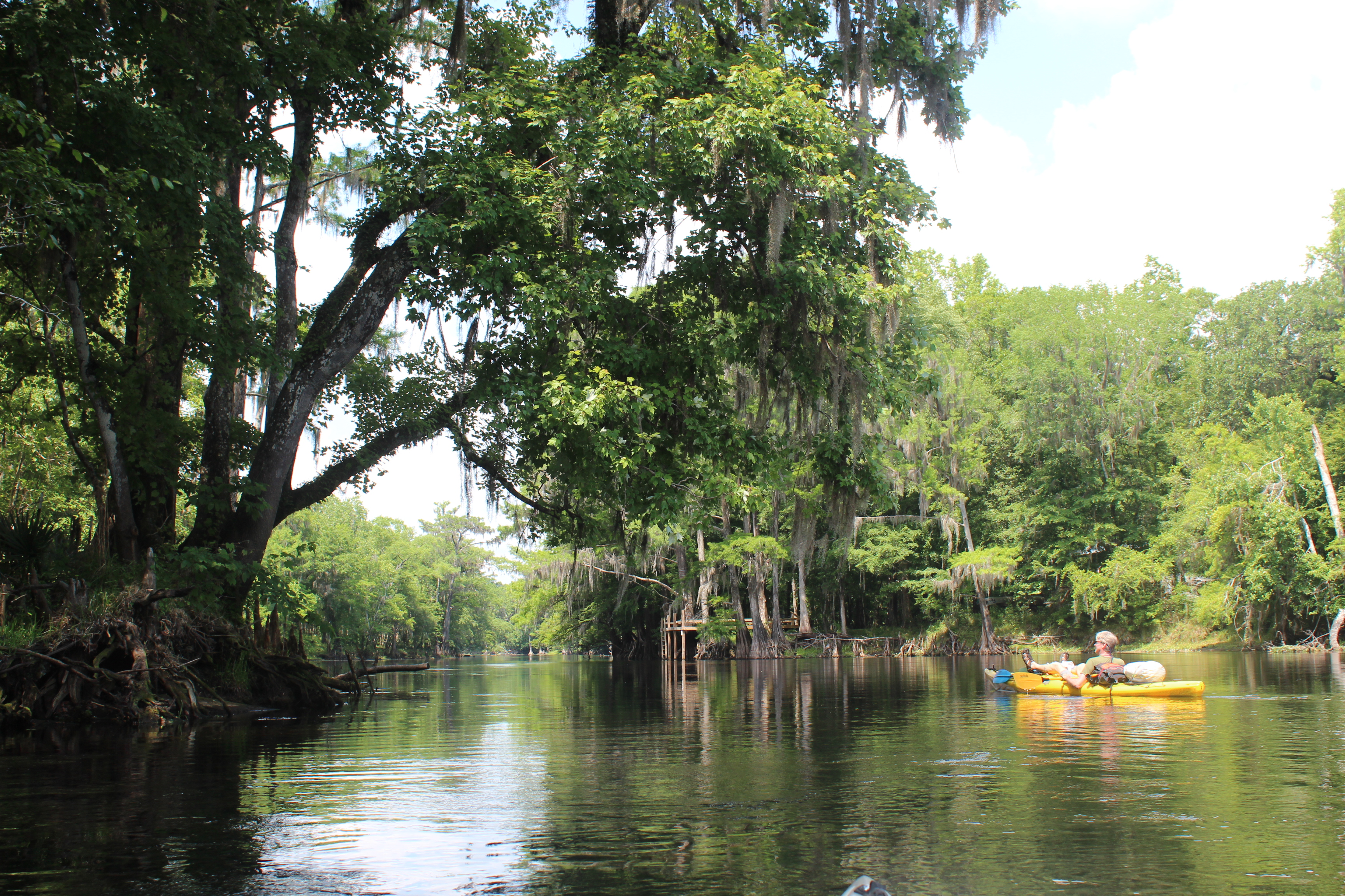
There are more than three dozen springs along the Sante Fe; Gilchrist Blue, Ginnie, Hornsby, Lily, Poe, and Rum Island springs – a contributor to that ‘sanitary’ feel to it all. On my paddles of the Suwannee river I have made a stop each time at the Sante Fe confluence and admired the inviting water coming from the river.
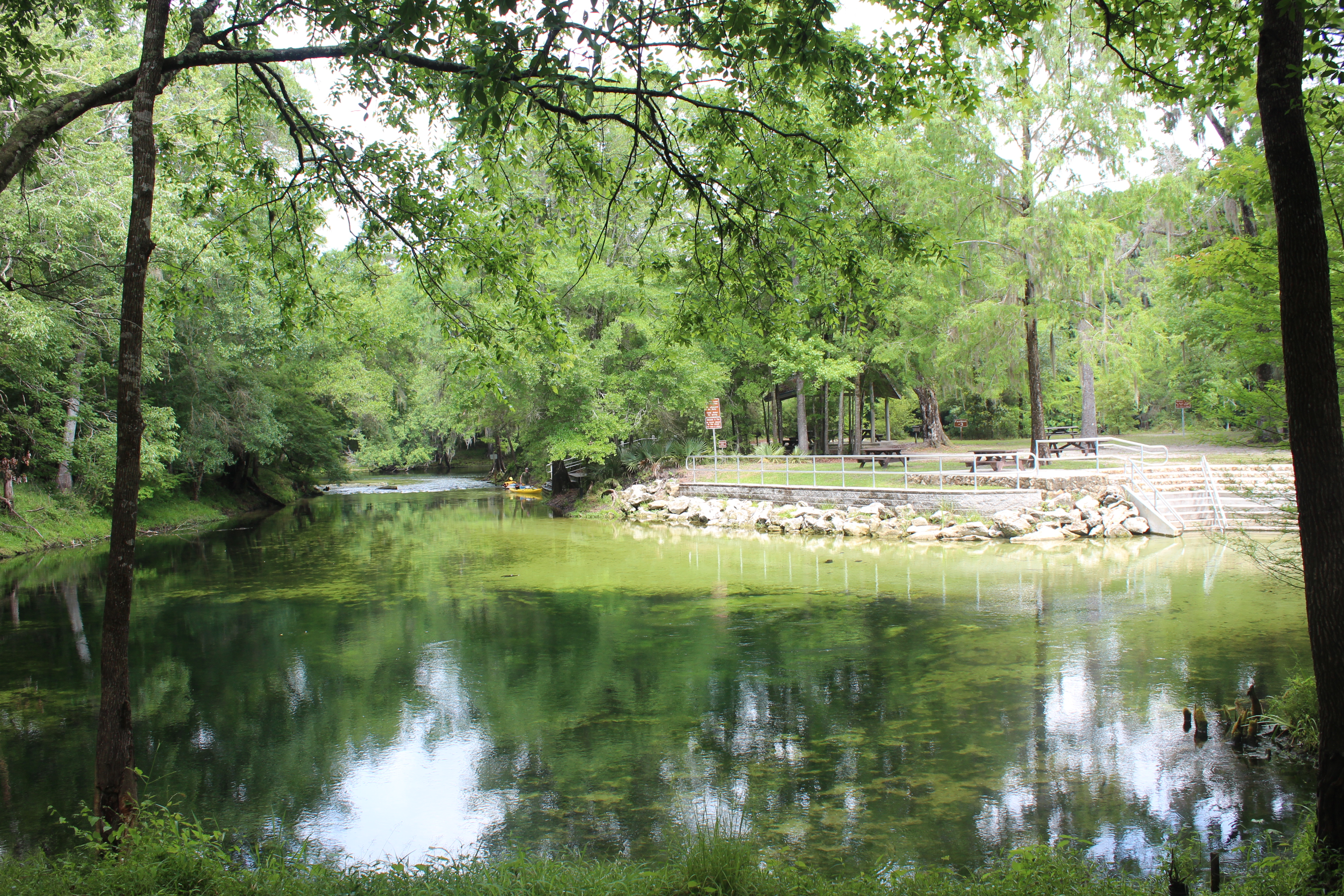
Poe Springs
All of the springs of the Sante Fe were open for ‘paddlin,’ facilities were available at most for ‘trail-stops.’

.
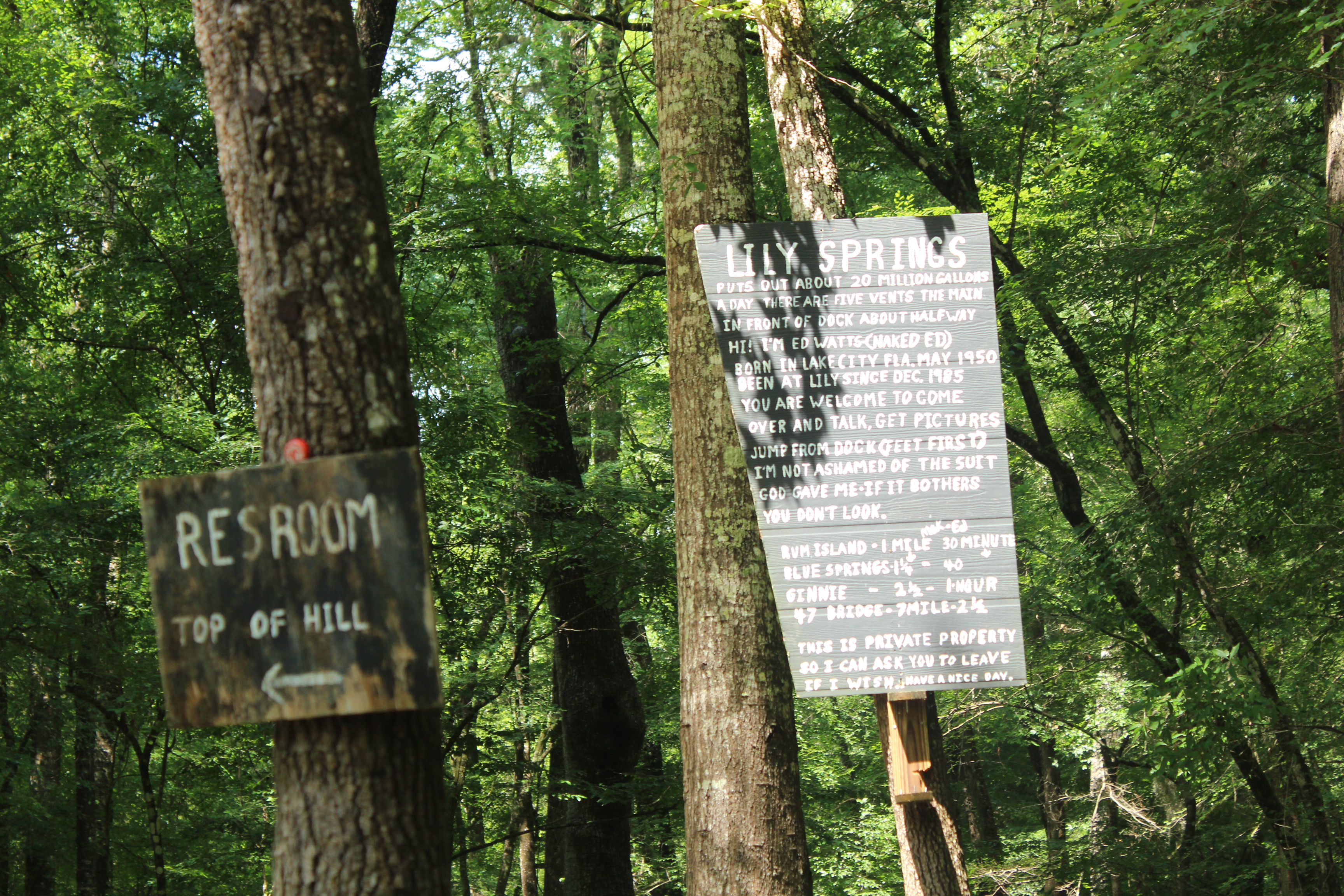
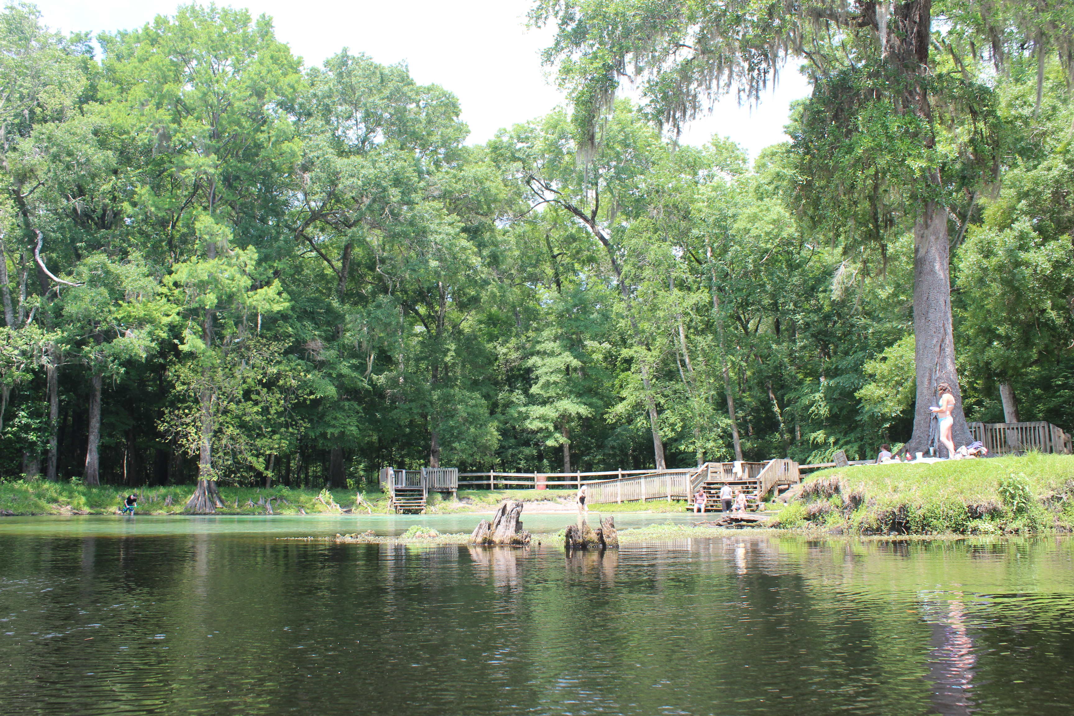
Lily Springs
Not far down from Poe was Lily springs
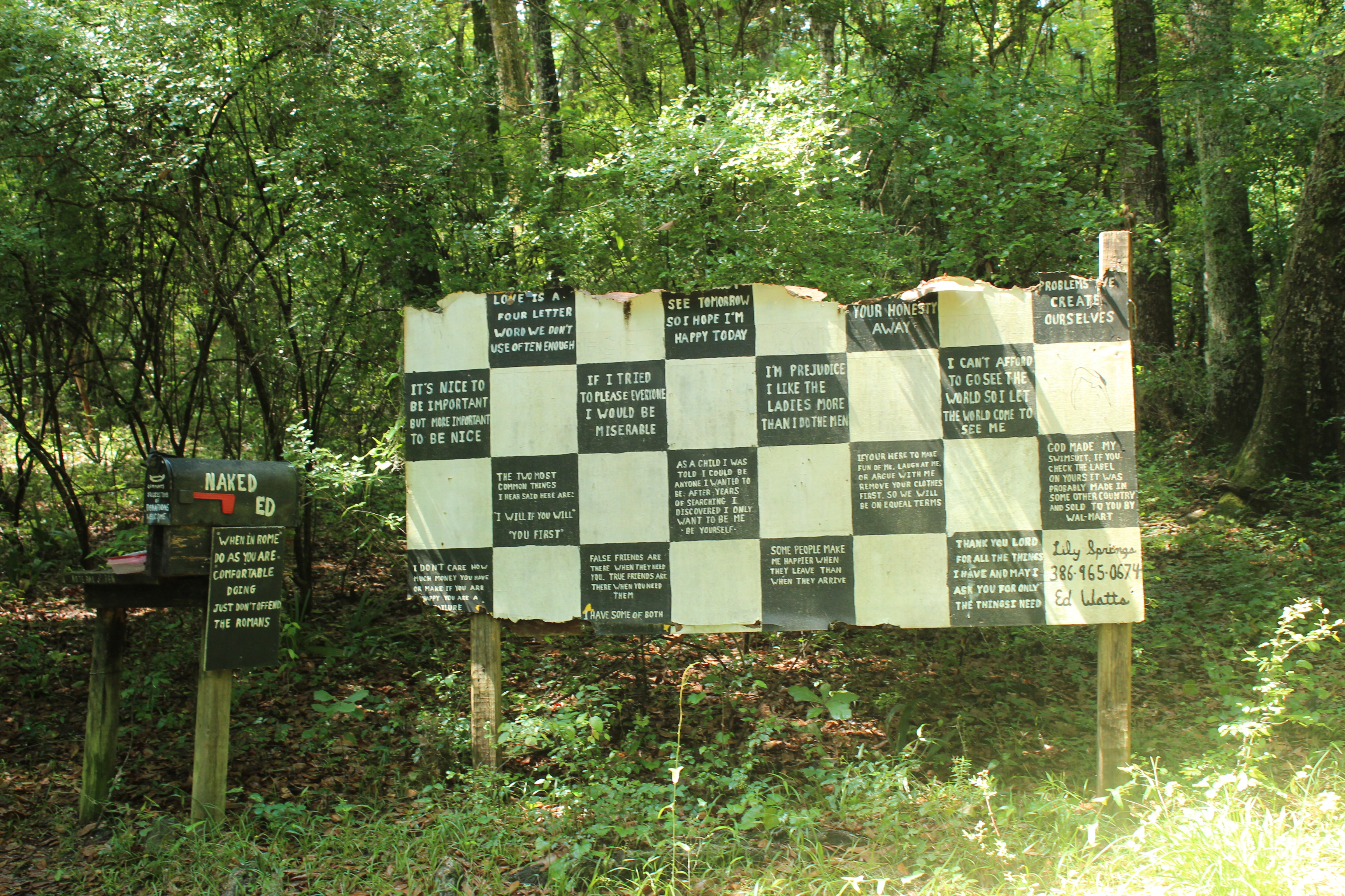
Clear as mud
and ‘Naked Ed’s abode. Nope, I didn’t see ole Ed – but his story and place makes the paddle all the more interesting; “riverspere” – just part of it!
.

.
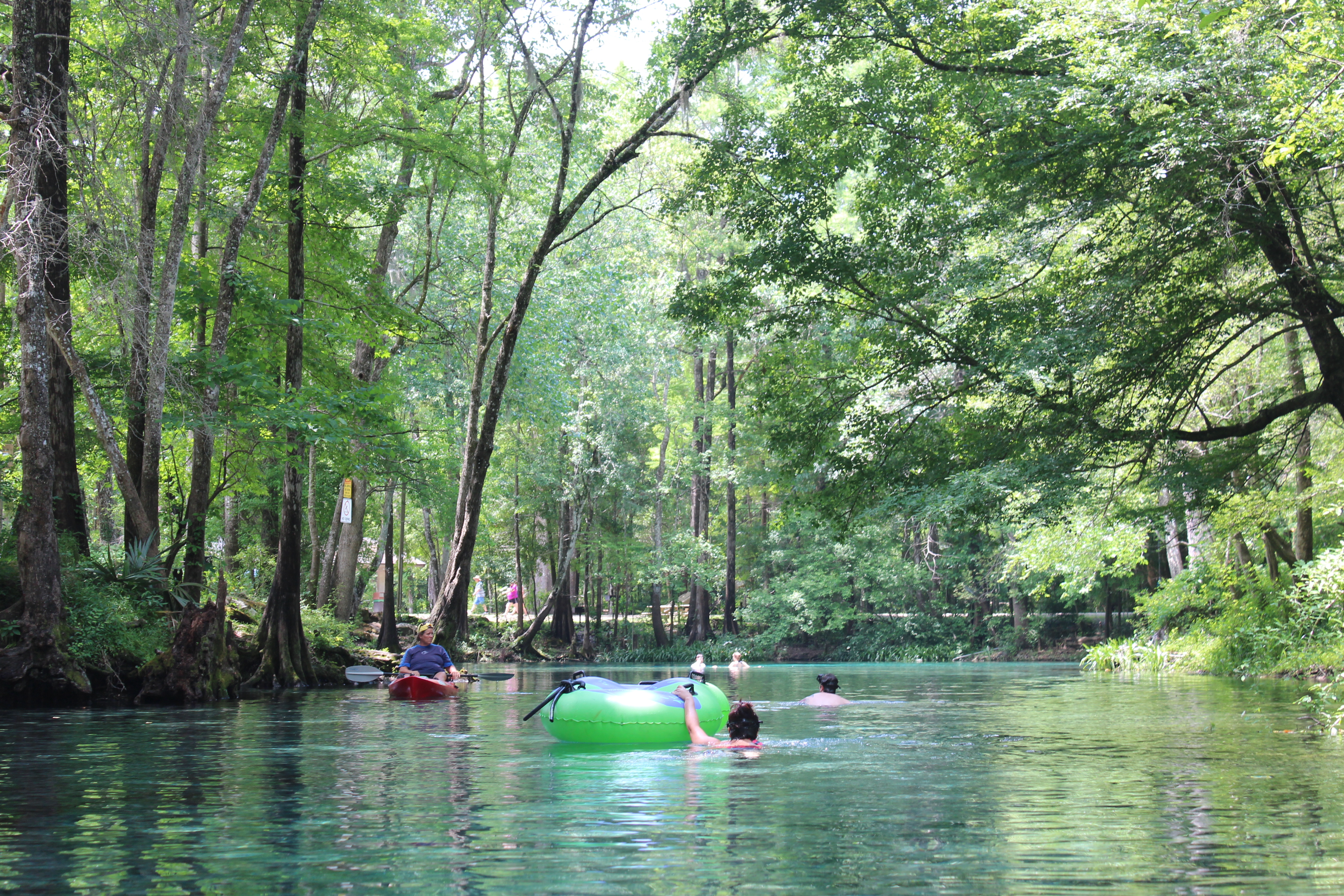
Spring at Rum Island
There was no rum available at Rum Island, but the spring was another beautiful example of the Sante Fe’s water. Beautifully clear water from the spring-head, felt good too – a constant 72 degrees.

Ginnie Springs
In addition, just down the way was Ginnie Springs
They have a fine place for folks to camp, dive, or just frolick in the waters
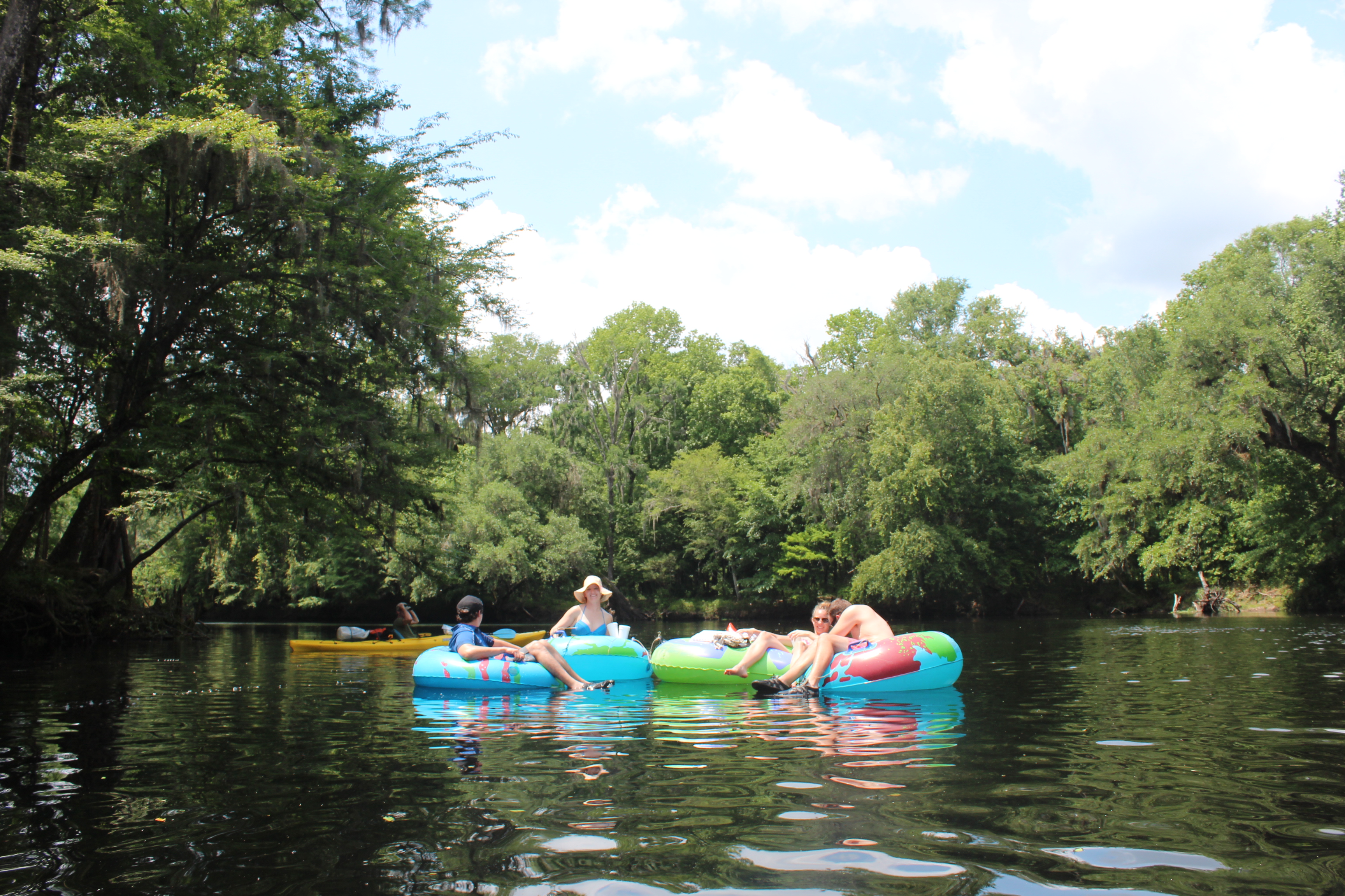
– on the spring-head, or while floating down the river.

The river’s gnarly characters, much like the Suwannee’s
.

Later down river and in the afternoon, mechanized traffic was present. Personally I don’t have a problem with mechanized traffic – they are doing their thing, Naked Ed’s doing his, and I’m simply doing mine.

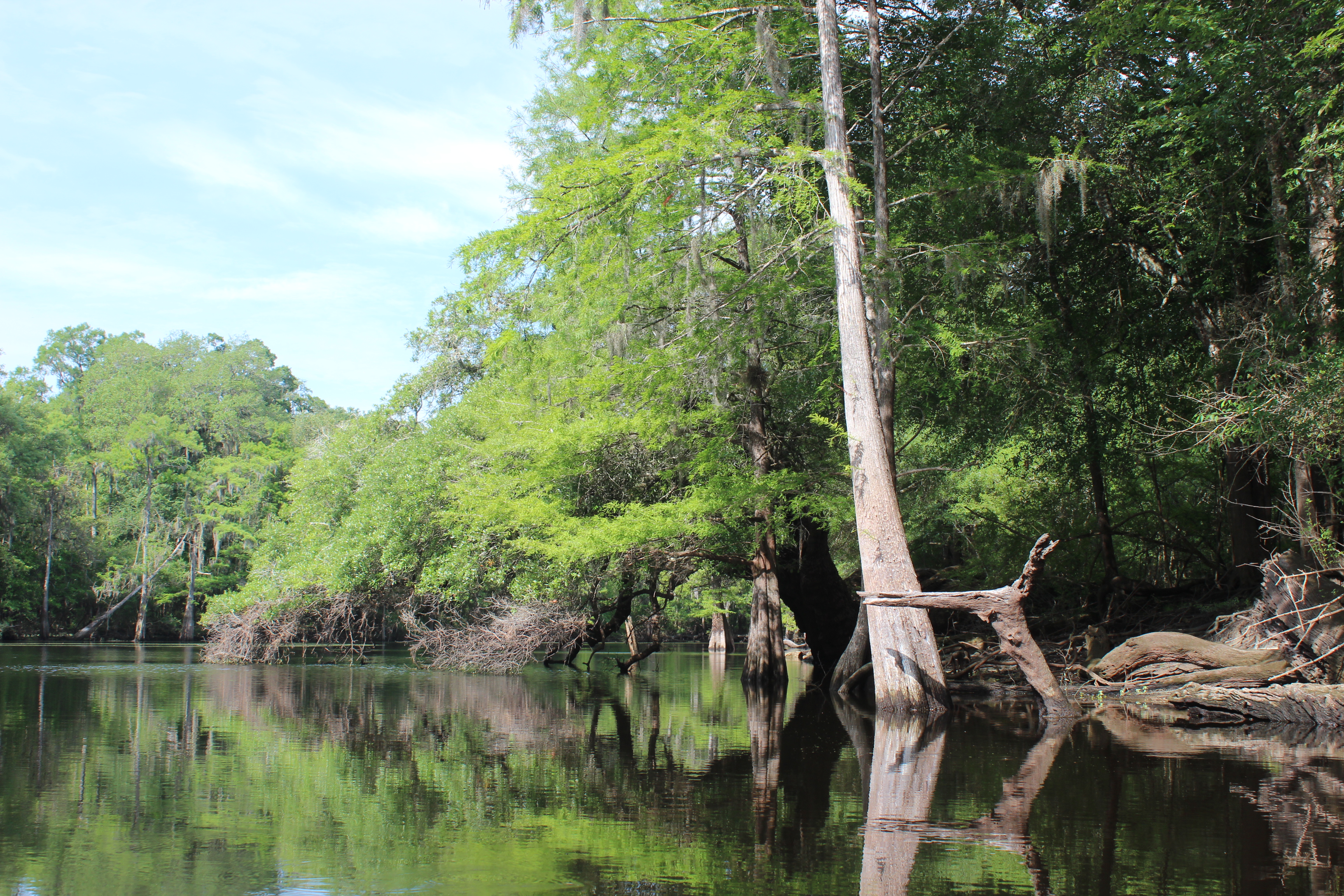
The trees too held waterlines of seasons past, there are some ‘standouts’ along the way; beautifully aged trees, many cypress – proudly supporting little eco-systems of their own.
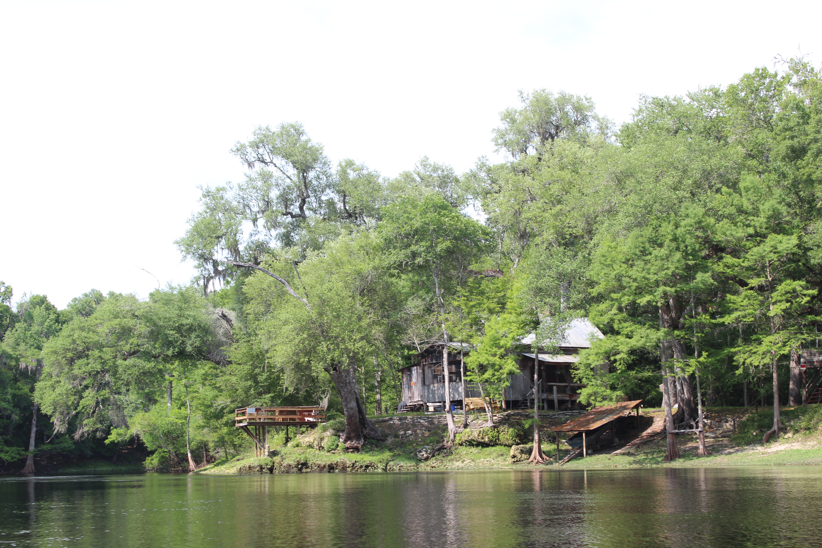
Early homesteads

Spending time with a river means living along the river, finding a campsite for the night; is once again, just a “part of it.” We had guestimated our stop at the Ichetucknee, but this island about an hour prior invited us in. It was a good choice.
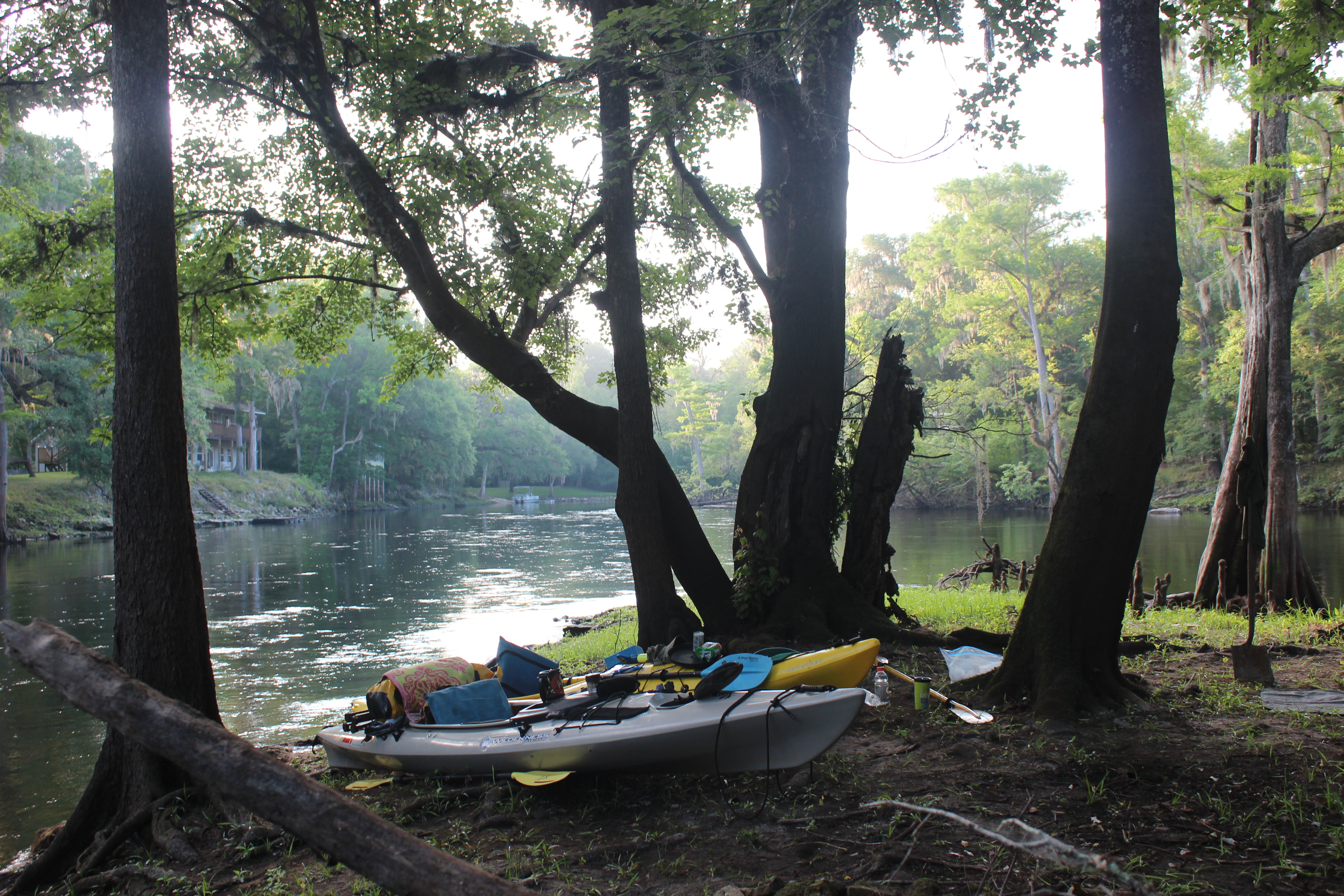
Along the way I’ve learned that a paddler goes down and rises with the sun, it just works that way after a full day of paddlin (with a few exceptions). For the day I had seen turtles, gators, turkeys, kingfishers, osprey,otters, deer, a family of wood ducks, and more. There were fishermen working the evening waters to entertain my supper, and the lullaby of the owls once again to send me through the night.
The ground was soft and level. zzzzzz.
The best thing about a good nights sleep, is that it is preparation for the finer moments that a river can share; morning paddles – be on the water at 8:15.

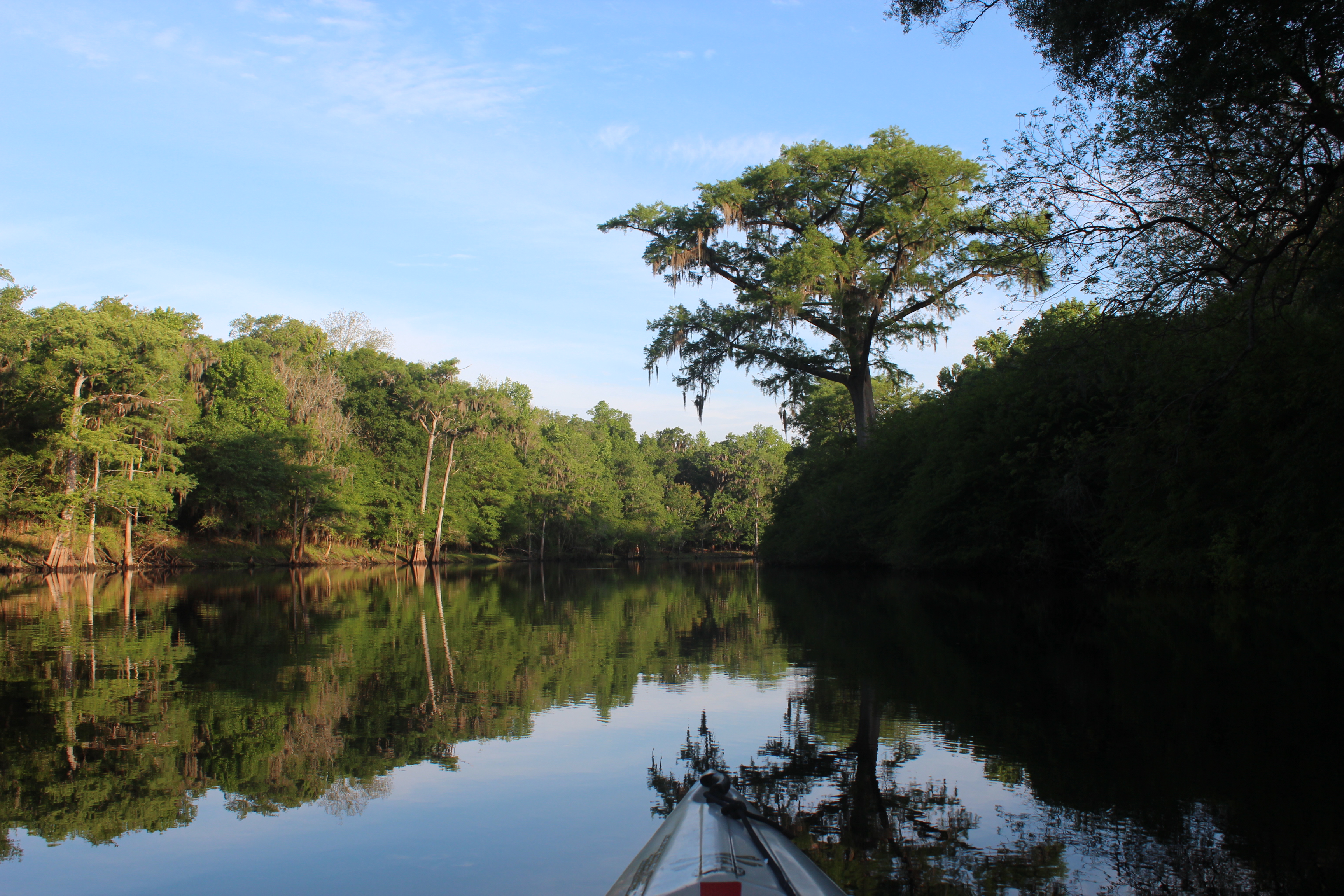
Gordy and I were once again paddling a familiar setting
coffee, and the morning’s peace eased the transition into another day.
 .
.
a cormorant, turtle, and speedboat

The Ichetucknee
At the Ichetucknee the water is a 10! Crystal clear, we paddled up to the first landing available. Our plans included the option of paddling the 6 miles up to the Iche’s spring-head, but having seen the awesome beauty of the Sante Fe’s springs already – the paddle really wasn’t necessary.
Our paddle rate had been leisurely and we wanted to keep it that way – so we eased on.

There were limestone shorelines of eons past

and mighty trees, some eroding away

.Simple directions

After the Hwy 129 bridge it was a few more miles out to the Suwannee.
It began to cloud up, and out of nowhere Ellie Rays appeared. At our pace it was easy to see the neon beverage sign on the window of their bar/restaurant. Could there be some ‘land-food’ in our immediate future??? It was one fine place, on one fine river.
The rain came about the same time as our double-burgers and my beverage went down like the water falling off the roof. There was serious contemplation about sitting right on that stool and calling the outpost – they could deliver our vehicle to Ellie Rays (a good idea for someone paddling the Sante Fe). The showers subsided, and Sun returned.
Working our way through the burger and another beverage – Gordy and I set-out to complete our trip as planned; a mile or so to the Suwannee, then 10 miles to Rocky Bluff….

I am impressed with this river and highly recommend the experience. The Sante Fe is a primitive river and with all those wonderful springs along the way the water clarity is high – to clear. The river’s Natural quality is beyond that. This river supports healthy aquatic life which in turn support other system-species seemingly abundant and thriving.
The Sante Fe provides a setting for family day trips, or longer paddle trips. If pondering distance paddling – this and/or the Suwannee rivers provide fine settings for getting a feel of such adventure. The river’s simple length of @ 30 miles with multiple access points and the potential of culminating at one of the RV parks (there are two beyond 129, Ellie Rays recommended) makes this a very desirable paddle experience for any paddler.
.
Sante Fe River Mileage Chart
00.0 Santa Fe Rise
02.4 Darby Spring river left
02.5 US 441 bridge
02.6 Santa Fe Outpost (rentals)
02.7 High Springs Ramp off US 441
02.8 Columbia Springs river right
04.8 Suck Hole river right
05.7 River Rise Ramp off US 27
05.8 US 27 bridge
06.6 Transmission Line
07.2 Allen Spring river left
07.8 Poe Spring
08.6 Lilly Spring
09.6 Rum Island County Park
09.8 Gilchrist Blue Spring river left
10.1 Transmission Line
10.7 Devils Eye and Devils Ear Spring river left, July Spring river right
10.9 Ginnie Spring
11.2 Ginnie Springs ramp
11.4 Sawdust Spring river right
13.0 Transmission Line
13.6 Unnamed springs in river bend
13.7 Siphon Creek East
13.9 Siphon Creek West
14.5 Santa Fe River County ramp off SR 47
15.0 Hollingsworth Bluff Ramp
17.5 Wilson Spring river right
17.7 Wilson Springs ramp
19.6 Ira Bea Oasis ramp
20.7 Jamison Spring river right
20.9 Sunbeam Spring river right
21.6 Oasis Spring right left
23.4 Ichetucknee joins from river right
26.5 Betty Spring river right
26.8 Troop Spring river left
27.9 Lemmons Memorial Park ramp off US 129
28.2 Sandy Point Campground ramp
28.8 Campground Spring
29.0 Ellie Ray’s River Landing Ramp
29.1 Trail Spring
29.5 Unnamed spring in swamp river right
30.0 Unnamed springs In swamp river left
30.2 Wanamake Ramp
30.3 Confluence with Suwannee River
.
Paddling the other two rivers on this trip didn’t work out, but somehow in justifying direction I felt fulfilled by the Sante Fe. It had rejuvenated me with the riversphere that I needed within – “Good ’nuff.”


Apr 19, 2015 @ 20:34:16
Good to see you back on the water. Always love reading about your trips. Hope all is well. Keep your paddle wet!
LikeLike
Apr 24, 2015 @ 08:38:49
Thanks Bob… all is well
LikeLike
Apr 27, 2015 @ 15:27:59
Thanks for all the great pics and information
LikeLike
Apr 27, 2015 @ 20:05:20
You’re welcome Steve, thanks for your interest – and have a fine time on the water….
LikeLike
May 20, 2015 @ 09:24:44
This is my river and has been since I was about 15. ( I am now 65) I love this river with all my heart! I now live about 1 mile from the 47 bridge and was looking to see how long a float it would be in my kayak to sandy point. I SO enjoyed your pics and posts. Thanks for sharing!!
LikeLike
May 20, 2015 @ 10:09:57
Thanks for your interest Sandy, have a nice paddle – great little river.
LikeLike