Suwannee River Mileage – Trip Agenda; Ideas
.
“Wanderlust”
– a strong, innate desire to rove or travel about.
– a positive emotion.
.
Suwannee River Wilderness Trail
trip-links

Go Paddle this thing !
..
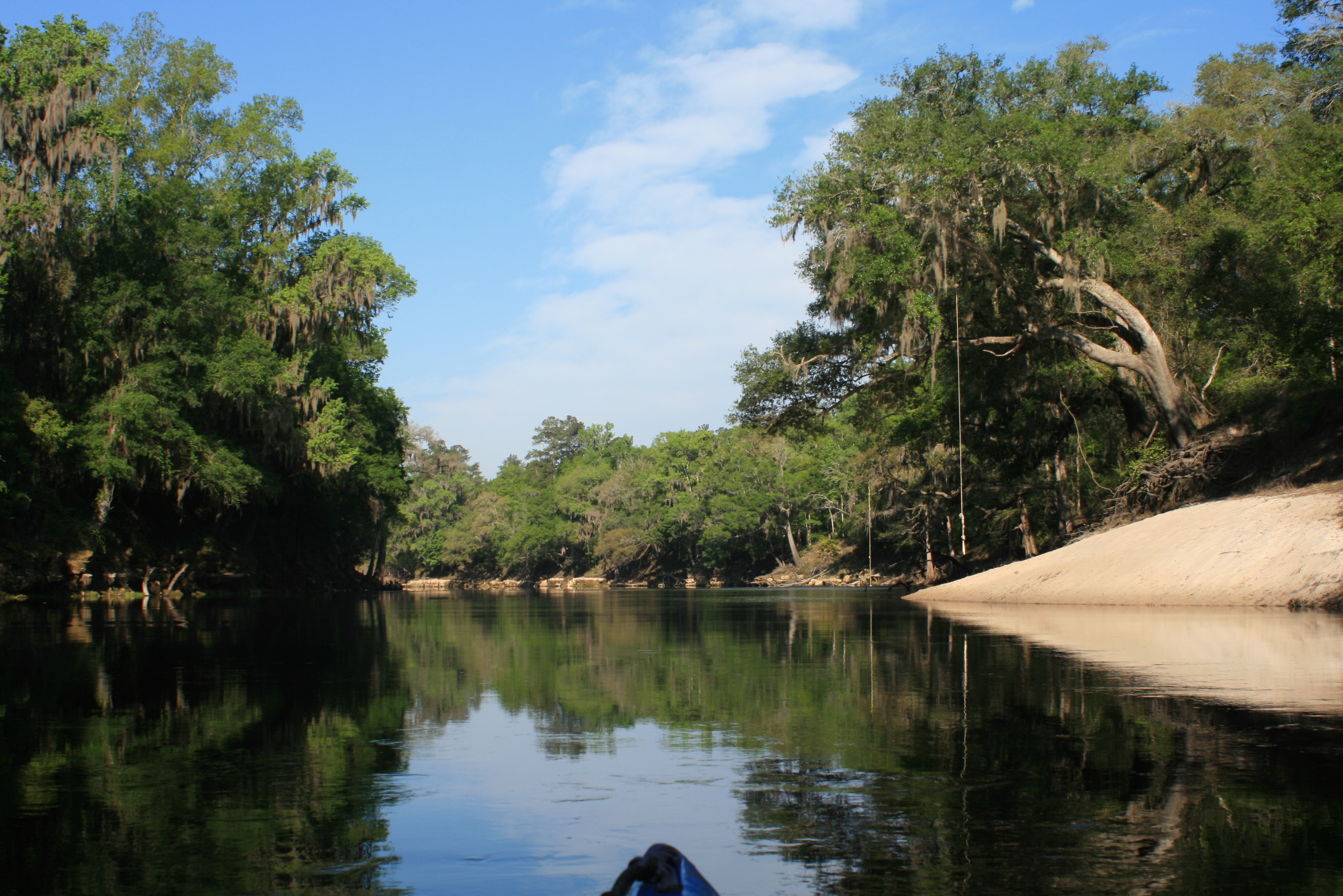
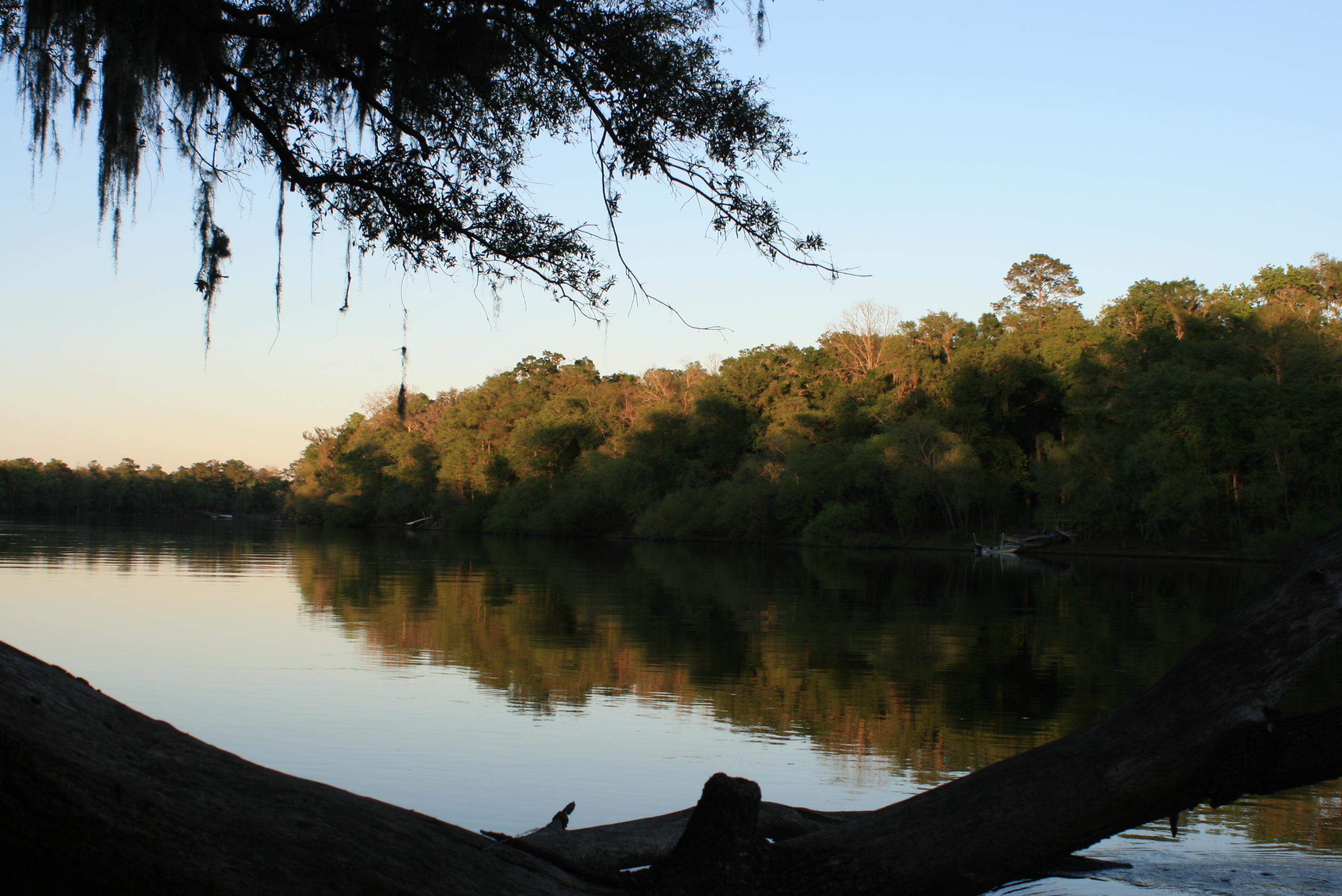
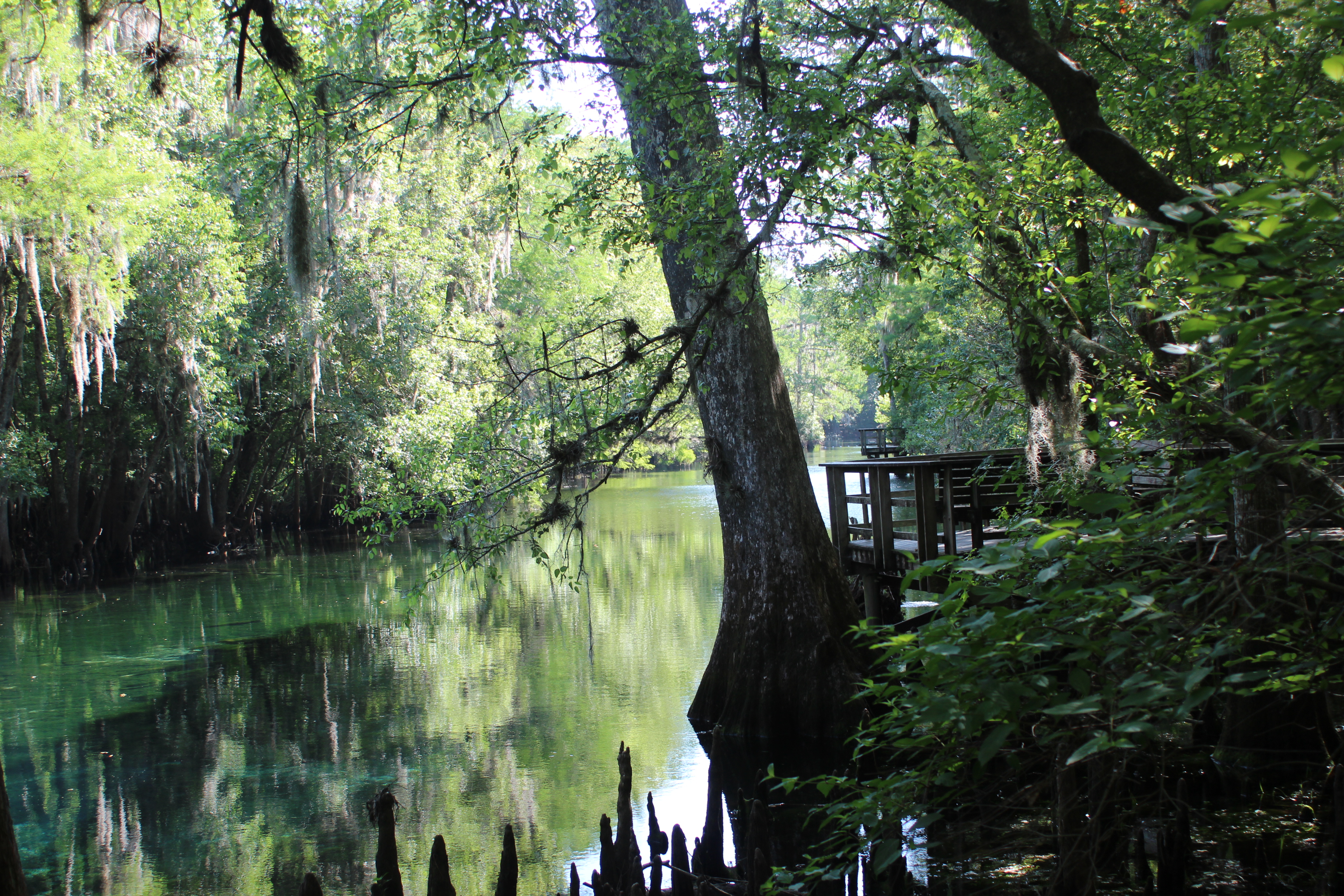
The Suwannee River begins it’s journey as bog-water within the Okefenokee Swamp of southern Georgia. The sediments of the area seep into the pristine water creating a tea-colored (tannic) liquid. This slow moving swamp begins its journey across two states as a creek, before emptying as a full fledged river into the Gulf of Mexico 240 miles later near the little town of Suwannee, Fla. A number of interesting and visit-able high-magnitude springs nourish that flow along the way.
Springs along the Suwannee Other cool Florida Spring pictures
The river is all paddl’able, and whether enjoying sections of the river or going the distance, you’ll find the effort along the Suwannee supported by local businesses, community spirit, and the State of Florida alike – “its good air.”
Big Shoals above hwy 41 (White Springs) is Florida’s only natural class-III rapid – it’s a @1000′ portage and in a good place for ‘through’ paddlers to camp.
For those seeking distance; the most practical starting point in Georgia is at Fargo (Hwy 441, or the Suwannee sill; this leaves a 9 or 10-day paddle 225-miles to the Gulf –BUT – there are multiple shorter options.
For a casual ‘feel’ to the Suwannee, the Holton Creek area is an ez two day one night acclimation; (put-in at Spirit of Suwannee Music Park (Canoe Outpost) – paddle upstream for a couple miles to Suwanee springs – then paddle downriver for a night at Holton Creek river camp. Next day; paddle a bit further and take-out at the Suwannee River State Park.
Other access points North to begin; the Suwannee Sill (above Fargo); Fargo at hwy 441; the Hwy-6 bridge, or Cone Bridge landing – these points are each above the Big Shoals portage.
Below Big Shoals; the hwy-41 bridge in White Springs, Fl,. The above BS points could add up to a couple primitive camps on the river before a hot-water night at Woods Ferry river camp, culminating at the Canoe OutpostCanoe Outpost (music park Live Oak)….. there you could get out, or restock from your vehicle before moving further down-river towards other outage points or the little town of Suwannee at the gulf.
CAMPING; Plan and pack for primitive camping.
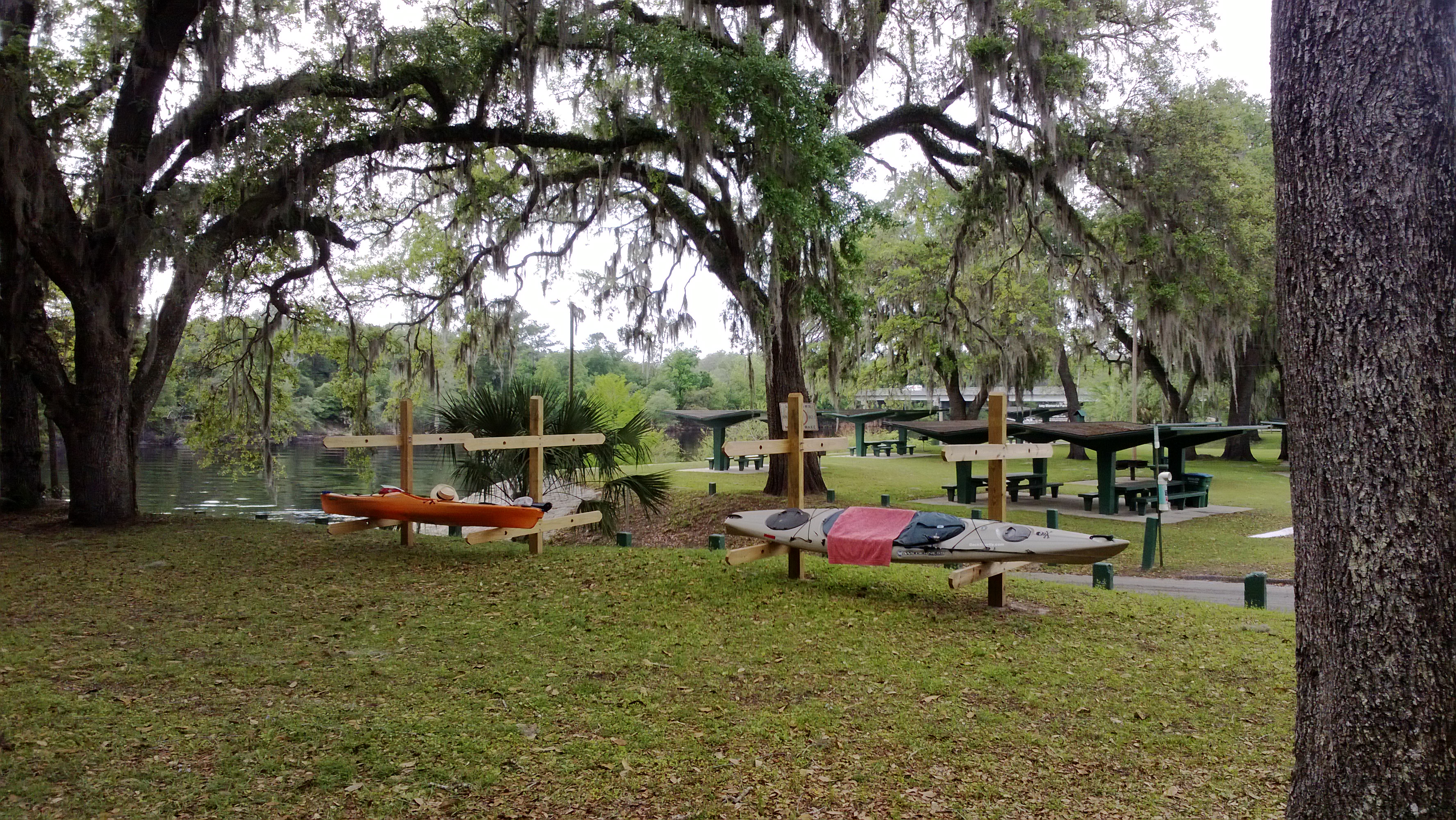
From Fargo to the Gulf; nights 1,2,7,8, and nine are primitive, other nights are much better with elevated screened rooms and hot showers provided by The Suwannee Wilderness Trail river camps. These camps are free of charge for paddlers or hikers only (you just have to call ahead). If by chance the elevated platforms are full, primitive spaces remain available at the river camps – with use of hot showers.
FOOD; Have your own. A foot-long subway usually provides me with a full day’s start (half for lunch and the rest later); then its trail mix and MRE’s unless something better comes along – most of the time I find myself more absorbed with the setting than that of being ‘hungry. Yet there are several points along the way where ‘land-food’ (ballast) is possible;
- mm 168 – at White Springs ( .8 walk, pass – shoot for day 4) Day 3 from Fargo
- mm 148 – at store/cafe within the Music park (.8 drive up if parked there) Day 4 from Fargo
- mm 76 – at Branford, Ivy Park – good ‘ballast-buffet’ restaurants (.2 ez walk) Day 7 from Fargo
- mm 65.5 – ONE mile up the Sante Fe river – awesome bar/campground/rv park – Ellie Rays ,could easily work as a ‘take-out’ point.
- mm 56 – top of hwy 340 bridge landing before Gornto, Rock Bluff store deli sandwiches, hamburgers, cold beverages…(.2 ez walk) Day 8 from Fargo
- mm34 – at Fanning Springs – the lighthouse restaurant immediately adjacent the Park, others too (.3 ez walk) Day 9 from Fargo
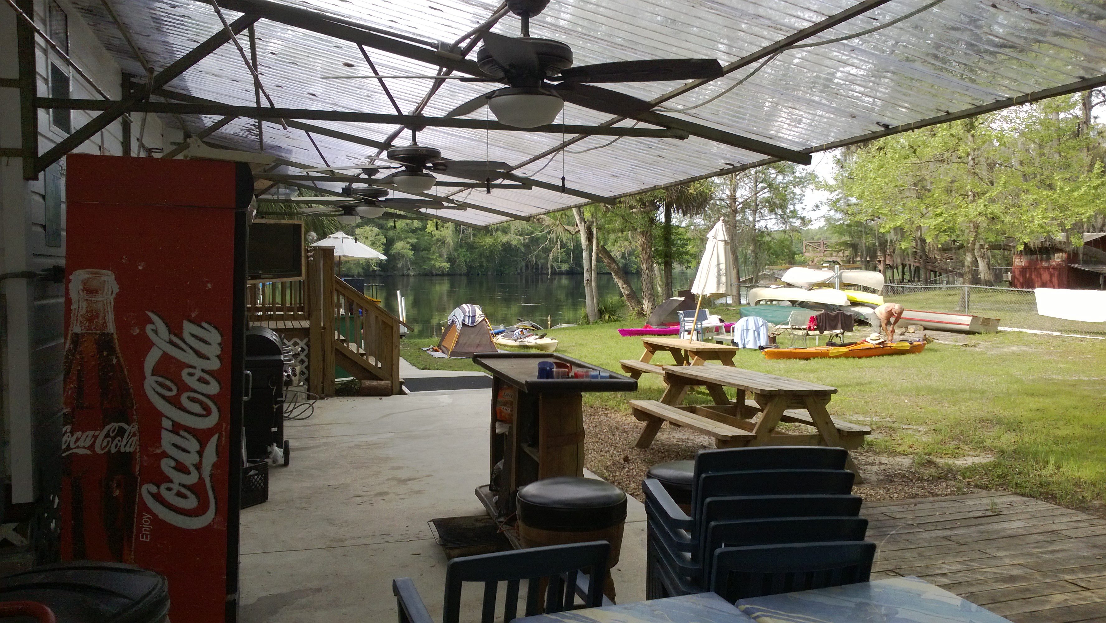
- mm 16 – at Fowlers Bluff – the Treasure Camp restaurant – camp there; live music at times (riverside) Day 10 from Fargo
- mm 1 – Salt Creek and Marker 29 Restaurant in Suwannee (.8 walk) day 11 from Fargo
WATER; In the kayak we maintained a gallon of fresh water (you can refill at any river camp; also at the granite steps below White Springs) – a canoe could of course be outfitted with an ice chest (and beverages) if that was your plan. Trash cans are available at the river-camps.
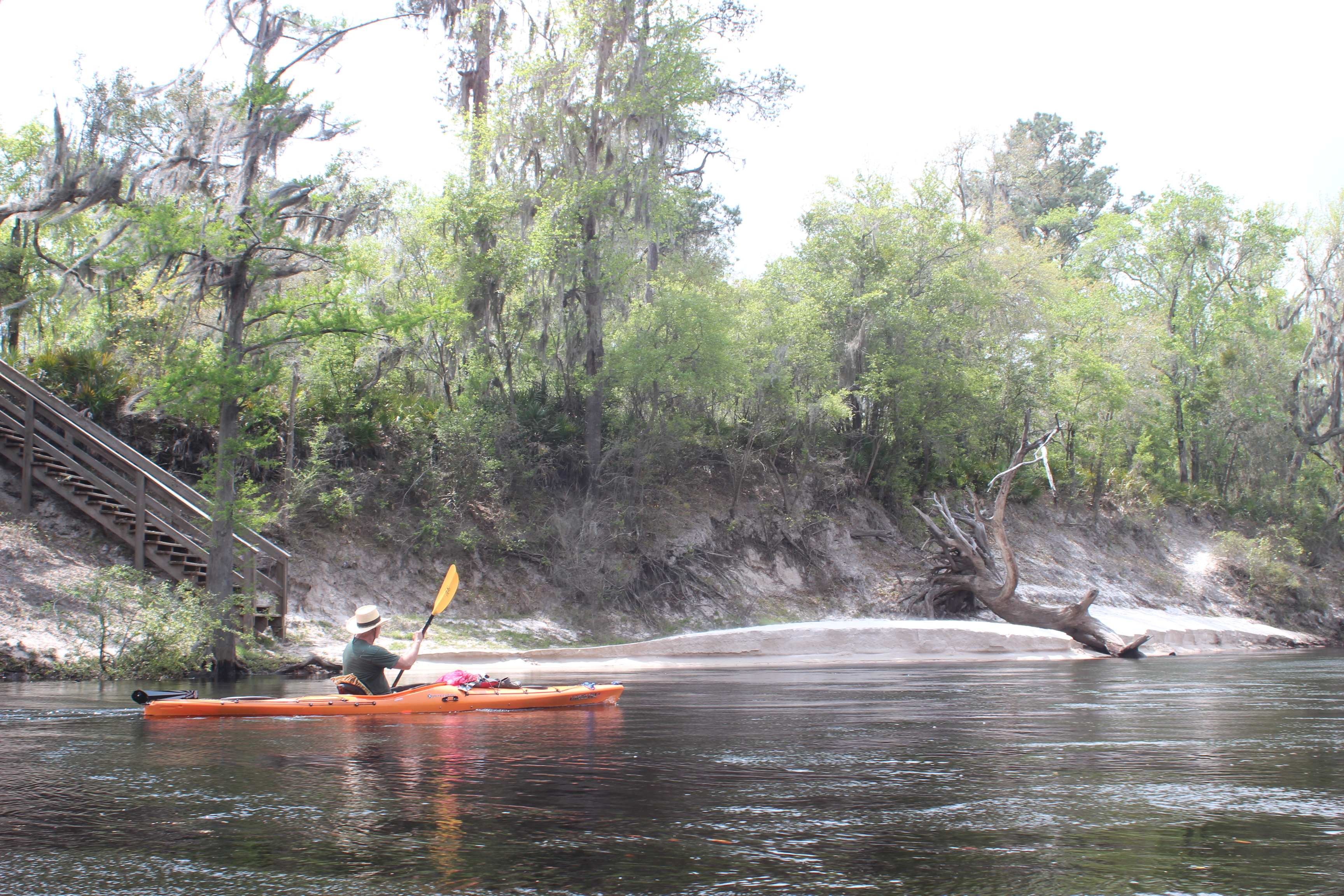
The paddle is a great opportunity to observe the changes where this simple flow of water has carved a niche through the ancient Florida landscape – along the river you’ll find the shorelines of eon’s past plus those of recent articulation. Most of all paddling the Suwannee is about doing yourself a favor and simply ‘unplugging‘ from the ‘rat-race’ of society – true “social-distancing.” A dedicated Suwannee river paddle is a great place to begin ‘this cleansing’ – try it with your phone ‘Off!‘ or at minimum ‘airplane-mode’ while paddling (ps; electronics can be ‘charged-up’ at the river camps).
- As for river-speed, just estimate a casual paddling rate of 2.5 to 3 mph (a solid mph greater with high water)
Oh yeah, my experience points to being on the water before 8:30 – the whole reason for paddlin the Suwannee lays within the peace and stillness of those early mornings. Nature’s best, it’s what its all about….. then stop early in the afternoons if you want to get the most out of camping/socializing..
– and sure, the complete Suwannee can be paddled faster than 10-days; but the best advice that I heard early on, was to make the most of your time and effort to be there, take your time – and savor the paddling experience. Solid advice.
.
2017 SW River Management Landings Map – PDF
Go Paddle this thing !
Suwannee River Mile References
Note; the Suwannee river’s mile references are correct – yet there are no physical markers (signs) along the river to help with ‘exact’ orientation. Markers on any river are not absolutely necessary but after a career of emergency service – having a ‘mark’ here-and-there seems prudent.
Maybe a little spoiled from 1800 miles of the Mississippi where such ‘benchmarks’ provided a measure of entertainment on long days. The Current river is another exceptional river to paddle (with crystal clear water) which would benefit with certain informational benchmark’s along the way (my 2-cents).
.
240.o The Okefenokee Swamp – a tricky section with several short portages
235 Suwannee Sill
221.0 Hwy 41 at Fargo, Ga from here it’s a nine day paddle to the Gulf.
NOTE:
CHECK this WATER DEPTH gauge (link here) refer to the WHITE SPRINGS reading!
Suwannee Rivers link and similar paddling suggestions
- below 51′ – from Fargo to White Springs; frequent shoaling, slow pools
- at 51 feet (less water) = slow water, keep the paddle moving
- at 53 feet – great water speed and level for the ‘topside’ section
 – best in between –
- 61′ reading (more water) = nice movement, but less riverside available downstream
- When over 66 feet – the river’s outfitters discourage paddling
Suwannee Springs with reading of 66′ at White Springs’
I’ve been asked about paddling the Suwannee when the reading at White Springs is over the 60′ level; having done it – it’s a more fluid ride with fewer noticeable shoals; you’ll get there easier/faster, but miss alot of the rivers true shoreline character.
Suwannee Springs with reading of 60′ at White Springs
Above 60′ camping will be less available as the river/camps sometimes close with high waters – Public springs on the lower part close (tannic water/gators creep in), and it won’t be as good a time to play along the way. No matter when/if you do it, the river will always be interesting in-your-own-way.
Our ‘high-water’ paddle at 60’+ was just fine – still, have a ‘plan-b’ in the worst of combined conditions (active weather + depth). As stated; the areas outfitters discourage paddling when over the 66′ reading at White Springs.
- being ‘hard-headed’; I take ‘opinions’ for what they are (esp from a non-paddler) and on more than one occasion have made the final decision at ‘waters-edge‘ – odds are if I’m there – I’ll ‘go.’

Suwannee Springs with reading of 52′ at White Springs
.
.
206 Georgia/Fla line
 (night-1 from Fargo, wilderness camp)
202.0 – Roline Ramp
197.7 – Turner Bridge ramp
195.7 Highway-6; some start here; its three days two nights to SR Outpost – Big Shoals portage ahead
185 – ‘Limpdick’ bend

186.5 – Cone Bridge ramp – Camping spot, but it can also be a zoo on the weekends; ‘locals,’ litter.
180 Night 2 from Fargo; primitive camp – sandbar in river (low water), or higher water you should make Big Shoals portage/camp
177.2 Big Shoals State Park – uphill to right, difficult to access
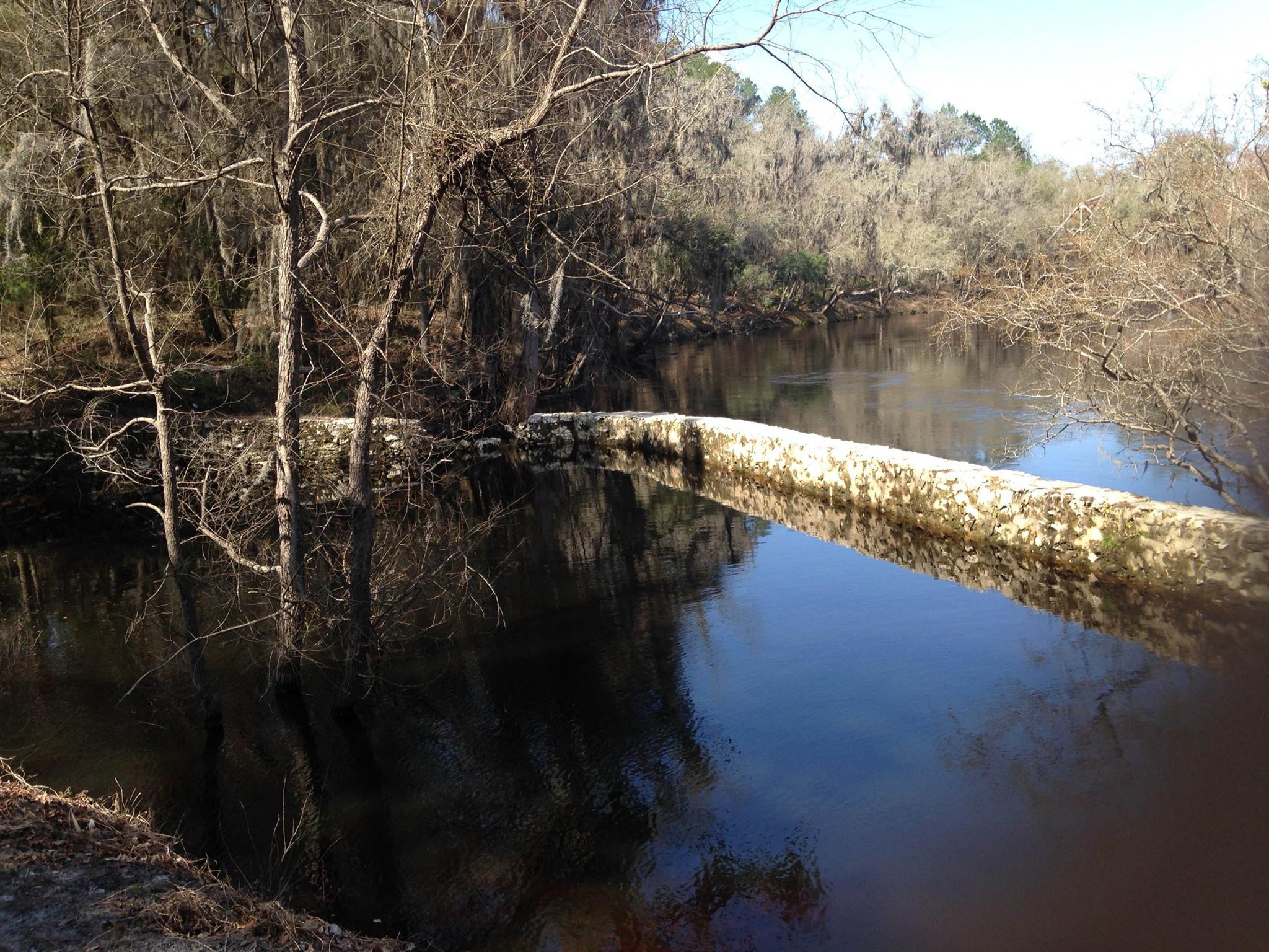
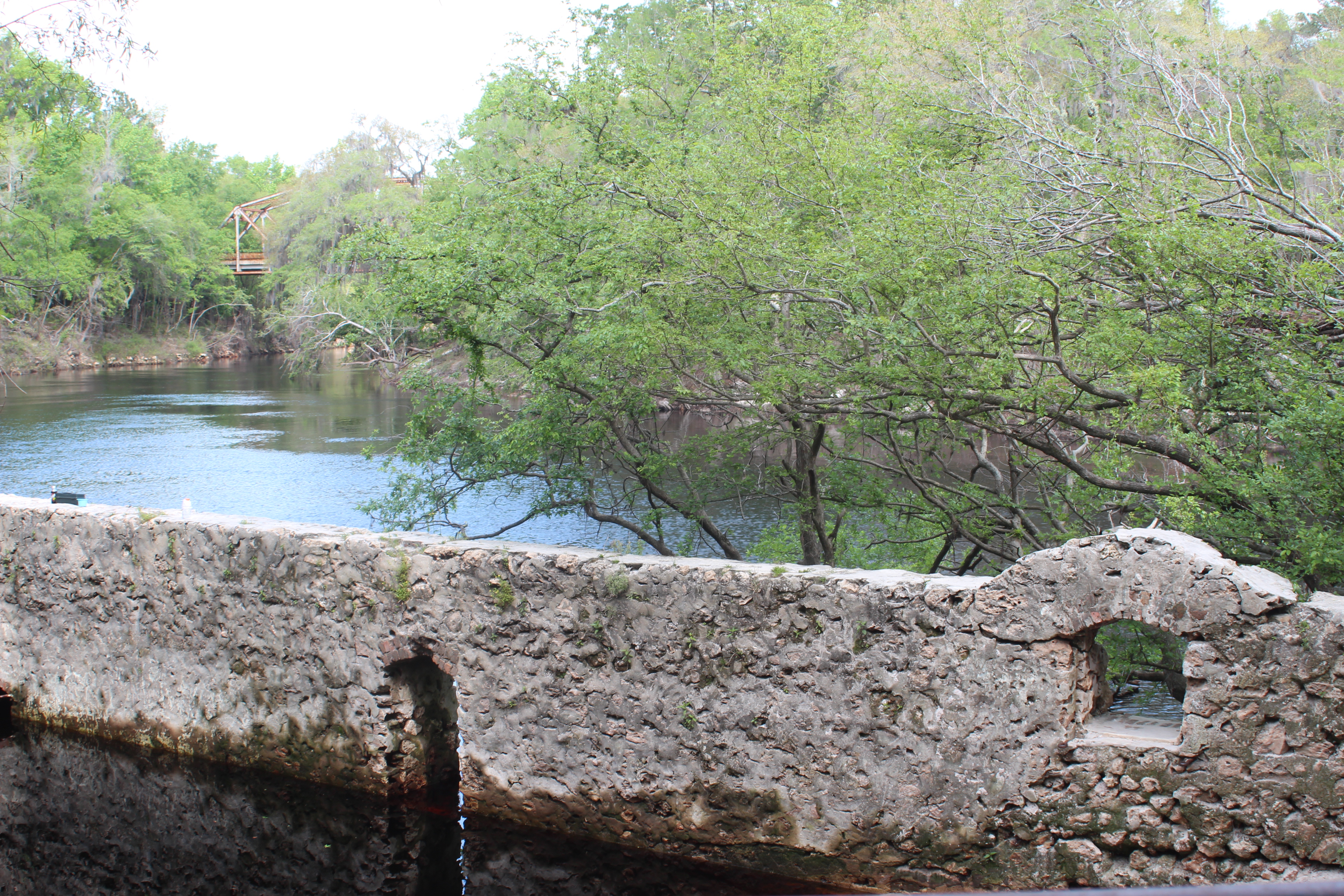
177 Big Shoals portage (camp) – to the left. The water above Big Shoals is slow-water, ‘pool-like;’ you can hear the shoals ahead. 1000′ PORTAGE. sign, great primitive campsite – Fla’s only natural class III rapid – N 30 21.19, W 82 41.24

Big Shoals camp
Half-way camp on Big Shoals portage
.

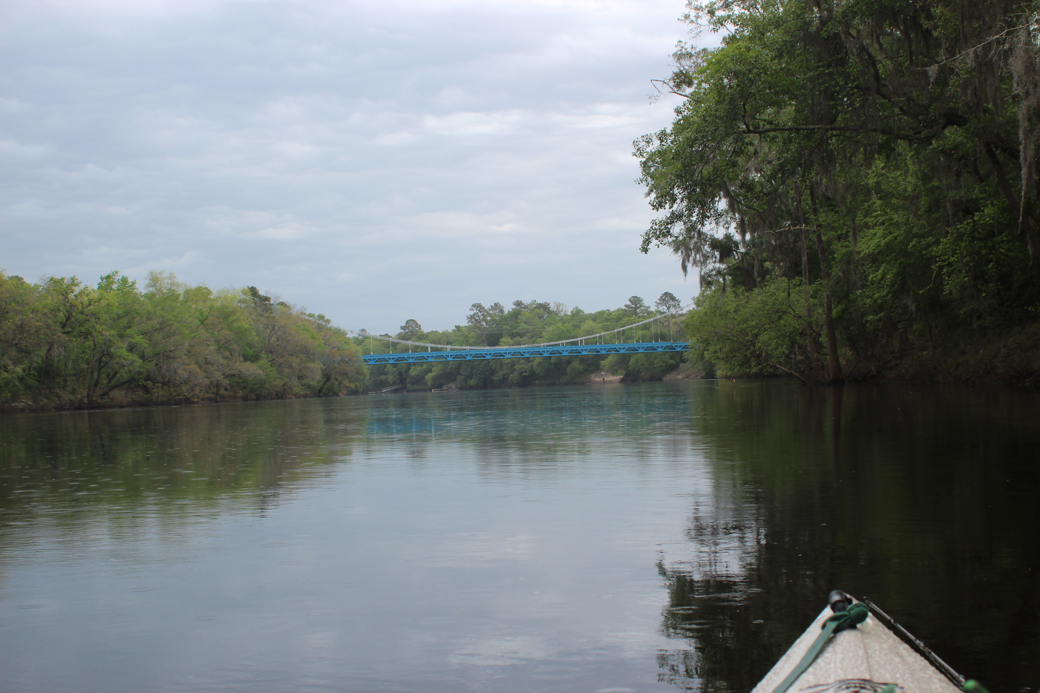
171 Highway-41 at White Springs; Great starting point for 2-day one night paddle to SR Outpost, ‘playful section’ – Here to Branford, with paddle days of; 11, 19, 27, 18 or 28, then 9 miles each day, you can stay at a river camp every night ! (N1, Holton Creek – to N2, Dowling Park – to N3 Adams Tract). A 10 mile paddle on day 4 gets you to Branford (or paddle 20 miles on day 4 to Ellie Rays RV park one mile up the Sante Fe river. Bar/land food). White Springs to Branford, a great stretch of the rivers character.
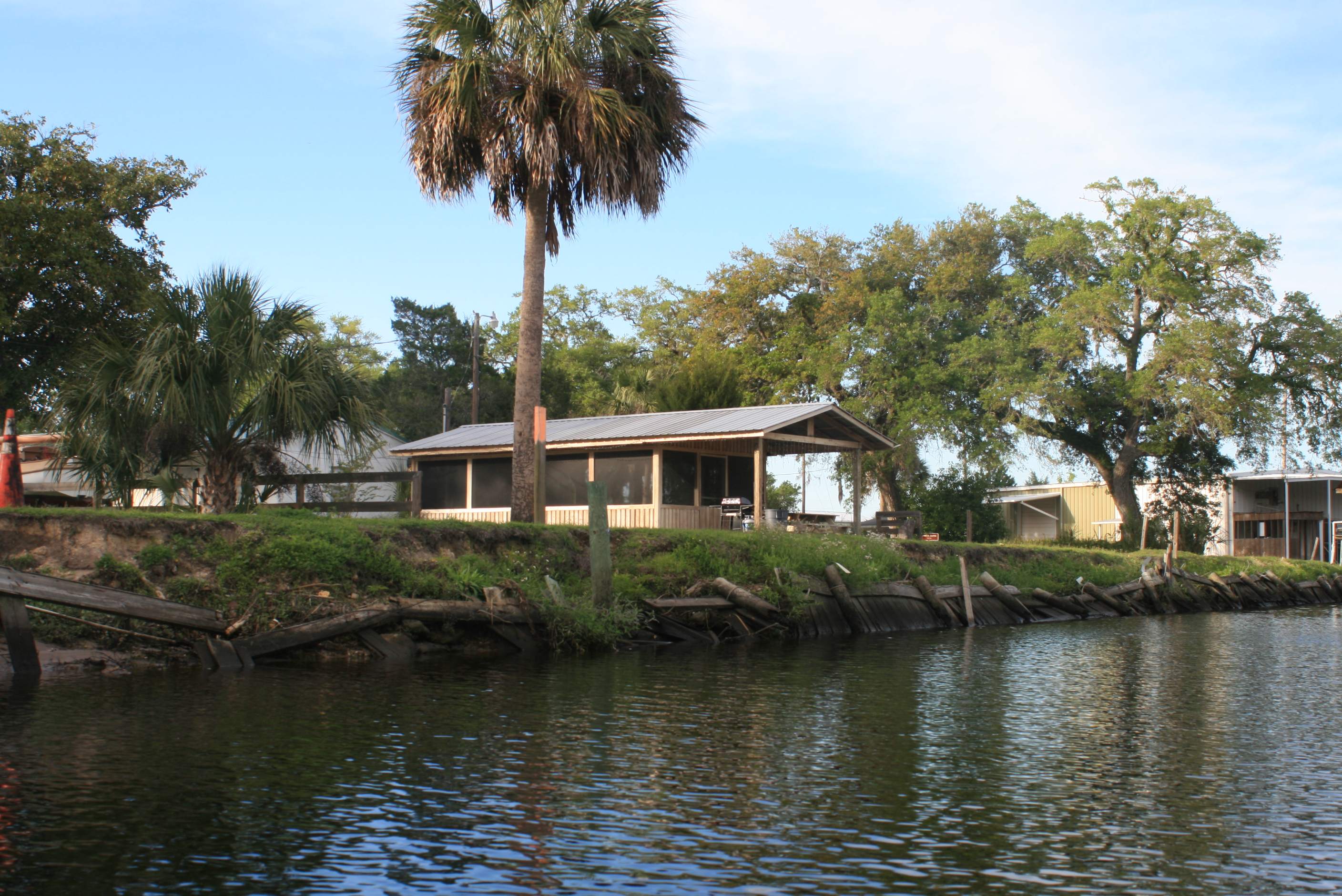
168.3 Hwy 135 Stephen Foster State Park White Springs – (Hub)
- Hubs are towns or parks ‘ A wide range of goods and services are provided to meet visitors’ needs. Visitors can enjoy special events, shopping and other activities.
163.2 – Interstate 75 – Blue Sink Launch/ramp
(night 3 from Fargo – Woods Ferry camp)
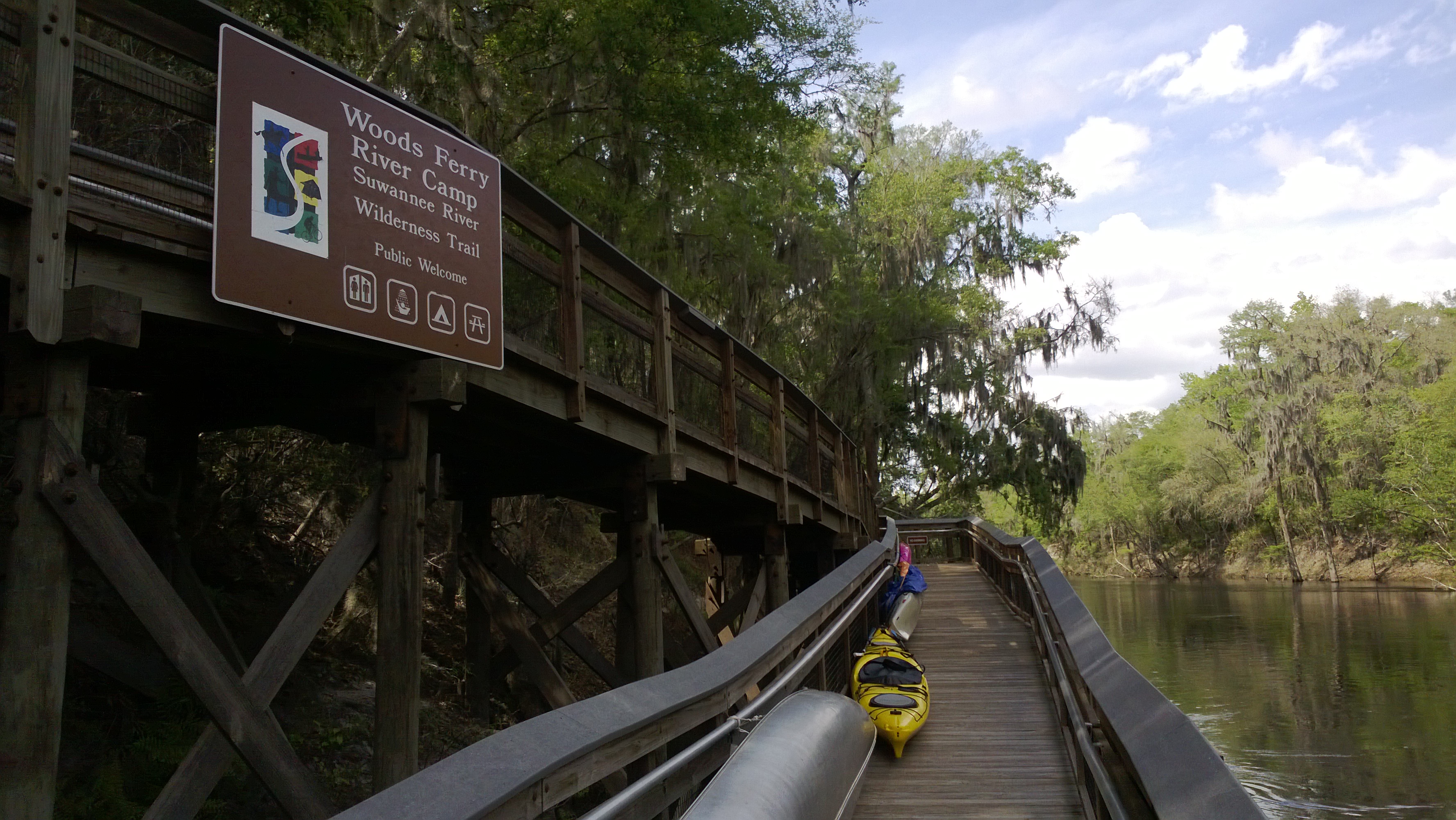
159.3 Woods Ferry River Camp
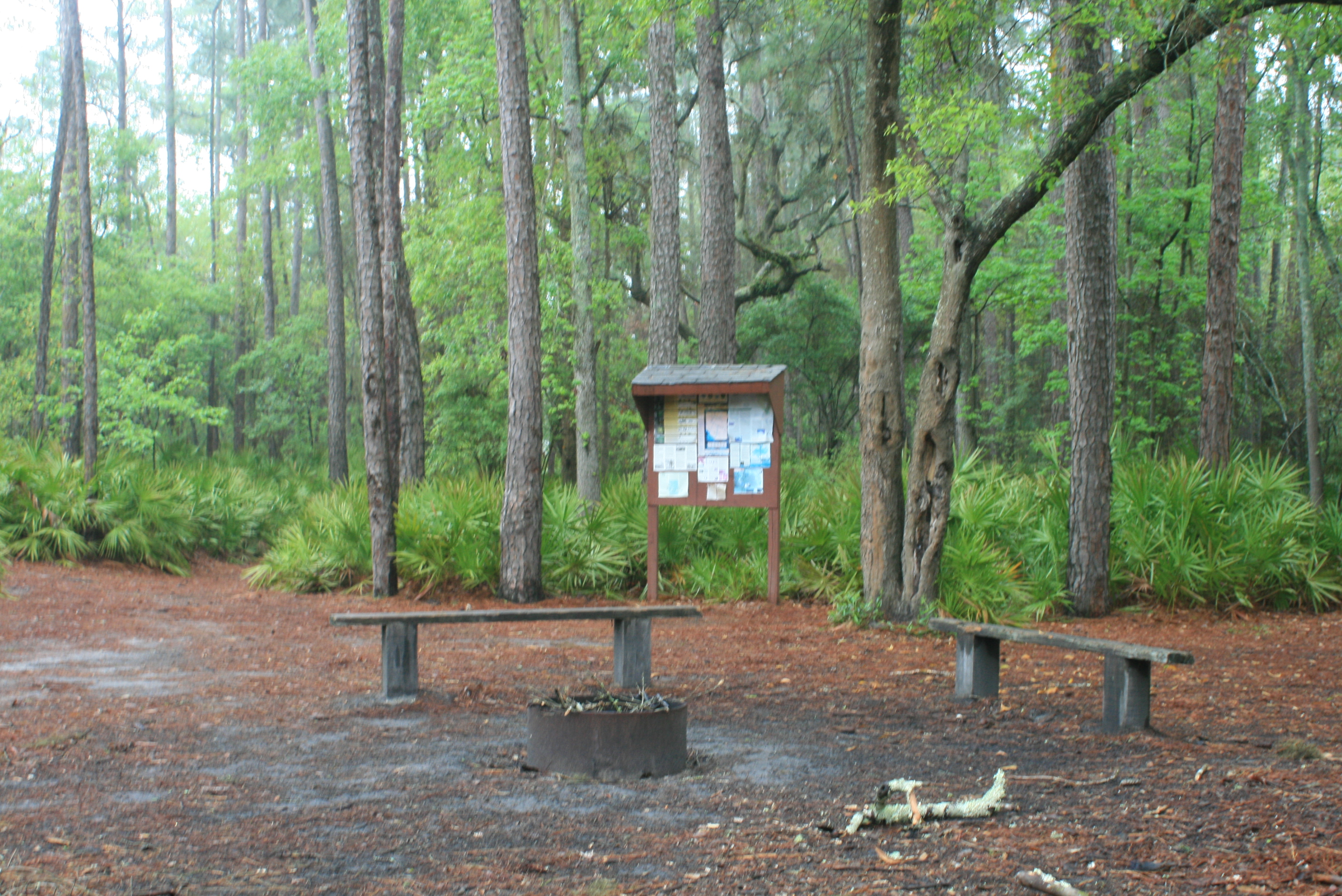
- River camps are located a day’s paddle between hubs. Accessible only from the river, the camps provide covered camping platforms, primitive camping and restrooms with hot showers – reservations; (800) 868 – 9914
158.0 – Woods Ferry Launch
.
150.0 – Suwannee Springs launch
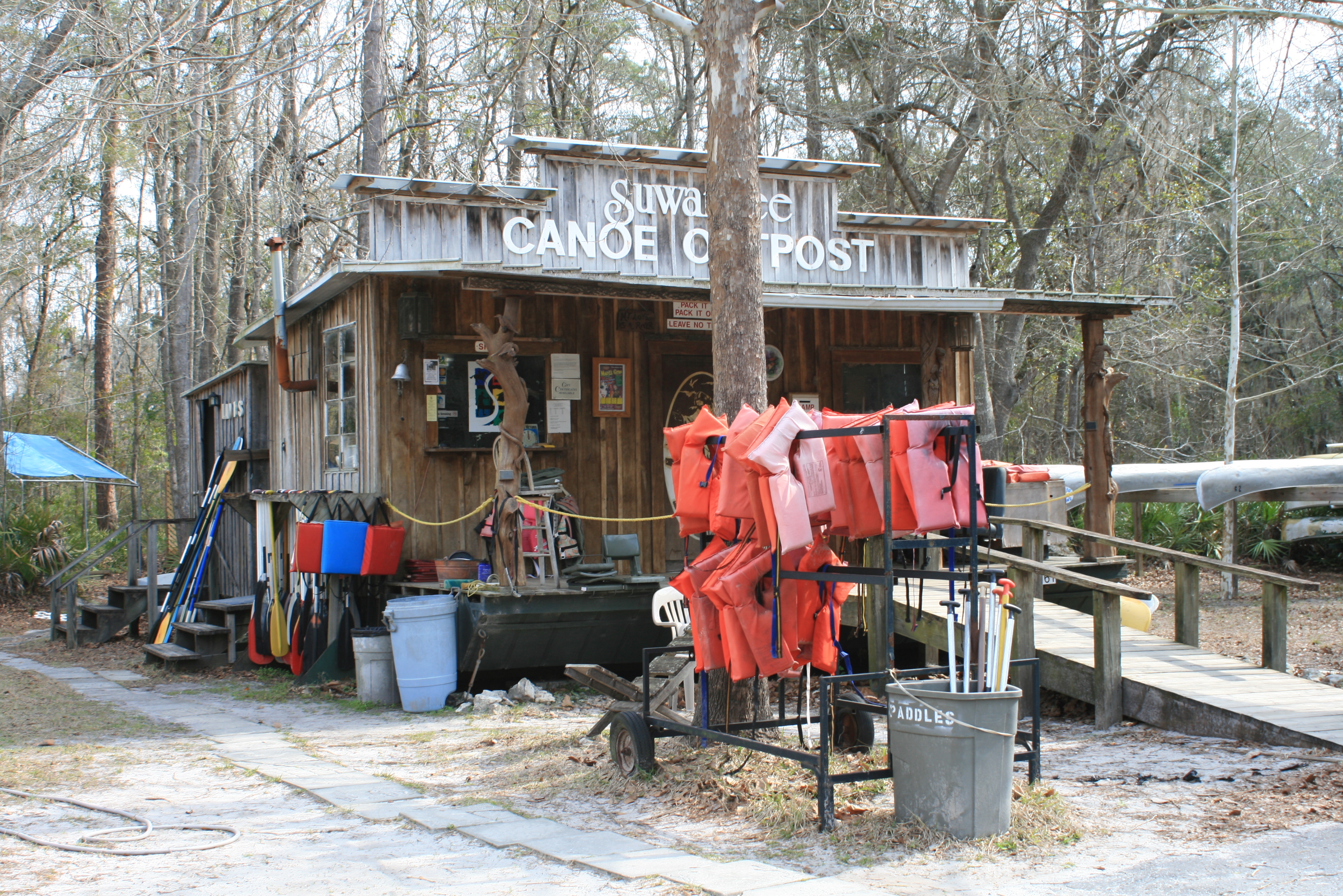
148.5 Suwannee Canoe Outpost located at rear of Spirit of the Suwannee Music Park – place to leave vehicle – Great starting point to Gulf or for shorter paddles.
Go Paddle this thing !
(GPS – 2461 95th Dr, Live Oak, FL)
- “Hubs” a town or park – A variety of goods and services are provided to meet visitors’ needs. Visitors can enjoy special events, shopping and other activities.
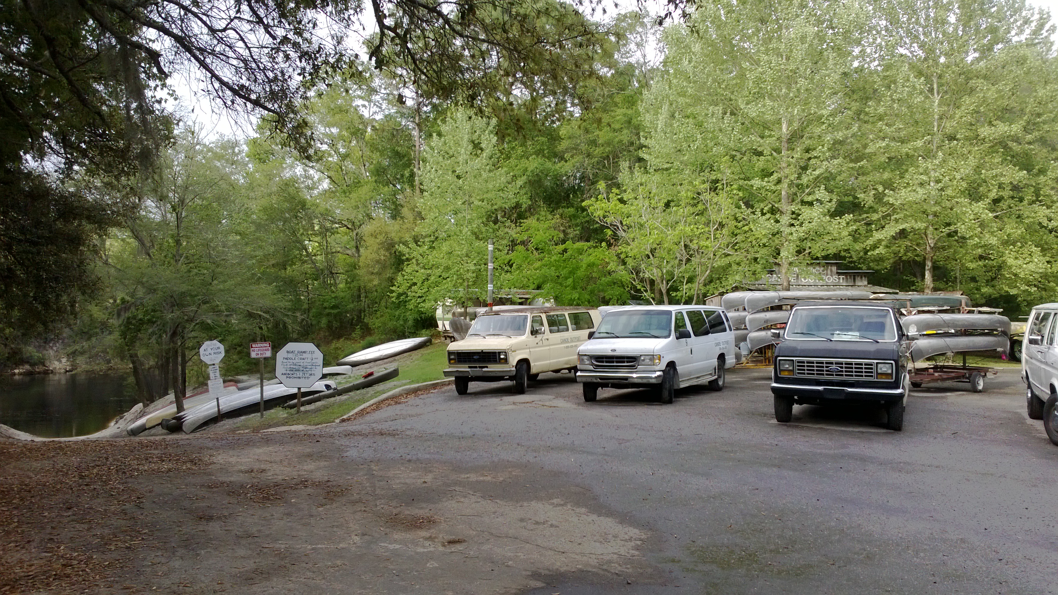
Our canoe start – Live Oak to Gulf – Spirit of the Suwannee Music Park ramp (8-days to the Gulf) “Topside of the Suwannee 2017”
- Nearby stays (I-75, exit 439) or Suwannee River State Park. The Suwannee River Outpost – shortest access to Music Park (I-75 exit 451). Easy, no hurry ‘first’ 10 mile ‘shake-down’ day with 2-mile paddle upriver to Suwannee Springs before heading downriver to Holton Creek River Camp for the night (very easy day)
140.9 Holton Creek River Camp FREE to hikers and paddlers
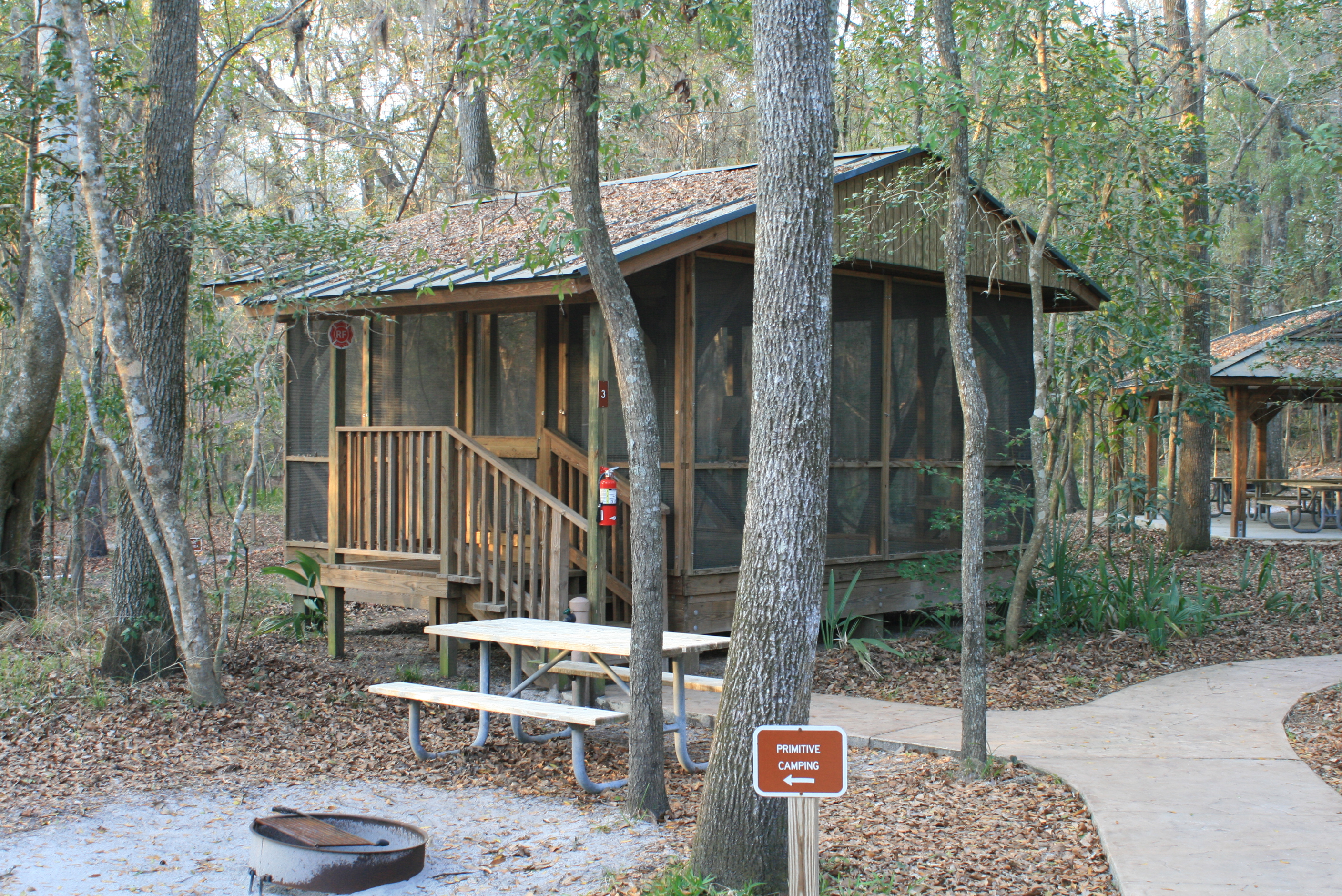
- River Camps are located a day’s paddle between hubs. Accessible only from the river, the camps provide covered camping platforms, primitive camping and restrooms with hot showers – reservations; (800) 868 – 9914
- 1st night from Live Oak, (night 4 from Fargo) On the river by 830, 20+ mile paddle/day. A couple light shoals below SR State Park, neat Geological layers along shore, exposed fossils – Stay at SR State park or Dowling Park river camp (it’s all “candy” after that)
135.6 Shelley Run (Alapia Rise) night camp option – private
135.4 ALAPIA RIVER Gibson Park ramp
130.4 – BRIDGE – Road 141 ramp
127.7 Suwannee River State Park, camping/hot showers – fee – (Hub)
- “Hubs” a town or park – A variety of goods and services are provided to meet visitors’ needs. Visitors can enjoy special events, shopping and other activities.
127.8 Withlacoochee River

113.0 Dowling Park River Camp N 30 14.81, W 83 14.87

- River Camps are located a day’s paddle between hubs. Accessible only from the river, the camps provide covered camping platforms, primitive camping and restrooms with hot showers – reservations; (800) 868 – 9914
- Day-3 from Live Oak (Wednesday), 29-mile paddle/day with stay at Adams Tract (85.5), or option of easier 19-mile Paddle day staying at Peacock Slough (95.8).- neat Springs along the way, laid back paddle rate – crystal clear springs, nice area.
106.5 – Charles Spring ramp
103.3 Lafayette Blue Springs State Park (Hub)
- “Hubs” a town or park – A variety of goods and services are provided to meet visitors’ needs. Visitors can enjoy special events, shopping and other activities.
97.4 – Telford Springs ramp
95.8 Peacock Slough river camp; River Camps are located a day’s paddle between hubs. Accessible only from the river, the camps provide covered camping platforms, primitive camping and restrooms with hot showers – reservations; (800) 868 – 9914 (Night 3 from Live Oak)
- Day-4 from Live Oak, More Springs, City-restaurant food ahead in Branford, paddle rate determines stop for the night with the Santa-Fe river as an Objective – Ivy Park at Branford has primitive/tent camp area – no showers
85.5 Adams Tract River Camp; River Camps are located a day’s paddle between hubs. Accessible only from the river, the camps provide covered camping platforms, primitive camping and restrooms with hot showers – reservations; (800) 868 – 9914 (night 6 from Fargo)

82.0 – Ruth Springs ramp
– Troy Springs – Little River Springs

Two little portholes; Thomas G Haynie and ‘Traveller‘
.
76 Ivey Memorial Park/ramp – Branford ; Just after bridge, Night 4 camp from Live Oak, primitive camp with land-food, sheltered pavilion if needed
65.5 Weekend awareness area;


65.5 The Sante Fe River (Ichetucknee Springs) depending on water level, beach to camp on. FYI; One mile up the Sante Fe = FOOD/BAR/Campground (nice!) possible ‘take-out’ point
56.6 Highway 340 bridge, ramp – FOOD/COLD BEVERAGE STORE at top of ramp Rocky Bluff Store – (secure camp spot with picnic table – water, power) ‘take-out’ point for Sante Fe river
55 Belly button of the Suwannee – Gornto Springs County Park ; Night 6 from live Oak, primitive camp at Park, small fee – cold shower – (this place can be a ‘zoo’ on the weekends, b.y.o.b. (‘locals’))
43.1 Hart Spring County Park /ramp N 29 40.46, W 82 57.26
35.8 Highway 98 Suwannee Gables Ramp

34.2 Fanning Springs State Park Camping, The Spring, COLD water shower – use of wagon to haul kayak to camp – Seafood, etc restaurant – convenience stores across street –
- “Hubs” a town or park – A variety of goods and services are provided to meet visitors’ needs. Visitors can enjoy special events, shopping and other activities.
- (Night 6 from Live Oak, night 8 from Fargo)
25.1 Manatee Springs State Park; camping, but sites are a long way from ramp. Canoe/kayak friendly (paddle in) April 1 to Nov 1 – More about the Spring N 29 29.34, W 82 58.67
22.7 – Yellow Jacket Campground – ramp
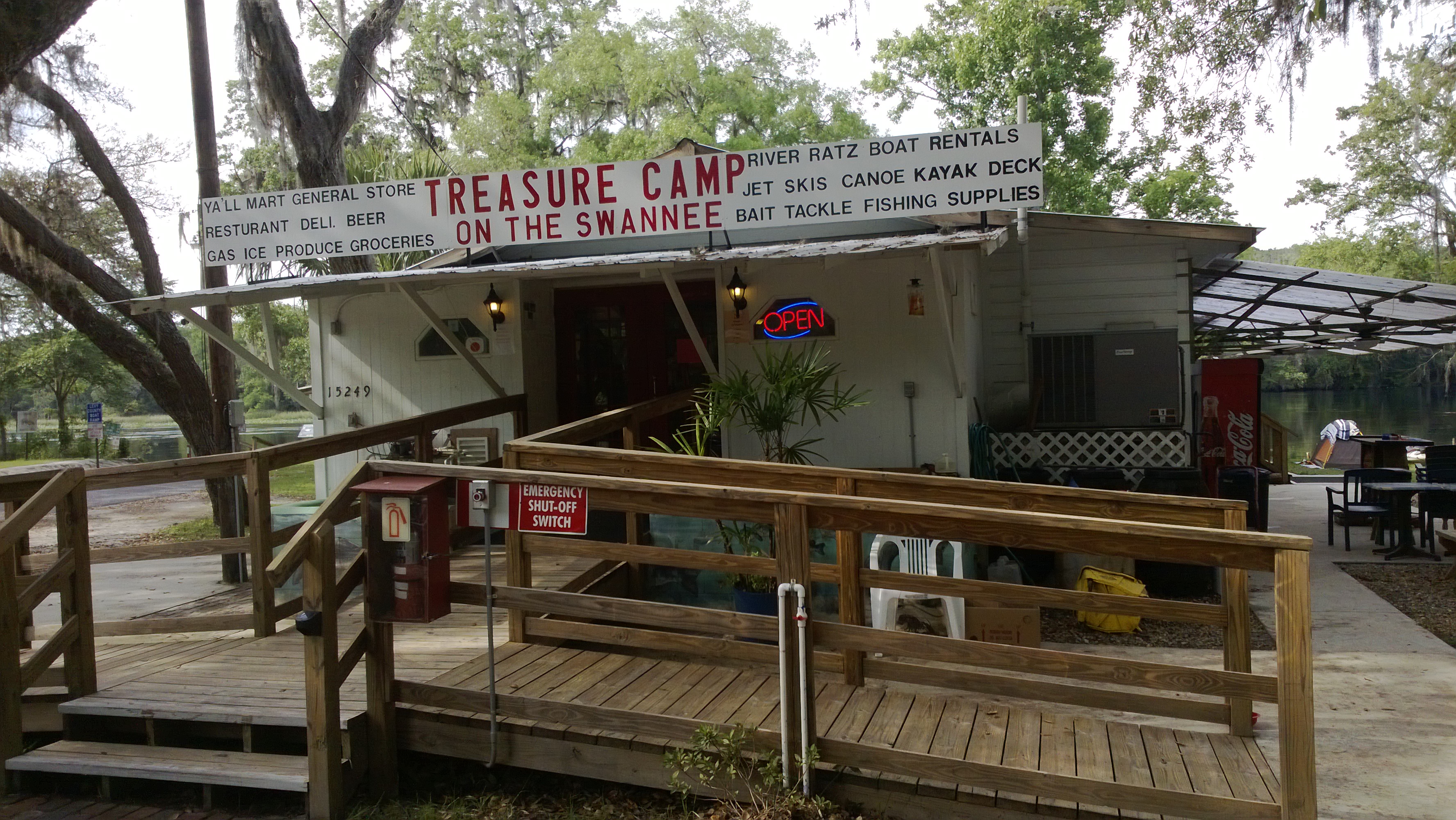
16.8 – Fowlers Bluff Ramp primitive camp at Treasure Cove restaurant, land-food, live music, cold beverage. natural-water (garden-hose) shower (Day 7 camp from Live Oak)
- Day-8: to Suwannee, the town -expect ‘no-see-ums’ (flyin teeth)
3.9 Anderson Landing River Camp (Bill’s Fish Camp) Camping (room or tent – no credit cards), hot-water showers, good food walking distance (Hub) – Salt Creek and Marker 29 Restaurant in Suwannee (.8 walk)
(GPS – 18 SE 225 St, Old Town, FL)
- “Hubs” a town or park – A variety of goods and services are provided to meet visitors’ needs. Visitors can enjoy special events, shopping and other activities.

Note; Live Oak to the Gulf trip with ‘green’ canoeists limited mileage to twenty a day – kayaks alone may average 25 to thirty miles a day – but hey, sometimes its good to slow down and appreciate the setting…..
.
PAST SUWANEE TRIP REPORTS
Fargo to the Gulf – kayak (225 miles) High water
- Post 1 of 3 – Days 1 – 4, Fargo to Dowling Park river camp
- Post 2 of 3 – Days 5 – 8, Dowling Park river camp to Gornto Park
- Post 3 of 3 – Days 9 – 11, Gornto Park (‘belly-button’ of the Suwannee) to Suwannee, Fl
.
Live Oak to the Gulf – canoe (150 mile)
Suwannee River Grin – 4 posts
- Day 1 – Live Oak to Shelley Run (rm 148 to 135) 13 mi
- Day 2 – Shelley Run to Dowling Park River Camp – rm (135 to 113) 22 mi
- Day 3 – Dowling Park to Peacock Slough River Camp (rm 113 to 95) 18 mi
- Day 4 – Peacock Slough to Ivy Park in Branford (rm 95 to 76) 19 mi
- Day 5 – Ivy Park to Gornto Springs Park (rm 76 to 55) 19 mi
- Day 6 – Gornto Springs to Fanning Springs State Park (rm 55 to 34) 21 mi
- Day 7 – Fanning Springs to Fowlers Bluff (rm 34 to 16) 22 mi
- Day 8 – Fowlers Bluff to Anderson River Camp in Suwannee, 16 mi
.
Fargo to the Gulf – kayak (225 miles) Low water
A River of Time – 8 posts
- Days 1 and 2 Fargo Ga, to riverside camp to just above Big Shoals (178rm)
- Day 3 Big Shoals to Woods Ferry River Camp (159rm)
- Days 4 and 5 – Woods Ferry to riverside camp (136rm) to Dowling Park River Camp (113 rm)
- Day 6 – to Adams Tract River Camp (85 rm)
- Day 7 – to riverside (56rm) just above Gornto Springs (56rm)
- Day 8 – to Fanning Springs (34 rm)
- Day 9 – to Anderson River Camp
- Day 10 – Suwannee, Fl (03rm, Gulf)
.
.
– we’re lucky….”
“When [you are to make] a speech…don’t jot down notes to speak from, jot down pictures. It is awkward and embarrassing to have to keep referring to notes; and besides it breaks up your speech and makes it ragged and noncoherent; but you can tear up your pictures as soon as you have made them–they will stay fresh and strong in your memory in the order and sequence in which you scratched them down. And many will admire to see what a good memory you are furnished with, when perhaps your memory is not any better than mine”. Mark Twain @1917.
Unsure why I included this quote – but paddin has some reflectivity in it. If you’re doing it as I have; it’s nice to make a return trip now and then.
The pictures that I make along the way are my main notes, it’s easy, and comes with the added dimension of feeling ‘presence’ within that moment.
Go Paddle this thing ! …


May 26, 2015 @ 07:25:05
Jan 18, 2017 @ 18:18:37
How many hours did it take you from Fowlers Bluff to Suwanne?
LikeLike
Jan 21, 2017 @ 09:02:06
It was @ 18 miles David, a good three to four hours – wind and tide could affect – give yourself plenty of time, few if any places to camp on that stretch.
LikeLike
May 30, 2018 @ 17:23:17
Hey great reading, Fargo to Suwannee in near future.
LikeLike
Jun 10, 2018 @ 08:38:53
Thanks Michael, have a good one….
LikeLike
May 21, 2020 @ 13:38:52
Fantastic site with lots of information. Were there plentiful sandbars from the White Springs to the Outpost section?
LikeLike
May 21, 2020 @ 18:49:40
I wouldn’t say plentiful, from White Springs there are few sandbars; but then just before the outpost – the sandbar settings begin. see you on the water… Peace
LikeLike
Aug 20, 2020 @ 22:05:20
Hey there, great info for this green gal. A group of friends and I are interested in paddling from white springs and want to be out for 3 days/ 2 nights. What would you suggest for our 2 night stopping points as well as our take out point?
LikeLike
Aug 21, 2020 @ 06:48:42
Perfect start from White Springs (hwy-41 bridge park), ez paddle – not quite as scenic day one past I75 bridge to Woods Ferry rivercamp – enjoy the evening (sometimes they may even have ice available). Day two more scenic, stop enjoy old Suwannee Springs and beach walk, then paddle to Holton Park night two – late start the next mornong and ez paddle to Suwannee River State Park take out…. Not sure of the shuttle you may use, but if self – sometimes you can park one vehicle at the SR State park… Cool, get loco 🙂
LikeLike
Sep 26, 2020 @ 13:51:42
Hi, Girl Scouts here 🙂 we would like to paddle from point to point in Florida. Starting at Suwanee and at where, lol? We will be driving back to our starting point. Also, where are best stopping points for us? Please and Thank You for any and all information.
LikeLike
Sep 28, 2020 @ 06:59:45
Put in at the park – Hwy 41 at White Springs, spend a night at Woods Ferry river-camp – then paddle down to the Outpost in the Music Park for takeout, they’ll love the adventure…
LikeLike
Nov 01, 2020 @ 08:46:34
Any thoughts on time of year for a Fargo to Suwanee trip? I am not fond of hot weather and prefer to avoid biting insects. I don’t mind a little chilly weather. Any caveats about a winter trip? I am a transplanted Northerner so a little frost overnight wouldn’t be a big hardship.
LikeLike
Nov 01, 2020 @ 09:28:28
Agree, I’m not fond of hot weather either, spring or fall is my favorite paddle time – but the Suwannee paddles mainly falling in February and/or April. November’s not that bad a time either – BUT – whenever it works for you; don’t let the paddle get lost in you’re “dang, I wish I’d done that.” Do it you way, Fargo to Suwannee really is a good river trip to experience… Have a good one Pete
LikeLike
Dec 21, 2020 @ 20:41:18
Hello, enjoyed the read. Realistically if you canoed 6-8hrs a day, how long would the trip take in your opinion. 30yo doing everything I can to live while also raising three children so I have to plan my trips appropriately, thank you for any input.
LikeLike
Dec 22, 2020 @ 09:31:07
If you canoed 6 – 8 hours a day you’d probably have a couple of weeks on the river. The sections would still work out, you’d camp at many of the same camps – and you’d thoroughly enjoy the accomplishment… Depending on whether the kids are going along too – after a few acclimation paddles, you might want to have one or two share some river time with you. If it’s something that you feel inclined to do, do it…. and do it your way. See you on the river..
LikeLike
Jul 14, 2021 @ 15:43:47
Do you think it would be possible to take a 4 foot draft 38 foot cabin curser up the river to Dowling Park when the river water level is 30 t0 34 feet at Dowling Park (River mile 115) Thanks for your thoughts and comments. George
LikeLike
Jul 15, 2021 @ 08:46:02
I do not have any expertise on this, but from what I have seen (the large Mona boats docked near the Sante Fe and Suwannee) and under the right weather/water conditions, yes.
LikeLike
Sep 06, 2021 @ 08:51:51
Great read, I have lived on the Suwannee for 30 years, but never made a canoe trip. I have had canoers stop by. They always love the river.
LikeLike
Sep 06, 2021 @ 18:35:52
It’s a great place to be Norm, glad that you like it too… its all perspective.
LikeLike
Mar 24, 2023 @ 18:07:16
Such an inspiring endeavor.
My little brother is doing Fargo to Suwannee right now. He is touring in a john boat. Trying to do in 6 days. He’s calling himself Huckleberry Finn on his gpa locator. He’s really enjoying Gods greatness. “How great thou art”….comes to mind actually!!
Hope to meet him on the bottom to celebrate his adventure!!
LikeLiked by 1 person