.

Water Clarity – 6+
Natural Quality – 7+
Perception – weekday
Coastal
.
.

A family gathering (her side), time to spare, and after previously paddling the Rehoboth – Lewes Canal, it was only right to return to explore the source of the opposite end of that ‘canal.
Broadkill River
The Broadkill river pretty much begins with Wagamons Pond at Milton, De – then flows about thirteen miles through the level sawgrass of the Great Marsh Preserve before entering into the Atlantic Ocean (via Roosevelt Inlet). Its a setting where the ocean’s perpetual tide continues to prod the creatures through another cycle of life.

.

.
For a ‘put-in,’ Milton has a great little public park with boat ramp behind the library. This October day was overcast and lightly sprinkling, but no matter..

.
– after paddling through three days of solid rain on the Suwannee River in Florida – I knew Gordy wouldn’t dissolve…..

.
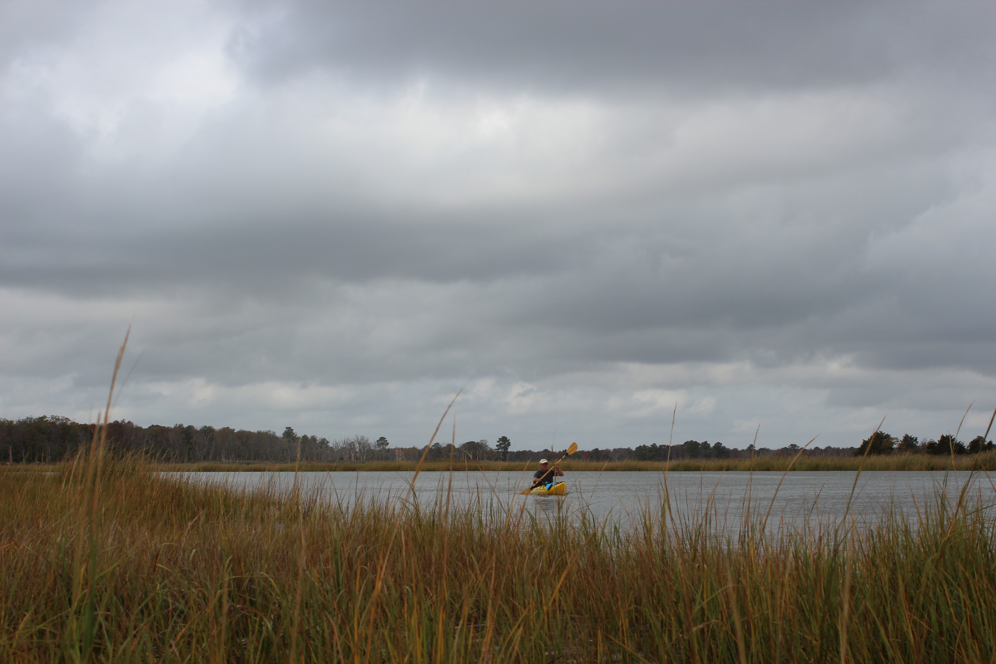
Gordy lives nearby and is part of our extended family, it was good to meet up with him for some time on the water. Once on the water and headed downriver (against the tide) – it didn’t take long to recognize the familiar setting of the Broadkill, which in many ways reflected Estero river where I was raised..

.

.
– except for the duck-blinds, at first they were occasional – then the numbers increased as we paddled nearer the coast. I am reminded of the huge flocks of Snow and Canadian geese (along with other foul) that pass through on the once mighty migration – the Atlantic flyway…

.
October and fall was in the air, leaves were beginning their seasonal change too. The river itself was fairly unremarkable, but there were areas that held a certain beauty all its own. The water clarity is more of a non-factor along the coast, my ‘take’ simply reflects the ‘brackish‘ character of the water – I really didn’t expect the same clarity as those Florida springs.

.
Today was more about simply escaping the ‘bustle’ and paddling a few hours, absorbing a different ‘stretch of water.’ Of course there were the reminders of how difficult it really is to find a place completely unaffected by ‘habitation.’ The number of human habitat along the river was surprisingly few – this being one of three separate areas of seasonal housing.

.

.
Nearing the Hwy-1 bridge, we joked about whether this was an old shipwreck or simply an old fishing pier….

.
along many rivers it’s hard to tell, but just beyond the busier highway-1 stands the long-idled bridge embankment – lives past….

.
which incidentally made good for time for a present day stop.

.

.
A mile of so later, seagulls were the only fall residents of Steamboat Landing RV Park.

.
‘Resuming a safe speed’ back out into the ‘flats’ (;_)), I missed seeing the fiddler crabs scamper across the mud at a lower tide. The river’s direction is a constant east and North, with a few wide ranging variables where the river meanders – increasing the distance to Roosevelt inlet. Along the way their were a number of canals that deviated into the marsh – would make for interesting paddling, another day…..
.
With the rain gone and sunshine coming and going, the wind made its presence clear – with the meandering river it just meant that the wind was at your back as often as at your face – “just a part of it.”

.
More duck-blinds, I hadn’t seen as many since the Mississippi River.. Once out on the sawgrass flat it was possible to mark the rivers course by spotting the blinds in the distance..

.
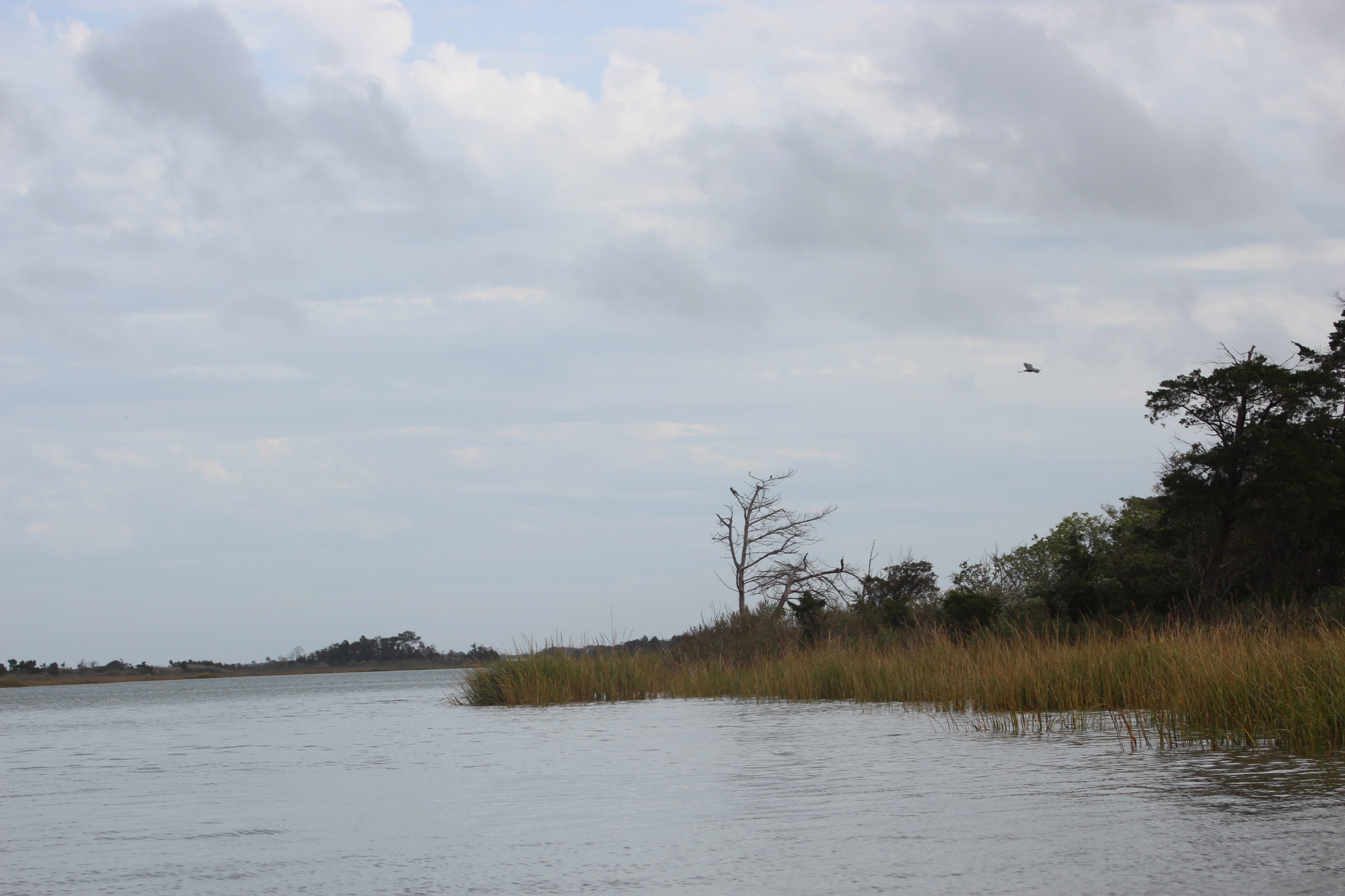
The old tracking station from the 60’s was a familiar sight, raised in Florida – we had one near our home in Ft Myers, I wondered what their present-day use might be. This one had an eagles nest close-by – with wildlife seemingly scarce, on the day we saw at least two bald eagles, numerous heron, and the ever-present king fishers. Its easy to appreciate the efforts of naturalists in this area – it does show.

.
Oyster Rocks Rd.

.
Upriver from Oyster Rocks

.
Once again a stop to stretch and calibrate. With the tide at its peak, we watched as two ‘jesting’ fishermen set up their poles as they found comfort for the outward flow – a good time to fish with the nutrients of the land moving outward….
.

Its just a stroke; sometimes when the paddling becomes mundane or I feel engulfed in the setting – I just remember what it felt like at Lake Powell, truly a grandiose place out there. University of Delaware’s windmill (bottom right) seems almost as massive when viewed from its base – I have seen the wind-fields in New Mexico and agree with this effort of research for easing our future fossil-fuel dependence.

.

Roosevelt inlet, three o’clock – five hours after ‘put-in.’

.

.
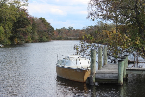
along the piers of the Lewes – Rehoboth Canal

.
5.5 hours to the Irish Eyes restaurant, with an empty boat slip it was a manageable take-out right into the parking lot – inside awaited a couple really cold beverages and some much needed ballast!
.
The thirteen miles from Milton was an interesting paddle, I was a little disappointed that nothing outstanding stood out – like abandoned vessels, or the abundance of wildlife – several times I thought that overall it was all fairly ‘unremarkable.’ With this being said, I’m sure that other season’s could provide the variables to completely change this perception.
Still, no regrets – time well spent…………….


Oct 21, 2012 @ 14:20:45
Never pass up an opportunity to get out on the water. I have never regretted going on a paddling trip, but I have often regretted not going on one. Paddle on!
LikeLike
Apr 24, 2016 @ 18:53:12
Good review of paddling our river.
Proper spellings: Lewes, Rehoboth.
LikeLike
Apr 24, 2016 @ 19:07:21
I stand corrected, Thank you
LikeLike
Mar 03, 2018 @ 22:53:59
Thank you am thinking of buying a pontoon boat have a site at Smith Landing you just convinced me it was a great idea..
LikeLike
Mar 04, 2018 @ 08:54:29
Many happy days to you Jim…
LikeLike