Home

Paddle The Pokomoke River – Md

Leave a comment

.

The Pokomoke river

Water Clarity – 5+ (fresh to brackish)

Natural Quality – 8+

Perspective; Weekday

.

1705-d1-IMG_5561

The Pokomoke River

Forty something years ago I was a 20 year-old truck driver hauling produce along the eastern shore; that’s when I first noticed the Pokomoke river.  I met the wife in Delaware back then too and over the many years of family visits that followed – well there was that river.

So I pondered the prospects of exploring the Pokomoke – top to bottom.

.

Within those years a career happened; retirement and ‘Life-at 60.” Stopping where and when I once couldn’t is now possible, and most likely – paddling this river was inevitable.

“The hardest thing about paddlin, – is getting out the door.” tgh

1705-d1-IMG_5572

.

 I simply liked the size and ‘nature’ of the Pokomoke.

There are as many reasons “Why?” folks paddle; as there are people; find your reason, and do it your way.   My reasons have evolved and where I am now is ‘pleasure.’  Smaller rivers seem to allow more pleasure than do ‘coastal’ points and with the Pokomoke flowing into the Chesapeake bay; this two night (I figured) paddle would have a little of each.

.

Porters Crossing
Newark, MD
38.222872, -75.363210
.

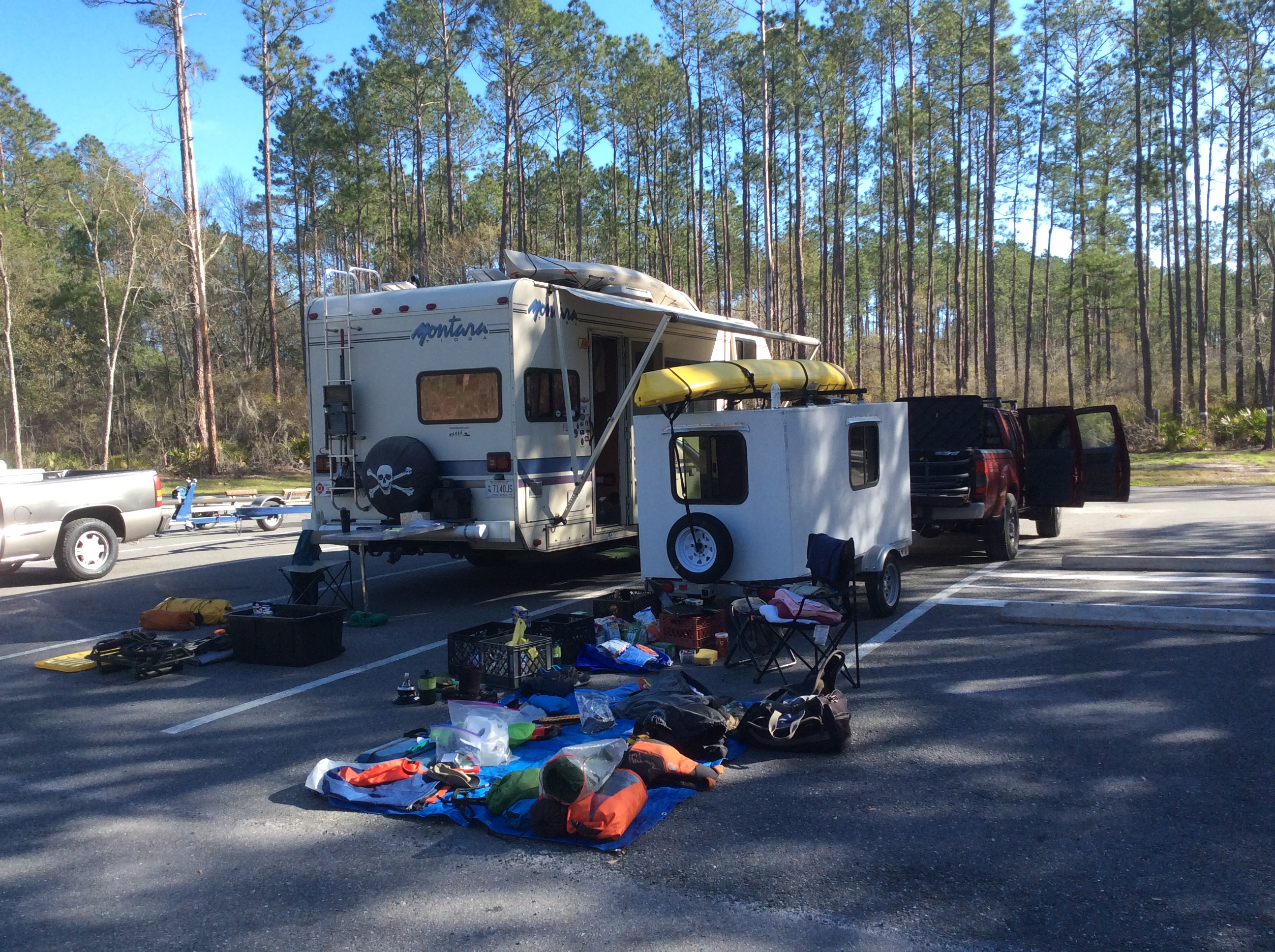
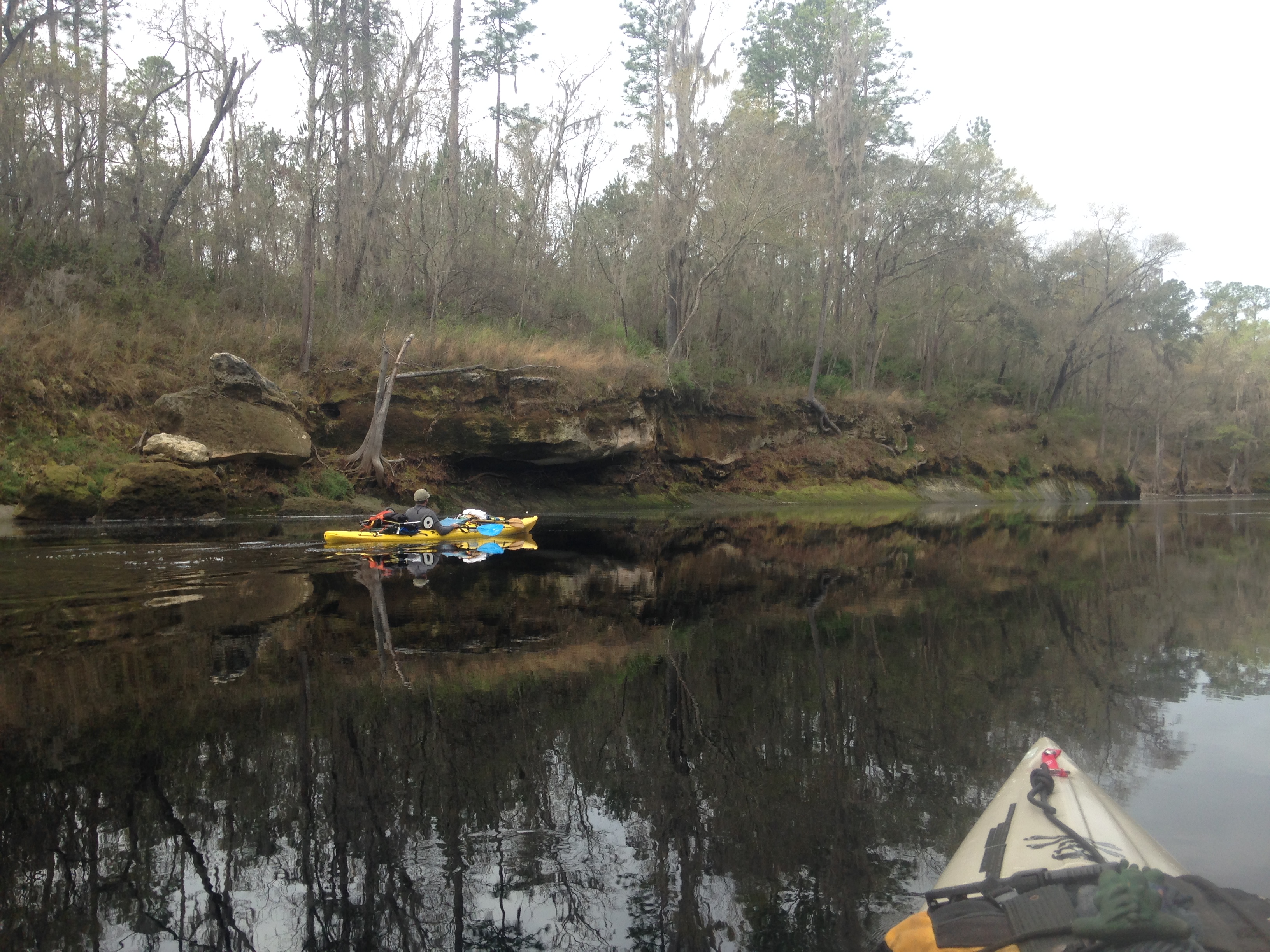
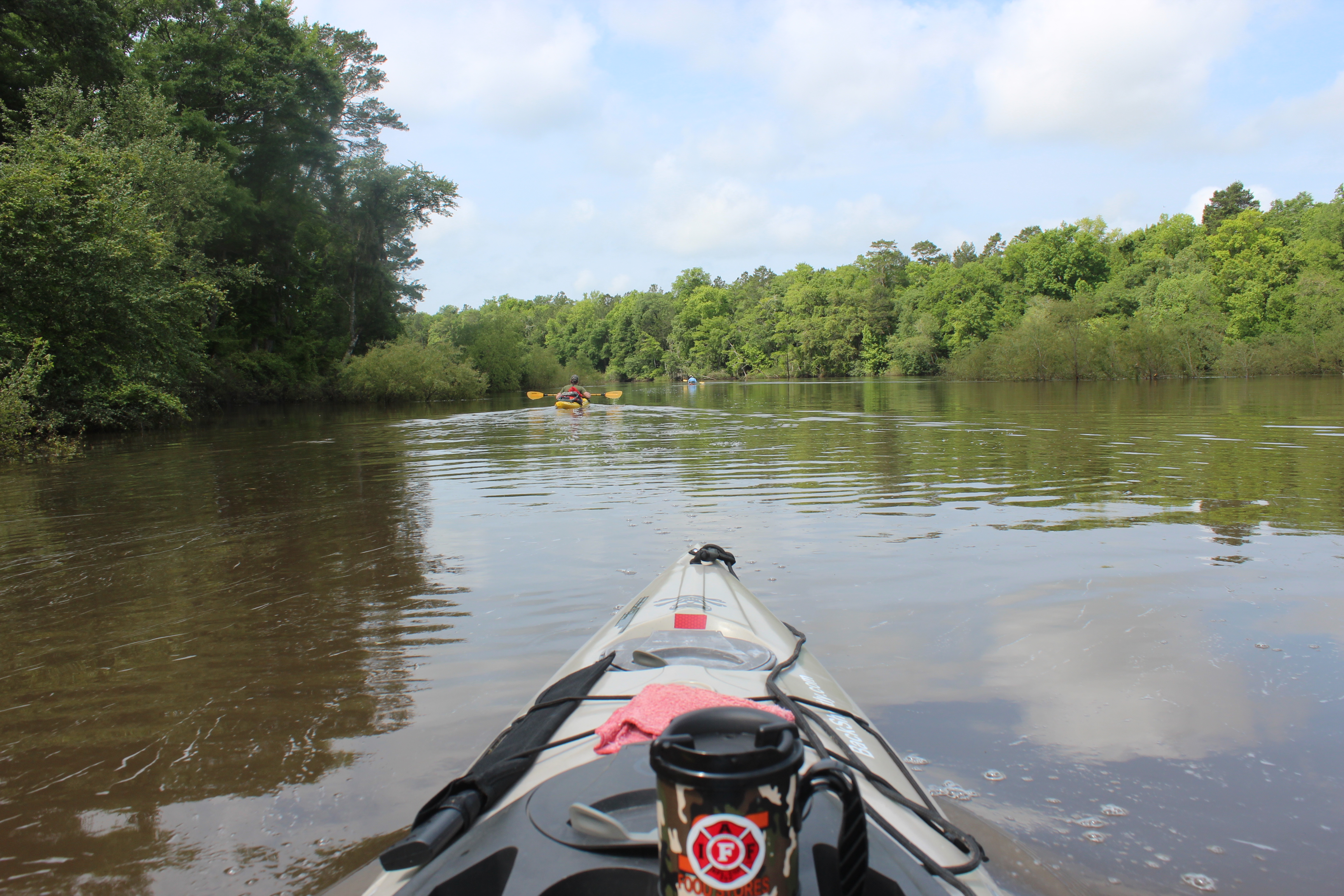
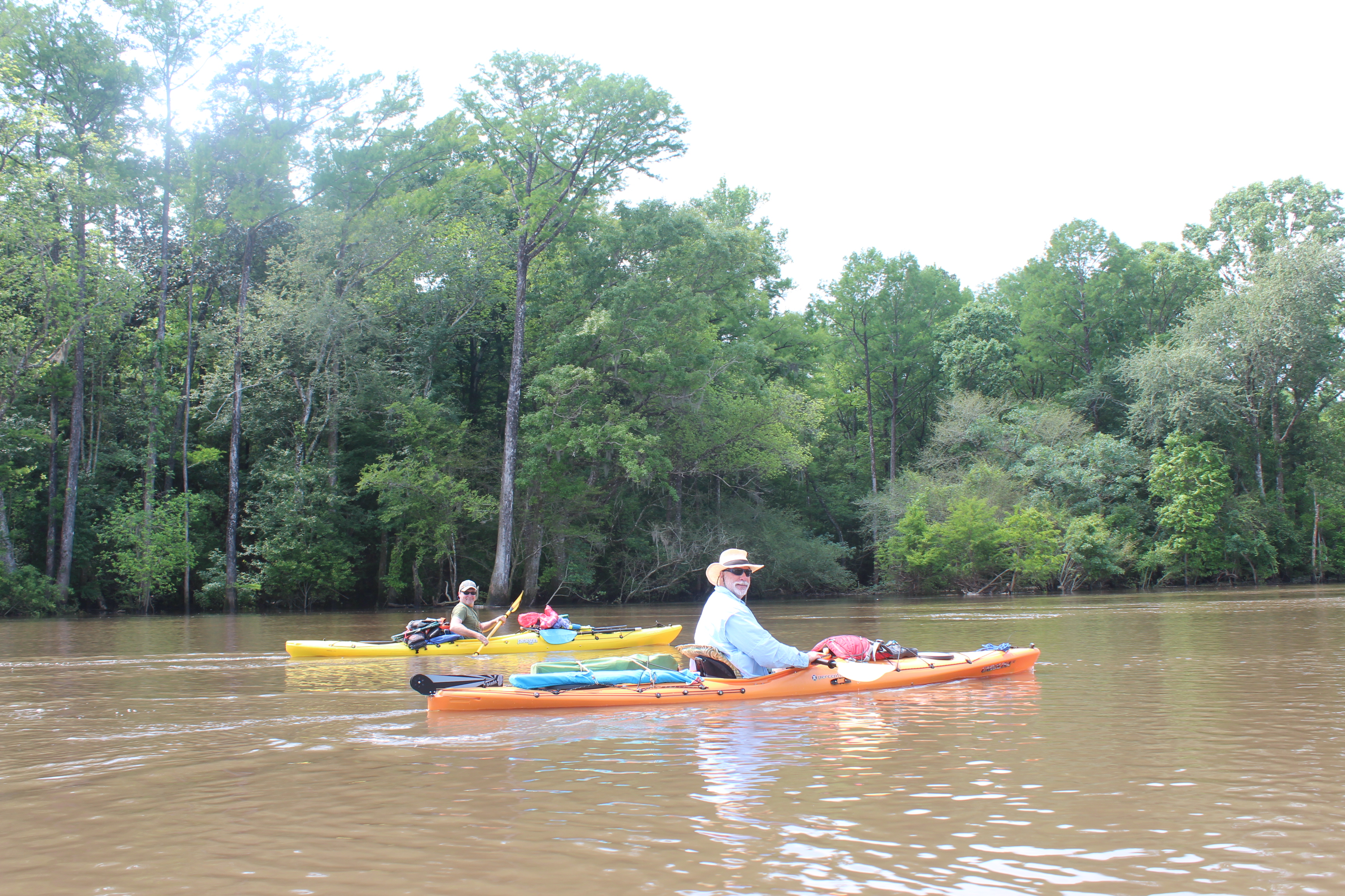
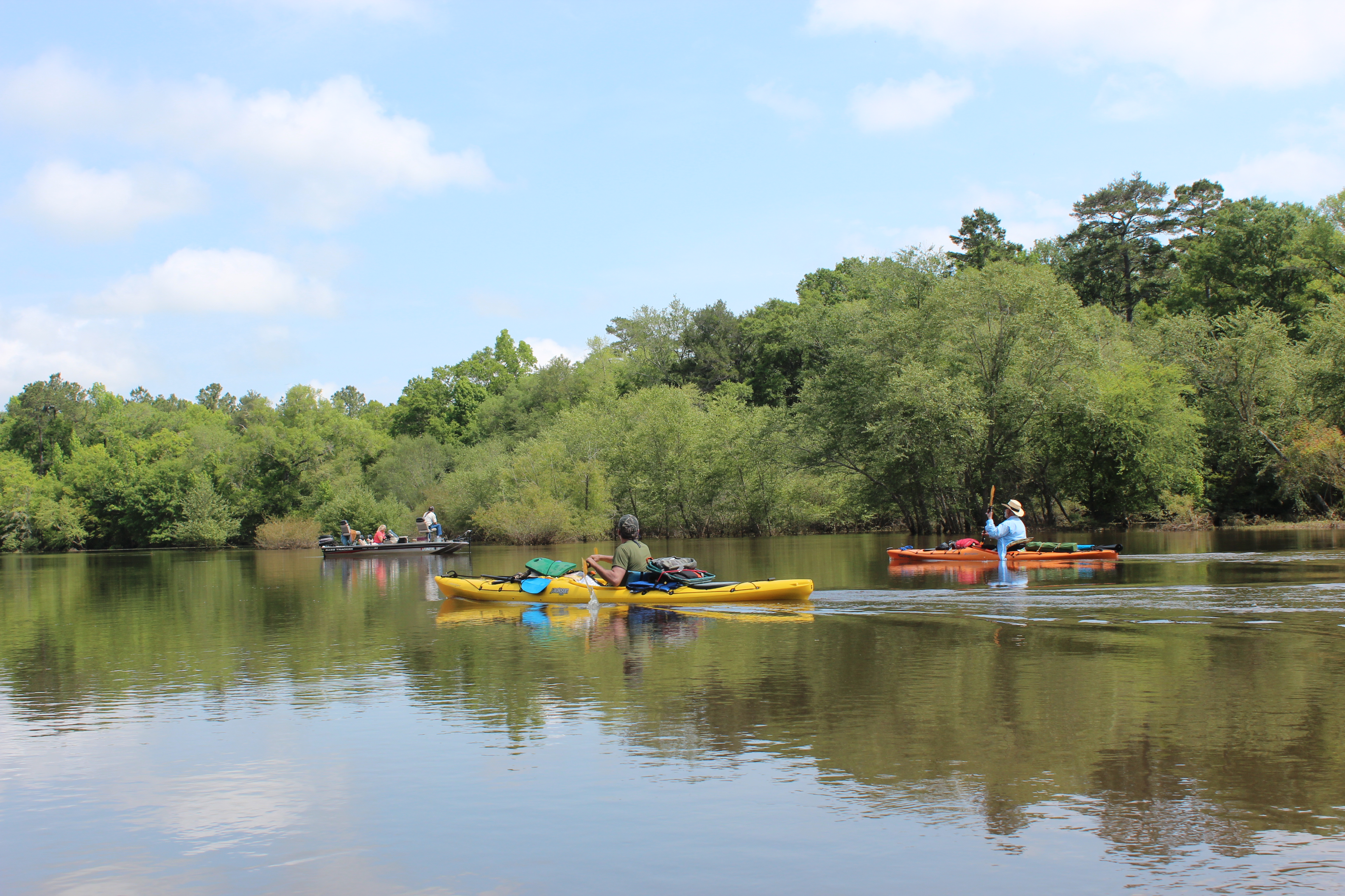
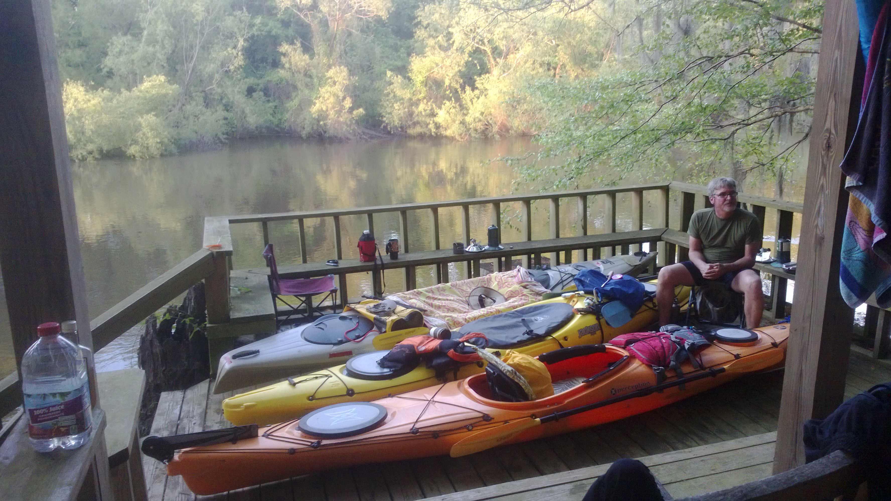
Camping along the way makes it even better – we pretty much camp as ‘through’ paddlers (anywhere the time/factors have me).  Having someone like-minded is good – Gordy (brother-in-laws brother) is always good to have around too – sometimes he ‘over-packs’ food and I benefit from that…  Gordy’s a strong paddler and is good with the ‘Western’ style of paddlin; independents go as a group (Eastern style is totally group – slow to move, too many waves for me) – I appreciate ‘short stories too….

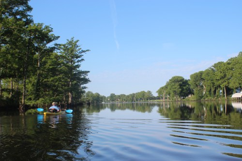
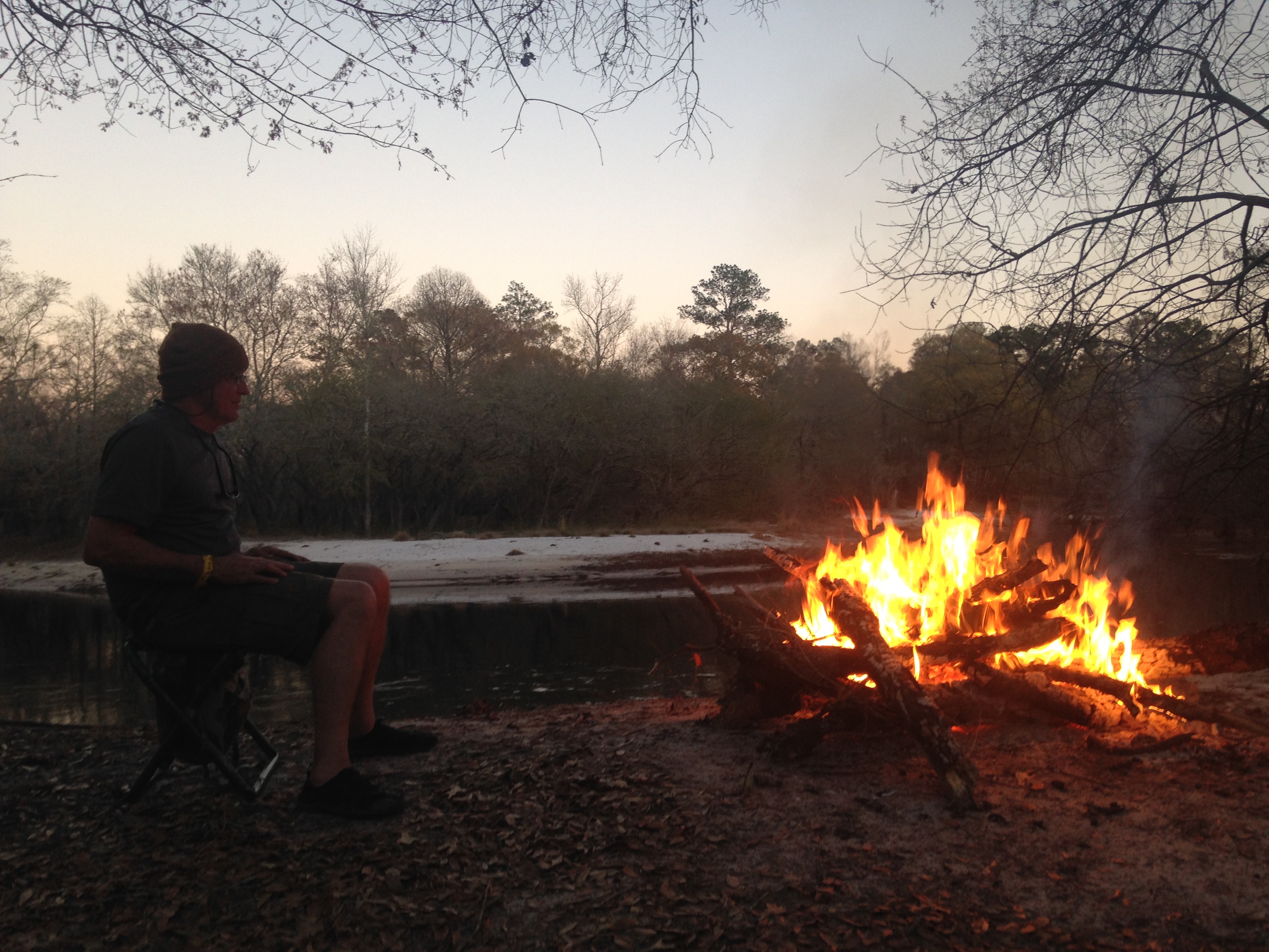
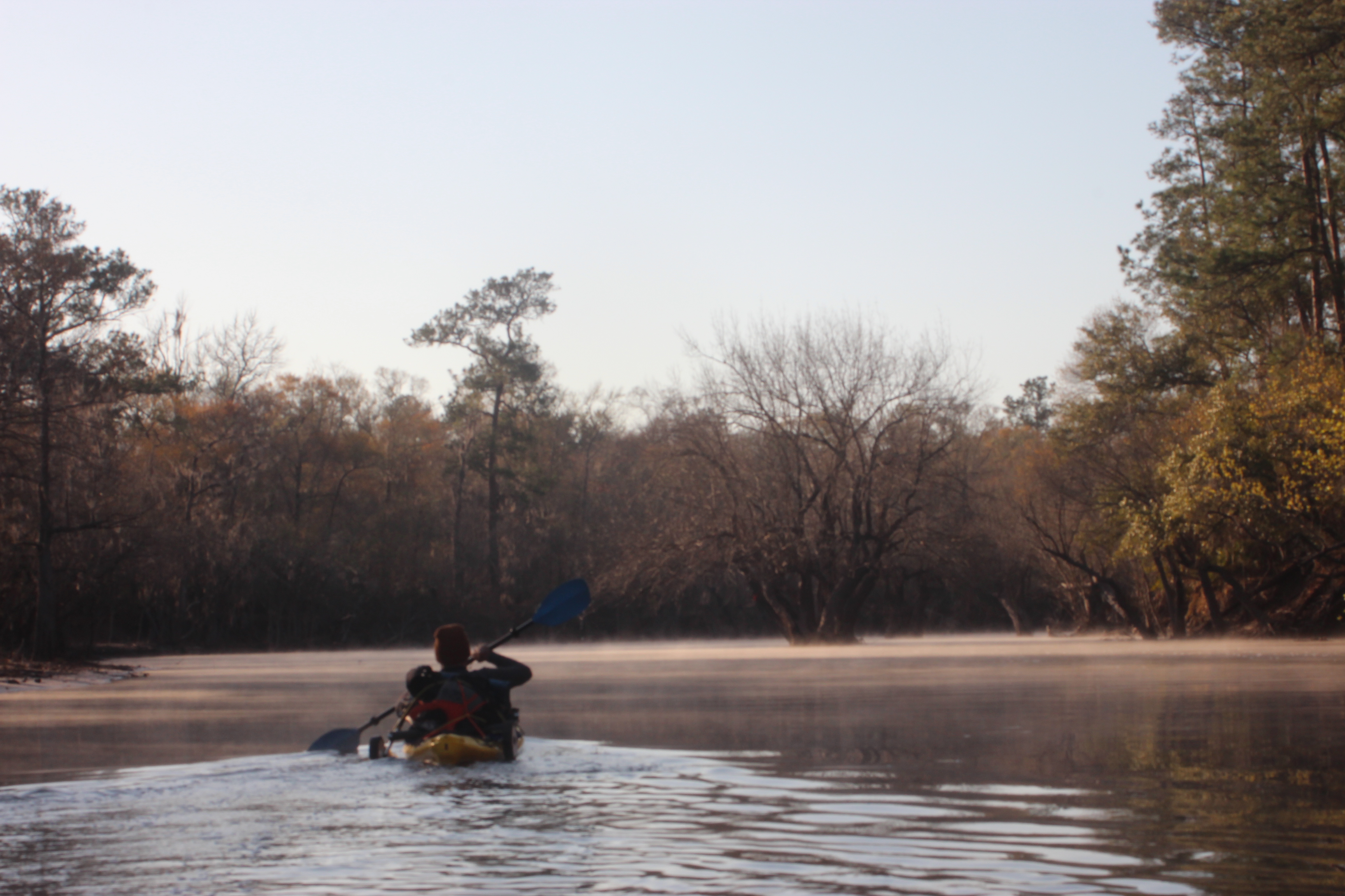
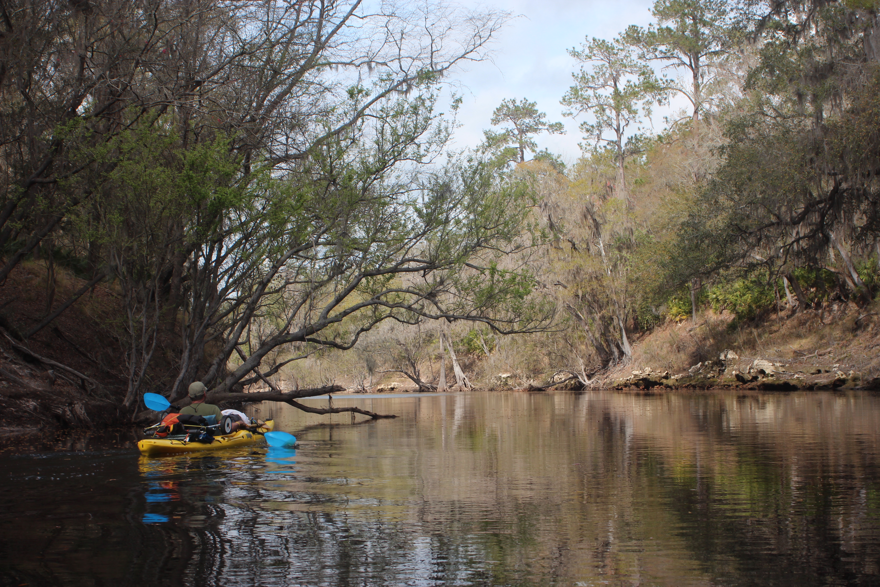
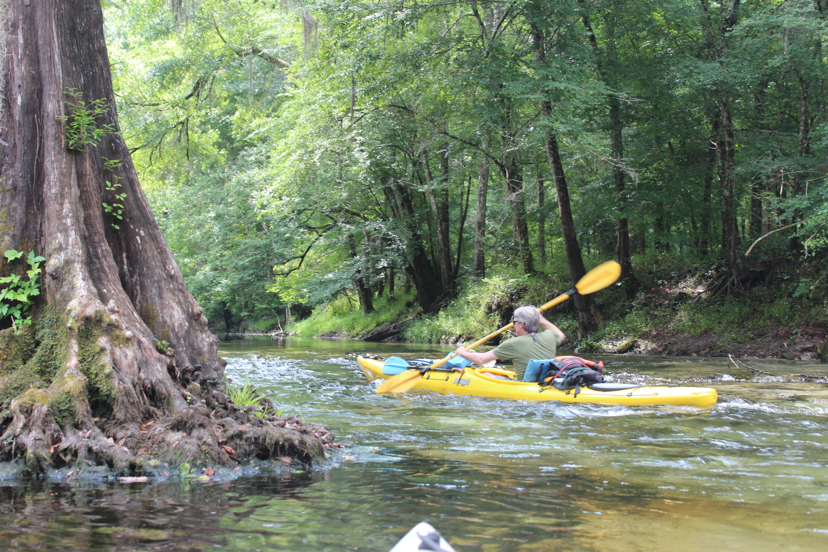
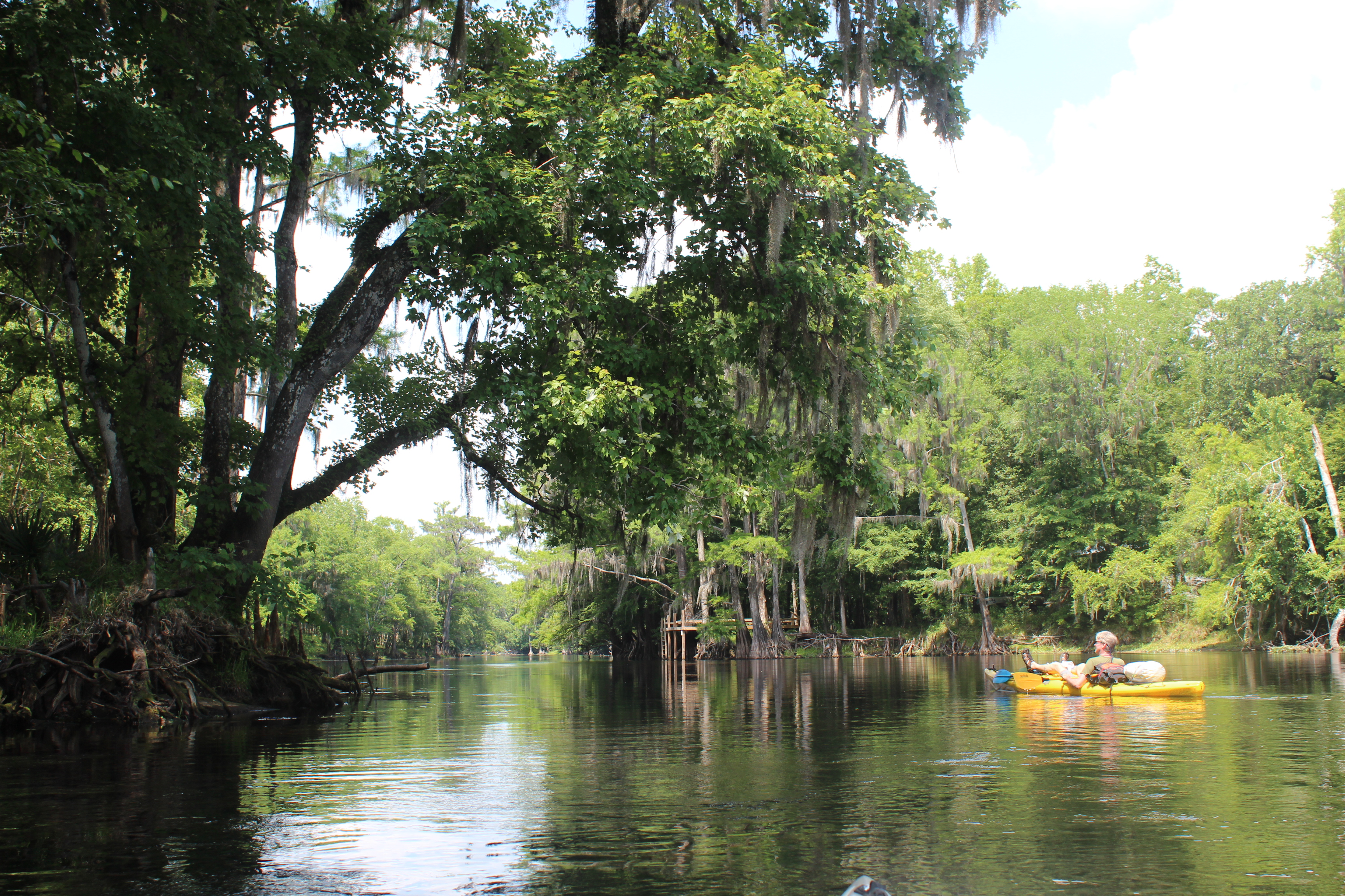
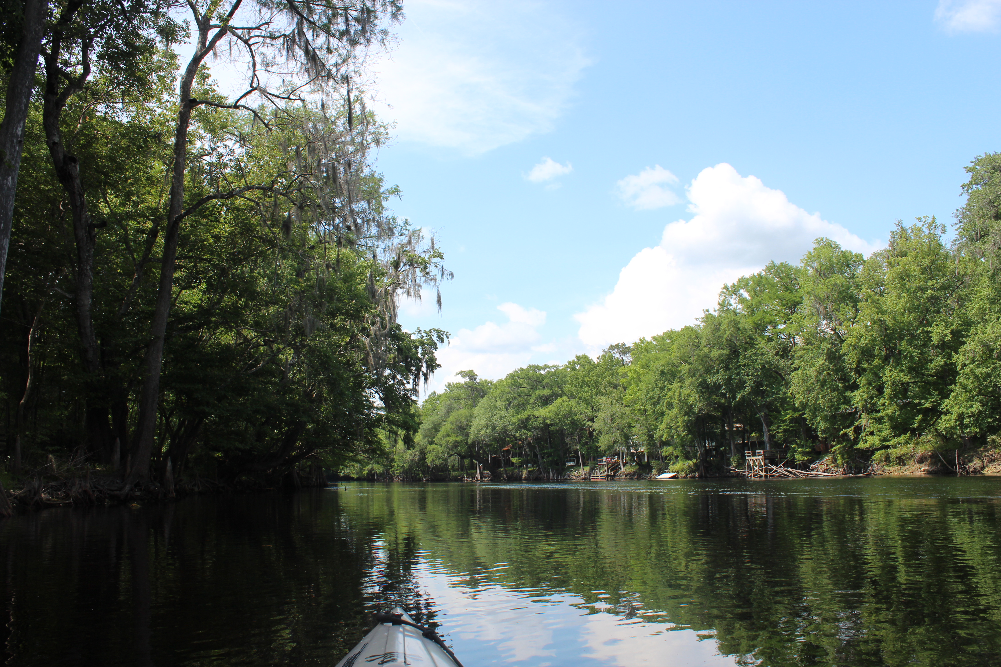
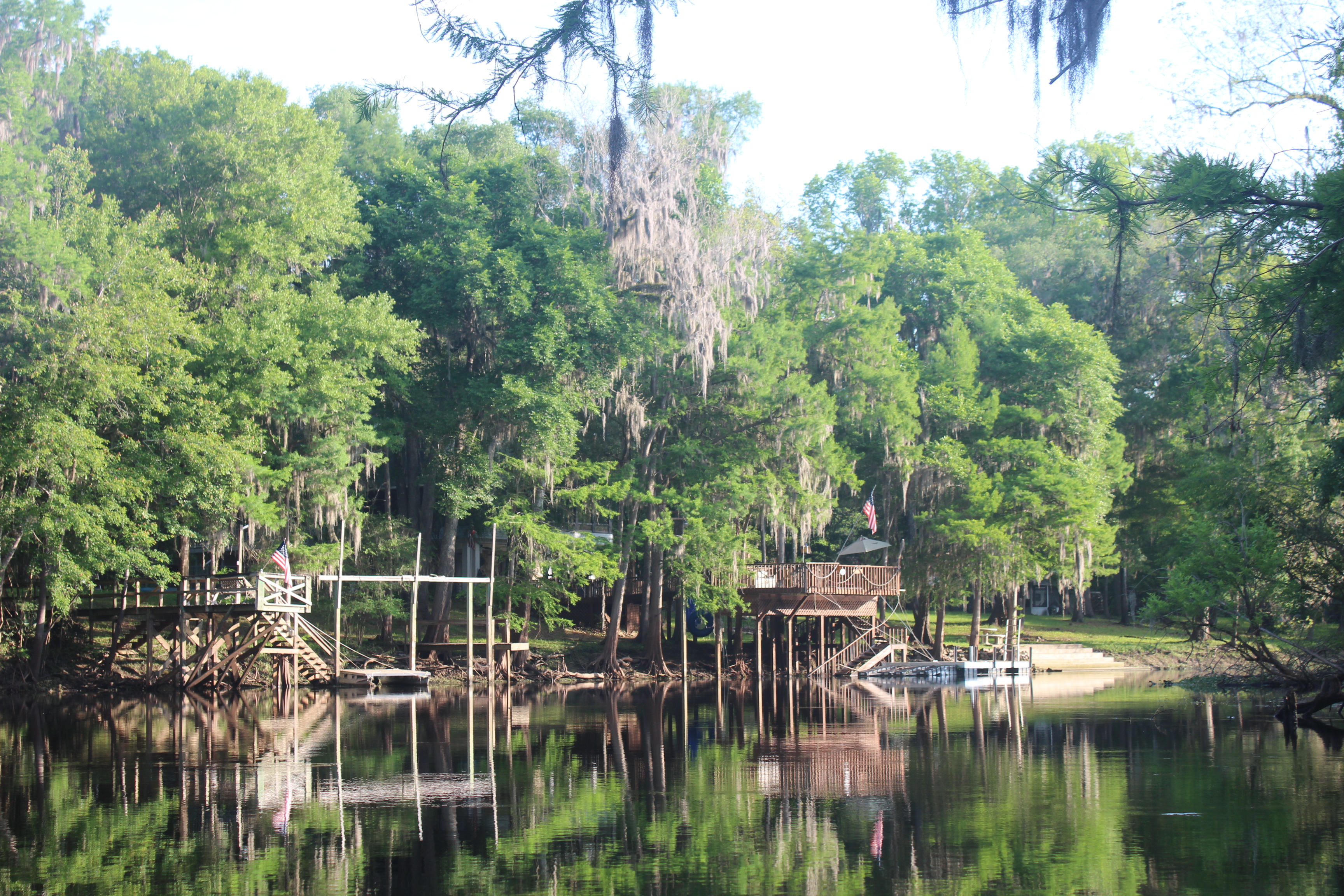
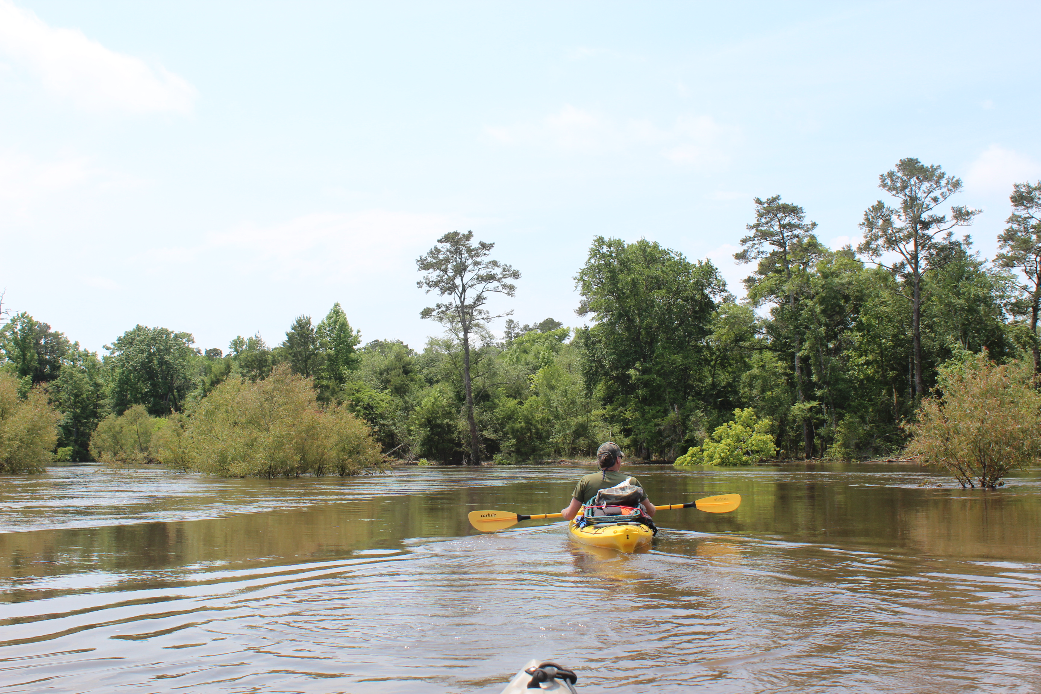
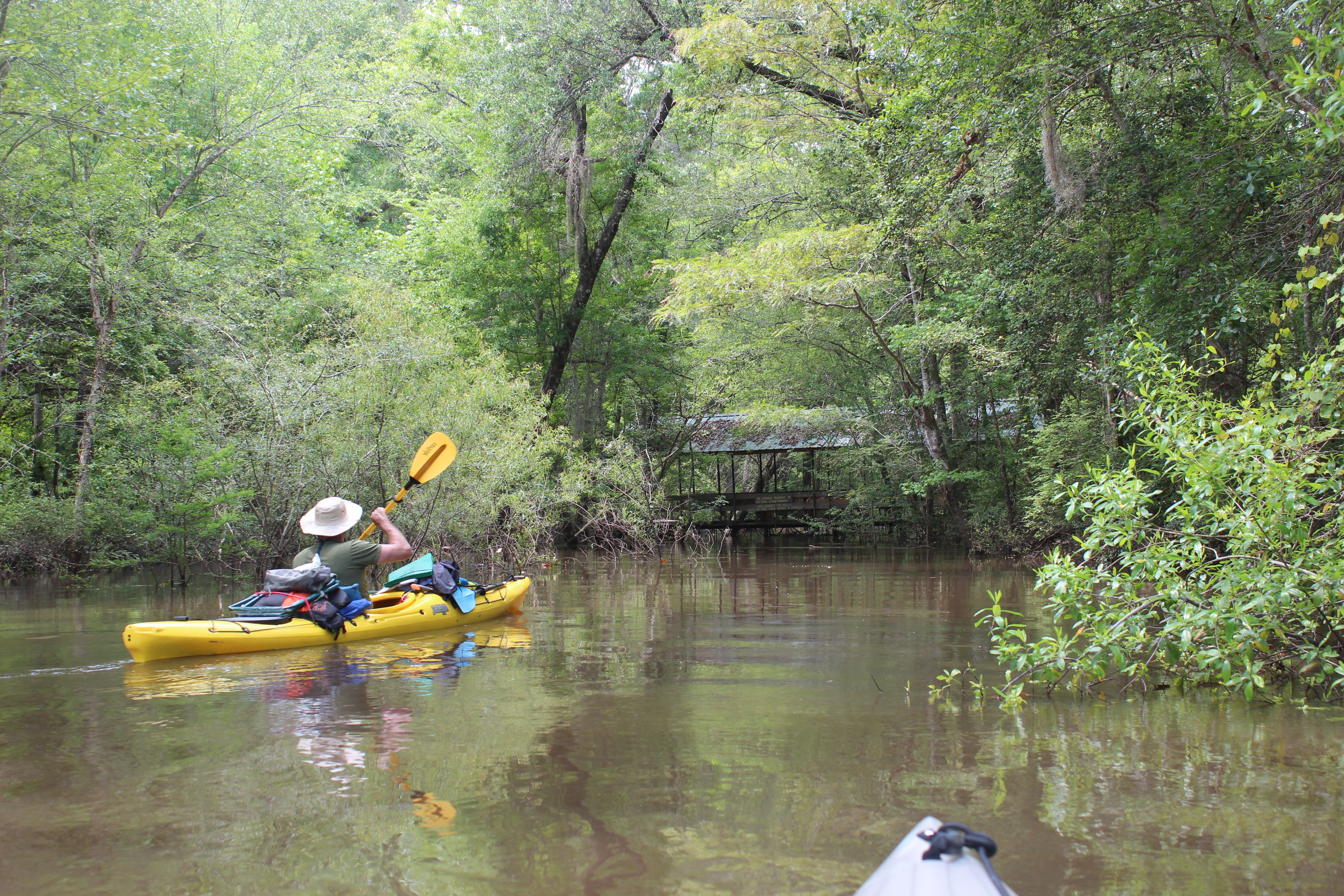
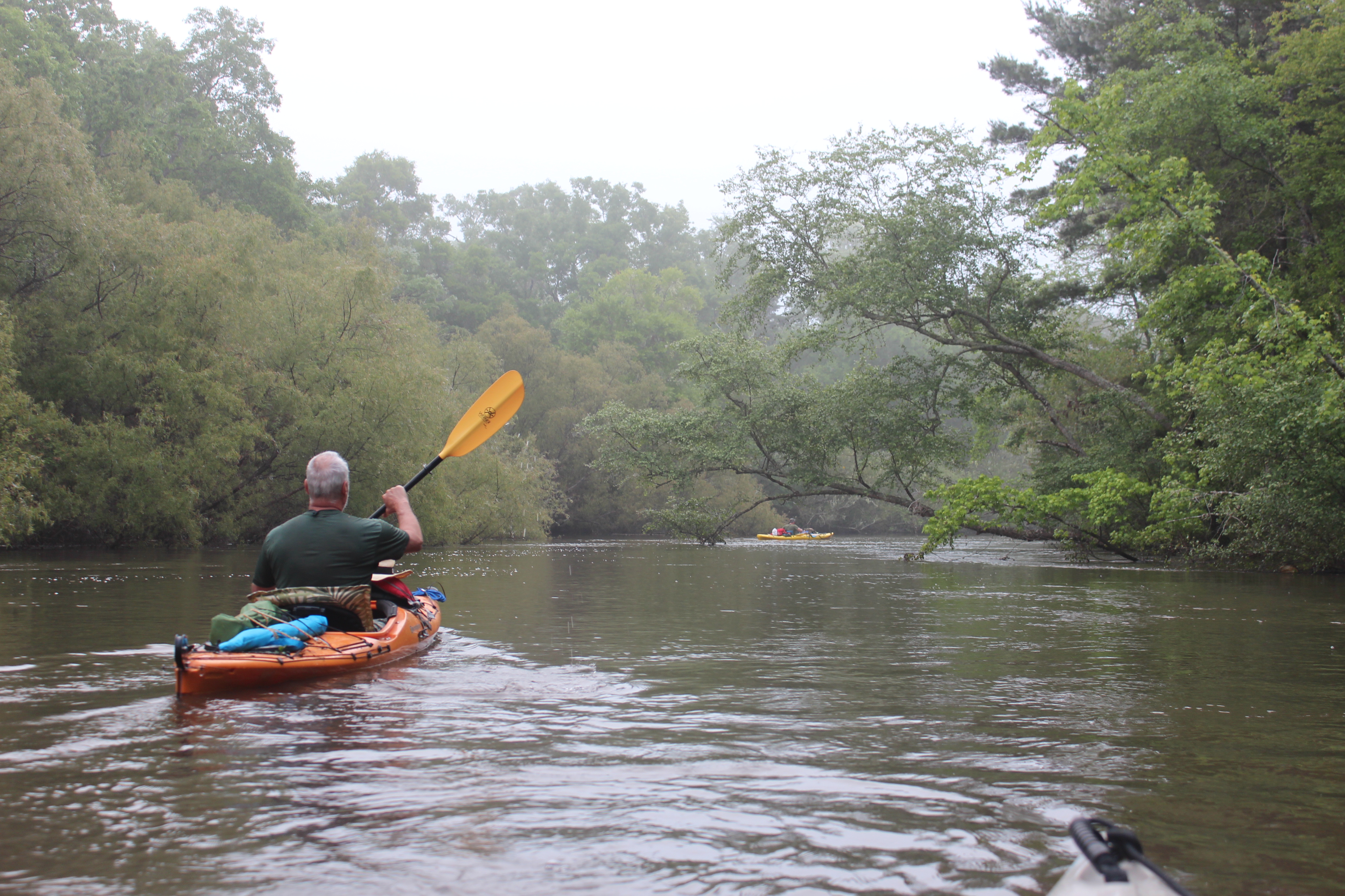
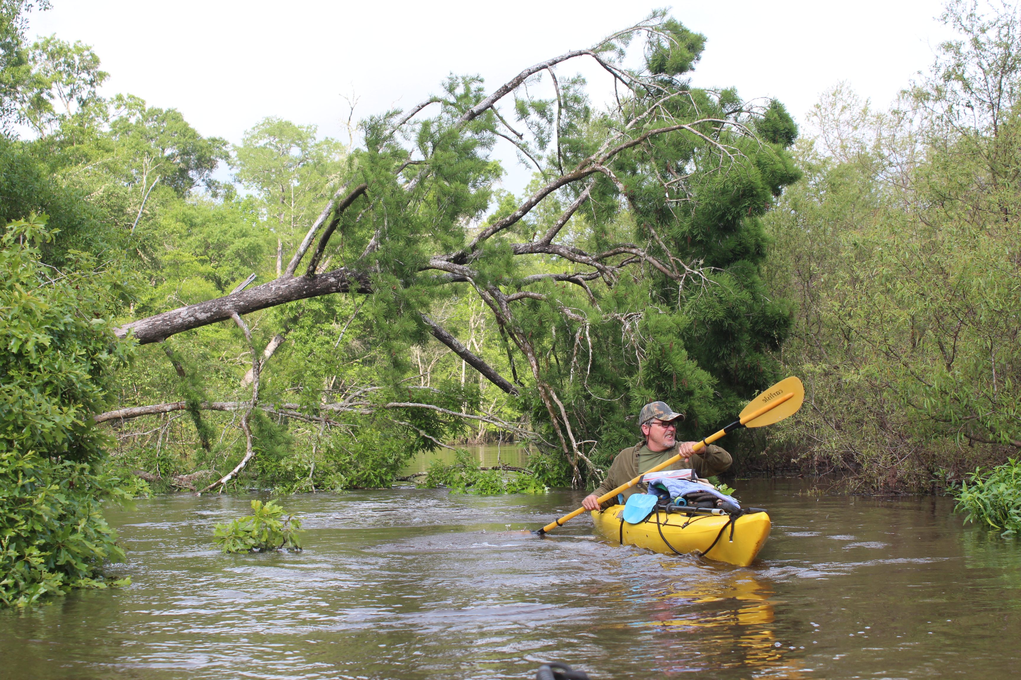
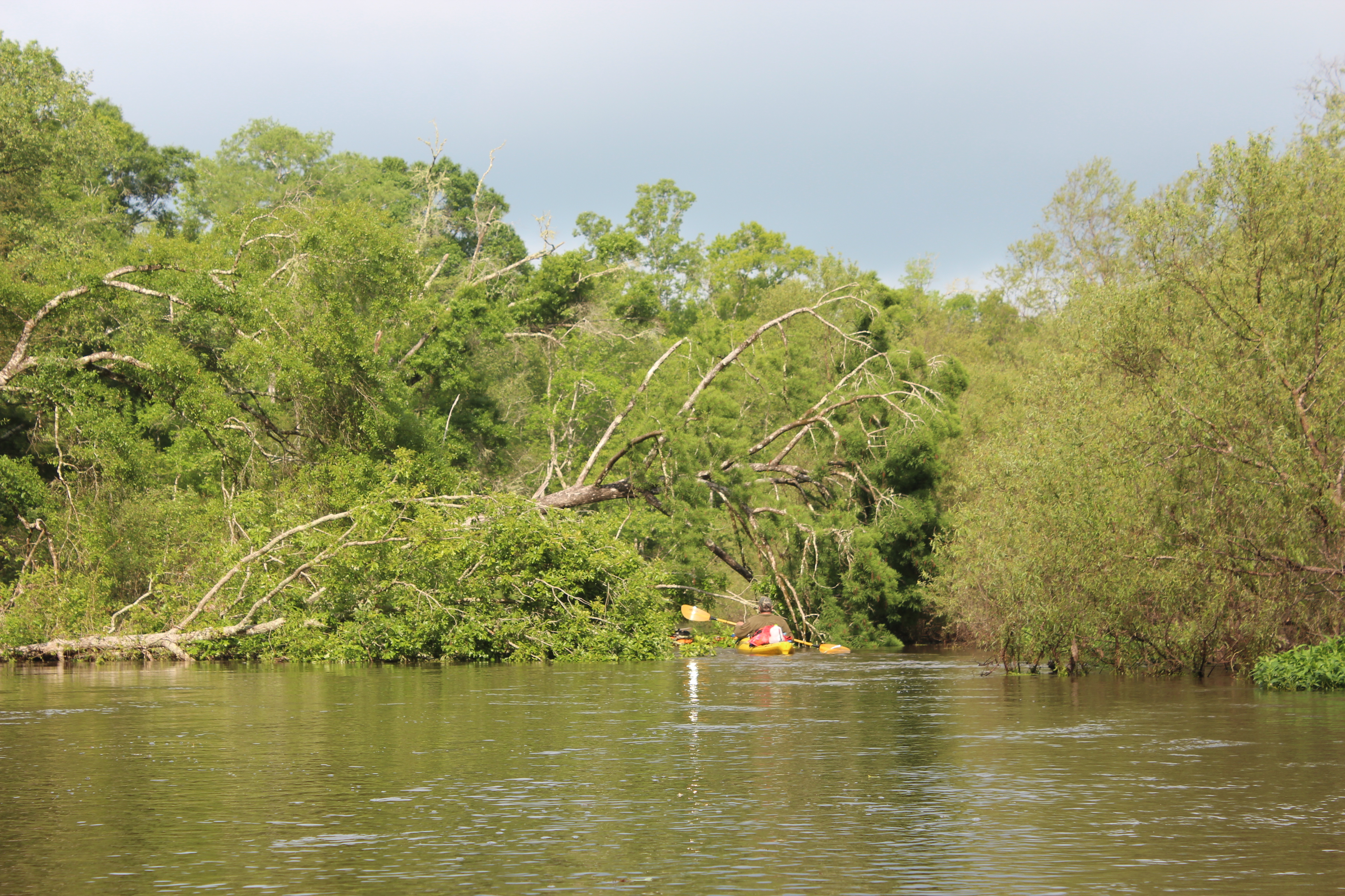
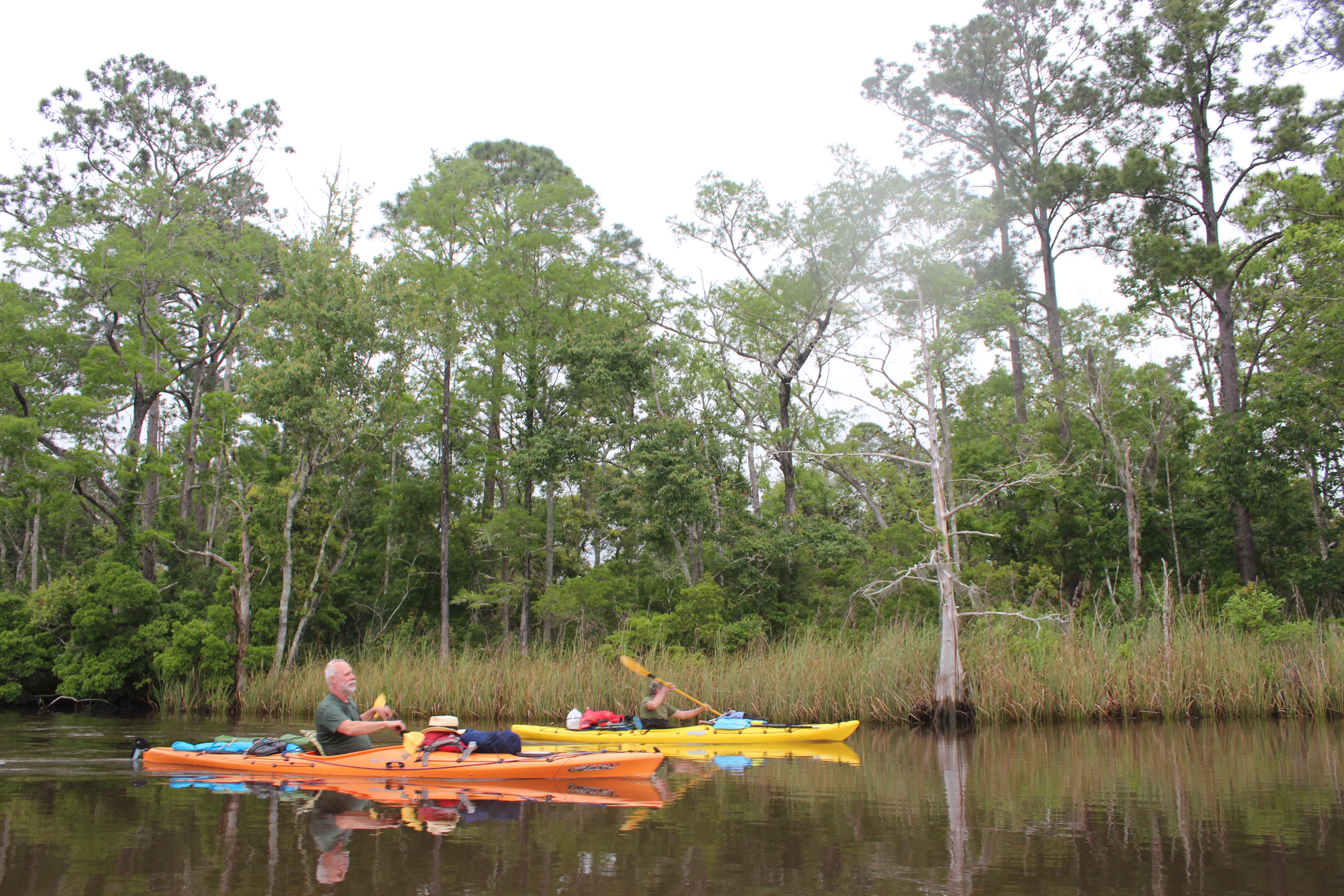
– anyway;  Our starting point for the Pokomoke was just off of Porters Crossing rd, North of Snow Hill, Md. and we were on the river before 8 am..  The best ‘river calibration/acclimation time is in the still of the mornings.  Best wildlife.

1705-d1-IMG_5575

.

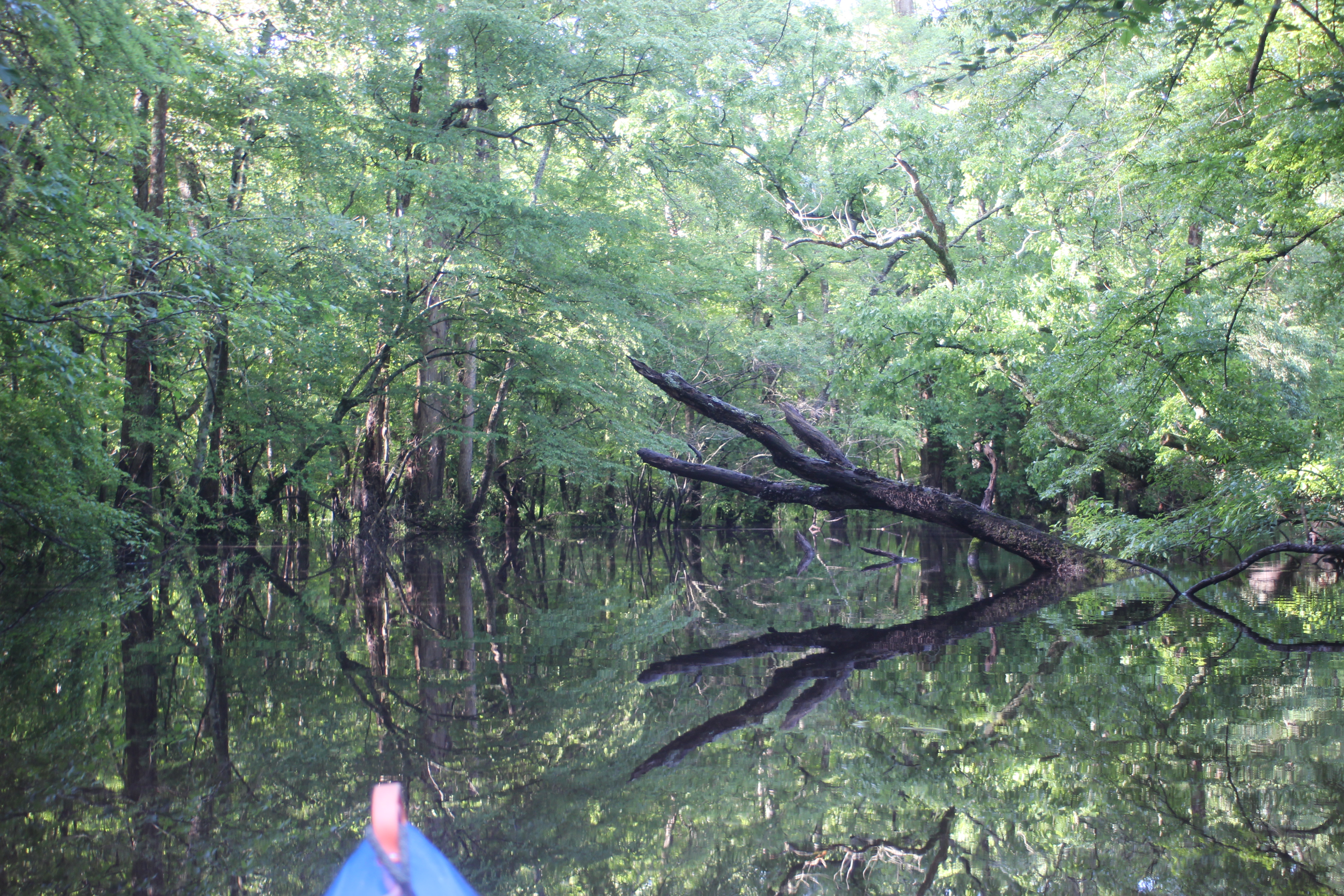
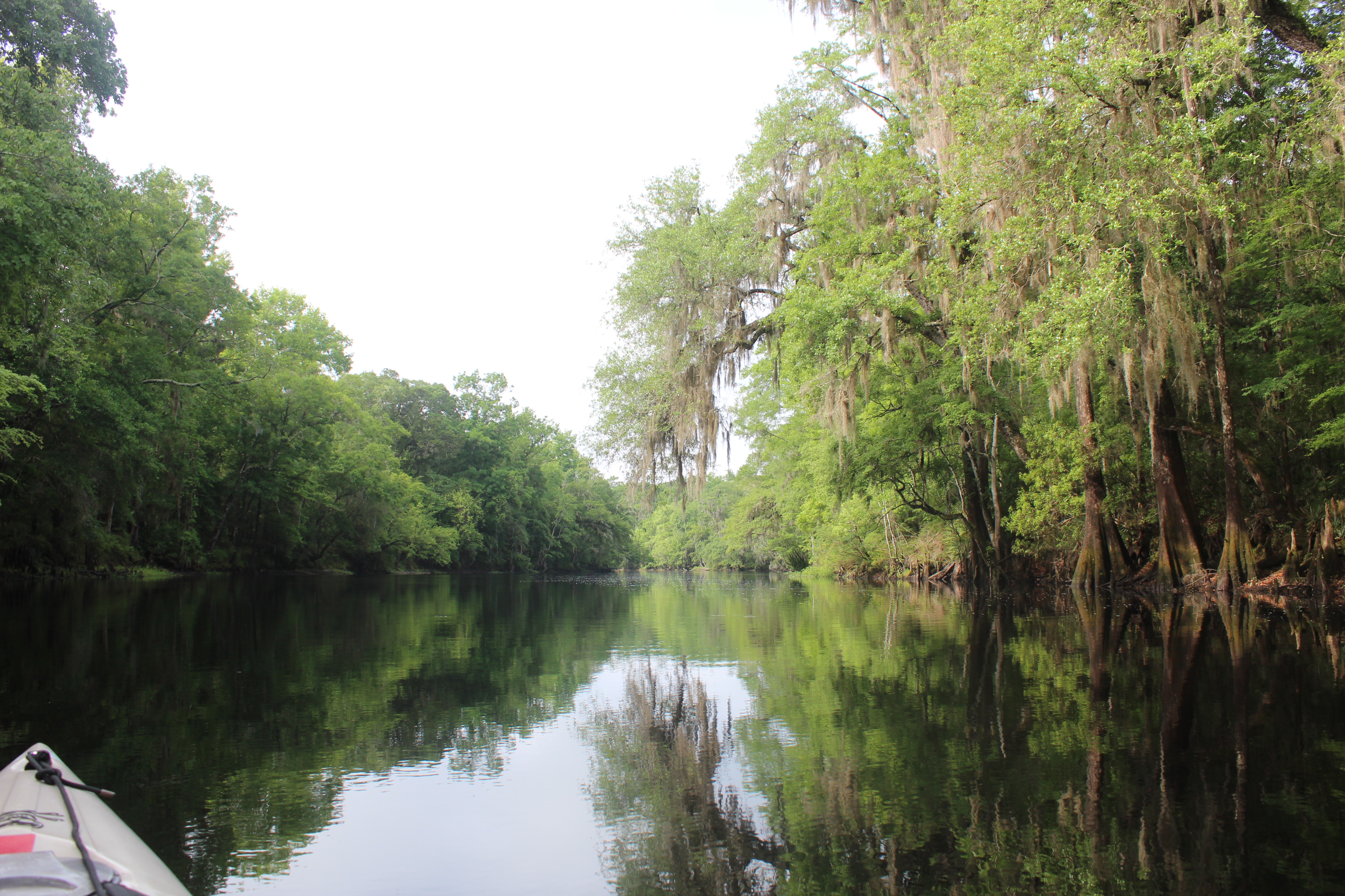
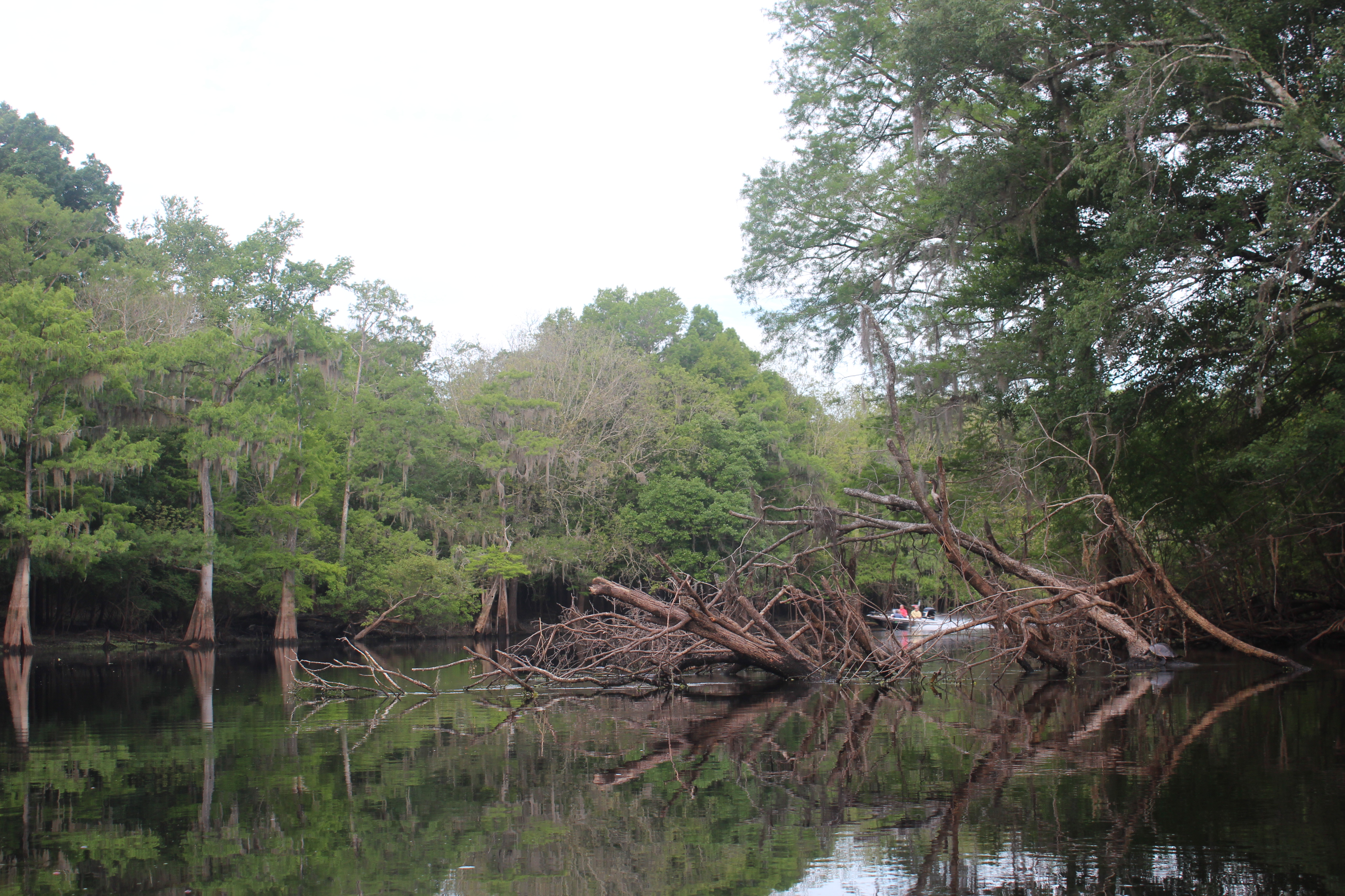
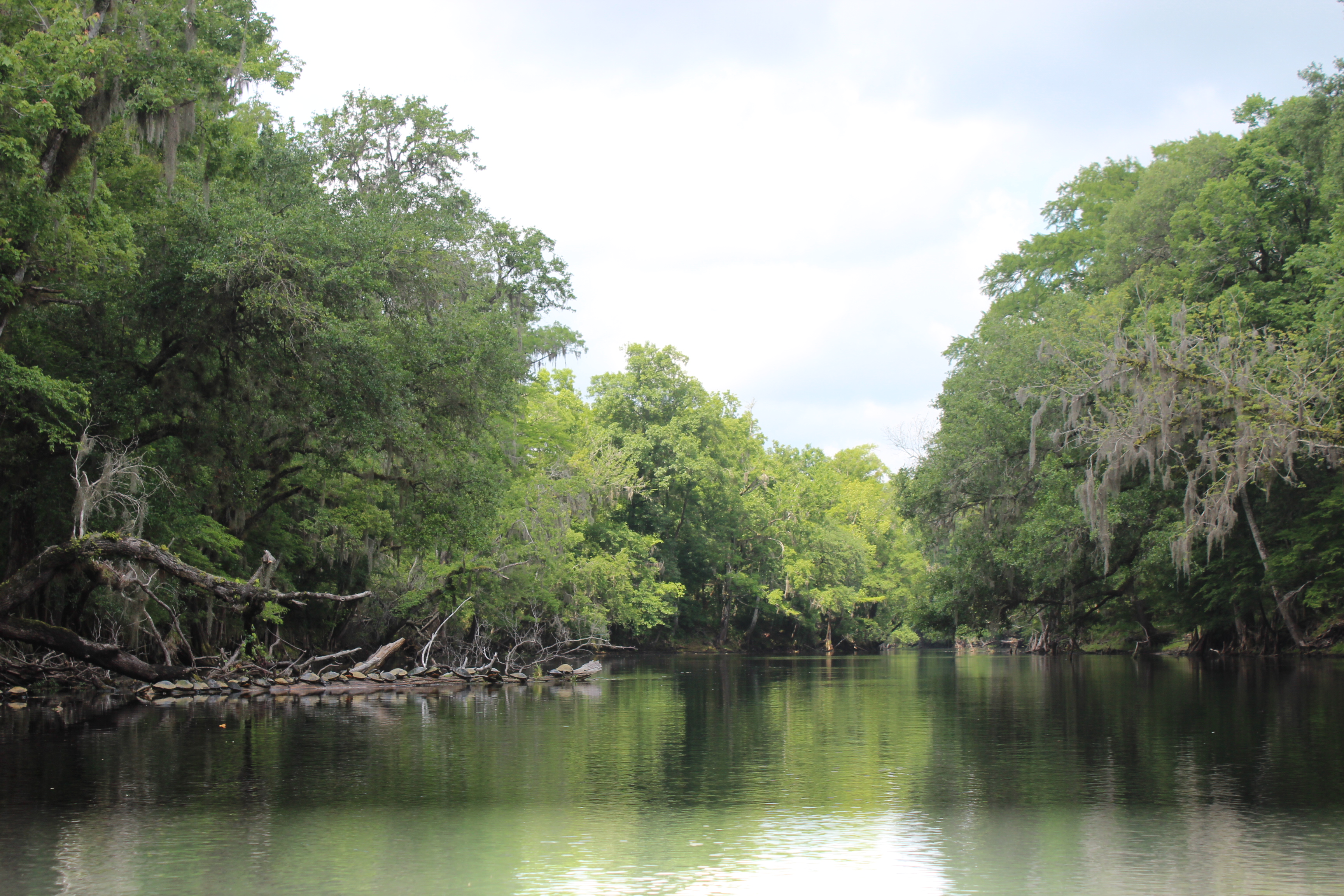
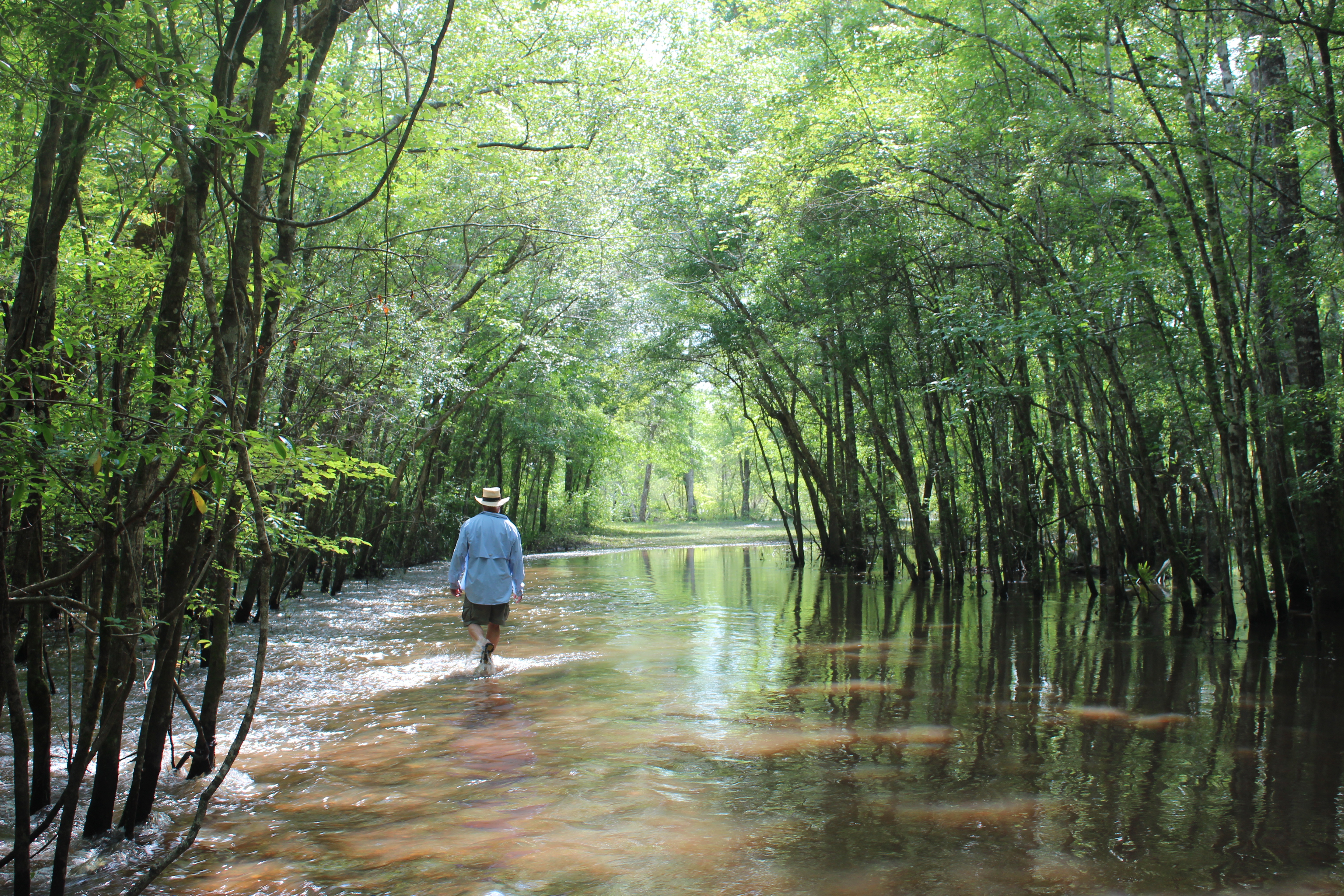
The Pokomoke is a Chesapeake tributary and becomes increasingly affected by the tidal changes of the Chesapeake. On this date it was nearing high tide; which is a good place to be.  In addition there was the moisture from all the rain; high water can be an asset on meandering rivers as its more forgiving when paddling down and through the bends.  With all the water there were places in the stream that were not clearly defined – paying attention to the waters movement helps.

.

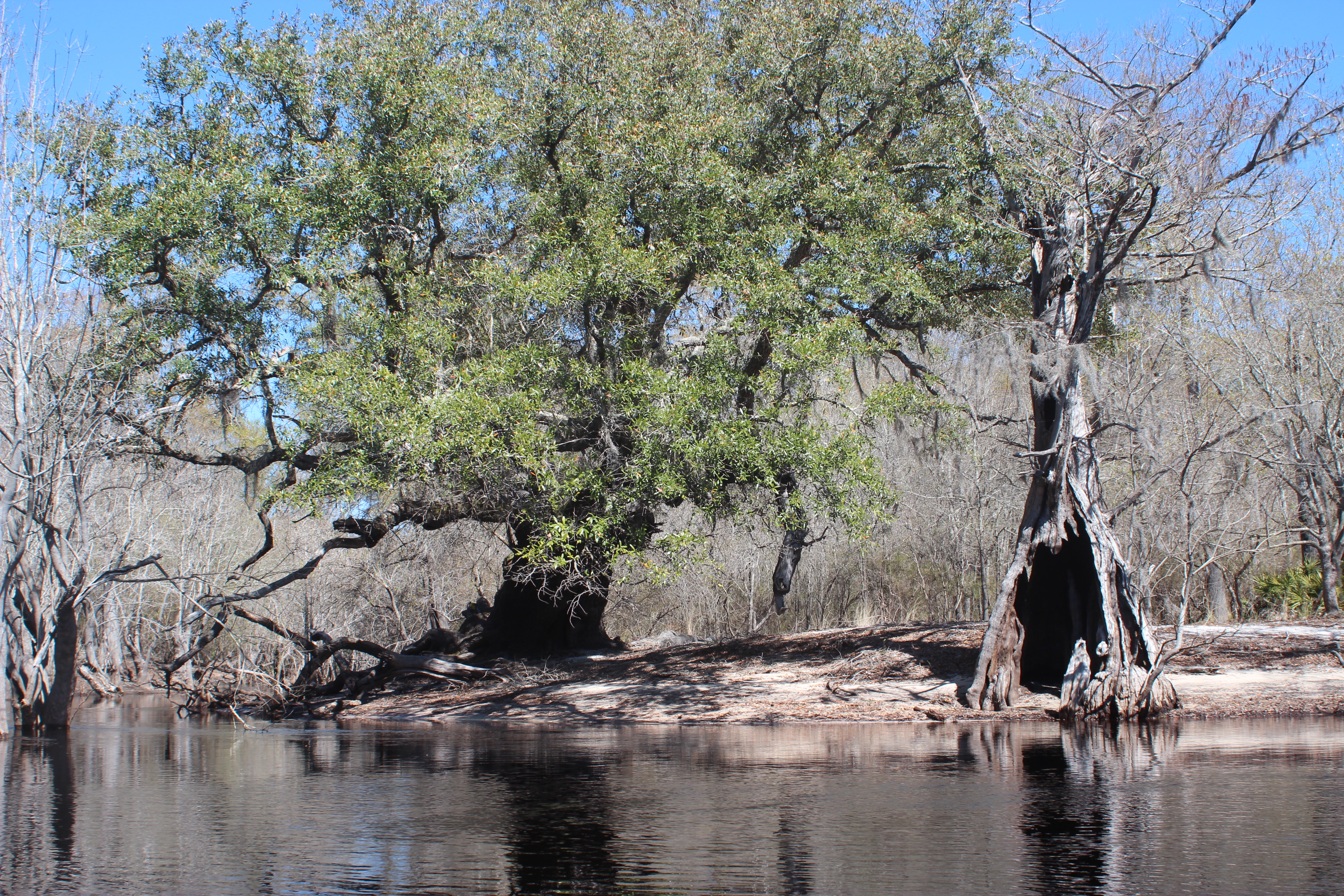
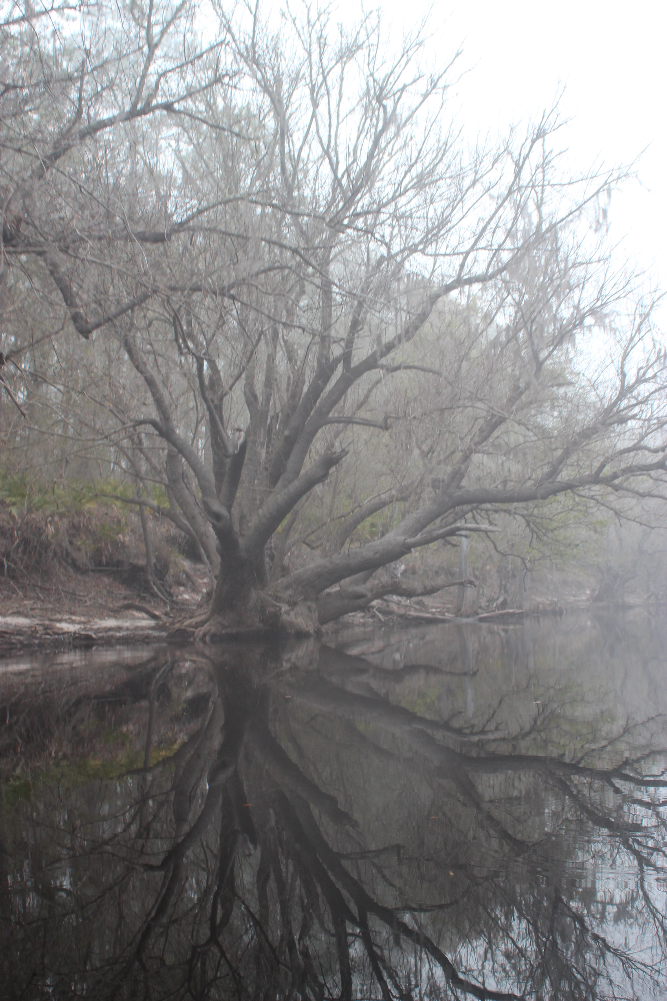
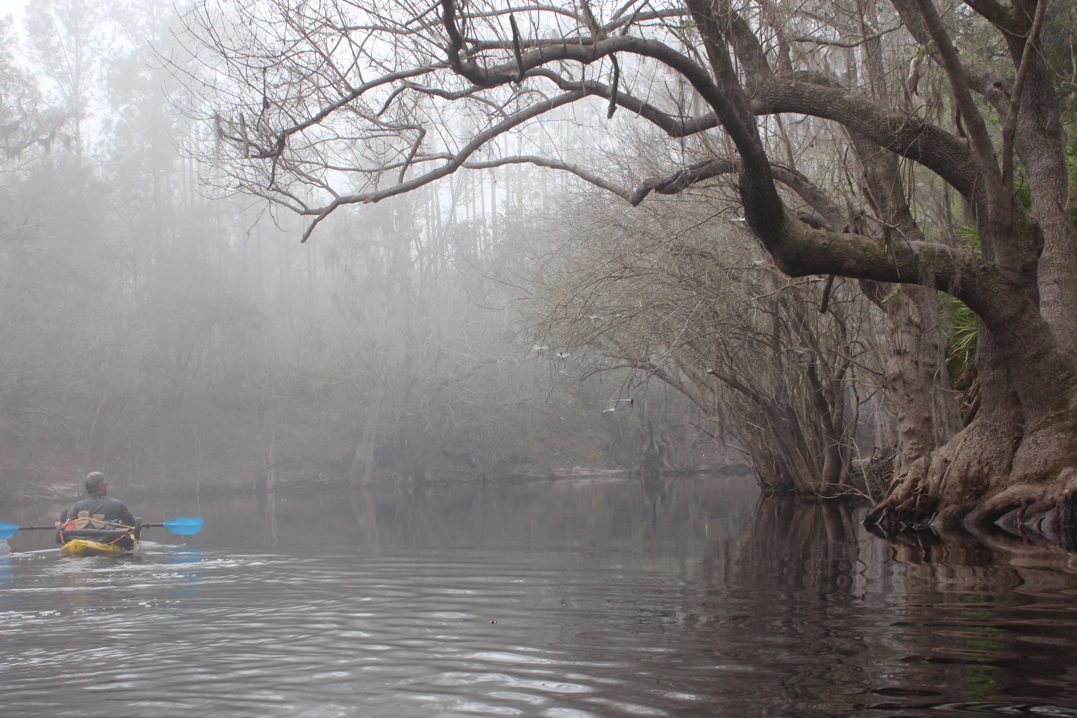
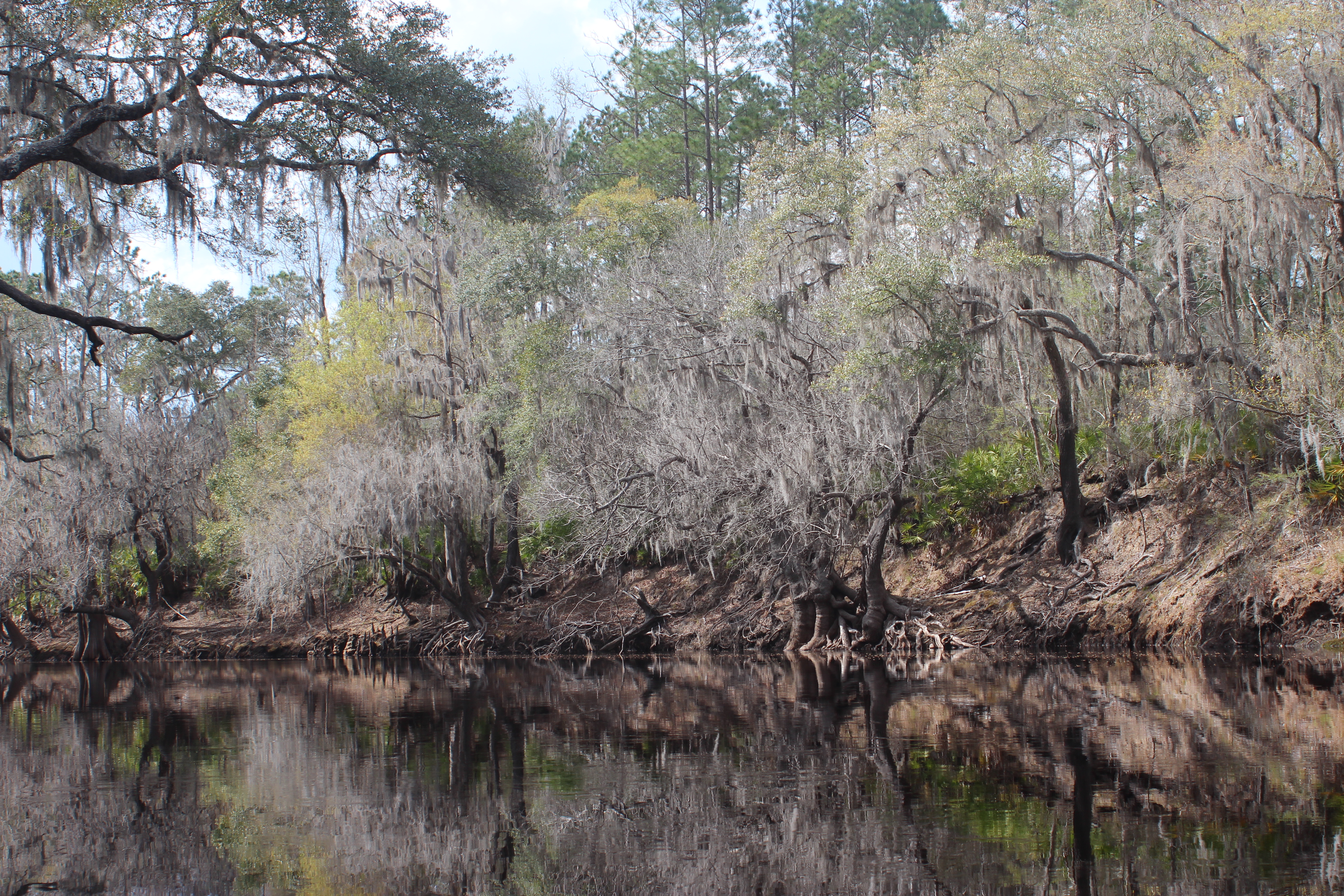
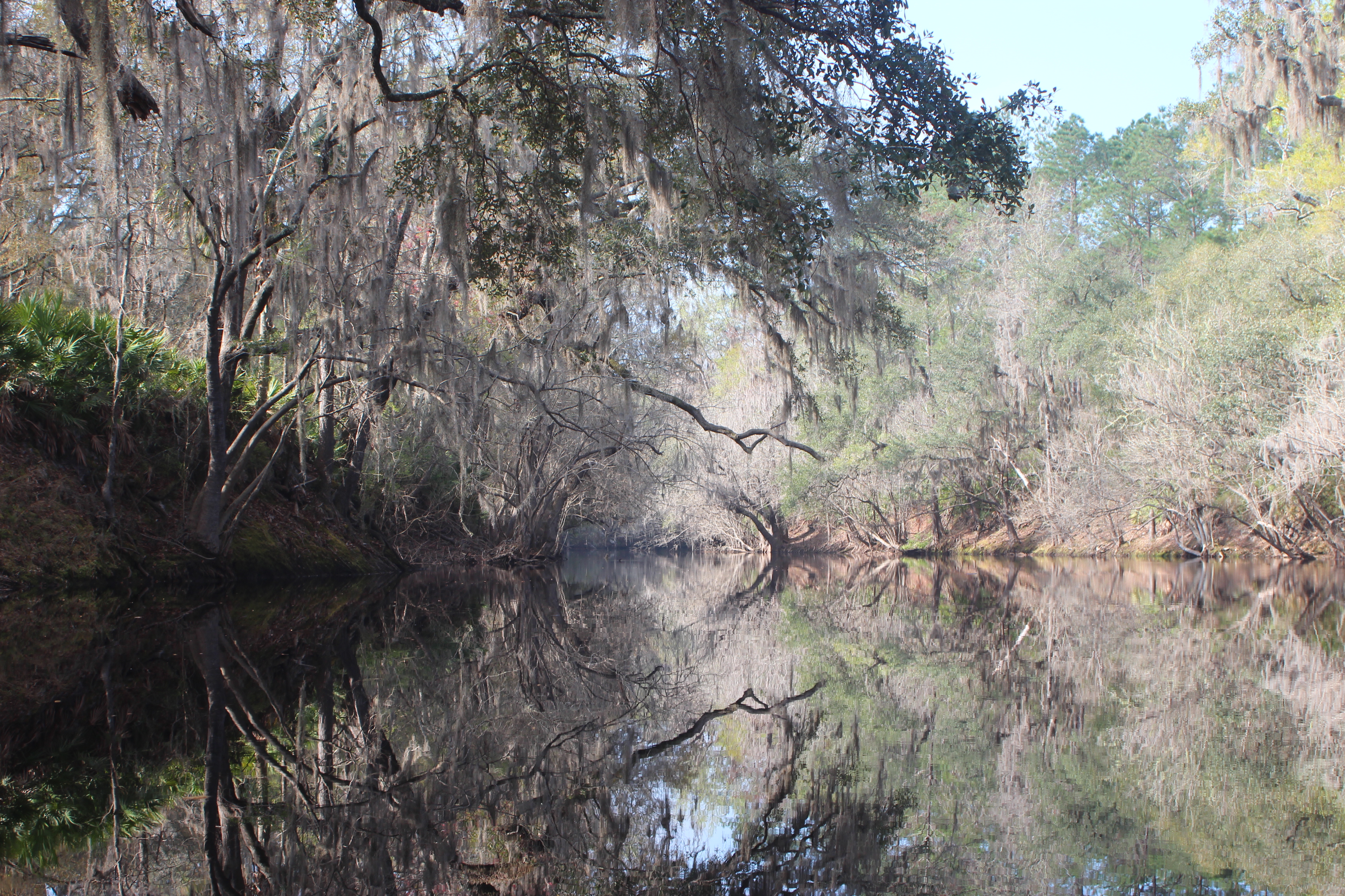
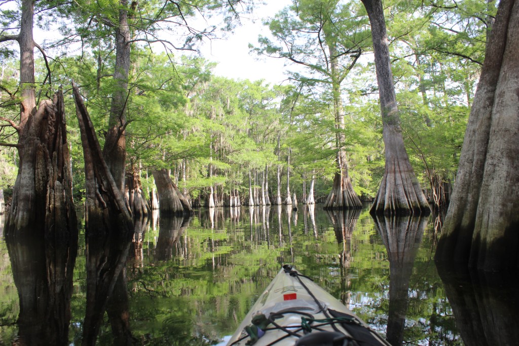
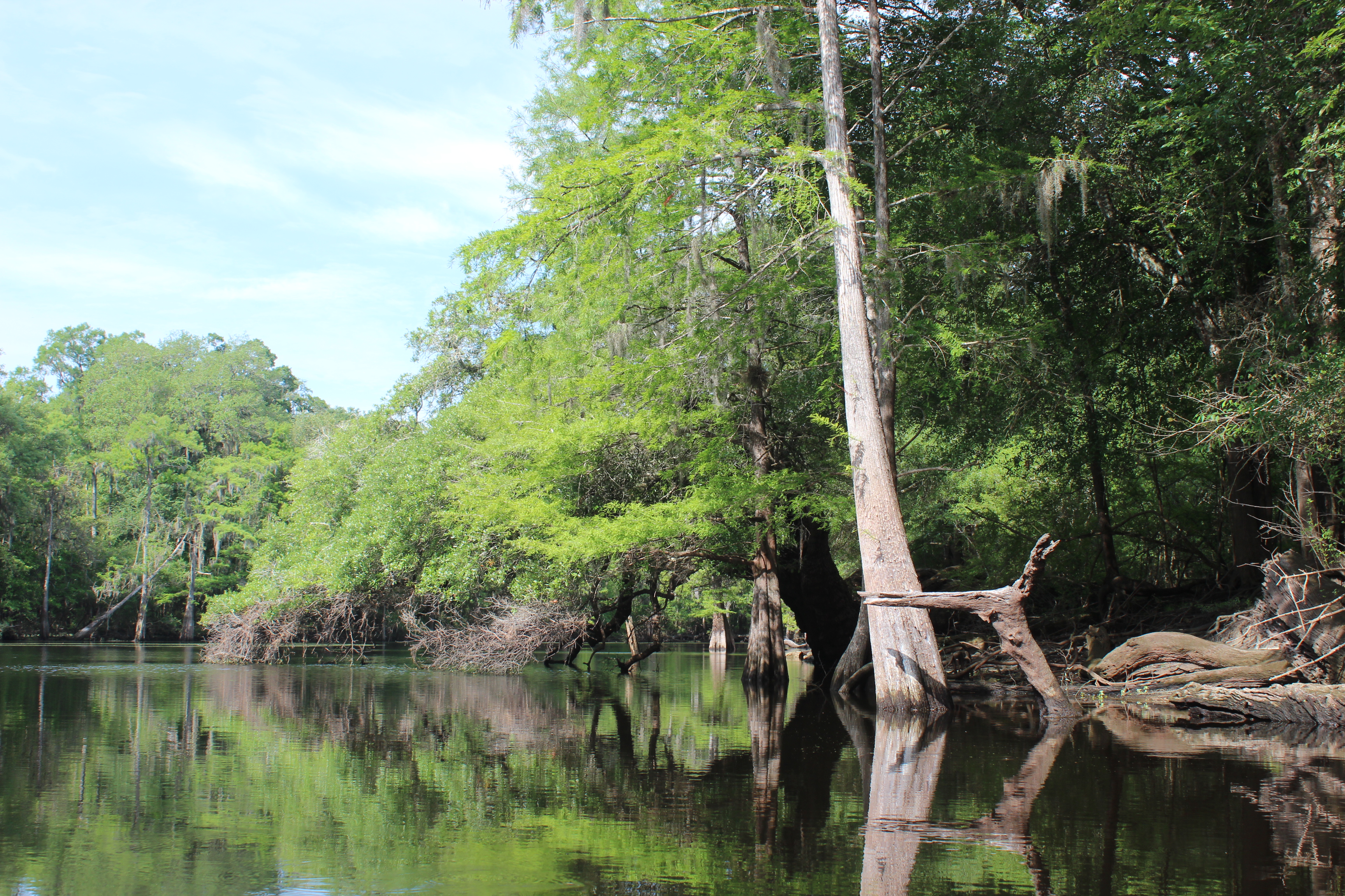
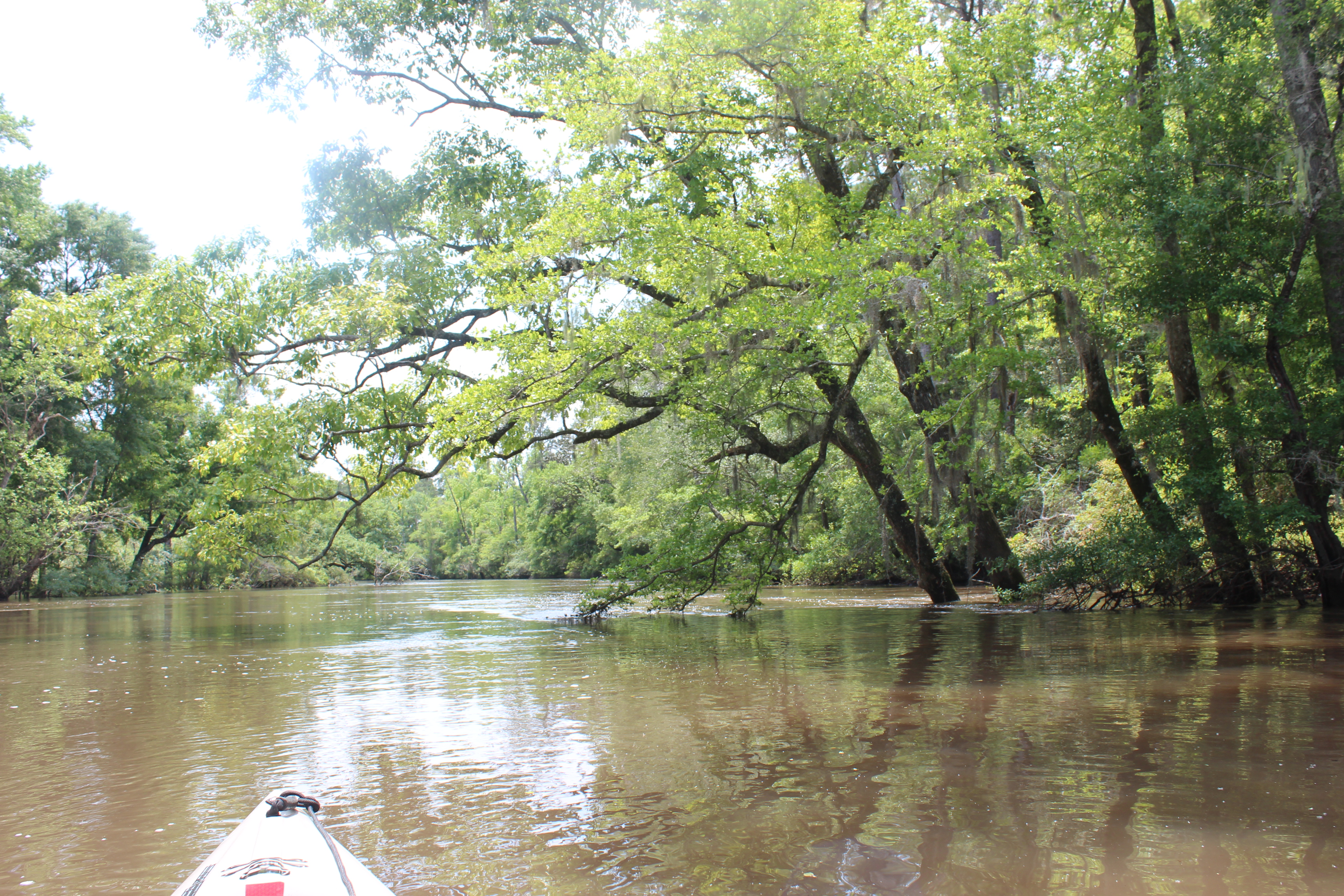
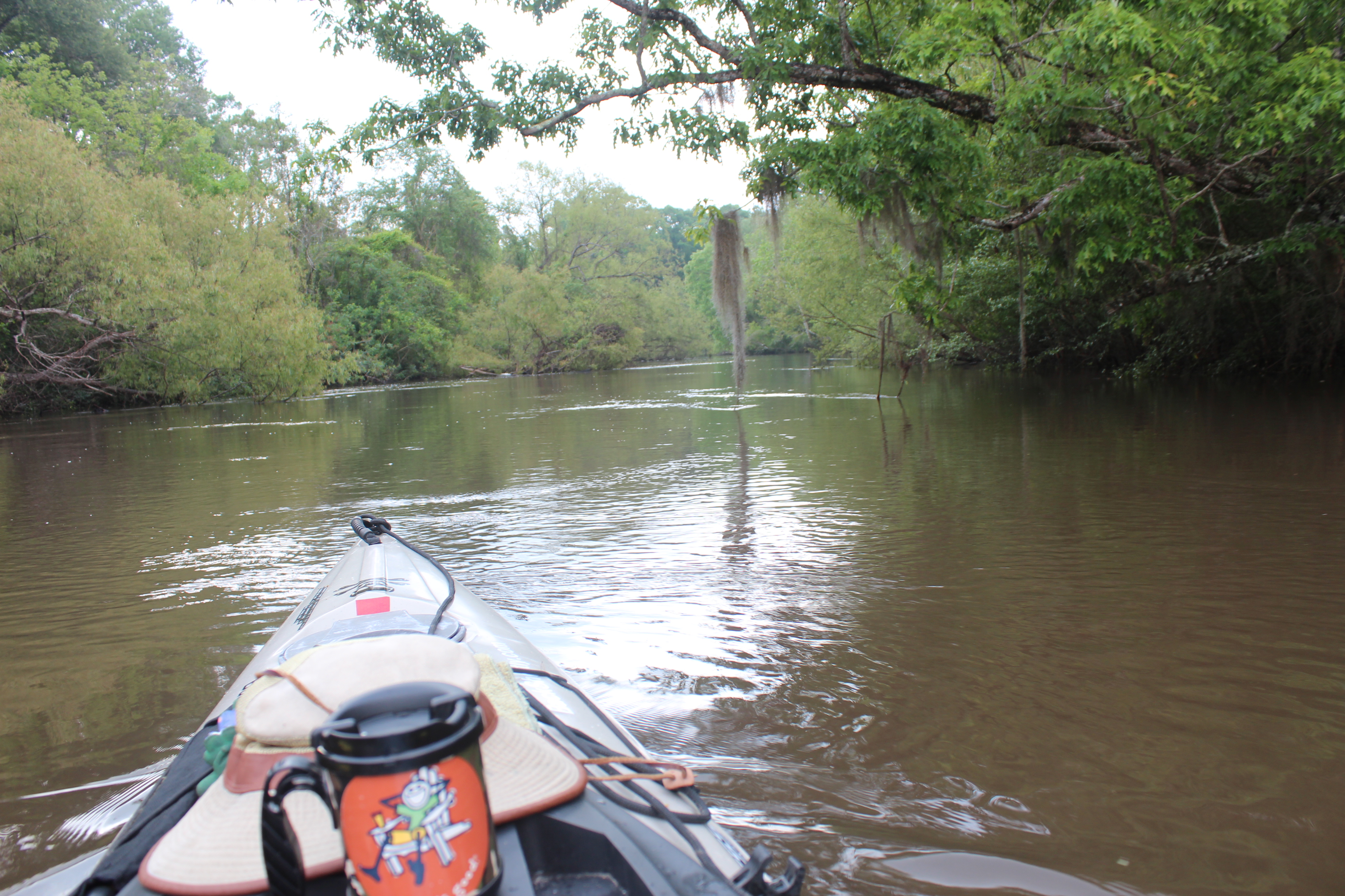
The Pokomoke’s water originates from the great cypress swamp of Delaware, so the ‘feel’ of the river begins much the same as the Suwannee river from the Okefenokee swamp in Georgia. .

1705-d1-IMG_5583

.

There are some mighty bald cypress trees along the way, as old and stately as any southern Oak I’ve seen. The water is dark and leave stained (tannic) another similarity.  The name”Pokomoke” is an American indian name given the river meaning ‘black’ water.

1705-d1-IMG_1796

.

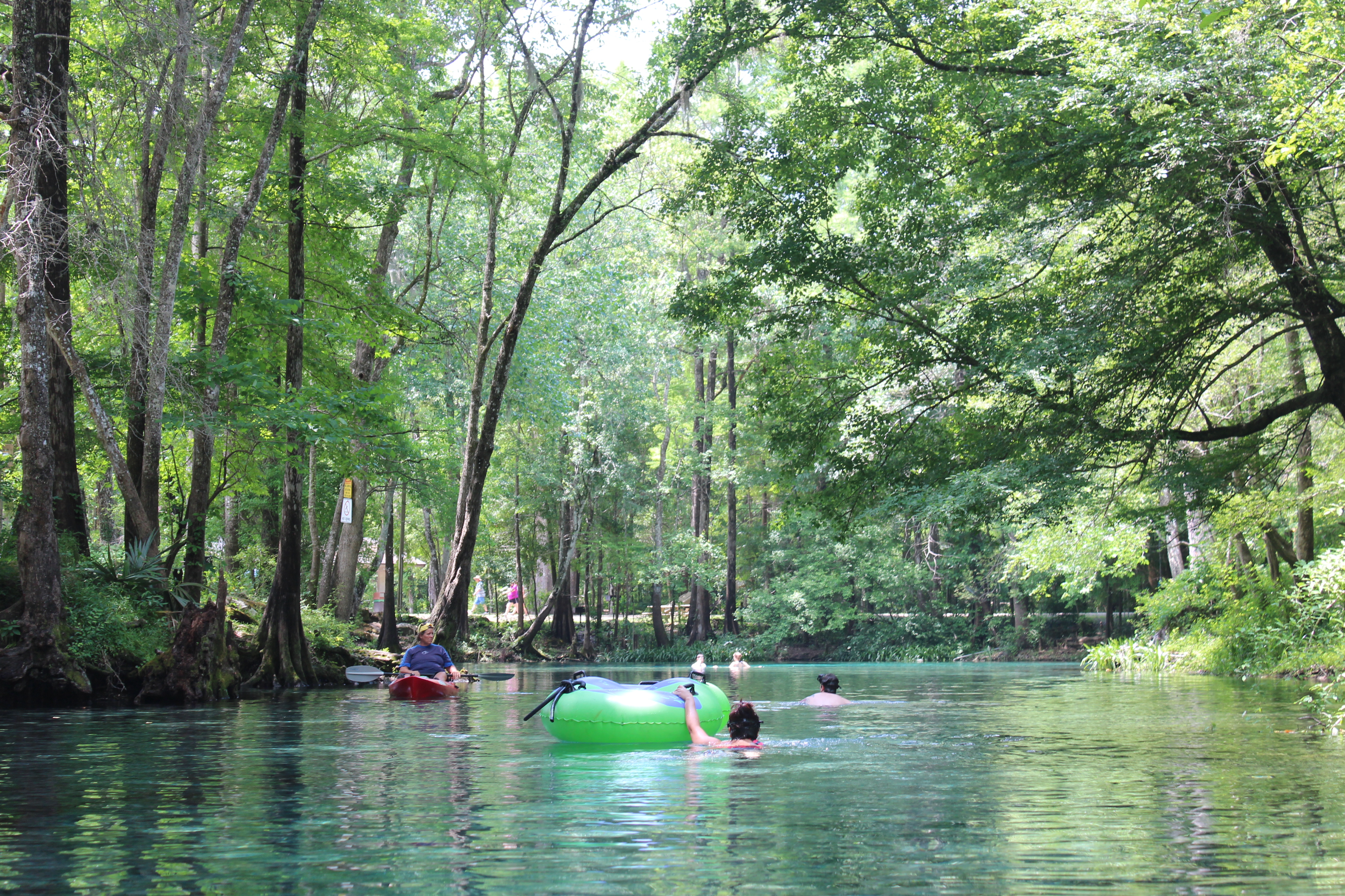
In considering the ‘Water Clarity’ of this river, the tip of the paddle remains visible beneath the surface and the clarity is good understanding the tannic qualities, I wouldn’t hesitate to jump in.  The clarity changes in the lower river as the tidal flow affects it more.

1705-d1-IMG_5589

.

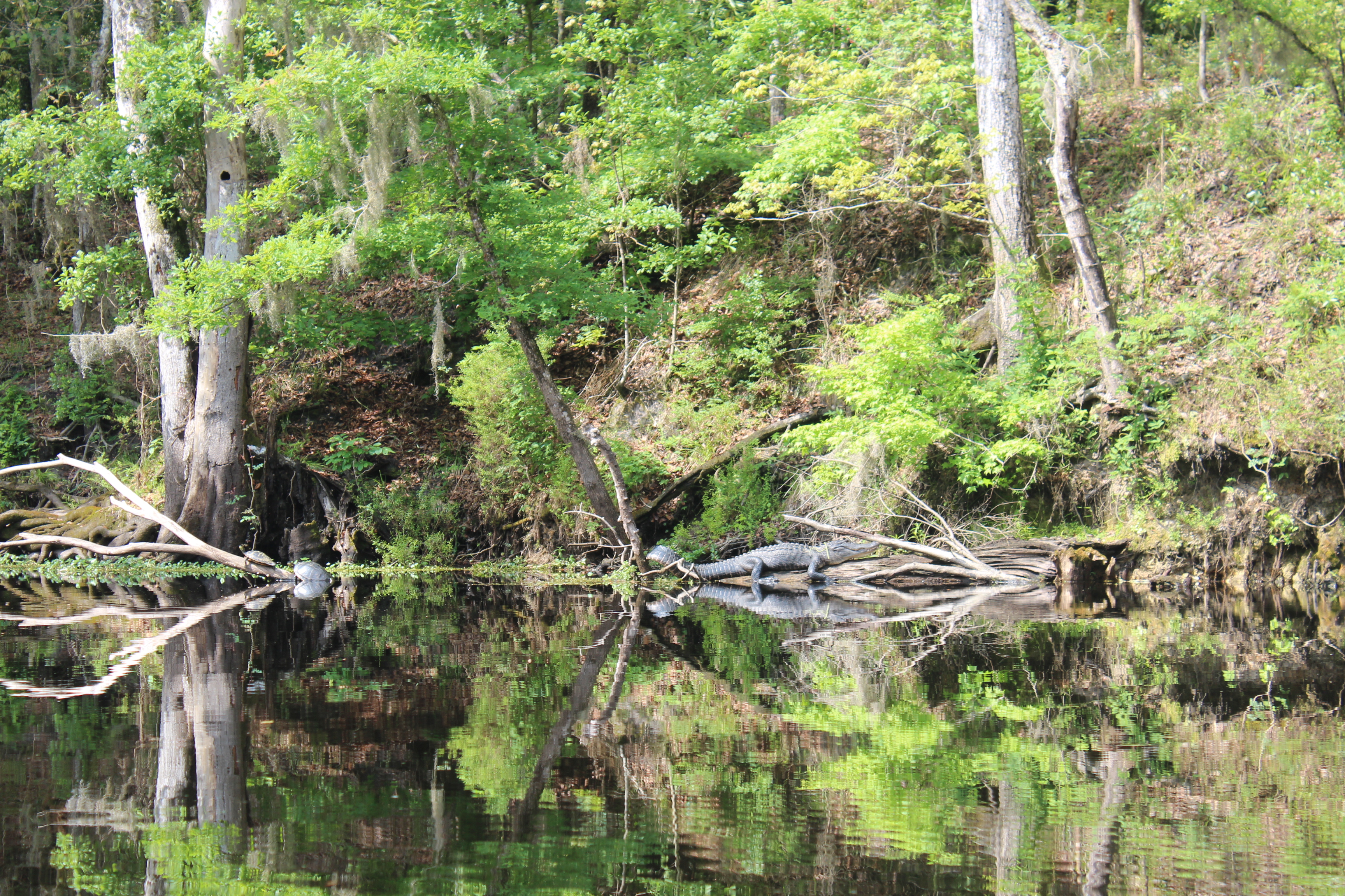
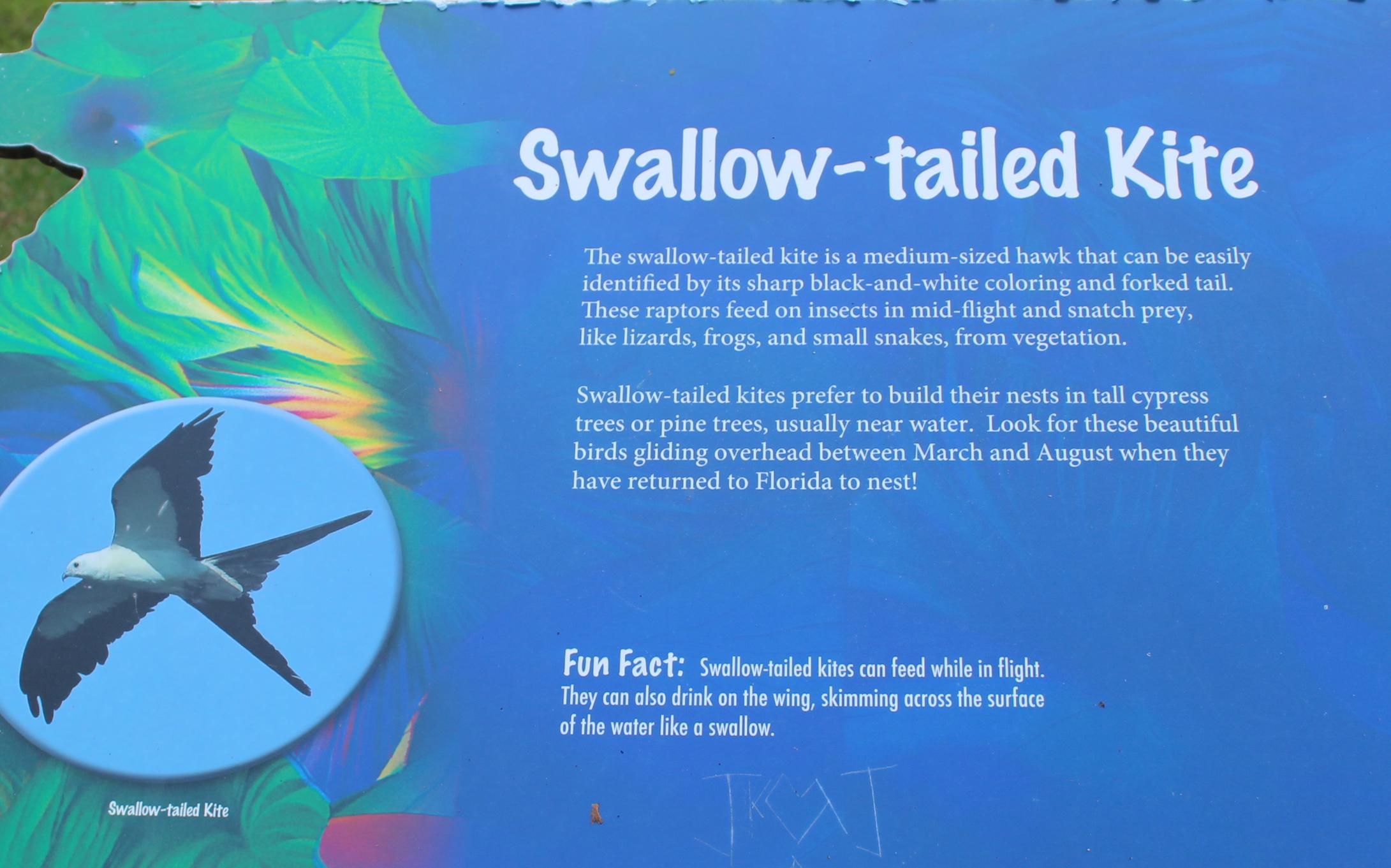
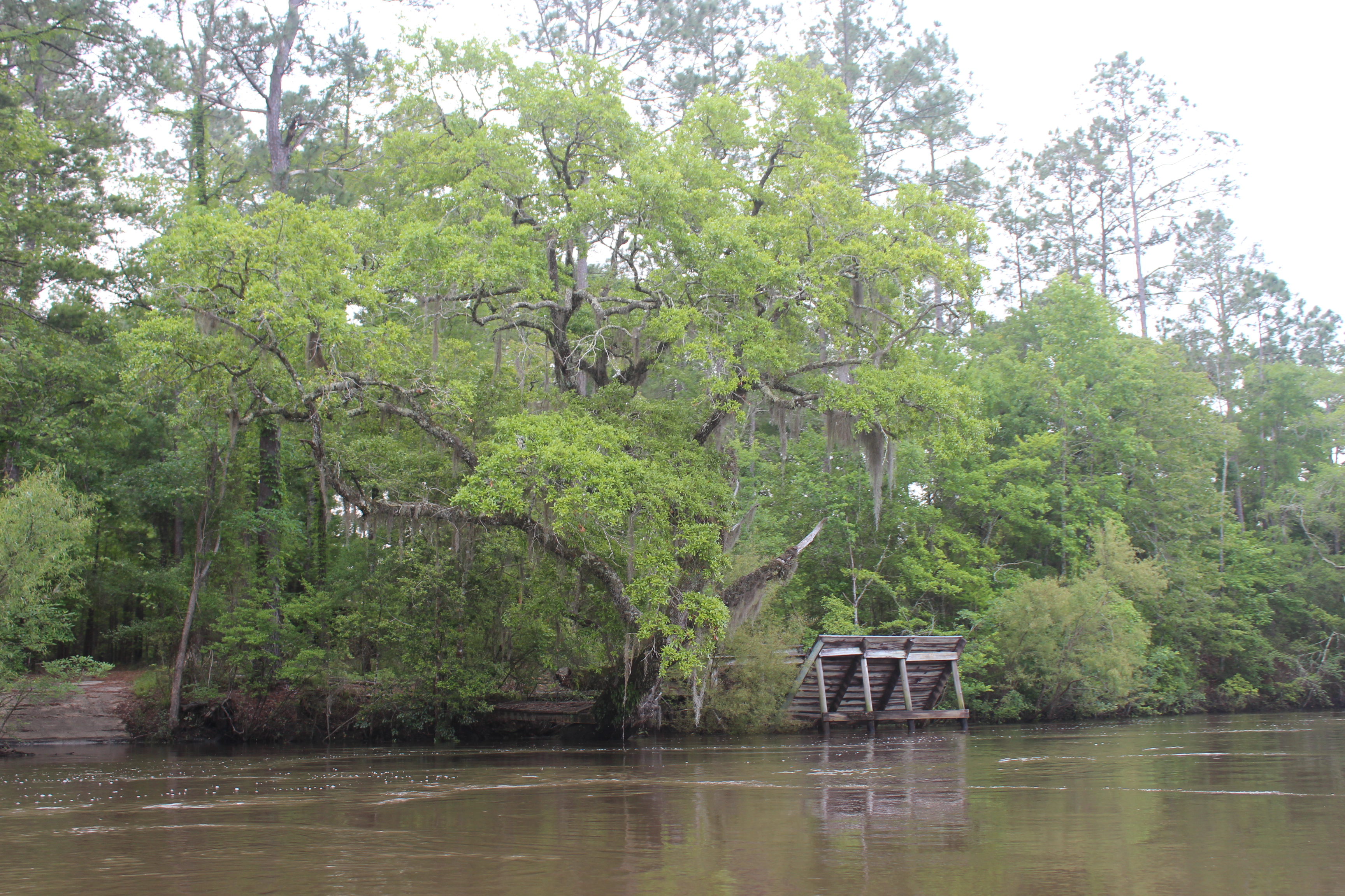
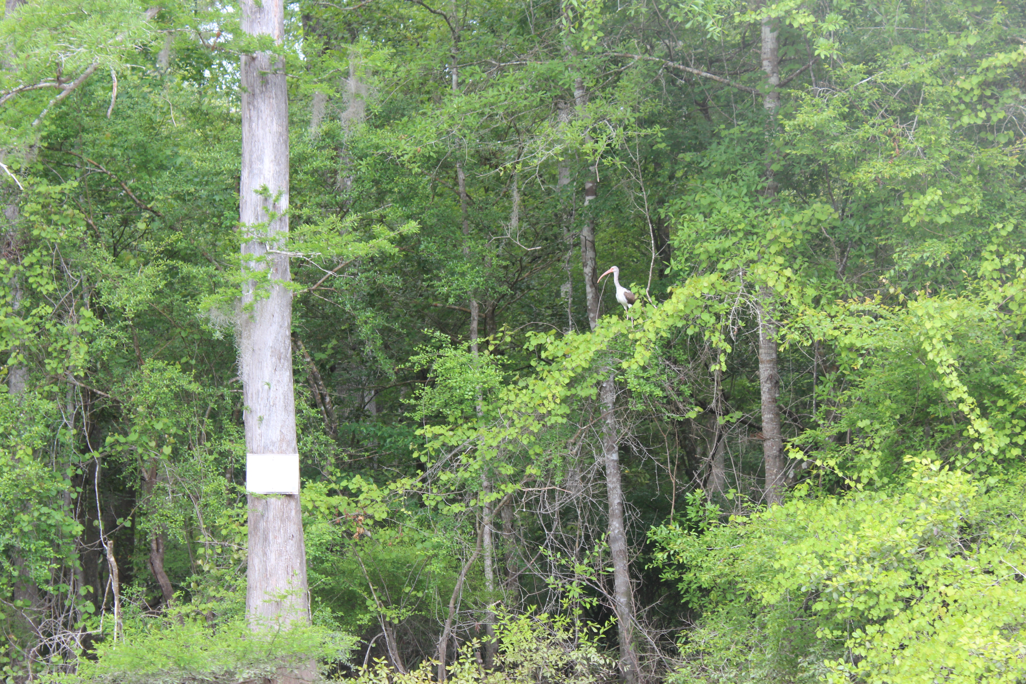
There too are numerous older duck-blinds. In considering the “Natural Quality” of the Pokomoke – we observed deer, wood-ducks, turtles, the signs of beaver, Osprey, eagles, and more along the river. The higher water in the beginning had a few water-snakes on the move; I didn’t bother them.

Its good habitat.

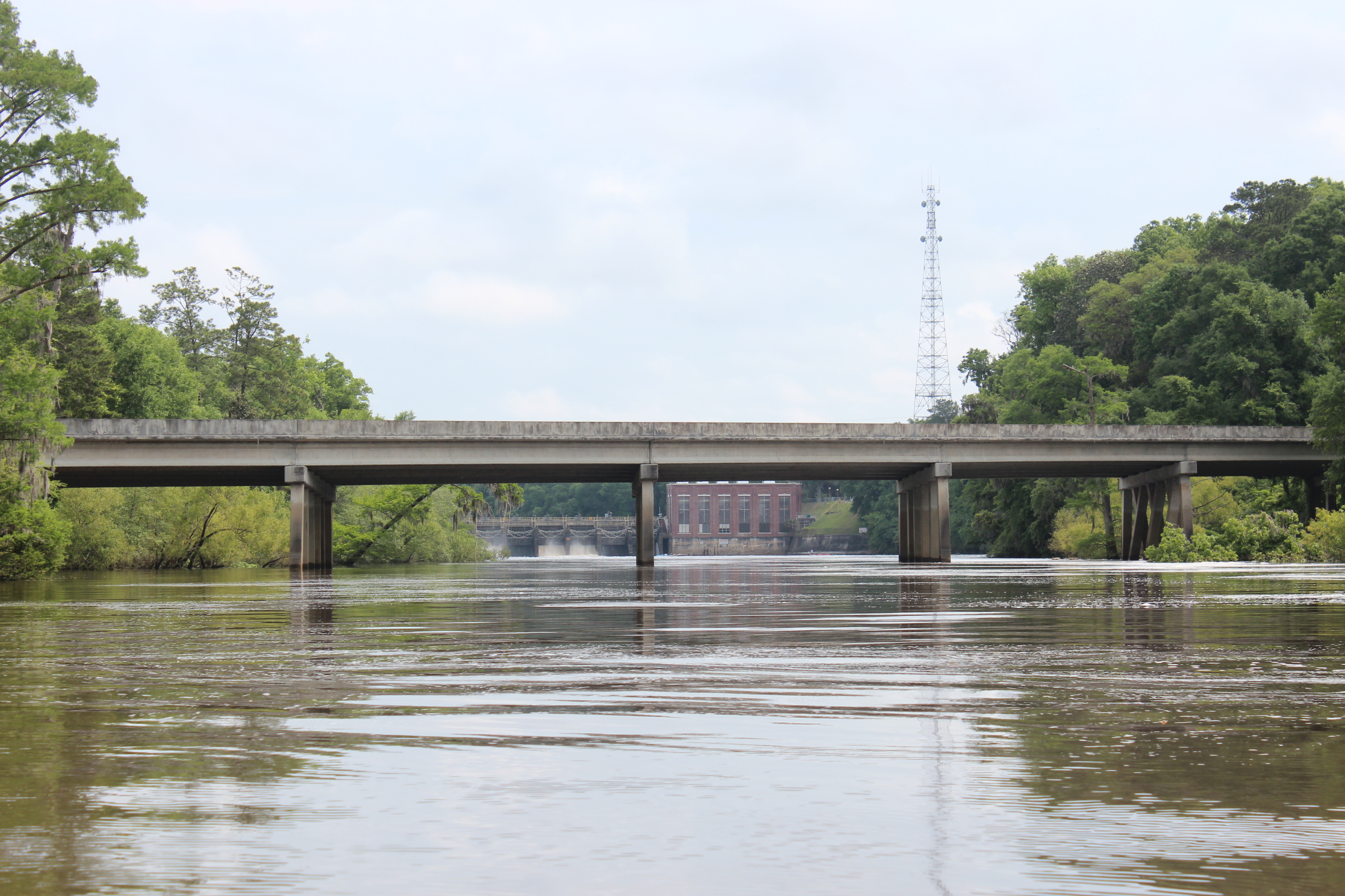
We made Snow Hill, Md an hour and a half after put-in.

1705-d1-IMG_1814

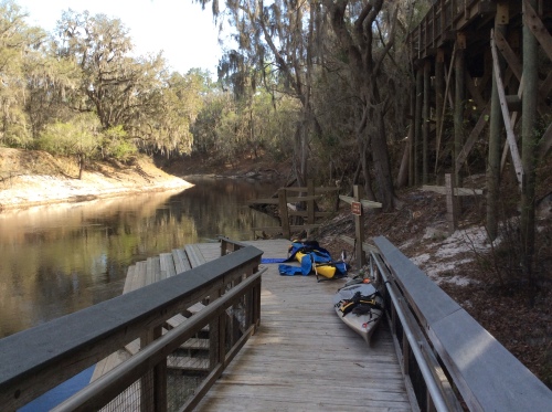
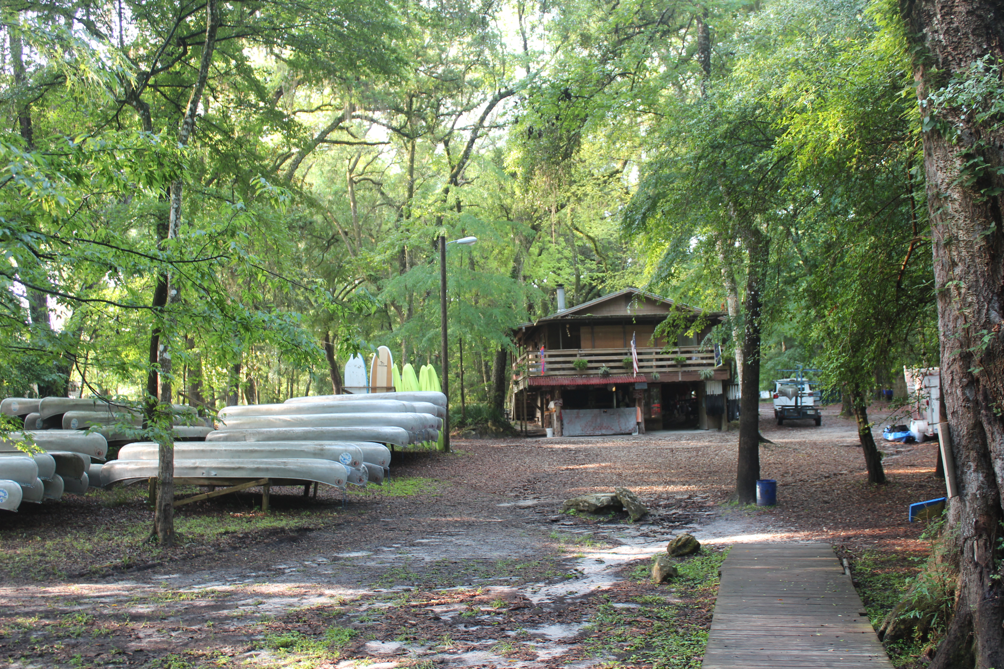
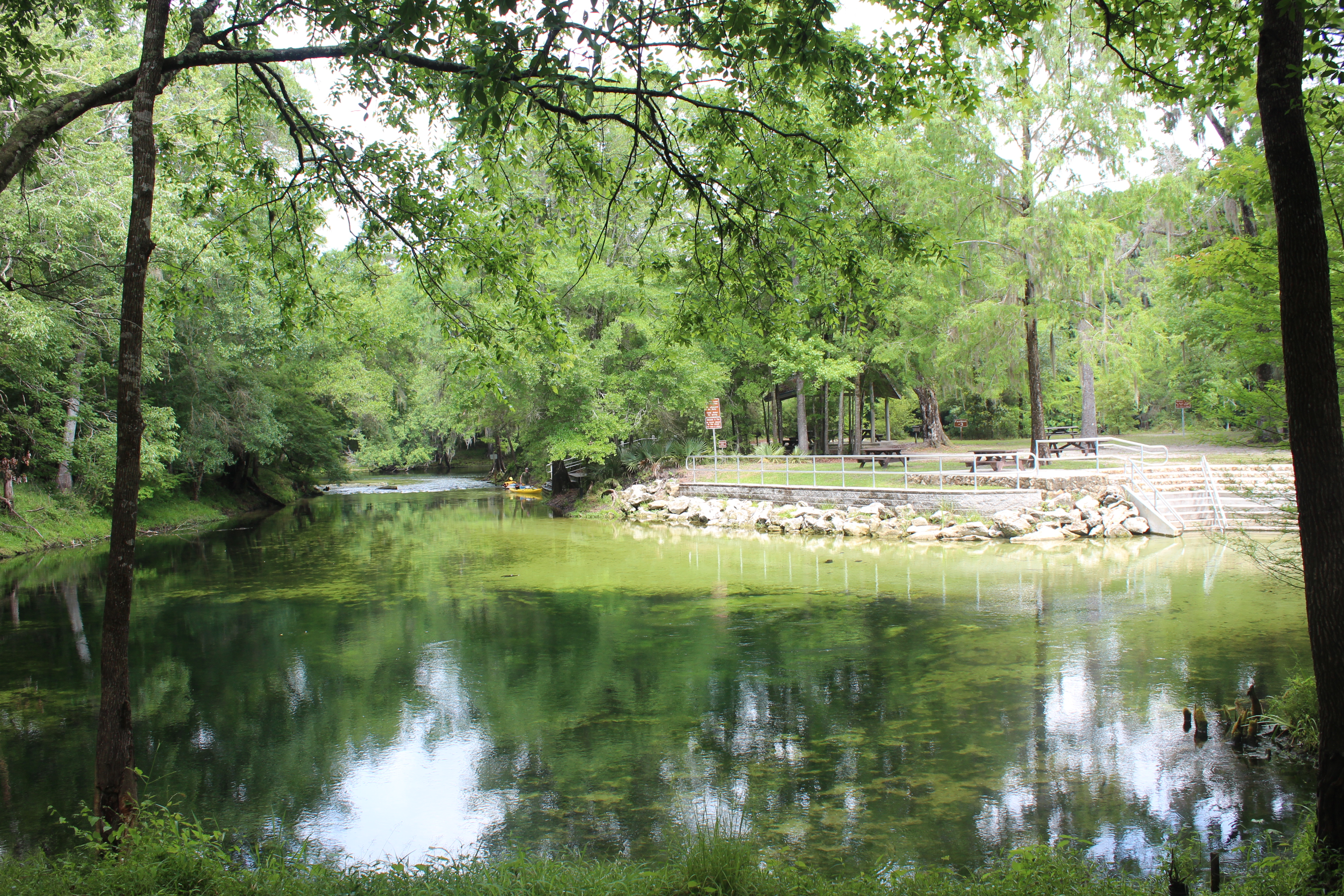
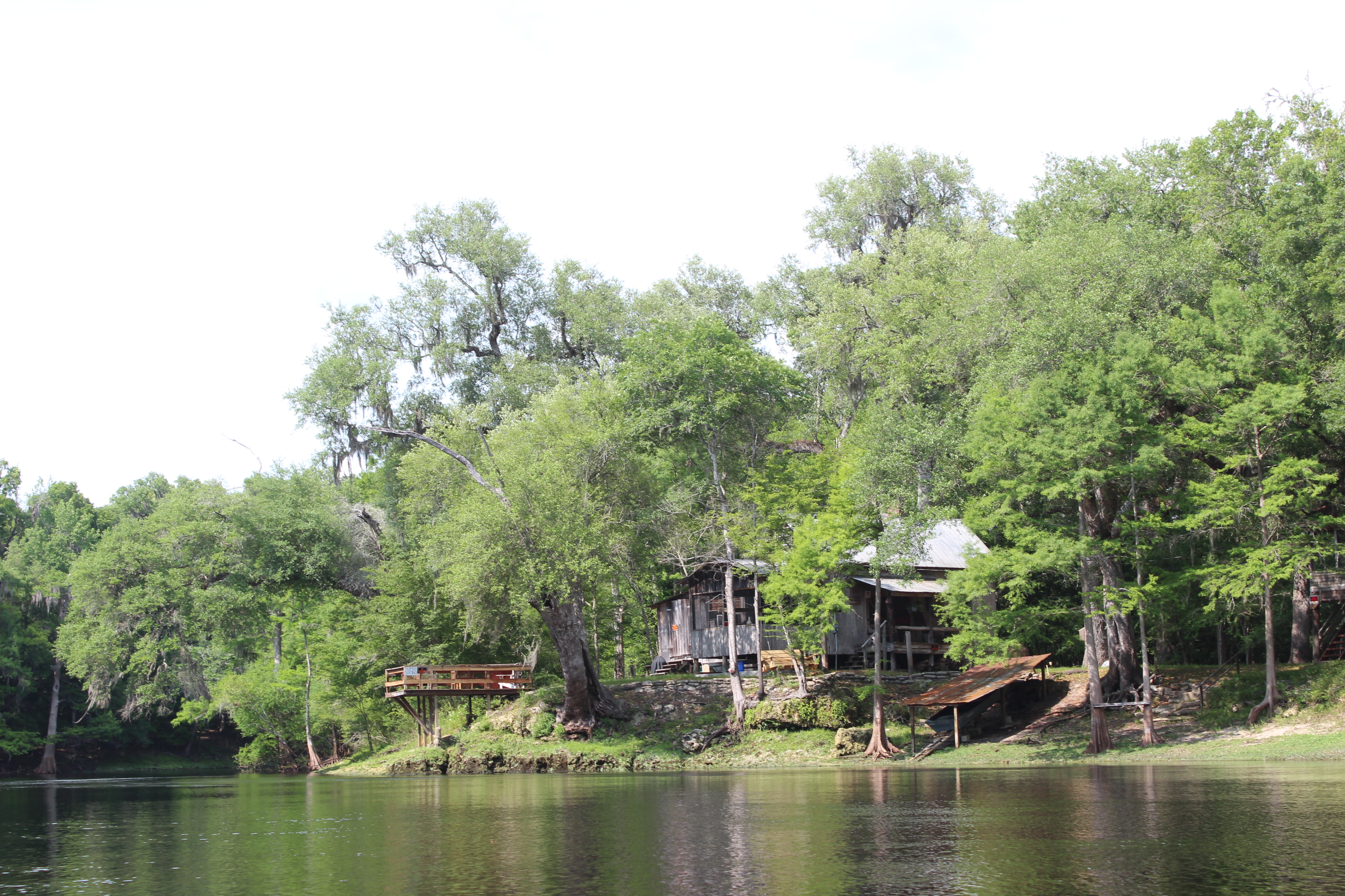
The Pokomoke River Canoe Company

.

The water was high enough to paddle right up on their dock; good place for traveller.

.

1705-d1-IMG_1800

We weren’t in any hurry, so it was great to stop and check out the character of the little canoe store. ‘Barry’ was present and if you have any questions about the river, paddlin, food, women, hang-nails, or just anything in particular; you’ll feel right at home with his warmth of conversation.  We hung around a while then wandered up the street for a cheese-steak.

1705-d1-IMG_1815

On return (and with the higher water) Barry had the state ‘bridge-tender’ come down and let us through….. The stop in Snow Hill was a good break

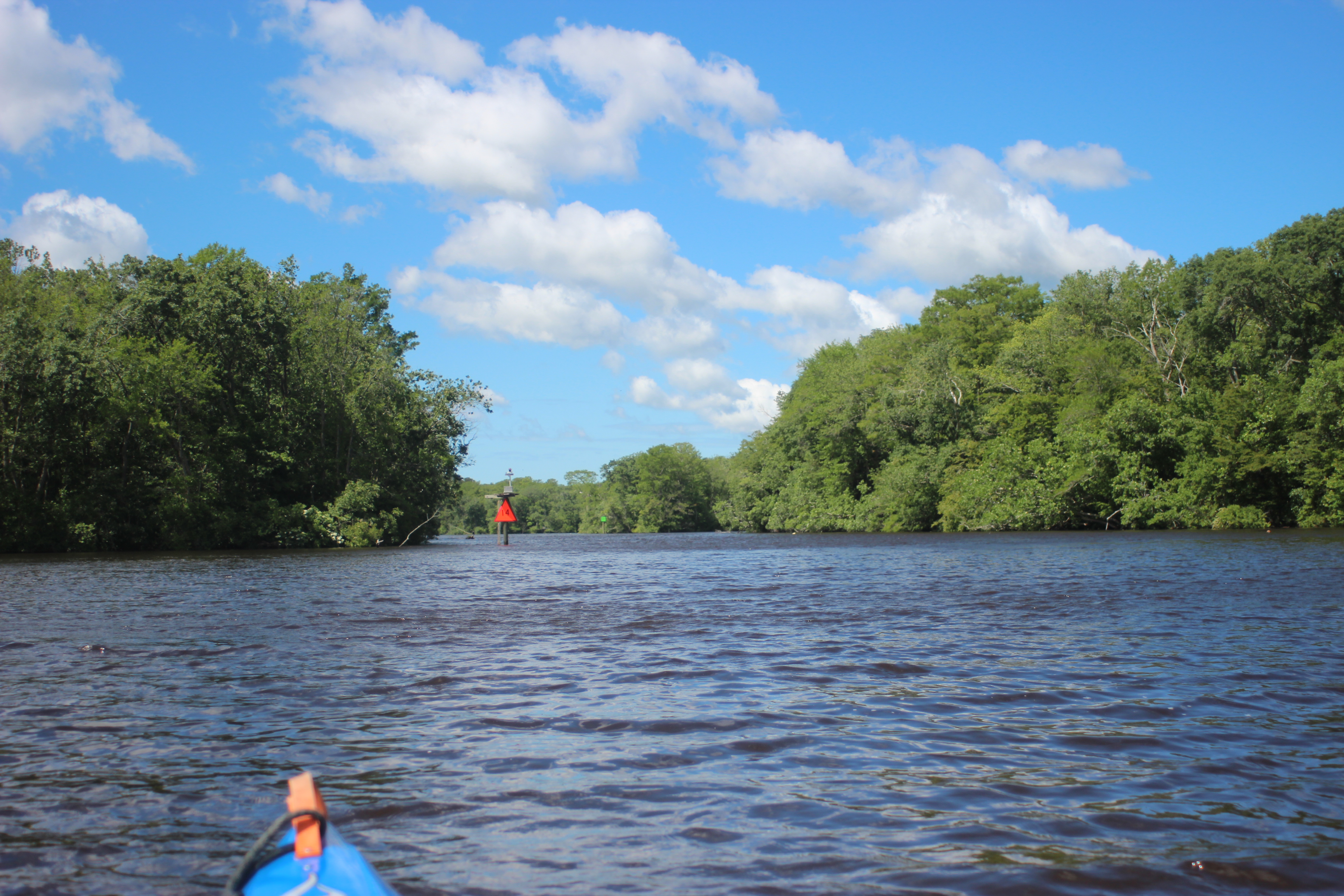
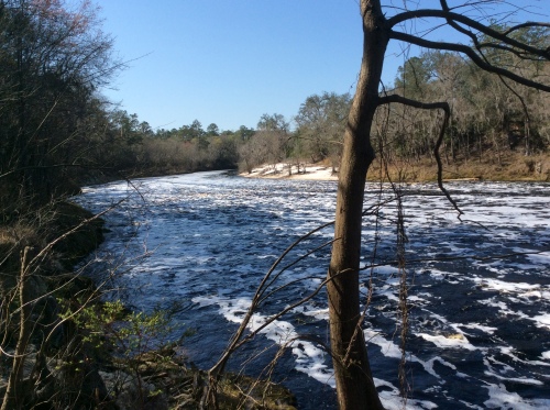
After Snow Hill  the stream widens and the wind can be more of a factor.

1705-d1-IMG_1821

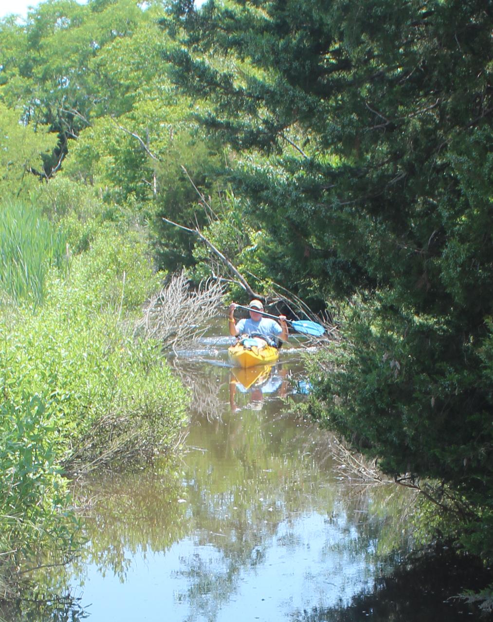
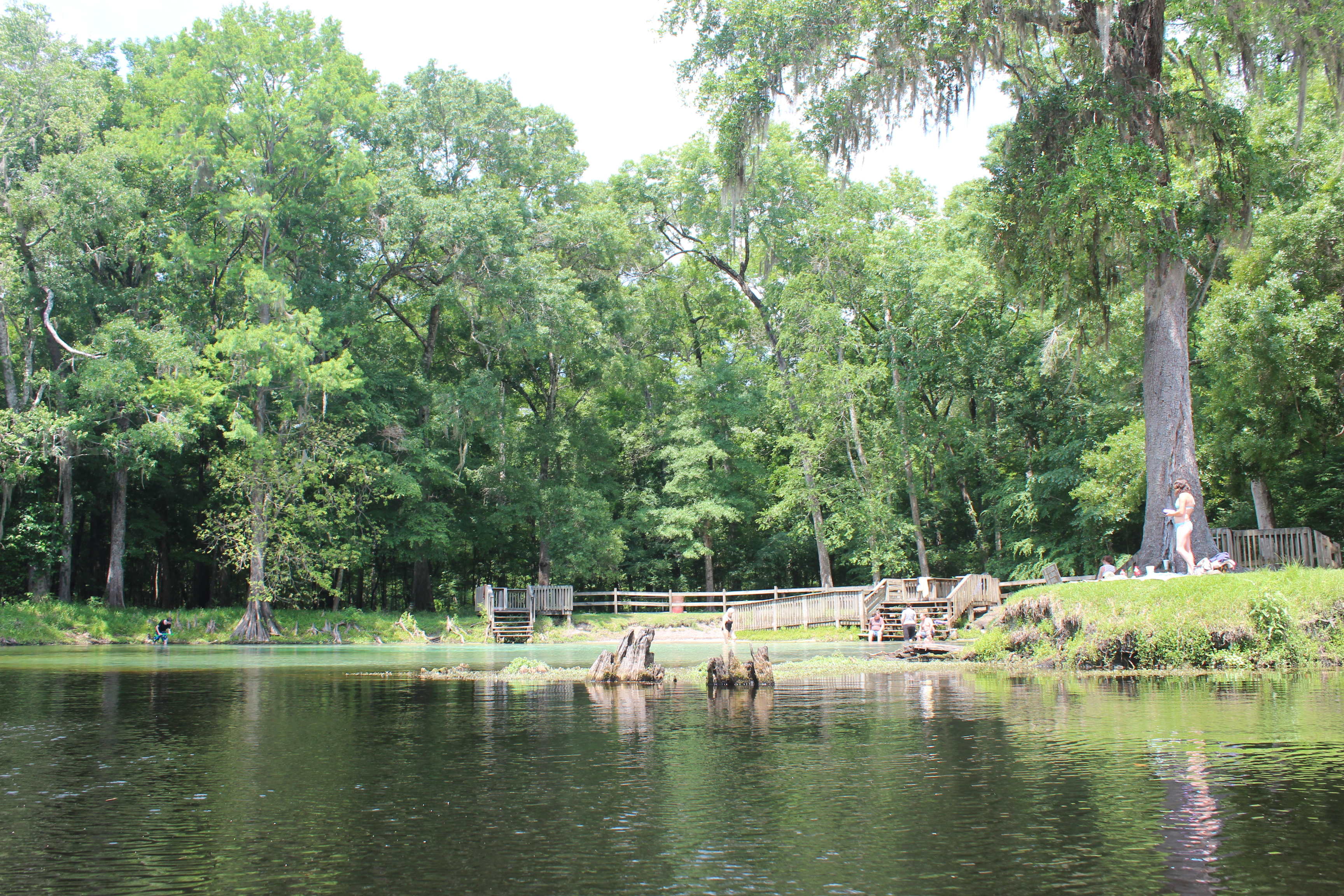
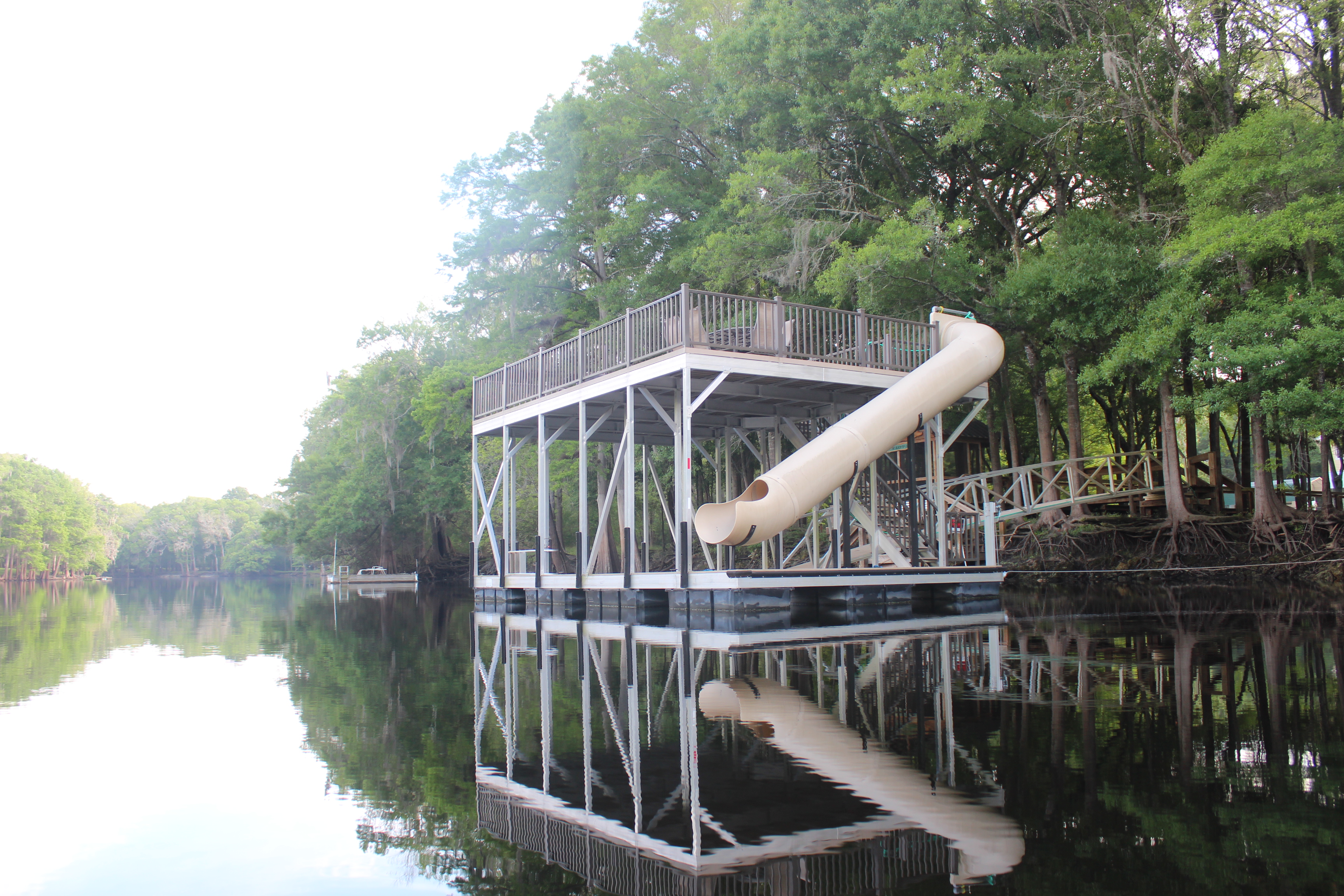
Below Snow Hill and just off the main river marked by a red/green marker is Shad Landing State Park.  In expecting some windy conditions for the day I had noticed in preplanning the river their canoe-trail.  Slough-like it winds near the park and around then back into the river a little further downstream – shelter from the wind and a little ‘peace’ for the mind.

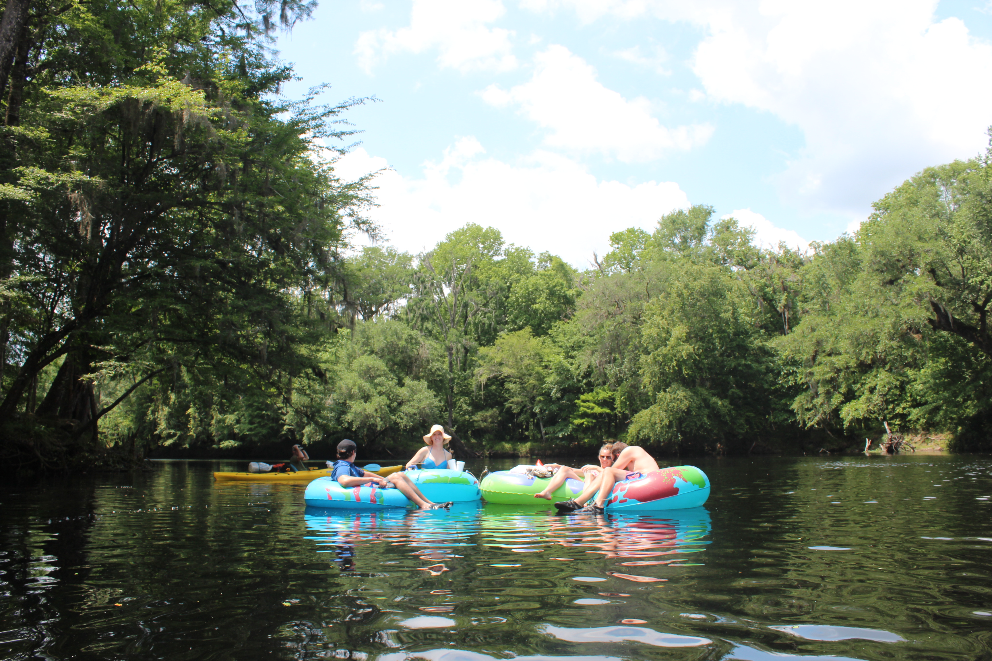
Kids were having a ball learning paddling skills near the swimming area.

Shad Landing Canoe trail;  a nice little interlude while paddling the river.

IMG_1827

When you ‘see’ wood-ducks on a river – that’s a positive indicator for the areas habitat.  Wood-ducks know that you are coming long before you can ever catch a glimpse of them – no matter how quiet you are; we were still able to spot a number of sets along the river; beautiful creatures.

Somewhere I read that there were 173 different species of birds/foul along the Pokomoke – I wasn’t counting, but no doubt the river was a special place.  We had an Eagle that continuously moved ahead of us much like an Osprey would when taking advantage of prey from the movement of a nearing paddler.

The efforts of many make all of this possible; the duck-house above (one of many) was marked with the boy-scout insignia.

“Rivers are ‘muses’ for your thoughts; barnacles on your brain are those things that you comprehend along the way”  tgh
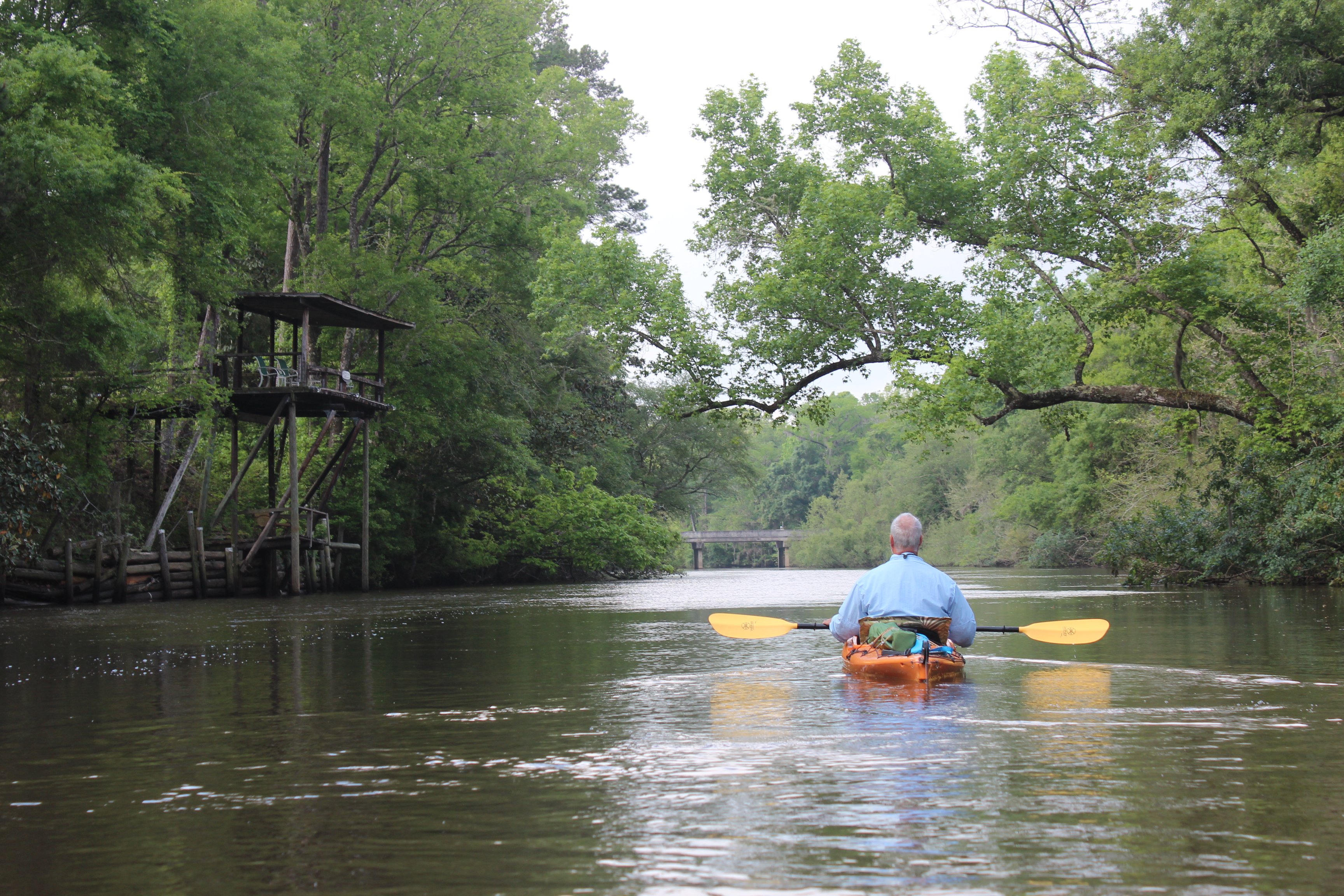
1705-d1-IMG_5627

Barnes Landing

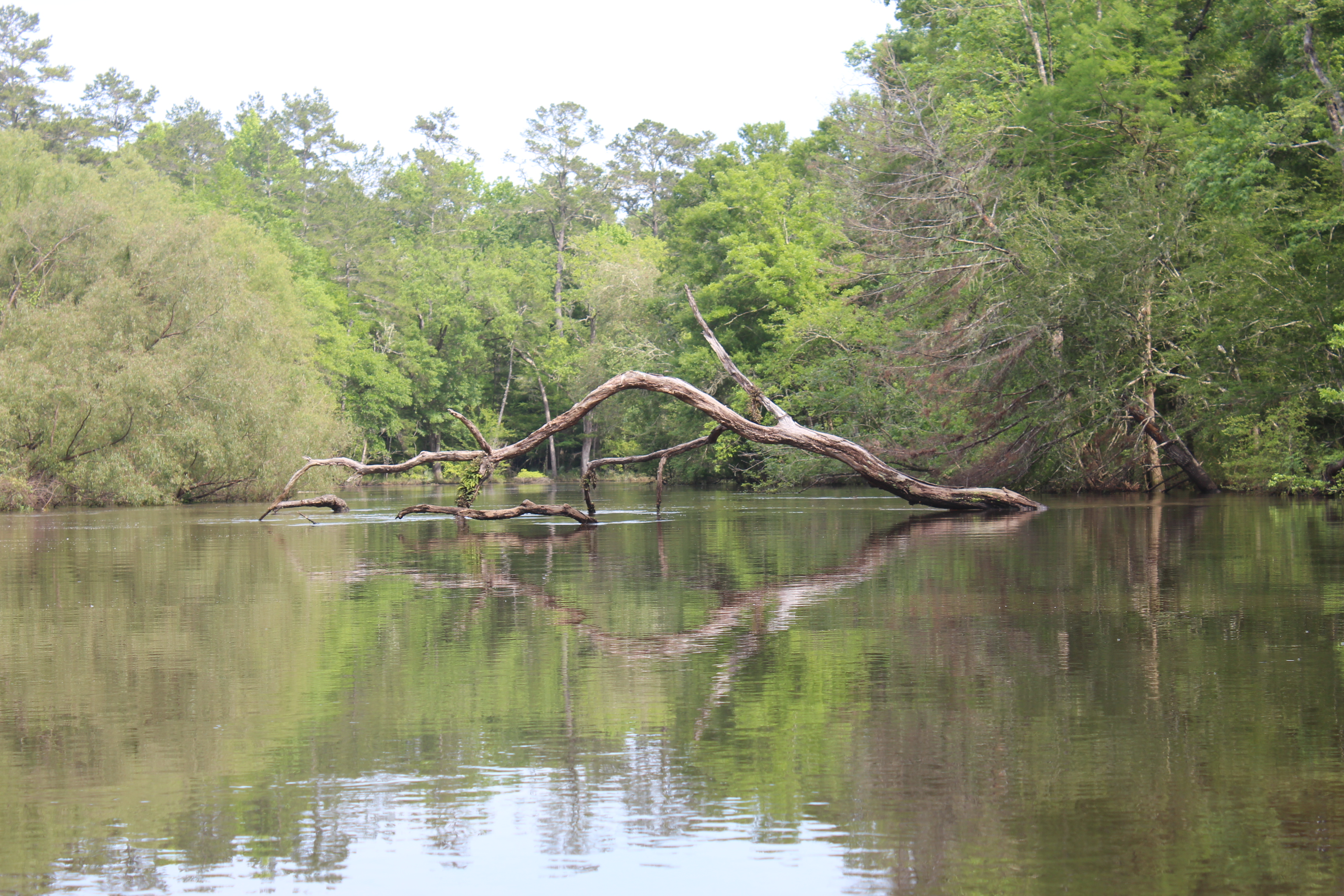
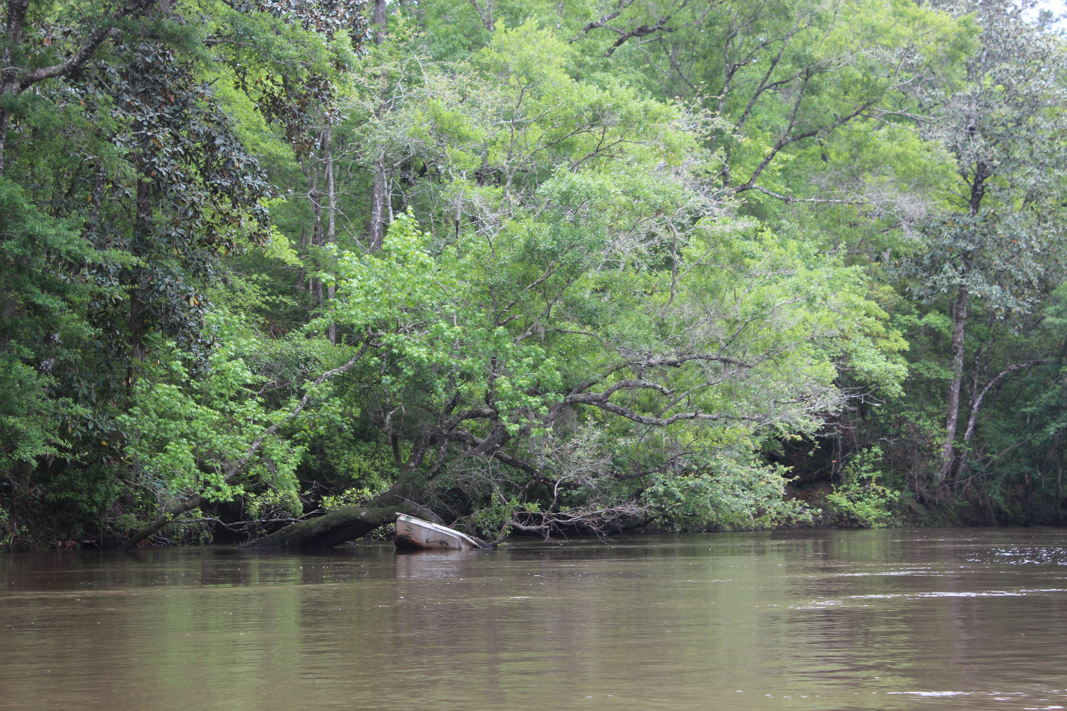
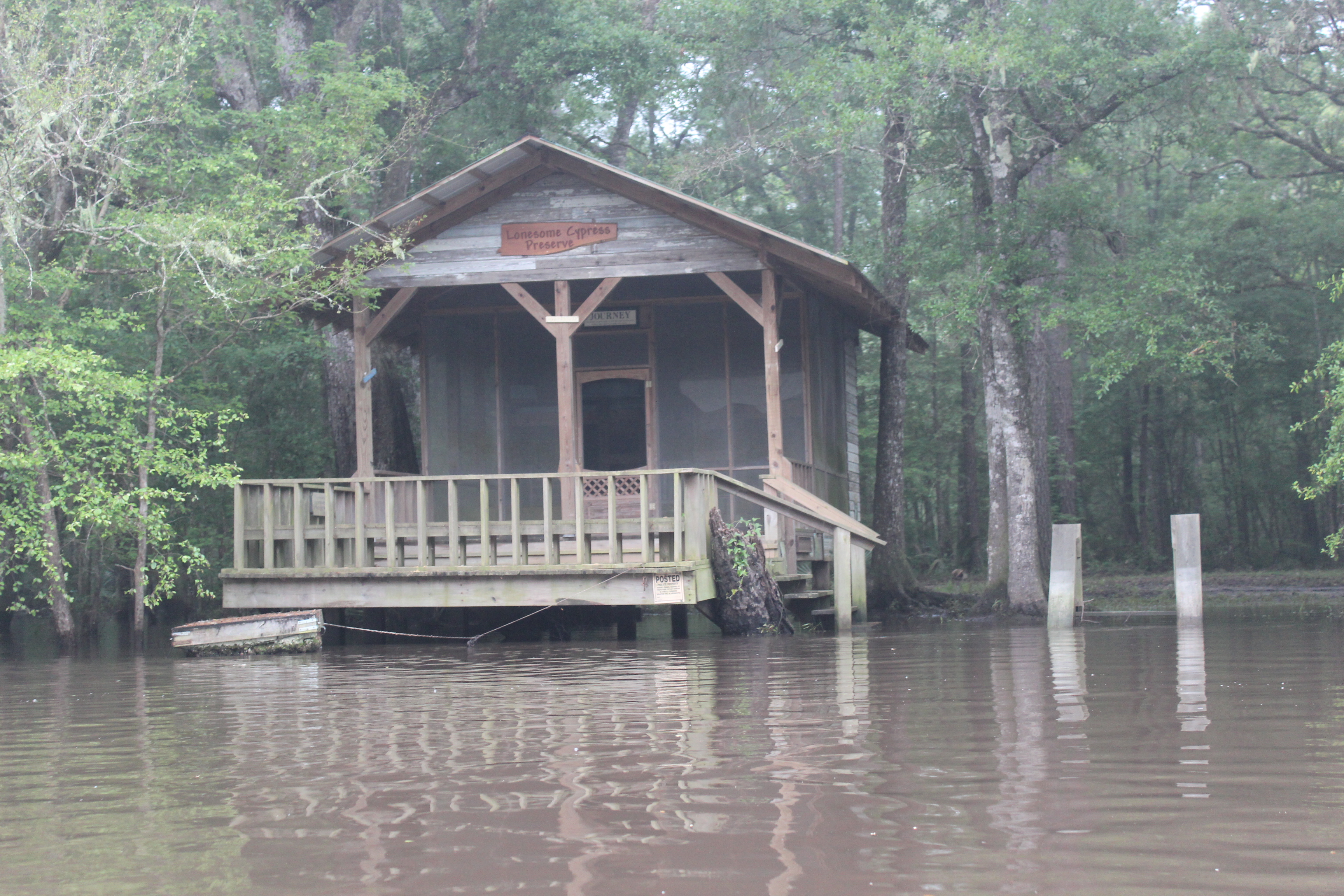
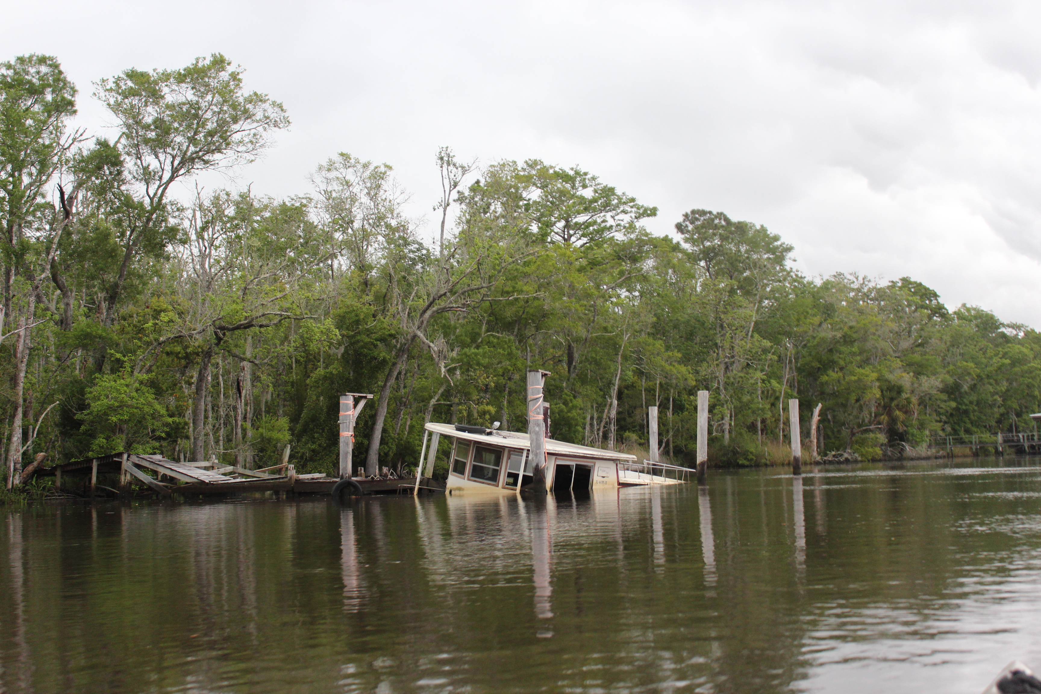
Here and there were structures – remnants, farm and otherwise frequently nurtured thoughts of the rivers history as part of the underground railroad during the Civil War

Cracker Jack

Pokomoke City, Md

1705-d1-IMG_5648

“Friendliest town on the eastern shore”

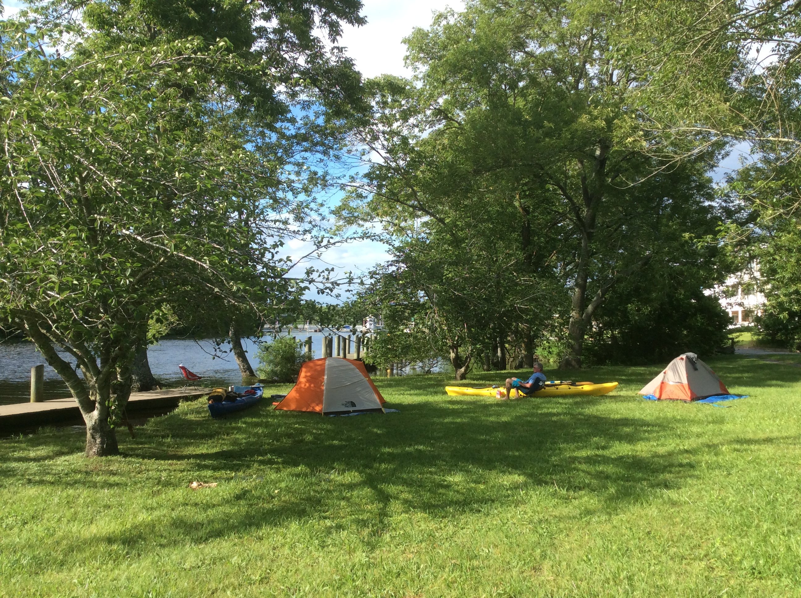
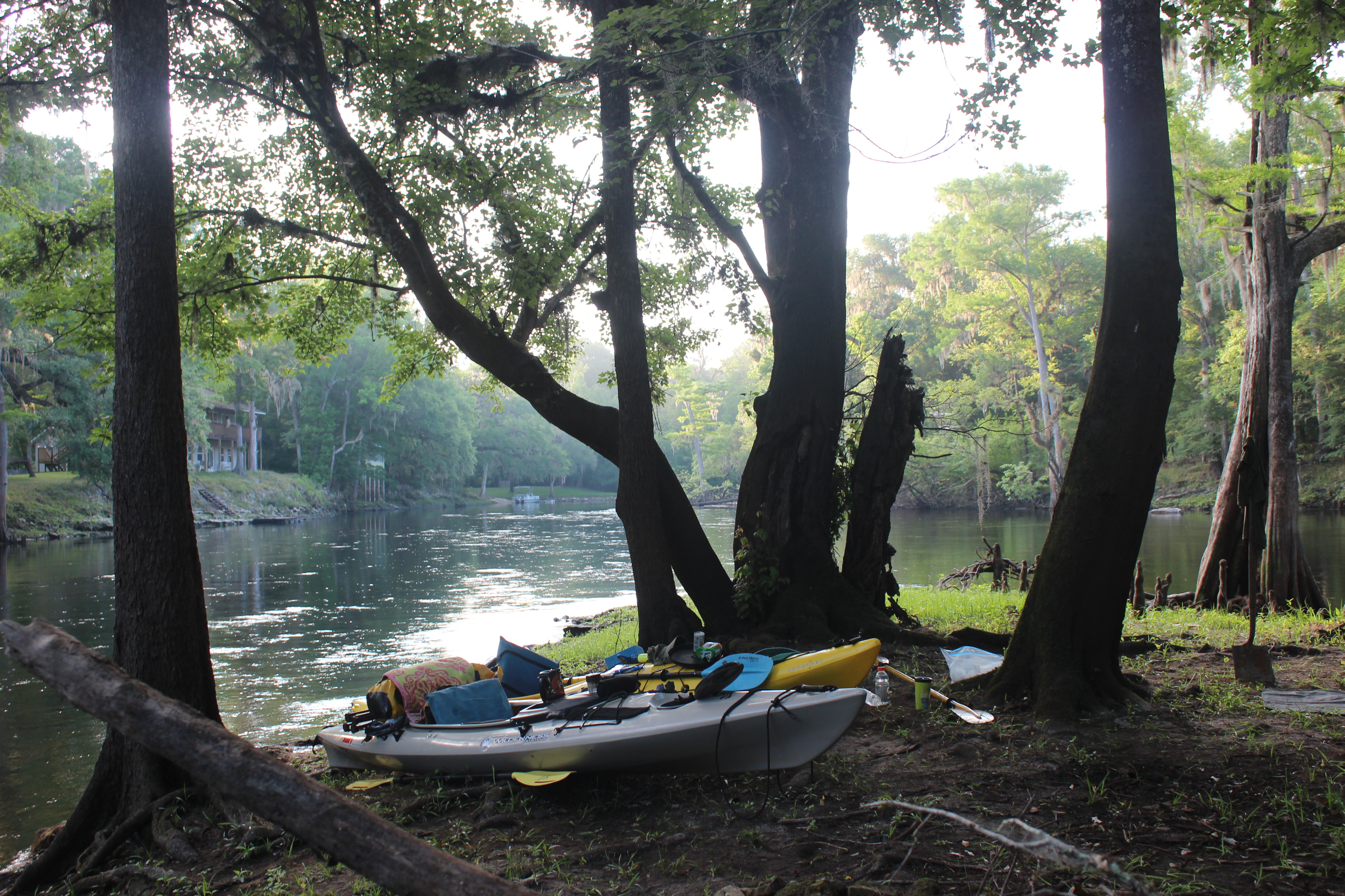
– and they were good to us.  We made Pokomoke City after 7.5 hours of paddlin, about 3:30, just in time for the Tiki Hut of the Riverside Grill to open…. Jenny served us with some friendly conversation and a couple frosty beverages, along with a chicken ceasar salad.  The city has a wonderful dock running the length of their river frontage, after beverage and conversation two weary paddlers found an opening near the city’s boat ramp and pitched our tents for the night.  Soon after, zzzzzzz

1705-d1-IMG_5659

It’s been my experience that a good through-paddler goes down with the sun and rises with the morning light.

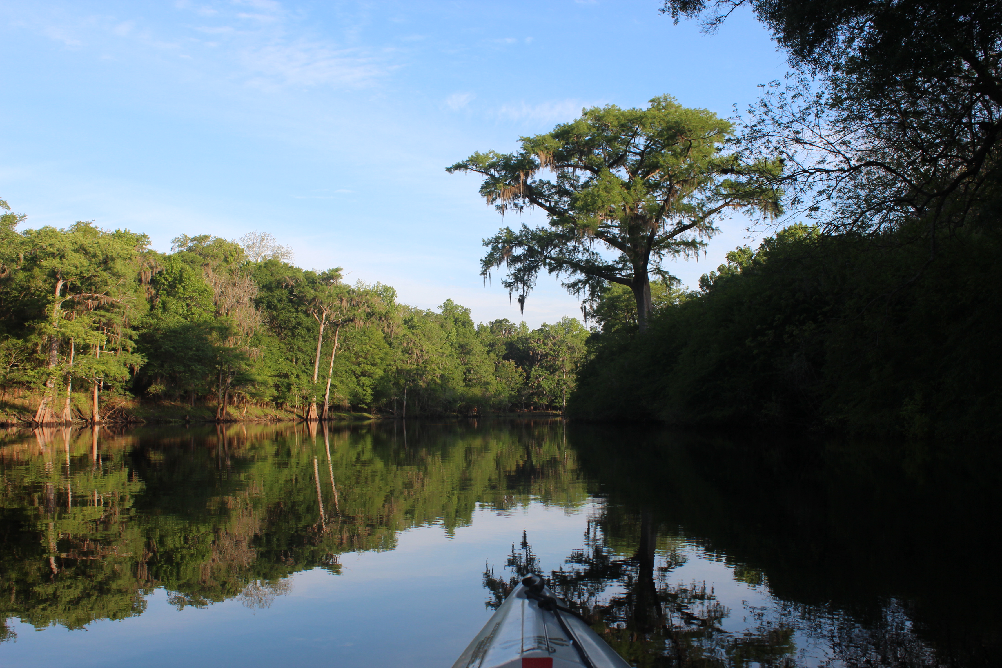
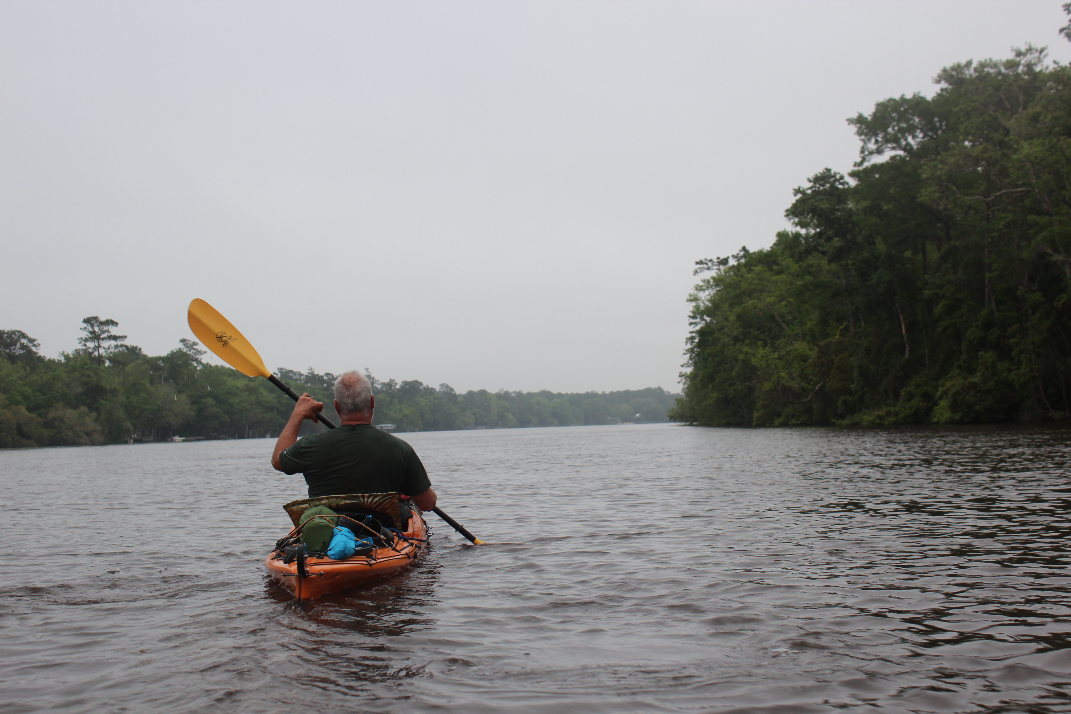
Being told that the tide could be more of a factor after Pokomoke we paid close attention to the mornings water.  High tide, and it was turning around….. you dang right, we were on it!

1705-d2-IMG_5671

– after the Nanticoke we figured we had four hours of favorable tide.  The wind was an unknown, but you can normally expect calm mornings…..

1705-d2-IMG_5685

With the increasing daylight of the summer we were on the water at 630a, in glass-like calm; time to burn…..

1705-d2-IMG_5684

Time to enjoy the paddle, and on more than one occasion – wildlife watching us pass (deer in the bushes)

1705-d2-IMG_5691

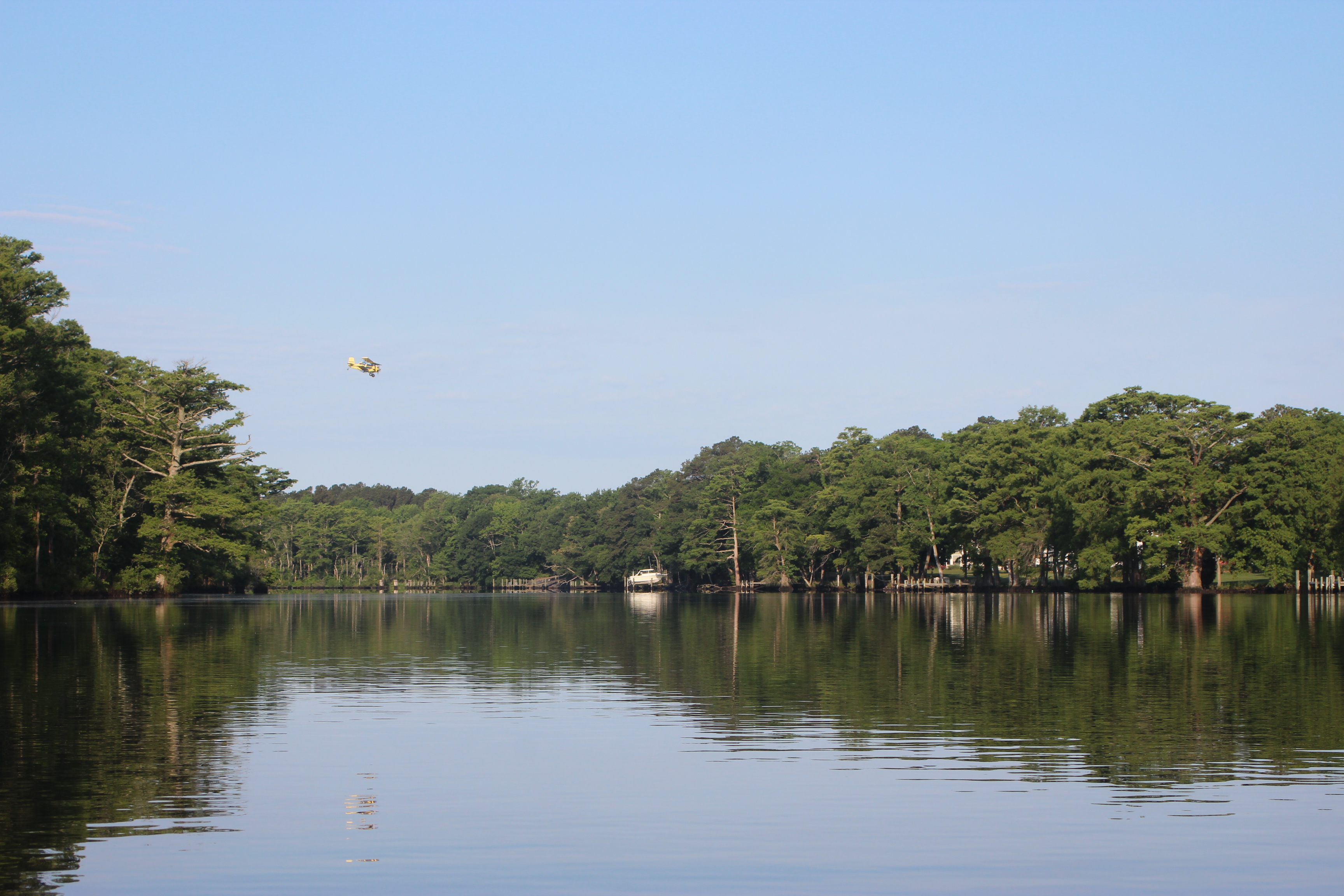
Couldn’t believe the flat-water; after paddling the Nanticoke last fall and being challenged with tide and wind – this was the reward. It was picture perfect paddling.  That’s not a dirty spot on your screen, its a crop duster working the crops beyond the horizon.

1705-d2-IMG_5696

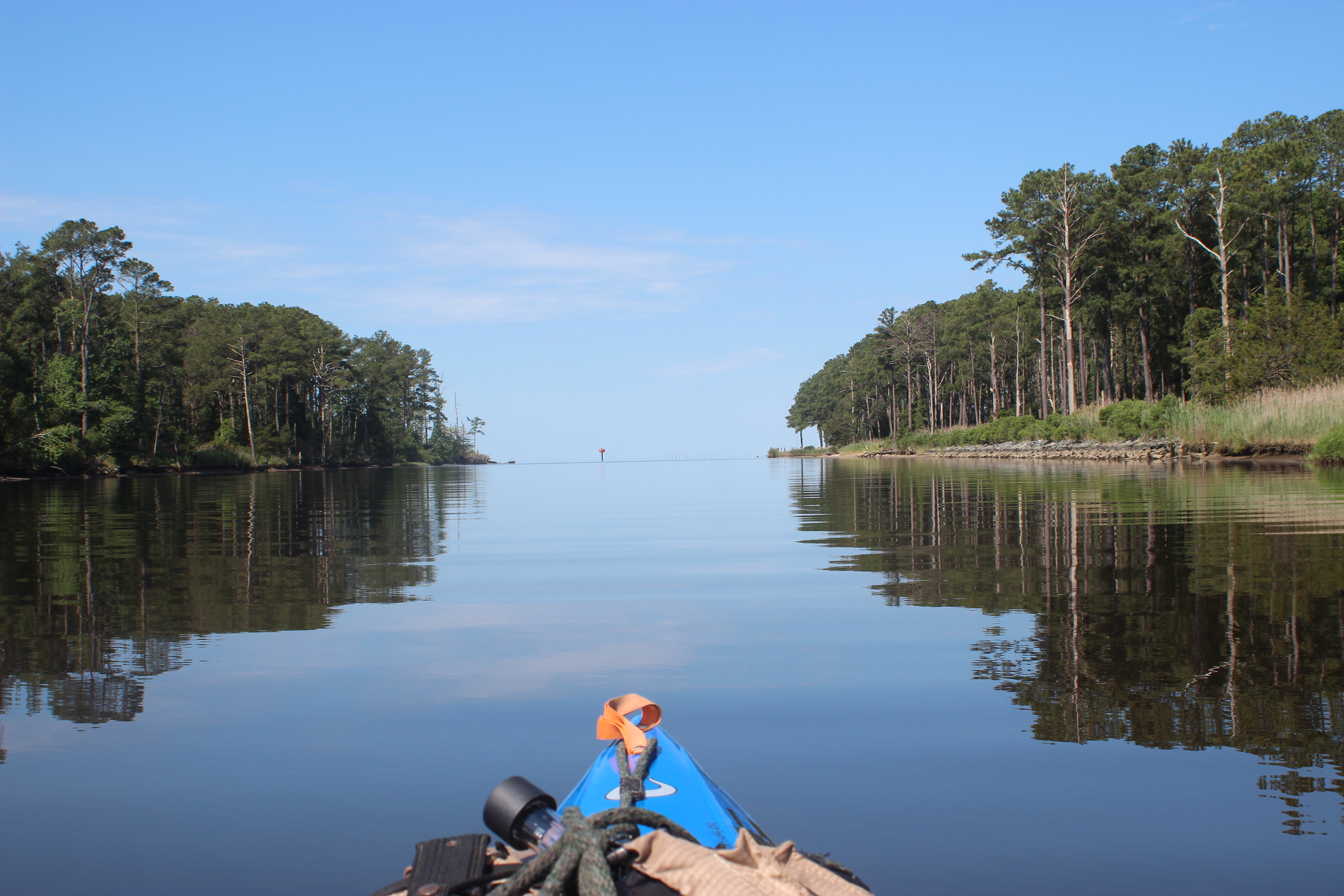
The extreme tranquility continued as we passed through the area of Rehobeth, onward and around the marsh toward Shelltown, Md

1705-d2-IMG_5720

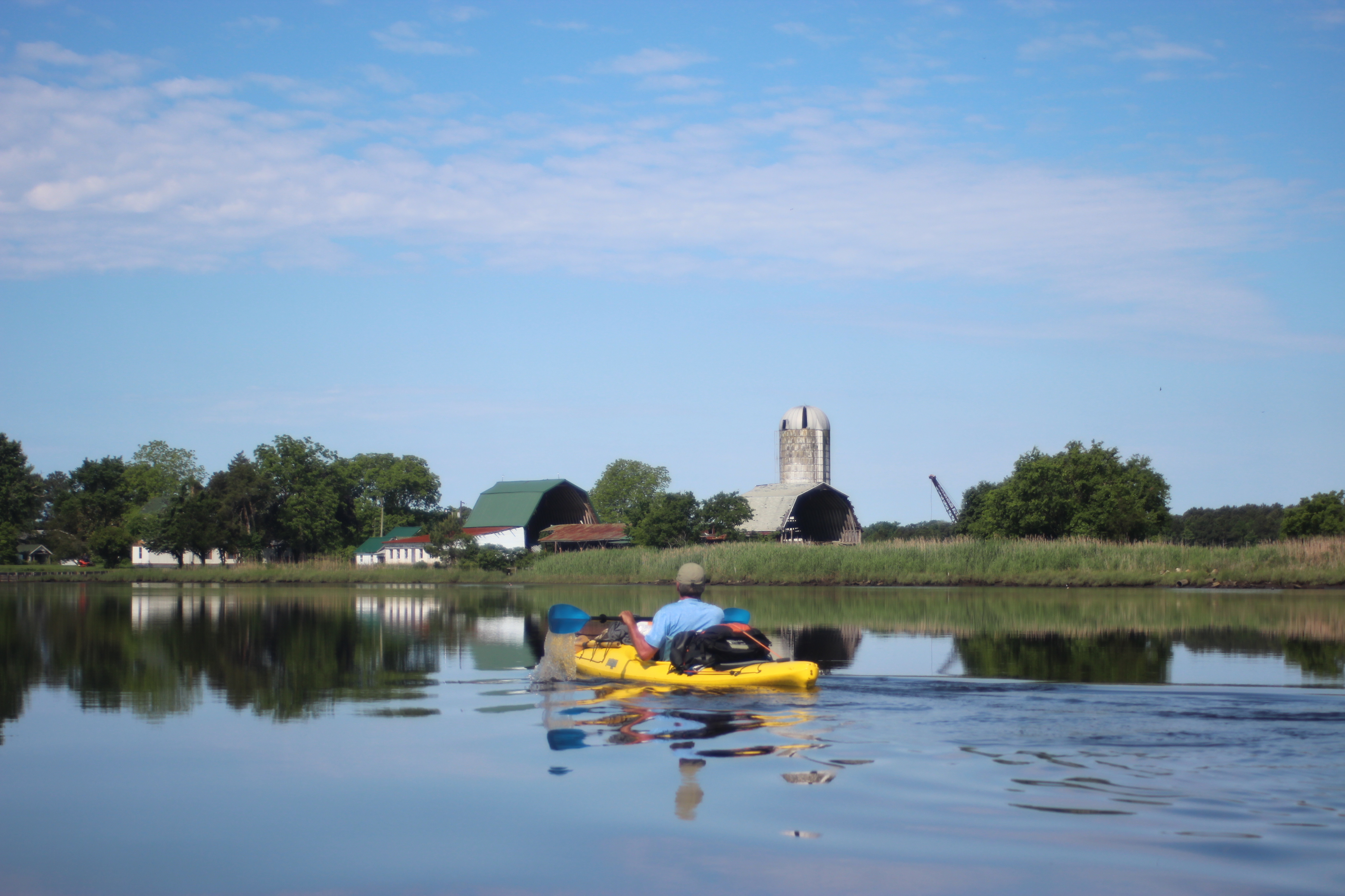
With several grand old fading farms along the water nearing the coastal flats

1705-d2-IMG_5728

four hours later, still riding the tide; life among the mud was good

With Shelltown, Md in sight you know that you are nearing the mouth of Pokomoke sound, stay right.

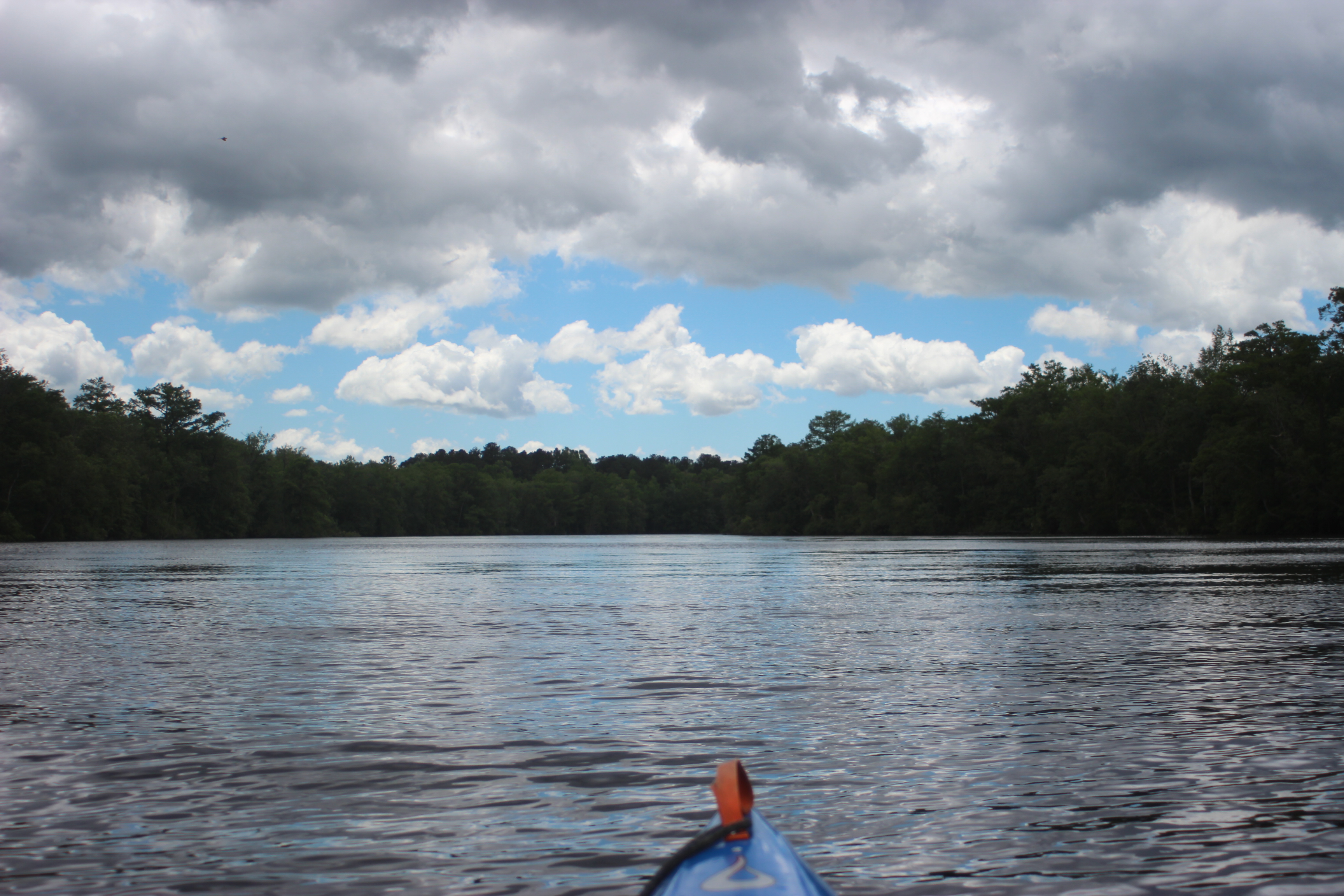
The mornings paddle from Pokomoke had taken 5 hours; Pokomoke Sound and the Chesapeake bay was straight ahead

1705-d2-IMG_5734

The Fair island cut was a welcome sight and marks pretty much the end of the Pocomoke river – my curiosity was satisfied in the best of ways.

.

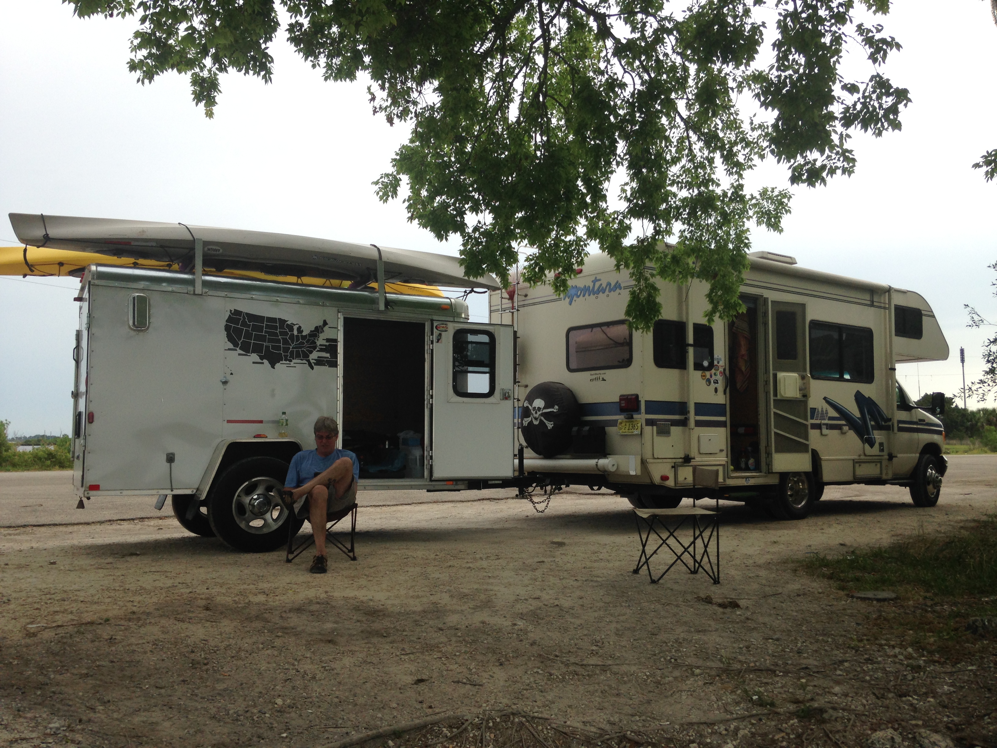
The Pokomoke is not a difficult paddle, 55 miles or so; have a reason.  Wildlife is good +.  We had favorable conditions, weather was everything.  I was packed for three nights out; only used one – a day and a half to paddle.  Land-food is available in Snow Hill and Pokomoke…. airplane-mode for the phone.

.

.

 We arrived at Pokomoke Sound as the tide stood still before us, nice…..

1705-d2-IMG_5742

After stretching on the sandy shore just outside the cut, set our sights 12-miles across the water. On the distant shore is a white windmill, in the direction of that windmill is the structure pictured below.  That marks Rumble Point rd. Rumble Point rd was our secondary escape/pickup point from the bay if needed… (Crisfield plan A)

Is was a long paddle in open water. Set a course, adjust with factors, paddle through it. Mental fortitude is a part of any paddling adventure.

.

1705-d2-IMG_5746

We made Rumbly Point rd with continued calm waters and investigated the pickup point. I’ve never seen so many mosquito’s on one porch, With favorable conditions we decided to move on…..

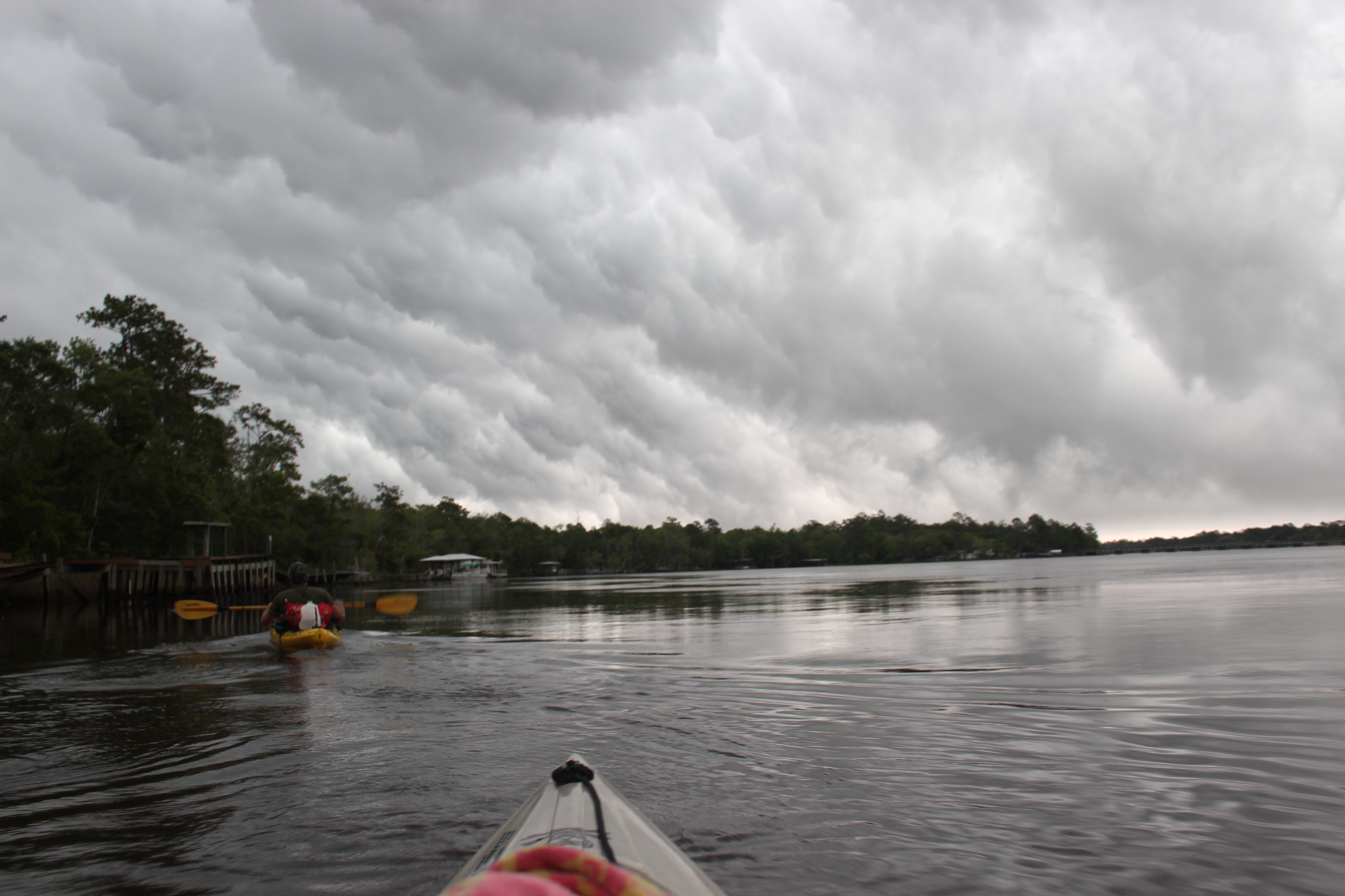
Those favorable conditions didn’t last.

It was well after lunch, the heat was rising, and things on the water were starting to roll, twist, stretch, list, and yawl.  Time on this water felt like too much like work – not the reason I paddle.

.

With wave-action and conditions worsening; we found a calm canal near Horse Creek  and reassessed our objectives.  With the phone GPS we located and paddled a ditch onto Phoenix Church rd.  very near Crisfield – thats where we called for our ride…..

.

1705-d2-IMG_5698

.

We had paddled the Pokomoke river and flirted with the Chesapeake

– it was all good…

.

Topside of The Suwannee; Fargo to Live Oak

7 Comments

Suwannee river trips;

A River of Time, The Suwannee Grin, Last Call, and now –

ONE MORE, ..GIN.

Top side;

Fargo to Live Oak

@77 miles – 4 days

0-1702-IMG_4972

.

February 2017; winter in the foothills of SC hasn’t been much more than a refrigerator door left open; other than that I’ve slowed from paddlin trips.  Maybe its a ‘cycle’ of sorts but from the moving streams and lakes that I’ve meandered – it’s more like I’ve “stopped to feel the bottom of ‘wherest I stand.”  What kind of rhythm is this ‘life-at-60‘ in?

1703-IMG_1570

At the same time, paddlin friend Gordy was hunting a way to ‘unplug’ and had planned a Suwannee trip of his own, – I pondered whether to paddle along.

1702-IMG_1207

Having just returned home after already a pretty good couple of weeks at Fisheating Creek in South Florida; rv style, ‘feet-up,’ ridin old folks bikes, and visiting with old friends. I was pretty satisfied.

On the return trip I did make a stop at Fargo, Ga, where the Suwannee river crosses under hwy-441. With no plans of paddling I just wanted to stand in the water and take a moment to reminisce.  The creek was swollen with the early spring rains and it beckoned.  I stood in the cool tannic waters in my chaco’s; and said “hello;” it felt good. These thoughts followed me home.

The river at the time was over the 55 foot reading for White Springs (a common gauge for paddlin the Suwannee); the water in Fargo was moving along really well. I’ve paddled the river at 51 feet and at 61 feet (lower and higher) so it wasn’t hard to imagine a few days atop the Suwanee’s current – along with the warmer southern weather – it was inviting.

I pondered what else if anything I had going on.  It was true My Dad’s estate still lingered and I really did need to make a trip to the Sanford area and touch some bases there.  Maybe a trip for that reason could include a 4-day, @77 mile paddle.  Yes! cool – thanks Dad..

0-1702-IMG_1375

I took off and met Gordy at Cone Bridge landing, just off 441 not too far south of Fargo. It was a new and improved landing from the past.  Having a couple days to kill we made the most of the time drinking waggitt-adder‘s and sorting through our ‘paddle gear.’

The river for our paddle would be running at/about 53-feet – using the White Springs reading.

.

Options for the night before a Suwanee river paddle include the Suwannee river state park or a hotel at the next exit south on I-75.  After a couple nights at Cone bridge we stopped by the Music Park (where Suwannee Canoe Outpost folks are located) – BINGO!  they were happy to shuttle us to Fargo right then, a day earlier than planned.

and there we were; back on the river again……..

There was a soft current to the Suwannee; smooooth on the topside.  I was sitting in something as comfortable as your favorite lawn chair; paddling with the least amount of effort or turbulence, peering out of these two little portholes…

In its own way yes, better’n home.

0-1702-IMG_5034

 I noticed trees doing the river dance,

The topside of the Suwannee is where generations of tree’s have danced (and/or “twerked”) their own two-step for thousands of years.  It’s a gnarly place.  It’s a moments paddle through where one might sense the roots of these trees finding kindred ground within the stoic nature of time ….


.

A day early and after an ez three hour paddle we found a primitive campsite; it was three oclock in the afternoon, early, but why not?  This trip is not about mileage, it’s a 4 day pleasure paddle….

0-1702-IMG_1408

Don’t get me wrong, I do/can cover mileage, but this trip is different….

0-1702-IMG_5012

We had passed and spoken with this fisherman earlier in the day, as the evening neared he came buzzing through the stillness; headed home… river life to home life.

peace

After a long paddle day (mileage) a good paddler goes down with the sun and rises with the morning light. Of course when you’re off the river early; sitting around a campfire can last as long as you like.

I’ve learned that with flatwater paddlin; to grasp the most of a river’s ambiance; start early (on the water by 8am) – the only noise is what you make.  To savor being there; stop early (campsite picked by 3pm) – set up camp; and be part of the rivers nature for a little while (and have a great evening).

OBTW; my interest leans toward ‘places and things;’ and not so much toward people.

“Tom, party of one”…. 🙂

In the mornings a good cup of river-jolt (coffee) hits the spot,

1-1702-IMG_5067

One of our factors in choosing a campsite was firewood; it was a good thing – because this night was a cool 42 degrees (and the fire had to be ‘stoked several times through the night).

A mechanical type of waking, hot water for coffee, MRE, stowing the gear.  There was a ‘nip in the morning air as we put-in; mornings are absolutely the best part of the day.  Its a muffled quiet in the haze, misty spider webs hang throughout the trees, it’s all there for you to absorb.  Once again; for the most part – the only noise out there is the noise that you make.

Night two was just before Cone Bridge landing.

As the Suwannee turns from a creek to more of a river there are simple changes that take place with the shoreline. On the topside of the Suwannee those changes remain predominately natural

like the Suwannee riverdances

1-1702-IMG_5073

In the miles before limestone rift of Big Shoals the movement of the Suwannee is slowed, more soft paddling.

The slow water of the elongated pools create more stable habitat for wildlife.  Paddling through the still tannic waters of the mornings; both physical and mental reflections move about freely.  Simple complexity.

2-1702-IMG_1434

Big Shoals was the target for Tuesday in our original paddle plan, but leaving Sunday we were a day early. Making it early to the portage of Big Shoals left us with the possibility of hanging out for the afternoon – which it would put us back on our original schedule. A great camping place; so we did.

Looking at the water flow at 53-feet over the shoals there appeared to be a paddlable ‘line’ on the far side – but, no takers.. camp was set

2-1702-IMG_1435

ll

Under this paddle rate I appreciate having stowed a real chair, even though its just a folding one – it worked well; ‘feet up.’

Putting in below Big Shoals the following morning was uneventful (it can be a challenge), the few miles before White Springs we were accompanied by the sud’s from the churning waters of Big Shoals.  A byproduct of the vegetation which gives the Suwannee its darkish colors, the suds disappear with time.  It can be a little surreal moving along with/in it at times.

Whats below or along the Suwannee shorelines dictate the direction and movement of the water by altering its perpetual current.  Where its possible to imagine those obstacles with the turbulence of the surface – the suds provide a more visible definition to the maze of resistance beneath.

I felt that a kayaks negative contrail would look pretty neat if filmed or photographed by a drone while moving through this sudsy mass…..

Musses.  At White Springs the suds disappeared; a comfortable mornings paddle while enjoying yesterdays cold coffee (I sure like those Yeti-type cups).

3-1702-1702-IMG_5094

We had each started out with a gallon of water, but with the more frequent stopping – making it to Woods Ferry would be close; we needed to refill.  There is water available for paddlers (spigot or fountain) at the granite steps of the Stephen Foster state park, just past White Springs and that is where we filled our jugs

ll

an hour or so later we could hear the traffic of Interstate 75

It was a simple morning paddle, no outstanding changes from years past.  Soon we passed under the interstate-75 bridge

another hour and we were pulling up at Woods Ferry river camp,

3-1702-IMG_1456

A roof and heck yes, a hot shower!  Woods Ferry is the first of six river camps available free to paddlers and hikers (Woods Ferry, Holton Creek, Dowling Park, Peacock Slough, Adams Tract, Anderson River camp) all part of the State of Florida’s Suwannee river wilderness trail, great job folks – thank-you.

1703-img_4741.jpg

It was all coming together…..

3-1702-IMG_5093

Moving along a peaceful river helps….

4-1702-IMG_5110

and the Suwannee river is a special place.  Here we passed Suwannee Springs, where years ago health was thought to be perpetuated with the Suwannee’s water

.

4-1702-IMG_5114

Maybe there’s some truth to it, just from a different stand point

– anothers view

On the fifth day, we made it back to the Suwannee Canoe Outpost, easily done in 4 – but with the early start, well…  I was on my scheudle

.4-1702-IMG_1470

We went for a burger and a beer up at their cafe – good stuff

4-1702-IMG_1474

after the land food and restocking from his truck Gordy headed back out for more of the river…

.


and I moved on down the highway to complete my business

1703-img_4745.jpg
.

Paddlin The Sante Fe River

6 Comments

Good ’nuff

The Sante Fe River

1504-IMG_4345

Cool place.

Water Clarity – 8+ (Springs – 10)

Natural Quality – 9+

Perception – Weekday

Nearest town to starting point; High Springs, Fl.

Water reading at Hwy 441 was 32 feet

(White Springs/Suwannee reading 55′)

.

I’ve been interested with paddling the Sante Fe for several years now – by chance its just never proceed further than me stopping along it’s banks and staring blankly down into it’s slow moving tannic waters – always something else down the road.

Fall and spring paddles seem to convey the ‘riversphere’ that strikes me most; this spring I set my sights on several rivers in Florida; the Sante Fe was first.  Gordy, a brother-in-law’s brother and paddlin friend dropped out of the Delaware deep freeze to figure-in; we met up at O’leno State Park and began our investigation of the Sante Fe’s ‘sphere.’

O’leno State Park is a pretty good place to start.  The Park is interesting (and cheap), there are some historical exhibits at hand – plus a short trail-walk that takes you around the landscape where the Sante Fe river disappears into the earth.  The river resurfaces 3 miles away at River Rise Preserve State Park.

Later on our paddle down the Sante Fe we noticed several occasions where smaller portions of the water would drop into the porous limestone – before bubbling up further downstream.

IMG_4295

(VGPS – 21410 US-441, High Springs, FL)

Our objective was to paddle down-river from the Canoe Outpost at Hwy 41, maybe up the Ichetucknee, then to the confluence of the Suwannee river.  Then ten more miles on the Suwannee (close a little-circle) to the hwy 340 bridge; two ez nights amidst the river’s orb.

IMG_4301

.

The folks at the Outpost are more than helpful, they of course will fill you in on any details, rent you a canoe – and/or go pick you up at one of the bridges downriver if you like.  ‘Johnny’ agreed to deliver my vehicle to our ‘takeout point,’ cool.

IMG_4311

I haven’t been on the water (other than our lake) over the past winter; different than years past.  My circumstances has been with ‘interest,’ I find interested in a project and commit to it.  This winter I found interest in Barn art, stuff I couldn’t do when I was younger because I couldn’t sit still long enough.  Barn art worked well with my ‘thinkin-cap’ on and before I knew it – another season had passed.

IMG_0333

Long story short; it felt doggone good to finally be sitting atop the soft current of the Sante Fe, ‘thinkin-cap’ fits there too.

IMG_4318

.

The turtles of the Sante Fe must have been fairly use to folks, as they remained in place as we eased by; normally turtles slip into the water at first sight of a moving paddle.  We joked that just maybe they know when the gators are hungry.

1504-IMG_4335

That soft current is much like the Suwanee‘s, slow and steady – with about the same 2.5 to 3 mph movement.  It’s a ‘second-nature’ stroke and an easy seat to be in.  Fishin must be good too, along with the  fishin-boats further downriver; there was also some ‘cane-pole’ fishin goin on at contemplation point.  Peace, and the simplest of times.

IMG_4341

Just past the Hwy 27 bridge stood the old highway or railroad pilings.  As a native of this state, I know that the highway was one of the original thorough fares of Florida, along with 41, 301, and several others. I eased by absorbing the setting much as one would respect the headstone in a cemetery.  Identifying natural or past ‘crossings’ along a river is the recognizing their story – stoic testimonies.

IMG_4351

Living testimonies (gators) to a further past were basking in the early sun (big lizards).

IMG_4358

Homes were infrequent day one, but several leaned against the river’s bank; each interesting with its own caricature – allowing more contemplation’s while paddling by

IMG_4362

like – What is your reason for paddling?

IMG_4365

While easing further along, the river-word I felt was “sanitary,’ even with the darker tannic waters of the main channel, there was something about the Sante Fe just provided that feeling.  When paddling different settings, it’s even possible to feel the difference in the water too (i.e.thinner/thicker) – anyway, the Sante Fe’s ‘sphere’ had a certain “sanitary” feel to it – something like the Current river in the Ozarks – a positive for sure.

The one or two areas of shoals encountered were an easy pass – the bottom was more of soft rivergrass with an occasional smoothed limestone bolder.  I could understand why so many folks could enjoy this river, along the way I only noticed only one area where unnatural debris was obvious.

IMG_4366

There are more than three dozen springs along the Sante Fe; Gilchrist Blue, Ginnie, Hornsby, Lily, Poe, and Rum Island springs – a contributor to that ‘sanitary’ feel to it all.  On my paddles of the Suwannee river I have made a stop each time at the Sante Fe confluence and admired the inviting water coming from the river.

Poe Springs

Poe Springs

All of the springs of the Sante Fe were open for ‘paddlin,’ facilities were available at most for ‘trail-stops.’

IMG_4380

.

Lily Springs

Lily Springs

Not far down from Poe was Lily springs

Clear as mud

Clear as mud

and ‘Naked Ed’s abode. Nope, I didn’t see ole Ed – but his story and place makes the paddle all the more interesting; “riverspere” – just part of it!

IMG_4398

.

IMG_4400

.

Spring at Rum Island

Spring at Rum Island

There was no rum available at Rum Island, but the spring was another beautiful example of the Sante Fe’s water. Beautifully clear water from the spring-head, felt good too – a constant 72 degrees.

Ginnie Springs

Ginnie Springs

In addition, just down the way was Ginnie Springs

IMG_4434

They have a fine place for folks to camp, dive, or just frolick in the waters

IMG_4440

– on the spring-head, or while floating down the river.

IMG_4459

The river’s gnarly characters, much like the Suwannee’s

IMG_4464

.

IMG_4466

Later down river and in the afternoon, mechanized traffic was present.  Personally I don’t have a problem with mechanized traffic – they are doing their thing, Naked Ed’s doing his, and I’m simply doing mine.

IMG_4473

The trees too held waterlines of seasons past, there are some ‘standouts’ along the way; beautifully aged trees, many cypress – proudly supporting little eco-systems of their own.

IMG_4482

Early homesteads

IMG_4487

Spending time with a river means living along the river, finding a campsite for the night; is once again, just a “part of it.” We had guestimated our stop at the Ichetucknee, but this island about an hour prior invited us in.  It was a good choice.

IMG_4492

 Along the way I’ve learned that a paddler goes down and rises with the sun, it just works that way after a full day of paddlin (with a few exceptions). For the day I had seen turtles, gators, turkeys, kingfishers, osprey,otters, deer, a family of wood ducks, and more. There were fishermen working the evening waters to entertain my supper, and the lullaby of the owls once again to send me through the night.

The ground was soft and level.  zzzzzz.

IMG_4497

The best thing about a good nights sleep, is that it is preparation for the finer moments that a river can share; morning paddles – be on the water at 8:15.

IMG_4505

Gordy and I were once again paddling a familiar setting

IMG_4520

coffee, and the morning’s peace eased the transition into another day.

IMG_4530.

IMG_4534

interesting objects

IMG_4558

a cormorant, turtle, and speedboat

IMG_4562

The Ichetucknee

At the Ichetucknee the water is a 10! Crystal clear, we paddled up to the first landing available.  Our plans included the option of paddling the 6 miles up to the Iche’s spring-head, but having seen the awesome beauty of the Sante Fe’s springs already – the paddle really wasn’t necessary.

Our paddle rate had been leisurely and we wanted to keep it that way – so we eased on.

IMG_4570

There were limestone shorelines of eons past

IMG_4571

and mighty trees, some eroding away

IMG_4575

.Simple directions

IMG_4580

After the Hwy 129 bridge it was a few more miles out to the Suwannee.

IMG_4576

It began to cloud up, and out of nowhere Ellie Rays appeared.  At our pace it was easy to see the neon beverage sign on the window of their bar/restaurant.  Could there be some ‘land-food’ in our immediate future??? It was one fine place, on one fine river.

The rain came about the same time as our double-burgers and my beverage went down like the water falling off the roof. There was serious contemplation about sitting right on that stool and calling the outpost – they could deliver our vehicle to Ellie Rays (a good idea for someone paddling the Sante Fe).  The showers subsided, and Sun returned.

Working our way through the burger and another beverage – Gordy and I set-out to complete our trip as planned; a mile or so to the Suwannee, then 10 miles to Rocky Bluff….

IMG_4391

I am impressed with this river and highly recommend the experience.  The Sante Fe is a primitive river and with all those wonderful springs along the way the water clarity is high – to clear.  The river’s Natural quality is beyond that.  This river supports healthy aquatic life which in turn support other system-species seemingly abundant and thriving.

IMG_4402

The Sante Fe provides a setting for family day trips, or longer paddle trips.  If pondering distance paddling – this and/or the Suwannee rivers provide fine settings for getting a feel of such adventure.  The river’s simple length of @ 30 miles with multiple access points and the potential of culminating at one of the RV parks (there are two beyond 129, Ellie Rays recommended) makes this a very desirable paddle experience for any paddler.

.

Sante Fe River Mileage Chart
00.0    Santa Fe Rise
02.4    Darby Spring river left
02.5    US 441 bridge
02.6    Santa Fe Outpost (rentals)
02.7    High Springs Ramp off US 441
02.8    Columbia Springs river right
04.8    Suck Hole river right
05.7    River Rise Ramp off US 27
05.8    US 27 bridge
06.6    Transmission Line
07.2    Allen Spring river left
07.8    Poe Spring
08.6    Lilly Spring
09.6    Rum Island County Park
09.8    Gilchrist Blue Spring river left
10.1    Transmission Line
10.7    Devils Eye and Devils Ear Spring river left, July Spring river right
10.9    Ginnie Spring
11.2    Ginnie Springs ramp
11.4    Sawdust Spring river right
13.0    Transmission Line
13.6    Unnamed springs in river bend
13.7    Siphon Creek East
13.9    Siphon Creek West
14.5    Santa Fe River County ramp off SR 47
15.0    Hollingsworth Bluff Ramp
17.5    Wilson Spring river right
17.7    Wilson Springs ramp
19.6    Ira Bea Oasis ramp
20.7    Jamison Spring river right
20.9    Sunbeam Spring river right
21.6    Oasis Spring right left
23.4    Ichetucknee joins from river right
26.5    Betty Spring river right
26.8    Troop Spring river left
27.9    Lemmons Memorial Park ramp off US 129
28.2    Sandy Point Campground ramp
28.8    Campground Spring
29.0    Ellie Ray’s River Landing Ramp
29.1    Trail Spring
29.5    Unnamed spring in swamp river right
30.0    Unnamed springs In swamp river left
30.2    Wanamake Ramp
30.3    Confluence with Suwannee River

.

1504-Inglis Gulf

Paddling the other two rivers on this trip didn’t work out, but somehow in justifying direction I felt fulfilled by the Sante Fe.  It had rejuvenated me with the riversphere that I needed within – “Good ’nuff.”

The Ochlockonee River

2 Comments

.

The Lower Ochlockonee River

Dam through the Bay – 76 miles

IMG_0466

.

Lower Ochlokonee River Paddle Map

.

Contemplating any ‘paddle’ usually begins with ‘googling’ the river (an aerial perspective) and figuring out shuttle logistics; for paddling the 72 miles of lower Ochlockonee in the Florida ‘panhandle,’ the research was no different.

.

.

Visually the river ‘meanders’ back and forth; draining through the knotted terrain of the Apalachicola National Forest.  This ‘lower’ section of the Ochlockonee zig-zags from Lake Talquin (near Tallahassee, Fl) for about 72 miles through Ochlockonee Bay and into the Gulf of Mexico.

Other blogs mention ‘swift’ water,’ what we found was no swifter than the Suwannee.  The first part of the paddle was a narrow corridor – which left a possibility for ‘swifter-water’ at a lower water level.  We left room for encountering potential strainers too along the way – several blogs about the Ochlockonee included accounts of paddlers ending up in the water.  Note taken but no deterrent – hey, its a ‘wet’ sport and sure the possibility exists, with the other part of my mind pointing a finger at – a ‘congestion’ of paddlers (groups).  These situations cause spillage (spread out folks) – paddling for me is ‘getting away.’

Within research of the Ochlokonee, I was intrigued by it’s distance, current, and the terrain.

.

'pearl'

pearl

.

As for the logistic’s of parking at each end, we contacted Ed and Bernices Fish Camp near the dam (VGPS -15380 County C-120, Hosford, FL) , this is where we left our shuttle vehicle for three days – covered with a launch fee of 5 bucks each (Jean will fix you up).  Initial thoughts were to stay at that campground before depart but with the recent flooding in the area – the grounds were left soggy (and no hookups).  As for the lower-end there are at least two choices, Ochlockonee State Park or the Holiday Campground at Hwy 98 on the bay – wanting to include the bay we used the campground.

While hoping for good sleep prior to our Sunday start on the river, Saturday night campground (‘trailer-park’) neighbors brought the saying; – “you’re happiness is beginning to piss me off!”  to lite – all in fun, and clearly – just a part of it.

IMG_0396.

Once on the river at the dam, the water clarity was unimpressive – the tannic water had more of a reddish clay look to it, plus the waters were foamy from the spillway drop – much like the foam at Suwannee’s at Big Shoals.  Sure the recent flooding played a part with the clarity, but we figured somewhere within the spirit of this river was the character interpretation (from the Hitchiti dialect) of the name.  There were also issues with spelling and proper pronunciation of the Ochlockonee – so much so that we moved on to the simpler things within our grasp


IMG_0400

.

Water Clarity –  5+

Natural Quality – 8+

Skill level – beginner to moderate

Perspective – Sunday through Tuesday

.

IMG_0403

.

– simpler things like the ‘natural quality’ surrounding us.

Just down from Ed and Bernices we passed one of the few homes along the river – there’s not many.  This home had children playing while parents watched – made us think about the alligators – not that alligators were a real concern to us, but maybe the children playing at water’s edge.

And it never hurts to find an official river water-gauge to ‘orient’ your paddle experience with – it won’t alter a set vacation but maybe lead to a ‘plan-B’ is necessary.  Change happens more with low water readings. Our paddle-guage for the Ochlockonee was the Smith Creek reading – just above 13′  (and dropping from 16) – for this paddle, it was high water.  I have learned that high-water is not always a bad thing.

IMG_0407


Gordy and Carl joined up once again for this 76 miler – three full days would do it.  Our planned primitive stops were; Pine Creek landing at 18 miles; Tates Hell Forest at 48 miles; with a last night ‘open.’

IMG_0411

.

In the first few hours we did pass a couple fishermen, but beyond that there were few landmarks leading me to think ‘unremarkable,’ this would change. But being a paddle trail more ‘marks’ seem appropriate, not that markers really matter – but with a mundane shoreline ‘benchmarks’ are helpful in passing time – I have found this true along the Mississippi, and along the Current river.  There was little to no cell phone reception available.


IMG_0415.

Also present in the first few miles was an eagle, this birds seem to be more and more abundant along our river-ways – certainly not out of the ordinary to spot one anymore. Eagles are a good sign of recovery.  The ‘natural quality’ along the Ochlockonee included the common kingfisher, egrets, herons, and Osprey sightings – plus my buddies the owls.


ONF sign

ONF sign

Leaning to different and interesting were the sandpiper’s and an ever present Swallow-Tailed Kite along the miles.


IMG_0426.

The ‘high-water’ was nice in that it allowed more room for error, and left room for an occasional ‘short-cut.’  Along the way there were numerous occasions to slip through the trees and catch the meandering channel of the river beyond the switchback ahead.

IMG_0431.

IMG_0432.

IMG_0434.

At the old Langston Ferry crossing (1876) there is a small memorial porch to S.I. Sam Stoutamire (it was his property).  The water allowed us to paddle right up to the structure – interesting because of the church pews present.

IMG_0450

.

IMG_0452

.

At 15 miles; The Huey P Arnold park boat ramp (note water level) was marked private; there were fire-rings, porta-johns and a dumpster – other than that the place didn’t look especially inviting.  It was true that we hadn’t seen the rest of the river yet, in hindsite – the grounds were not affected by the high water and the place could have been a fine place to camp.  The truth is that only 15 miles from the dam, we we’rnt ready to ‘drop anchor’ just yet.

IMG_0455

.

The river was moving along pretty well, my guess was 3.5 mph (as compared to the Suwannee’s 2.5).  As usual there were the occasional strainer; but no apparent obstacles to speak of – Could it be the water level?  I remembered the blogs where folks had turned over, and couldn’t help but once again think that group’ paddlin contributes to this.  The congestion of folks (at different skill levels) creates conditions ripe for someone getting wet.  Its all within ‘Why?’ a person paddles.

During the day there was plenty of time to ponder traveling this river at a lower water level, I wondered whether a more distinct channel was worth the obstruction challenges that could be present then.


IMG_0465

.
IMG_0463

At 18 miles and in the late afternoon, we found more flooded conditions at Pine Creek landing.  We had put-in at the dam near noon and five hours later it was time to seek a camp-site.  Pine Creek was muddy with a gator and once again could have worked, but we decided to move on a little further to seek the next best spot – always a gamble.

.

IMG_0472

.

Lonesome Cypress

A Lonesome Cypress

an hour later…………..

IMG_0475


There was a nice flow to the water and the course was easy to follow – after Pine creek there were no places or shore to camp (kinda like the mouth of the Suwannee) and it was getting late.  From out of nowhere this cabin appeared out of the dusk – we paddled right up to it.

Now its not a usual practice to stop at someones cabin, but out of necessity and circumstance – we checked it out.

Lonesome Cypress Preserve

Lonesome Cypress Preserve

The place couldn’t have been more perfect, and came at the right time.  The deck would work just fine.  So with a lot of respect and a little house keeping (had not been used in a while) we washed the heavy pollen from the floor and settled in for the evening, nice.

WP_20140427_006

.

WP_20140427_014

.

The Lonesome Cypress Preserve; not a clue whom the place belongs to but simply ‘the best’ way to spend an evening, this by far was my second favorite ‘night’ on the water (first at Lake Powell)

IMG_0479

(found a buck in the horse trough)

IMG_0486

.

 I don’t think anyone should count on staying here without permission, but thanks to the circumstances it happened – thank you preserve folks, it really was perfect;

We treated your place with respect and left nothing but footprints.

8 am

8 am

.

Day 2

Never seems to fail, a serious paddler goes down with the sun and is up with the morning light.  First thing, we had breakfast and river-jolt (coffee) in the most comfortable of settings, by 8am we were sitting ‘bac on the river.


IMG_0517

.

Mornings are absolutely the best time to be easing down the water.

IMG_0508

Nice to get back to that ‘lawn-chair’ feeling in the kayak, on the water.  The channel of flowing water took us through some light brush – all easy obstacles, easy ‘lines’ (once upon them) to pick.  We eased passed Jack Langston’s Fish Camp a few miles downriver at 22 miles – would have been forced to camp here if ‘heaven’ wouldn’t have happened the night before.

IMG_0513

 .

IMG_0523

 The Ochlockonee is not a straight paddle – your mind stays busy with the zig-zagging, brush, along with – the peace.

IMG_0528

.

IMG_0536

.

IMG_0535

.

The interesting thing about the Ochlockonee was the changes – it changed from an unremarkable flow at the dam, to an interesting river.  There are pools where the water sits before moving through small playful sections and curves – before channeling through a natural corridor into the Gulf.

.

IMG_0568

Somewhere about the 40 mile mark the unmarked Roberts landing came into view – just above Hitchcock lake, there were few places to stretch along this section so Roberts landing was good for a break – tap water available.

IMG_0556

tree ibis

IMG_0576


After a full day of paddling with few landmarks or inviting stops – Tate’s Hell Campground came into view, 48 mm, once again – at the right time.  The nights lightning-bug show was the most phenomenal that I have seen, and the owl’s entertained.  The rest was well deserved after a long thirty-mile day on the river. .

day 3

IMG_0582

.

Shoving off for day 3

IMG_0585

.

IMG_0589

.

another fine morning paddle

IMG_0598

.

There is a ‘shortcut’ near Woods Lake entrance, we did see it (water flow) but being unsure stayed with the main channel.  Along the distance we did notice ‘surveyor’s’ ribbon placed which could indicate a paddle trail – we saw ribbon that also marked fishing lines.

IMG_0602

.

The river widened and began to have the heavy coastal feel to it.  Here just below Sopchoppy and before hwy 377 (@57 mm), the Georgia Florida and Alabama RR trestle pilings still stand from the 20’s.

IMG_0608

.

Sawgrass – the coast is not far off, I’m sure that the tide has some influence on this area but on this date and paddle the predominant thought was becoming more about – the weather!

IMG_0613

.

IMG_0612

.

‘chicken-little,’ and the sky began to fall!

Now I don’t mind paddling in the rain – but this was a very active weather front bearing down on us.  As the first rains came about 11 am we found an empty boathouse, got under the roof and relaxed – it was a good time to review our options.  From our point it was a 4-hour paddle to the campground; the state park was the only thing between us and the bay (besides the boathouse we were in).  We put our feet up, ate, drank, and contemplated – we would have to decide by one pm if we wanted to commit.  After two hours and a little let-up in the rain we gave it a go – once in the open, the weather enveloped us.

It’s not the kind of situation paddlers like to be in; out in open sawgrass without options.  It was a solid paddlin situation – it counters enjoyment and my reasons for being there.  The paddle action was a constant ‘dig’ along with frequent lightning-bolts, which sure invigorate the effort.

While working the wind and river near the saw-grass I jabbed an unsuspecting 10+’ gator with a stroke – I say that because I had the best view of him as he suddenly rolled under my paddle in the shallow water before lurching under the nose of my kayak towards open water.  The action was fast and intense – and lifted my kayak into the air; ending with a large splash.  Way too quick to be a oh-crap moment.  The ending was good and under the circumstances – I never missed a stroke.

I looked back at Carl whom was just behind – wished I had a picture of that expression, but my camera was put-up because of the rain.  From that moment I don’t think either of us looked back until we all made it to the campground – ‘just a part of it.’


WP_20140430_002


So yes, there are alligators in the Ochlockonee river – and the river is an interesting cross section of Georgia pine into a cypress knot and coastal palmetto/sawgrass setting.  An interesting ride through three days of switch-back channels and straight corridors in moving water, “just follow the flow.”

Time well spent surrounded with an ecology supported within the mix of fresh and brackish waters, a simple time and place rich with those simple things of life – lightning bugs and sleeping with the owls

– experience it.


.

Older Entries