II
THE SUWANNEE RIVER GRIN
Live Oak to Suwannee, Fl – The Gulf
(previous days 1,2 Suwannee Music Park to Dowling River Camp)
Day 3 – Dowling Park to Peacock Slough River Camp (rm 113 to 95)

At the Dowling Park River Camp Chuck and Yoda (his little dog) were fine camp hosts, they were throwing the frisbee along the beach as we arrived then after ‘visiting’ a few moments they disappeared into the woodwork – I like ‘short stories.’
The camp was spotless and welcoming, leading to some evening stories about a camp-host named ‘Jim’ from the Holton Creek River Camp the previous year – ‘Jim’ had been alone in the woods waaaay tooo long and the camp had become ‘his-domain.’ He would sit all arriving hikers and paddlers down and recite the rules to them before handing them a single trash bag for their visit – trash cans were minimized. ‘Funny,’ and a little zany in comparison to the other river camps I have visited. Still within it all the camps are free, so no complaint – just an observation…

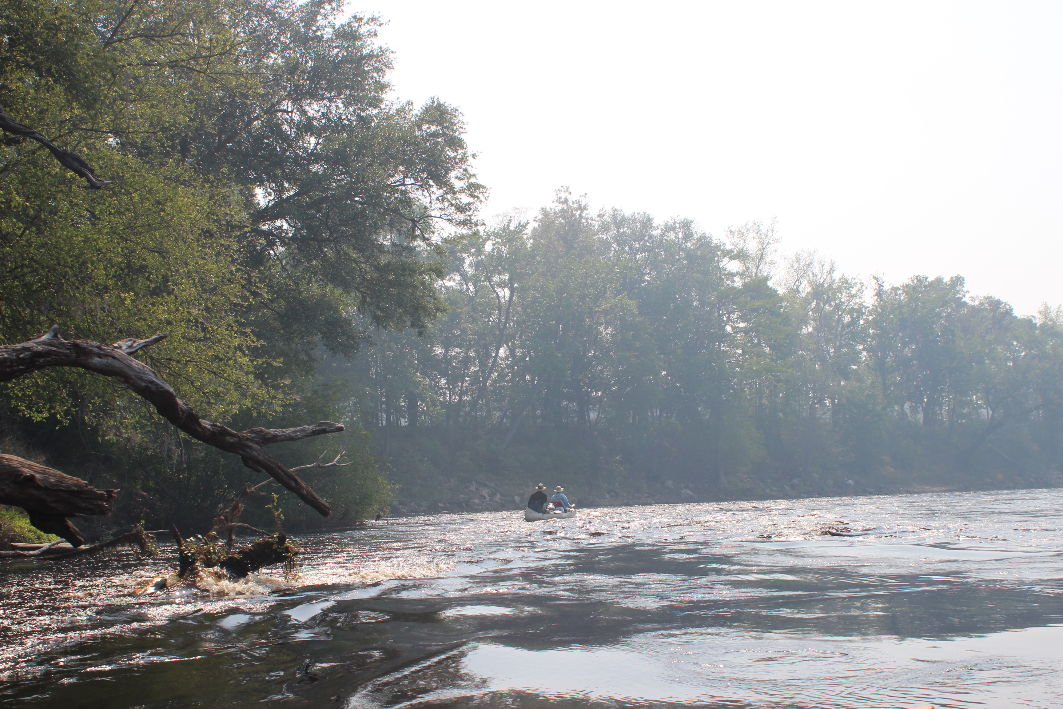
Our third morning reinforced a simple pattern; shower, coffee = a fresh start. The setting is tranquil as we slowly load our vessels. Somewhere in this (and it didn’t matter who went first) we each slipped back into the rivers peaceful movement and eased downstream..

After the previous day Richard sought some ‘upright zen’ for the day – Carl rocked the canoe in jest

– and off they proceeded. At the bridge just downstream from Dowling Park (and up the landing) is a store less than 1/2 mile down the road, FYI – I walked for ice before paddling on to catch up with the canoe.

.

The current remained positive and continued to support an easy paddle, there were areas of abrupt shore line carved over eons.

There were stops to stretch,

.

.

mixed with observation and amusement at the myriad of efforts of individuals to conquer a simple trek to water’s edge – the effort ever complicated with the river’s nature of fluctuation – battling common sense engineers..

After the ‘blue bridge’ at Telford Springs comes Bathtub Springs,

.
the weather continued to be perfect, for anything you wanted.

Schools of mullet were constantly visible in places where the clear spring water meshed with the rivers tea-colored waters, there were a number of springs along the way to paddle or just gander.

And yes there were the Sturgeon, BIG leaping fish – we had several good glimpses of them as they ‘cleared the water’ and fell back with a ‘can-opener’ splash.

As we made Peacock Slough River Camp – I went ahead first for the cart (wagon-like to help with our gear), I was a little surprised when I had to walk all the way back to the ‘hosts’ trailer to get it, but then again – hard to complain. As I reached for the cart the host stepped out of the shadows – it was JIM! – I laughed when I recognized him and told him what a ‘legend’ he was as a camp host, at the same time spitting out that we would all be available so that he could ‘read us our rights!’
On my way back to the landing I noticed that all the trash cans were made unavailable with the exception of one, later Jim sat us down, and read us the camp rules.
From there (and maybe during) we drank and laughed about the subject into the night.
.

.
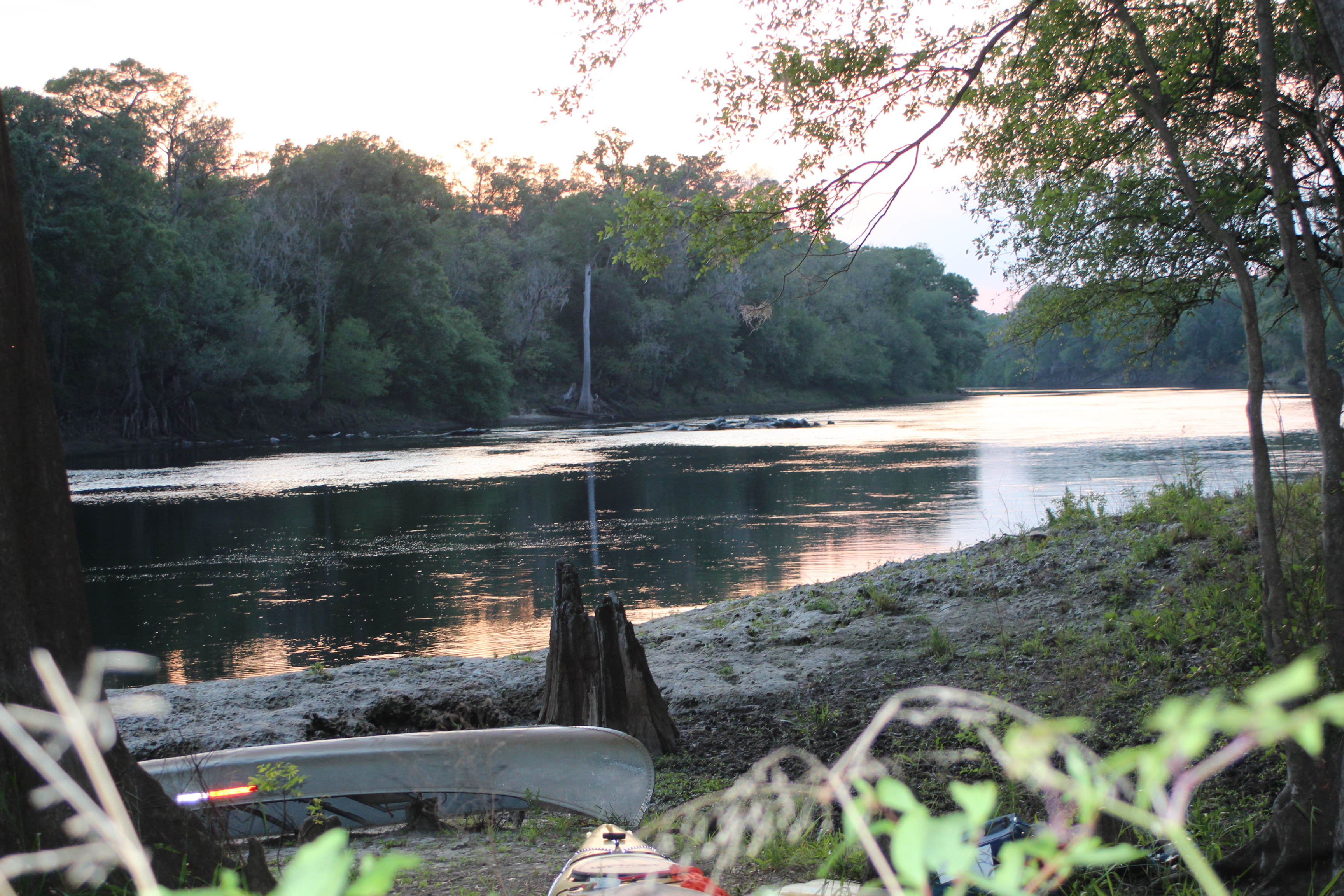
There was also time to notice the sunset on the Suwannee…
.
Day 4 – Peacock Slough to Ivy Park in Branford (rm 95 to 76) 19 mi
.
.

.

It didn’t take long to put our single trash bag in the single trash can and head downstream for the day, we were on the river before 815.
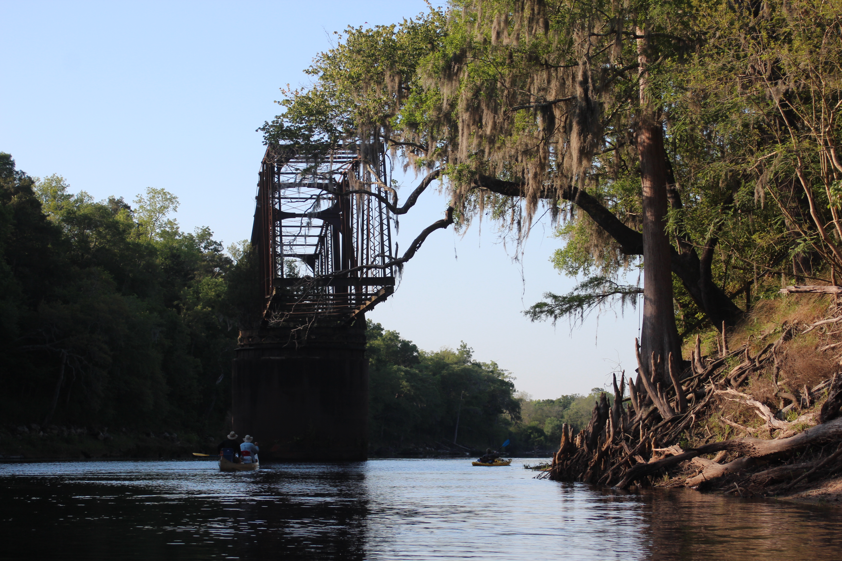
In a short distance the long abandoned Live Oak to Perry Railroad (LO&P) trestle stands watch in the middle of the river, it’s base of steel reflects years of neglect – I give it 30 more years before it too succumbs to the Suwannee and tumbles in (also referred to as the Drew Bridge).

The canoe seemed to be plenty seaworthy; the canoeist’s mental stability remained in question.

.

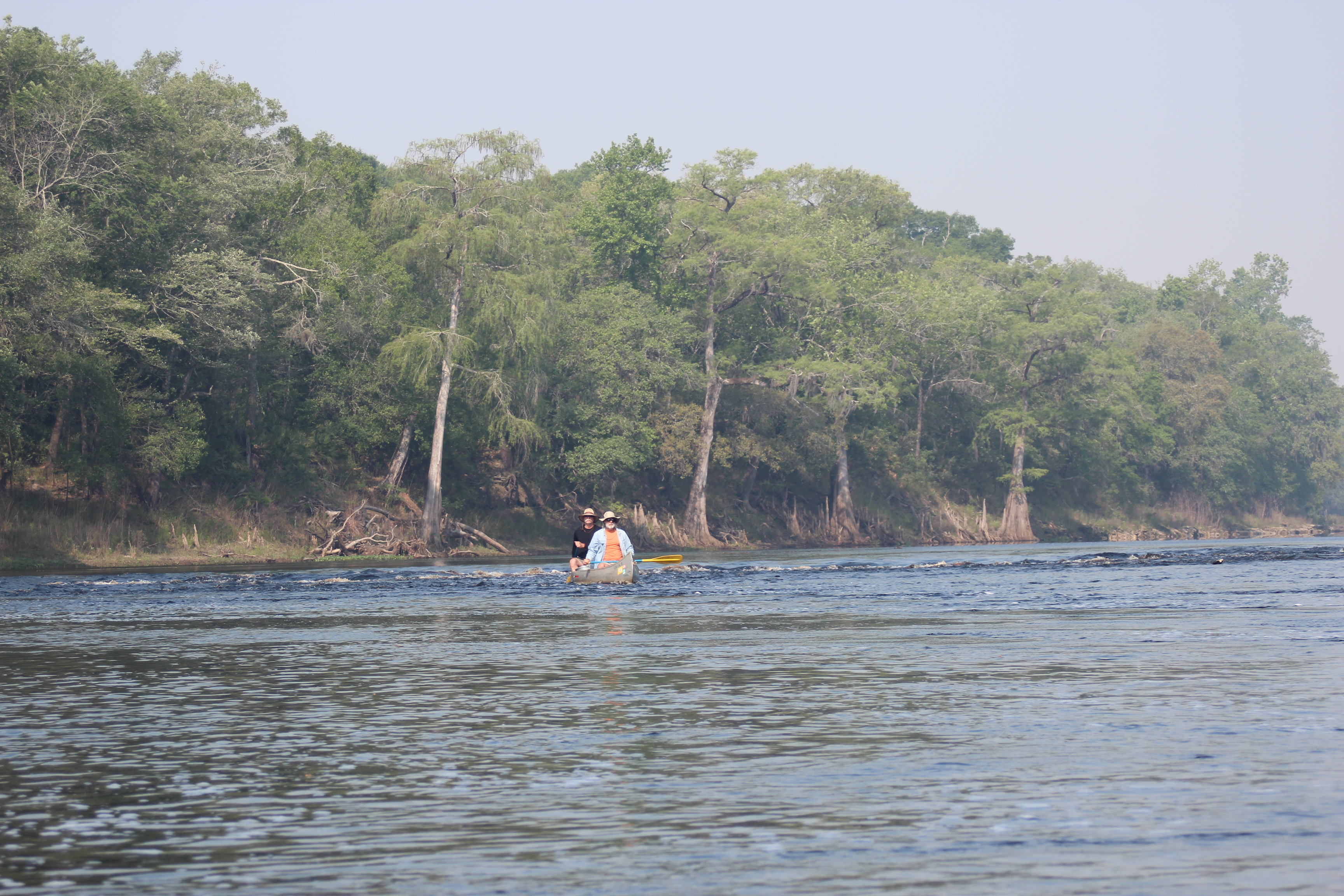
Gordy continually worked the ‘point’ ahead adjusting to the change of pace – there were times that it was difficult to see him in the heavy Florida smoke on this date. In noticing a person working along the shore (and thinking they were a little more ‘tuned’ into the news) we asked what all the smoke was about? – their exact reply was that it was “from a fire burning somewhere!” Now that was a real blast of information!
.
There were four sets of shoals through this section of the Suwannee, playful sections that broke up the constant paddling and helped the time pass a little faster. It made me wonder if the lower river level had increased the current’s rate of flow (current), I felt likely, in places.

And their were the ever present signs of the Suwannee’s constant ‘flushes.’

Always interesting along the shore, trees in unusual places

– and some diligent ‘little buddies’

.

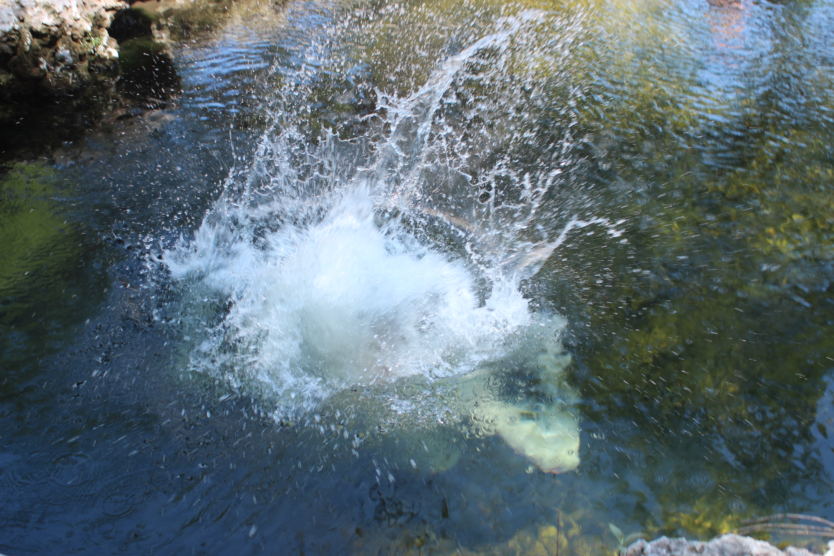
and some gator-bait at Little River Springs,
.

This is where I really noticed the lower water, last year as I came through their were cave divers around, on this date there were SCuBA tanks laying around – but I suspect this guy name ‘Bruce’ (below) had them scared off.

.

Back on the river, a little cooler and cleaner from the dip.

Branford and Ivy Park to camp.

.

Land Food, ballast buffet at Nell’s.
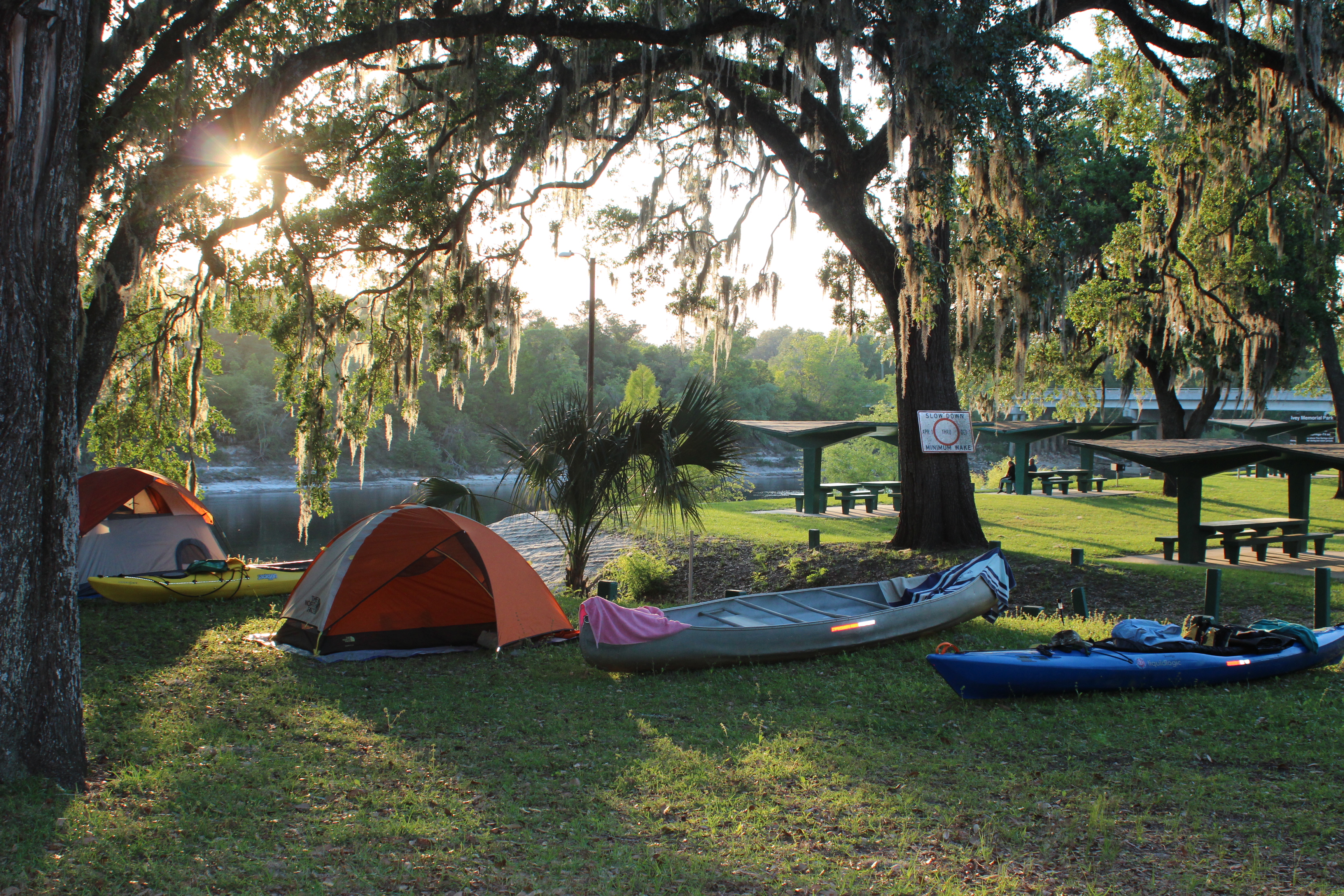
Not a bad spot to camp, the land food and convenience stores were a welcomed addition to our paddle. We could sit, stand, stretch, chat, and laugh all while observing the natives. No showers here (but there was a water-spigot), a ‘bird-bath’ had to do.
In the night the owls returned to make us feel ‘at-home’ along their river.
.
Next Day – Day 5 – Ivy Park to Gornto Springs Park (rm 76 to 55) 19 mi
.
Suwannee River Mile References
note: even though mentioned and shown on available maps – there are NO physical ‘river-mile’ indicators along the river. For further Suwannee River mileage information, check this link – Suwannee River Mileage, Trip Agenda ideas.
Opinion; Marking existing landmarks such as bridges, ramps, and river camps with a numerical reference would provide basic orientation points (and emergency references) along the river (the Mississippi has them).
.
.


Leave a comment