Home

Kayaking the Suwannee River, Fargo to the Gulf (day 8)

3 Comments

– post 6 of 8 –

A RIVER OF TIME

Georgia to the Gulf, 225 river miles, 10 paddle days

.

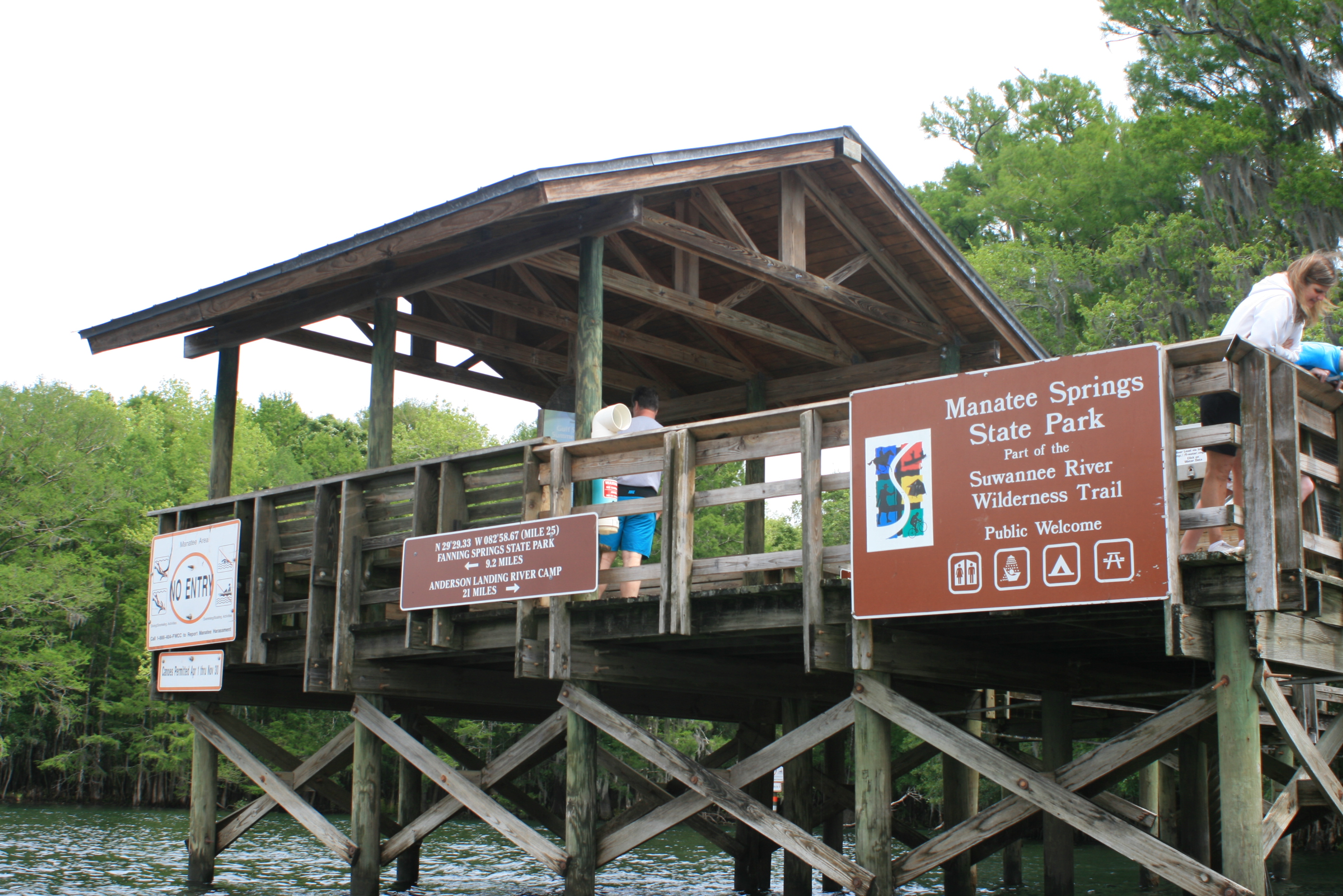
Day 8, Riverside camp (59 rm) to Fanning Springs State Park (34.5rm)

IMG_8821

A primitive camp/riverside night; where the only sounds were the occasional mullet jump and Sturgeon splash. – note; with just a little more effort better stops just ahead at hwy 340 bridge (park top of landing) OR Gornto Park.

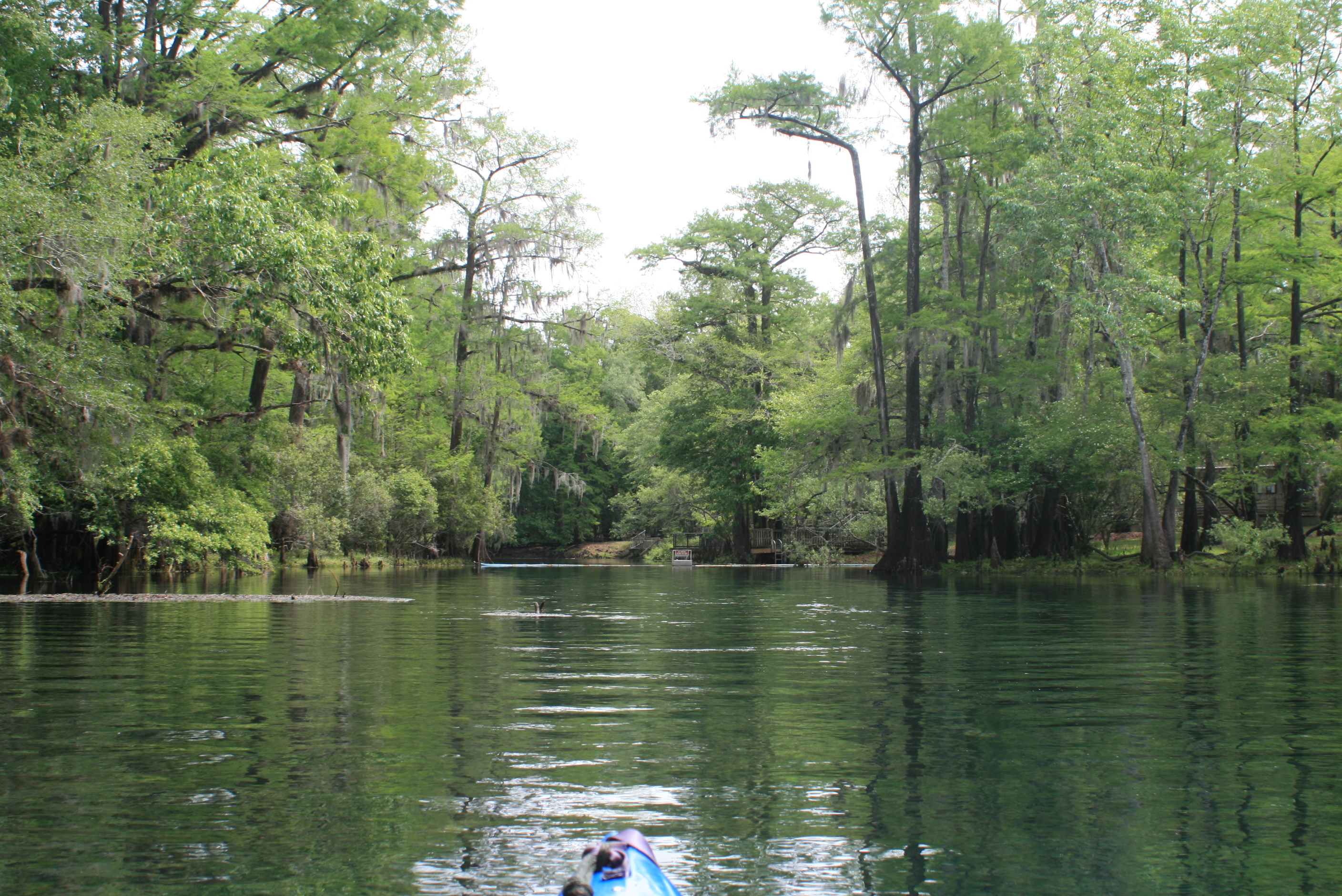
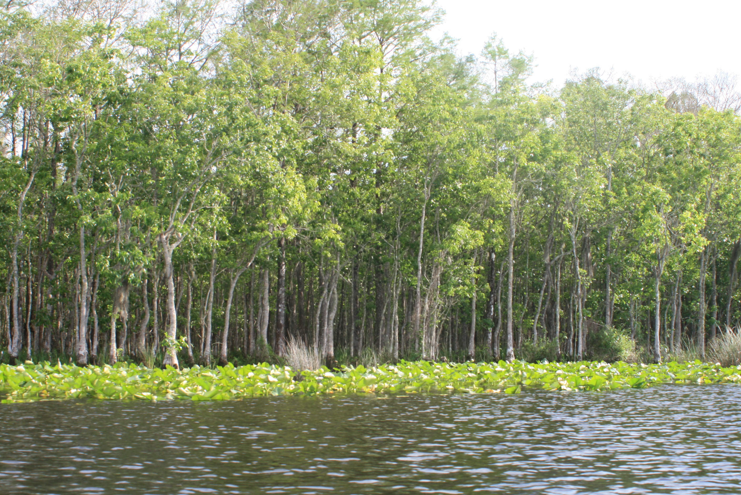
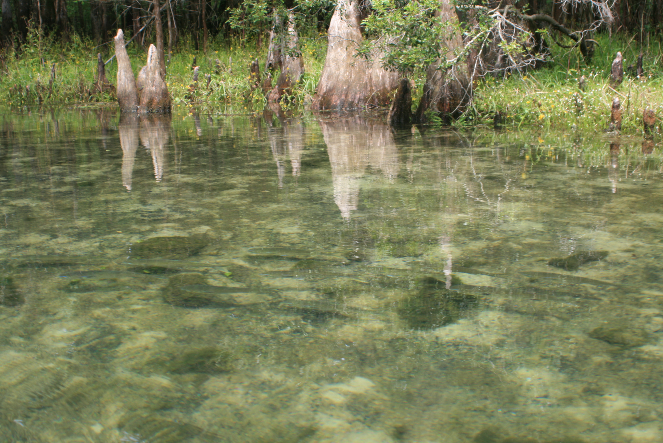
In beginning a new day there was yet another spring just down the way – another corner to explore. While researching prior to this venture the advice was notably passed along NOT to paddle the river quickly; “take your time” – it’s good advice, especially for the mornings.

IMG_8833.

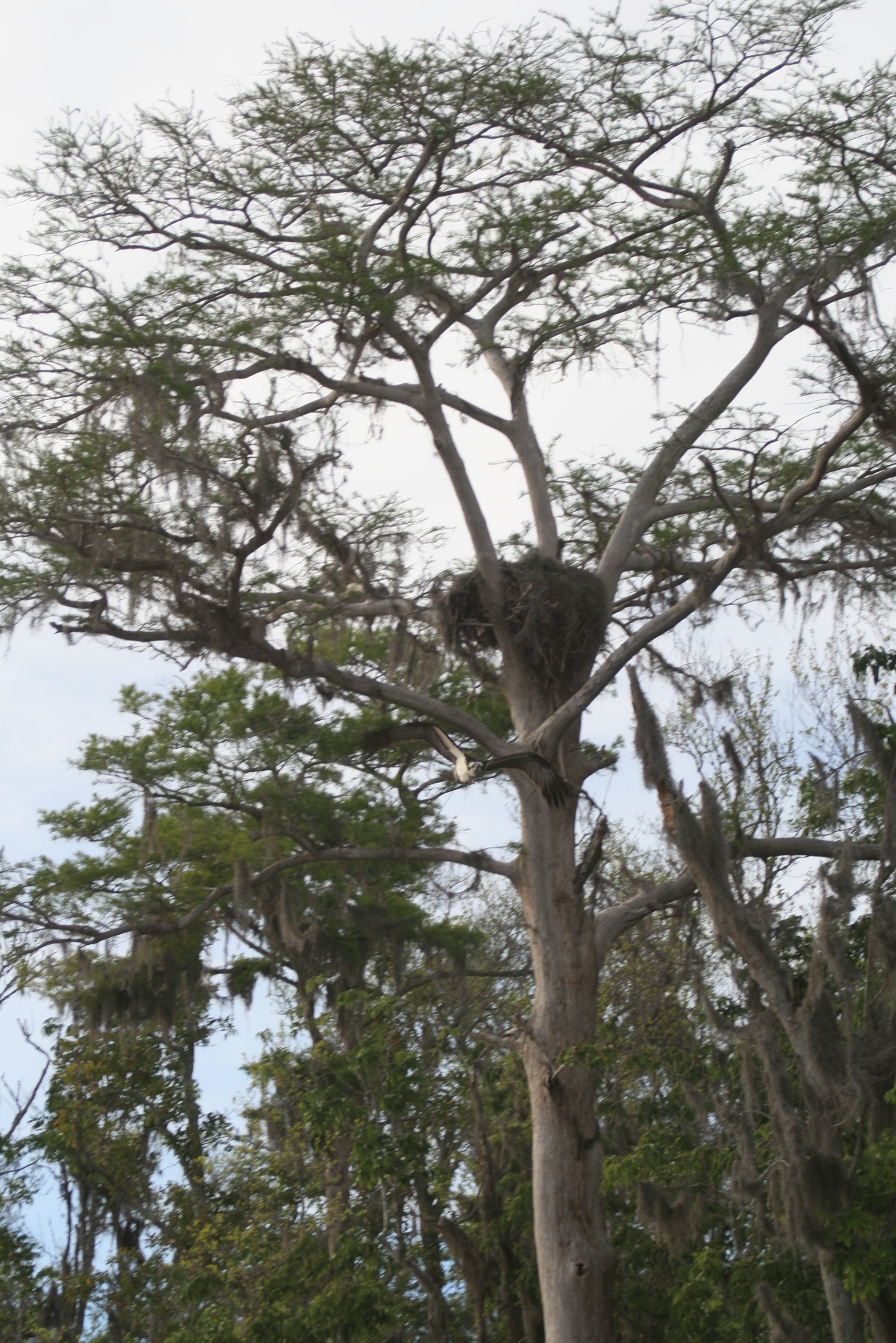
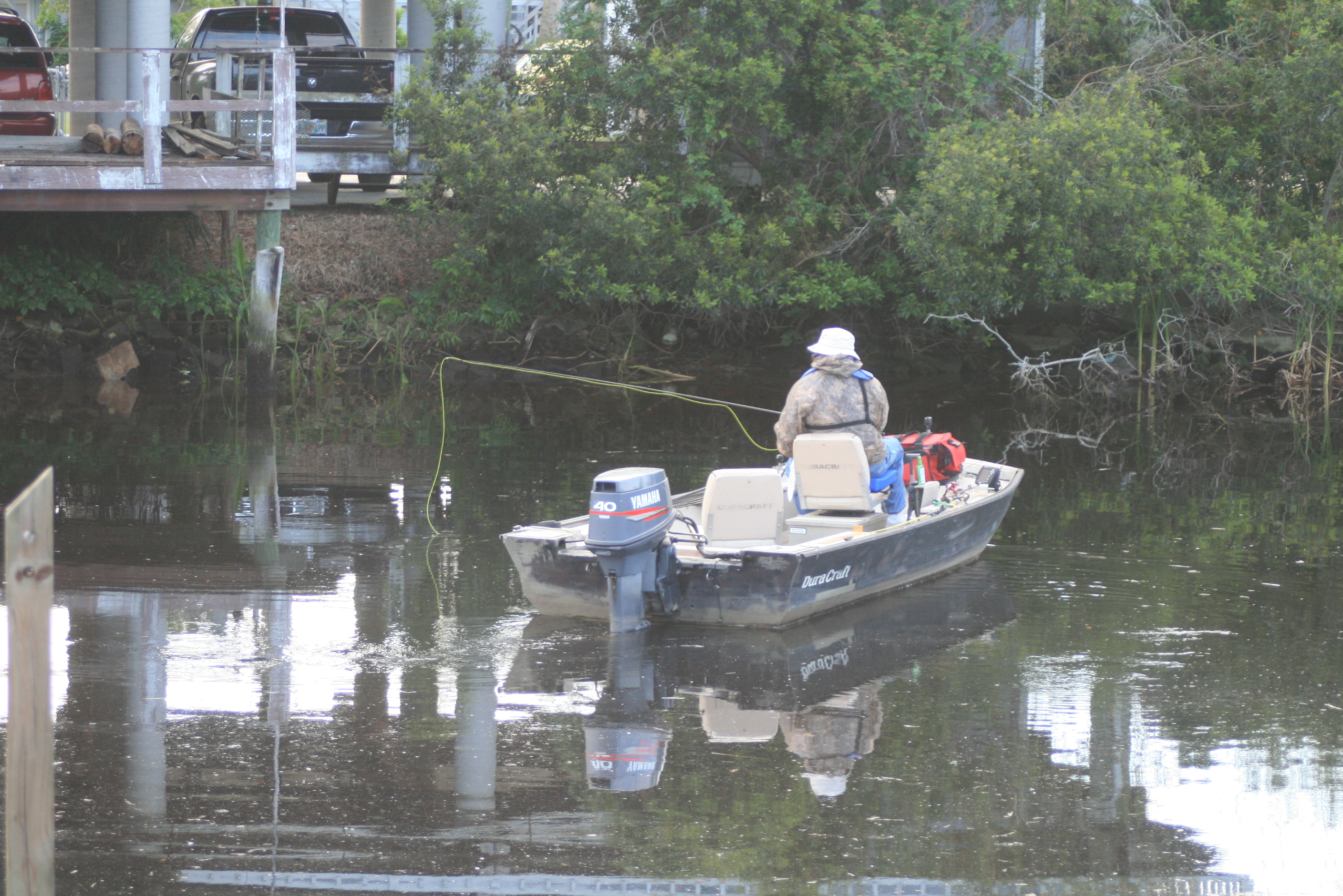
Between the periodic jumps of mullet, sturgeons (dinosaur fish) would do the same – yet Sturgeons can be much larger (size of a dog).  These large fish clear the water completely before crashing back with a ‘thud’ like splash, there were many along the way – none predictable (picture of a mullet in mid-air at Ichetucknee Springs).

There are warning signs posted noting the potential of injury if a sturgeon happens to land in your lap, I think the danger is more with speed and being in a power boat.  The likely hood of concern for a paddler is more in the lines of encountering a manatee pop-up… (suprize).  I never felt concern but did catch a few glimpses, these fish can be huge (manatees are friendly).

IMG_8835

IMG_8840

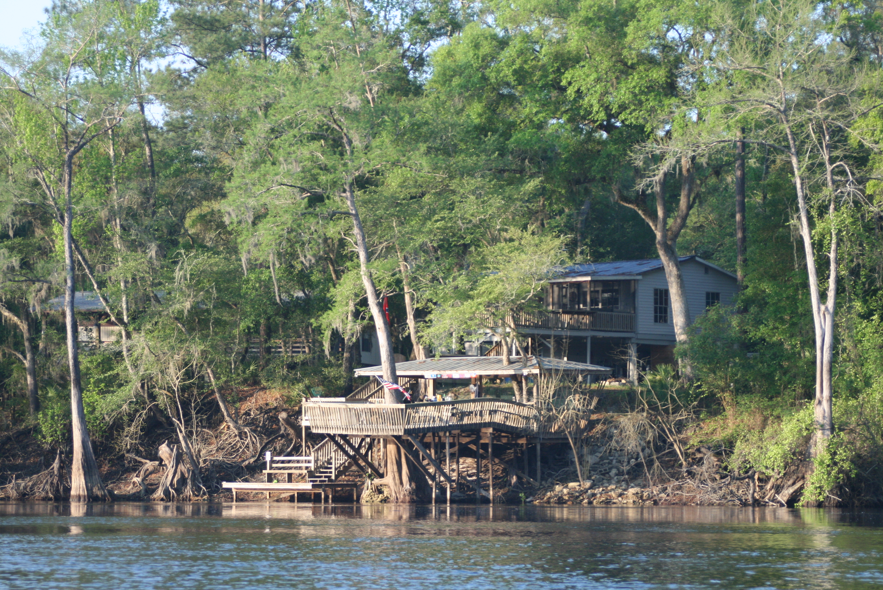
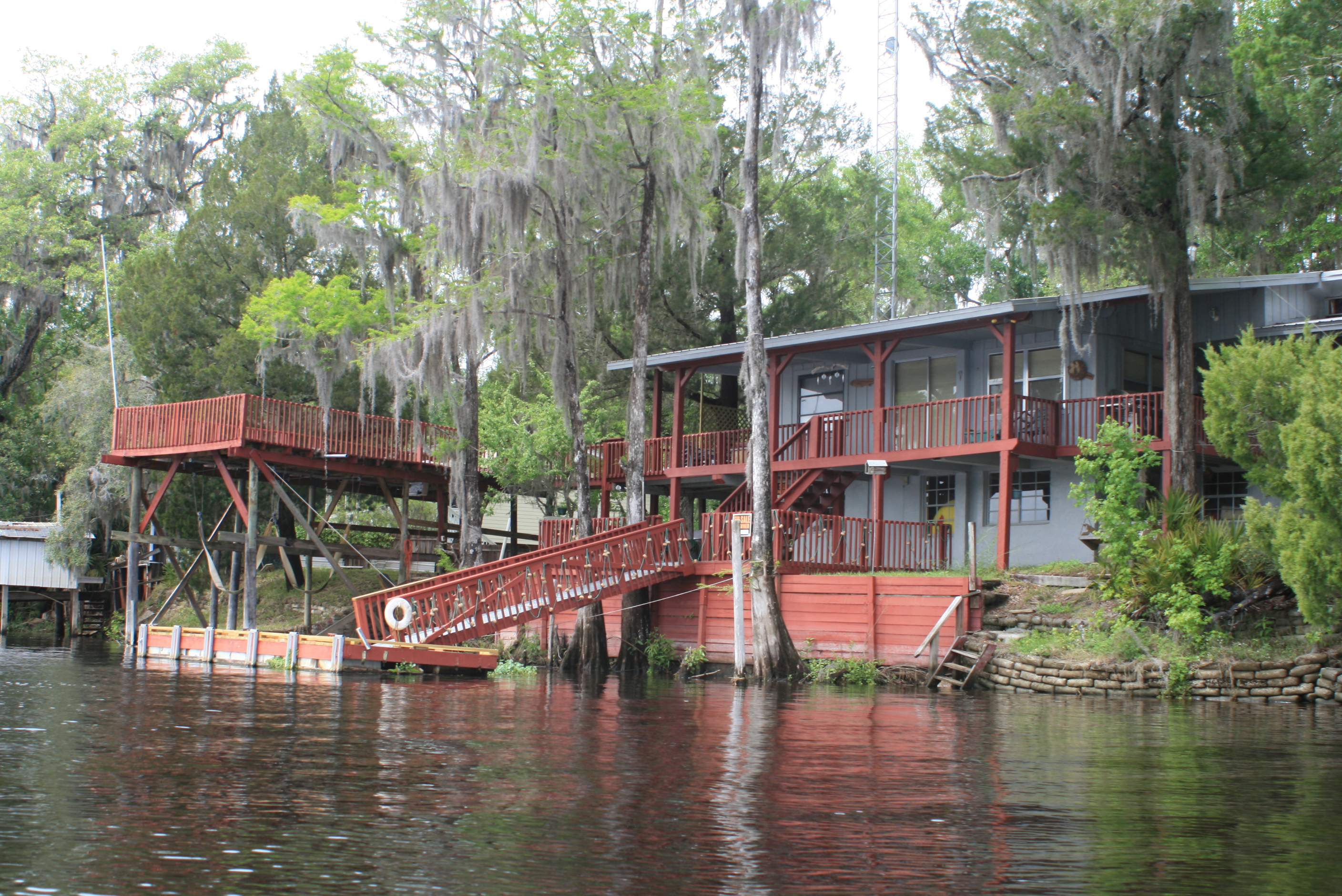
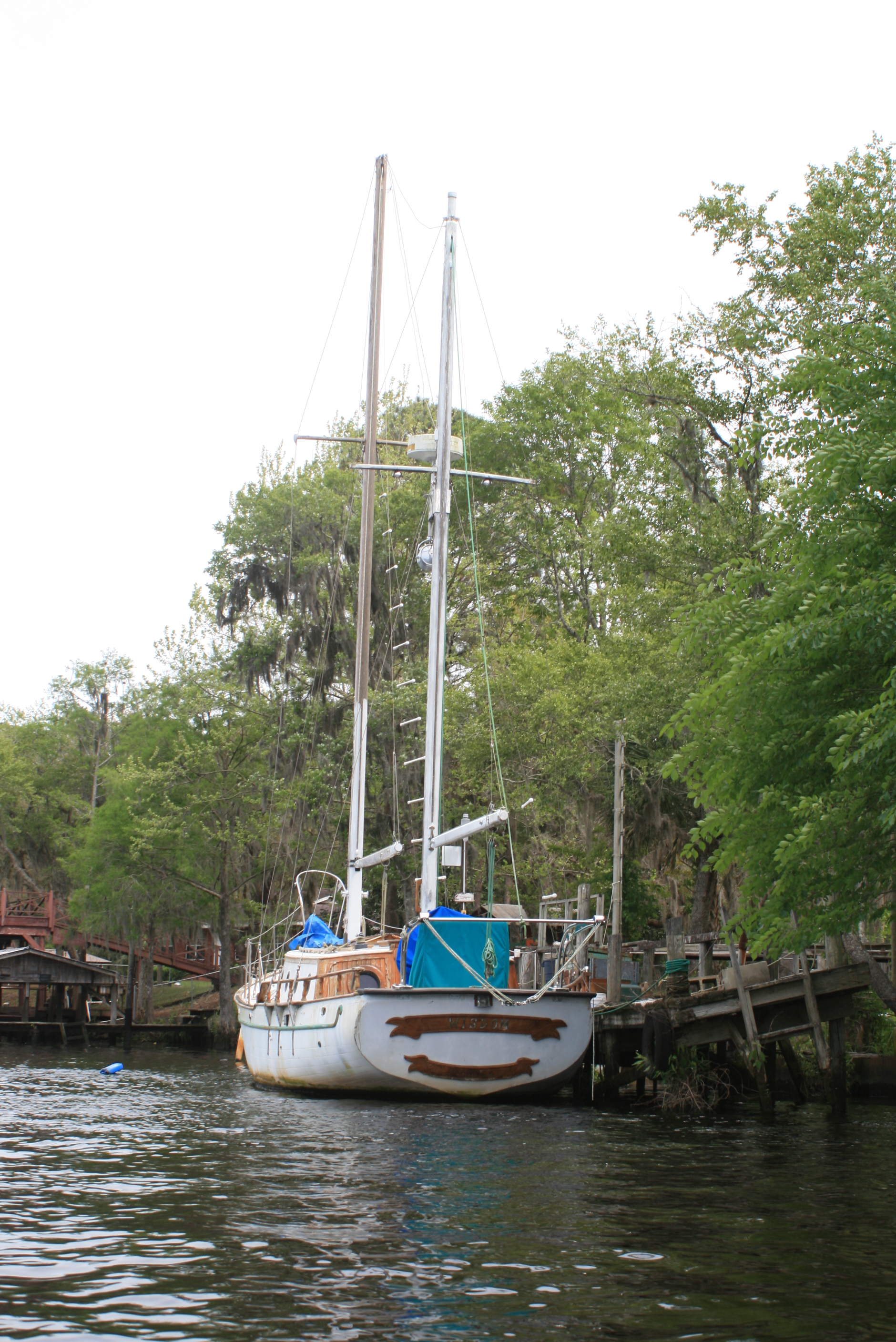
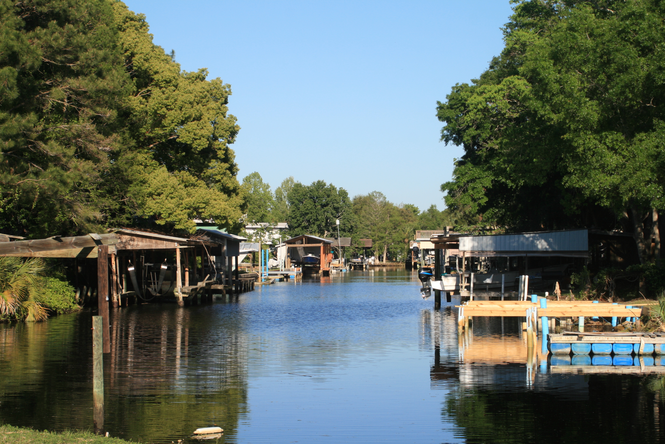
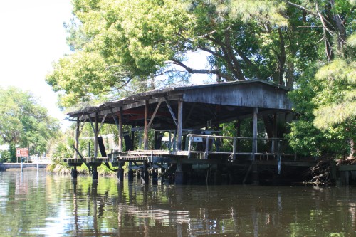
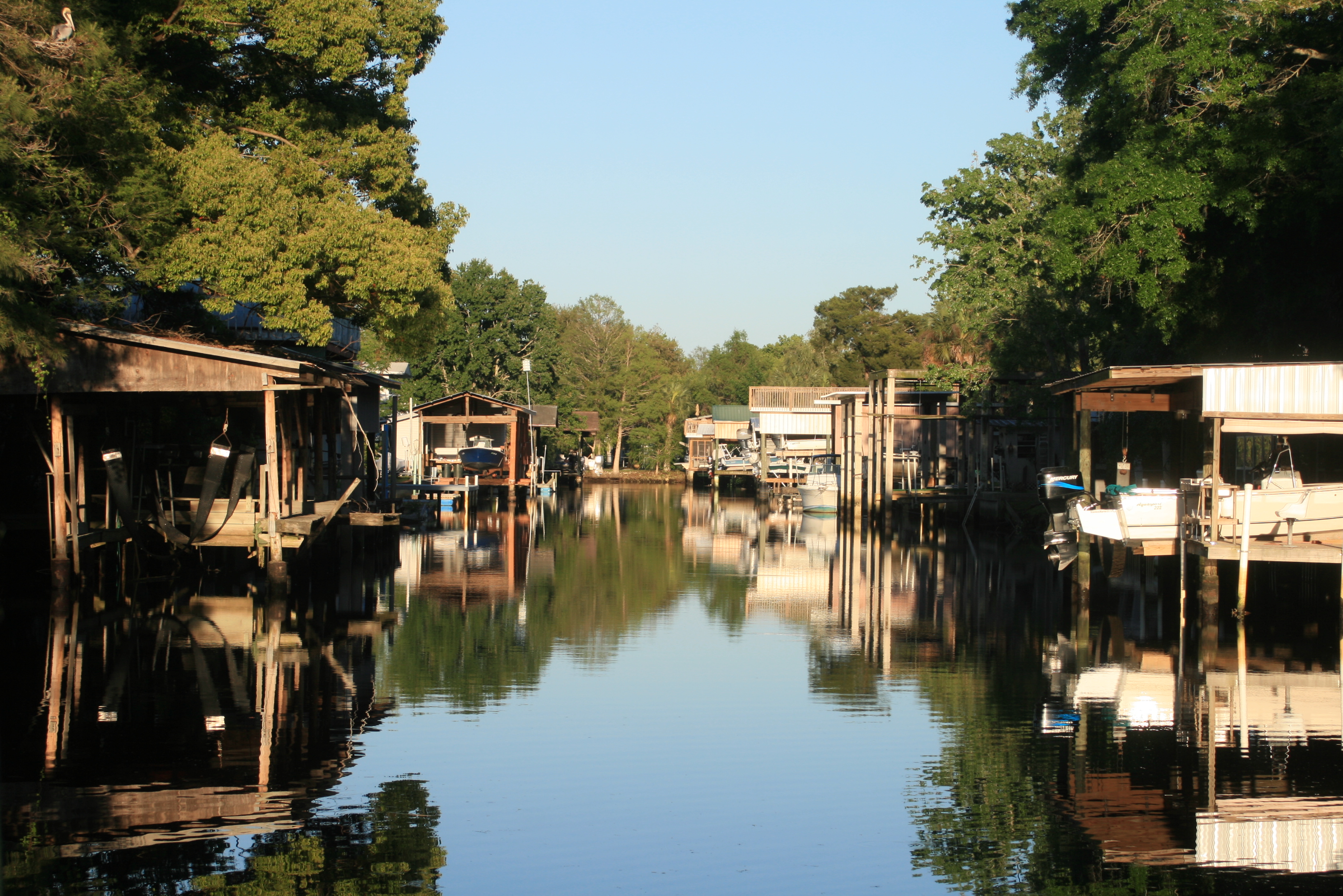
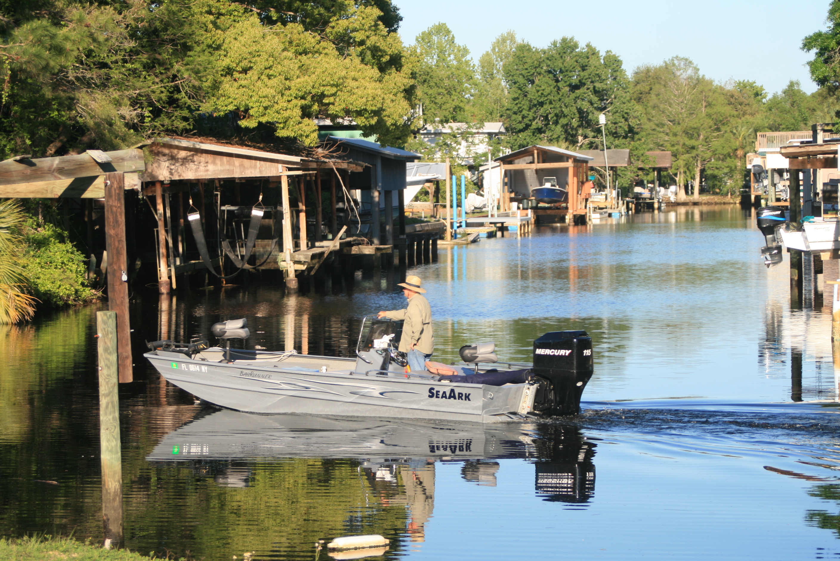
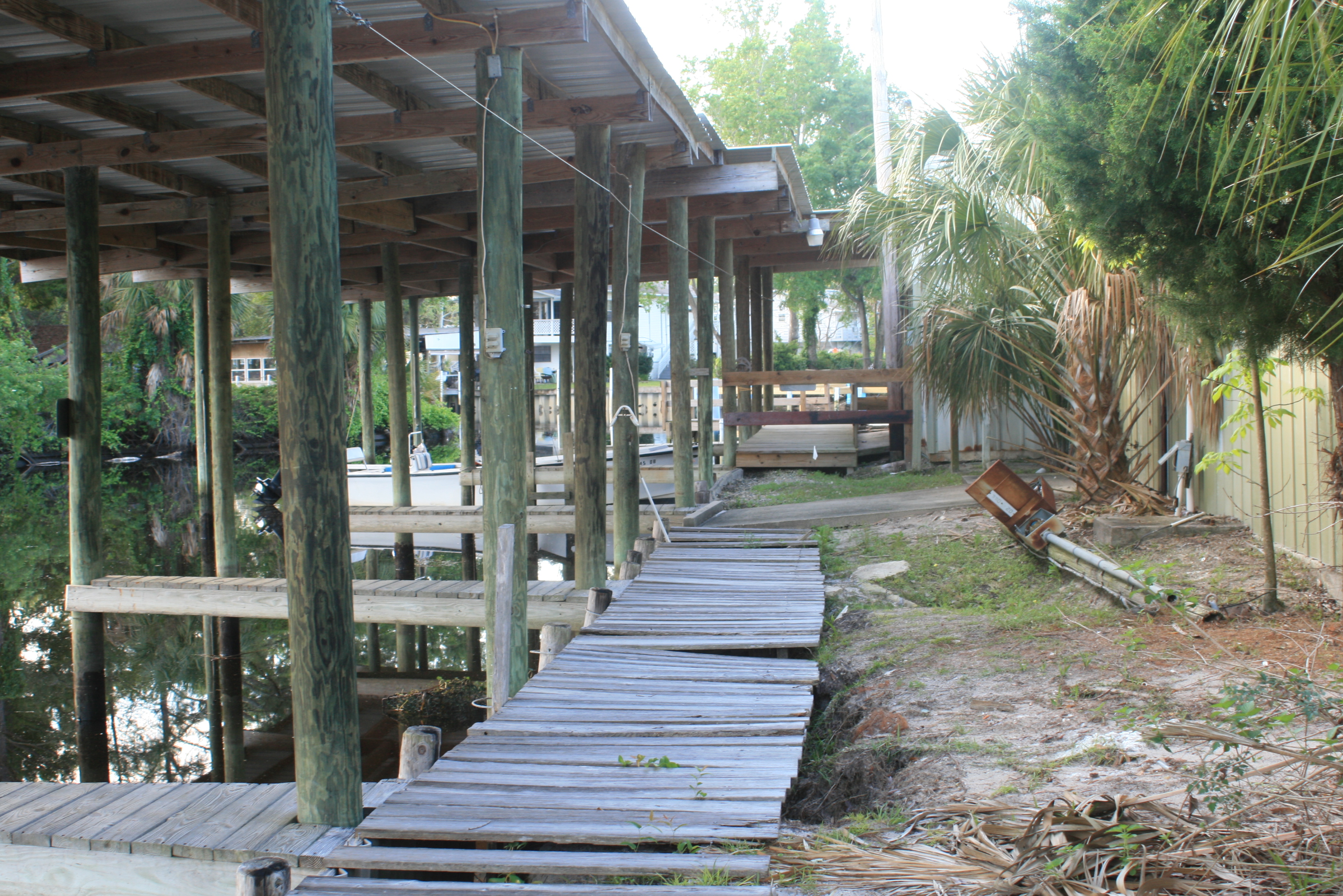
Approaching Gornto Springs its easy to admire the individual efforts at dockage – some folks are more successful than others.  The occasional ‘flush’ of water coming ‘down the pike’ has to be considered and I’m sure the dead trees/logs/debris within that gush ‘reak their own share of havoc to the structures along the way.  It was in this neighborhood that I realized where all those old pontoons ‘go to pasture’…..

The docks can be improvised or have evolved in various fashion to suit the shore-scape, lots of plastic barrels and retired pontoons.  There were also the ‘Florida rooms’ built in all kinds of places – on all kinds of posts and trees, a good number improperly shored or braced – ‘old-man river’ style.

IMG_8852

There were also some solid one’s too.

IMG_8860

While taking a stretch (trail-break) I noticed a small spring and figured that I might take a walk and take a picture or two deeper in the woods.  As I crossed the dew covered ground I sensed something in the distance lurking in my direction, a white object – moving stealth-like – so I slowly (and quietly) stepped across the kayak, and quietly sat – pushing back into the water.  I sat motionless watching it’s continued approach.

This albino doberman sniffed his way to the shore and was nothing but muscle – lean, yet seemingly well mannered (damn glad).  He wasn’t being aggressive towards me, but then with a single bark, I moved on.

Wild looking and I say ‘albino’ because I noticed pinkish nose and ear coloring – “no maas buddy.”

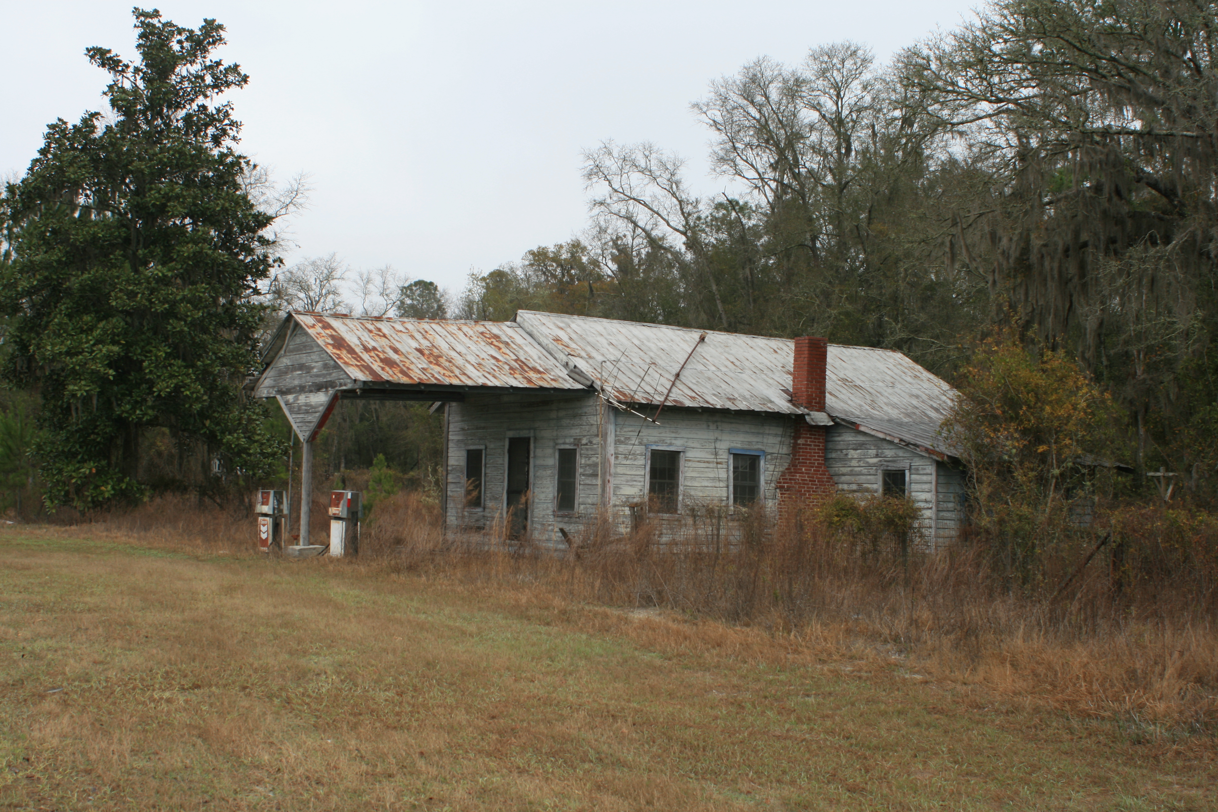
‘Paradise’ (its for sale).

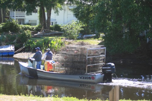
A little further down was a logging operation ramp (like on the discovery channel) along with several other machines that make it all happen.  I noticed only this operation along the Suwannee – from what I hear they can log whats under the water but cannot disturb what is above the waterline.  Another one of those things to ponder on, could the logging disturb the natural process of the Suwannee (water quality or bottom erosion)? – I didn’t come up with an answer.

IMG_8920

The cement of an old boat-ramp mangled by the roots of an even older oak.

I had been thinking too about what someone had asked me a few days earlier “Whats your purpose?” they asked as I passed – “just paddling” was my response, but it left me to ponder.

I suppose that I paddle for several reasons, (one) – I like the back-roads of our country because they are less exposed and intriguing, maybe waterways are similar; primitive avenues.  (two) I see new things, interesting things – ideas, I see Americana – I see character.

Paddling is also pretty basic, cost-effective, and eco-friendly – it’s a pleasant ride between here and somewhere else.

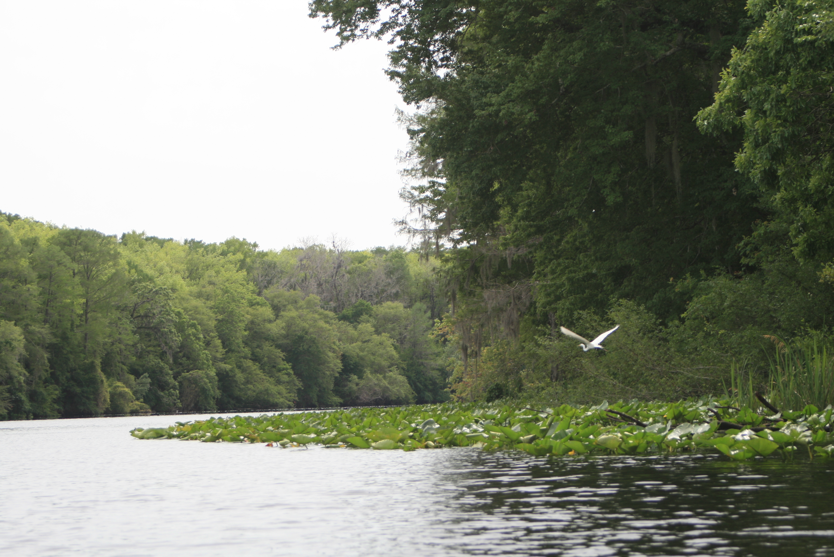
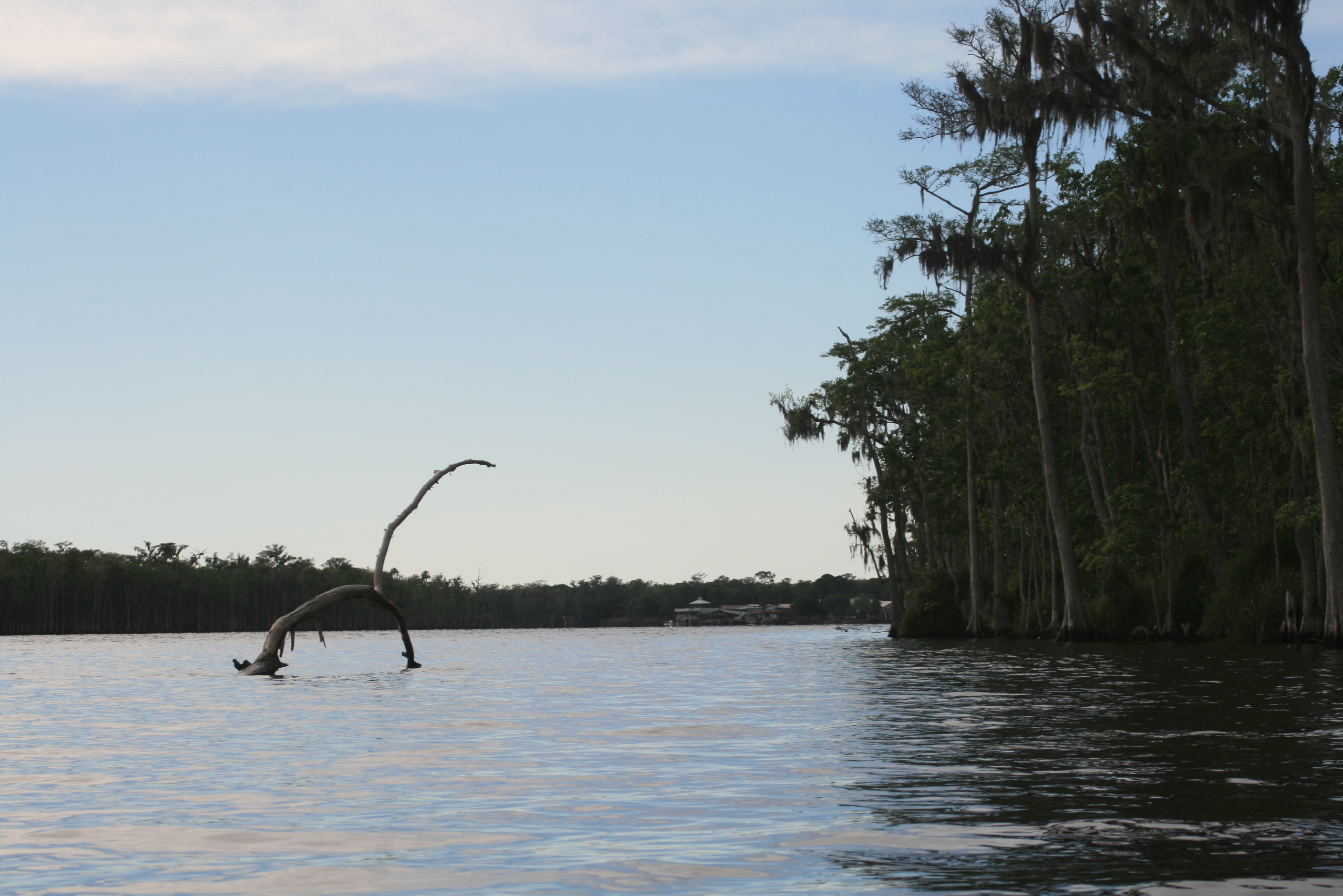
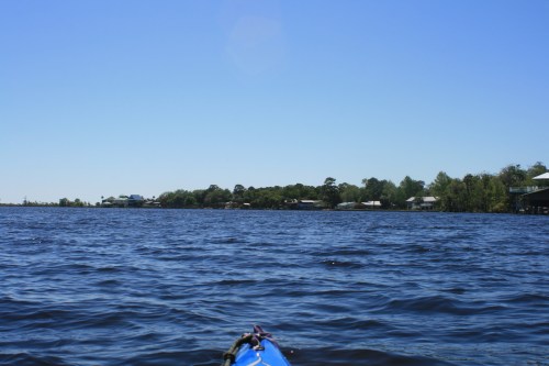
After lunch the wind came from the South in a convincing manner, the Suwannee is much wider now and its almost possible  to watch the wind ‘funneling’ down and racing across the water towards you – have the hat-strap to the front.  Because of how the river meanders it is also possible to work the wind much like paddling against a current, utilizing wind-eddy’s or land features for ‘dead-air’ instead of the water kind.  Having a compass on the bow is interesting too, I watched it frequently for Gulf orientation.

IMG_8975

Unrelenting wind, all day – white caps even, the spray-skirt came in handy for both the wind and the sun.  As for my arms, I haven’t noticed them in several days, I know they are there moving the paddles but I’m relaxed and enjoying the scenery.  Sorta like like riding a bicycle, feet are moving and you’re just sittin there just there ‘lookin around – such has been my paddlin lately.  Paddle on.

IMG_8988

IMG_9032

Railroad trestle above Fanning Springs

Gator buddy, I didn’t see alot of gators maybe five or six all together – not sure why, April is early in the year – they court in May.

IMG_9046

There were several sections of the river where it was possible to hear traffic looong before you saw it or the bridge carrying it.  This area before Fanning Springs and Hwy 98 was one of those areas (I-75 from White Springs was the other).

IMG_9052

A forgotten landing above Fanning Springs (cut-off by a new highway I think).

Fanning Springs

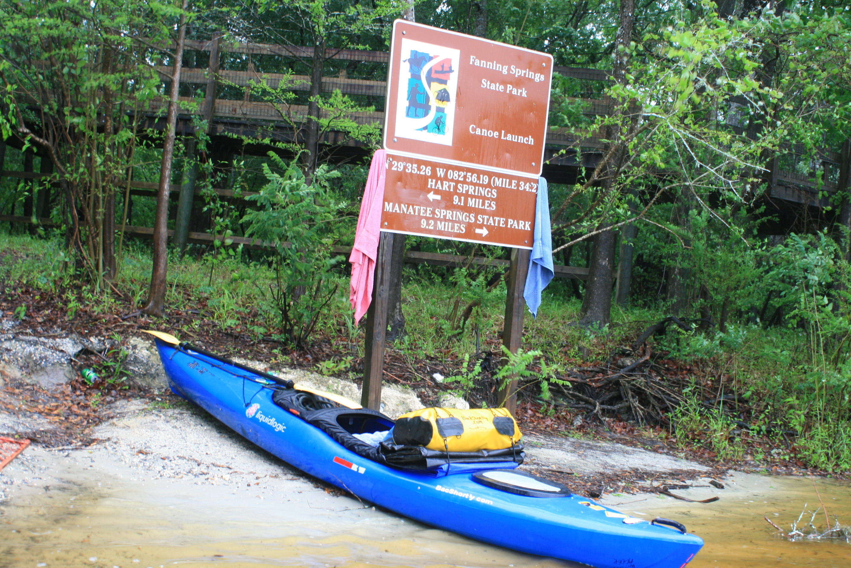
It had been a tough paddle against the wind all day, 21-miles I think, and it was after 4 pm.  Just after Hwy-98 bridge was Fanning Springs State Park a welcome sight, and with a weather front coming through I wasn’t going any further tonight.

As I approached the State Park ramp this group of Outward-Bound folks were just setting out, evidently they paddle, camp, exercise, and discuss getting their lives back on track before setting out for the day.  I have run across these kids several times before on the Suwannee (once at Cone Bridge). You can’t help but to admire the young leaders for doing such a thing in/with this environment.  It all leaves me to appreciate the Suwannee a little more for being the quality environment that it is.

IMG_9068

Fanning Springs State Park emphasis is more on the Springs to which the community (‘cut-offs and dated bathing suits’) frequent rather than camping – so there are no established campsites with power or water service.  There is a cold-water outside shower or there are the springs, no hot water shower to defunk, I used the springs.

The camp sites are in a field with a large fire-ring and near an out door stage.  The highway and eating establishments (land-food) are just across the street, its a deal for 5-bucks a night (and its level). They do have cabins, for those that have the ability to plan ahead (2-night minimum, $100 a night).

I had a great day of paddling, even with the head-wind.

Barely making it back after a fine oyster dinner I squared things away for any impending storm which might arrive during the night (it came at 6 am it was gone in an hour and a half).   zzzzzzz

.

Facebook Post; “Mon – day 8; 22 hard miles against a stiff wind, camped Fanning Springs”

.

Next day, day-9;

  • Day 9 – to Anderson River Camp

.

note: even though mentioned and shown on available maps – there are NO physical ‘river-mile’ indicators along the river.  For further Suwannee River mileage information, check this link – Suwannee River Mileage, Trip Agenda ideas.

Opinion; Marking existing landmarks such as bridges, ramps, and river camps with a numerical reference would provide basic orientation points (and emergency references) along the river (the Mississippi has them).

Kayaking the Suwannee River, Fargo to the Gulf (day 9)

2 Comments

– post 7 of 8 –

Georgia to the Gulf, 225 river miles, 10 paddle days

A River of Time

Fanning Springs to Anderson River Camp, Suwannee, Fl

.

IMG_9072

When I set up the tent last evening at the State Park in Fanning Springs the possibility of being idle on this date (due to passing weather) was real.  Luckily the ‘front’ came through at 6am and was gone by 730 (I’ve slept through worse on the Mississippi). After packing a damp tent and tarp I rolled traveller down to the ramp, and while returning the dilapidated cart to its rightful place I headed to search for breakfast across the street.

The rangers at the gate/office informed me that the power in the vicinity had been knocked out by the passing storm, but they were about to make-a-run to a fast-food restaurant down the road to fetch themselves a biscuit.  “Figure me in, I’ll take two please.”

It was good of them to offer – but it was at least 40 minutes before the rangers returned (as I sat and listened to another ‘chatty’ ranger wound up on coffee). They produced some ‘insta-biscuits from a grocery freezer, how could I complain? Nope, a big thanks – and on my way at 10:30!… munchin a microwaved biscuit and drinking a coke.  Anyone that knows me knows that I hate ‘hanging around (hence the ‘bacshortly’) but then I continued to remind myself that I could be sitting in the tent listening to the wind and lightning have its way with my little speck of ground.  Life is indeed good, and so were the folks as they offered to grab me a bite – thanks guys.

IMG_9076

It was once again good to be working the shoreline, I did think about the Outward bound group of girls that had departed so late the evening before and wondered how they might have completed their night – you have to respect what those young leaders do.

In the area of Fanning Springs is Old Town, after the RR Trestle is an historical shipwreck (underwater) marked by buoys – The City Of Hawkinsville.

With the late start and the Gulf still 34 river miles away I prepared for a night of riverside camping – my dread was that the weather front that had just passed also meant a chilly night ahead, 40’s forecast – least if I had to sleep near a gator I might see his breath first.

The Suwannee’s now become flat and wide, the shoreline is only sporadically showing mans presence – fewer residences and more hunting and fishing type of camps.  There were structures nestled sporadically between the cypress stumps, trees, and protected habitat.

– plus more lily-pads, reflecting the ‘delta’ nature of the area.

IMG_9099Manatee Spring entrance from the Suwannee River, 25 miles from the Gulf.

IMG_9107

Paddling into the clear water of the Manatee Spring (allowed April to Nov) I paddled past a single Manatee, huge with a rounded fin, a seemingly gentle and harmless giant – these animals were commonly referred to as ‘sea-cows’ when I was growing up in Ft. Myers. They have done alot to protect the Manatees, after you have seen one with propeller wounds across their back, you really appreciate the State’s efforts.

Paddled up to the boil point where further paddling is prohibited.

Mullet were active and schooling in the clear and comfortably warm waters.

IMG_9121

– and then back out into the Suwannee. Camping is possible here, but the camp sites are just too far from the river  – and your kayak.  It was just after noon and I was surprised with covering the nine mile distance from Fanning Springs so quickly.  I figure three mph at a ‘leisure’ paddle; maybe the current is helping more.  Yesterday was tough against the wind, today – with the weather front through and the cool night ahead the wind was mostly from the north, behind and supporting me in its own quiet way towards the Gulf.  Sometimes things just work out.

IMG_9130

The homes that I did encounter were in groups or clusters – many bearing the sign of our times – “For Sale.”  There were several along the way that I really liked, especially with Gulf access – the best of both worlds; since Branford I had noticed many homes for sale.

This was the only law-enforcement I saw in my complete paddle.

– a little later the Yellow Jacket campground @ 230 pm (23 rm) came out of ‘nowhere.’


IMG_9148Nothing but a wet towel on my bow, a breeze at my back, mullet, sturgeon, and the gators.

The land is mostly protected with one side bearing the signs of a Federal Wildlife Reserve, the opposite side only rarely shows the signs of private use – forgotten camps and picnic tables with vegetation growing from the accumulated leaves rotting the tops from them.

It is a ‘wetlands’ wilderness type of setting – I saw few places to pitch a tent.

IMG_9174

There were ‘gator-holes’ that ran back into the woods, I regretted not taking time to explore these but was trying to compensate for my late start to the day; “paddle on.”

IMG_9190

It was three thirty when I came upon the boat ramp at Fowler’s Bluff (17 rm), hoping for a land-sandwich and noticing a small group of folks at what appeared to be a diner – I paddled in and stopped.

They were kind folks in the process of getting the diner open for the ‘season,’ stating also that a couple paddling the river had camped at their picnic tables the week before.  It was 330, and in hindsight maybe I should’ve just stayed right there for the night.

One fisherman explained that it took him about thirty minutes to make the town of Suwannee (when he ran ‘wide-open’ in his boat) – my inclination was to move-on (he also mentioned that there were few if any places to camp) – Fowlers Bluff was essentially ‘it’ (this was a true statement).

Update, 4/2012.  Treasure Camp restaurant has opened and is awesome; ice, cold beverages, real land food – and primitive camping $7 per paddler. A good stop – but I didn’t.

My thinking at the time had to do with the cold-front moving in and while paddling away from Fowler’s bluff I felt a little more ‘pushed’ to cover the remaining 17 miles, not the way that I wanted to paddle this river.

Using the favorable winds I paddled a bit more steady reasoning that if it became necessary I could opt by setting up my tent on one of the two remaining boat ramps between here and the town of Suwannee.

gator ahead

IMG_9213

In retrospect there really wasn’t a good place to camp between Fowlers Bluff and Suwannee – neither of the boat ramps were apparent – and I looked for them as I paddled.

Nearing 6 pm and without noticing any boat ramps, it was a good feeling to finally see some roof tops on the horizon ahead; could it be Suwannee? – no matter; my tent was going up somewhere among them, – soon.

IMG_9220

Alongside was this Osprey nest, if you enlarge the pict you might notice the Osprey swooping down towards me.

The village of Suwannee, Fl ahead.

There are no markings for the Anderson River Camp from the Suwannee River, fortunately at the first canal a fisherman directed me into the canal and to my left – where eventually a small sign appeared.

‘Bill’s Fish Camp’ is where you sign-in to use the river camp, they also have rooms – 65 bucks a night (cash or check only).  I considered a room with the cold front coming through but with thirty-two bucks cash it would be the screened porch, this worked out just fine at five bucks a night, awesome – “give me two nights, the shuttle is coming to pick me up Thursday and I’ll just take the ‘day-off’ tomorrow (the best choice). 

IMG_9336

Anderson River Camp was once part of Bills fish camp, not sure how the river folks worked this out – but its another awesome invitation for paddlers to explore the Suwannee River’s natural quality.  They also have a primitive camping area plus allow use of this screened ‘porch’ when there are fewer campers (I was the only) – with a damp-packed tent from Fanning Springs it was a great room to set-up and allow it to dry, a luxury – now for the cool night ahead.

Last day, the canals of Suwannee;

The shower available is in one of the ‘least nice’ rooms of ‘dated’ motel, with no furniture inside.  It’s almost ‘nasty’ after all of the newer showers in the other river camps upriver – but again, for five bucks a night its a luxury – and I know it was attended to by ‘Wallace’ and not overlooked.   It was 41 degrees this night.

IMG_9337view from the screened porch.

.

Facebook Post; “Tues – day 9; 31 miles with the wind at my back, 4-miles from Gulf in little town of Suwannee till Thursday, feet up.  Now I know to where the Suwannee flows….”

.

Suwannee River Mile References 

note: even though mentioned and shown on available maps – there are NO physical ‘river-mile’ indicators along the river.  For further Suwannee River mileage information, check this link – Suwannee River Mileage, Trip Agenda ideas.

Opinion; Marking existing landmarks such as bridges, ramps, and river camps with a numerical reference would provide basic orientation points (and emergency references) along the river (the Mississippi has them).

Kayak the Suwannee River, Fargo to the Gulf (day 10)

5 Comments

– post 8 of 8 –

A RIVER OF TIME

Anderson Landing

(GPS – 18 SE 225 St, Old Town, FL)

Suwannee, Fl

The reward.

IMG_9222

Day 10 – after 225 miles of paddlin this was the perfect layover – Suwannee, the town.  I would suggest to others arriving in like-manner to take an extra day here, ‘stop and put your ‘feet-up.’

IMG_9235

Just outside of those two little portholes are the comings and goings of the folks that live with this area’s blessings – leading to another perception gained while paddling the Suwannee’s length – I wouldn’t hesitate to eat anything that comes out of these waters.  Throughout the distance of the Suwannee I never noticed an industry along her shorelines, and only heard a single voice of concern over the nutrients originating from mid-Florida livestock – I couldn’t help but to feel that whatever comes from the Suwannee’s waters is quality food!

I even tasted some excellently seasoned ‘gator-tail’ while at a local eatery.

While ‘putting your feet-up‘ there are four possibilities, (1) – paddle westward through the canals and into the saw-grass maze towards the Gulf

IMG_9261

Its gator habitat too – while paddling toward the flats I did notice a gator with only a third of a tail – knowing that their tails are an important factor of propulsion, I later posed the question (for conversation) to a ‘local’ while ‘bellied-up’ at the Salt Creek bar – wondering too if anyone knew of this particular gator.

“Could a gator survive in the wild without it’s tail?” the ‘local’ said “sure” they could, and “that was probably his tail that I was eating.”

IMG_9252

another possibility is (2) inward and paddle ‘canal world’ where almost everyone has a boat garage’ – each with their own version of a fish-cleaning station; old and new.

IMG_9361

It must feel like this in heaven.

or (3) the eastward direction back onto the Suwannee’s main flow to maybe say “adios” Poseidon for sharing ten days from the ‘topside‘ on her waters.

IMG_9306

.

Which I did also – with the incoming tide and the outgoing wind I sat motionless on the Suwannee – held in check by opposing forces.  In research for paddling the river, advice to check the tide direction was noted; – I thought about this as I paddled the last leg from Fanning Springs yet really did not believe that the tide was a factor until reaching this point, the town of Suwannee.  The tide at this point could be a strong ally with running to the Gulf and back – Bills Fish camp has tidal information available for the asking (its shorter if you paddle through the town to the Gulf).

The Cape Coral

IMG_9318

The delta landscape of the Suwannee River near the Gulf.

IMG_9339

or (4) just sit back and enjoy the world in front of you.

IMG_9389

IMG_9386

IMG_9373

It was the best ten bucks that I’ve spent in a long, long time.

Ten bucks for camping two nights at a place you can paddle through the canals of the little town; head out into the marshes, or the river, or out to the Gulf. Take some ‘no-see-um’ spray….

Eats; In walking distance is Sarah’s Suwannee Cafe (breakfast/lunch), a Post Office, and the Salt Creek Restaurant (diner/bar), spend the savings from the room to replenish what you’ve burnt coming down the river.


A small example of the homes, there were many more conventional.

Double-wide on stiltz


I like how they ‘jacked them up’ and screened in the area below, nice.

.

but I guess I can’t stay forever, “I got boats to build” (jb)……..

Facebook Post; “Took the day off and paddled the flats of the Suwannee delta”……..

.

Paddling Live Oak to the Gulf

.

Suwannee River Mile References 

Georgia to the Gulf, 225 river miles, 10 paddle days

Links to the other posts of this paddle trip;

  • Days 1 and 2 – Fargo Ga, to riverside camp to just above Big Shoals (178rm)
  • Day 3 Big Shoals to Woods Ferry River Camp (159rm)
  • Days 4 and 5 – Woods Ferry to riverside camp (136rm) to Dowling Park River Camp (113 rm)
  • Day 6 – to Adams Tract River Camp (85 rm)
  • Day 7 – to riverside (56rm) just above Gornto Springs (56rm)
  • Day 8 – to Fanning Springs (34 rm)
  • Day 9 – to Anderson’s Landing River Camp

.

Paddling in The Okefenokee Swamp

3 Comments

.

.

The Okefenokee Swamp

“Stretching from Waycross, Georgia to the Georgia-Florida border, the Okefenokee Swamp represented the last of the untamed wilderness in Georgia after the War Between the States. Covering more than 700 square miles of territory, this vast land mass was once thought to be uninhabitable and as such was not distributed by Georgia when it was “acquired” from the Creek Nation. Actually, the Okefenokee was inhabitable and had been extensively settled by early cultures of Moundbuilders, both prehistoric and transitional.” OurGeorgia History.com (other Okefenokee facts)

The group with which I had just paddled on the Suwanee had thrown out the idea leaving the possibility ‘open’ of stopping by the Okefenokee for a quick paddle on the return trip home –

– traveling separately my primary mission returning home was to check out some river-points and land-marks along the upper Suwannee for a complete paddle of the river the following month, but I too ‘left the possibility ‘open’ to paddle the Swamp.

In moving ahead of the others I was able to maintain a casual pace making stops in White Springs, Big Shoals, Cone Bridge Landing and then Hwy 6 at the river – the Northern most accessible areas of the Suwannee, its more of a large creek as the river passes the Georgia state line.

The Okefenokee National Wildlife Refuge is pretty much off the ‘beaten trail in the lower part of Georgia, but its also a point that I regularly travel past without entering.  Getting into the heart of the Okefenokee requires following hwy 177 from Hwy 441 near Fargo, Ga – to its abrupt end 18-miles into the center of the swamp.

(VGPS – 17515 GA-177, Fargo, GA)

Being raised near the Everglades in South Florida I have always held some doubt as to a similar landscape further North, but its there – alive and well in the South Georgia heat – along with the gators, turtles, hawks, and all the other swamp critters that love to call a swamp its home.

Once inside the Stephen P Foster State Park I found the group unloading near the store landing, I guess a quick paddle of the Okefenokee was going to work-out after all.

At the landing the Park service has a neat little store with some interesting trinkets (no stuffed gators) along with basic quick food improvisations, and this is where you pay the day-fee of five-bucks.  From this point its possible to rent one of their thirty something John-boats (4-hp motors) canoes or kayaks and head out along the canals and canoe trails to witness the cypress trees, wildlife, – its a sense of living geography – with the minimal of direction.

The gators were present and closely watching at the ramp, from there it was just a matter of heading out and along this narrow canal to a larger one (Billy’s Lake) about a half-a-mile further into the swamp.

Once on the larger canal you decide which direction to take – we went to the right towards Billy’s Island, once a Billy Bowlegs hideout for 20 years.  This earthen island (4-miles long 1.5 miles wide) once served as home to early native Americans and then a village of about 500 loggers early in the 1900’s.


There is signage to help with your decision to which way to paddle, and from what I noticed back at the store – help is on hand if something arises – just might take them a bit to get to you.

There were gators immediately apparent, most basking in the sun or immediately proximate to our kayaks – with the number of us I figure the odds were good that I’d make it back uneaten, just needed to stay in the boat.  Paddlin towards Billy’s island there was always the sense that something was watching – lots of gators, some that look across as you paddle by, those that slowly sink under the water as you near – and then those that lay motionless just beneath you.

Along some areas of the swamp there were large and impressive cypress stumps left over from the logging many years ago, many with new growth.  The cypress trees have made a solid comeback, pondering on the stumps it was easy to imagine the once majestic and prehistoric forest that once stood here.

Hundreds of gators – I wanted to kid one kayaker that they were just along as ‘bait,’ but then the ‘aura’ of the place told me ‘No’.  In paddlin the swamp there is more regard than concern – with that it remained the kind of place that a person would not want to be splashing around.

again there are marked canoe trails that ran off of this main channel.

I was surprised at the number of other folks that were out on those little boats – paddling, canoeing – and other groups, there were almost as many people as there were alligators.

a small dock marked the Billy’s island landing

pickinfrog2.gif (6564 bytes)

I hear banjo music…

Once at Billy’s island we took a walk on the Parks marked trail, there are some history/informational markers, some old boilers, and a cemetery to gander at.

The walk was about thirty minutes, and once back at the dock we paused with a snack while other paddlers and families continued to come and go, again a much busier place than I had anticipated.

and this is where I had another issue too – a camera issue.  Actually it was my error in knocking the adjustment to the wrong position and not noticing, so after an hour or so paddle back out and taking some great shots (easy to say) of some great stumps and gators with the sun at my back – none of my pictures ‘came out’ (overexposed)….. but don’t take my word for it – paddle the ‘Oke

You will just have to believe me that the scenery was impressive…. My suggestion on paddling the Okefenokee is to paddle with another for sure – we spent about 4 hours there to Billy’s Island and then through a paddle trail – we could have easily spent more time going into the trails.

If you are on a trip south, its a simple day paddle and I highly recommend it, paddling in the presence of the Okefenokee alligators will prepare you for any others that you may encounter further south – heck, others may not even phase you after paddling here.

Paddling The Suwannee River

.

Water Clarity – naturally tainted and high-quality

Natural Quality – 10

perception – Feb weekend

.

note: even though mentioned and shown on available maps – there are NO river mile markers along the Suwannee river (which begins in the Okefenokee) , landmarks or bridges, ramps, and river camps along the way.  For further Suwannee River mileage information, check this link – Suwannee River Mileage, Trip Agenda ideas.

It would be positive to see a marker every couple of miles or on existing landmarks, benchmarks – as safety reference markers.

Swamper Tom (Everglades)

Older Entries Newer Entries