Home

Cascade Lake – NC

5 Comments

Water Clarity – 6+

Natural Quality – 8

Difficulty – easy

(GPS; @210 Staton rd, Hendersonville, NC)

Perception – Weekday

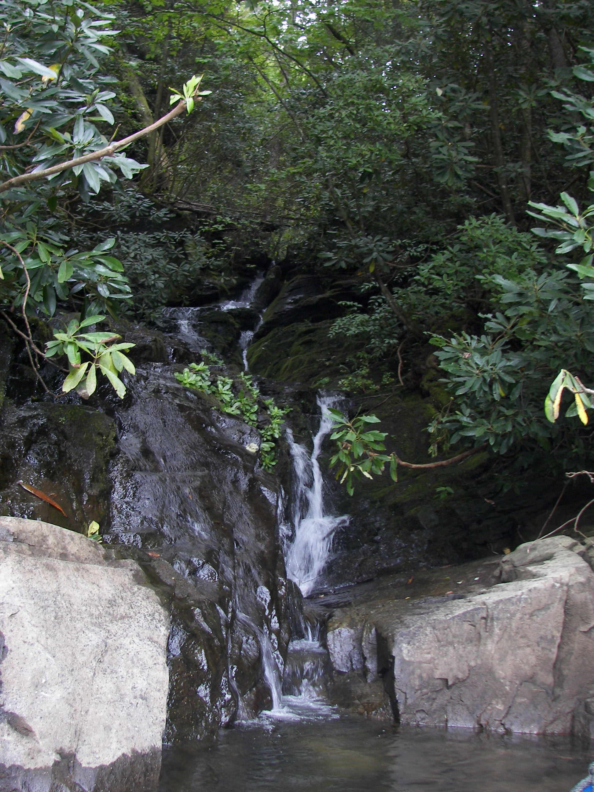
Cascade Lake is a small lake, known by a few flat-water paddlers in the Asheville/Brevard area of Western North Carolina, it is located 14 miles from Hendersonville on the fringe of DuPont Forest.  DuPont Forest is a protected setting for a number of activities such as horse-back riding, hiking, and dirt-biking, plus waterfalls more spectacular than that of Hooker’s, the one just above Cascade.

,

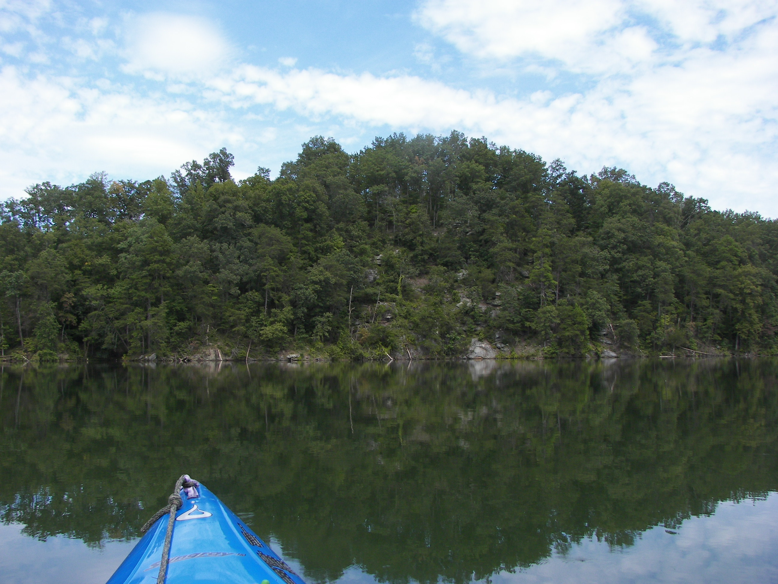
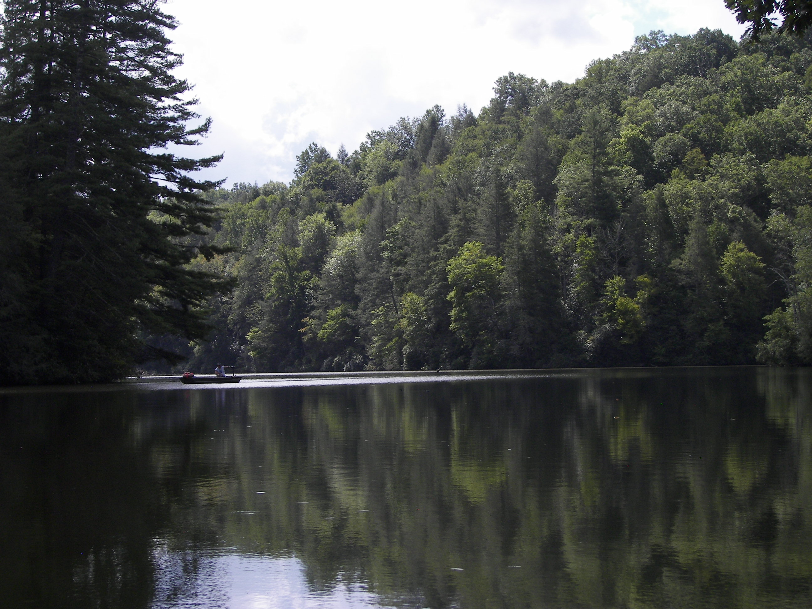
I have paddled this small lake a several times (@ 2 miles in length), it’s simple and especially nice in the winter for its peaceful setting, water clarity, and of course that convenience of just ‘getting away.’

100_8458

Trout Waters, Hooker Falls

On this date I put in at Hooker Falls (named after an old Grist Mill Owner rather than a profession), putting-in here requires a portage of a little better than 1/4 mile. Its a park-use trail with a natural area and the stream flowing alongside (2020 note: trail has been modified away from along stream, a little more intense of a walk and portage).  I have heard that for five bucks you can put in at the Cascade Lake Camp Ground but having for me (and my ‘dollie’) the portage here is easier than the complicated drive there

(Note; campground closed Nov 2015 – check for reopening – update 2021, Lake not open to public).

New Trail goes by the Hooker – Moore 1800’s cemetary, interesting.

There is a video on You-tube of folks going over the 14′ falls in whitewater kayaks…

.

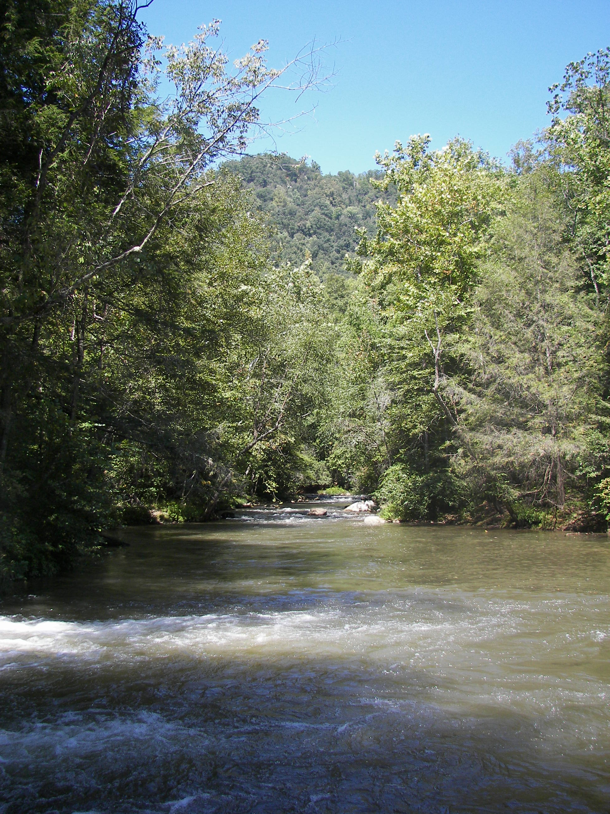
Once in the water I wasted little time heading downstream………..

1008_8474

finding more of what I came here for, – peaceful paddlin.

.

About halfway down the lake is the only human habitation on the lake, a campground – the rest of the shoreline is wooded and natural.

On occasion, the stealth of paddlin allows one to slip up on “wildlifes daily-life,” – which I like.

Human camp-life surrounding some campsites can be amusing too…

.

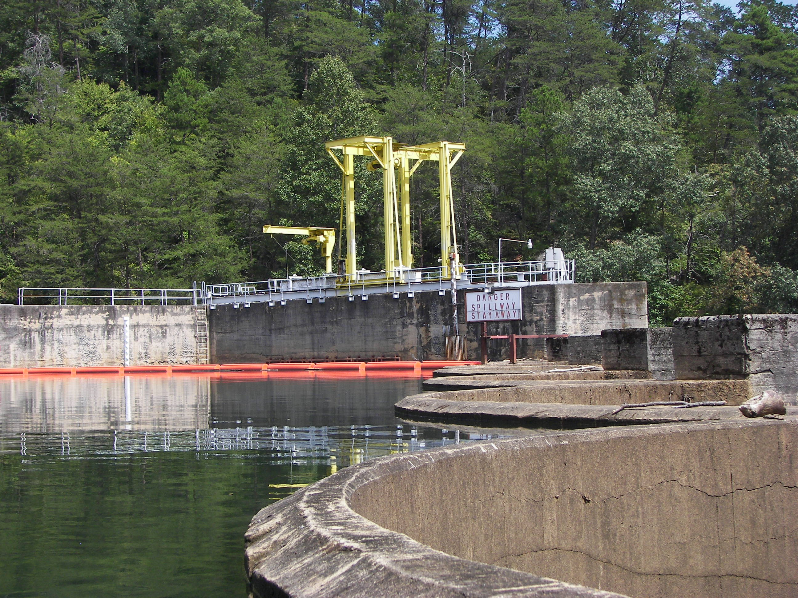
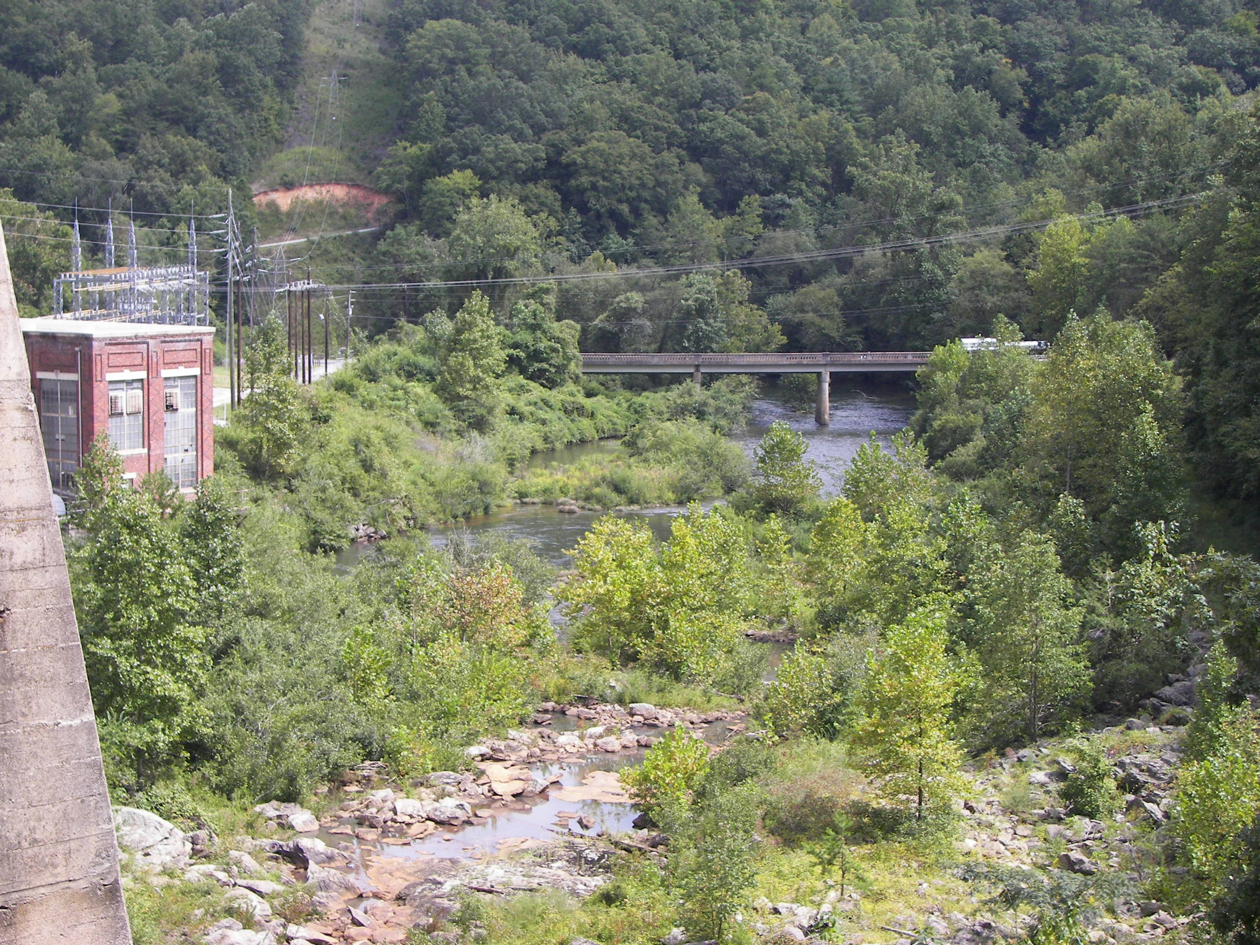
A little further down the lake is a restricted area just before the Dam, an early 1940’s effort of hydro-electrical power. There is a dirt road (Cascade Lake Rd.) that skirts the lake -which provides a better view of the falls from the road.

DIGITAL CAMERA

– and the long forgotten wooden conduit that once carried the water a few miles downstream to the old power plant.

.

The 3 pictures above are from a previous drive along Cascade lake road, it’s a pretty impressive gorge below the dam.

1008_8504.

On the return is a cove with a cement shore line, leading to an even older foundation of some sort – I even spotted the ‘lil Dipper in the daylight.

.

I am unsure of the history of this particular foundation, possibly another mill (maybe Hooker’s?).

1008_8528

But back to paddlin…

How about a dinosaur spine?

.

There were foraging deer in this one marsh area, also a beaver dam with signs of activity.

It was a relaxing morning paddle; tranquility base, ez pace.

Appreciating the opportunity of the moment, and that it is a small lake with limited access. Few really know about the lake part of it.

1008_8563.

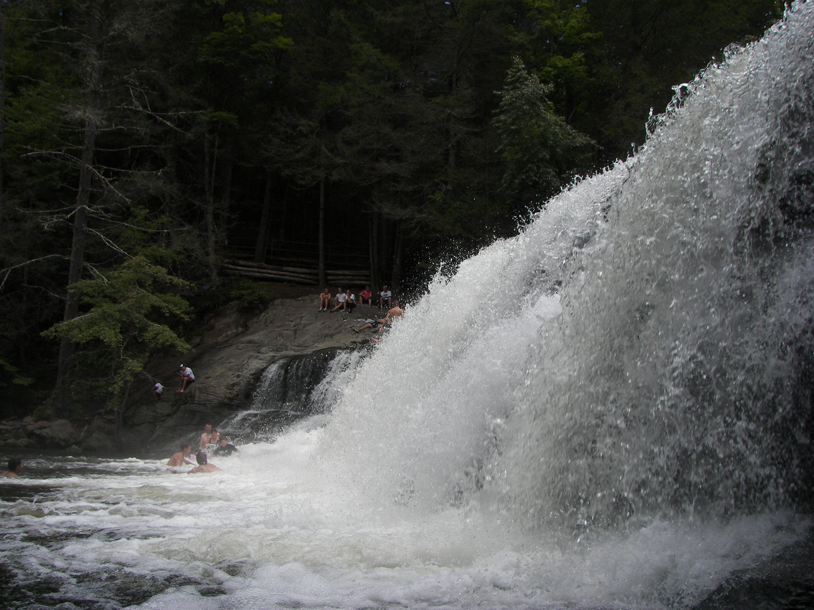
But many more know about the falls.  Back at Hooker falls it was a different story. As I rounded the corner in a peaceful state of mind, it was a different story. It was August heat Friday – and, the Falls were alive with people; folks having fun. Noise, – happy noise.

1008_8570.

Cascade paddler

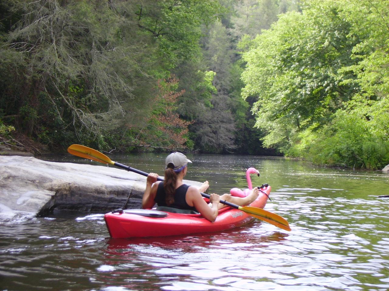
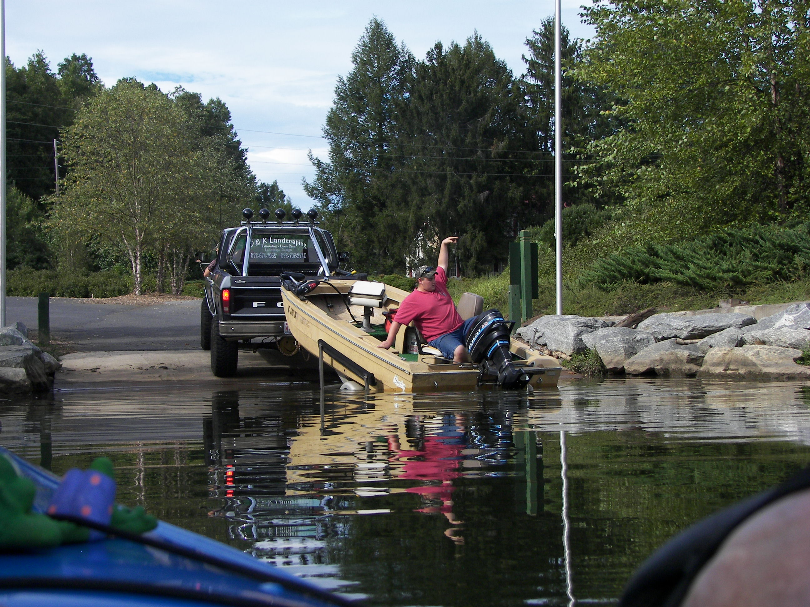
another Cascade paddler

.

After sitting in the mist of the falls, I parked the yak and jumped in the water with them……

– it was ‘fresh!’

and worth the walk for me.

Cascade Lake was a simple paddle, not a totally ‘mundane‘ lake – alot of it has to do with Why? you paddle.

If time is a factor, the entire lake can be seen in three hours or less. If not, make any paddle worth the effort that you have put into being where you are, Yes! I’m saying “appreciate the opportunity that you find yourself in” – anytime of year.

‘Feet-up’

.

Lake Jocassee, SW

3 Comments

Lake Jocassee, SC

(GPS – 897 Devils Ford rd, Salem, SC)

Water clarity- 8+

Natural Quality – 8

Difficulty – moderate in distance

I’ve boated almost every inch of lake Jocassee , paddled it I had not.  There are so many coves, crevices, that it’s just not possible to appreciate them from a larger vessel, one creek in particular had been on my mind for some time; it was in the SW corner of the lake – just out of reach, so feeling the August doldrums and in the still of a morning I figured Why not?  The yak was loaded and I was on Jocassee by 10am..

Devil’s Fork State Park is a great place to begin a Jocassee trek, the Park provides three separate ramps to launch from.  For a newcomer it is tempting to launch off of the main launch at the visitor’s center, and you can – but if you launch from the remote boat ramps within the park you will save lots of time, fishing boats, and needless paddling.

Immediately at the entrance to the park make a left through the gate and follow the road (past the campgrounds) to the ‘remote boat ramp’s (@ 2 miles).  Along the way you may have to stop and pay a day-fee at the ‘can’ (honor system) but then head on through.  The first ‘remote’ ramp on the right is where alot of dive training takes place so stay left and use the last boat ramp to the left – this is where the majority of paddlers put in.

The creek that I wanted to check out was on the SW corner of the lake, Limber Pole or Howard Creek.

It was a ez paddle with the breeze at my back and there were few souls on the water – likely because it was a weekday and also because there was weather moving in, slowly.  Out on the main body of the lake afternoon weather can move in quickly creating menacing whitecaps, so my plan today was to simply run the left bank towards the westward edge of the lake.

100_8390

Top of Howard Creek, I followed it as far as I could – until I had to walk, then I walked a little further upstream, with all the August humidity the vapor coming from the cool mountain stream was apparent.

The cool water felt great.

100_8405always stuff to ponder on…..

The overcast had ‘burnt off’ and the sunlight had me ‘oiling-up,’ or spraying down which everway you want it (I like the spray on sun-block over the 80 weight rub-on), made several stops just to jump in. Water was clear, shoreline was peaceful – heard something rambling in the woods but never got a real take on it.

100_8421Lake Jocassee has many small (and large) waterfalls in and about the shoreline, the SW corner of the lake has its share of smaller (but very nice) ones – in checking the chart any creek or water marks flowing into Jocassee is a fall, some are just larger than others and most are in very peaceful coves – if you listen you will find one.

The sprinkles came and I didn’t rush one little bit – wet, is wet (and it really felt good).

Stopped for a sandwich, power bar, and a cookie – found out that blue gills prefer sandwich crust over chocolate Oreo cookie’s (which they avoided all together), they liked the vanilla ones…. (‘smarter than a fifth grader’).

100_8432Just alot peace mixed with shoreline.

Covering this corner (follow the shoreline left from the ramp) of Jocassee is an easy half-day paddle – I put in at ten and was out by 3, at a slow to moderate pace.

In an extended paddle crossing the main body of the Lake to the Northeast you will find more of the real beauty of Jocassee, the lakes channel will even crosses into North Carolina several times.  Returning you will find the nicest of white sandy beaches to the left in the large cove under ‘jump-off’ rock (mountain) – and the water, well its absolutely ‘fresh’ and clean.

100_8435

The rain came and the parka came out, it was still very comfortable.  I have been on the Lake in July when the pelting rain here would make you shiver, at that time it was warmer to get out of the boat and sit in the water until it passed – today I just eased along under the branches and rocks of the shoreline.

There is no way to see Jocassee in a day, especially from a kayak.  Taking it in ‘baby-step’s is a good idea if you can.   The lake is sparsely populated with limited camping, Devils Fork Park is a fine place to camp if need be – as for me I only had about ten miles to go for home.

As I was taking out there were two Michigan paddlers (Lansing) awaiting their ride, which was an hour or so away.  They were in a kayak and a canoe and had been camping for several days, we hung around and shared a laugh or two while it rained – talking about the shoreline sure beats talking about the weather.


More Jocassee paddling information from WNC Paddlers.


Lake Adger – NC

1 Comment

Lake Adger – NC

@450 acres

Water Clarity – 7

Natural Quality – 7

Difficulty – easy to moderate

Perception – Weekday

The upper Green River of North Carolina feeds several WNC lakes and is known as a ‘peaceful place to cast a line’….

DIGITAL CAMERA

“hammerhead”

‘The upper green’ is also known for the World Class whitewater activity which takes place through the ‘ gorge.’

.

 Lake Summit sits atop the green river, then the whitewater kayak and tubing sections of the river which ultimately flow into Lake Adger, another mountain lakeside community.

100_9498

(GPS – @ 669 Lake Adger Rd, Mill Spring, NC)

Lake Adger is about 40 miles south of Asheville, NC – nearest to an interesting little ‘railroad’ town to visit, Saluda, NC (try the music/beer/pizza of the Purple Onion or Green River BBQ).  The shortest way to Adger for paddlin is from Exit 59 on I-26, left on Green River rd (down through the 17 ‘switchbacks’) @ five miles or so to the end and another left on Silver Lake rd, and a right after the bridge to the Lake Adger Marina (4585 Lake Adger rd – for those with those Garmin GPS things) – the lake is also accessible from Hwy 9 below Lake Lure. NC.

From the Marina you have the choice of two paddle sections, Right for a shorter paddle through the wetlands and up the gentle current of the Green River (Adger option) for a several miles while enjoying the cool shade, clear water, and schools of bass swimming under you – or Left onto Lake Adger proper – on this date I took the lake paddle, Left.

As I paddled across the width of the lake a fellow in a fishing boat mentioned that he had seen an eagle – I did not see an eagle but there was a heron in the general vicinity – just up from a small babbling ‘brook’.  Lake Adger is not a wide-bodied lake as one might imagine but one in which the main channel winds through the land above the ancient river bed.

100_9288

I simply followed the Southern shore and used the shade while exploring every cove possible, two of the coves went much further than I had anticipated with each ending in a ‘wetlands’ setting, turtles were numerous.  The water was very smooth and I was both surprised and impressed with the tranquil nature surrounding these coves.

100_9307

100_9326

Continuing along the Southern shore all the way to the Spillway, it seemed every other dock had kayaks on them – I could feel that these waters were appreciated.

100_9334When I made the lake’s spillway there was not a ‘clear’ or absolute barrier; plus not feeling any imminent doom or a quick case of stupidity, I eased along the shade right up to the cement barrier…

100_9339and sat alongside this barrier – the dam.  A foot away was about a 100′ drop…

So I held the camera out and down – I didn’t feel ‘in-danger,’ but I did feel ‘the-danger.’

100_9340It was a long way up, and not a good place to be playing around because I certainly couldn’t out paddle a sudden breach.  So I moved on; sometime or another I will travel highway-9 and get a picture looking back.

100_9351Back to the trees, turtles,

– and turkeys! There were six lounging around in this particular area and three more in Jackson Cove to the North.

Now following the opposite shoreline I paddled a cove, then into a short creek and back out to a beach to rest.  Sometimes you just have to jump in…. the ‘dip’ and a snack were refreshing – this is where I noticed more wild turkeys in the field above.

100_9367

100_9369

With more than 4 hours of paddling behind and now late in the afternoon I started thinking about the marina and heading that way. The day had been just right – overcast just enough to keep the blaring sun off of me, yet sunny and warm enough to jump in too.

100_9379

Of course I love public boat ramps, it is the cheapest of entertainment – from something much more comfortable than a lawn chair...

100_9286

My memories of Adger had to do with the wind in the main channel, what I found was that on any given day the coves should provide areas of protected paddling without the wind or whitecaps.   The water of Adger held that ‘fresh’ feeling and quality that mountain lakes are known for, it is populated – but not over populated.  The natural quality is present within the coves, the fishing, the turtles, turkey and other wildlife that are present or simply passing through.

100_9298

The Lake Adger folks that I encountered were the most polite and ‘wake-conscious’ of all.  The lake had a good feel to it and seemed the most kayak friendly lake that I have paddled yet.

It was now 5 pm, and my 5 1/2 hours of paddling had made this day ‘complete.’

Upstream, right from Marina – Lake Adger Option

.

‘Running The Fence Lines’

1 Comment

Time is nearing for another road trip (end of September/October) towards Colorado.  Great chance to stop and kayak the Current river in Missouri along the way.  Looking forward to the visit with the Carr’s, then to Southern and Northern California for a wedding – then (weather dependent) maybe the Northern arch before returning to the Carolina’s, “running the fence lines” my Dad might say.

Since paddling Ocracoke in April I’ve been resigned to ‘hang close,’ saving for the trip while at the same time enjoying the cabin-life at Lake Cherokee.

It became an unexpected bonus to have the kayak so handy that it simply takes the urge, a fresh beverage, and in no time I’m gliding backwards from the dock onto the flatwater and paddling towards the shady side, all the while watching for wildlife, relaxing, and pondering simple observations – the kayak has become as comfortable as any lawn chair I’ve ever sat in.

With this time I have accomplished several things, 1- improving on my fly-rod casting from the kayak, its still coming along, but I was initially reminded about the the laws of inertia – you know that equal and opposite action thing.  It seems as you cast that the kayak absorbs the motion and moves in the opposite direction making the cast less effective, then the kayak drifts into the line – its getting better, but I only see more time to improve.  I’d also like to have or invent a rod-holder which lays the rod out the bow.

2- beverage holder, the trick is the container because there are few places that you can actually put a beverage ‘holder’ in a kayak that’s not in the way (or will be spilled) – and on occasion I want something other than a bottle of water.. I’ve got this one mastered.

3- a camera holder on the bow also, I’m working this one – it just may have to double as a rod-holder or vise versa, I would’ve loved to had one at Juniper Springs.

Simply-put there is alot of highway between here and there and I want to see it without being in a real hurry – the ‘Chuck-wagon’s’ been checked-out, wheels/bearings-packed and I’m ready to ride.

The Chuck-wagon

Besides all the interesting stuff along the highway, I would like to kayak below the Hoover Dam, and with the time remaining before departure I”ll continue to ‘googling’ all my options to make the most of such a trip.  Certainly I will post as I go, Why-not?

Older Entries Newer Entries