@500 acres
Water Clarity – 8
Natural Quality – 8
Perception – weekday
(Lat: 35.247663 Lon: -83.0715282)
.
.
For many years while raising a family, it was simply about making it from one ‘payday to the next – occasionally ‘extra’ funds would show up, it was always a short-lived feeling. Inevitably and within the same mailbox there was yet another bill (usually from an insurance company) that that completely wiped-out that breath of a ‘windfall’ from the equation. Nothing bittersweet about it, it was sour everytime. Years passed and the kids grew up, for the most part that era passed also – well, until last week when the spike in my health insurance for the coming year reminded me of that sinking feeling from years back – the insurance/medical racket stinks.

As good as life is (and it really is) the feeling this circumstance brings is totally relative to the “one step forward two steps back” saying. Instinctively I know it boils down to tackling the issue and moving on, but the thought of it has certainly swayed my ‘ire the past few days.

(GPS – Bear Lake road, Tuckasegee, NC)
So you see my mind wasn’t really on paddling yet at the same time I really needed to ‘paddle.’ My choices for the day were to explore lake Tugalo with some friends, Nantahala lake, or go solo on lake Bear – I took the lone paddle route as not to vent but to find a pause for it all in my own simple way.

‘Bear Creek Lake’ has been sitting quietly up the road for me, an isolated but convenient little lake for just such a day – couldn’t have been a better time for it.
“fishin here”
Bear Creek Lake is part of the Duke Power Nantahala system, the east fork of the Tuckasegee river, the lake is just under 500 acres and with 13.5 miles of shoreline and can be completed at a leisurely paddle in less than 6 hours – perfect size for a day trip with plenty of coves and fresh creeks to hold your interest, really nice place.

The weather was ideal, so my basic objective was to paddle to the farthest point – ‘headwaters’ (southeast) before working my way back along the opposite shore – I would finish up by paddling the coves of the spillway/dam area.
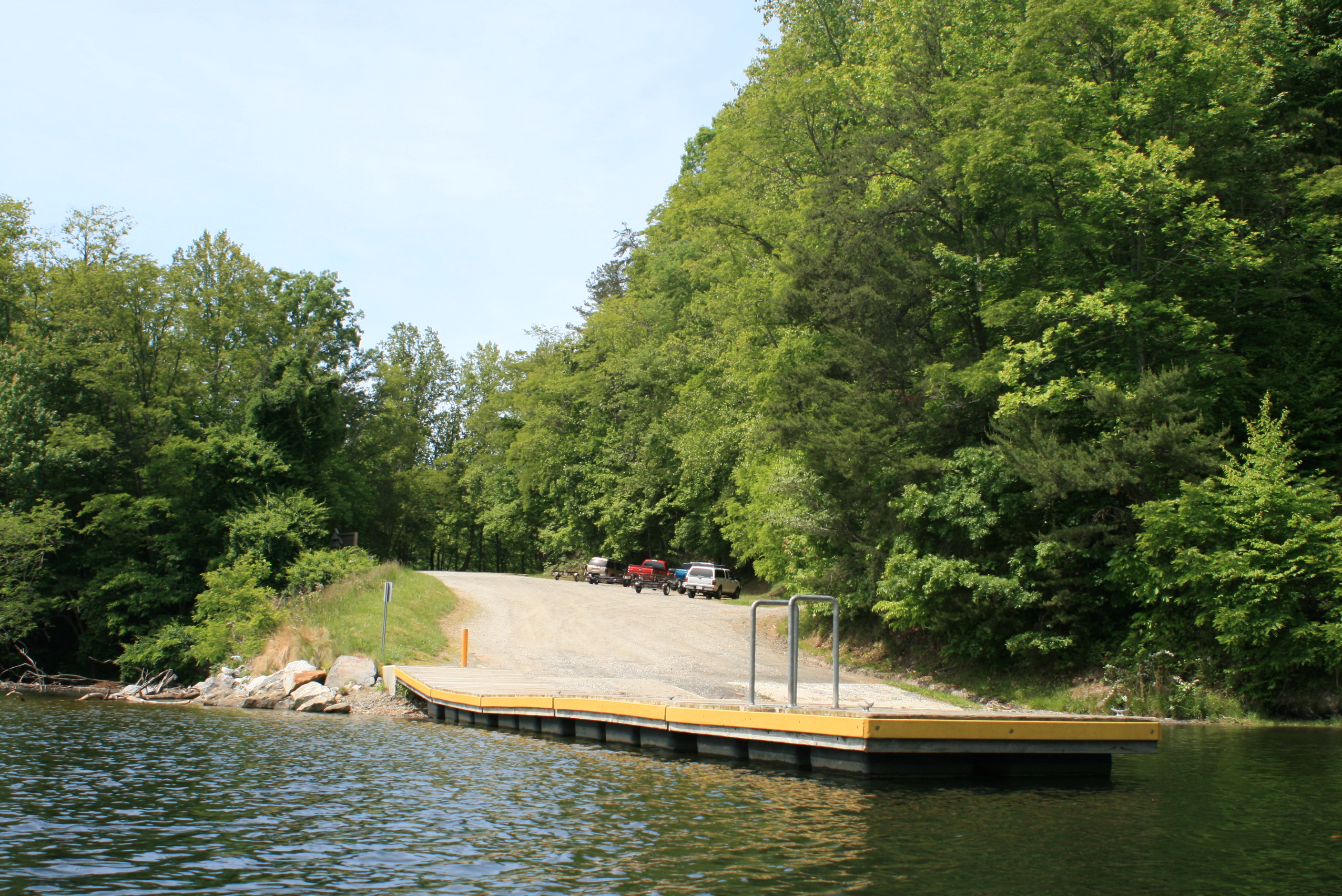
After a small delay (I ran past the boat ramp off hwy-281) it was good to be on the water and paddling – even though it was 1130 am, a later paddle.
I’m not sure if there is any scientific explanation to it but there are times that the water of a lake can feel ‘thick’ or a little ‘thin’ on the paddle. While out west this past fall the water of several lakes felt ‘thin’ to me, like I was in low-gear and slowly moving while paddling at a normal pace – I suspected it had something to do with the elevation or maybe even my enthusiasm level for the day – but today the waters of Bear Lake felt ‘thick,’ this was a good sign.

The lake is not a distinctively round ‘body’ of water (mundane) other than the small area near the spillway – just a main channel with coves and numerous small creeks feeding into the lake. I paddled slowly at first searching ‘rhythm’ while at the same time considering my approach to covering the lake.

As I paddled towards the falls this small boat passed me with a few kids in it, they waved and moved on – I noticed their family later camped on the first of two islands. There were about five other vehicles/trailers at the ramp, fishermen. Fishing is suppose to be good here.

Thirty years ago I had a neighbor that regularly fished this lake, he was always telling me about it while trying to get me to go with him, which I never did. Since then I have found several occasions to paddle and ‘boat’ her waters, of which neither time did I take time to explore the coves – I would today.
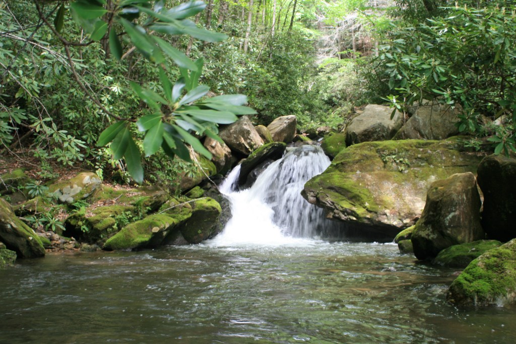
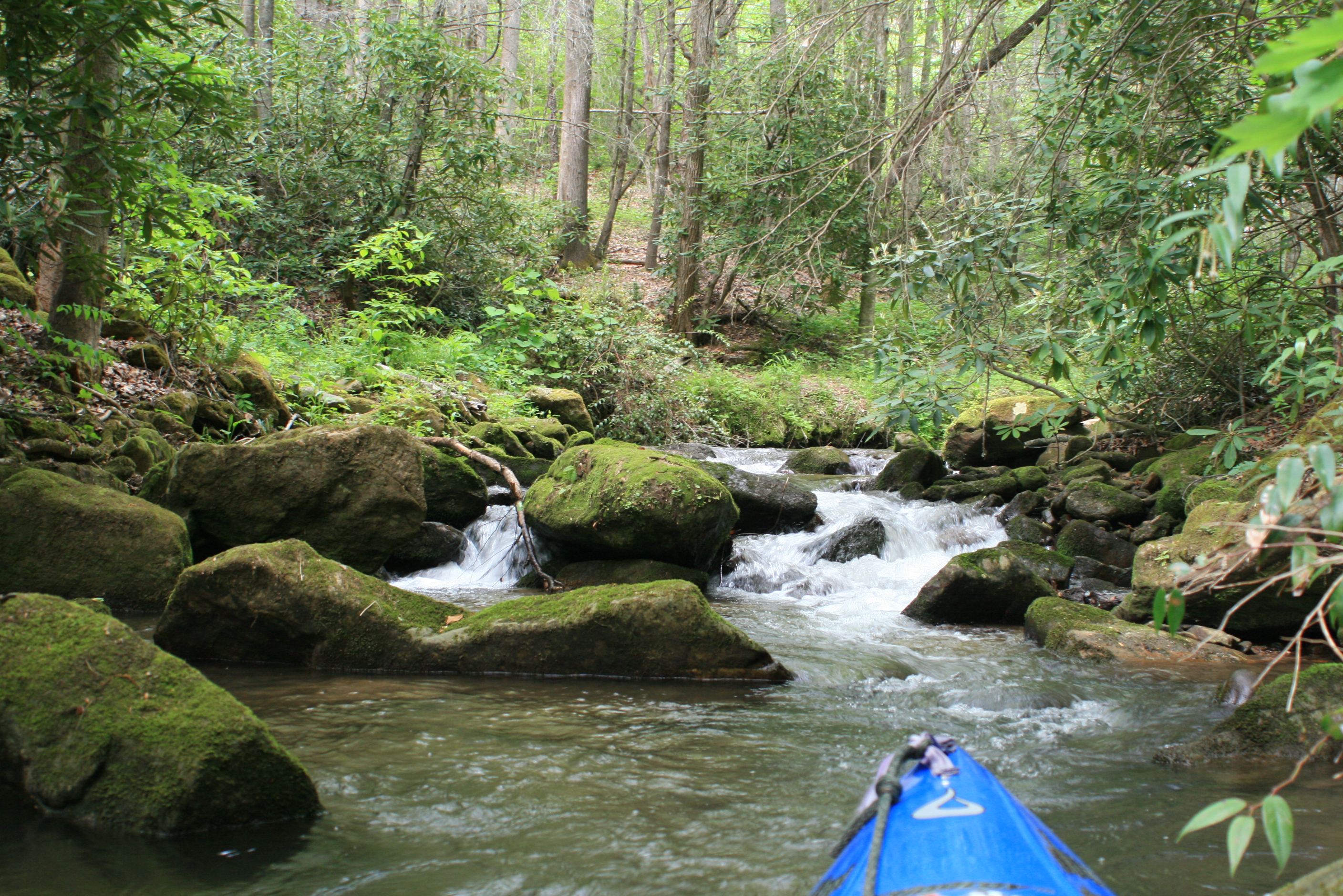
Paddling past the little island I worked to the right and up into a small cove where this small creek entered the lake.
A beautiful little creek – clean mossy boulders, distinctively clear waters splashing down into the lake while pushing cool air outward. There were small-mouth bass lingering too, a perfect place to pause with a sandwich, more distant from my @#!* week.

Soon I was back out into the lake and passing the small island where the family was camped. The cliffs ahead reminded me of the stories of wild goats that roamed these cliffs – but I have yet to see one in my last three visits.
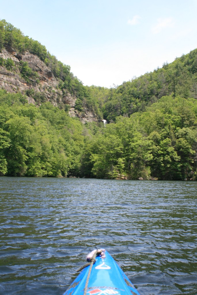
But it was easy to imagine the goats on the cliffs (like the Big-horns along the Colorado). The falls are visible if you pay attention, plus it is possible to walk a path to their base – I’ve been to them before so I continued on towards the headwaters.

The lake meandered and narrowed into the Tuckasegee stream bed, houses were few – different from all the boathouses I have noticed along my last few paddles, this is a Duke Power lake with the property immediately along shore likely leased on log-term basis, so only a few docks here – and most of them were ‘generic’ in appearance.

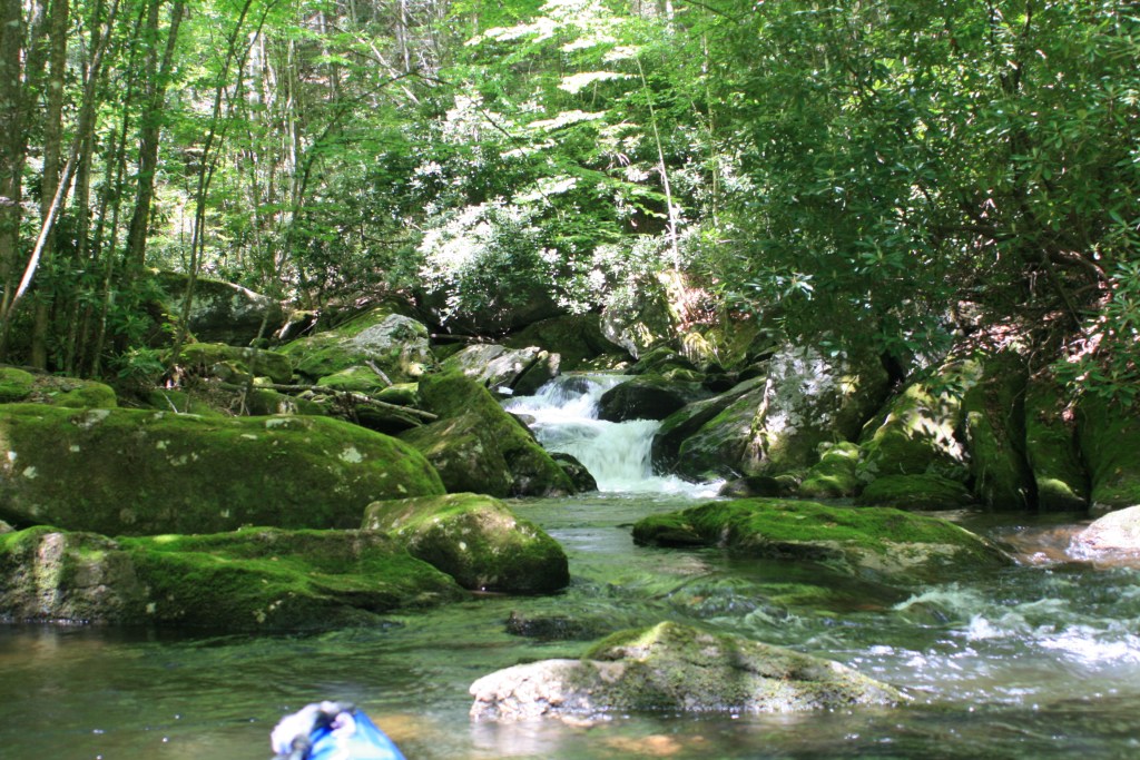
The second island of the lake marked the beginning (or end) of the headwater stream-bed.

Streams are some of my favorite places to paddle, the shade of the trees –

It wasn’t long before I came upon the seldom used bridge of Gray’s ridge rd – and a warning sign of potential rising waters.

So of course I paddled right up to the mouth of the tailrace chute, with another small stream running nearby I felt sure that this was used when water conditions and power expectations were high – no danger on this date; 2011 Tuckasegee river releases. The waters when released come from the Tanastee Lake and Wolf Creek Lake reservoir.

Turn around point, 2 hours. Looking back down the river bed towards the lake, a quick stop – then a slow paddle back.

Past the little island at the mouth

and back out into the lake towards more fishermen floating along.

I did paddle to the creek of the falls, again – same beautiful flow into the lake as with three other coves I had seen – there were more to come.

Paddling past the first island I wondered how long the family might have been camping there, then after clearly hearing the father and mother scold a child – my answer was; “long enough.”

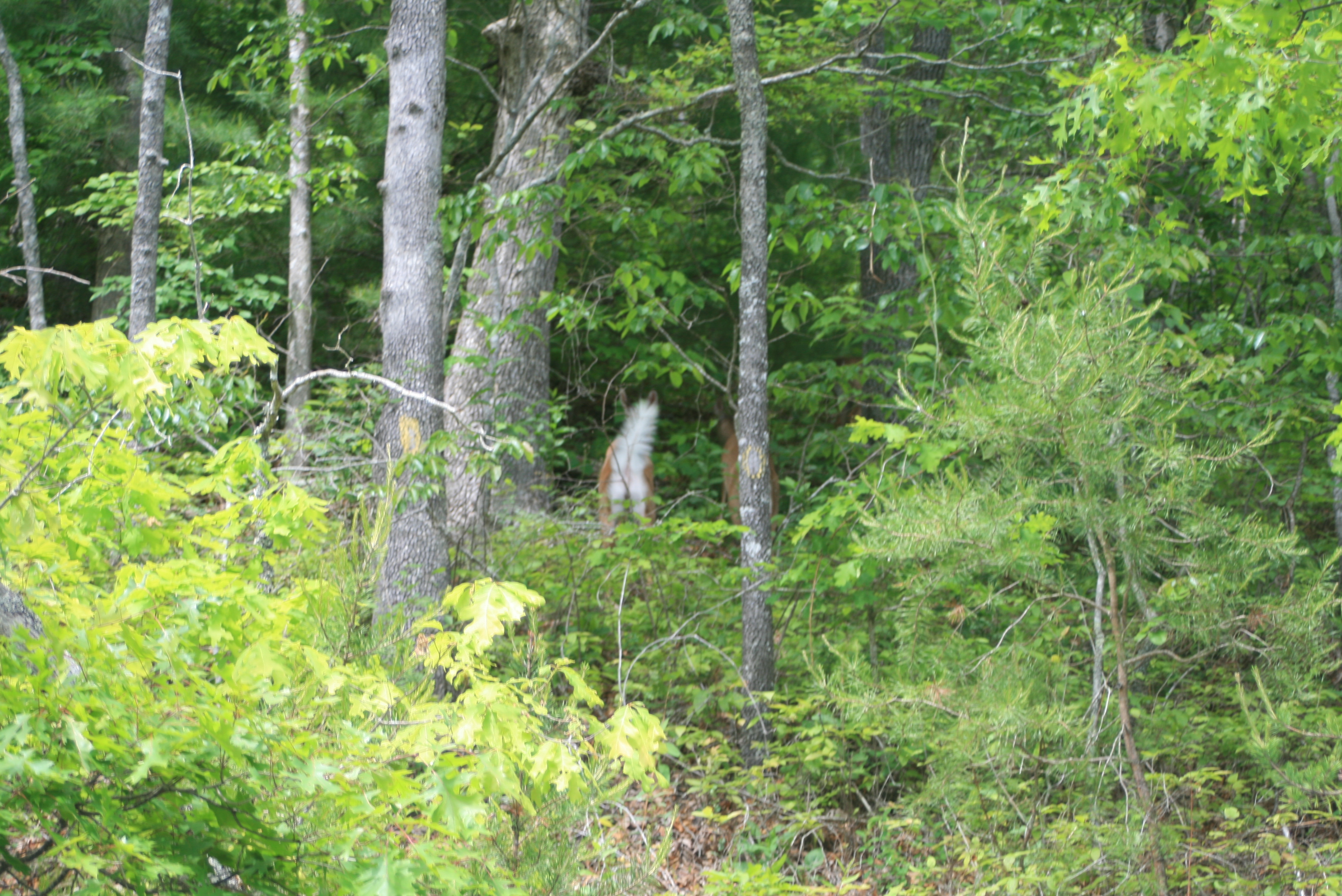
So I found more peaceful waters and after several occasions of hearing something moving through the leaves on shore I noticed this small herd of deer – with one good look (from each of us) they were history….

More babbling brooks

and coves to cool off in…

Making my way back out to the dam/spillway area one of those generic docks had ‘broken loose’ – wonder if I could pull it home?

Bear lakes spillway and release area.
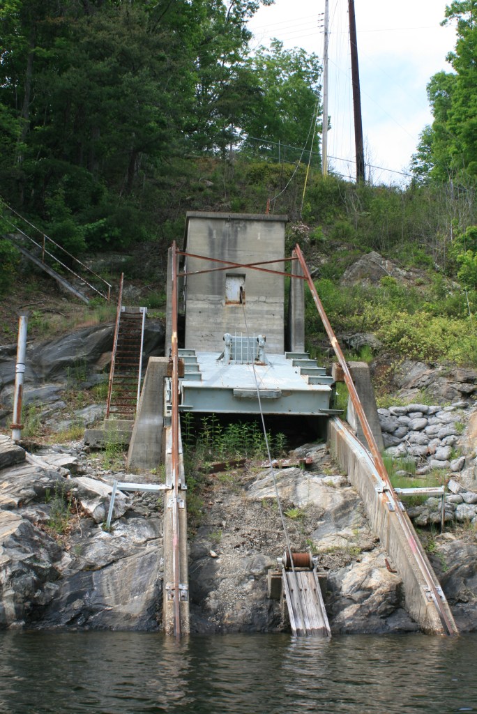
Near the spillway is the dam thing, I suspect a water bypass system for when the structure needs repair or maintenance.

With time left to explore the coves of this area also, more generic docks, several more homes.
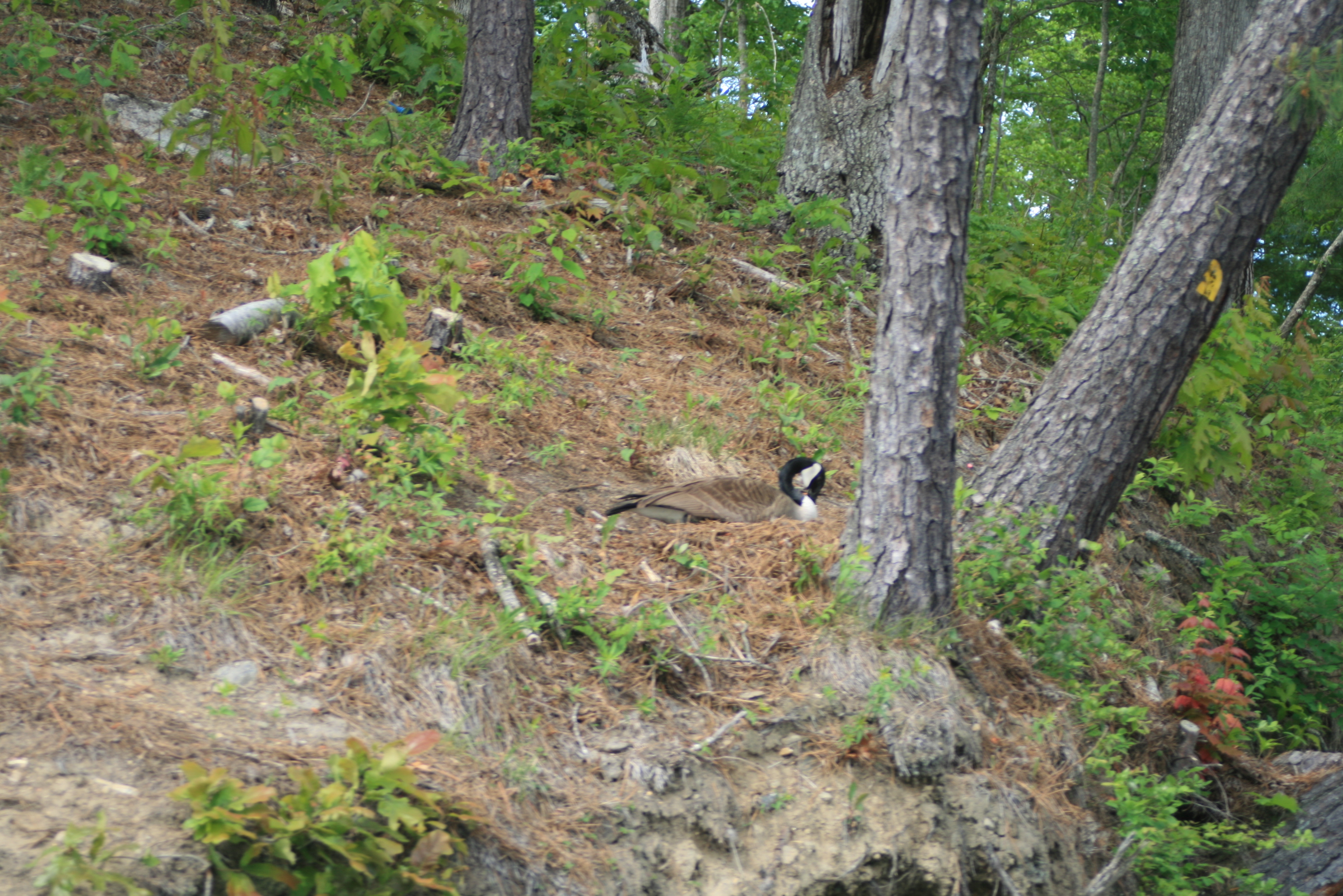

‘wildlife’ too

These were interesting tent-like structures built upon some platforms not too far from the landing, later learned they are called ‘yurts,’ not sure of their full story – but likely good ‘in-law’ roosts (keep them from staying forever).

Paddled right on past the boat landing and further into the cove and wetlands nearby.
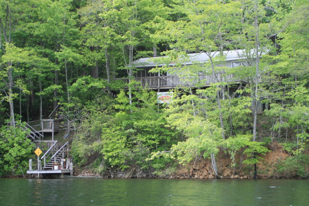
Past a home with a “Jim’s Landing” sign tacked to the porch the lake turned into a ‘wetland’ protected cove, always good to see, even better to quietly paddle through.


With yet another babbling brook.

It was now about 5 pm and I had been on the water a little less than six hours – just right for what I needed.

– a good day and Bear lake is really a perfect place to paddle with its Natural quality and size, try it sometimes….
.
(and yes, it helped to get ‘stuff’ figured out, – ‘life’ is indeed good)
.


May 21, 2011 @ 17:12:01
We feel your insurance pain too. Glad you had some sunshine to drift in.
ps. those tent like things are called Yurts. Jon and Kate are putting one up on thier property as we speak. they are pretty cool! In Law roosts indeed!!
LikeLike
May 21, 2011 @ 20:10:14
Thanks Jessica, hope that you get some sunshine soon too
LikeLike
May 23, 2011 @ 11:13:33
Just did that nasty today (insurance). Love the post. Your writings touch all who read it.
LikeLike
Aug 05, 2013 @ 18:50:54
My brother recommended this website.
He was totally right. This post truly made my day.
Thank you!
LikeLike
Jan 27, 2014 @ 19:14:25
great photographic tour of the eastern tuckaseegee river lake of bear creek ,strong work!!
LikeLike
Nov 01, 2015 @ 19:41:14
I am planning a trip thanksgiving weekend. It’s between Santeetlah and Bear. I know there is camping allowed on Santeetlah…..is it possible to camp on Bear Lake too?
Any suggestions/preferences between the two lakes?
LikeLike
Nov 02, 2015 @ 07:34:55
Santeelah is an awesome place (even cooler water) with more facilities available fore camping – much larger lake. Bear Creek is a simplistic lake and in November camping could be found on the little island mentioned, no organized facilities. Both are fine places to paddle, hope this helps – have a great visit
LikeLike
Nov 02, 2015 @ 19:37:57
Perfect. I am a bit of a minimalist when it comes to camping. I have been mostly doing section hikes of the AT and the Linville Gorge since moving here. I got a really nice fishing kayak from a friend, and have taken it out, overnight, a couple times. Want to see how far I can push it. Basically pack what I would for a hike, and of course hope to catch fish as well.
Thank you sir.
LikeLike
Mar 18, 2023 @ 12:34:47
Hi!
It’s possible to use some of this images to illustrate a writing dedicated to the rattle snakes and Bear Creek Lake?. To publish in our magazine dedicated to the reconnectin with nature: Natura Amantes Magazine
LikeLiked by 1 person
May 05, 2024 @ 17:41:37
Sure
LikeLiked by 1 person
Aug 21, 2024 @ 14:24:03
sure
LikeLike