.
Post 1 of 3
“LAST CALL”
(high water ahead)
Fargo, Georgia to the Gulf – at Suwannee, Fla
221 river miles
.
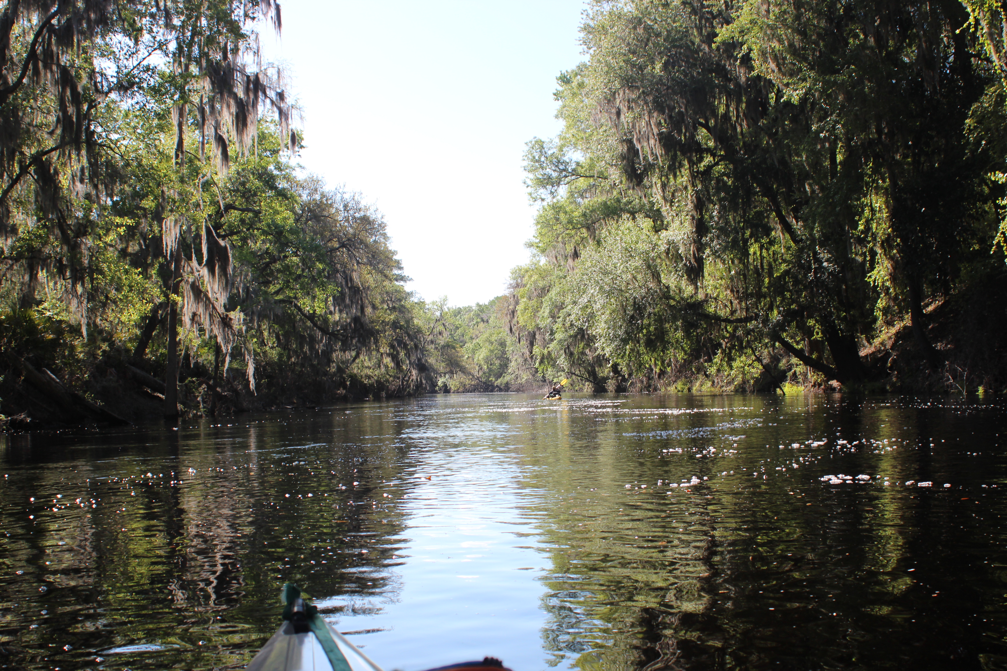
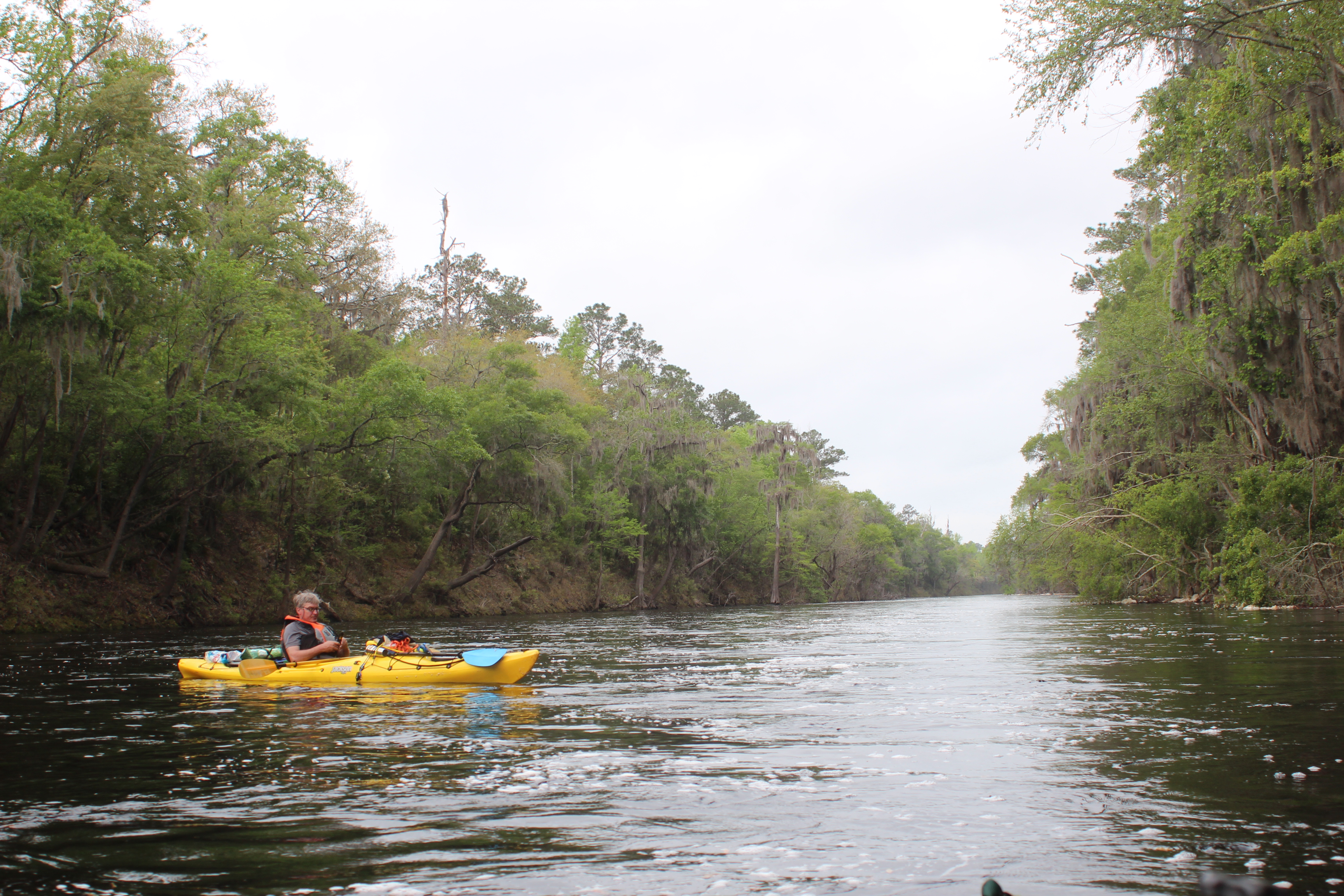
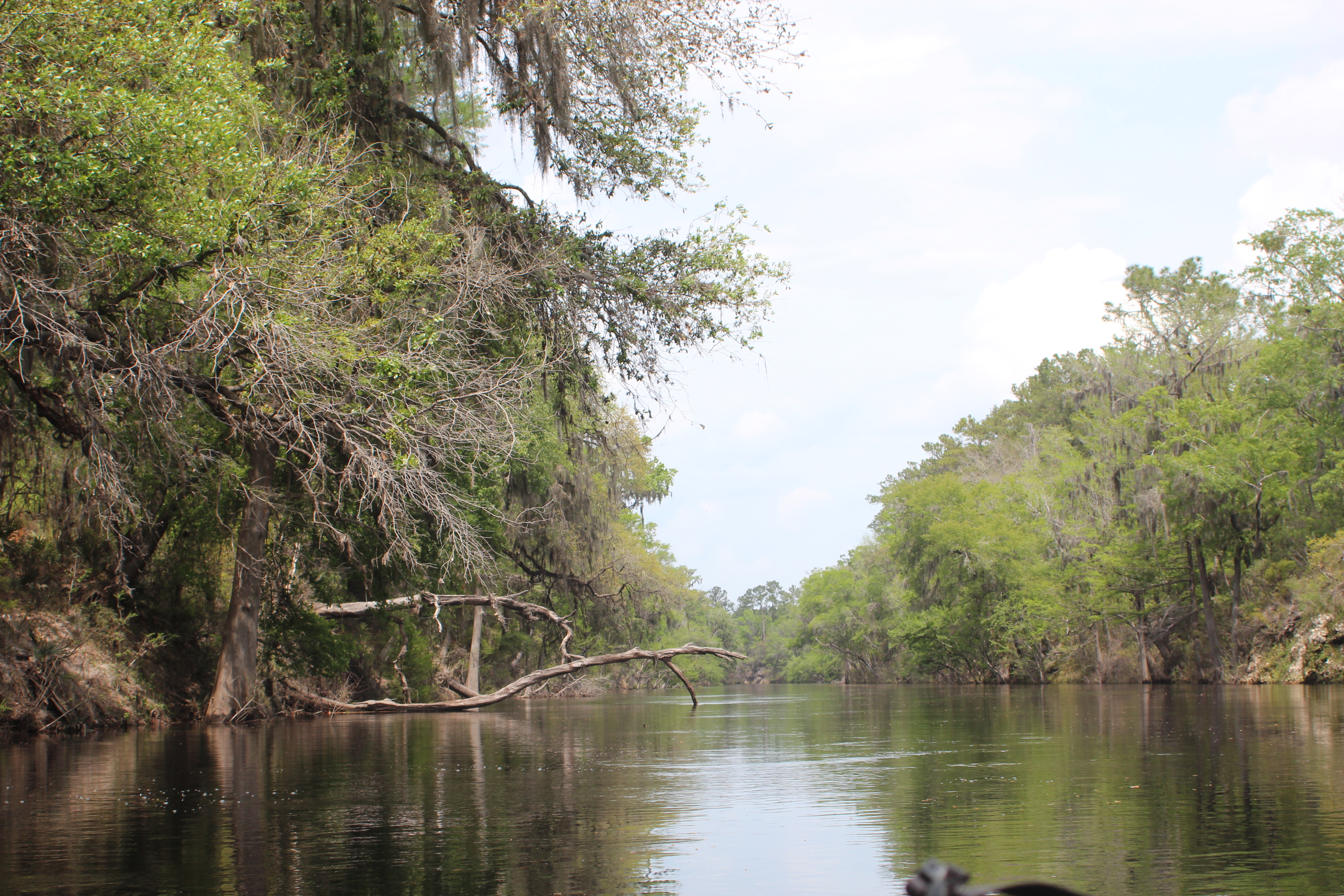
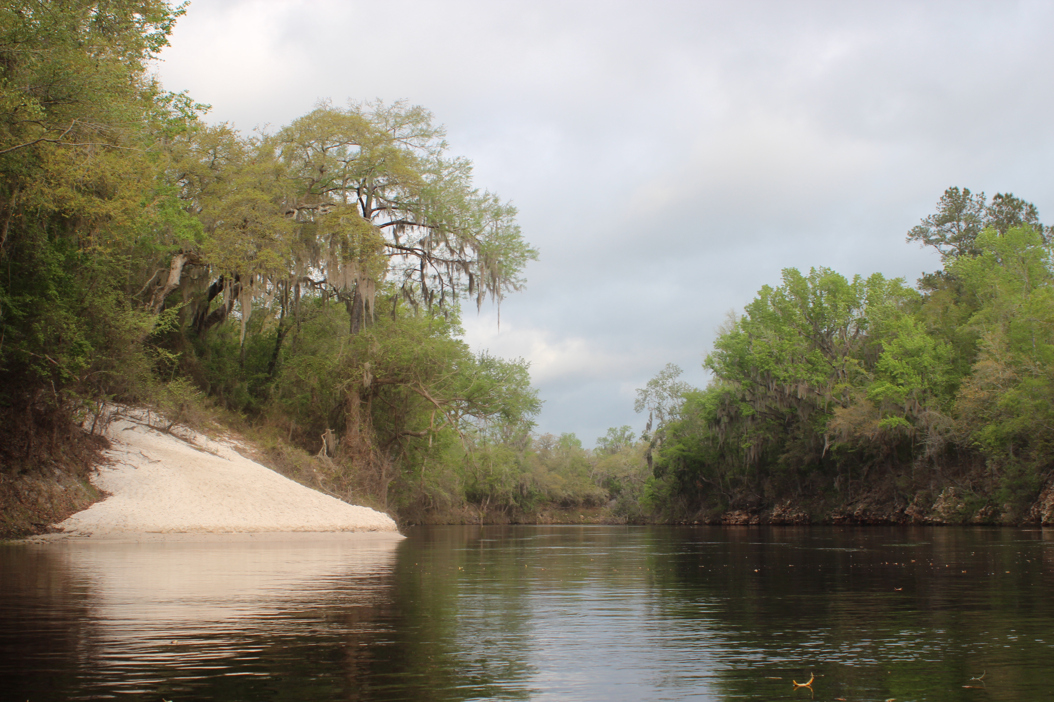
The Suwannee River begins it’s journey as still marsh-water within the Okefenokee Swamp of Georgia, then a creek develops into a full-blown river as it crosses two states on its journey of life to the Gulf. The rivers distance from the swamps of Georgia to the Gulf of Mexico at the small town of Suwannee, Fl is about 240 miles (Suwannee Mileage).
A leisurely paddle of the distance in a kayak or canoe, from Fargo Ga; takes about ten days.

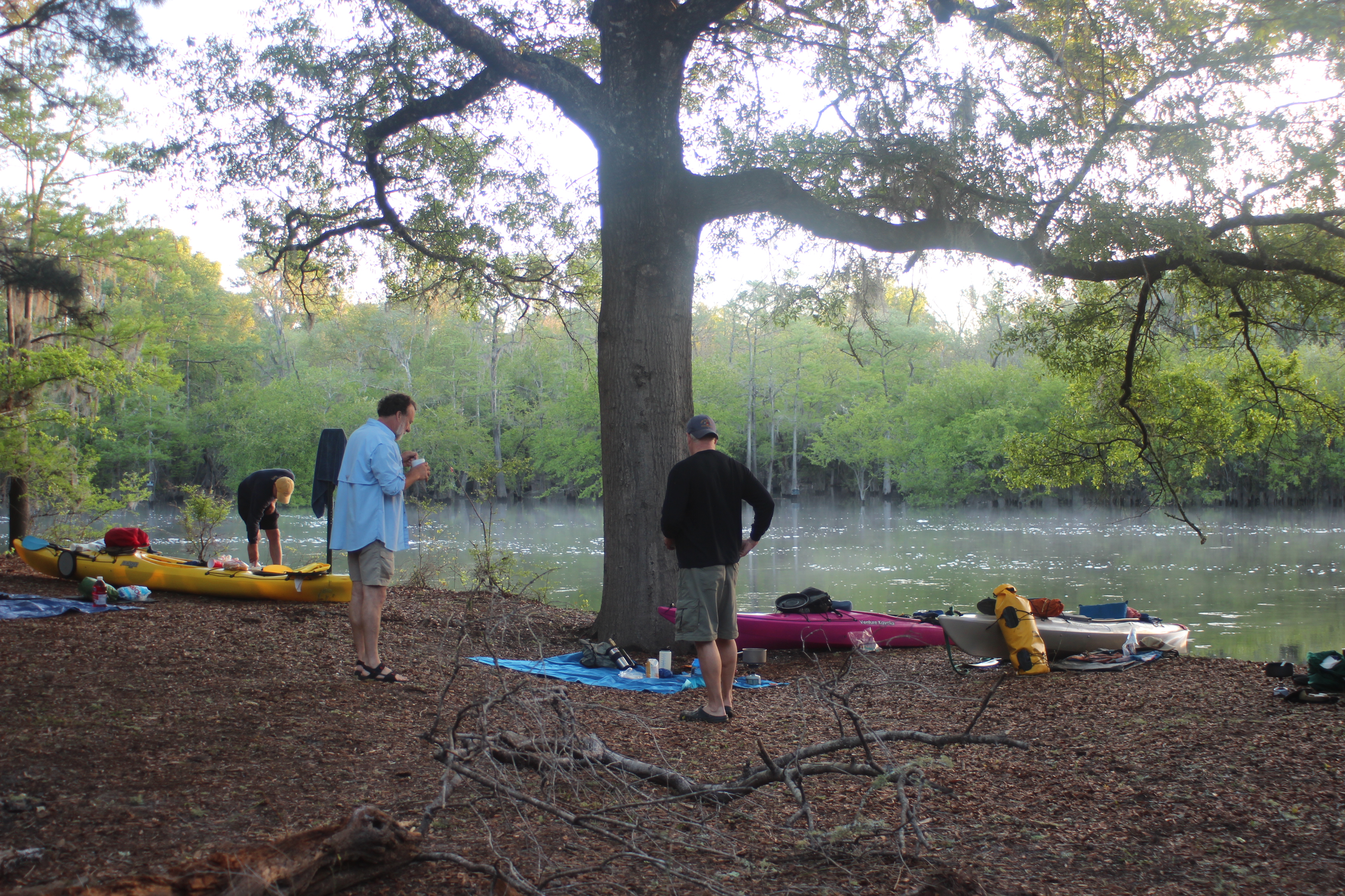
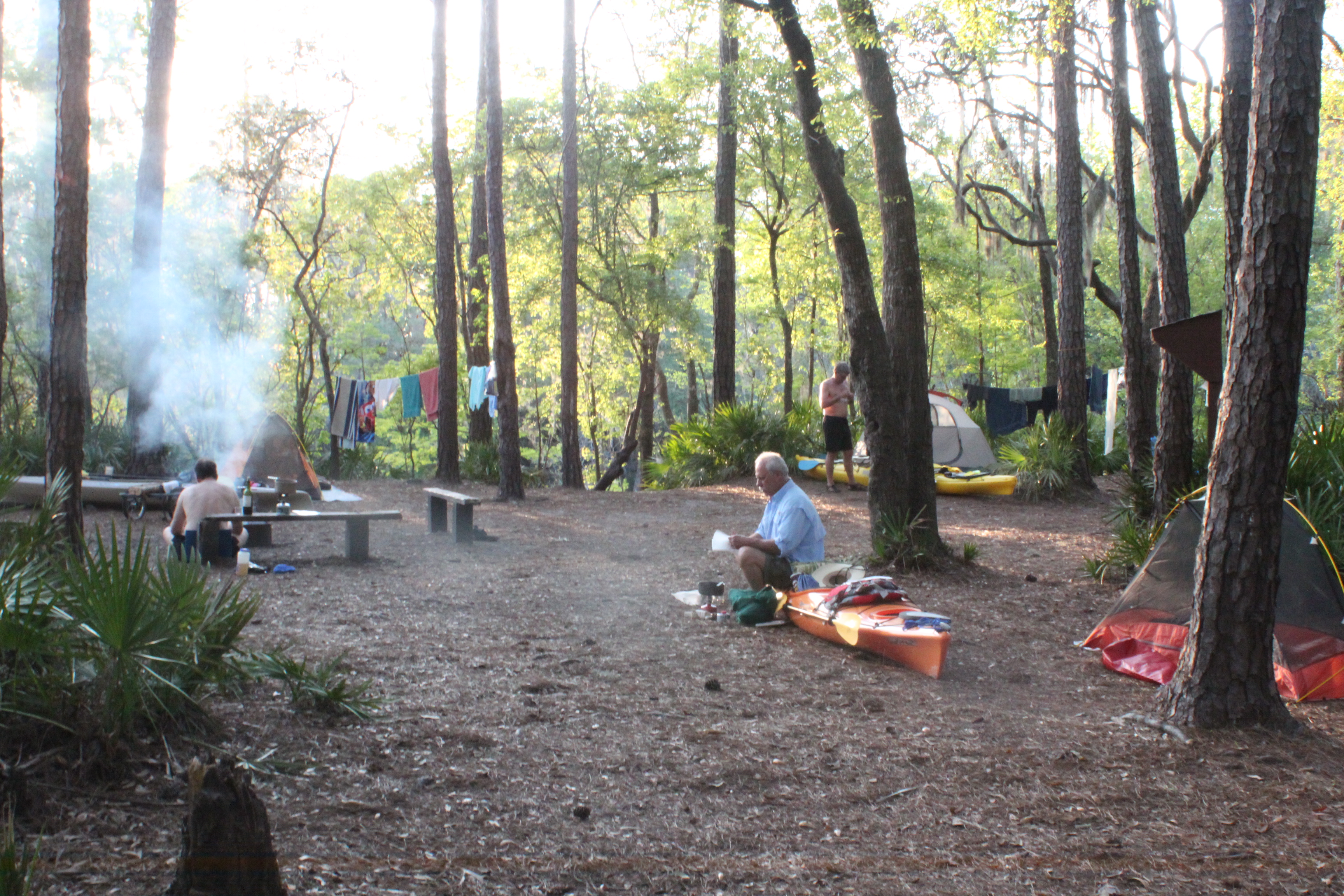
Several friends; Carl, Gordy, Richard and I, met-up at the closest hotel – just as we had for last years paddle. This was the third year for Gordy and I while Carl/Richard have stroked two (canoe/yak) trips to the Gulf.
.
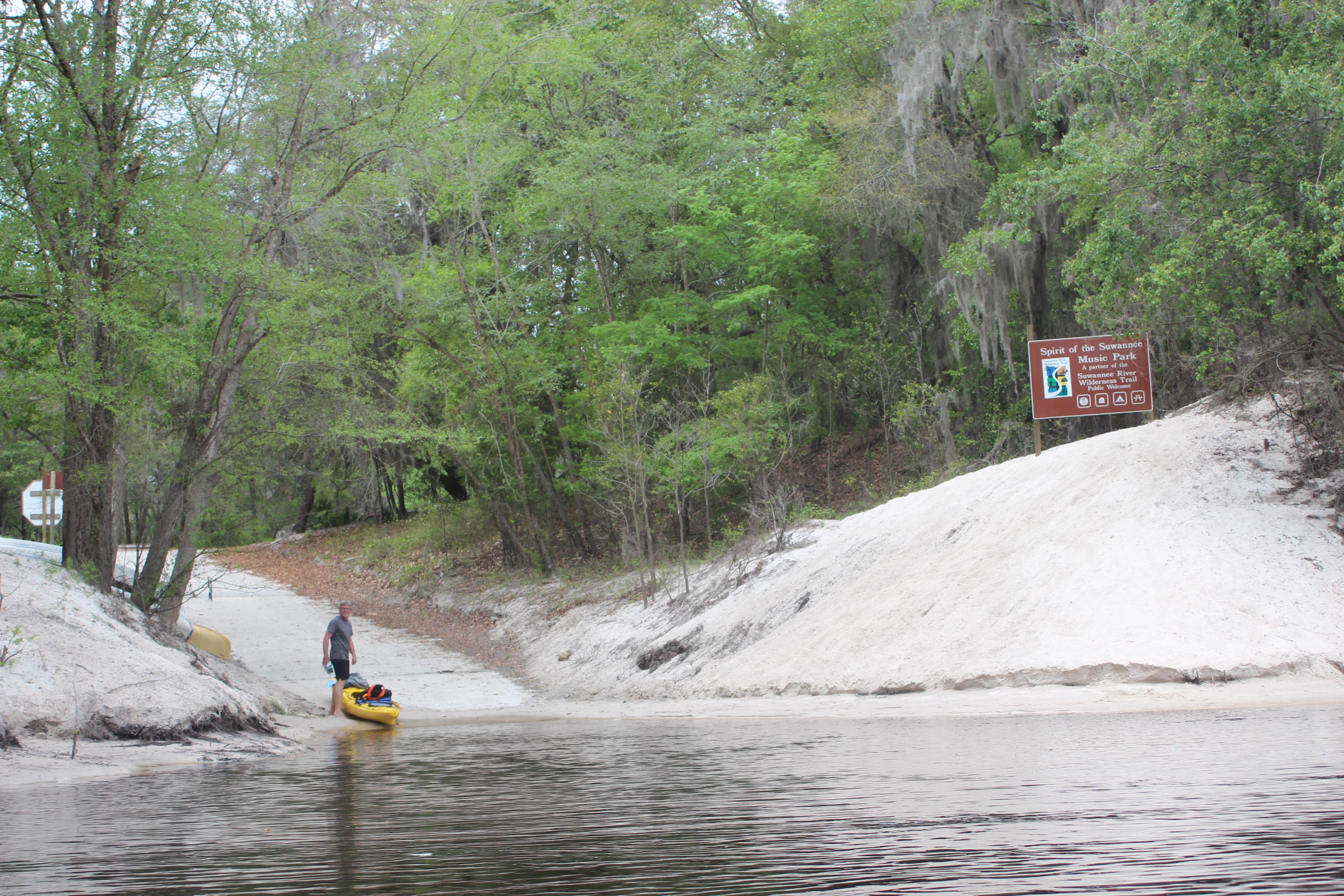
The shuttle would take us to our ‘put-in’ at Fargo Ga (from the Outpost within the music park) and schedule to pick us up in Suwannee,Fla 11 days later…..
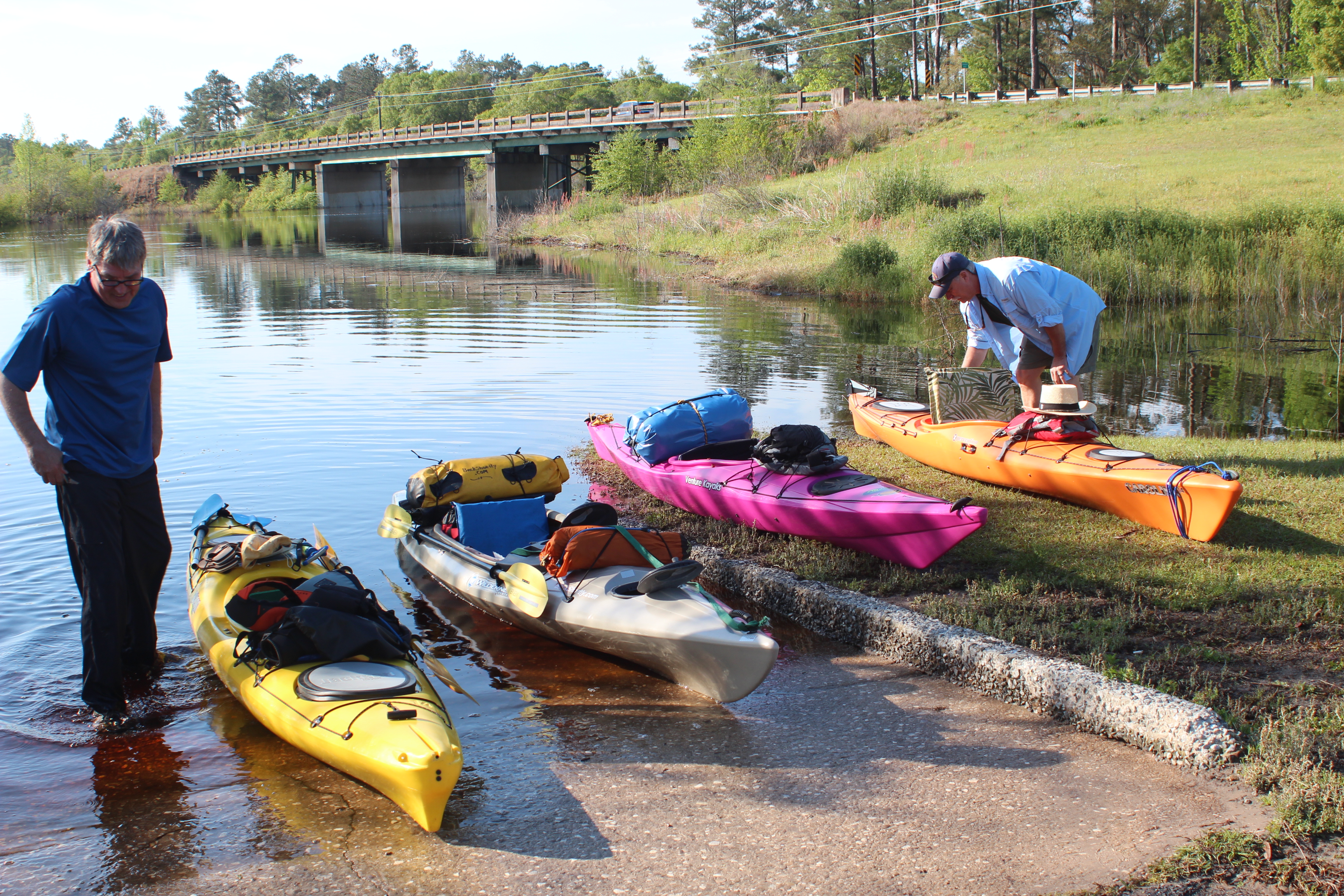
and we were on the river well before ten in Fargo, Ga.
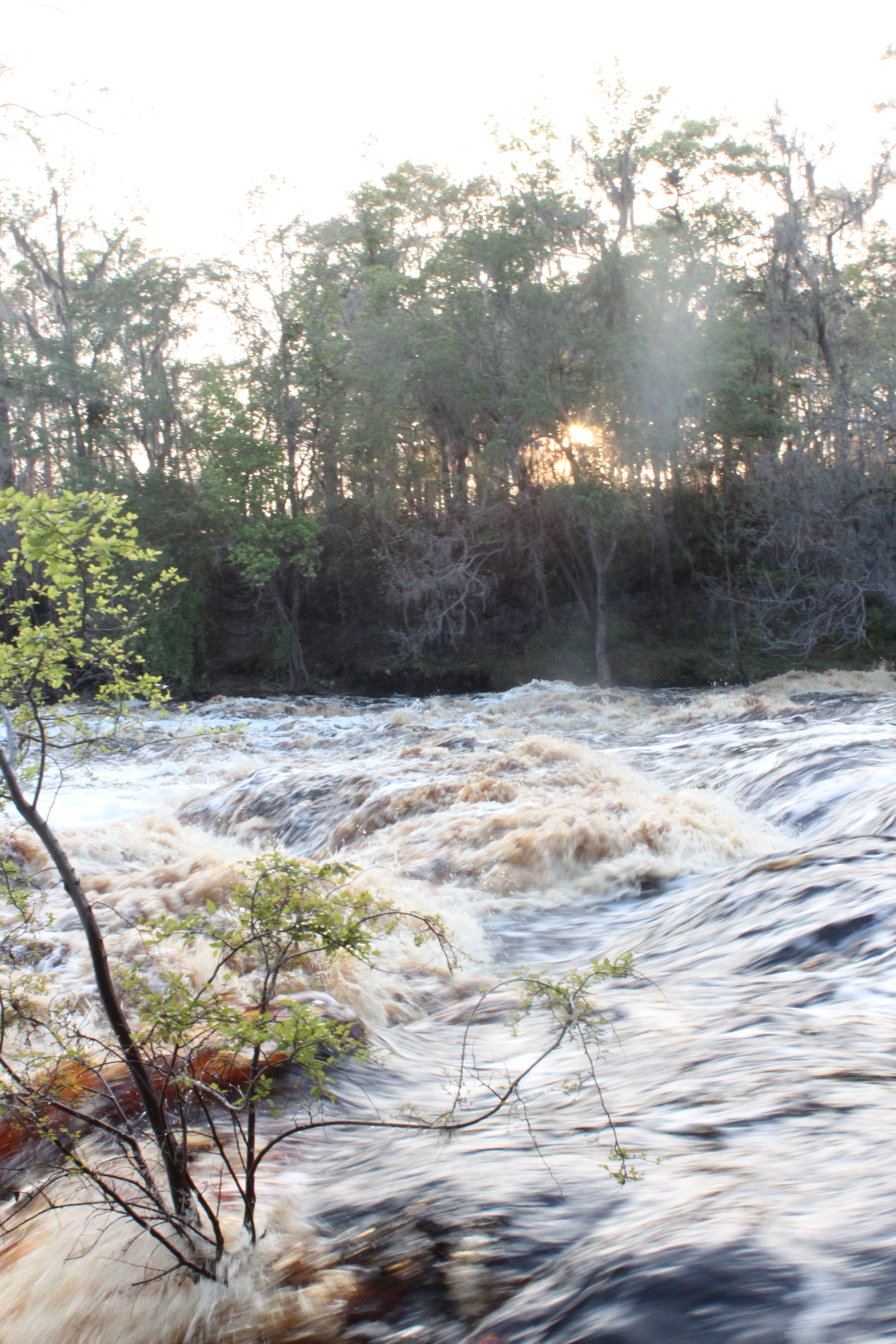
There is little we can do about it, but one thing to watch when paddling the Suwannee is the water gauge reading at White Springs. The recommended paddle level is a reading of over 52 feet, for our paddle this year it was ‘holding strong’ at 60 feet. After paddling the distance two years ago with a reading of 50 feet! I was eager to learn the difference this volume of ten feet would make; maybe I could retrieve some ‘rewards’ from the first trek’s vigor.
We were quick to find a very positive difference….
The 60′ reading provided a solid base of flow for the entire length of the river to the Gulf – I can now highly recommend paddling the river at this level.
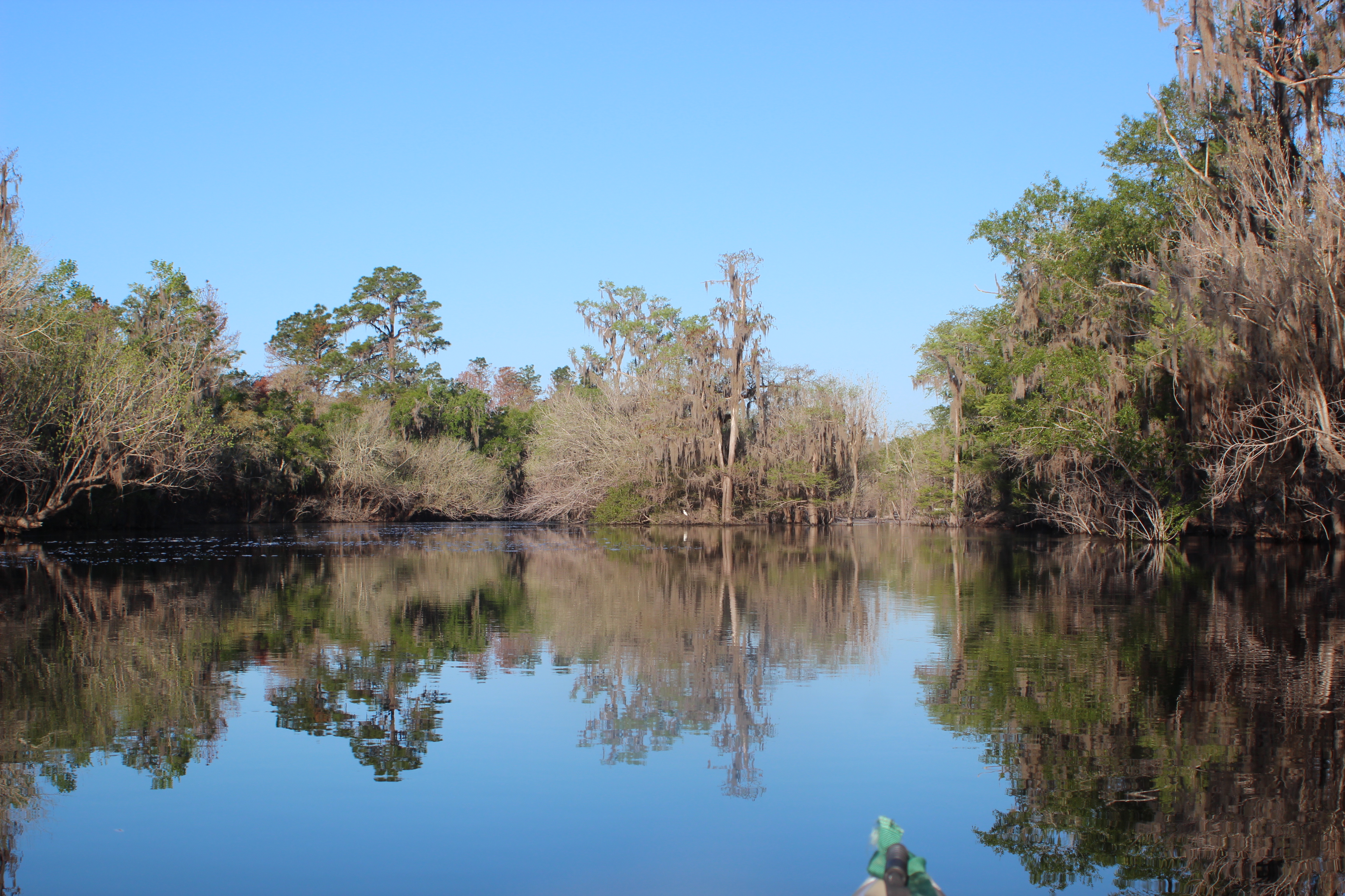
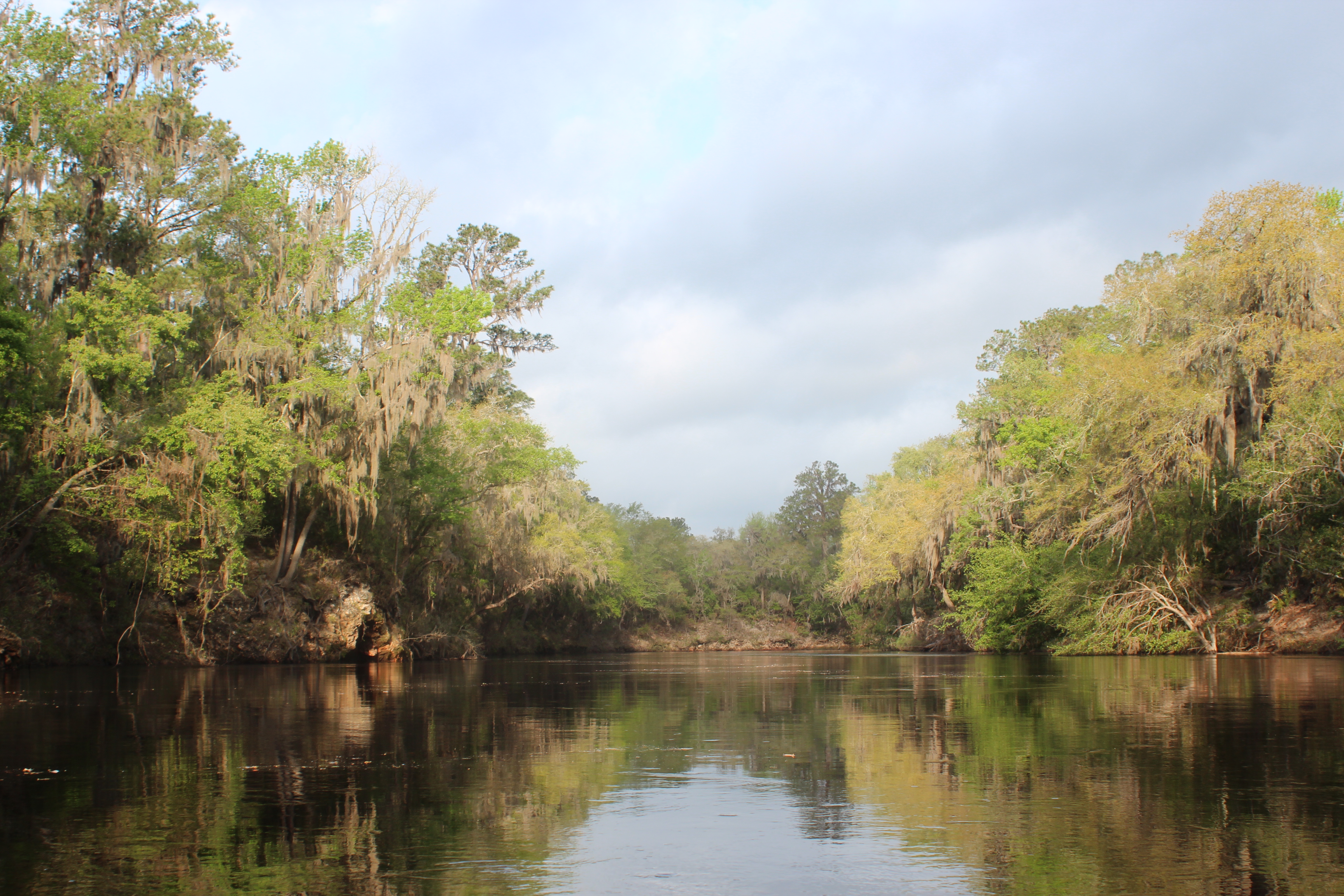
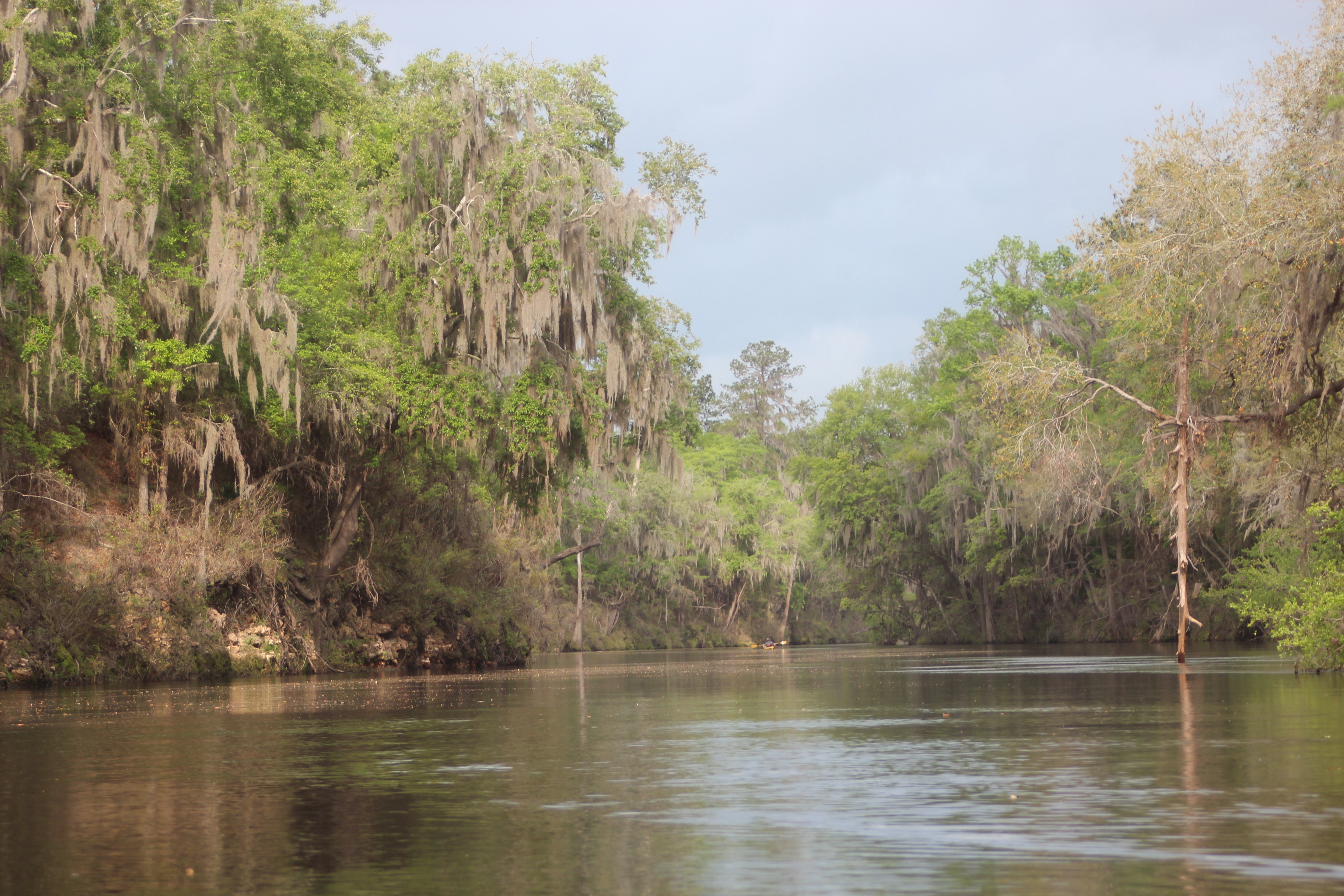
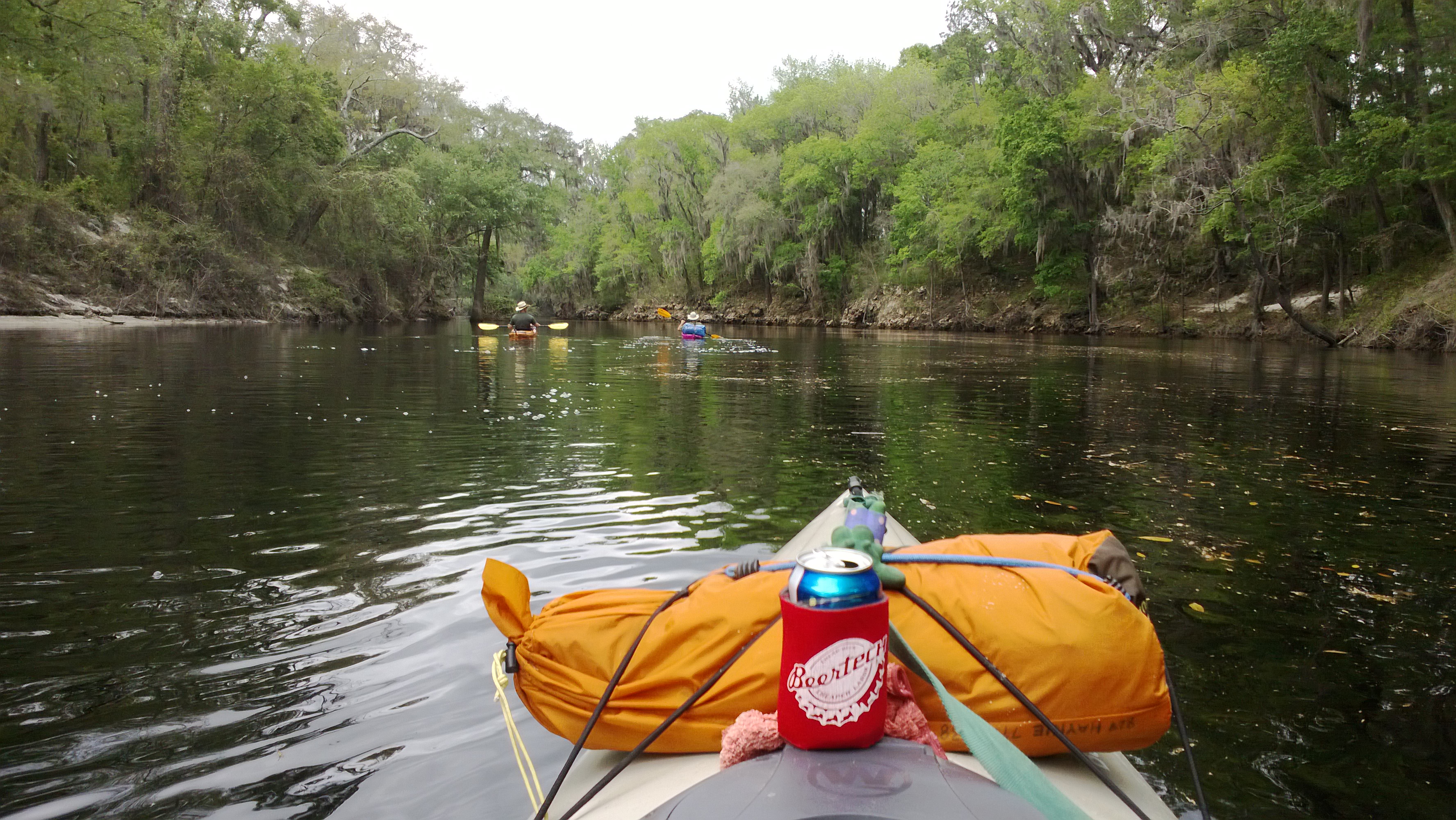
It is true – you will miss some of the characteristic roots and relics of the setting with the higher level, many of the smaller shoals will be hidden, and some of the springs of the river could be closed from an influx of those tea-colored tannic waters of the Suwannee (gators can get into the springs too). But as far as paddling; the higher waters provided a welcomed ‘ease’ to any paddling efforts. Twenty-plus mile days are with simple effort, the halfway point and any ‘benchmarks’ are easily attained. I could relate a similar feeling to the ‘free ride’ offered by the Current river.
Paddling ‘with current’ over distance allows a simple education of how currents/flow/eddy’s effect the maneuvering of your vessel. Distance with a solid (class 1,2) flow should be a requirement for all paddlers as an introduction to ‘flat-water’ basics. Current includes ‘decision-making’ along the way – where ‘doing nothing’ can also be an option.
 .
.
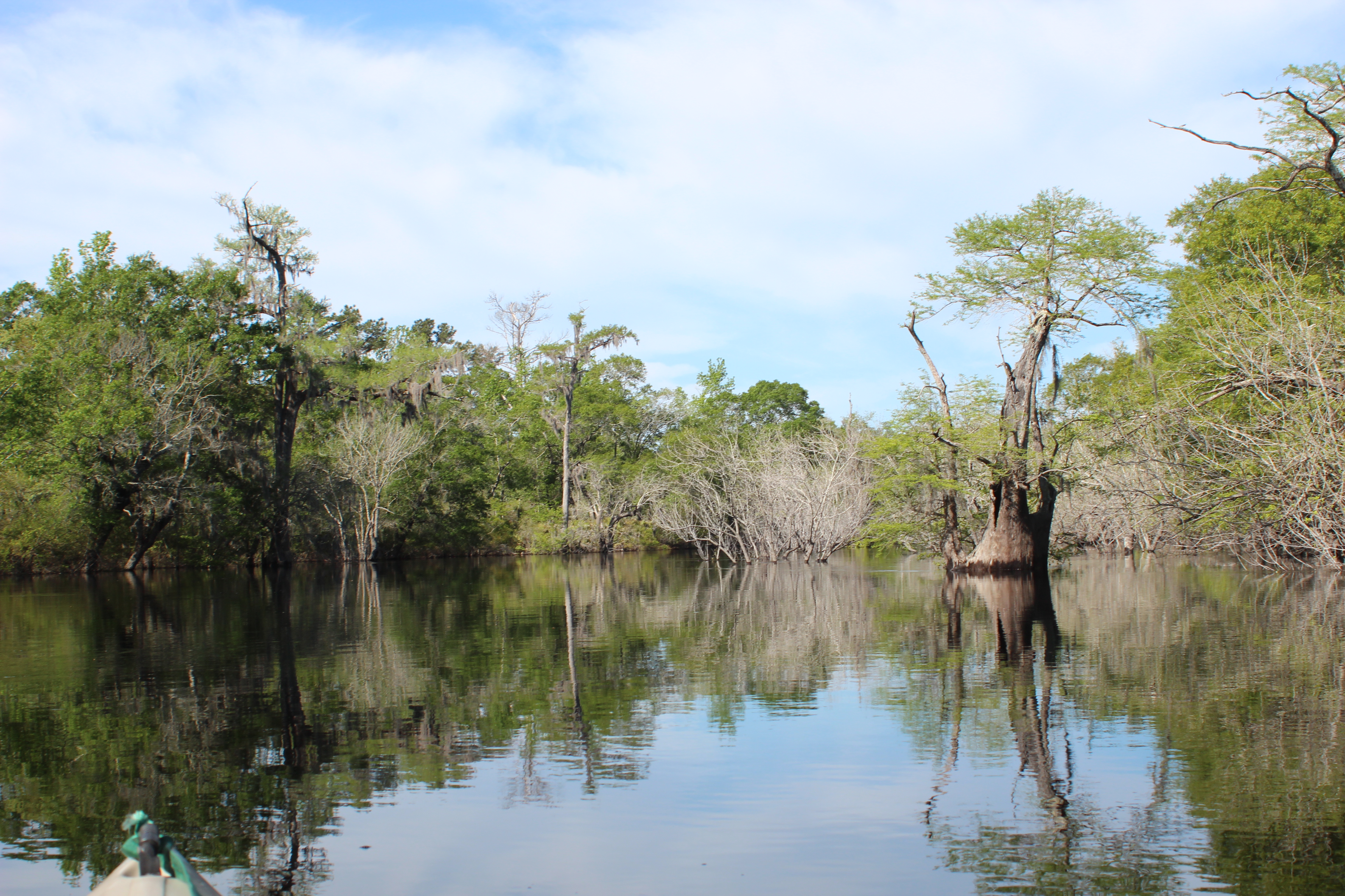
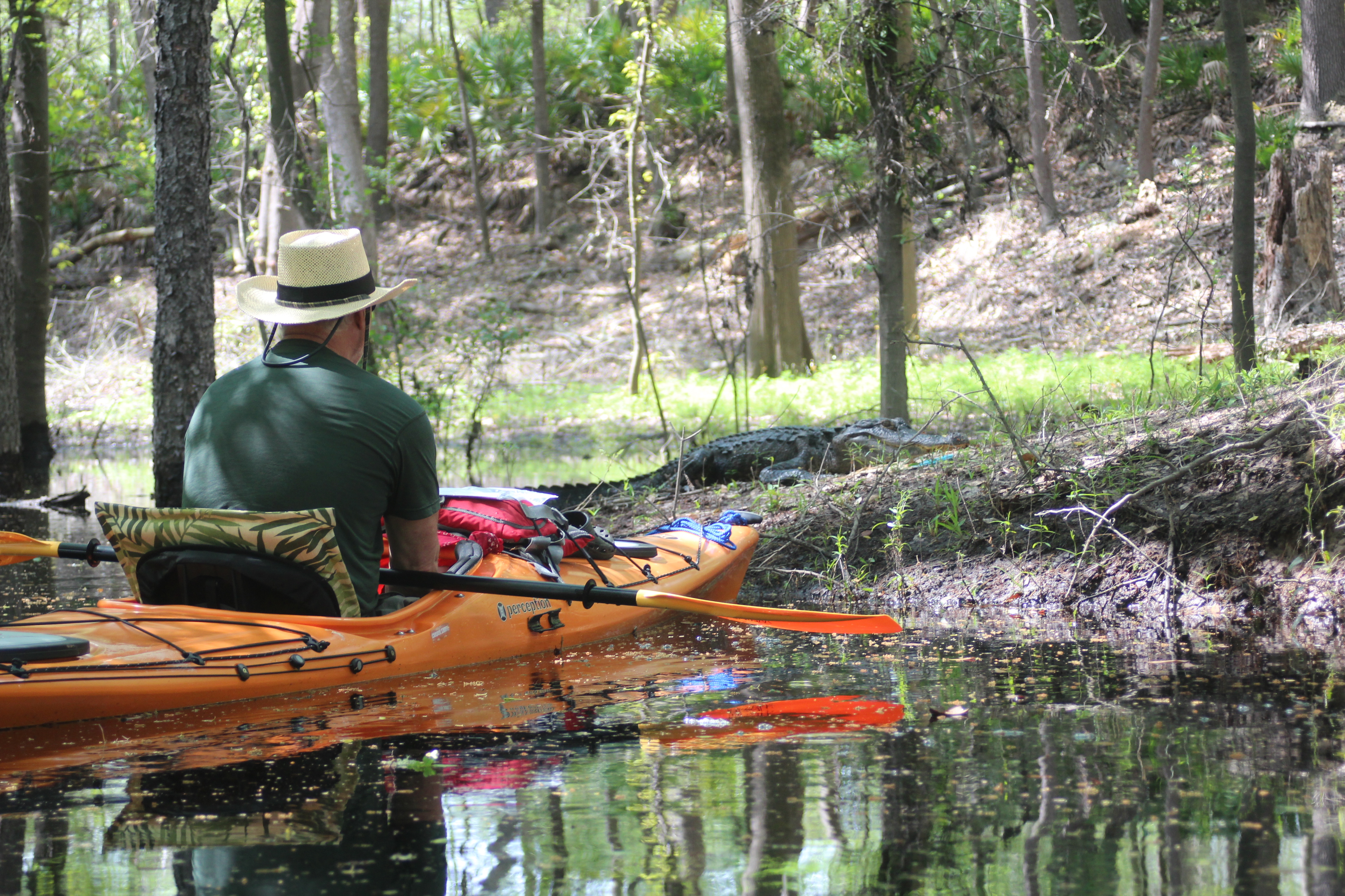
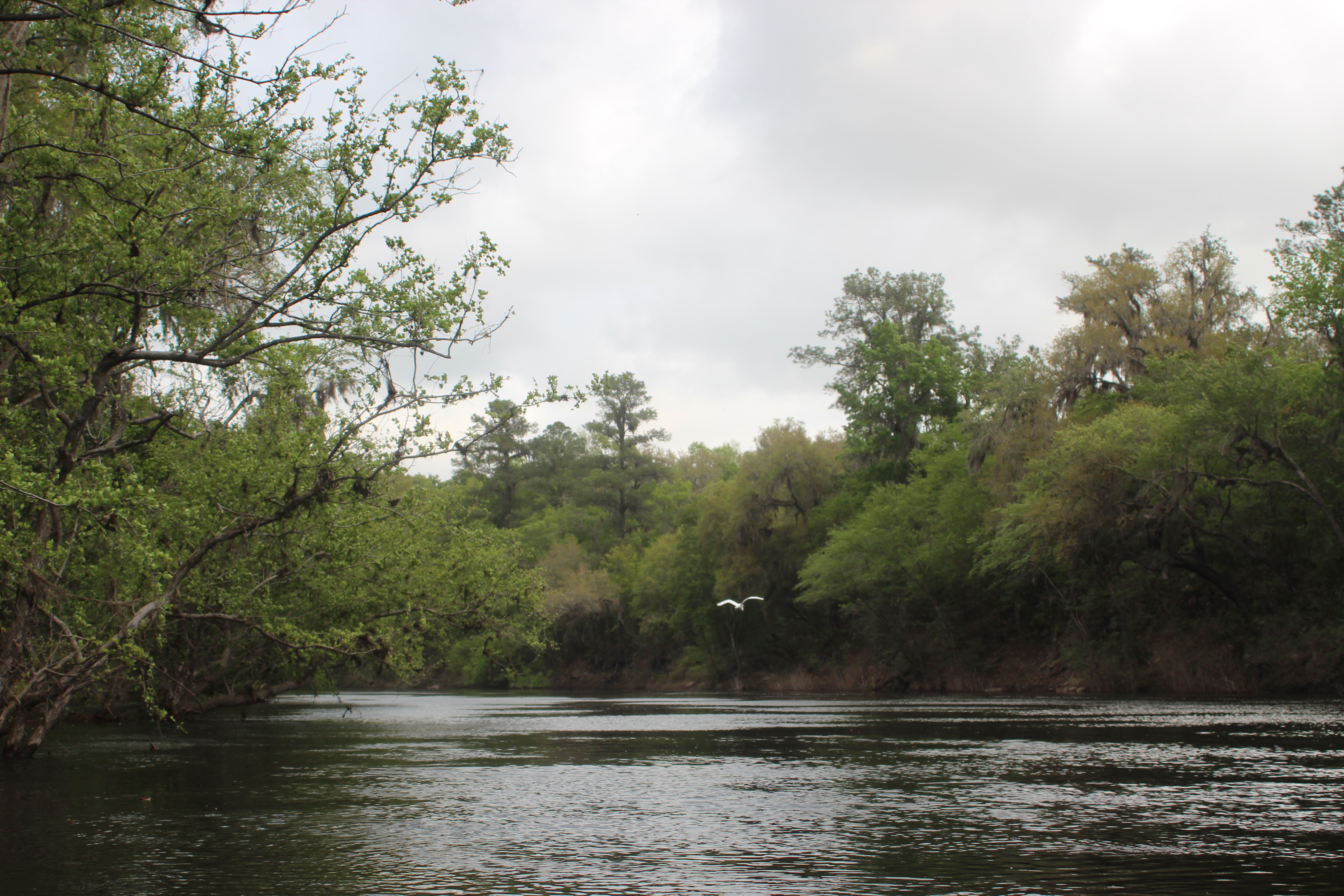
It is also possible to notice, even feel how the shape and depth of a river affects the flow and gravity of your paddling. Prior to Big Shoals the water slowed, you can feel the depth (gator holes) you can hear and slip up on wildlife, and you can ride her to the roar of the shoals in the distance….
Paddlers should be noticing these things (Why else are we there?) along with all the other neat things about the cycles of life. I respect the many methods/types/and variables within the paddling society – ‘flatwater’ certainly has its benefits.
One of the better aspects about the time spent paddling for me; is that the setting is one of having a single responsibility – and that is to nature itself…..
Our presence on this date did little to deter the peace and beauty of the area.
 .
.
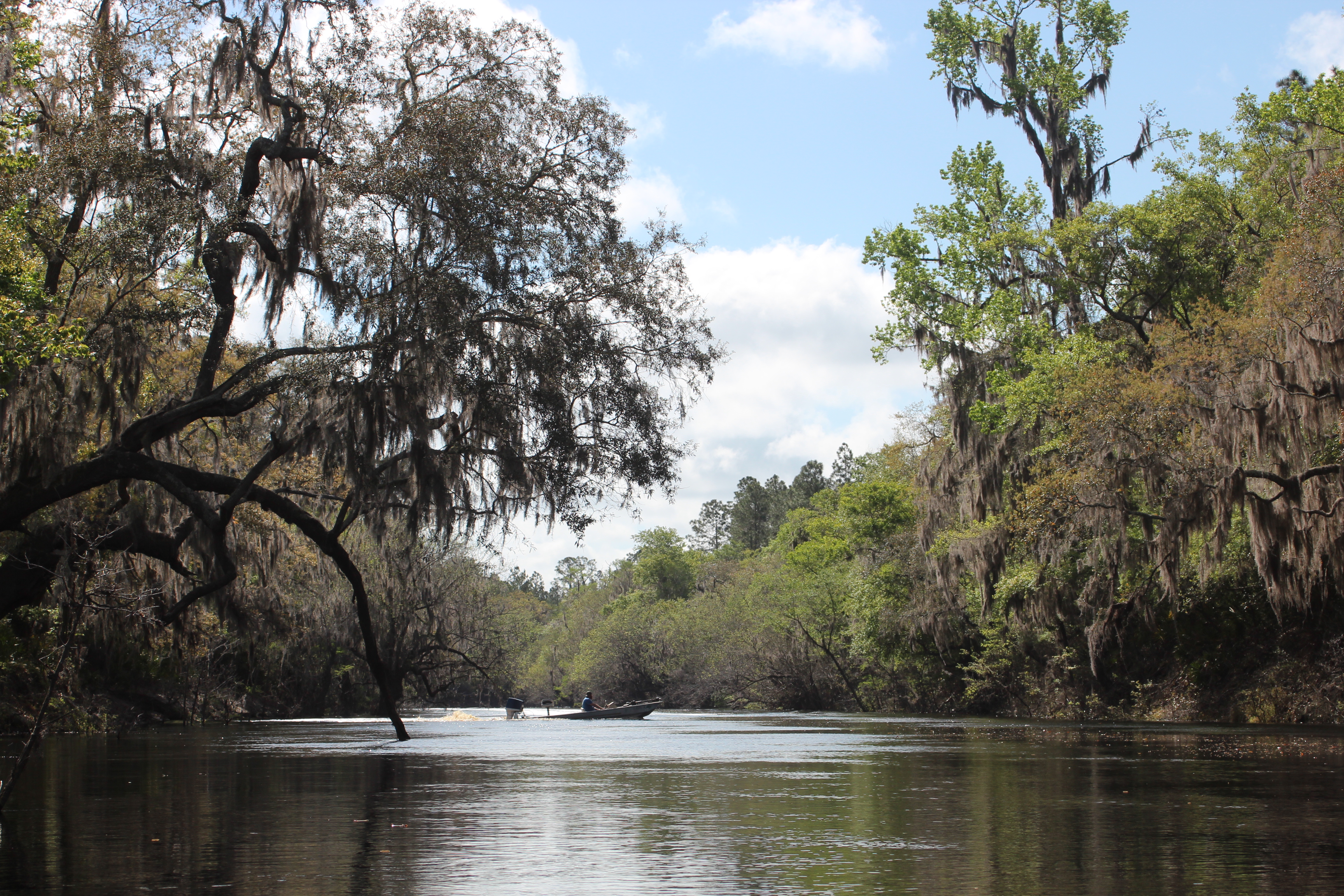
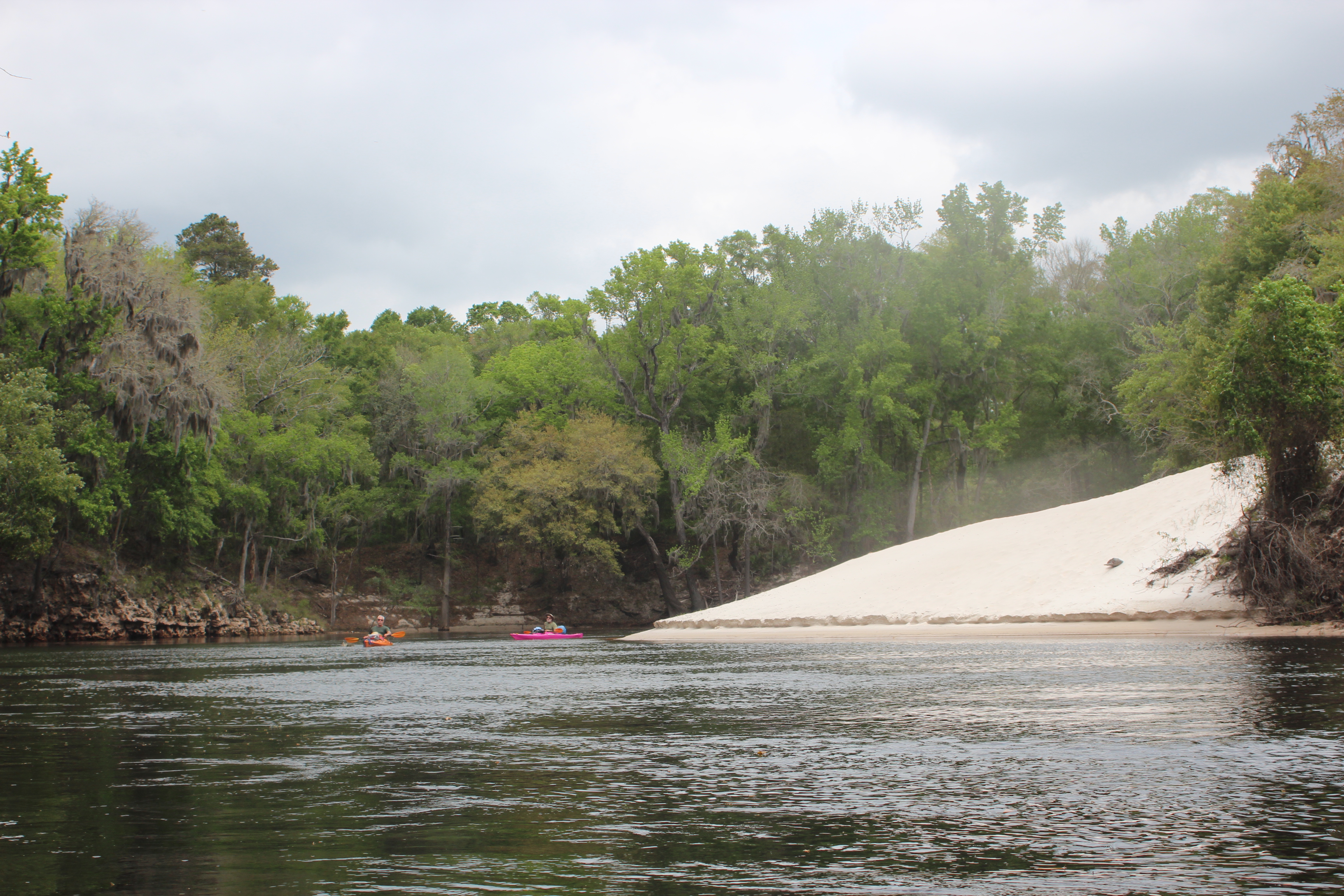
The higher waters provided an avenue to many normally out of reach points of interest (a Ga fish camp).
 .
.
There is little more that I can add about the Suwannee not already noted within my previous trip-reports, so my only expectations of report – is to condense this particular ten-day Georgia to Gulf (“last-call”) river trip to the best of my abilities. Please check-out my previous trip reports on the Suwannee for more of this depth (kayaking the Suwannee (8 posts) and paddling the Suwannee (4 posts)).
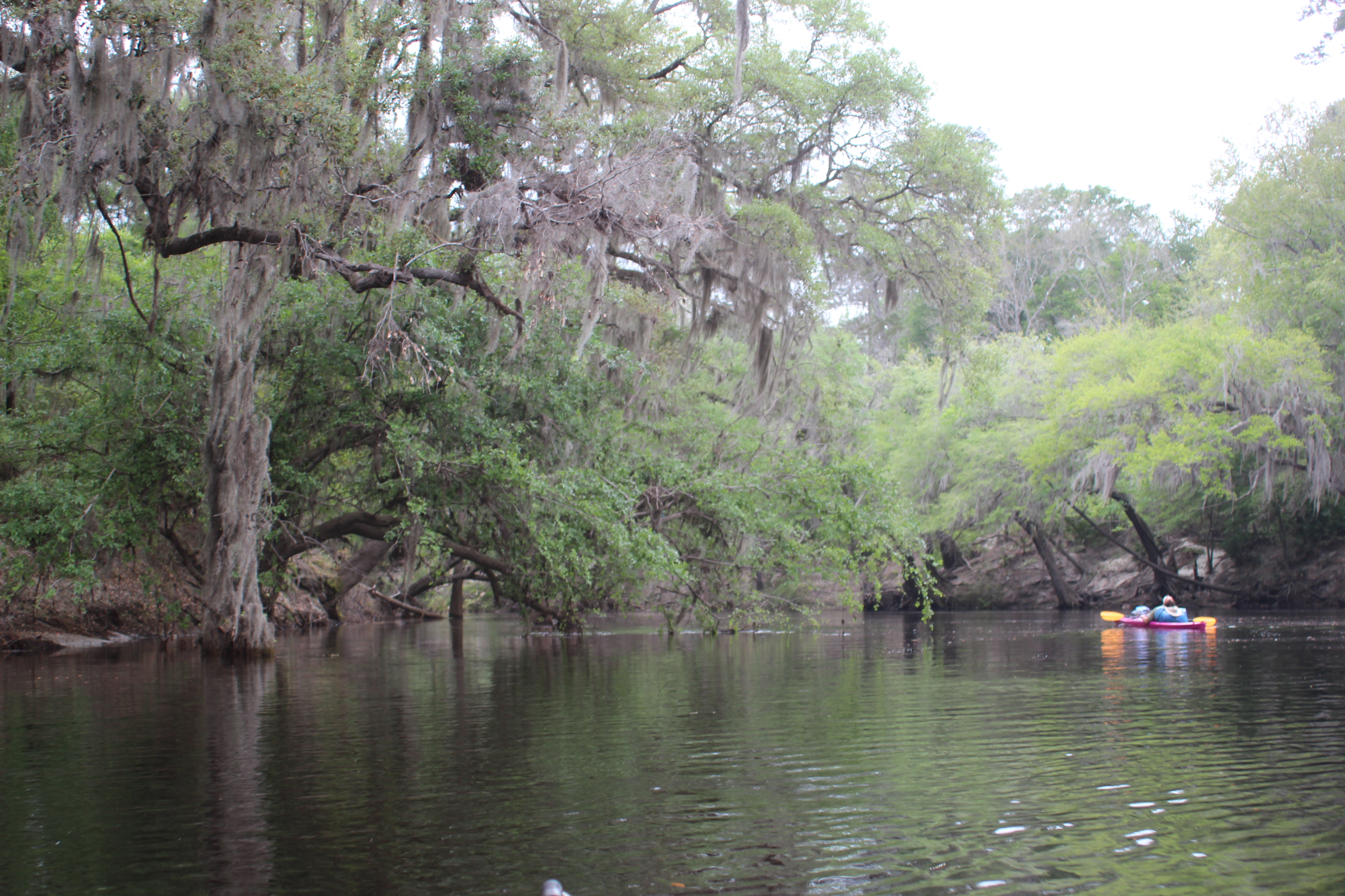
Where the kayak provided comfort, this year’s higher water was allowing more time to enjoy the setting. Combining the two it was possible to ‘play with the flow’ a little. The soft current and gentle “zigs and zags” of the channel meshed becoming opportunities with ample time to skirt under and drift though otherwise obstructed routes. The depth easily forgave any errors of choice. My Wilderness yak (kryptic) only rubbed one cypress knot and I never had to back out of a chosen ‘short-cut’ – it was a good day on the water.
 .
.
Our benchmark for the day was to the hwy-6 bridge in Fla (195mm), but not wanting to camp under a bridge we located an early afternoon campsite a couple miles above the bridge (200mm). Two years prior at the lower 50′ level, Gordy and I had worked hard to make 18-miles on a full day over this section, today – we had comfortably eased across more than 21 miles with little-to-no effort, this must be the ‘reward!’
 .
.
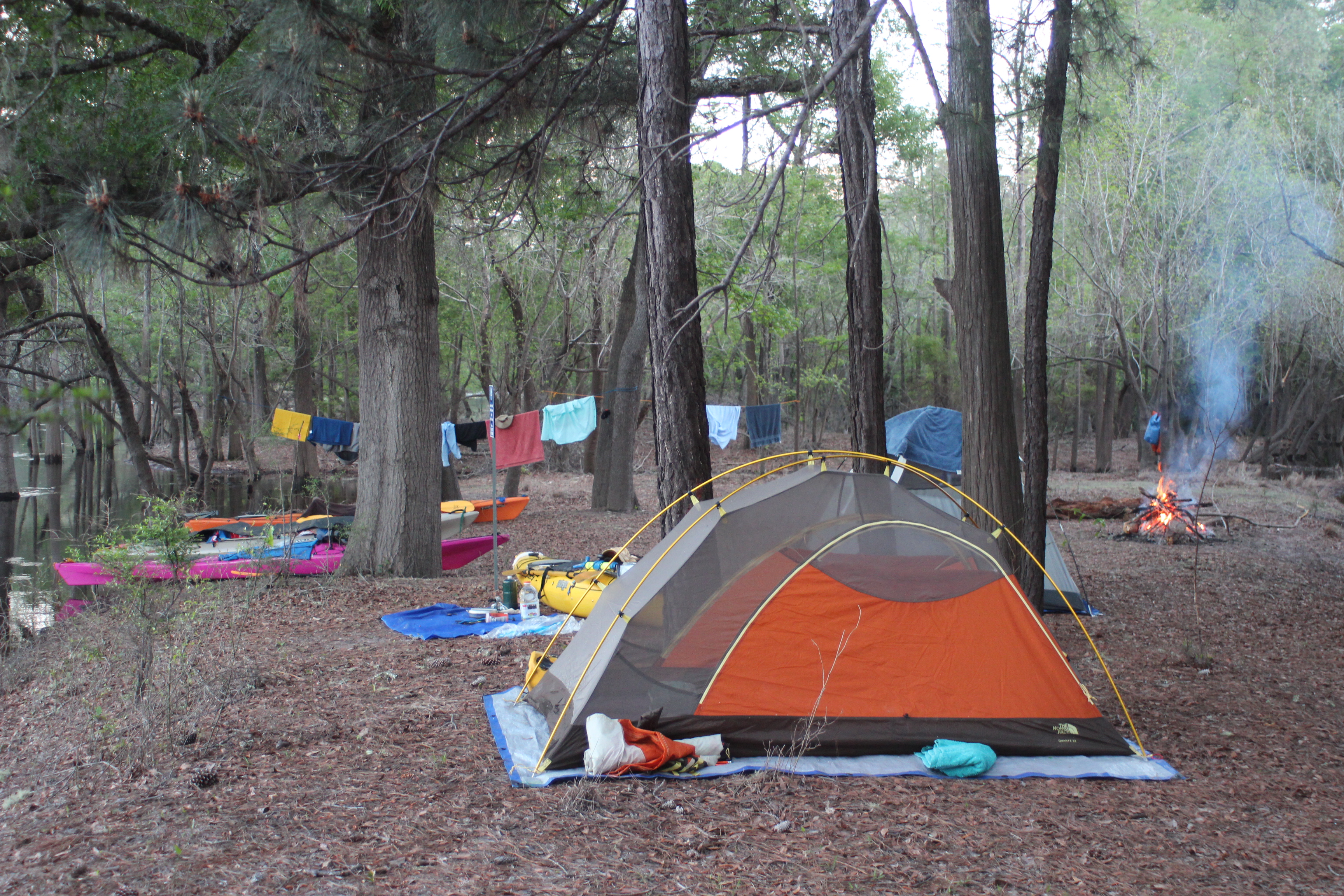
The campsite (river-right) was just as perfect as the day had been. Owls too.
.
DAY TWO – Highway-6 to Big Shoals
.
.
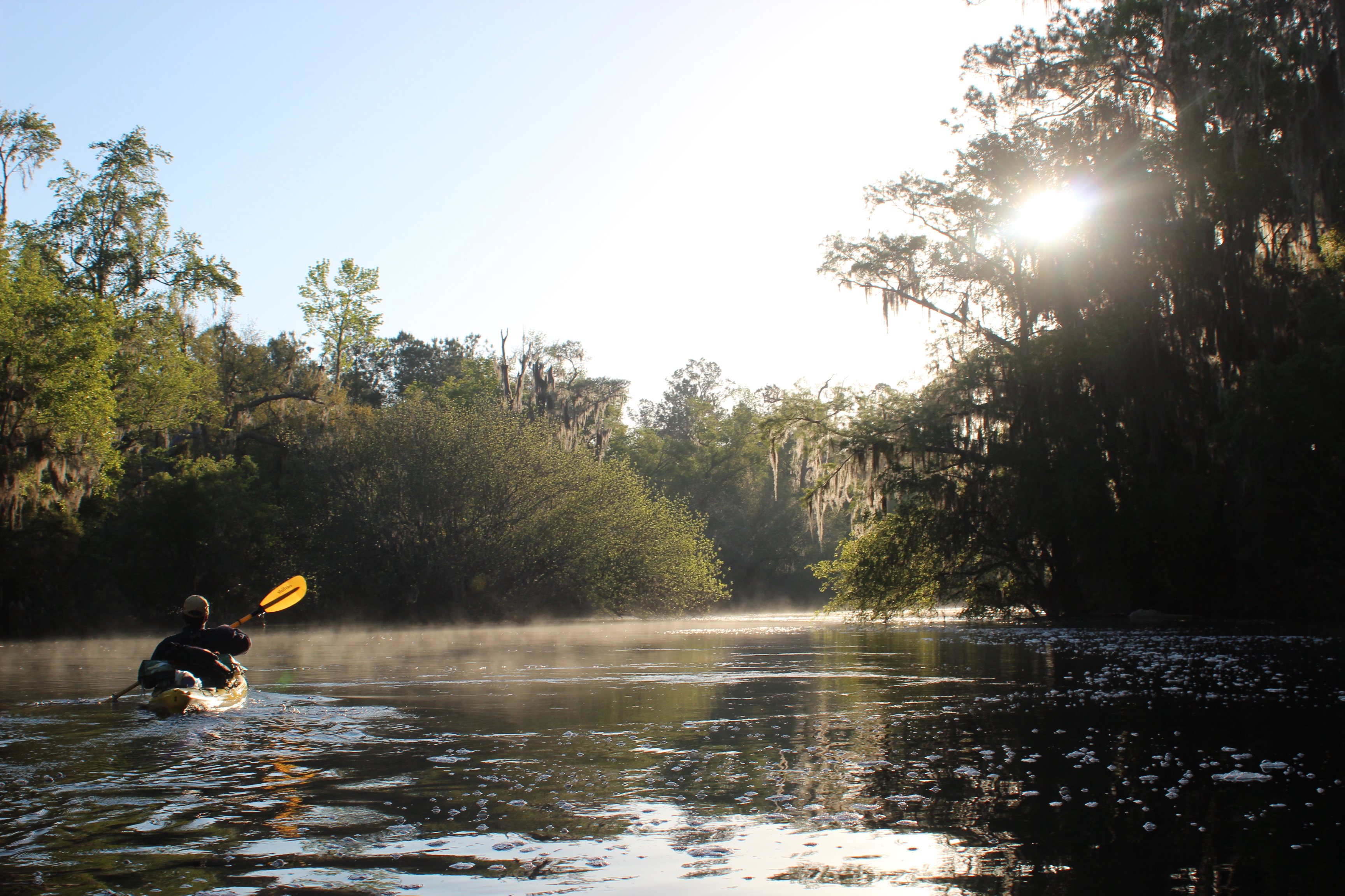
MRE and Coffee, then on the river before 8:30. No doubt those that spend some time on the river go down – and rise with the sun – it just works out that way.
 .
.
There had been kingfishers, herons and woodpecker’s throughout the day – and once again the Suwannee’s owls charmed each other through the night. Wdddddddllllllloooo, wddddddllllll,ooo!
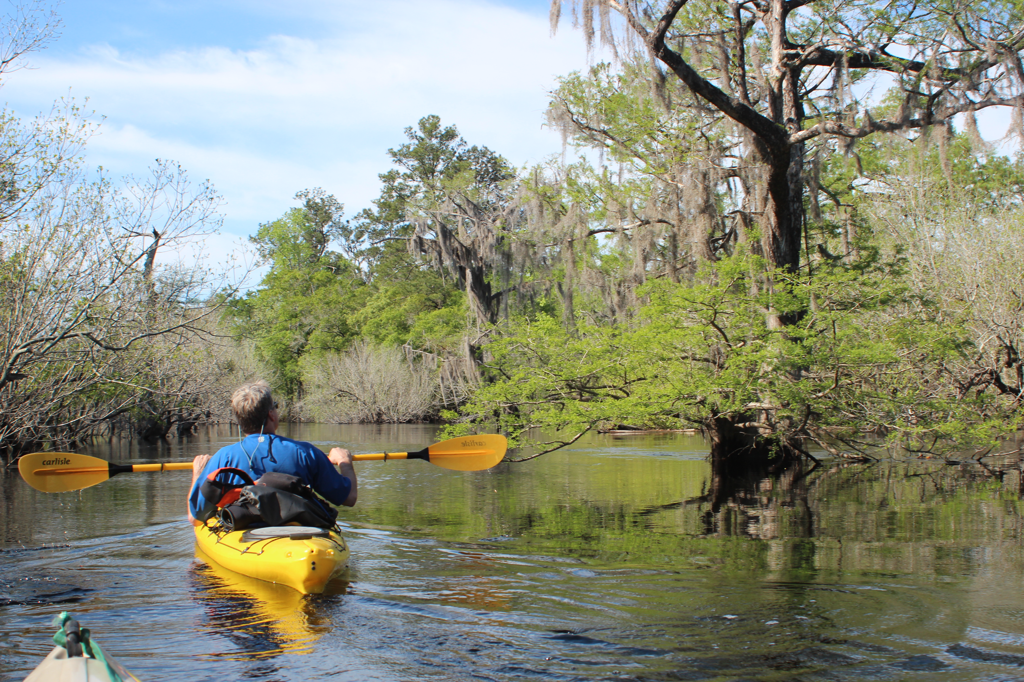
On this our second day, Gordy and I were savoring the Cadillac ‘ride’ towards Big Shoals – Carl and Richard were somewhere a few miles back finding their own pace. They wanted it that way and not being one for the ‘group thing’ (takes my mind off why I’m there) the independence allowed each of us to find our own reasons within the setting.
Benchmark for this day would be the campsite on the Big Shoals portage trail (175mm) – 25 miles downriver.
 .
.
Gordy and I kinda fell into a two-boat ‘group’ over the same terrain that we had previously rambled – the flow was holding strong 4 days now. Normally you could figure a paddle rate of a leisurely 2.5 to 3 mph; we were finding this rate more to the tune of 3.5 to 4 mph, just move your arms. After working through lower water and tougher times, we appreciated it.
 .
.
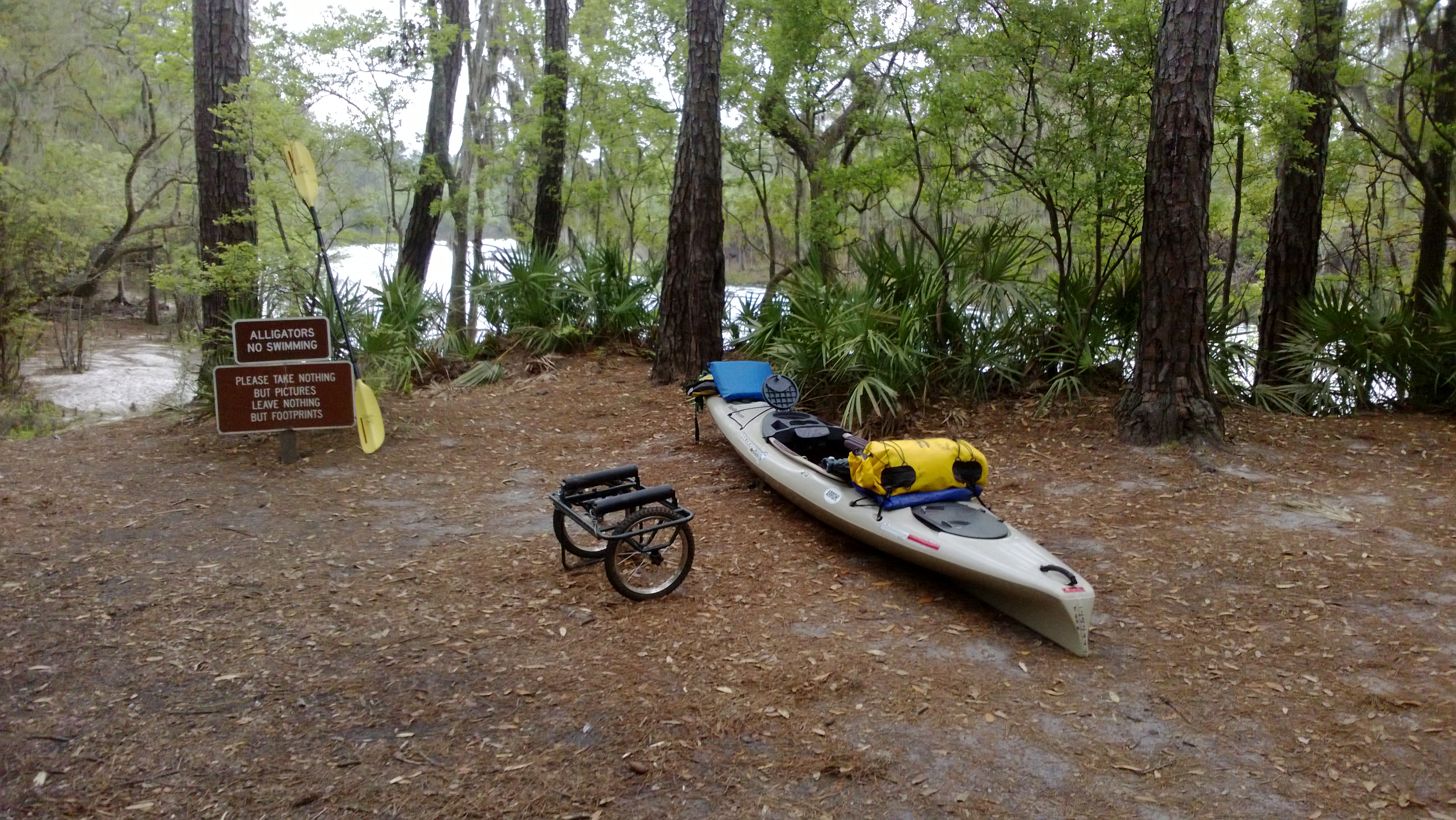
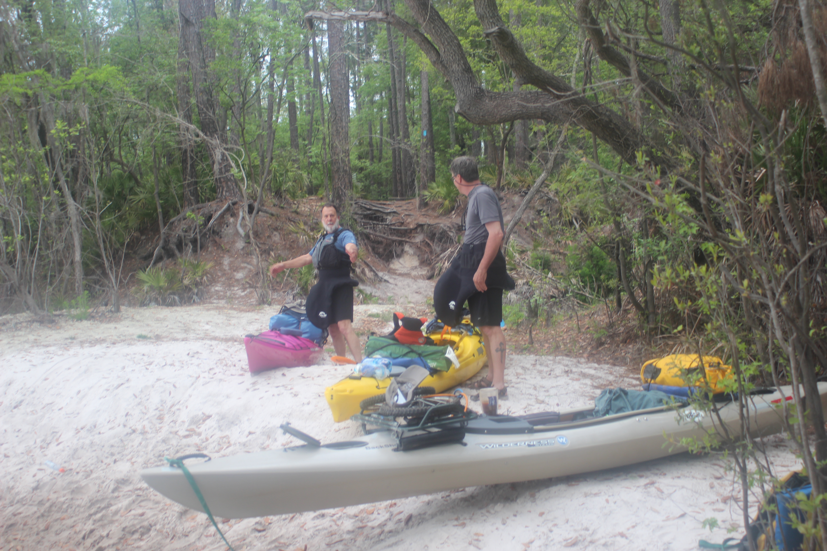
This first section in Florida narrows and shoots past fishermen and boaters of the area. Just past ‘limp-dick’ bend (aerial 188mm) is Cone Bridge landing (I didn’t name it either). With our @25 mile target for the day, this was our halfway ‘lunch’ point. We had also stowed a kayak ‘dollie’ for the 1000′ portage of Big Shoals in the bushes here a few days earlier – so Cone Bridge also became a ‘pickup’ point.
 .
.
 .
.
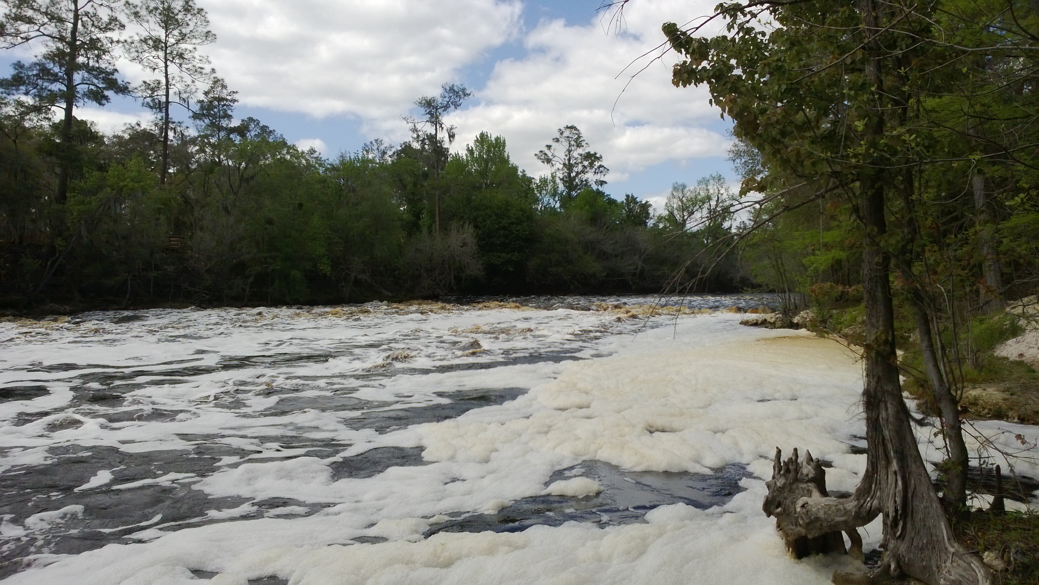
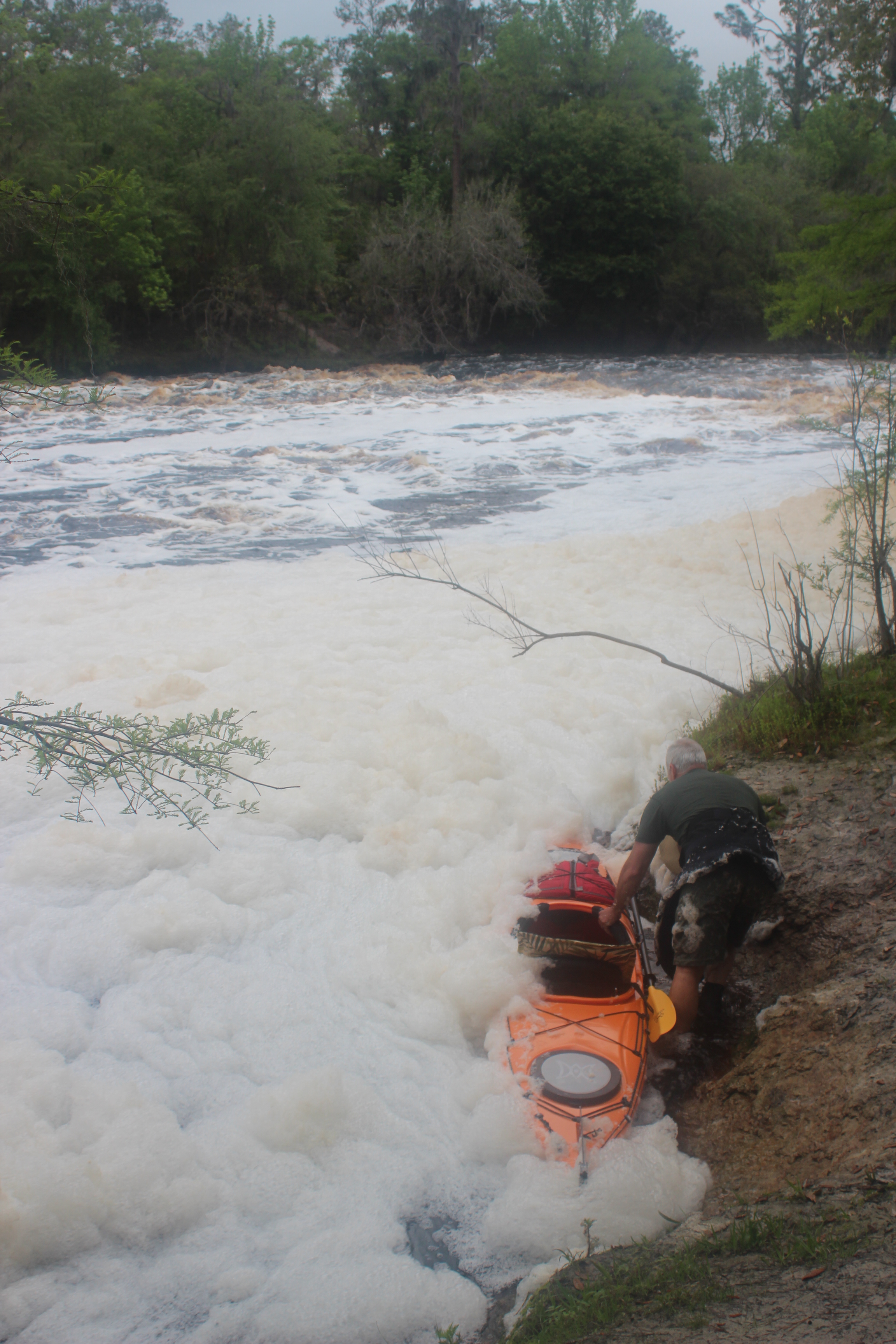
‘Big-Shoals’ is Florida’s only natural class III rapid. A couple years back the reading at White Springs was at 52′, ‘picking a line’ through was possible – on this date it was holding strong at 60′, not I. Big Shoals is a portage point and campsite (with fire pit), depending on your vessel – the wheels help alot and can be dropped off in a couple days at our parked vehicles.
 .
.
Carl and Richard ambled in a couple hours after Gordy and I. The campsite was simple, clean, and a perfect setting….

Big Shoals – @60′
– for the rumble of the river alongside.
.
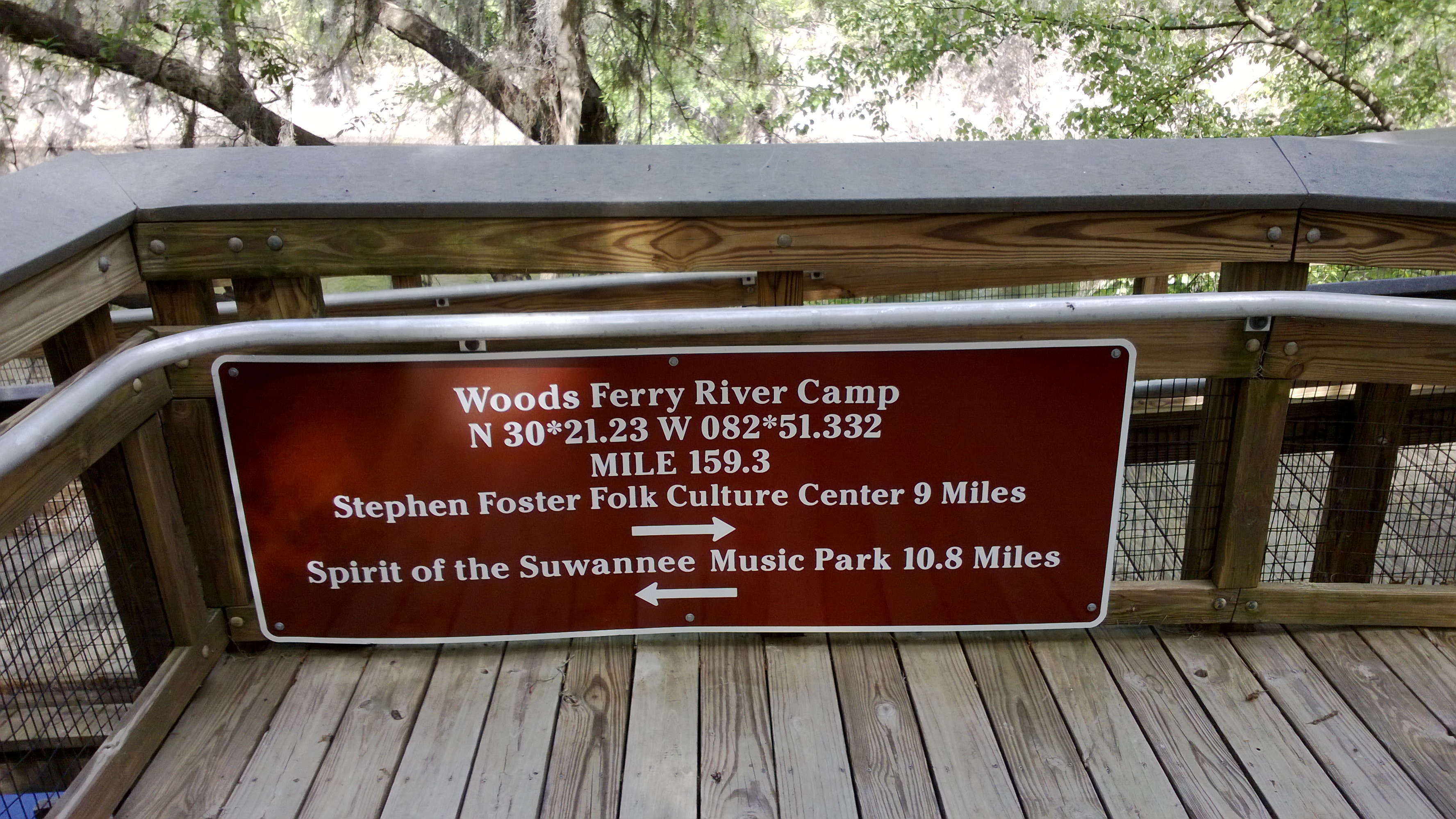
DAY 3 – Big Shoals (175mm) to Woods Ferry river camp (159mm)
 .
.
The entertainment for the next morning was getting back into the river. As the tannic (leaves-colored) water churns over the shoals it bubbles and foams. With the power and increased flow of the river on this only amplified the amount of bubbles – as a firefighter it reminded me alot of the old ‘high-expansion’ protein based foams we once used.
 .
.
Eager to begin this day, brothers Carl and Richard became ‘one-with-the-river‘ early with their spectacular ‘launches.’ Gordy and I watched – then used the lessons to make much smoother entry’s ourselves; being last is not always a bad thing.
 .
.
The two sets of shoals before White Springs and the hwy-41 bridge were unapparent under the high water.
 .
.
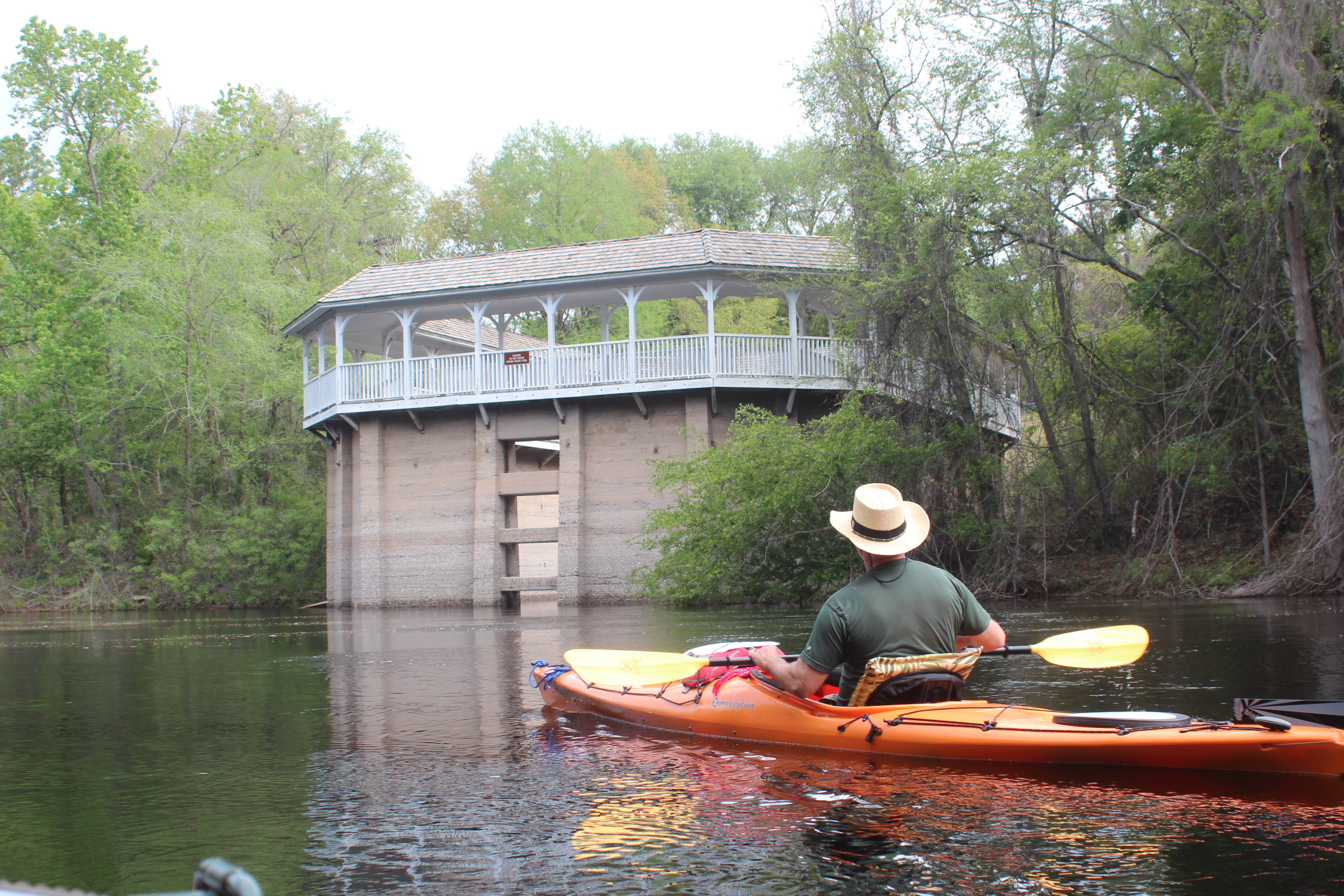
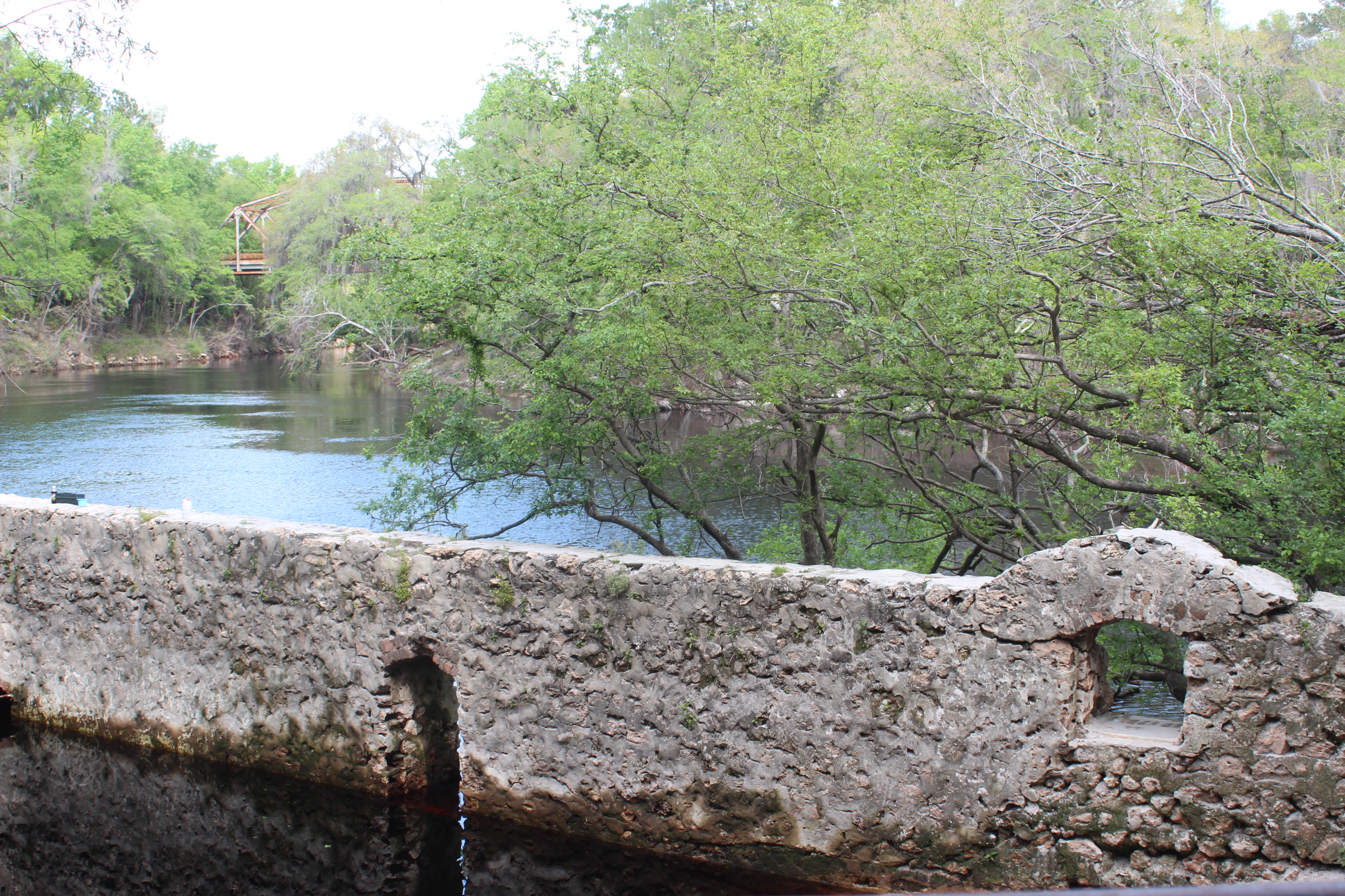
Below White Springs, in the 1800′s this was a wooden ‘spring-house,’ then rebuilt at a later date – more history on this link.
 .
.
 .
.
With the help of the water a very simple paddle rate was developing, stopping along the way became more of a necessity than an option. I-75 came and went, unlike the year when Gordy and I saw it as a ‘waterfall‘ in a heavy Fla downpour…
.
.
When the water level is ‘right’ (52-56) this is a great section between White Springs and Woods Ferry of ‘playful’ curves and currents. At this level and with the natural obstacles of the channel, ‘boils’ become more pronounced. Like on the Mississippi and at a lesser degree – these ‘suck-pockets‘ affect your direction of travel. No big deal, it’s just water under you.
This section of river bears the scars of high summer-use, two day one night ‘runs’ at the river, while also used as float events by local charities as ‘fund-raisers.
 .
.
 .
.
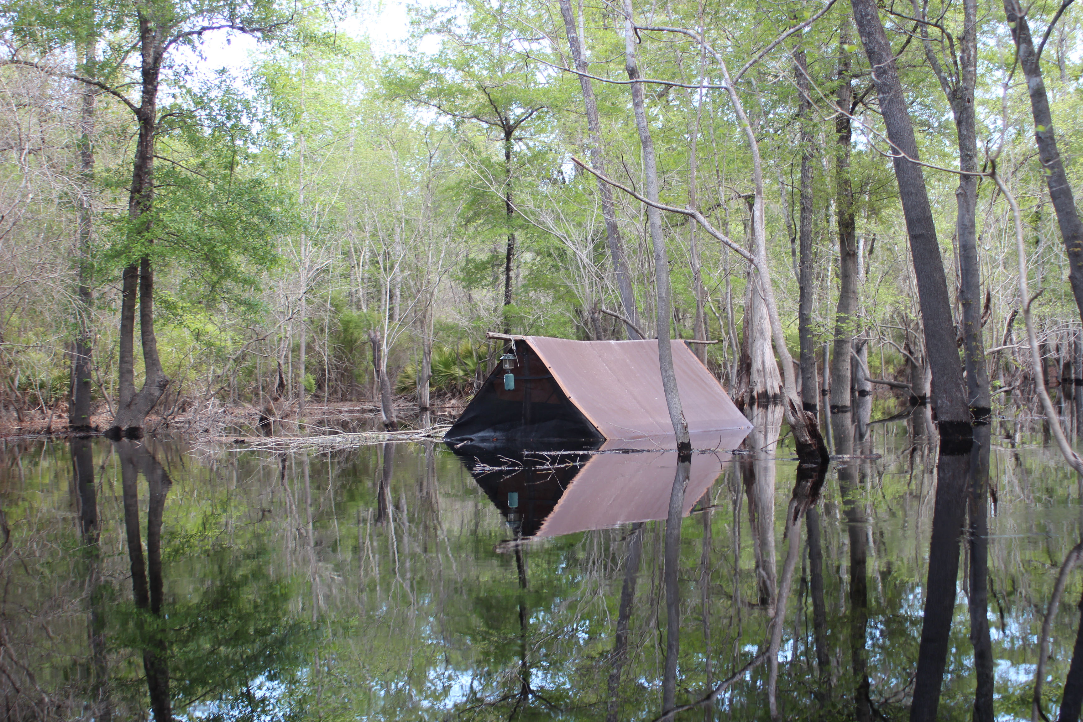
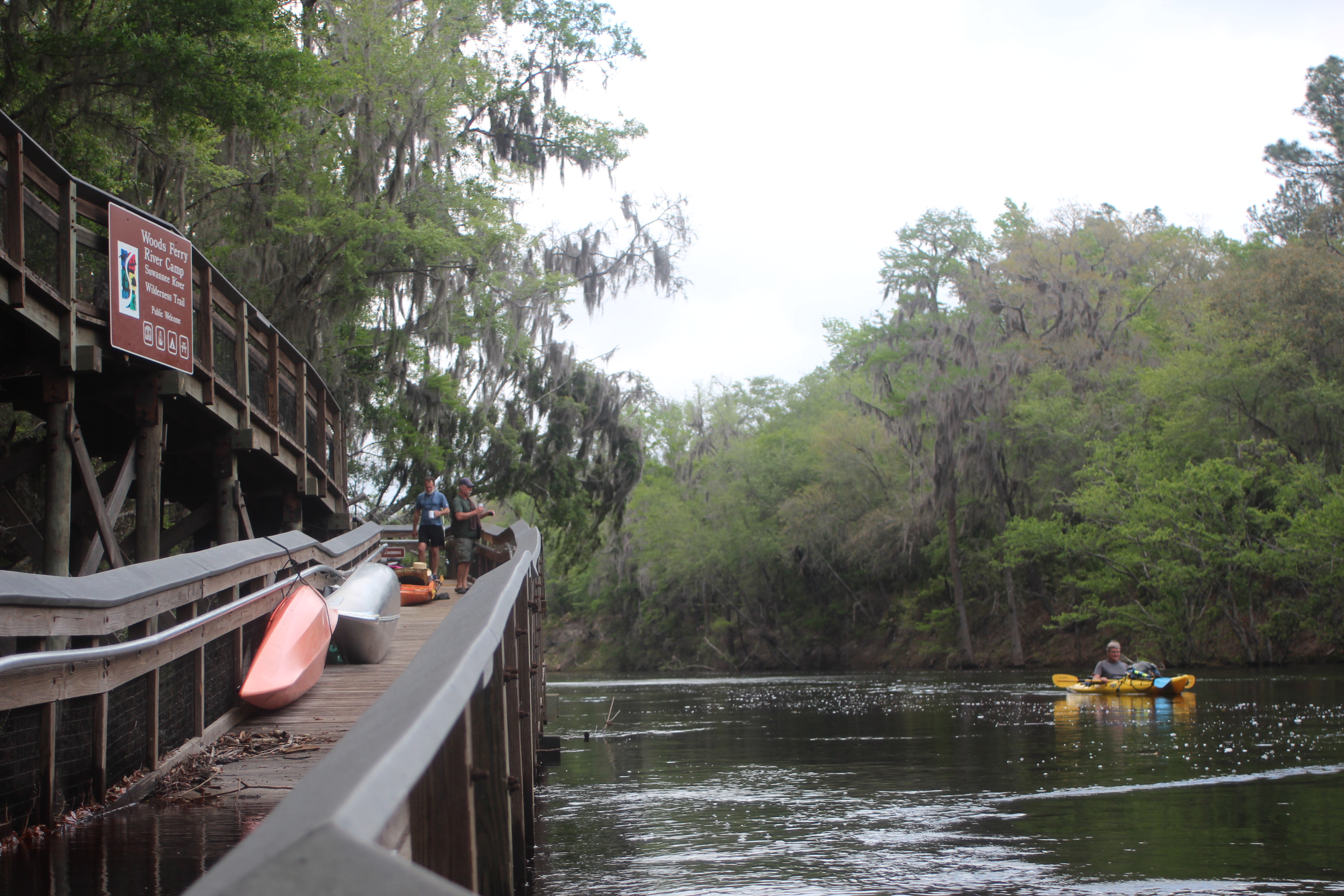
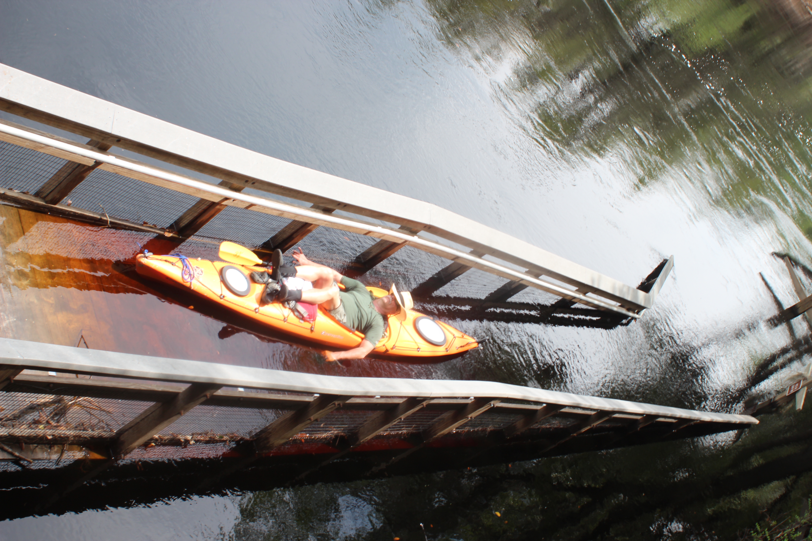
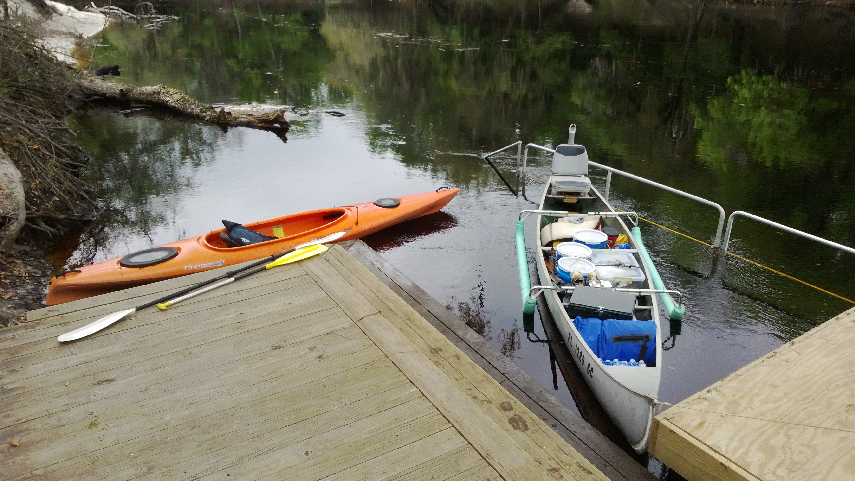
We found high water at Woods Ferry (159mm), up the deck. This left us to stow our kayaks on the walk with others (Holton Creek paddler).
 .
.
The screened platforms of the available river camps are always a welcome sight, thanks Suwannee Wilderness folks.
.
“feet-up”
.
DAY 4 – Woods Ferry (159mm) to Holton Creek river camp (140mm)
.
 .
.
 .
.
On the river just after 8am. It is my belief that the earlier you get on the river – natural beauty has greater opportunity to find you.
 .
.
At any time if one of us wanted to ‘move-on,’ we could – and did. In Colorado I learned the ‘Western rules ‘ of paddlin stressed independence. A group of independent souls, I like that.
 .
.
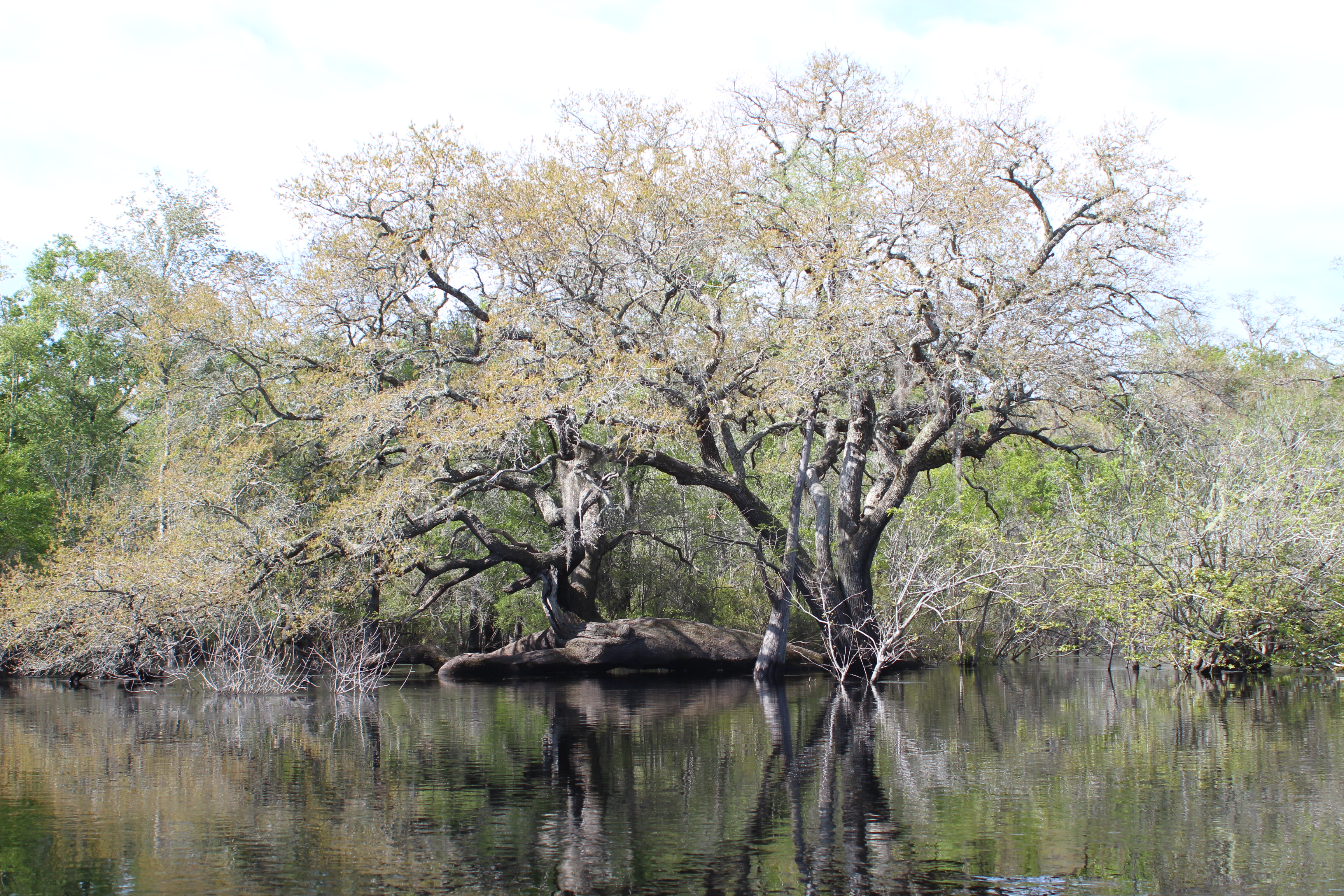
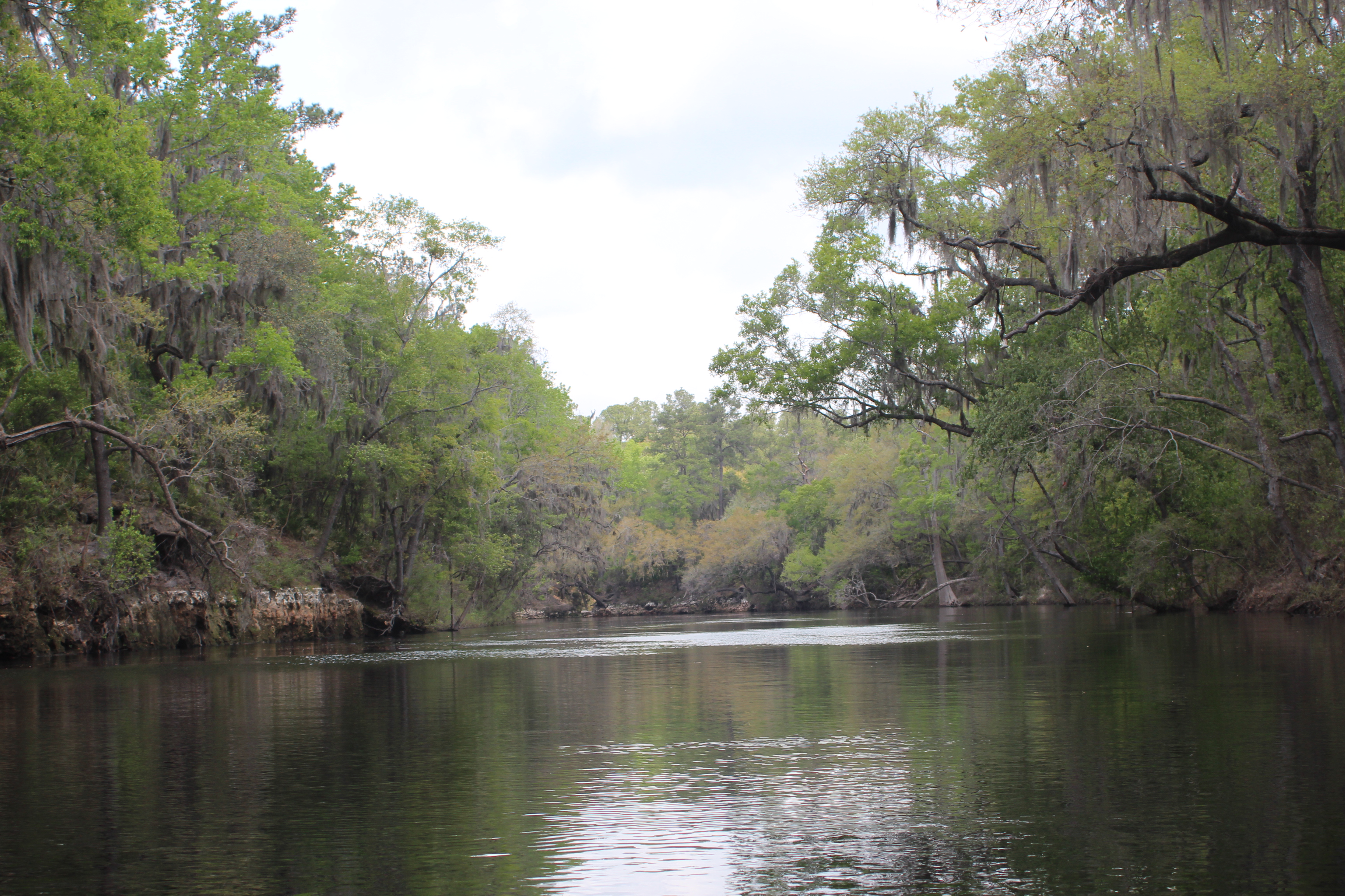
This is the Holton Creek section, one of distinct earthly beauty – the shores are little different today than 30,000 years ago…
 .
.
 .
.
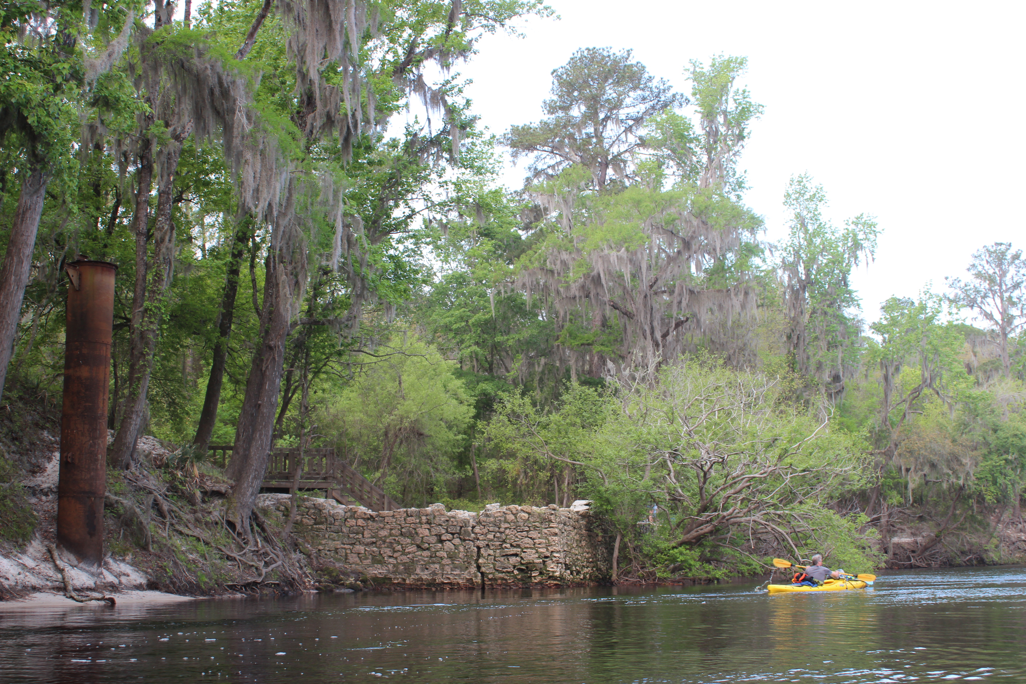
Suwannee Springs is an interesting stop – from the late 1800’s to the 1920’s the waters were thought to heal ailments from gout to marital problems, Gordy and I joked bout the marital problems cure (a drowning was included).
 .
.
 .
.
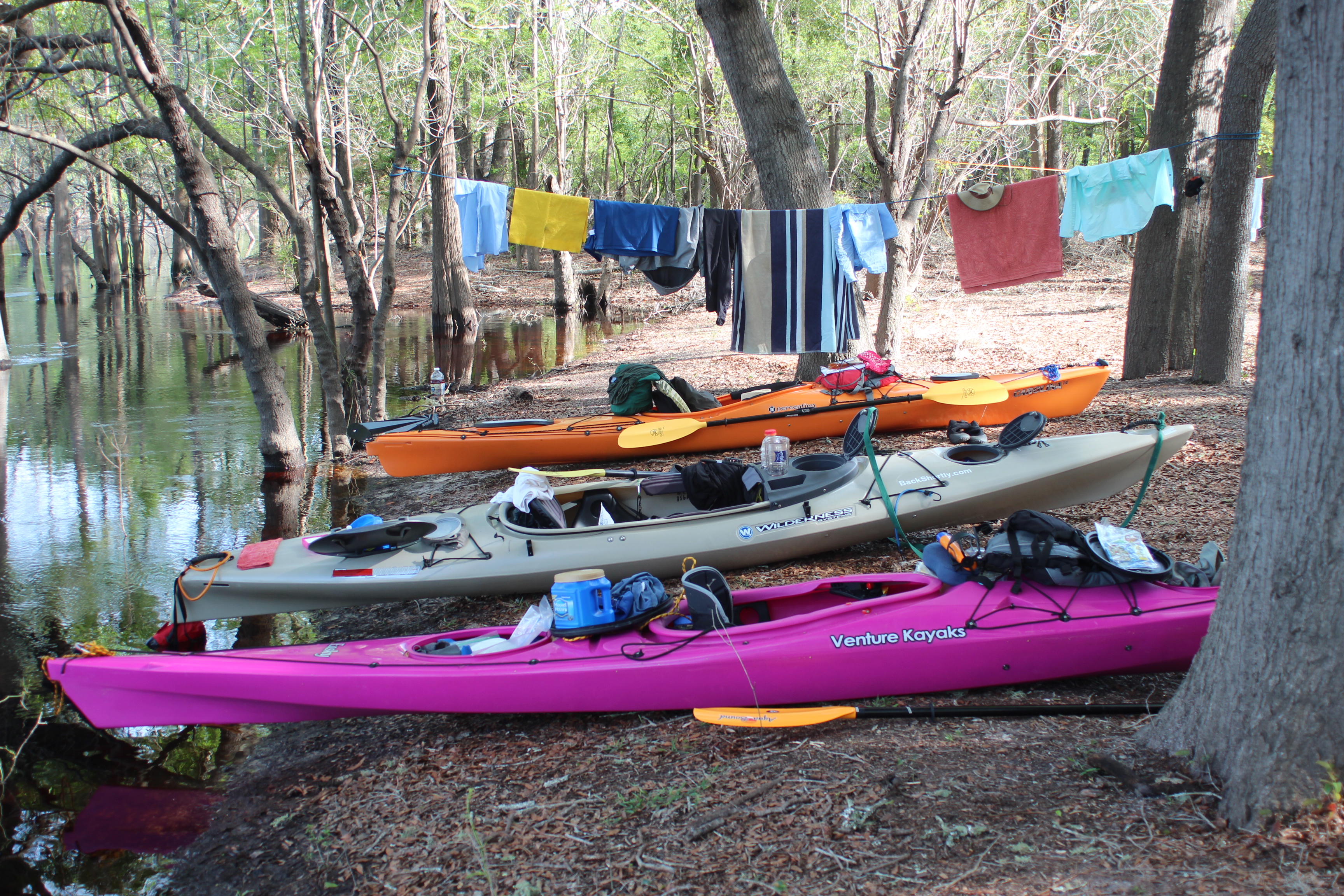
And at the 1/3 mark of our trip the outfitters, our vehicles (for restock), and the Music Park for some land-food at the Cafe; a big ole jucy burger served by ‘Raven.’ Gordy made the call once again to return to civilization, work had summoned him on that little black lightning-bolt to the world.
.
– so after that burger this beverage summoned me too. Back on the river, headed to the Gulf.
 .
.
 .
.
It helps to have an objective. Whether paddling to the headwaters or whatever angle your boat is pointed – direction is your animal and you are the Captain… Choose from one of the factors that day, put your head in that direction (and plan to turn those phones ‘off’) when paddlin…..
 .
.
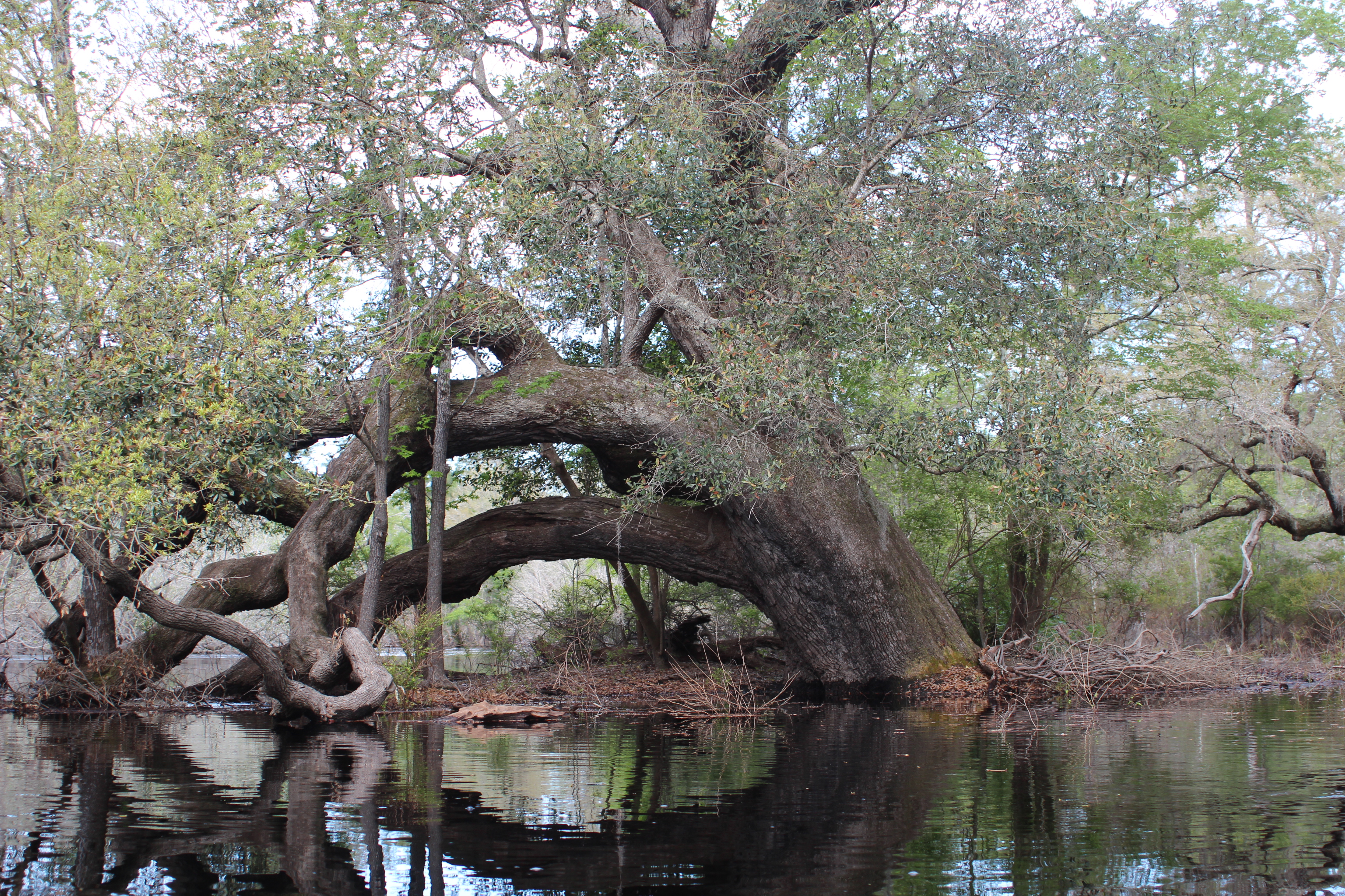
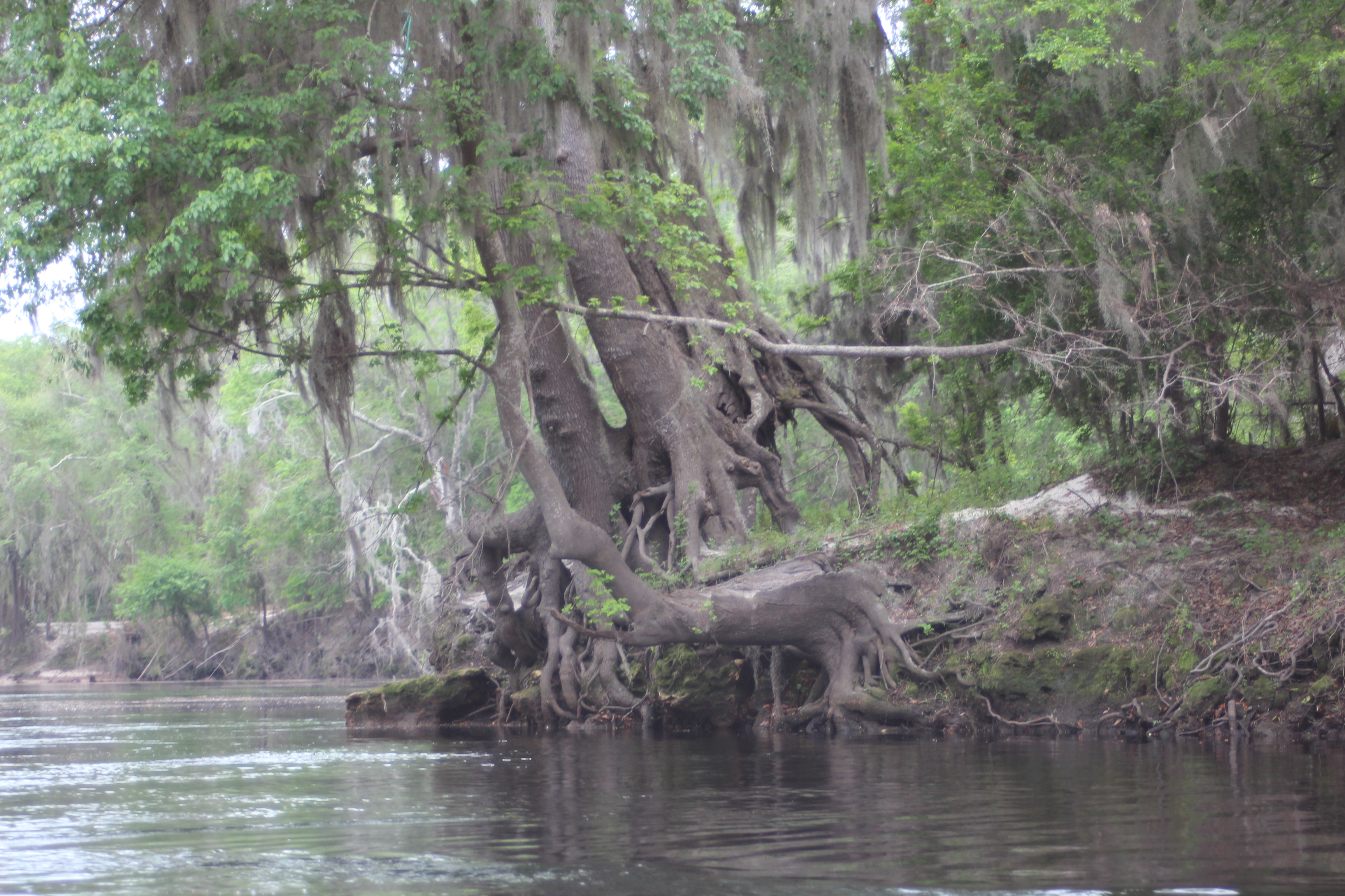
The tree root above was awesome, the sand below the old oak had completely washed away – leaving the great tree suspended above the ground on its roots. The picture was taken in hindsight, and doesent do it justice. Ok, you know where its at.
 .
.
Normally a large sandy beach, the Holton Creek walk stood knee-deep.
 .
.
Entertainment was down at the Yacht-Club…
 .
.
The two from Woods Ferry ambled in, a couple more adventurers doing the river in ‘their own way.’ I think the father-son group said it was eighteen days since they left the Okefenokee Swamp, headed for the Gulf. Seems all that we met this trip were eager to tell their story; a ‘snow-bird’ from Bradenton this guy was giving it his best-shot and had all kinds of ‘bad-luck.’ Good or bad, some folks have it all.
.
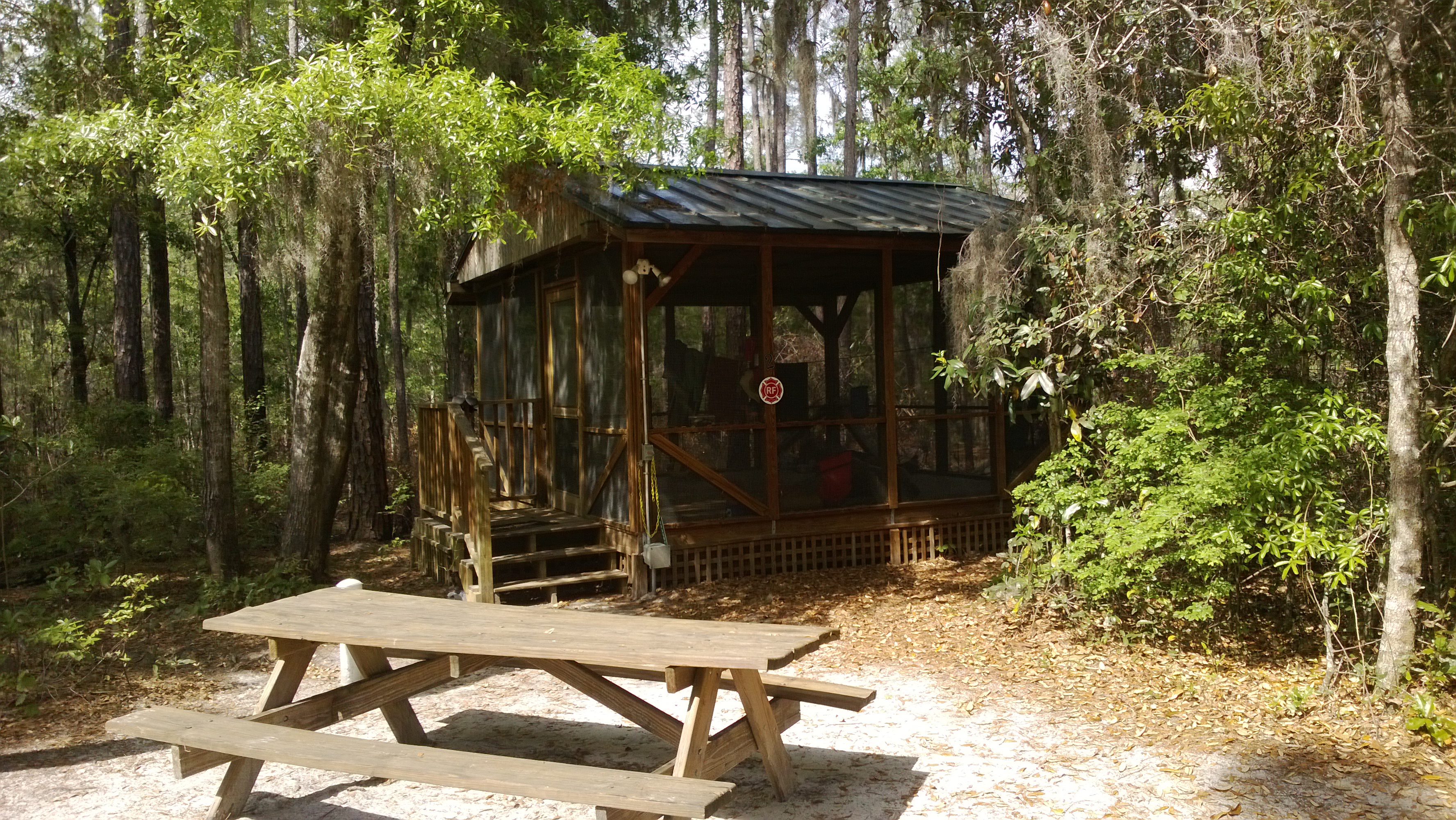
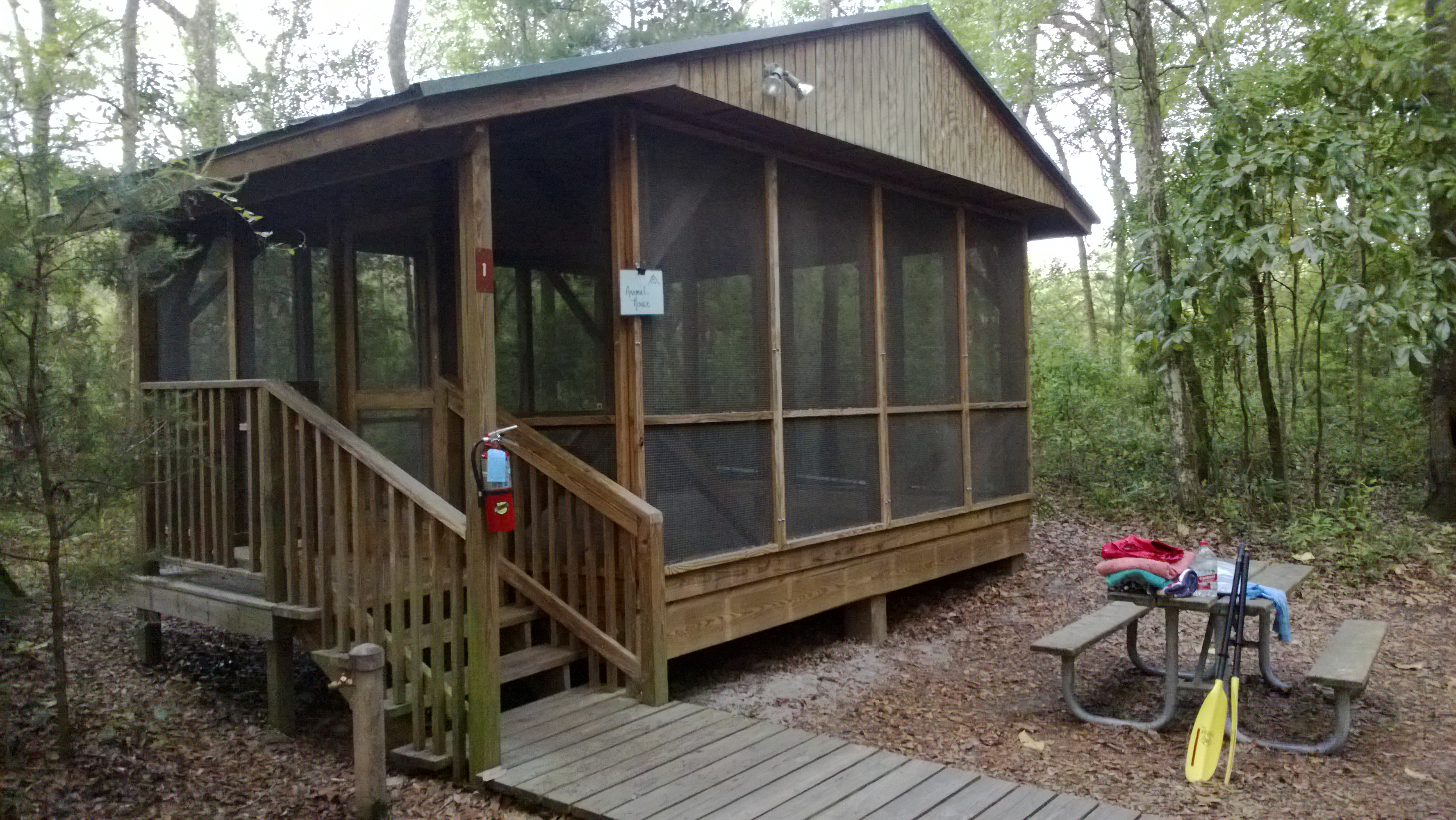
And my story for the night, was that my cabin #1 (dubbed ‘animal house’) had a squirrel trapped in the attic for the night, try sleeping through that one! Where it’s not unlikely that animals might amble through the camp (armadillo, racoons, turkey, etc.) during the night, it’s just not a normal event within a river camp structure. This situation was a simple effort of maintenance to vent the structure making it more comfortable for visitors – holes had been drilled for simple attic vents. I suppose there was a lapse of time when this critter found his way into one of the holes. The vents were screened leaving the critter inside.
I didn’t sleep well, finally grabbed my flashlight at 4 am and after assessing the problem (along with a few impatient words and tripping over the work ladder) poked out a vent-screen creating an escape route for the critter – he hadn’t taken to it by sun-up.
But I took to mine, the river. – and I was on it early.
Suwannee River Mileage/trip info
.
The next days, (5-8) to Gornto Springs Park
.


Leave a comment