Home

Bear Creek Lake – NC

11 Comments

Bear Creek Lake

@500 acres

IMG_0674
Bear Creek Lake

Water Clarity – 8

Natural Quality – 8

Perception – weekday

(Lat: 35.247663 Lon: -83.0715282)

.

.

For many years while raising a family, it was simply about making it from one ‘payday to the next – occasionally ‘extra’ funds would show up, it was always a short-lived feeling.  Inevitably and within the same mailbox there was yet another bill (usually from an insurance company) that that completely wiped-out that breath of a ‘windfall’ from the equation. Nothing bittersweet about it, it was sour everytime.  Years passed and the kids grew up, for the most part that era passed also – well, until last week when the spike in my health insurance for the coming year reminded me of that sinking feeling from years back – the insurance/medical racket stinks.

As good as life is (and it really is) the feeling this circumstance brings is totally relative to the “one step forward two steps back” saying.  Instinctively I know it boils down to tackling the issue and moving on, but the thought of it has certainly swayed my ‘ire the past few days.

IMG_0539

(GPS – Bear Lake road, Tuckasegee, NC)

So you see my mind wasn’t really on paddling yet at the same time I really needed to ‘paddle.’  My choices for the day were to explore lake Tugalo with some friends, Nantahala lake, or go solo on lake Bear – I took the lone paddle route as not to vent but to find a pause for it all in my own simple way.

‘Bear Creek Lake’ has been sitting quietly up the road for me, an isolated but convenient little lake for just such a day – couldn’t have been a better time for it.

“fishin here”

Bear Lake Landing

Bear Creek Lake is part of the Duke Power Nantahala system, the east fork of the Tuckasegee river, the lake is just under 500 acres and with 13.5 miles of shoreline and can be completed at a leisurely paddle in less than 6 hours – perfect size for a day trip with plenty of coves and fresh creeks to hold your interest, really nice place.

The weather was ideal, so my basic objective was to paddle to the farthest point – ‘headwaters’ (southeast) before working my way back along the opposite shore – I would finish up by paddling the coves of the spillway/dam area.

After a small delay (I ran past the boat ramp off hwy-281)  it was good to be on the water and paddling  – even though it was 1130 am, a later paddle.

I’m not sure if there is any scientific explanation to it but there are times that the water of a lake can feel ‘thick’ or a little ‘thin’ on the paddle.  While out west this past fall the water of several lakes felt ‘thin’ to me, like I was in low-gear and slowly moving while paddling at a normal pace – I suspected it had something to do with the elevation or maybe even my enthusiasm level for the day – but today the waters of Bear Lake felt ‘thick,’ this was a good sign.

The lake is not a distinctively round ‘body’ of water (mundane) other than the small area near the spillway – just a main channel  with coves and numerous small creeks feeding into the lake.  I paddled slowly at first searching ‘rhythm’ while at the same time considering my approach to covering the lake.

As I paddled towards the falls this small boat passed me with a few kids in it, they waved and moved on – I noticed their family later camped on the first of two islands.  There were about five other vehicles/trailers at the ramp, fishermen. Fishing is suppose to be good here.

Thirty years ago I had a neighbor that regularly fished this lake, he was always telling me about it while trying to get me to go with him, which I never did.  Since then I have found several occasions to paddle and ‘boat’ her waters, of which neither time did I take time to explore the coves – I would today.

Paddling past the little island I worked to the right and up into a small cove where this small creek entered the lake.

IMG_0566
creek

A beautiful little creek – clean mossy boulders, distinctively clear waters splashing down into the lake while pushing cool air outward.  There were small-mouth bass lingering too, a perfect place to pause with a sandwich, more distant from my @#!* week.

Soon I was back out into the lake and passing the small island where the family was camped.  The cliffs ahead reminded me of the stories of wild goats that roamed these cliffs – but I have yet to see one in my last three visits.

IMG_0579
falls

But it was easy to imagine the goats on the cliffs (like the Big-horns along the Colorado).  The falls are visible if you pay attention, plus it is possible to walk a path to their base – I’ve been to them before so I continued on towards the headwaters.

The lake meandered and narrowed into the Tuckasegee stream bed, houses were few – different from all the boathouses I have noticed along my last few paddles, this is a Duke Power lake with the property immediately along shore likely leased on log-term basis, so only a few docks here – and most of them were ‘generic’ in appearance.

The second island of the lake marked the beginning (or end) of the headwater stream-bed.

Streams are some of my favorite places to paddle, the shade of the trees –

It wasn’t long before I came upon the seldom used bridge of Gray’s ridge rd – and a warning sign of potential rising waters.


So of course I paddled right up to the mouth of the tailrace chute, with another small stream running nearby I felt sure that this was used when water conditions and power expectations were high – no danger on this date; 2011 Tuckasegee river releases. The waters when released come from the Tanastee Lake and Wolf Creek Lake reservoir.

IMG_0631

Turn around point, 2 hours.  Looking back down the river bed towards the lake, a quick stop – then a slow paddle back.

Past the little island at the mouth

and back out into the lake towards more fishermen floating along.

IMG_0669

I did paddle to the creek of the falls, again – same beautiful flow into the lake as with three other coves I had seen – there were more to come.

Paddling past the first island I wondered how long the family might have been camping there, then after clearly hearing the father and mother scold a child – my answer was; “long enough.”

Deer smiles
IMG_0701

So I found more peaceful waters and after several occasions of hearing something moving through the leaves on shore I noticed this small herd of deer – with one good look (from each of us) they were history….

More babbling brooks

and coves to cool off in…

Making my way back out to the dam/spillway area one of those generic docks had ‘broken loose’ – wonder if I could pull it home?

Bear lakes spillway and release area.

IMG_0728
Dam thing

Near the spillway is the dam thing, I suspect a water bypass system for when the structure needs repair or maintenance.

With time left to explore the coves of this area also, more generic docks, several more homes.

Goose on her eggs

‘wildlife’ too

These were interesting tent-like structures built upon some platforms not too far from the landing, later learned they are called ‘yurts,’ not sure of their full story – but likely good ‘in-law’ roosts (keep them from staying forever).

Paddled right on past the boat landing and further into the cove and wetlands nearby.

IMG_0746
“Jims Landing”

Past a home with a “Jim’s Landing” sign tacked to the porch the lake turned into a ‘wetland’ protected cove, always good to see, even better to quietly paddle through.

IMG_0753

With yet another babbling brook.

It was now about 5 pm and I had been on the water a little less than six hours – just right for what I needed.

– a good day and Bear lake is really a perfect place to paddle with its Natural quality and size, try it sometimes….

.

(and yes, it helped to get ‘stuff’ figured out, – ‘life’ is indeed good)

.

Lake Yonah – Ga

8 Comments

Lake Yonah – Ga/SC Border

@325 acres

IMG_0181

Water Clarity – 7+

Natural Quality – 8 (fewer folks)

Perception – weekday

(Lake Yonah fishing report)

.

.

My first thought was Where in the world is Lake Yonah?  With a little research I found that Lake Yonah is part of Georgia Power’s Tallulah River ‘chain of lakes that run along the Northeastern Ga/SC border.  Yonah is downstream from the Tallulah Gorge and Lake Tugalo and is fed by both the Tallulah and Chatooga River.

Lake Burton is the first Lake of the Tallulah river-bed, then Lake Seed, and then Lake Rabun before joining up with the Chatooga river at Lake Tugaloo.  Lake Hartwell is where the water goes from Yonah – after passing through Hartwell’s dams it continues to the Atlantic Ocean as the Savannah River.

IMG_0219

(GPS – 4 Dike Rd Clarkesville, GA)

A group of friends and paddlers from the neighborhood gathered to paddle ‘Yonah’ (which is Cherokee for ‘big black bear’) to help and solve this mystery for me.  As a group we have paddled together before on the Chatooga River (section II), today’s trip would be a simple flat-water paddle just a short distance away.

Lake Yonah has approximately 85 residences spread out along the 9 elongated miles of peaceful shoreline, the lake did not feel crowded at all.

IMG_0168

Of course the first thing our armada attacked was the ‘peace’ of it all, but that’s just one of those sacrifices you unintentionally make with a group paddle.  Paddling becomes more of a ‘social’ opportunity than an insight to the lake’s character, but the perspective is always there if you know what to look for.  I went for the ‘opportunity,’ along with the welcomed change of enjoying some of the fun and fellowship that a casual group paddle provides.

Being a smaller lake (325 acres) I continued to break-away in search of the quiet coves and any sound of running water,

IMG_0174

all the while admiring the individuality of each boathouse along the way, little wooden islands

Well it is a river-type of lake with limited coves and streams flowing into it – this small stream just before the Tugalo Dam offered cool shade and a babbling brook, a nice change to the upper-eighty temperature out on the lake.

Tugalo Dam

In no time at all we were at the Tugalo Dam where we all dismounted to enjoy a quick snack on one of the picknic tables of the campground.  Its a simple and clean little campground just below the Dam, 2 bucks a night – honor system, be nice kind of place, pay at the entrance – fish your heart out.

but a simple stop/snack/chat

IMG_0237

and then again back down the small lake our ‘Cherokee armada’ went.

somewhere in here I took a plunge, the water felt great even though I was air-dried in short order.

IMG_0268

The entire paddle didn’t take long at all, less than 4 hours – it’s a nice little lake providing a quiet place to paddle while enjoying the shoreline more completely.  From the reports I have read the fishing is excellent, probably because it is in a little known corner of Georgia.

The end of the paddle and the boat ramp came way too soon.

There are two boat ramps, one below the Tugalo Dam and campground and one on the Southern end at the Yonah Dam (off Yonah Dam rd) near Toccoa.  For those paddling Yonah its a great place for beginners and those ‘getting their feet-wet,’ even though it could be more complicated with wakes from skiers and boaters of the summer – I suspect the volume of boaters is low in comparison to other more accessible lakes and weekdays are the best everywhere.  What stuck out for me was the fishing potential of the lake.  It’s one of those lakes that few know about or care to travel to, a little known opportunity below the busier lakes (Tugalo) of the area.

ez paddle.

Kayak the Suwannee River – Fargo Ga to the Fla Gulf (days 1-2)

26 Comments

Post 1 of 8

A RIVER OF TIME

Fargo, Ga to Big Shoals

(Low water paddle)

10 Days on the Suwannee River, Georgia to the Gulf of Mexico – 225 miles


The Georgia Suwannee

Paddling the Suwannee River had been on my mind for quite a while; an inkling of a thought growing into a small tilt and then finally tangible movement.  I wanted to paddle the complete Suwannee from Georgia to the Gulf of Mexico.  The kid inside of me wanted to follow the creek as it becomes a river, maybe the trek would allow a better understanding of the changes surrounding the both of us along the way.

As I threw out an offer for any to join up I also met-up with a local paddle group whom had planned a weekend ‘social’ trip – a great opportunity to grasp the logistics, shuttling, and intricacies of the Suwannee.  The Holton Creek weekend happened in February, I was planning an early April run at the river – Gordy, a friend (and brother-in law’s brother) from Delaware quickly signed on for the paddle, awesome.

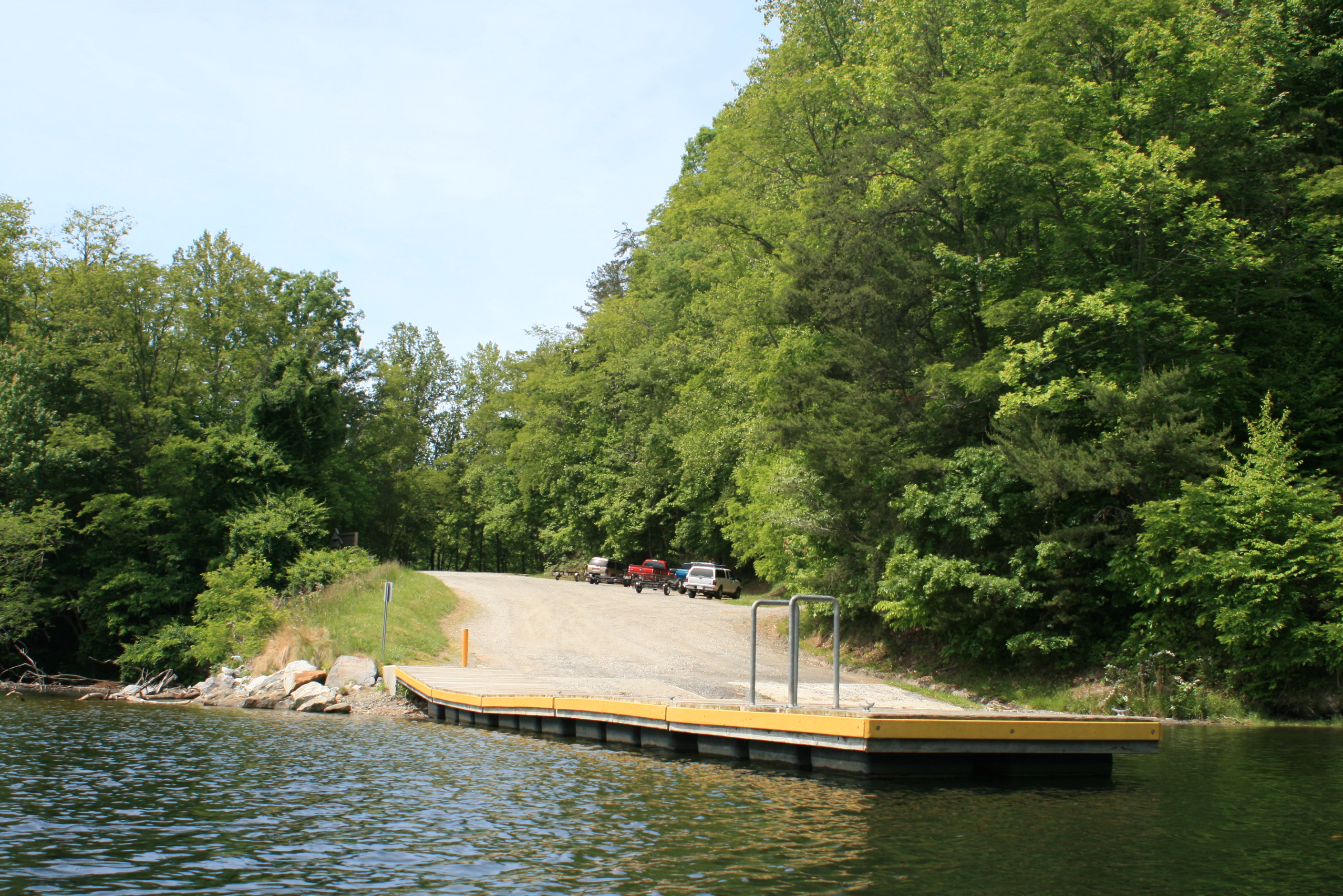
 Gordy drove down from Delaware and we proceeded to The Suwanee River State Park where we camped on Sunday, the next day (Monday) we would take the shuttle from the Suwannee Outpost to Fargo, Ga – from Fargo it would be 221 river-miles to the Gulf, via the Suwannee.  There are other outfitters available but the Suwannee Outpost seemed the most convenient (our vehicles would be riverside and secure at the one-third mark, an advantage if restocking or adjustments were needed).

Dropped Off

Fargo, Ga. – DAY ONE, (Monday) – 221rm to 203 river mile = 18 work miles (10-days planned)

1104-IMG_7731

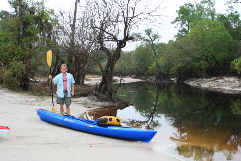
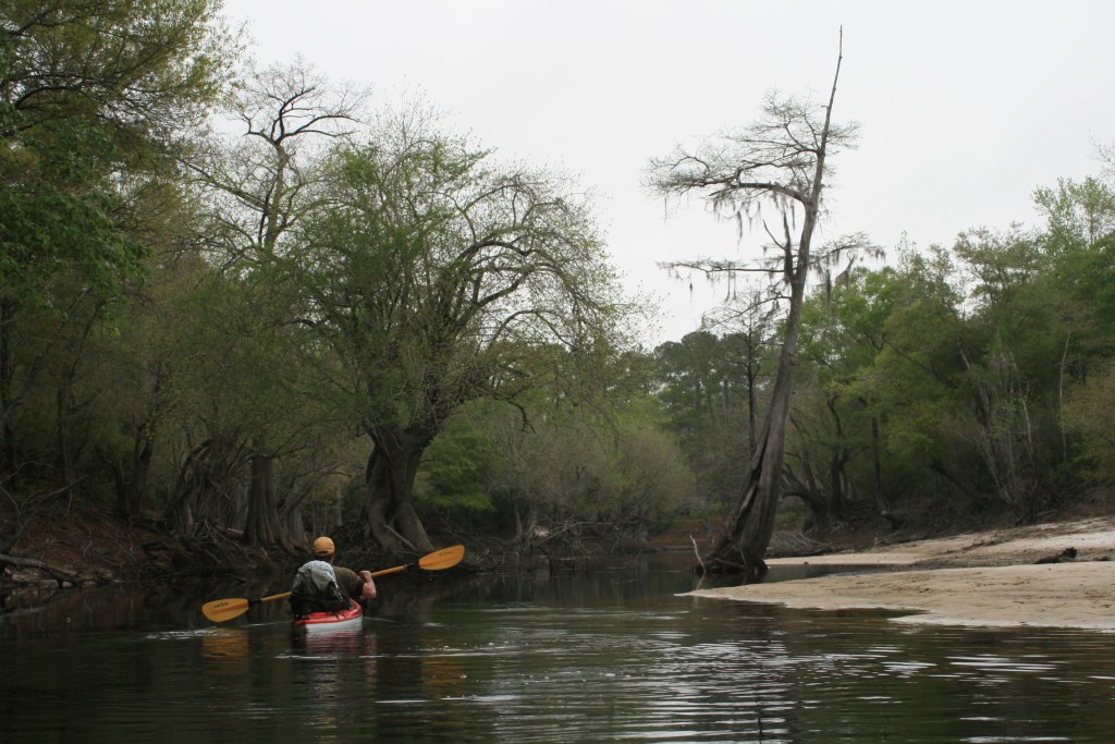
The lowest recommended paddle depth for this section of the river is a 51-foot reading at White Springs, on this date it was low-water 50.4 – a deterrent?, – naaa, too many things in motion, us being the largest factor.  It was a late 10 am drop off and start from the Highway-41 bridge in Fargo – a handshake, and Gordy and I were off.

A later high water paddle at 60.3 ft – same area/distance.

The Suwannee in Georgia

1104-IMG_7801.

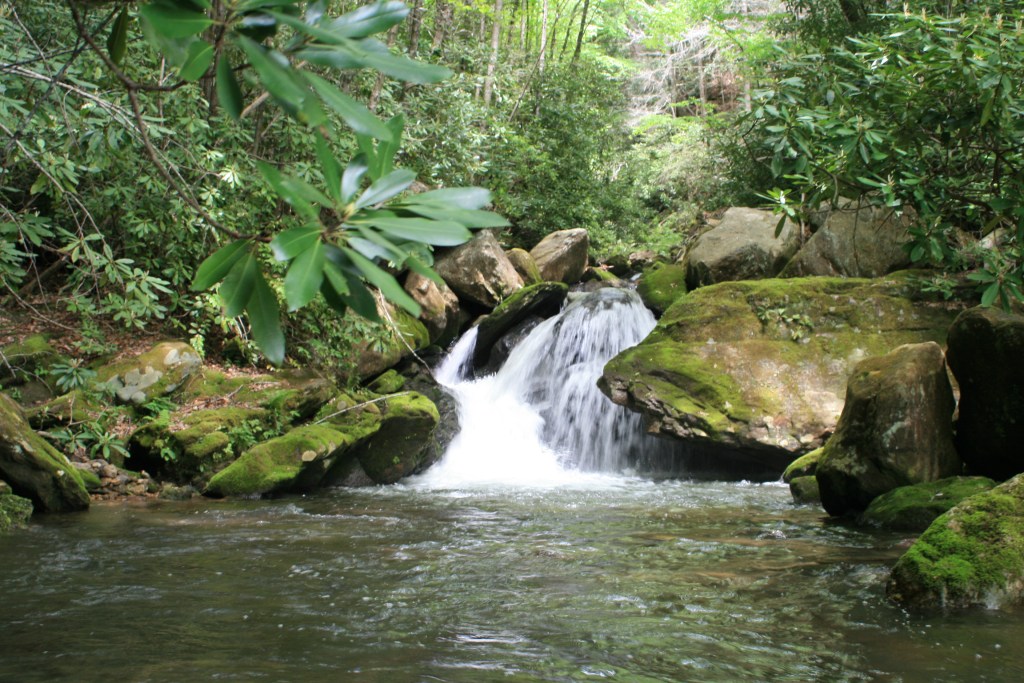
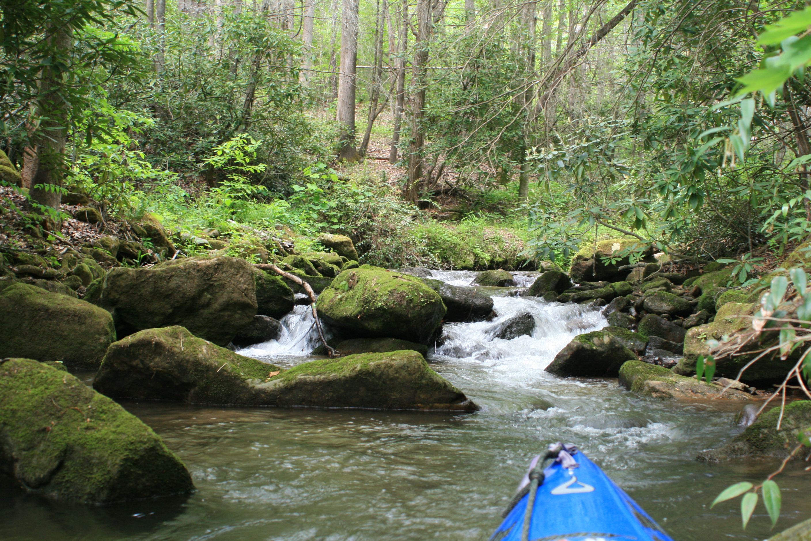
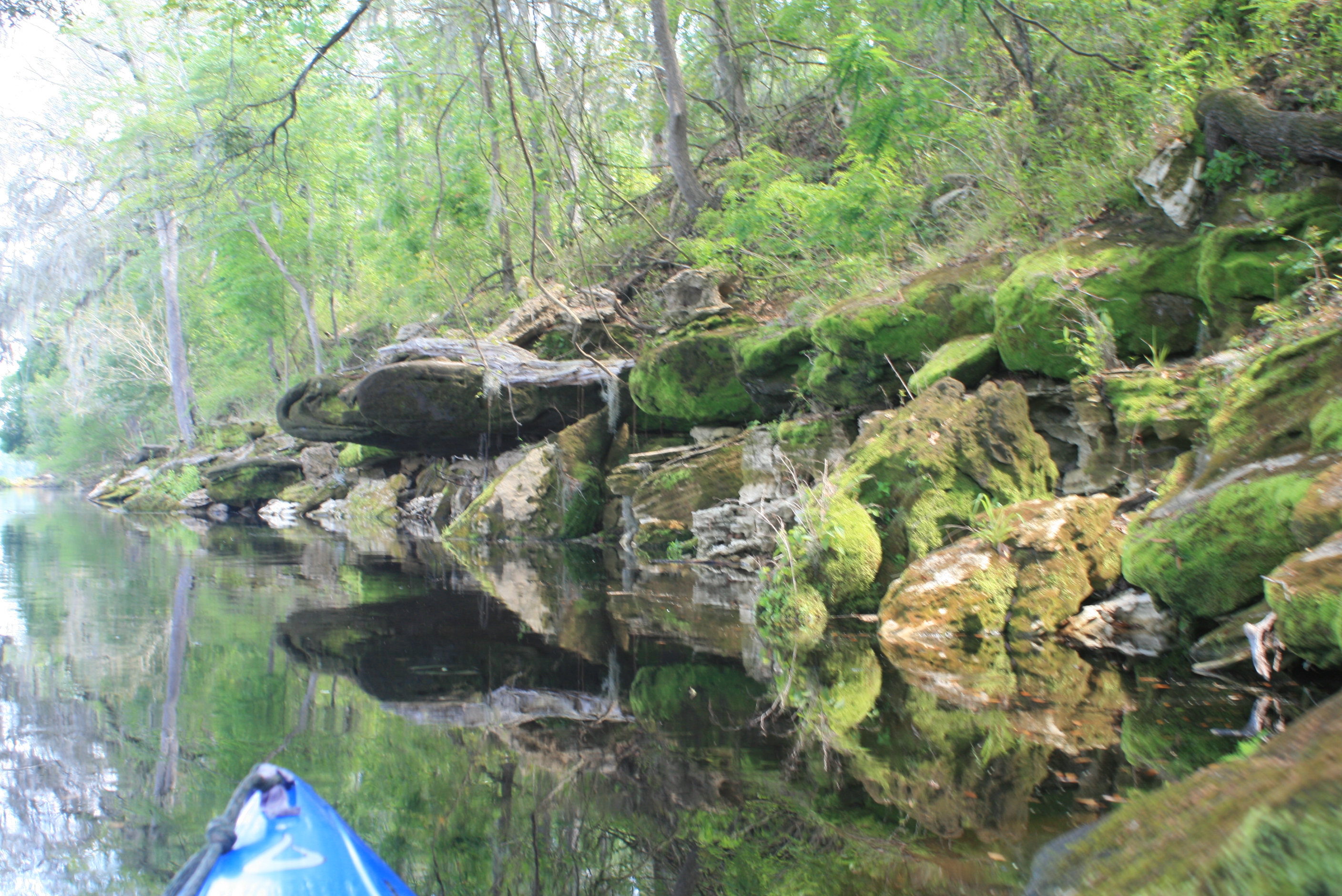
Here the little creek 12 miles out of the Okefenokee Swamp really wasn’t much, but it was full of character – both natural and human, which on this date we found naturally stoic.  The shorelines were weathered and the ‘line’ of the river randomly altered, everything about the Suwannee was interesting – it remained that way the entire paddle to the Gulf (at Suwannee, Fl), cool.

With the White Springs reading at 50,’ the Georgia section of  the Suwannee shows all the signs of rapid fluctuation – a ravaged and beaten shoreline. On this date we saw it totally placid and seemingly dead-still – several times through the day we commented about the ‘peaceful nature’ of it all.

IMG_7788

There were the anticipated areas of shoaling (movement of sand creating sand-bars or shallow water), and places between the slow water where stepping-out to cross or a simple hand-shove (low water) was necessary – not bad, just “part of it.”

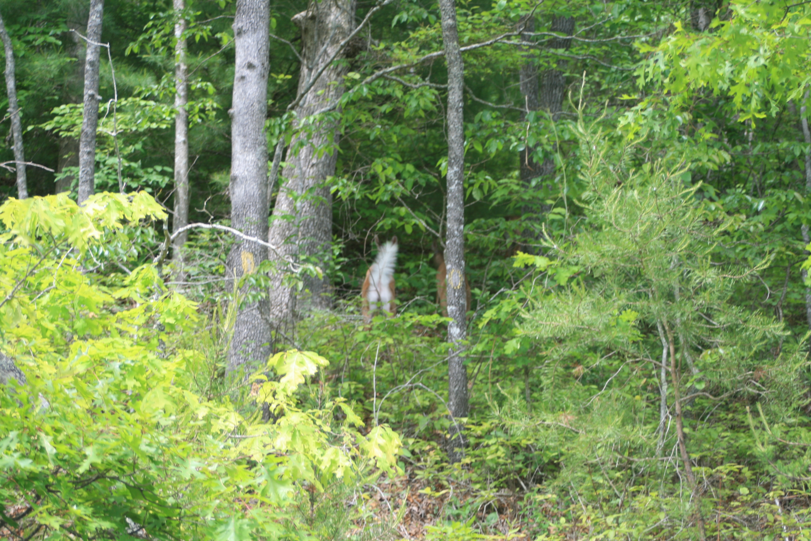
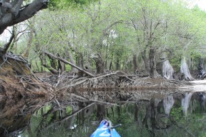
The gnarly tree roots were ever-present, the natural rebellion of trees vs the elements to survive creates a myriad of character.  There were the occasions where an aged tree had lost the battle and crashed into the creek.  There were also reminders of the once vibrant era of nearby Ga highway-41 – where an occasional dated tire (50’s/60’s) peeked from the shoreline; fixture’s – not so much ‘trash,’ but adjusted within the setting as ‘relic’s’ to contemplate.

ever-dilligent Osprey

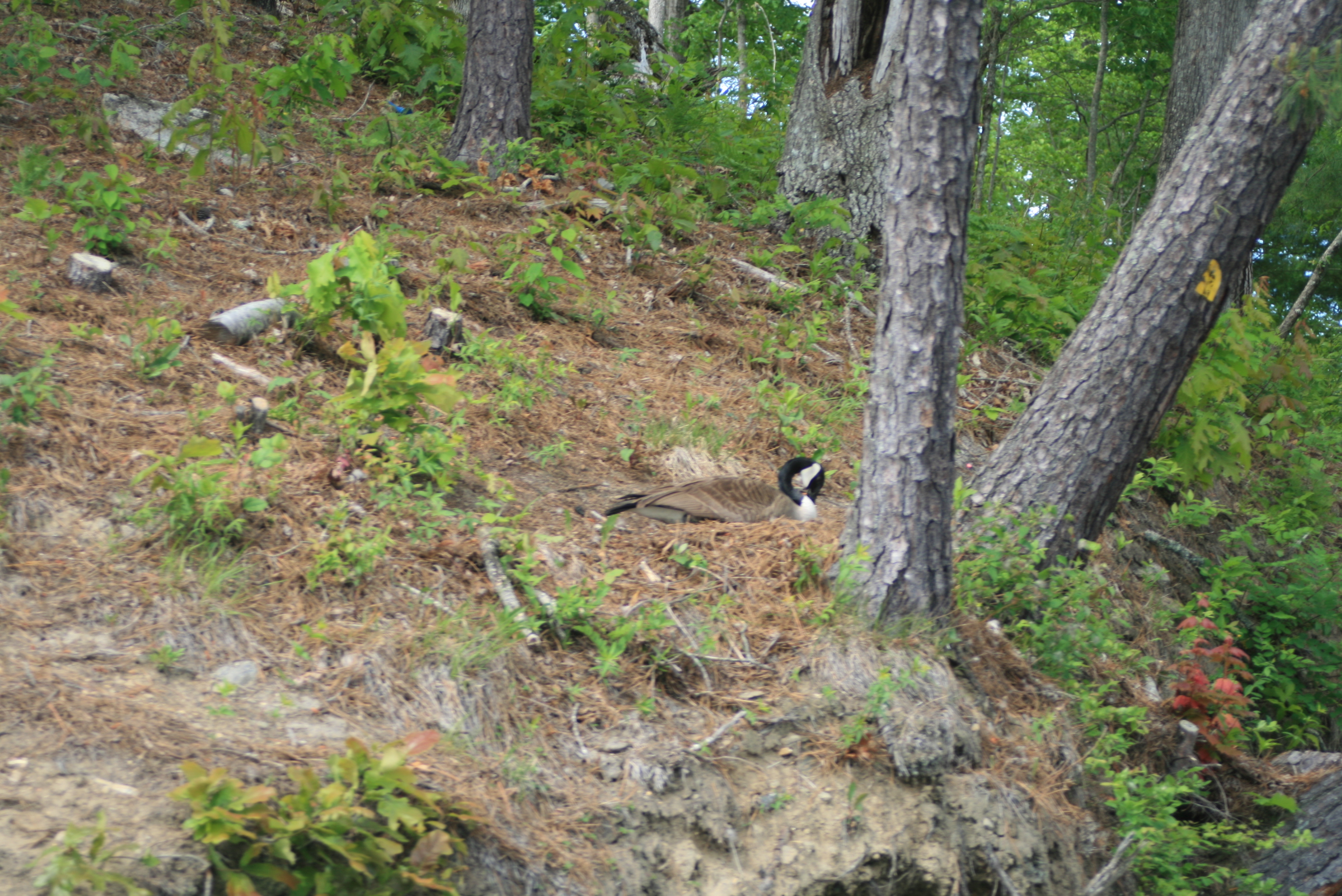
There were the kingfishers darting about, an Osprey (which I think remained with us the entire trip) continually working far ahead in search of prey that sensed our movements.  Like the Current River trip, I’m starting to believe that its an ‘opportunity’ that these birds use in catching prey ahead from our movement.

And there was the almighty ‘peace,’ surrounded.

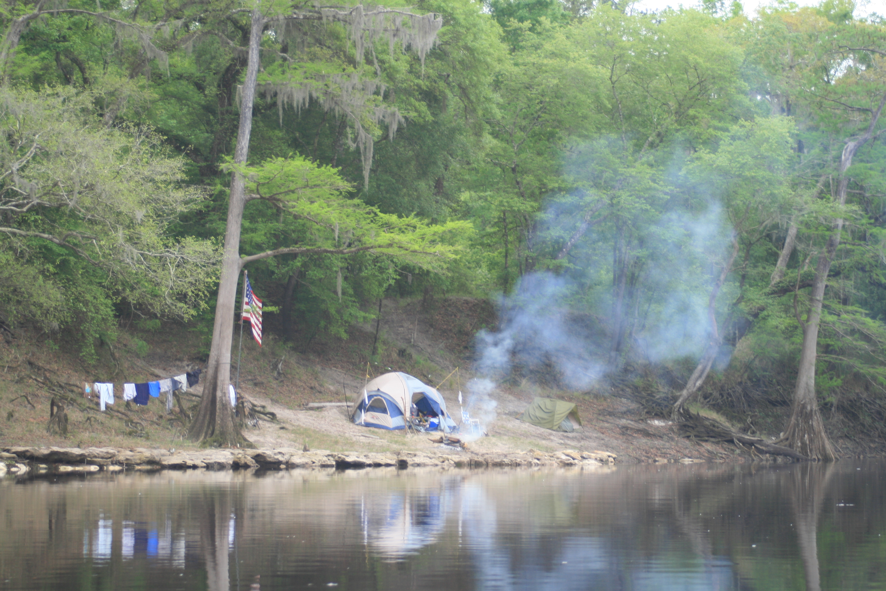
We paddled until about five before setting up camp high on river-left – near the Fla/Ga state line.  Finishing the last half of our Subway sandwiches for supper and zzzzzzzz by seven, only the Owls stirred after that.

The first day had been overcast and misty – ‘just another part’ that anyone has to anticipate dampness when making a multi-day paddle.  Periods of lite rain arrived during the night.

Topside of the Suwannee, 2017

Facebook Post – “Fargo to Ga/Fla line, late start, 16 miles – low water, getting lower, Overcast day with mist, kinda nice – felt like it was 80. Gnarley trees, owls, Osprey’s. Camped on suwannee, day 1 done, using battery power to post – alls good”

.

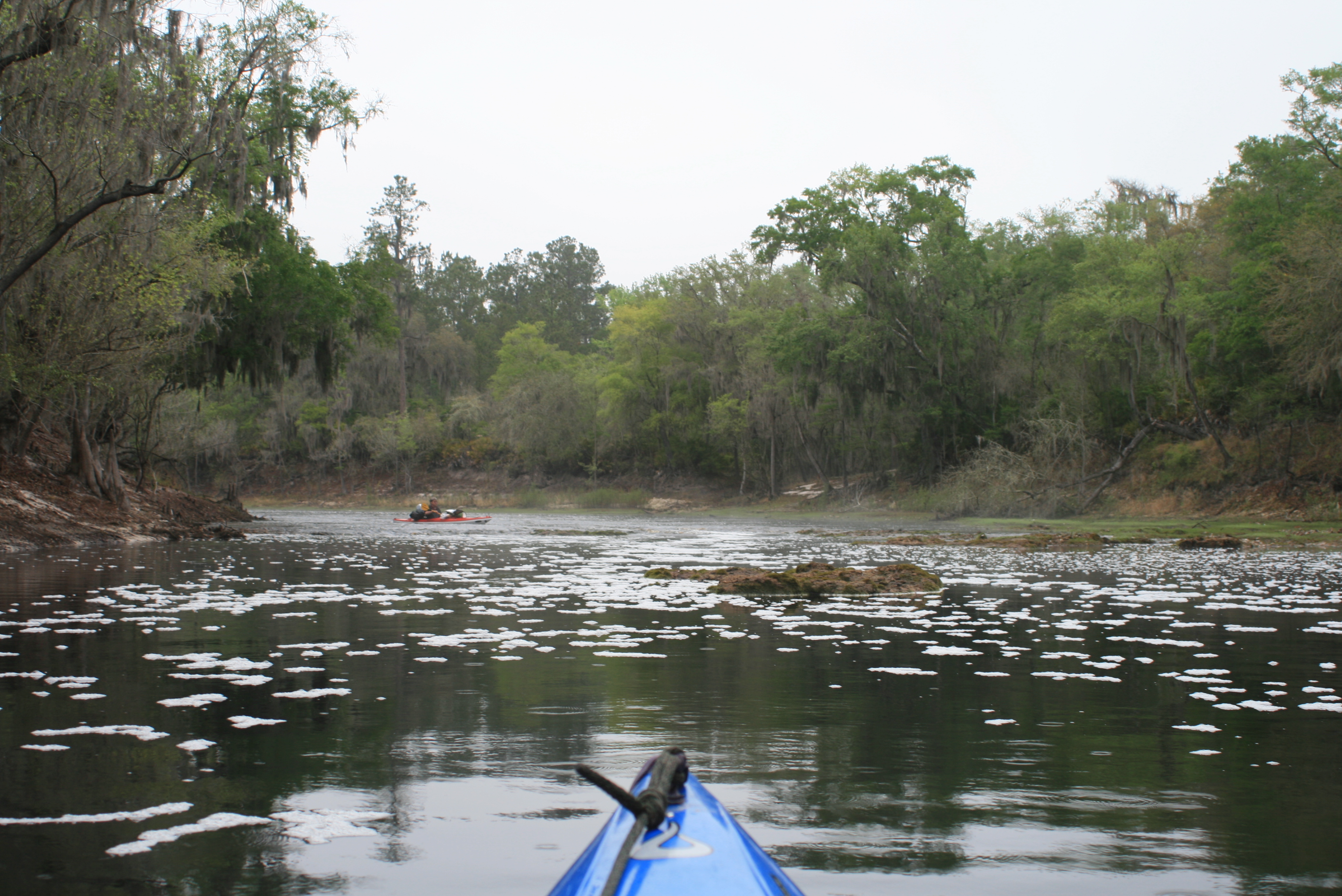
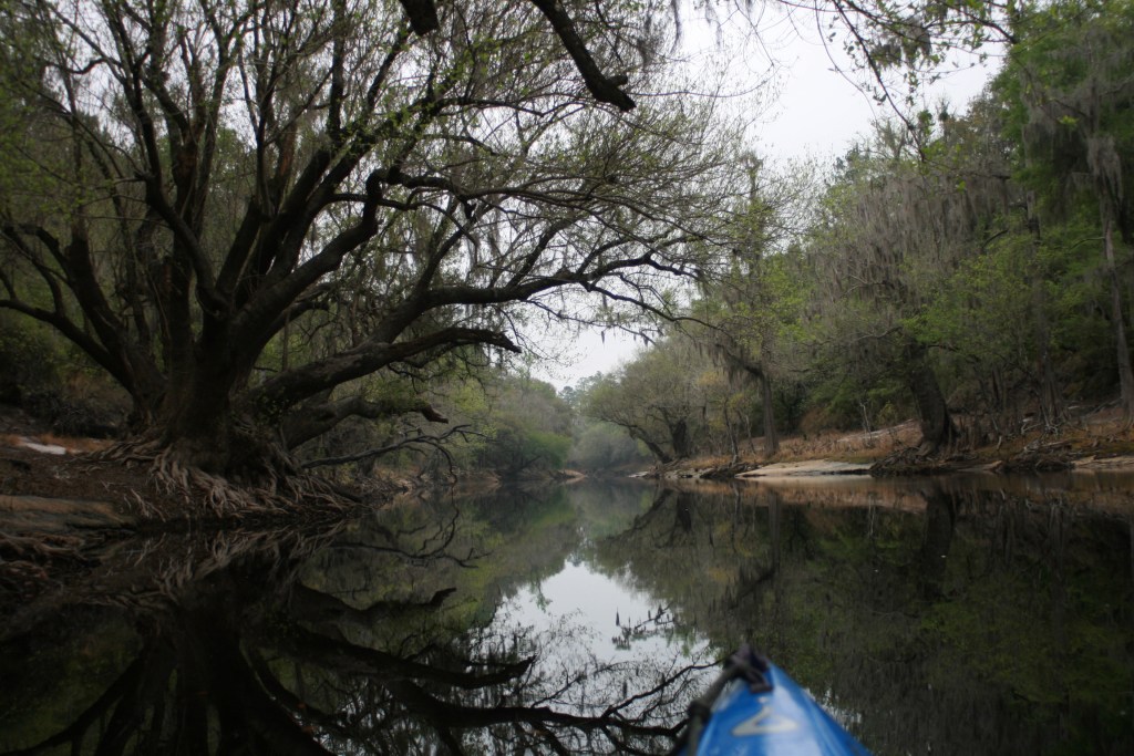
DAY 2  (Tuesday)- 203 rm to @180 rm = 23 ‘easier’ river miles

For the most part the lite rain passed through the night – so we packed damp gear. It was insta-breakfast meals (not bad), and some ‘rough’ river-jolt (coffee).  Chewing on a few grinds we were bac on the water by 8a.

IMG_7833

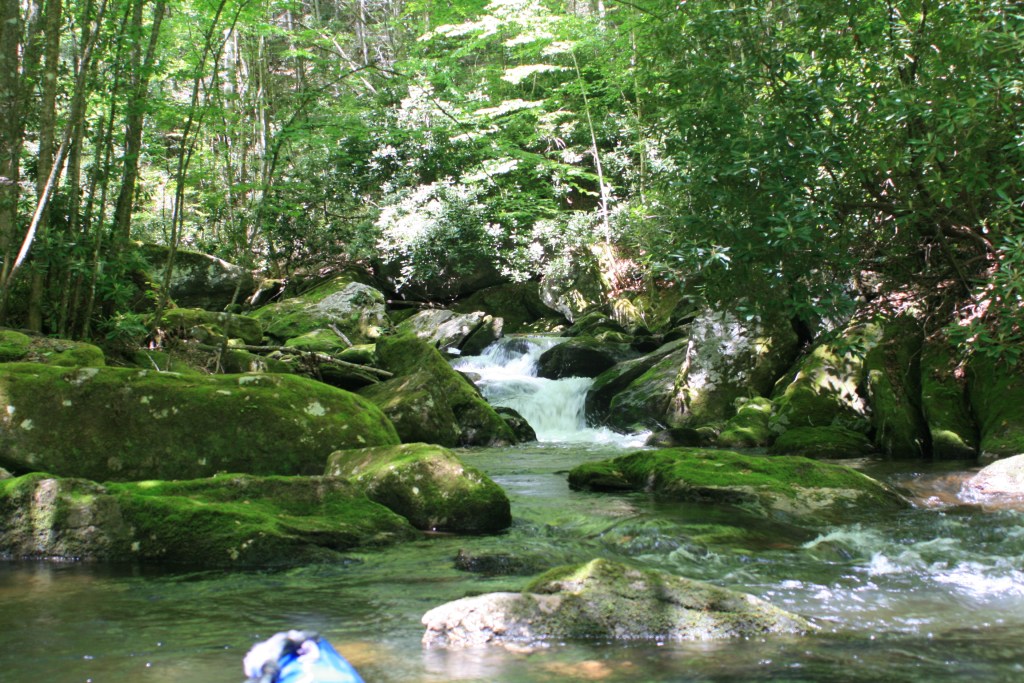
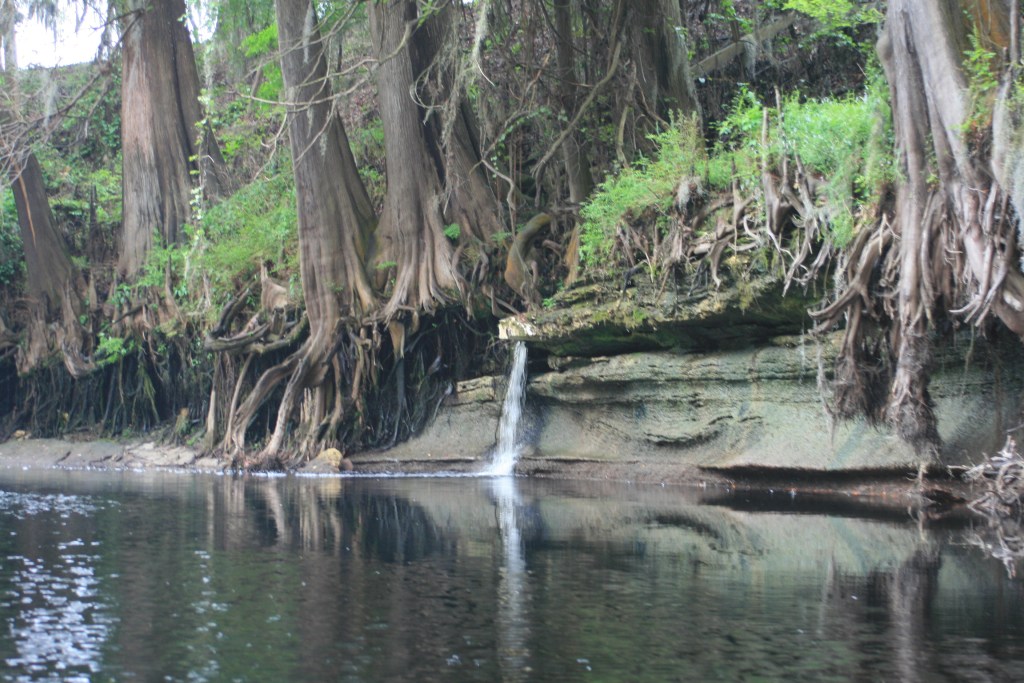
The creek now resembled a larger stream, there were longer and deeper sections of ‘slow-water’ and stepping out for shoaling was less frequent.  There were also occasional areas of rock shoaling where ‘picking a line‘ was necessary.  At the 50.4 ft water mark, locating the ‘right line’ (decision-making) through these shoals became a game.  At the same time – each narrowed current provided a simple and welcomed ride.

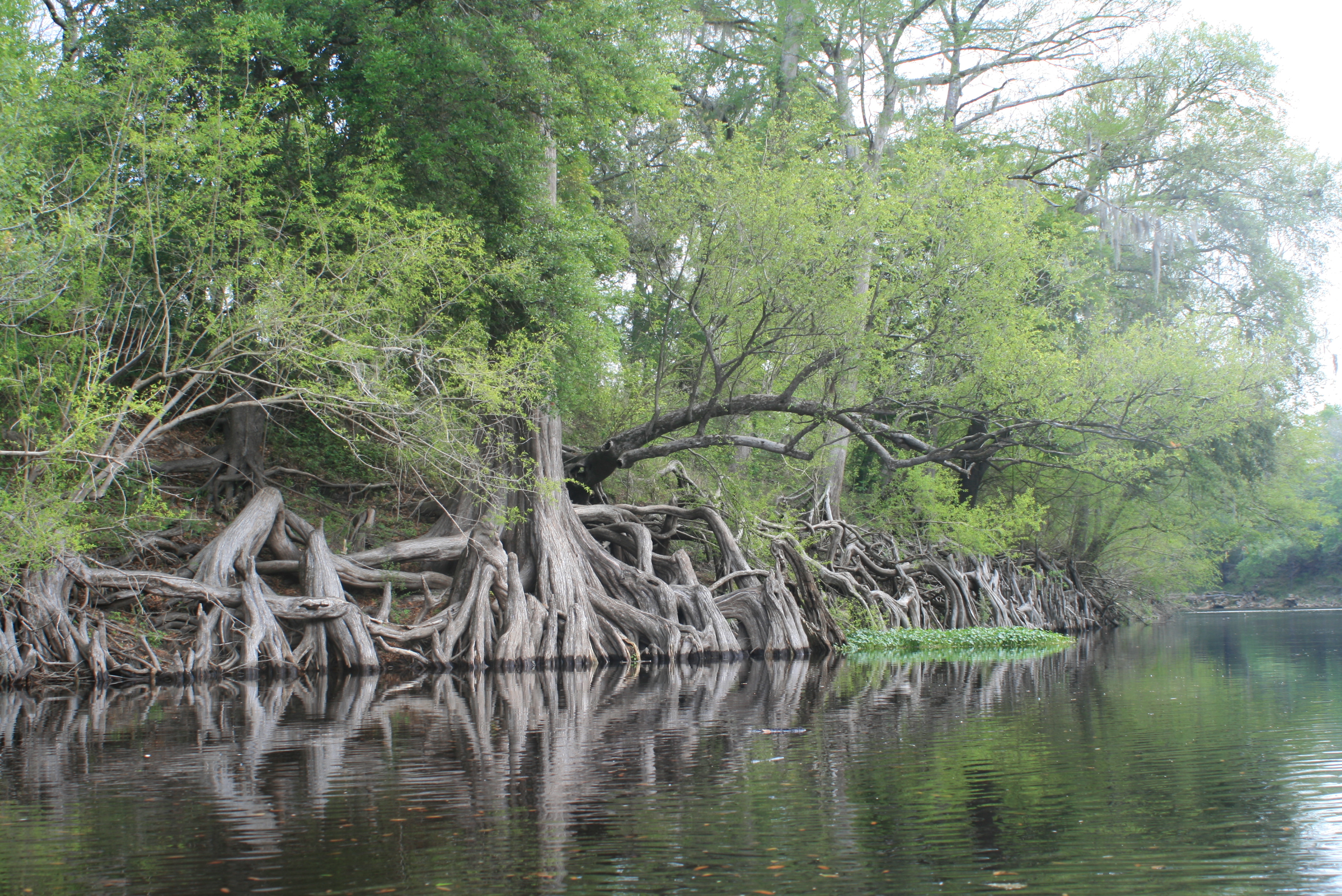
The bubbles (above) showing were from the water flowing over the porous rocks in combination with the tannic acid (natural coloring from the leaves, vegetation) composition of the water – not from any unwanted crap in the water.

In retrospect the Suwannee’s water had a ‘quality’ feel to it all the way to the Gulf.

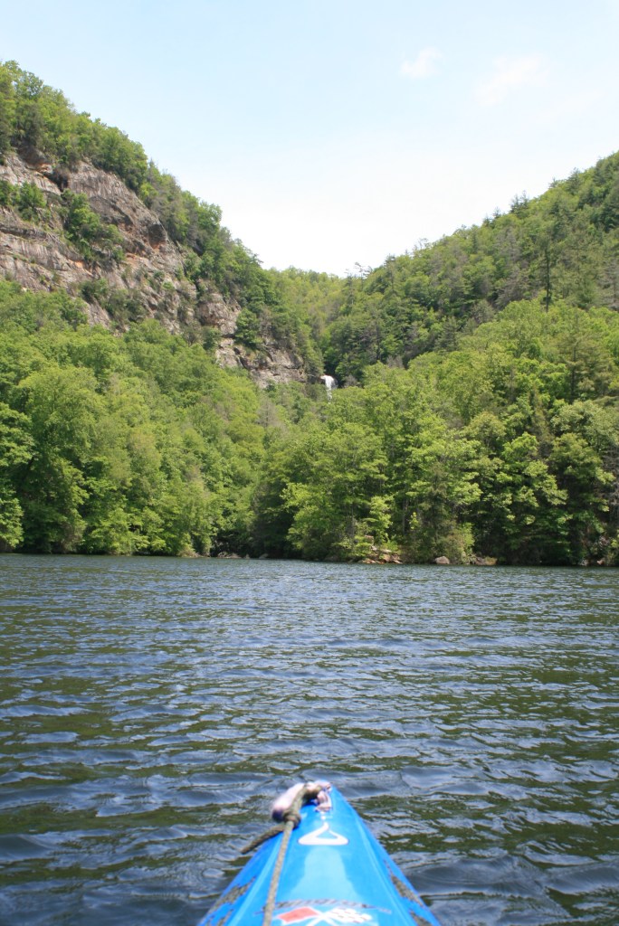
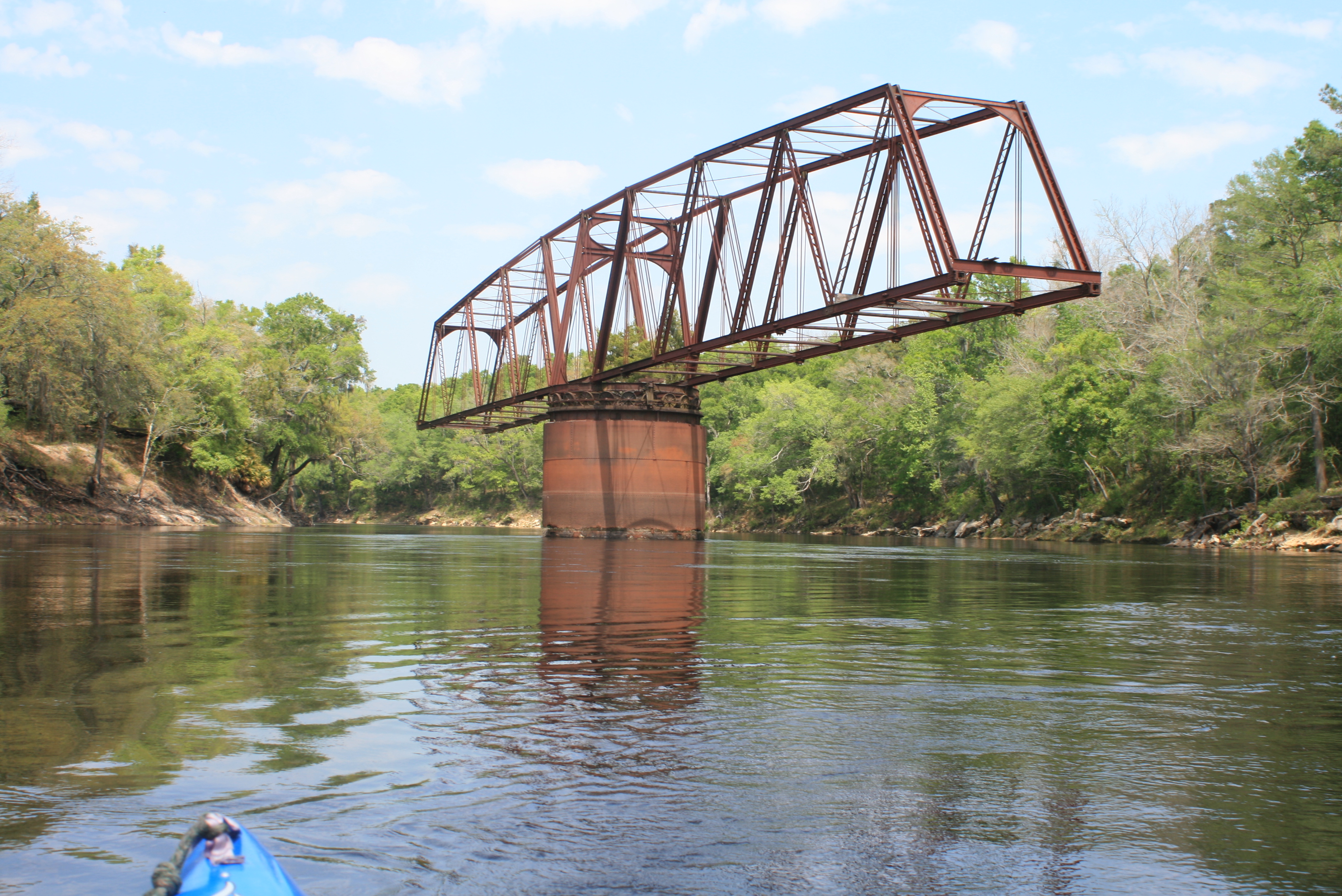
Around 11 am we made the Hwy-6 bridge, an optional shuttle starting point for many paddlers from Live-Oak.

IMG_7855

Around three pm we made the Cone Bridge Landing; interesting thing here was ‘as the crows fly’ the area between Cone Bridge Landing and Hwy-6 was 5 miles, but via  river it had been 9 river miles.. still alot less deviated than the Mississippi.  Just a note for this section; in between is ‘limp-dick’ bend, no kidding that’s the real name -if/when you look at the aerial view of this section – well, you figure it out.

The images within the trees along the river are incredible also, easily leaving room for similar landmark namesakes….

Our paddle rate was in the neighborhood of 2.5 mph, a comfortable rate – this would increase slightly downriver, but not by much.

This was not a trip to ‘paddle’ the Suwannee; it was a trip to ‘enjoy’ the Suwannee – while simply paddling it.

1104-IMG_7879

Not a bad day on the Suwannee – even though it was overcast with lite rain – the underlying current gave it a ‘soft’ comfortable ride.  It was a fine day in ‘the lawn chair‘ as our-buddy the Osprey remained diligently working the waters ahead.

(“my vessel is as comfortable as any ‘lawn-chair’ that I’ve ever sat in.” tgh)

We passed-up on a sandbar in the middle a few miles back and regretted it; not so many miles later we stopped near a private hunting camps boat ramp (@180 rm) – mosquitoes were present (but not a factor in the tent). With water levels a little higher I’m sure the camp-site on the Big-Shoals portage would have been achieved, but for this night; this ‘was-what-it-was’ – just a “part of it.”

Another night of movement in the woods and owls courting throughout the night; there were a few flashes of lightning crossing the sky.

Sleep was fleeting; the ‘pollen-lines’ that I had noticed earlier along the river haunted me. sinus stuff.

Still, mornings come – again up to Gordy’s boiling water, insta-food, and coffee – a ‘wet pack and damp start to day-3.

Topside of the Suwannee, 2017

Next Day;

.

More day 1 and 2 pictures

.


more information this link; SUWANNEE RIVER MILEAGE INFORMATION, TRIP IDEAS

Suwannee River Mile References 

Note; the Suwannee river’s mile references are correct – yet there are no physical markers (signs) along the river to help with ‘exact’ orientation. Markers on any river are not absolutely necessary but after a career of emergency service – having ‘marks’ along the way seems prudent – and, just maybe I was a little spoiled from 1800 miles of the Mississippi River where those ‘benchmarks’ provided some entertainment on the long hot days.  The Current river is another frequented river which could benefit with certain signage and benchmark’s.

As for river-speed, just estimate a casual paddling rate of 2.5 to 3 mph (a solid mph greater with high water)

.

240.o The Okefenokee Swamp – a tricky section with several short portages

221.0   Hwy 41 at Fargo, Ga from here it’s a nine day paddle to the Gulf.  Check the water table reading at White Springs;  below 52 feet (less water) = more paddle  53 to 61′ reading (more water) = nice ride, fluid paddle

206      Georgia/Fla line   (night-1 from Fargo, wilderness camp)

202.0 – Roline Ramp

197.7 – Turner Bridge ramp

195.7   Highway-6; some start here, three days two nights to SR Outpost – Big Shoals portage ahead

185 – ‘Limpdick’ bend

186.5 – Cone Bridge ramp

180   (our night 2 from Fargo, wilderness camp) – sandbar in river, or high water will get you to Big Shoals

177.1   Big Shoals State Park – to right

177.5   Big Shoals – to left, portage, signs, campsite – Fla’s only natural class III rapid –  N 30 21.19, W 82 41.24

171      Highway-41 at White Springs;  Great starting point for 2-day one night paddle to SR Outpost, ‘playful section’

168.3   Hwy 135   Stephen Foster State Park White Springs – Hub; Hubs are towns or parks  ‘ A wide range of goods and services are provided to meet visitors’ needs. Visitors can enjoy special events, shopping and other activities.

163.2 – Interstate 75 – Blue Sink Launch/ramp (night 3 from Fargo – Woods Ferry camp)

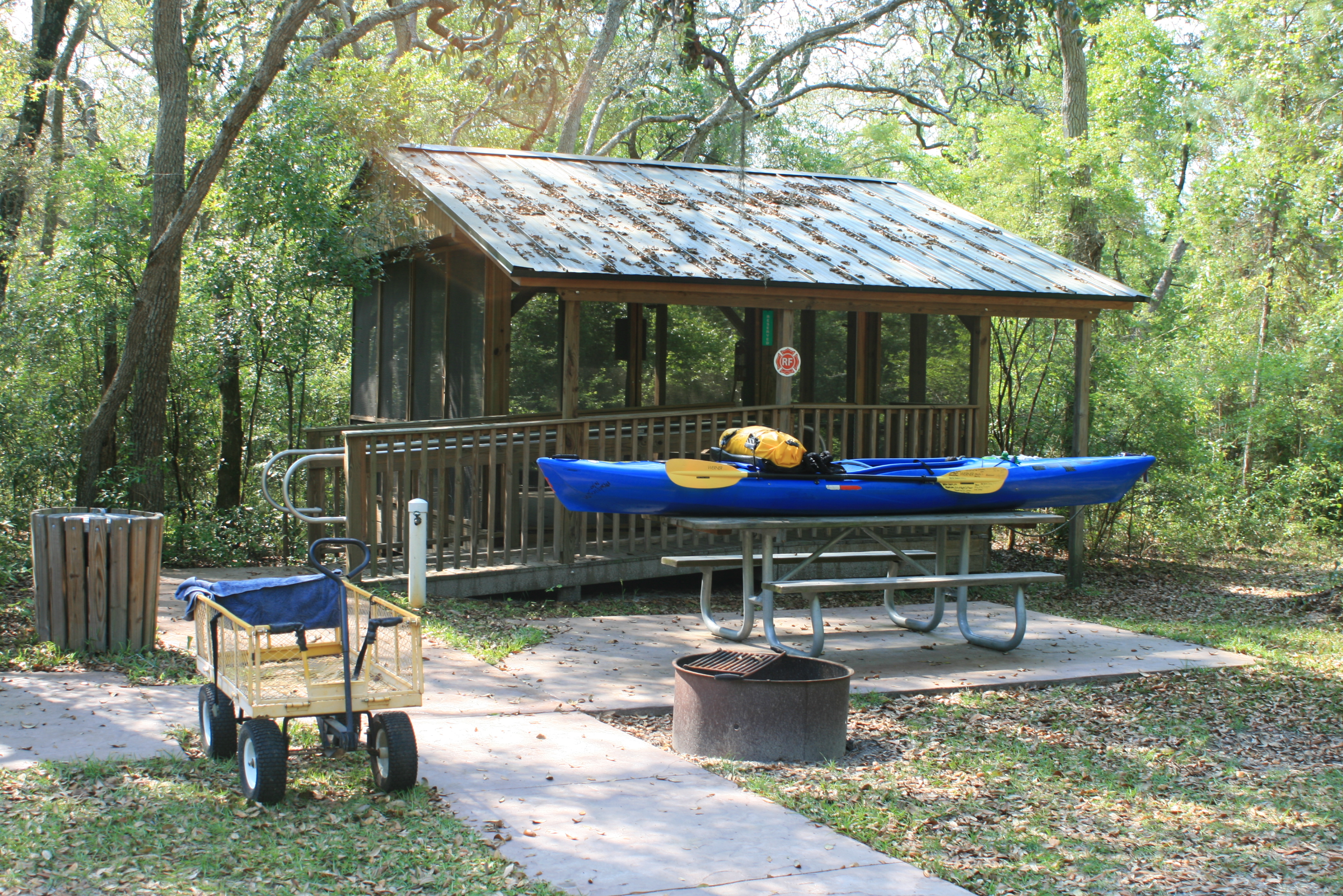
159.3   Woods Ferry River Camp – River Camps are located a day’s paddle between hubs. Accessible only from the river, the camps provide covered camping platforms, primitive camping and restrooms with hot showers – reservations; (800) 868 – 9914

158.0 – Woods Ferry Launch

150.0 – Suwannee Springs launch 

148.5   Good starting point to Gulf or shorter paddles. Suwannee River Outfitter at rear of Spirit of the Suwannee Music Park – place to leave vehicle.  Hub – Hubs are towns or parks  ‘ A wide range of goods and services are provided to meet visitors’ needs. Visitors can enjoy special events, shopping and other activities. (GPS – 2461 95th Dr, Live Oak, FL)

Our canoe start – Live Oak to Gulf – Spirit of the Suwannee Music Park ramp (eight days to the Gulf)

Nearby hotel (I-75, exit 439or Suwannee River State Park.  The Suwanee River Outpost – shortest access to Music Park (I-75 exit 451).  Easy, no hurry ‘first’ 10 mile ‘shake-down’ day with 2-mile paddle upriver to Suwannee Springs before heading downriver to Holton Creek River Camp for the night (very easy day)

140.9   Holton Creek River Camp  FREE to hikers and paddlers

River Camps are located a day’s paddle between hubs. Accessible only from the river, the camps provide covered camping platforms, primitive camping and restrooms with hot showers – reservations; (800) 868 – 9914

Night 1 from Live Oak, (night 4 from Fargo) On the river by 830, 20+ mile paddle/day. A couple light shoals below SR State Park, neat Geological layers along shore, exposed fossils – Stay at SR State park or Dowling Park river camp (it’s all “candy” after that)

135.6  Shelley Run (night camp option – private)

135.4   ALAPIA RIVER Gibson Park ramp

130.4 – BRIDGE – Road 141 ramp

127.7   Suwannee River State Park, camping/hot showers – fee. (Hub) Hubs are towns or parks  ‘ A wide range of goods and services are provided to meet visitors’ needs. Visitors can enjoy special events, shopping and other activities.

127.8   Withlacoochee River

113.0   Dowling Park River Camp       N 30 14.81, W 83 14.87    

River Camps are located a day’s paddle between hubs. Accessible only from the river, the camps provide covered camping platforms, primitive camping and restrooms with hot showers – reservations; (800) 868 – 9914

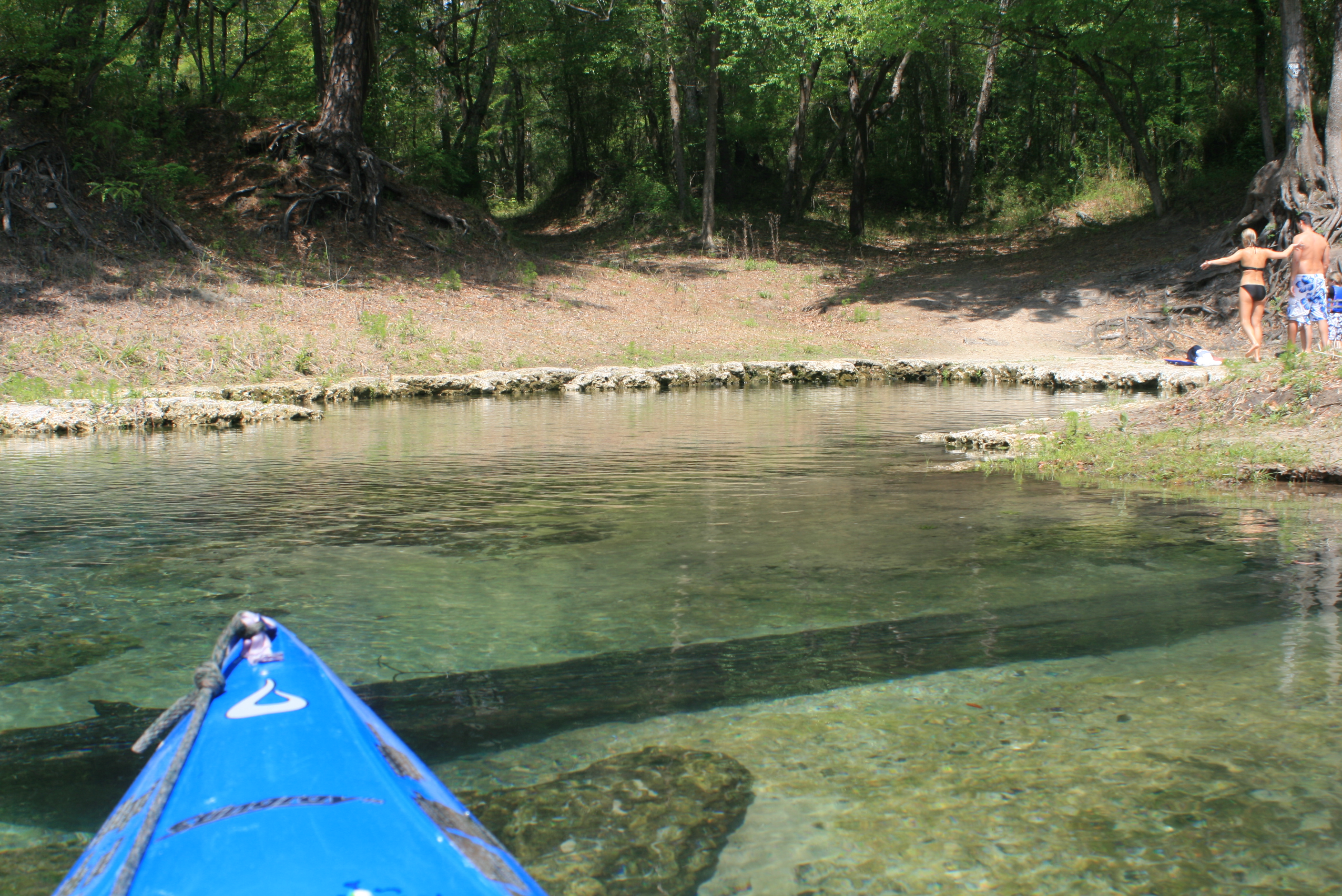
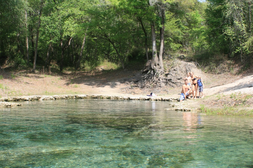
Day-3 from Live Oak (Wednesday), 29-mile paddle/day with stay at Adams Tract, or option of easier 19-mile Paddle day staying at Peacock Slough.- neat Springs along the way, laid back paddle rate – crystal clear springs, nice area.

106.5 – Charles Spring ramp

103.3   Lafayette Blue Springs State Park (Hub) Hubs are towns or parks  ‘ A wide range of goods and services are provided to meet visitors’ needs. Visitors can enjoy special events, shopping and other activities.

97.4 – Telford Springs ramp

95.8    Peacock Slough river campRiver Camps are located a day’s paddle between hubs. Accessible only from the river, the camps provide covered camping platforms, primitive camping and restrooms with hot showers – reservations; (800) 868 – 9914  (Night 3 from Live Oak)

Day-4 from Live Oak, More Springs, City-restaurant food ahead in Branford, paddle rate determines stop for the night with the Santa-Fe river as an Objective – Ivy Park at Branford has primitive/tent camp area – no showers

85.5     Adams Tract River CampRiver Camps are located a day’s paddle between hubs. Accessible only from the river, the camps provide covered camping platforms, primitive camping and restrooms with hot showers – reservations; (800) 868 – 9914   (night 6 from Fargo)

82.0 – Ruth Springs ramp

– Troy Springs – Little River Springs

76        Highway 247 at Branford, Fl (just before – easy walk up behind the old train depot – park is just after)

76        Ivey Memorial Park/ramp – Branford ; (Night 4 camp from Live Oak, primitive camp with land-food)

65.5     SANTA FE RIVER  RIVER  (Ichetucknee Springsbeautiful beach to camp on

56.6     Highway 340  /ramp – FOOD/COLD BEVERAGE STORE at top of ramp Rocky Bluff Store

55        Gornto Spring County Park ; Night 6 from live Oak, primitive camp at Park, fee – cold shower – (this place can be a ‘zoo’ on the weekends (‘locals’))

43.1     Hart Spring County Park /ramp            N 29 40.46, W 82 57.26

35.8     Highway 98  Suwannee Gables Ramp

34.2     Fanning Springs State Park Camping, cold-water showers – good food across street (Hub) Hubs are towns or parks  ‘ A wide range of goods and services are provided to meet visitors’ needs. Visitors can enjoy special events, shopping and other activities.

(Night 6 from Live Oak, night 8 from Fargo)

25.1     Manatee Springs State Park; camping, but sites are a long way from ramp.  Canoe/kayak friendly (paddle in) April 1 to Nov 1    N 29 29.34, W 82 58.67

22.7 – Yellow Jacket Ramp – campground

16.8 – Fowlers Bluff Ramp   primitive camp at Treasure Cove restaurant, land-food, live music, cold beverage.  natural-water (garden-hose) shower (Day 7 camp from Live Oak)

Day-8 to Suwannee, the town -expect ‘no-see-ums’ (flyin teeth)

3.9   Anderson Landing River Camp Camping (room or tent – no credit cards), hot-water showers, good food walking distance (Hub) Hubs are towns or parks  ‘ A wide range of goods and services are provided to meet visitors’ needs. Visitors can enjoy special events, shopping and other activities.  (Day 8 from Live Oak, Day 9 from Fargo)

(address)

(GPS – 18 SE 225 St, Old Town, FL)

Note; Live Oak to the Gulf trip with ‘green’ canoeists limited mileage to twenty a day – kayaks alone may average 25 to thirty miles a day – but hey, sometimes its good to slow down and appreciate the setting…..

.

PAST TRIP OVERVIEWS

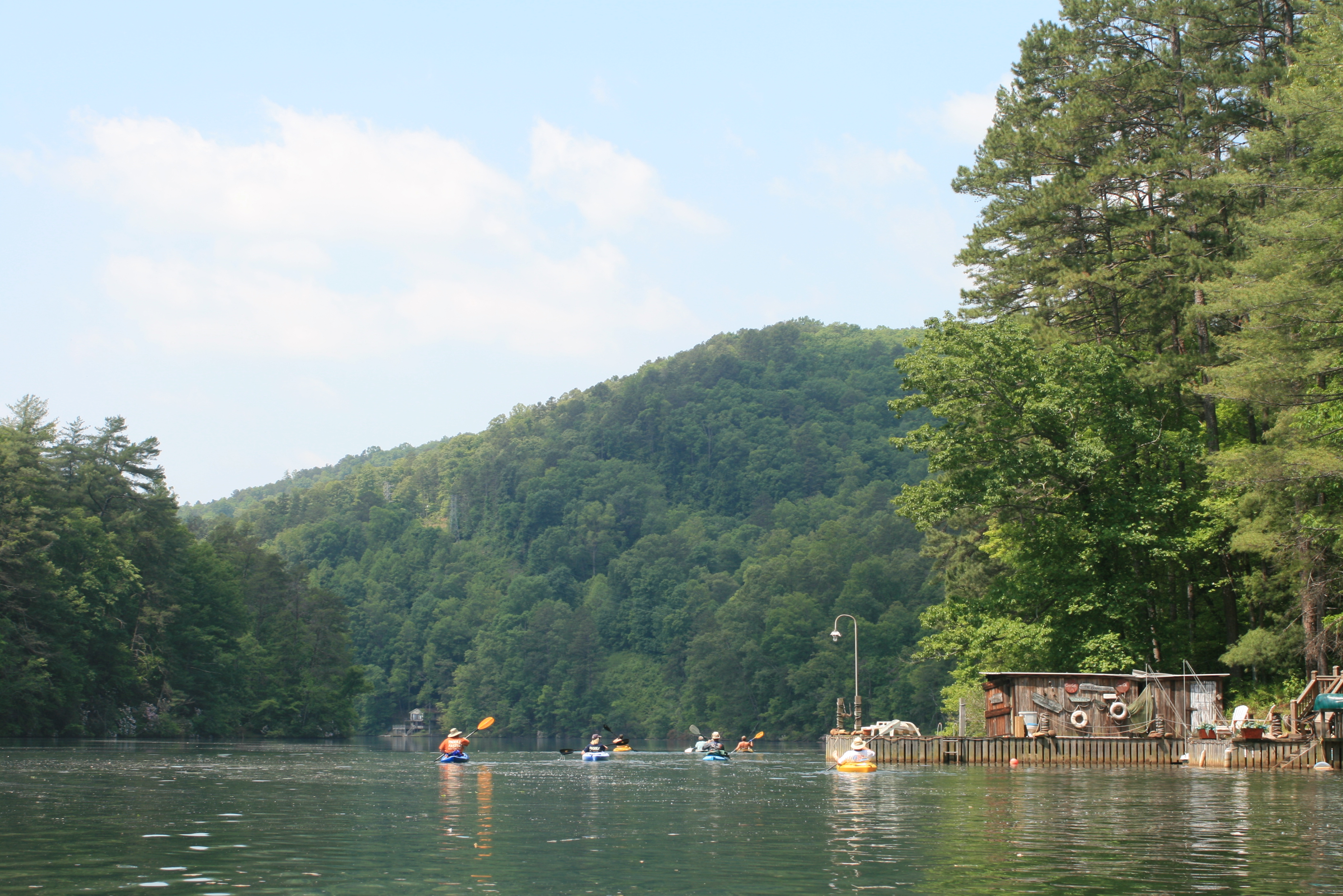
Fargo to the Gulf – kayak (225 miles) High water

.

Live Oak to the Gulf – canoe (150 mile)

Suwannee River Grin – 4 posts

.

Fargo to the Gulf – kayak (225 miles) Low water

A River of Time – 8 posts

  • Days 1 and 2 Fargo Ga, to riverside camp to just above Big Shoals (178rm)
  • Day 3 Big Shoals to Woods Ferry River Camp (159rm)
  • Days 4 and 5 – Woods Ferry to riverside camp (136rm) to Dowling Park River Camp (113 rm)
  • Day 6 – to Adams Tract River Camp (85 rm)
  • Day 7 – to riverside (56rm) just above Gornto Springs (56rm)
  • Day 8 – to Fanning Springs (34 rm)
  • Day 9 – to Anderson River Camp
  • Day 10 – Suwannee, Fl (03rm, Gulf)

.

Kayaking the Suwannee River, Fargo to the Gulf (day 6)

6 Comments

– Post 4 of 8 –

A RIVER OF TIME

Georgia to the Gulf, 225 river miles, 10 paddle days

Dowling Park River Camp to Adams Tract River Camp

.

Day 6 (Saturday) – Dowling Park River Camp (113 rm) to Adams Tract River Camp (85rm)

1104-IMG_8413

Cloudy weather, but sunny – and once again on the river before 830.  Paddling in the early mornings are surrounded by ‘peace.’  the wind is nil while the water is like glass. This morning its an easy stroke along the shady side while pondering the individuality of the docks and stairways of the homes along the way.

It’s a ‘soft’ underlying current – almost a drift, but you still have to paddle leaving it easy to find your own comfortable pace along waters edge.  During the day I move from bank to bank with the shade as the river meanders – sometimes along a course that follows the most direct route, much like a race car driver uses the racetrack – there are always factors to consider, but that of being in a hurry is not one.

In the quiet of the morning several folks are having coffee riverside on their dock – a simple ‘good morning’ as I move further along.  Its the kind of morning that I felt would be the ‘reward’ after the first three days of shoals and rain, finally.  Things seem so simple out here.IMG_8265.

There is a campsite in the distance, easing toward the smoke a lone female sits just inside the tent combing her long hair, she repeats a simple “good-morning” – I nod and while wondering if there’s a fisherman nearby, I paddle on.

The surface geology remains apparent but the Suwanne’s shoreline has now become less abrupt and stark.  I sense changes within the nature of the river itself too – the same kind of change that I felt with the Mississippi river after moving on from Greenville, Ms.  It’s the point that rivers ‘open up’ becoming wider, seemingly flater (if possible), while surrounding with that slow ‘lazy feel’ about.

The Suwannee is beginning to show the same changes – with this the banks also bear less fluctuation marks and scarring from the flood waters shooting down from the North, still there are the occasional indications of periodic ravages (and/or poor craftsmanship) along the shoreline.

I imagine most of the trees and cypress are offspring from the swamps of Okefenokee – finding their downstream root after so many thousands of years.  Within the setting are also large domineering oaks – from most hang some sort of rope swing, leading my thoughts to those dated bathing suits.

1104-IMG_8426

I explored several natural springs along the way before noticing this one, each adding more quality water to the Suwannee River – so I paddle into this still pondering those dated bathing suits and noticing everything ahead – “the springs Tom, the springs”….

This is Nichole and her family,  just behind them is another part of the springs – her son Morgan had just made his first underwater journey to the main body of water – she mentioned that the name of these springs were “bathtub springs,” they had also arrived by canoe.

1104-IMG_8431

Bathtub Springs

Great little family, after simple and friendly conversation I return to the Suwannee noticing the confluence of clear spring water against the tea-colored water of the Suwannee.  It took a few more minutes to refocus on ‘the ‘river’ – sometimes life can be cruel, why can’t we stay young forever?…..

1104-IMG_8474.

A few miles down the river this long abandoned Live Oak Perry & Gulf railroad trestle helped to bring me closer to the present day – somewhere along this stretch I had completely missed the Peacock Slough River Camp – no matter, too early to stop anyway – plus after the bathtub springs scenery I needed to keep busy.  Along this area there were also several other shoals to ‘find a line‘ through.

1104-IMG_8515

Really beautiful settings along the banks.

1104-IMG_8542

After Dowling Park I had considered the Peacock Slough River Camp for the night, but it was a mere 18 mile paddle – Adams Tract River Camp was a 28 mile paddle which worked out better considering my day, at around 4 pm found the camp. and sluggishly drug traveller up the steps.

Adams Tract Showers

Adams Tract Pavilion

I had the camp all to myself for the night – asleep at dark with only a nosy armadillo moving about.

.

Facebook post; “Day 6, 28 miles to Adams Tract River Camp, a wider river with occasional clear springs along bank – interesting geological layers (ancient seabeds) and limestone (ancient coral) exposed – along with a gentle current the Suwannee has a natural ‘clean’ feel to it leaving the paddle as comfortable. Maybe a stop in the town of Branford for a real lunch tomorrow.”

.

The next day along the Suwannee; 

.

note: even though mentioned and shown on available maps – there are NO physical ‘river-mile’ indicators along the river.  For further Suwannee River mileage information, check this link – Suwannee River Mileage, Trip Agenda ideas.

Opinion; Marking existing landmarks such as bridges, ramps, and river camps with a numerical reference would provide basic orientation points (and emergency references) along the river (the Mississippi has them).

.

(tomhaynie@yahoo.com)

Older Entries Newer Entries