Ozarks National Scenic Riverways
.
(hasty post)
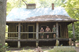
Cabin at Pulltite Spring
.
.
A while back I took a ride to California and along the way soloed a 36 mile section of the Current river from Pulltite to Two Rivers. The impression that the river left with me was one of simple awe, I like ‘good‘ water – and the water of the Current was Great! I wanted more time on the Current. To give you an example of the river’s reputation, later on that same ride I was able to paddle with a Colorado group on the Gunnison river – several of the paddlers had also experienced the Current and conveyed the highest regard for the river. The Buffalo river was also on their list.
That visit to the Ozark riverway was as the season of ‘weekend rafters’ was ending, September – truthfully the timing (and fewer doggone people) always seems to work better with my spirits (like at the Ichetucknee). ‘Off-season’ paddles ‘naturally’ increase the overall quality of a stretch or body of water, plus it’s more about why I paddle.
At that time the ‘water clarity’ and ‘natural quality’ of the Current was a strong 9+ on my ‘recter scale; also why I was eager to return. It was another one of those little circles to close….
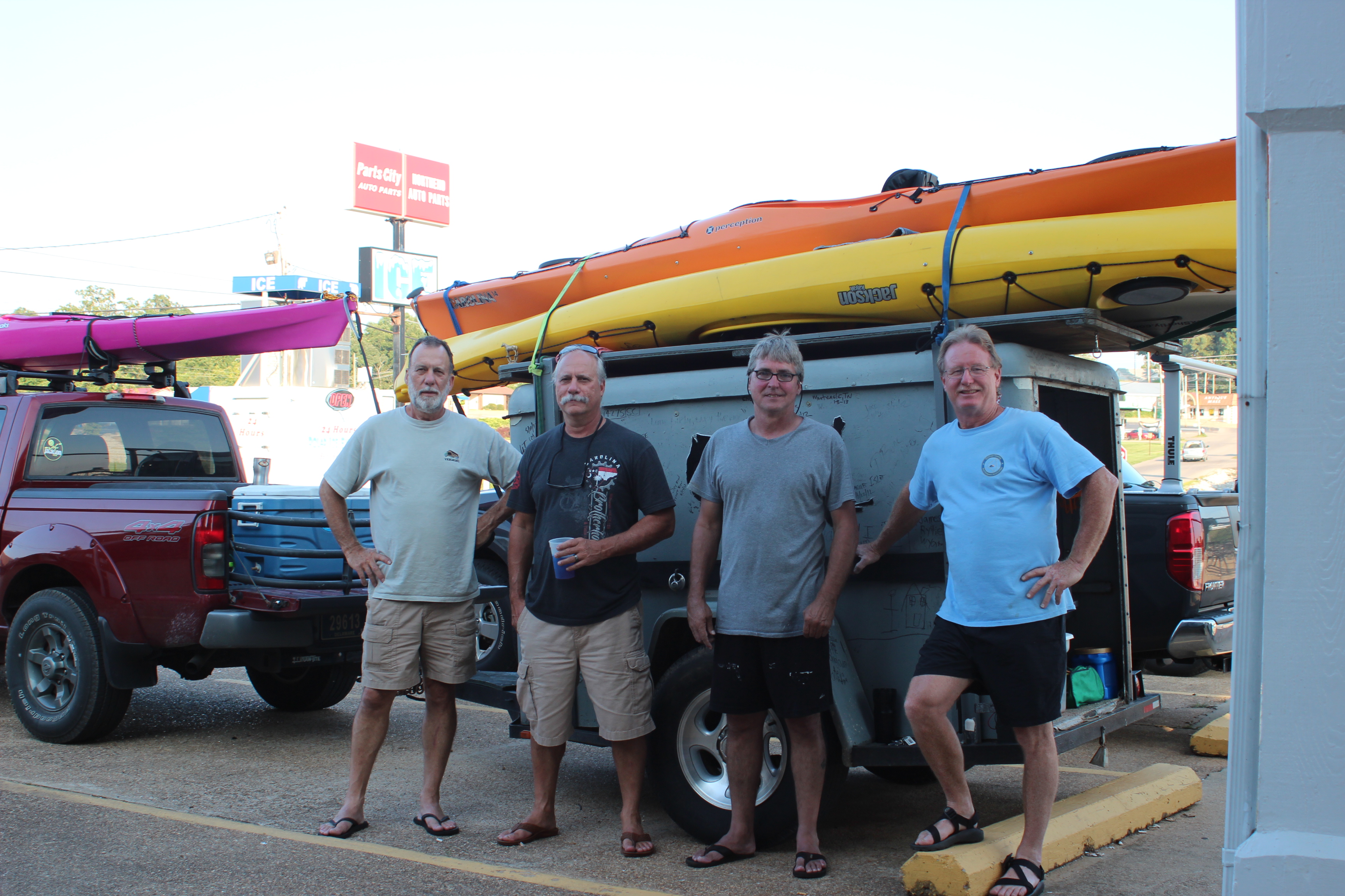
The Soggy Bottom Crew
Earlier in the year while paddling the length of the Suwannee with three friends (Carl, Gordy, and Richard), plans were thrown out to paddle the Current – and with a little time, the August date was formalized.
.

In paddlin, one of the greater hurtles ( I think) of exploring ‘yon waters’ has to be with a shuttle; also one of the reasons that I lean towards ‘distance’ paddlin too – I like to minimize frustrations. Yes I’m probably a little bit misfit/flower-child, love/peace/and all that stuff – so paddlin is mainly about absorbing the surroundings with the least amount of ‘baggage.’
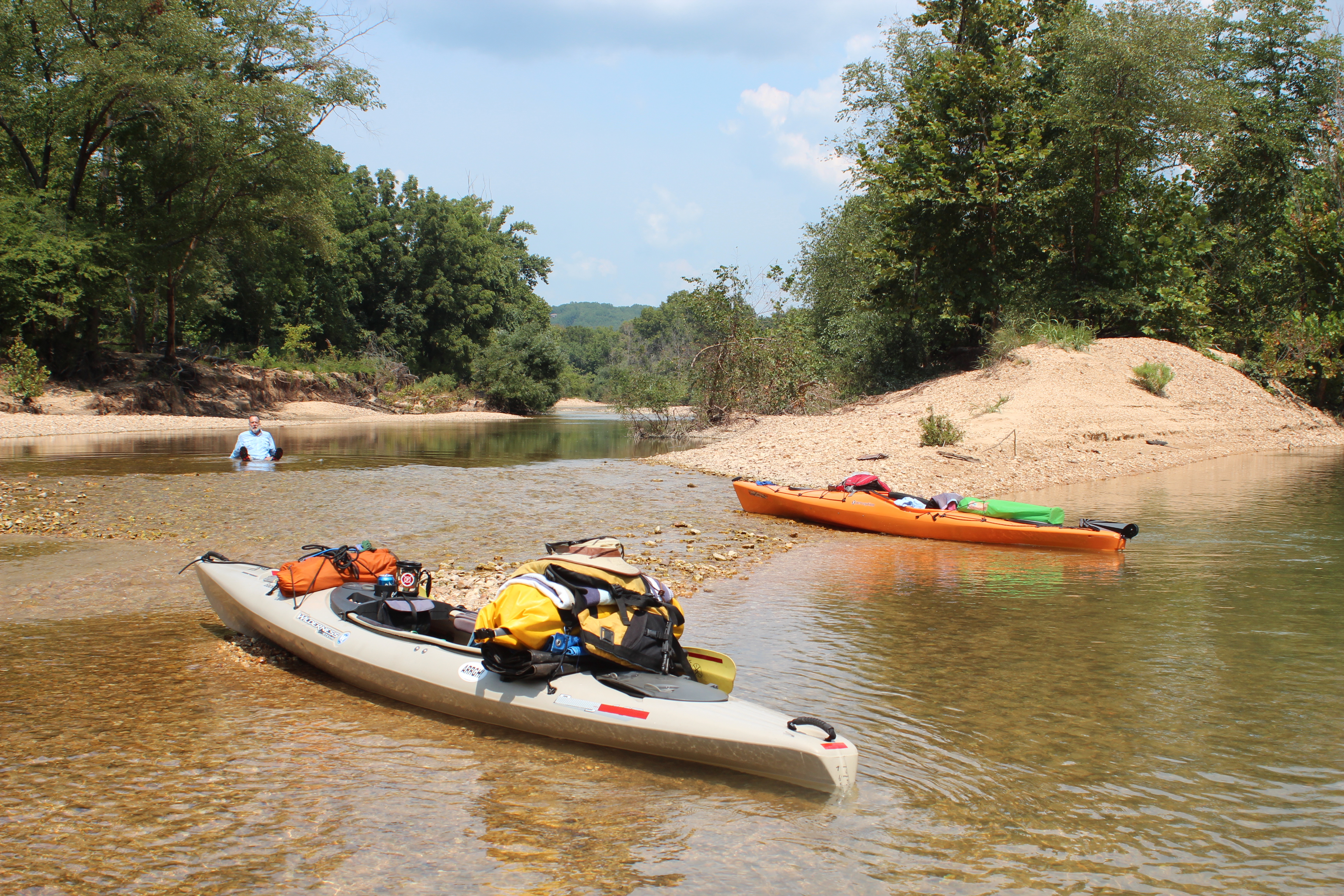
We figured to start at Akers Ferry and pull out around Doniphan, Mo a week later – 110-miles or so of river – simple/distance. I know too that making plans is kinda like ‘picking a line’ before you see the rapids so with plenty of time ahead I threw some ‘feelers’ out for a shuttle on a related facebook page. After a couple of weeks that hurtle was lifted when a native of the area agreed to move our vehicle – thank you very much Deb! (from Doniphan/Springfield).
When paddling the Current several river maps are available; each with differing mile indicators; for reference, I will be using the one provided by the Ozark National Scenic Riverways (not that I agree) which mile-markers begin downriver at Gooseneck (0mm) and sets Montauk Springs (the beginning) at 105mm (yes, I think it should run ‘with’ the river’s current such as the map available through missouricanoe.org).
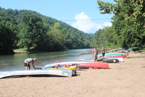
Akers Ferry
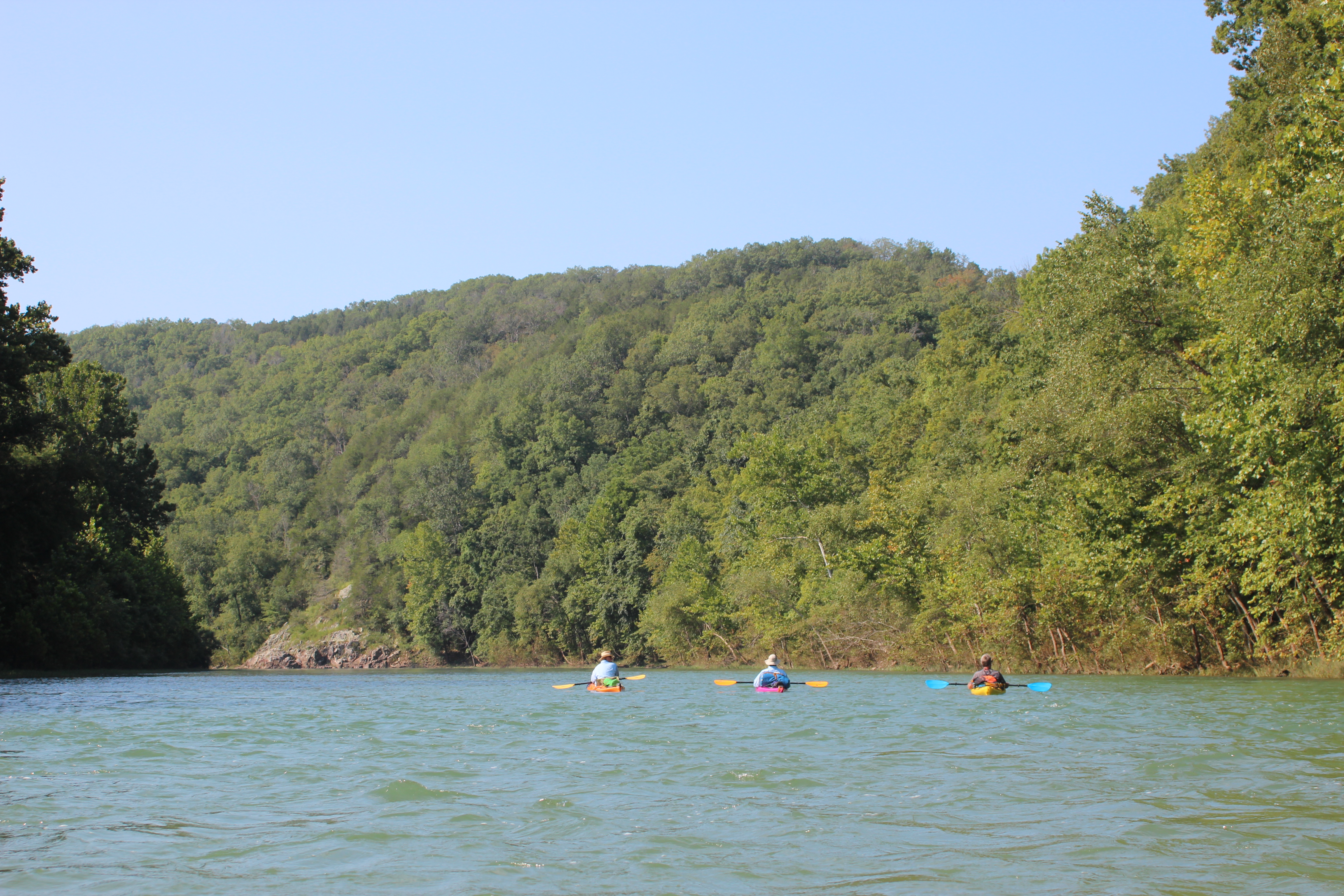
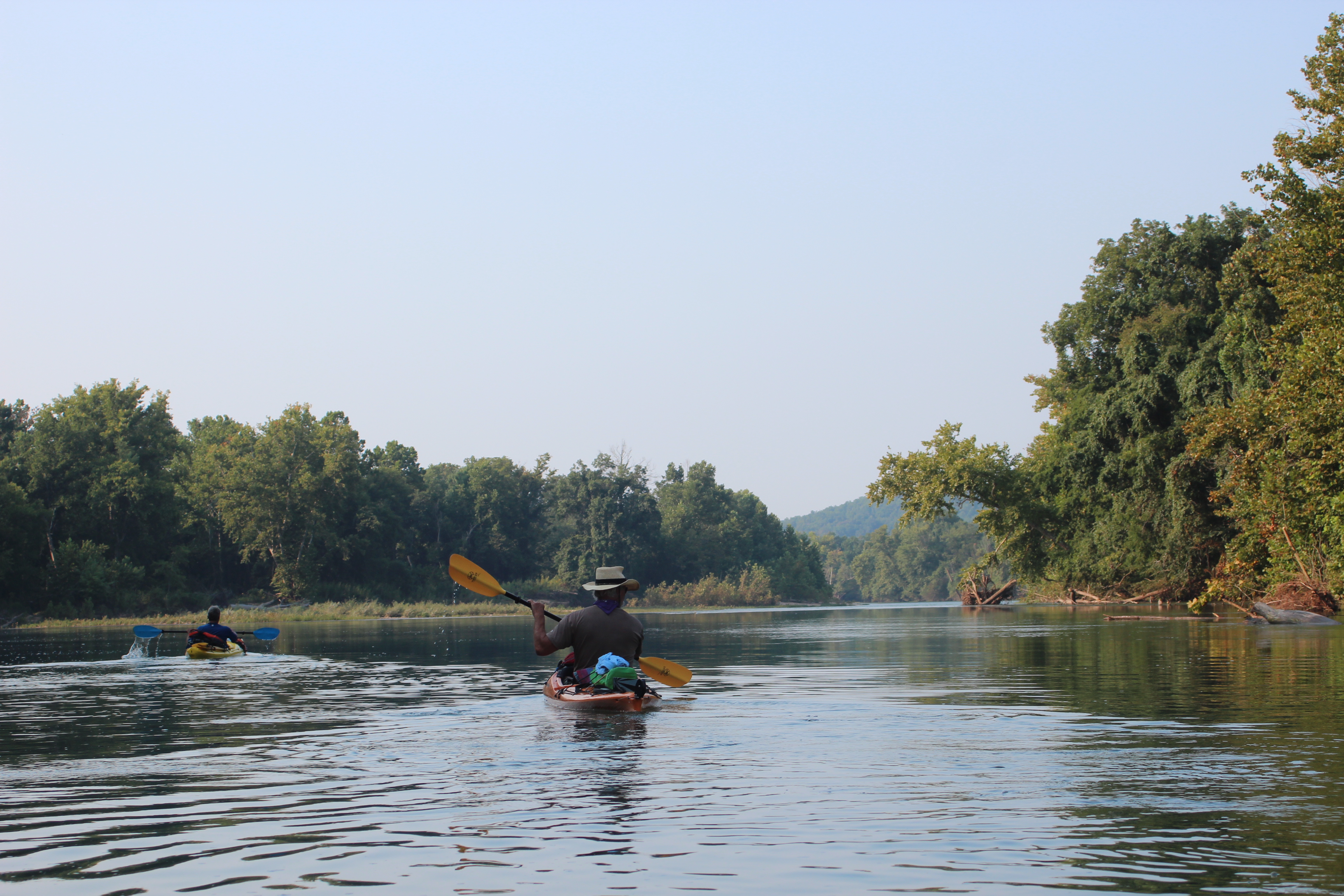
Day 1; Akers Ferry (92mm) to near Sinking Creek (74mm)
at Currentrivercanoe.com – hwy kk, Salem, MO
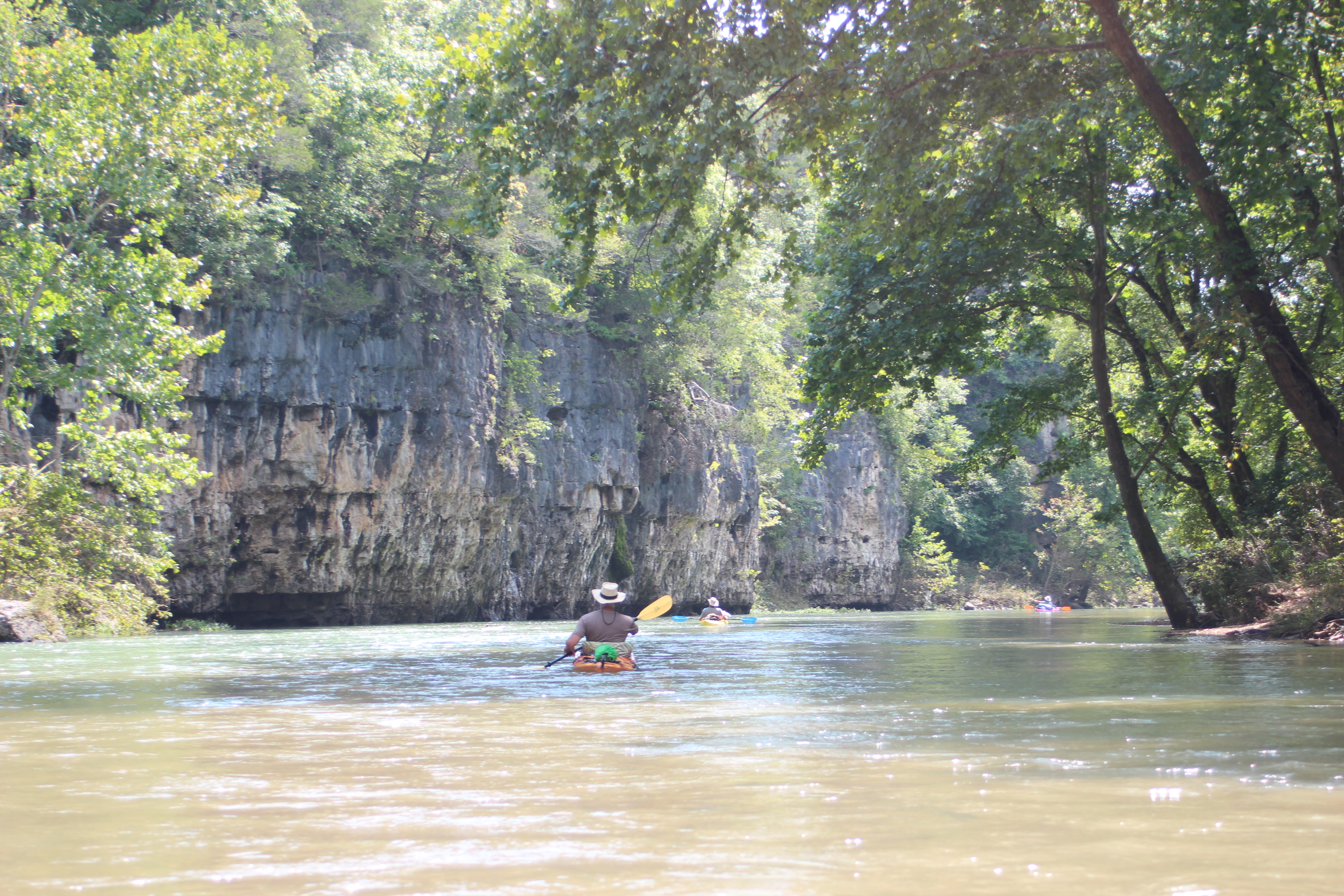
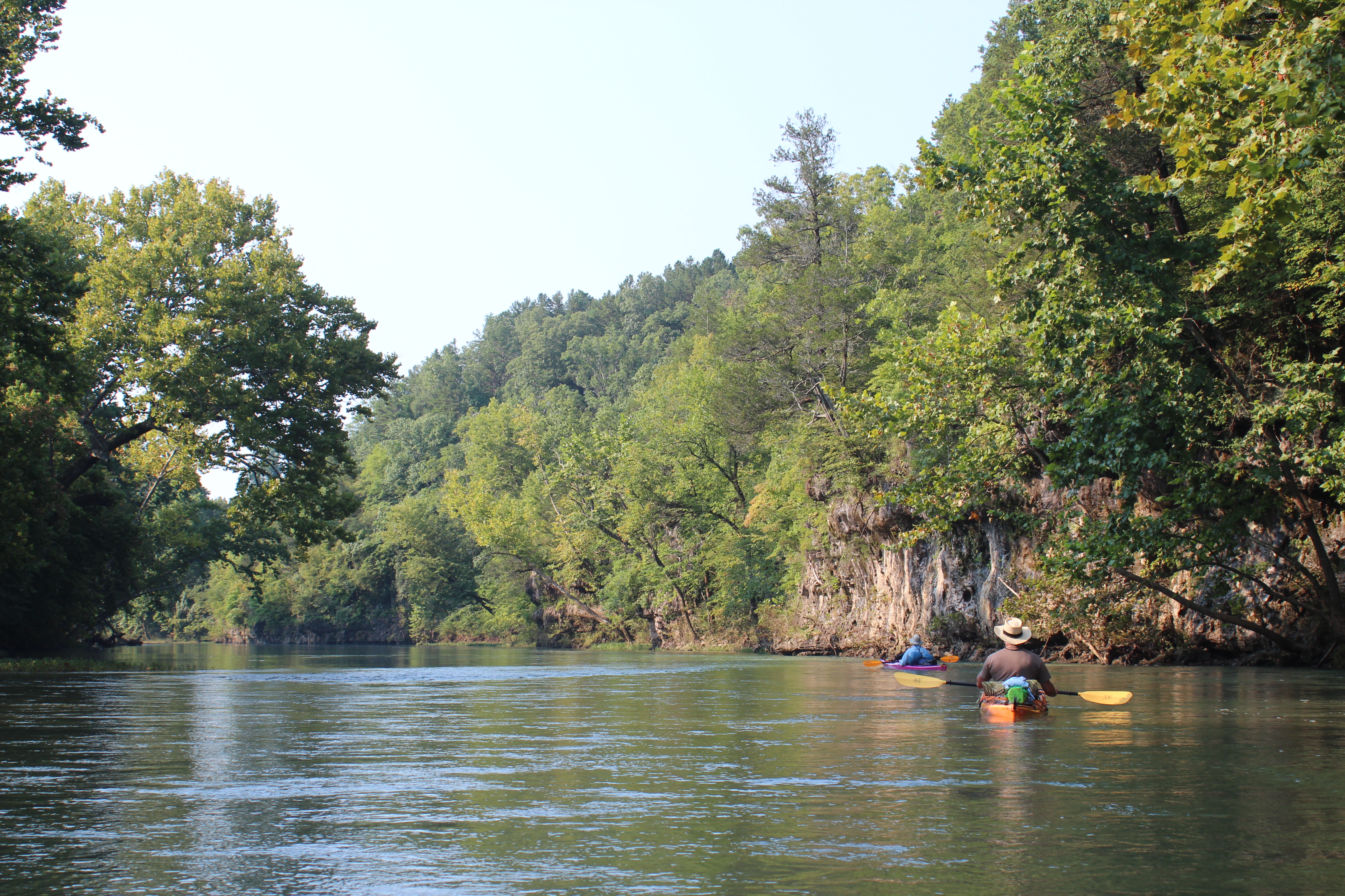
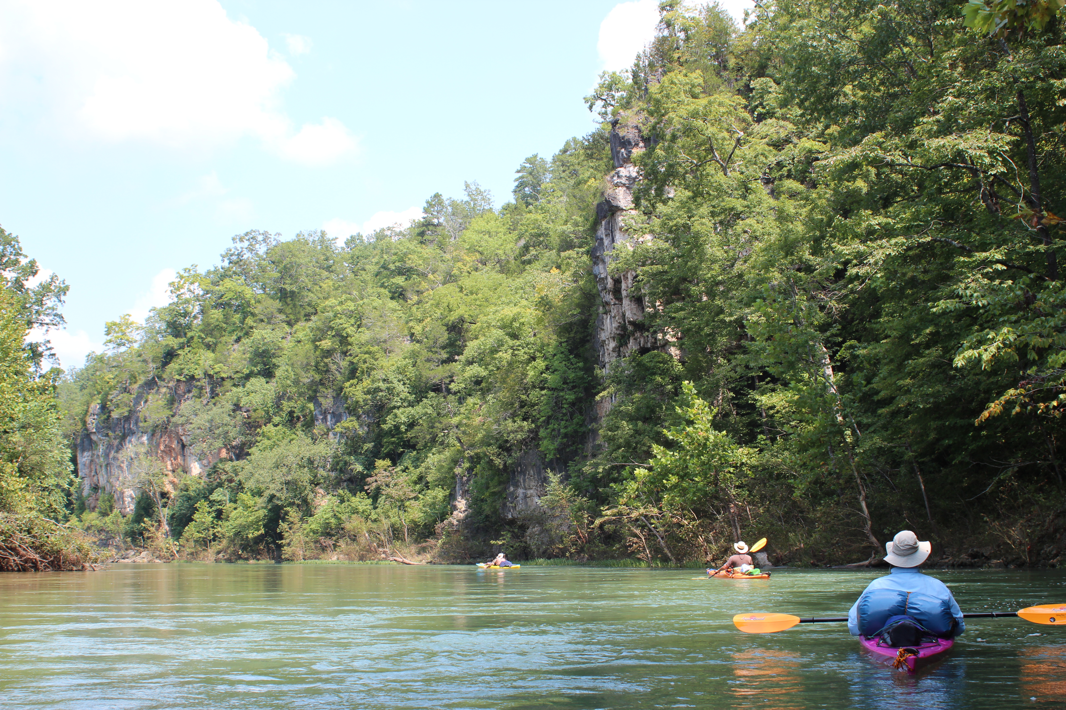
Ok, to make a long-story short…… The Current’s water is clearer and swifter than the Suwannee a beautiful change. Along the way the scenery of the Ozarks is a vivid reminder of just where the word ‘natural’ comes from. It’s a primitive camp paddle with cell connections to the outside world limited, by limited I mean ‘nil’ – you are cut-off from gas prices, political events, and text messages (awesome place 2b). This of course leaves more time to laugh and enjoy the more important things in life like those lil ‘pila-biters’ (grandchildren) or the ‘bottum-rubbers’ (shoals) in the river.
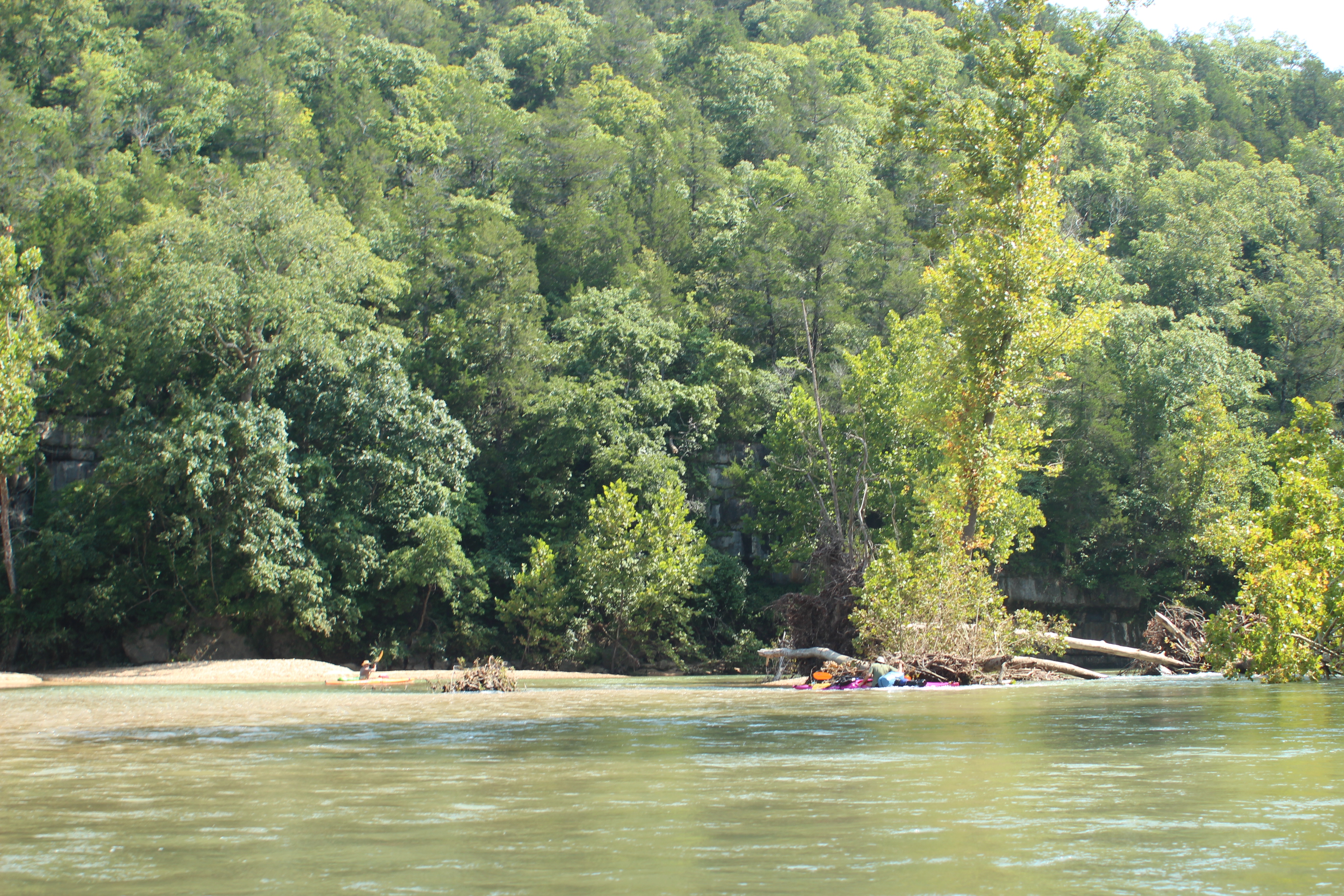
We put-in at Akers Ferry, a week after flooding and the waters remained a bit cloudy, that clarity improved each day. On this trip I gave the river a 8+ on water clarity, and an 8 on natural quality – still high marks which I know improve as the summer season fades.
With the recent flooding I wondered Why? (and how?) could they ‘close’ this river during those periods (‘closed’ to rafters) – I realized more the further down the river I traveled. It’s a rapid fluctuation, plus with the ‘strainers’ along the way…. well, you just have to figure it all in.
.
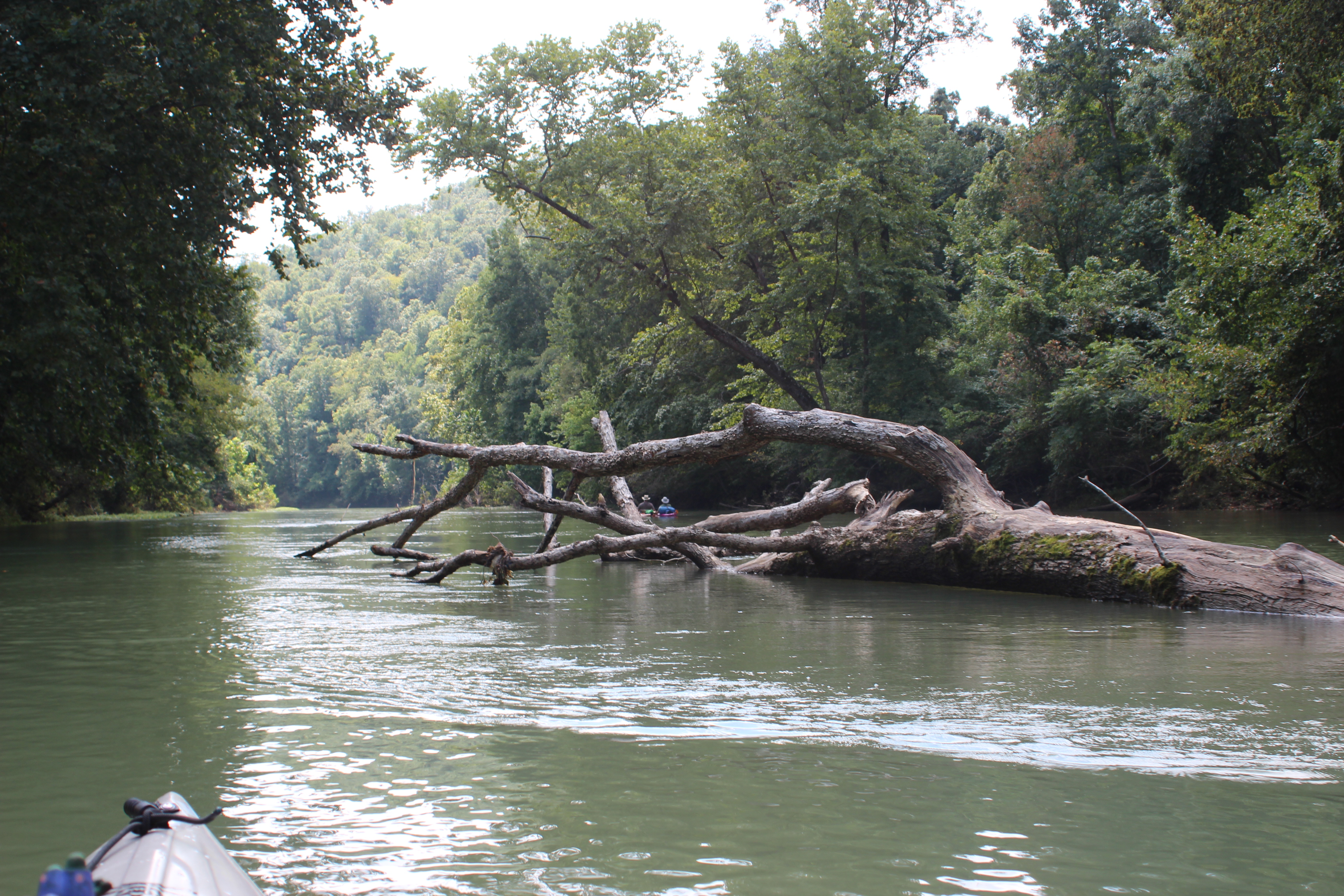
‘Strainers’ are trees or objects in the water that present particular hazard when encountered in a broad manner. Flooding erodes the banks and trees topple settling into and along the water’s channel as other events occur. The force of water can be deceiving, once your boat/canoe gets sideways – it’s difficult to pull from an entanglement and it could become deadly (with a strong current and panic). I’m not sure that tubes can be steered and I’m thinking with pilot error (protecting the cooler tube) they could drift right into a strainer. Swift-water classes will heighten a persons awareness on river entanglements.
On the first day – the ‘purple-dog’ (the only name that really fits Richards kayak) played up against a strainer (above) after the second bend, but it was a ‘save!’ Richard pulled it out without rolling under – it was an appropriate reminder of the potential obstacles ahead.
 .
.
with some fine paddlin, or should I say – a ‘free-ride’ ahead
 .
.
 .
.
Cave Spring along the way
 .
.
and then Gordy’s 180 reminder; Richard explaining how wonderful it all was….
later we stopped rambled around the Pulltite cabin (picture at beginning of post) and spring-head before riding further down the ‘free-ride’ of the current.
 .
.
After our last paddle trips of ten-days or so being on the Current was a fitting reward. There was no difficulty at all in finding an awesome spot up the bank in the trees for a camp site. In heaving it up the shore, Gordy’s boat was doggone heavy (still full of water). Surprisingly there were few if any mosquitoes even though they did show up later in the trip below Van Beverage (Van Buren) – but the upper Current river – even in the shade, was a fine place and time of year to stop, and watch for others riding the river.
We left only footprints.
.
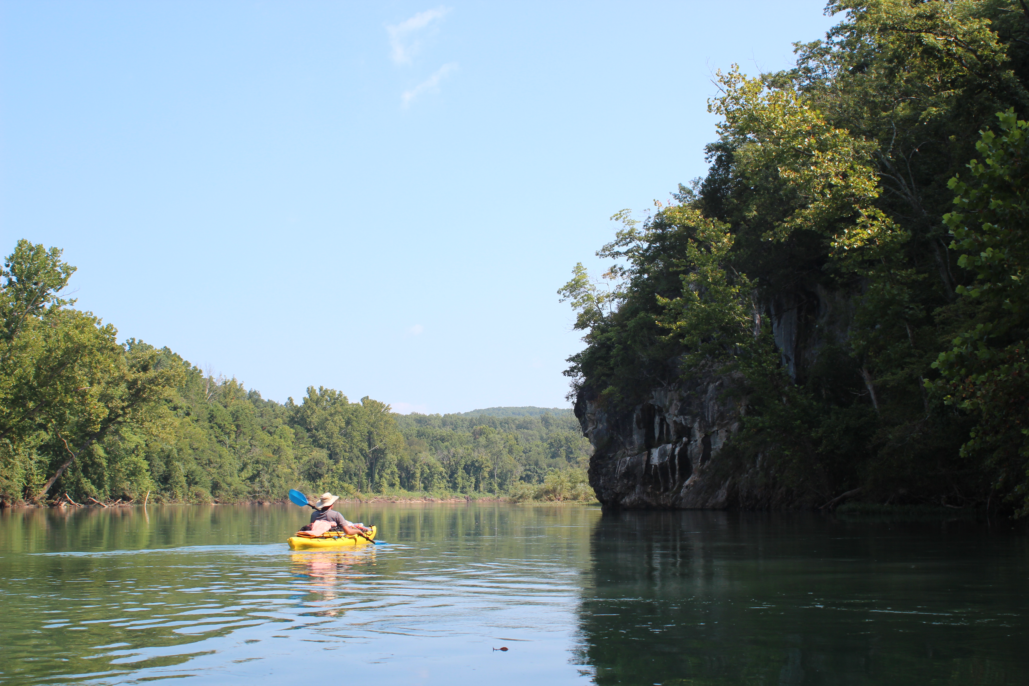
Day 2 Sinking Creek (near 74mm) to Martin Bluff (51mm)
 .
.
Highlights of Day 2; Morning fog, horseflies, a confluence, and bluffs
.

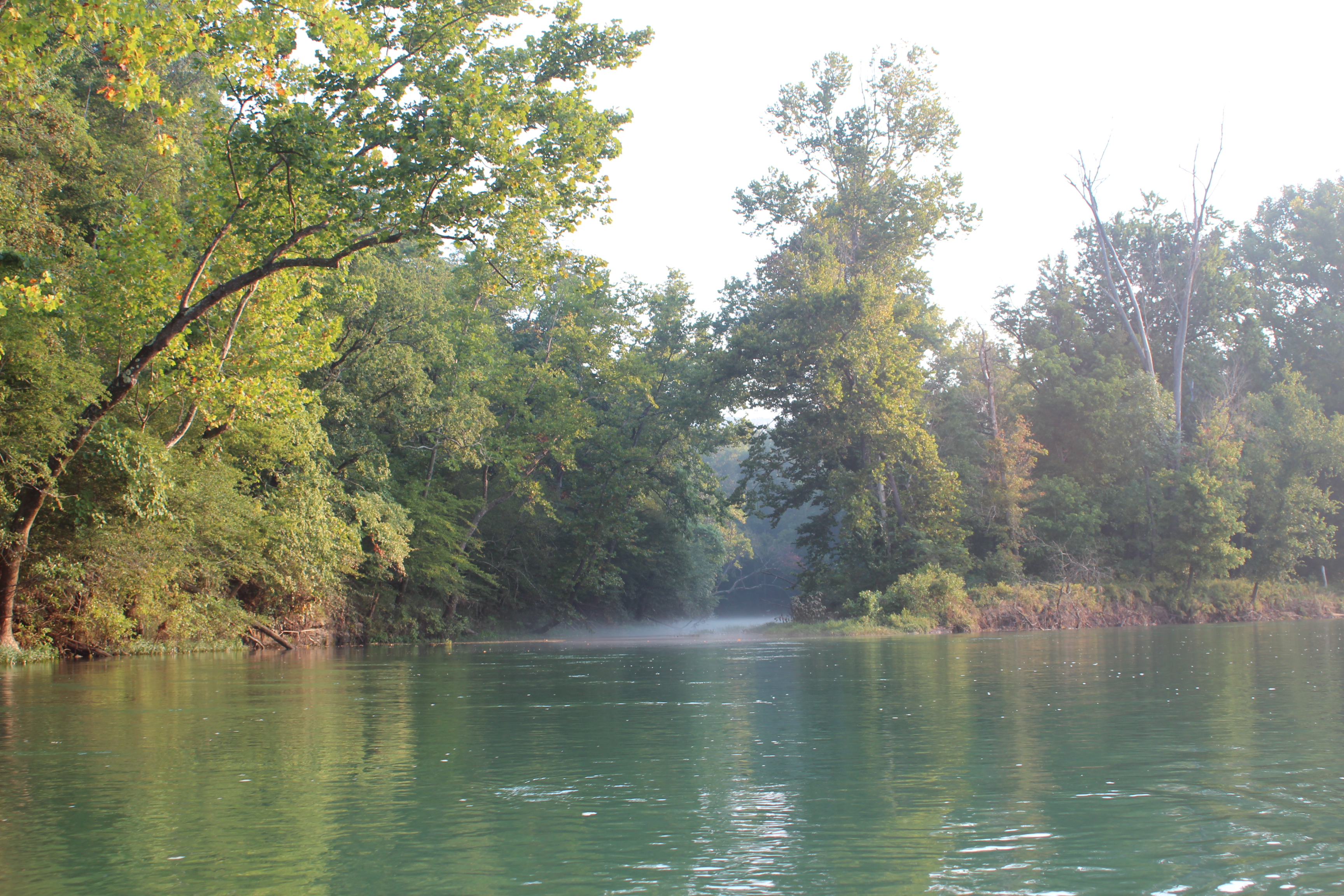
The mornings were kinda neat, each day – very unintentionally, we found ourselves back on the river around 8am – cup of coffee in hand. The fog lingered and along many of the overhanging trees spider-webs dangled heavy with the moisture.
.
 .
.
.
 .
.
 .
.
It’s easy to understand the popularity of this river, the drift is lazy and comfortable – on top of that there is plenty to admire – plenty of time to realize that this world has evolved…. and we “are but a mist droplet in the ocean of time.”
 .
.
I believe this is Big Creek, the waters were distinctly warmer – we walked up abit, it’s a loose gravel base with crystal clear water (10).

.
Plenty of time too, to stop and converse along the way with others, these two had camped at Big Creek and were just a mile or so down river – this was afternoon! talk about ‘feet-up.’ I remembered this spot from a previous paddle, my favorite camping spot on the river – I understand completely why they stopped..
 .
.
 .
.

Motley Crew
.
A warm beverage stop at the confluence of Two Rivers and a few miles further we located a shoal near Martins Bluff, ‘feet-up’ in the breeze. One thing about primitive camping along the Current, prepare to camp on coarse gravel. Fortunately I had an extra rain tarp which provided an extra layer below my tent. The Current also welcomed us with perfect weather, the only reason we needed to use a ‘fly’ was the moisture and vapor from the river in the mornings.
For the day we had seen Osprey, Bald eagles (2), kingfishers, wood-ducks, small egrets and plenty of Blue heron.
.
Day 3 Martin Bluff (51mm) to just above Waymeyer (32mm)
.

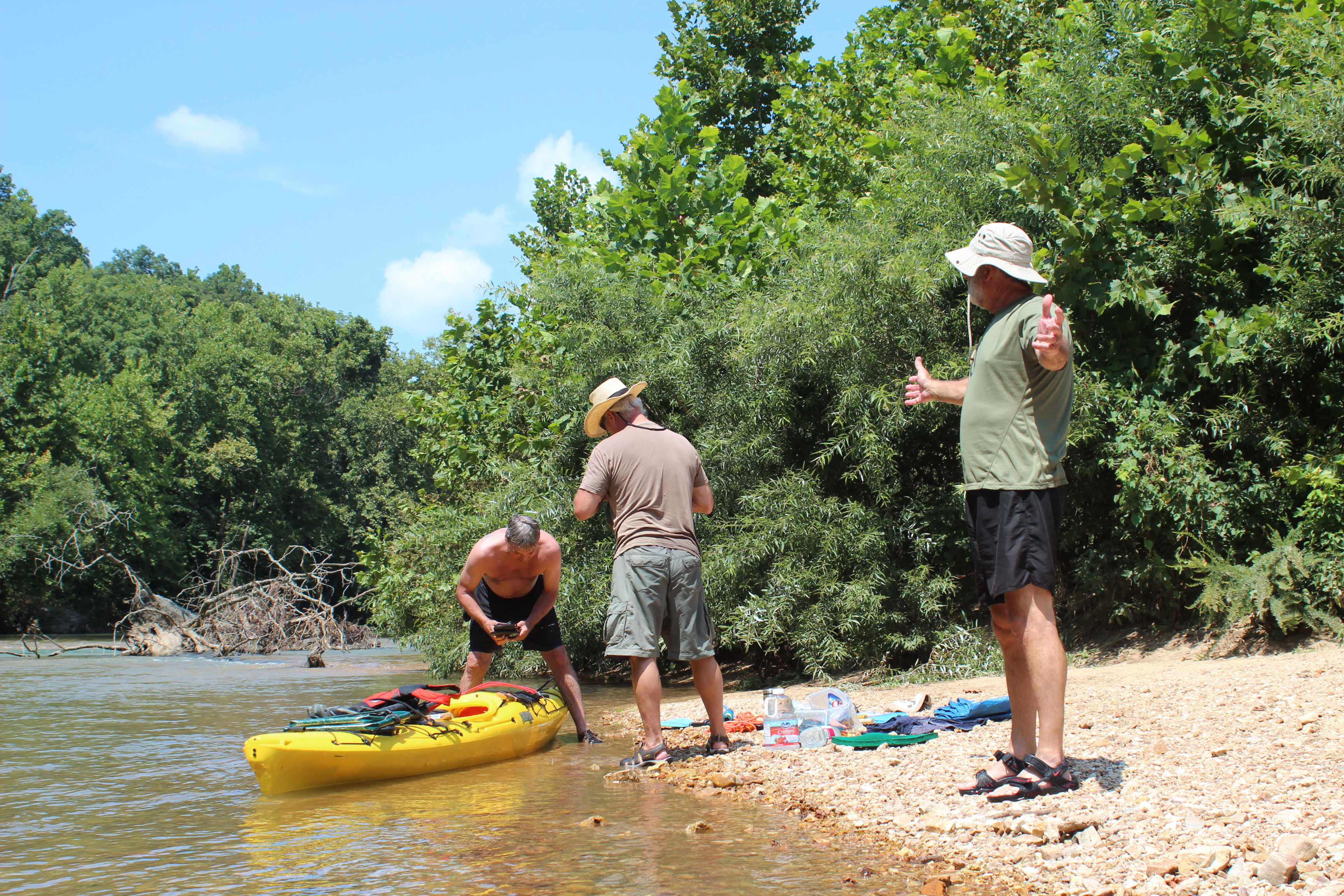
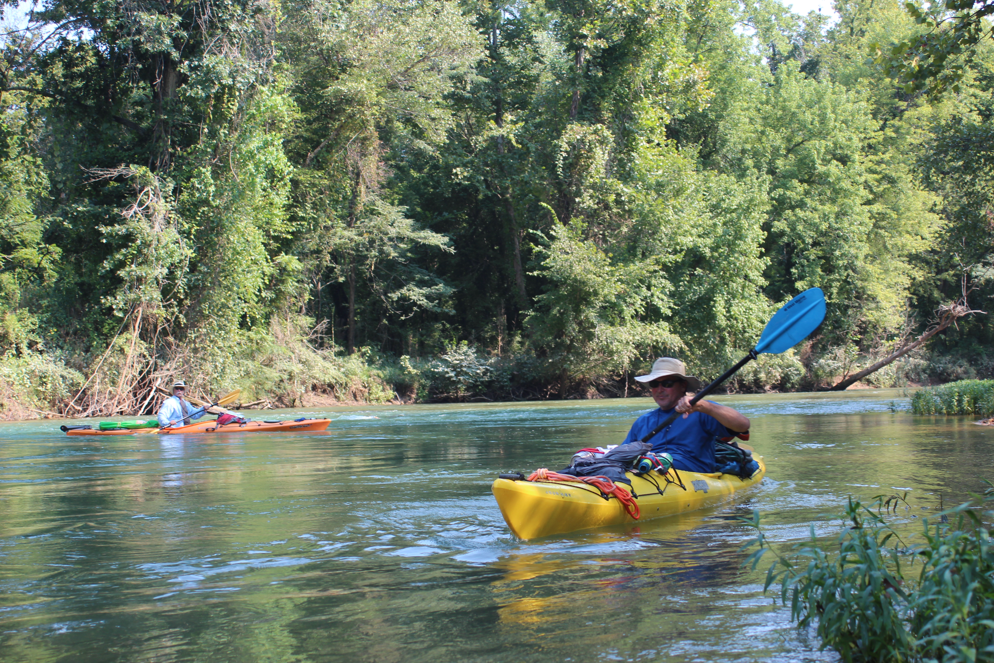
I’ve been asked how we manage our gear in a kayak, it’s really pretty easy; just carry what you ‘need!’ (and practice).
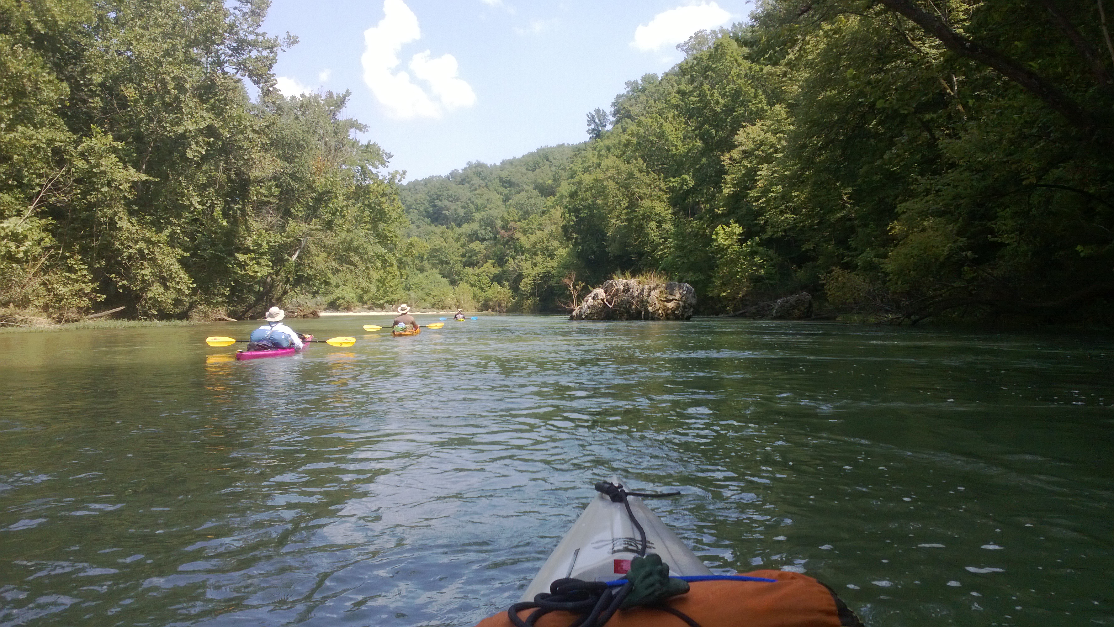
The Current is one of those rivers that is ideal for a canoe though – you can carry alot of stuff, and the water will carry you both….

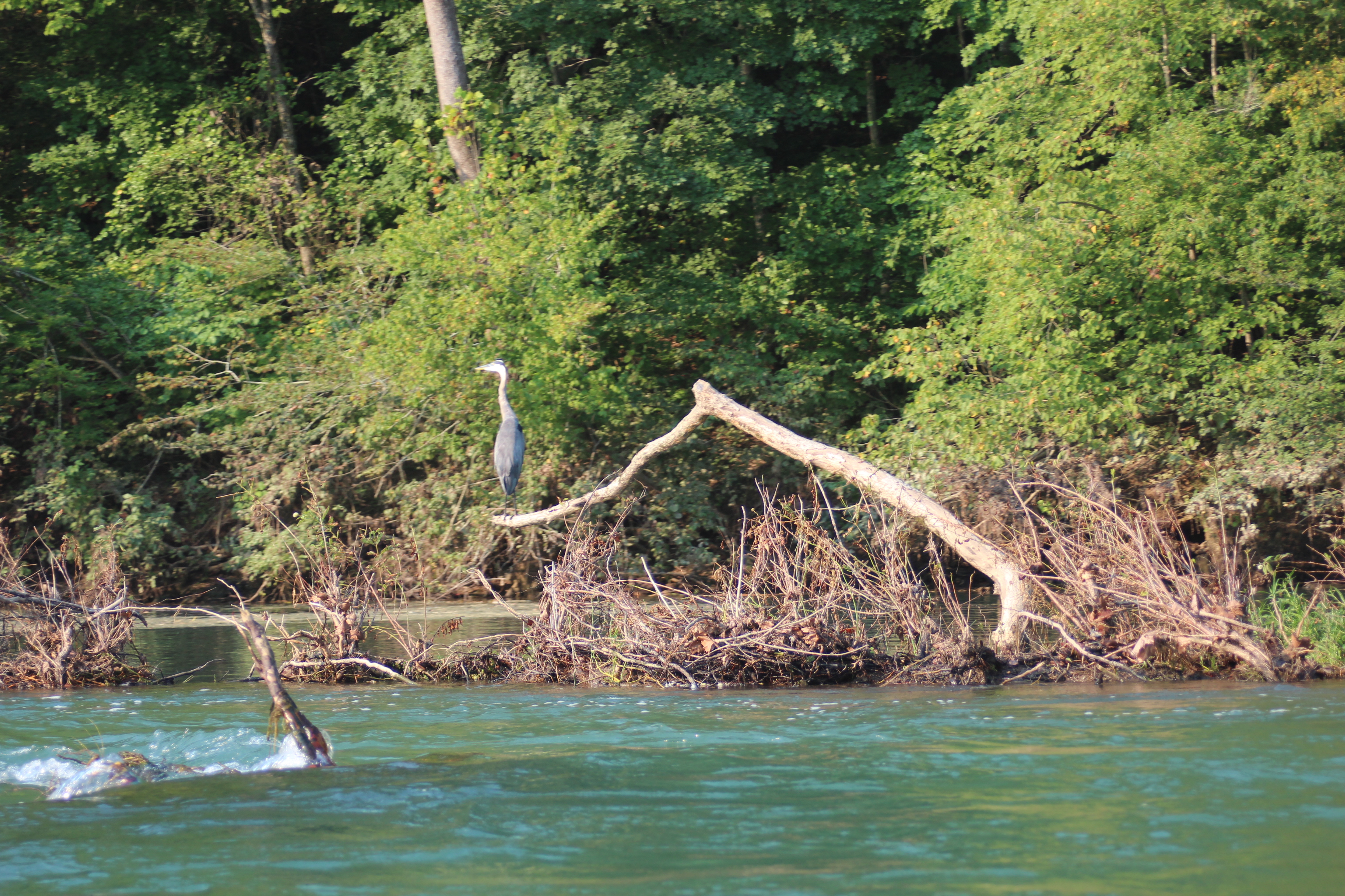
Strainer
..
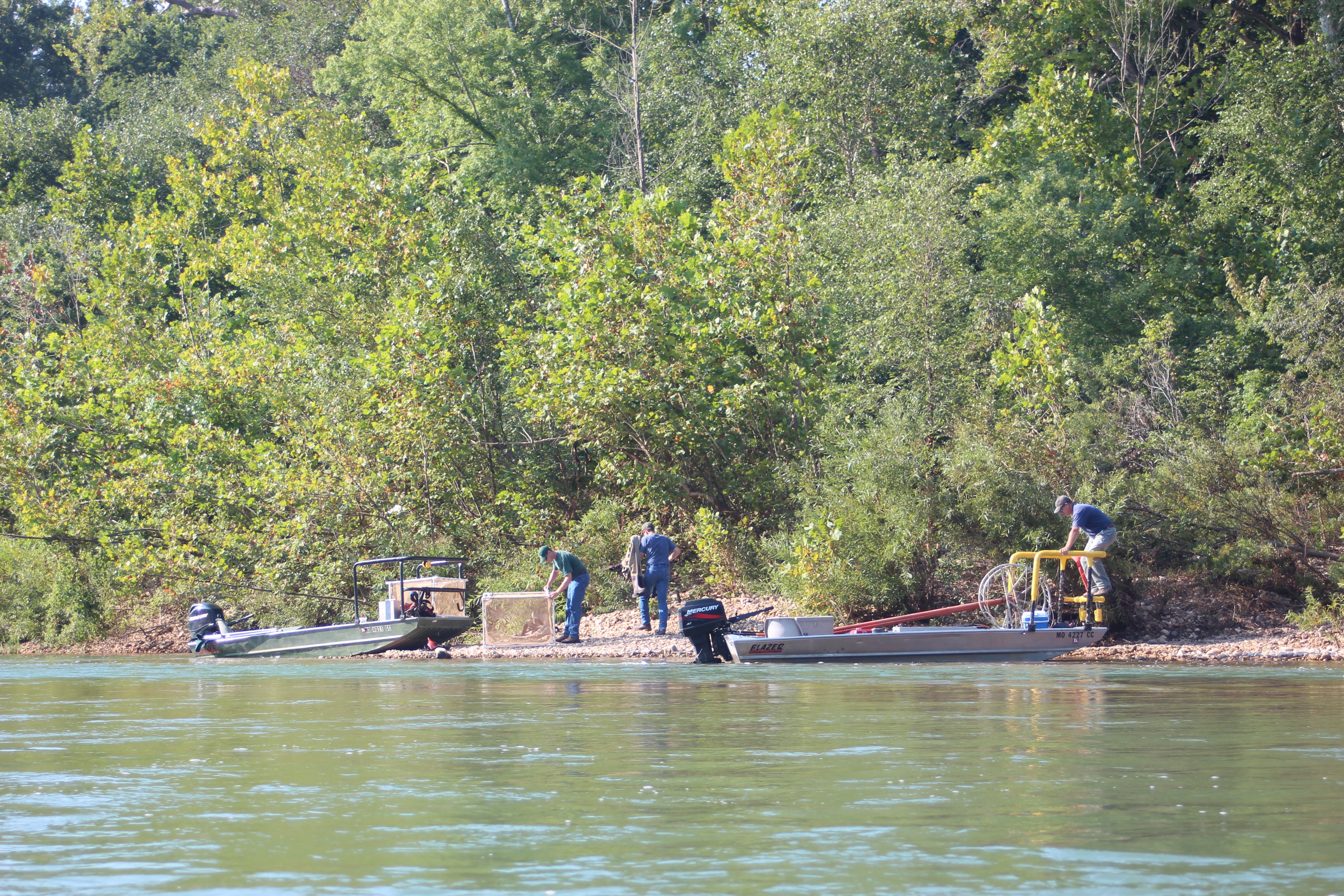
Marine Biologists
Somewhere in here we missed Blue Springs, we commented several times about how well the Suwannee River folks have provided signage for paddlers. We did see biologists making fish counts along the Current, twice; once upper, once lower.
 .
.
 .
.
What else but to admire and appreciate…
 .
.
Without cellphones too, hey – these guys did good – this was the third day and I think all became good. There was plenty of time to stop/ponder/swim/then paddle dry – no particular order. My surface water temp reading (yeah, I got lots to do) was around 58 degrees on the upper Current (64 on the lower).

Richard could tell you about the water, he actually had the hardest yak there to maneuver – a long skinny coastal boat. One day he’ll get us to the coast and have his laugh…… but today it was ours.
.
 .
.
a glacial strainer

a ‘divit’
.
I like to call the areas where water sometimes takes its own shortcut a ‘divit.’ These ‘divit’s are where you will find wildlife residing in more of their natural setting – away from people. For paddlers ‘divits’ can also be an area of overgrowth or strainers, so there’s a risk when making that decision – you might be blessed with a wonderful natural insight, and/or you might have to backtrack out.
 .
.
A few miles above Weymeyer a gravel shoal beckoned us for the night – across from a cliff. The shoal stood in a narrow corridor with the occasional fishing boat blasting through; a great spot to swim, camp – we knew the boats were around. It was a more entertaining perspective than from the water, and the ships hold got a little lower that night…..
.
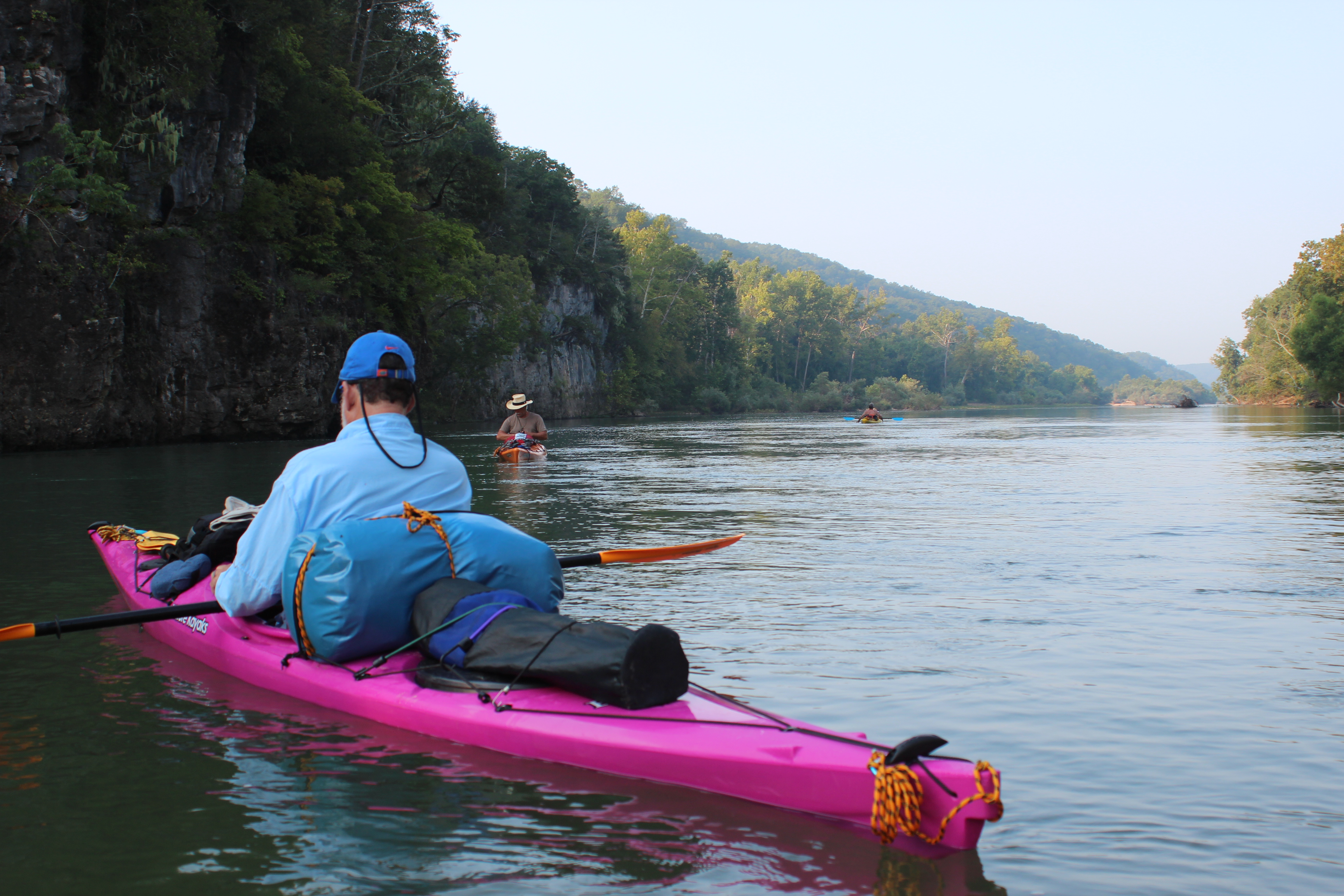
Day 4 – Just above Waymeyer (32mm) to near Catarack Landing (8mm)
. .
.
Another start to a river day, we began on Monday and it was already Thursday! – I was thinking maybe next paddle (always got to close ‘those circles‘) start on a Wednesday – giving a sample of weekend floaters vs weekday peace….. At this time we were talking about taking it further than Doniphan. Our last three paddles had been of 225 miles each, this trip was definitely feeling shorter than normal, but definately higher in quality.
 .
.
The river was now beginning to feel familiar, a wider, flatter sense. There were more trees moved around from the flooding and a greater sense of the magnitude of water recently passed. Funny how when the trees find a place to settle they can create a whole new channel. The tree/strainer acts much like a wing-dam on the Mississippi, the hydraulic power of the water moves the loose gravel shoals – the deepest ‘line’ for paddling is near the tree, which can also be the most challenging line.
We saw more marine biologists in this area too. We also stopped at Van Beverage (Van Buren) for some well deserved land-food, ate ‘colossal burgers’ at the Mercantile restaurant – 1/2 lb of mmmmmmeat!!…… yummmm.
 .
.
 .
.
With 90+ degree days, a dip was always a thought away. Being of freckled complexion I have found the lighter fishing shirts most useful, stop – jump in, and the wet shirt acts like an a/c as you paddle on…. its dry before you know it….
 .
.
Old hand-poured bridge/trestle pilings below Van Buren
 .
.
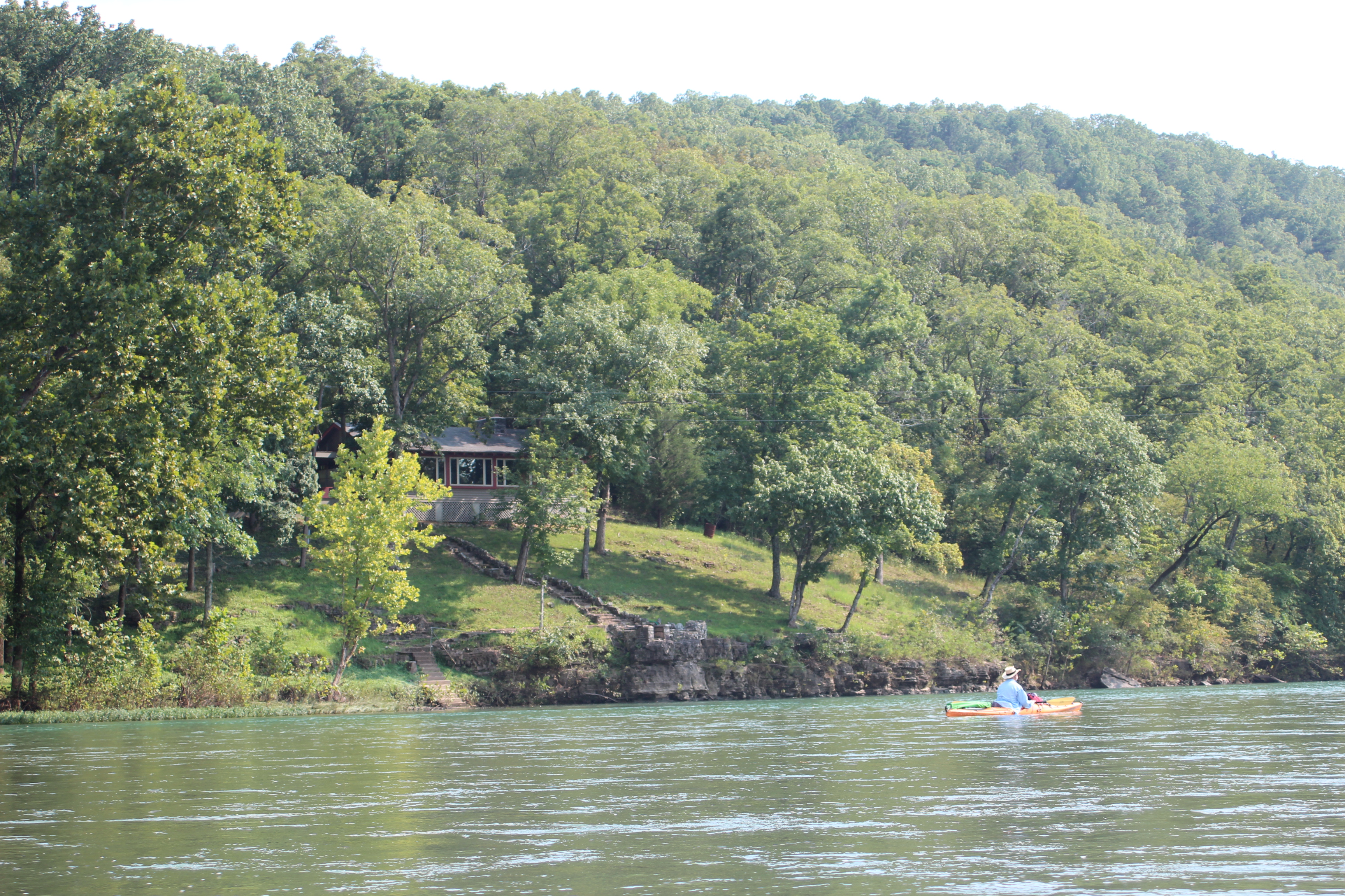
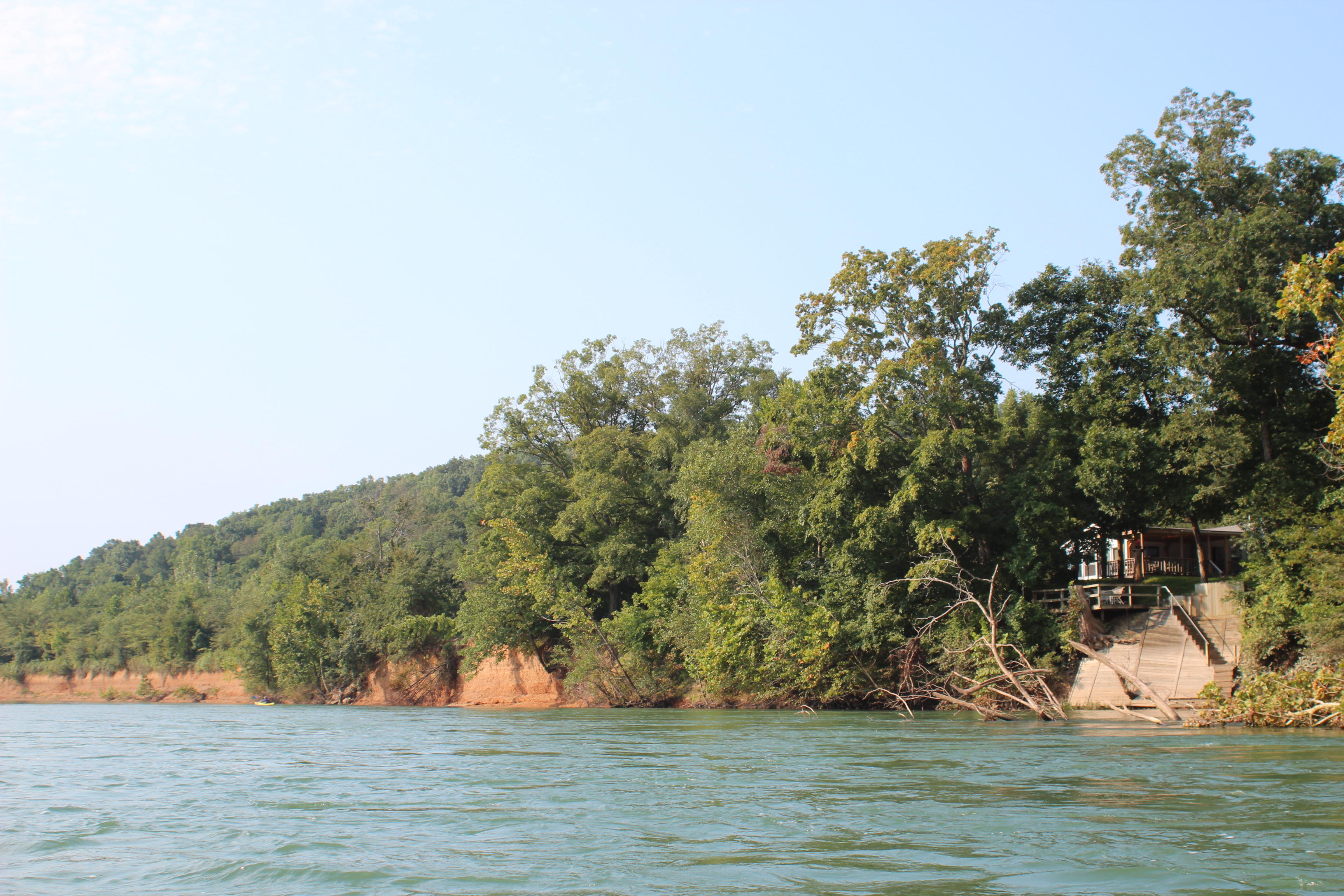
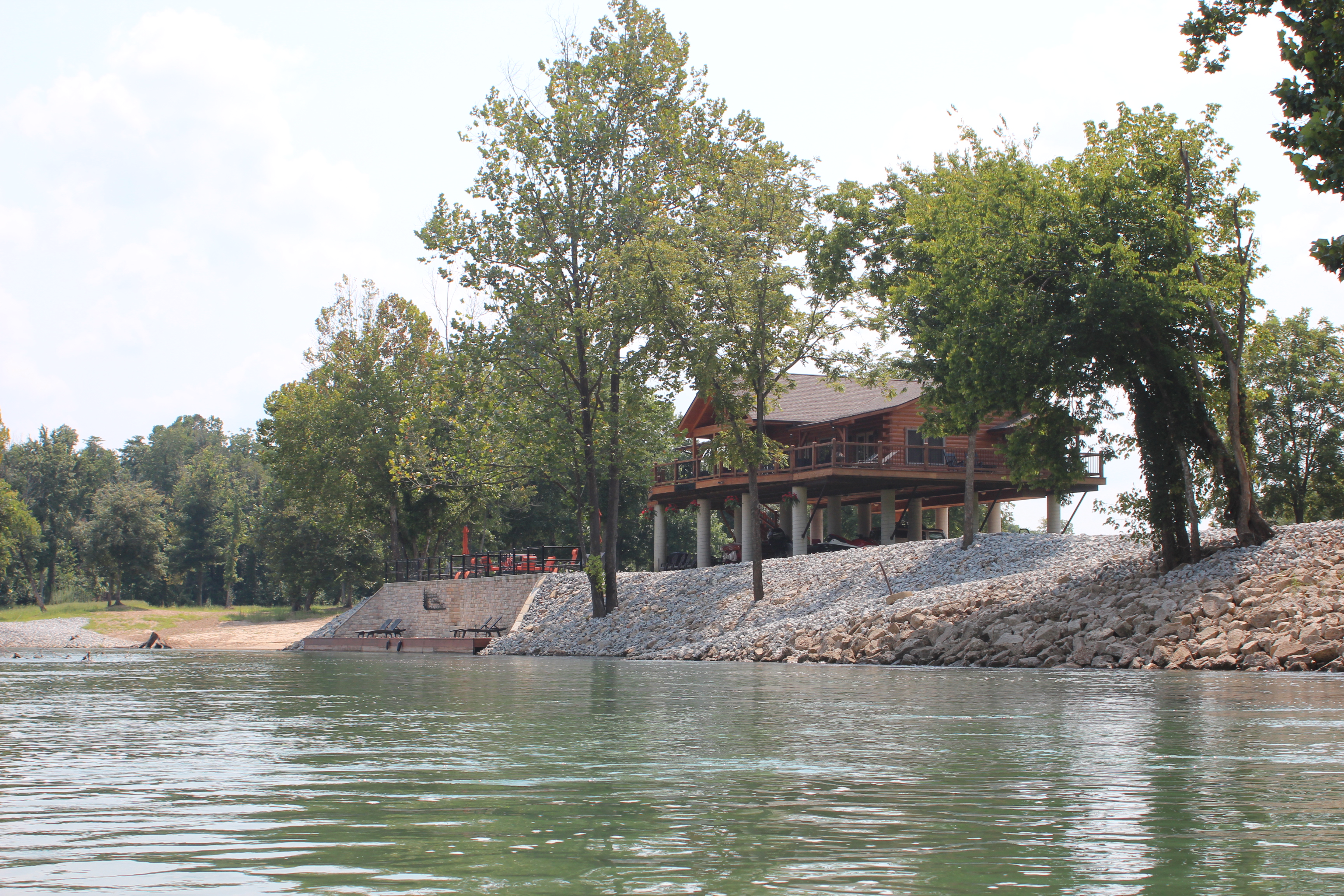
And homes were sporadically showing up too – somewhere in here we crossed the confluence of Big Springs to the right – the water change/temperature was dramatic. I paddled a short way up the clearer/cooler waters before turning back to join the others, I regret not exploring further. Another little circle left open.
 .
.
There were picknic tables and fire-rings along the shoreline, but after the recent flooding – we left them to the skeeters mud and sediment left behind. A shoal in the breeze was our target for the evening and eventually we located another for one last camp. I think I have learned that generally paddlers go down with the sun and rise with the morning light. No one had any problem sleeping on this river.
 .
.
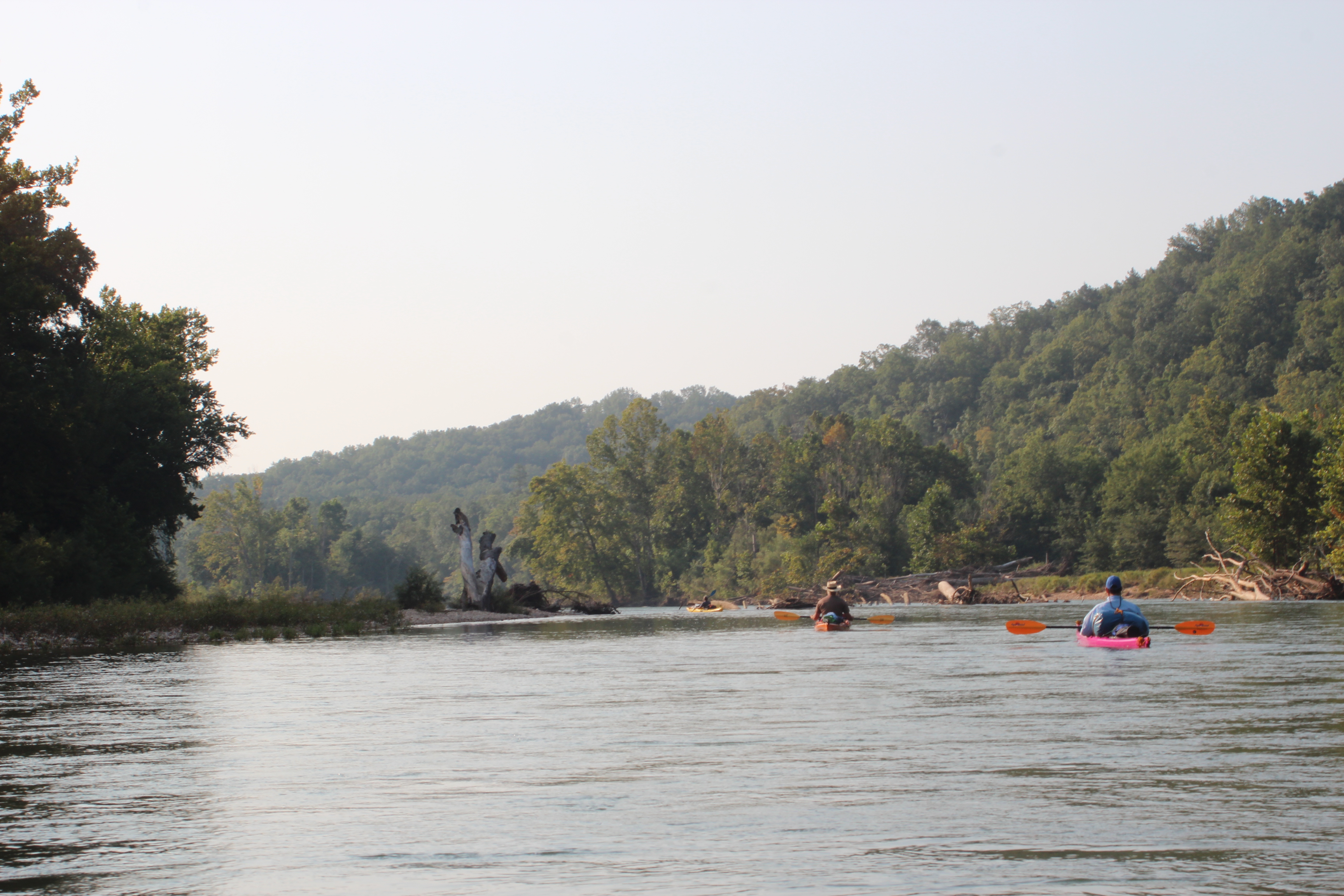
Day 5 – Cataract landing to Doniphan (@ 20 miles)
.
 .
.
 .
.
The water had cleared considerably in the last 4 days, the river itself was now about longer bays of slow water before finding a rapid to ride across. The ‘divits’ were larger too, strainers were more abundant and pronounced.
For a paddler rapids are about ‘decision-making’ – good experience for choosing ‘lines’ on other more treacherous rivers.
 .
.
 .
.
Herons, kingfishers, and wood-ducks remained plentiful – once again another bald eagle lingered just ahead of us. I was surprised to have only heard a single owl in the night along the distance.
 .
.
This family was fishing in what they called ‘Bay Nothing,’ another slow-moving area of the lower river.
 .
.
 .
.
always followed by one of those ‘free-rides’ over some rapids
 .
.
on the lower Current the shore line was more of a clay/sediment base (maybe where all the stuff between the gravel went from the upper Current eons ago) – the bank was certainly of different character than that from the more hilly Pulltite area. This shore line bore the scars of recent and long passed flood erosion. I did draw parallels to the red clay of Georgia, made me wonder about the grand-scale of things….. (calibrated).
.
 .
.
We did choose one of the divits in this area to challenge ourselves with, it was a shady running by-pass to the main channel which provided an awesome ride on a playful current. There were several two-foot drops which was a good change to the slower ‘bays’ more common of this lower section.
 .
.
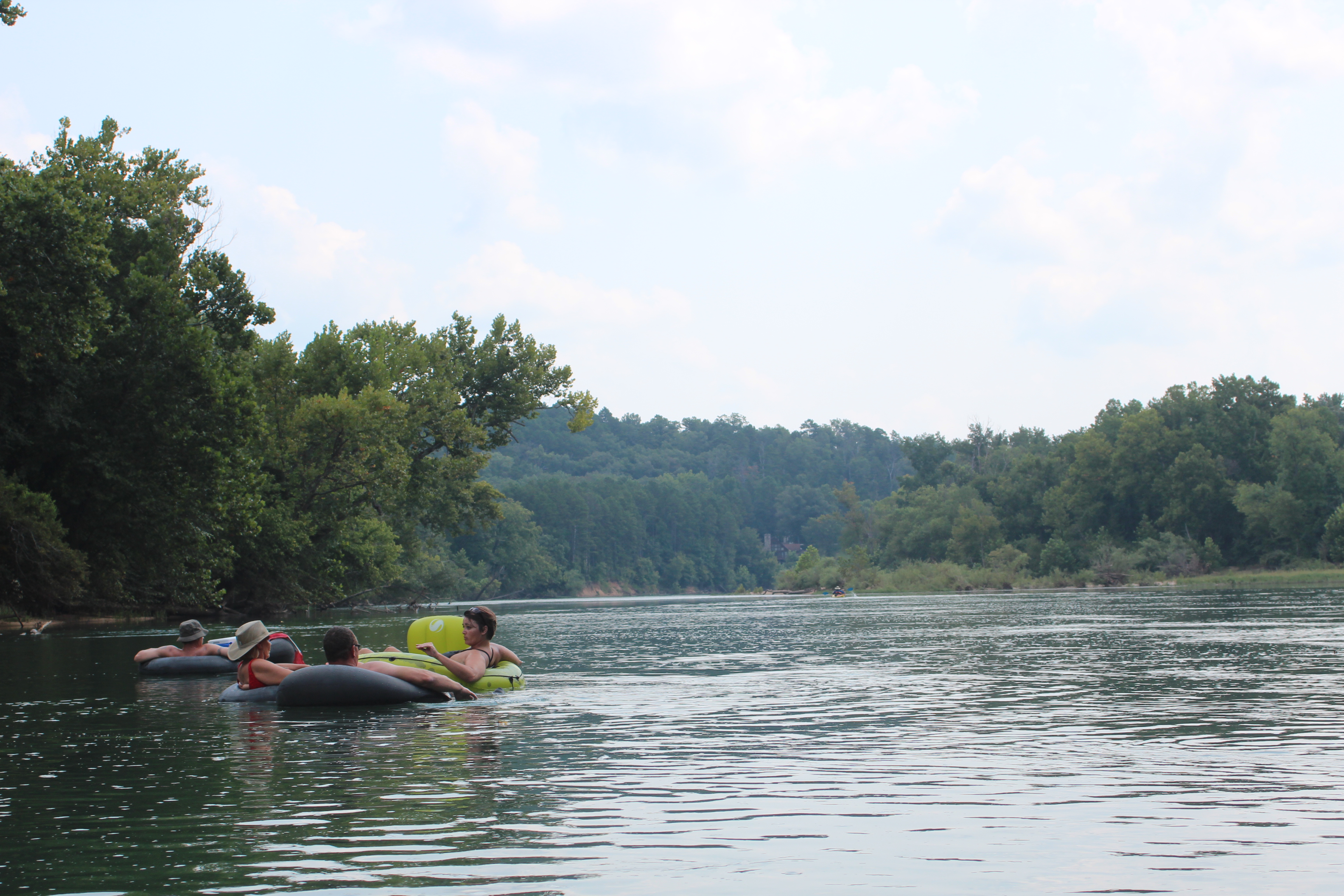
Friday, and there were ‘tubers.’ good to see folks relaxed (with ice-chest in tow) and moving slowly down the river for miles at a time. We chatted just a few minutes before moving on and I didn’t mention the herd of black cows standing in the river just above them, they weren’t moo-ving at all.
 .
.
fishing on the Current
 .
.
Homes along the way
 .
.
and the Doniphan bridge

.
A wonderful river to paddle and experience. The folks that live near this river are so lucky to have this beautiful resource. As the main industry for the area (recreation) the only improvement we noticed was with a little better signage along the way, this would help many stop to enjoy the historical value of the landmarks while providing some clearer emergency ‘benchmarks’ if needed (like you could actually call someone).
Absolutely no complaints and only praise for what the folks do to support this riverway – 110 miles was not enough, we’ll be back.
The Current River
Water Clarity – 8+
Natural Quality – 8+


Aug 31, 2013 @ 19:10:42
Sounds like a great time. Someday I hope to be able to take a multi-day trip like this. Thanks for allowing us to follow along.
LikeLike
Aug 31, 2013 @ 19:49:50
Thanks for noticing Bob, hope all is well..
LikeLike
Sep 01, 2013 @ 11:10:53
fantastic!
LikeLike
Sep 07, 2013 @ 18:11:36
Tom, sounds like another great trip. You are truly blessed to be able to make these trips. Did you hear any banjo music? That was a long trip without cold beverages. Feet up! Alan
LikeLike
Sep 08, 2013 @ 08:32:55
It was a fine trip Al, the best of water – only sounds were natural (including my own). Always room when you find the time buddy, lets plan a trip…
LikeLike
Sep 16, 2020 @ 19:14:07
“That was a long trip without cold beverages”
This is why God made Christian Bros. Honey Brandy!
Heading out Monday to Wed/Thurs for a short Van Buren to Doniphan
Days are shorter now and we plan to drag our feet a lot.
Thanks for the story!
LikeLiked by 1 person
Sep 17, 2013 @ 07:20:46
River was murky during that period almost 2 weeks after the light flooding in early August, nice write, and good pictures. you went right by our cabin, about 5 miles below Bay Nothing
LikeLike
Sep 17, 2013 @ 07:22:32
Loved reading your blog. Our family has had a cabin on the Current since the early 50’s … between Van Buren & Gooseneck (you posted a pic of our property). As someone once wrote in our guest book “ah peace, ah contentment”.
LikeLike
Sep 17, 2013 @ 07:59:33
I am glad you enjoyed your burger at The Mercantile in Van Buren. Look us up anytime you are coming through. We also do shuttling of vehicles, just give me enough time to have someone take my grill shift lol. Always glad that people are enjoying some of nature’s beauty! Mary
LikeLike
Sep 17, 2013 @ 09:16:22
Enjoyed this post and the rest of your paddling adventures! I live near the Ozarks and float Missouri’s beautiful rivers year round. Glad you enjoyed your trip to Missouri and come back soon! I also write a paddling blog about my adventures, fllog.wordpress.com
LikeLike
Sep 17, 2013 @ 13:57:26
Great read. I’ve floated all along your route in different trips, just not in one big trip. Me and a friend are floating the upper Current near Akers next weekend. This blog got me ready to go NOW! 🙂 Thanks for posting!
LikeLike
Sep 17, 2013 @ 16:16:04
I took my 12 pound yorkie and my 8 year old nephew on July 15th, We left Baptist Camp, just below Montauk Springs. We ended up in Doniphan in just 41/2 days. A total of 125 miles. We actually did 90 miles in the first 3 days. I have posted my pics on flickr. http://www.flickr.com/photos/smile10e/
You will probably see some of your picture spots on mine also. When I was 17 years old I took my little brother who was 3 years old 140 miles in 10 days. The nephew I took was his son.
LikeLike
Sep 17, 2013 @ 17:07:17
Couldn’t think of a better place/river to do what you did Mat…. nice.
LikeLike
Jan 14, 2019 @ 19:13:32
Great read. We’re wanting to plan a trip June 8 thru 15. Any knowledge of the river this time of
Year. Looking for a multi day trip and this just
confirms what we’ve been thinking. It’s a must now. Just want to hit it the right time of year.
Any info would be great
LikeLike
Jan 15, 2019 @ 08:53:33
Larry, I don’t believe that you’ll regret any trip to the Current river. The water is awesome and gives you plenty of opportunities to learn about how the vessel and the water’s current interact. The water is normally crystal clear, but is also prone to flooding with lots of rain. There are beautiful areas to camp along the way – pick one early and watch the others paddle or drift by. Time of year; June is good – likely more ‘tubers’ along the way – but thats our entertainment. My first simple adventure there https://backshortly.com/2010/09/15/the-current-river/ was my education with it, I liked the longer version much better. Its a trip that I will do again soon… Don’t let the opportunity pass..
LikeLike
Apr 10, 2019 @ 12:38:21
Thanks for the reply Tom, looking forward to my own Current River story’s.
LikeLike